MALHARGAD
TYPE : HILL FORT
DISTRICT : PUNE
HEIGHT : 3130 FEET
GRADE : MEDIUM
Many forts in Maharashtra have their own unique identity. Some are famous as ancient forts, others for their architecture. Some are revered for being sanctified by Shivaji Maharaj’s presence, while others are remembered for the significant historical events that took place there. But Malhargad is renowned for a different reason. It is known as the last hill fort built in Maharashtra. In the long tradition of fort construction, stretching back to the Satavahana period, Malhargad became the final addition in the Maratha kingdom and marked the end of hill fort architecture in Maharashtra. The term "hill fort" (Giridurg) is used deliberately here, because although Malhargad was the last hill fort built, it was not the last fort altogether. For example, in 1769, the British constructed St. George Fort adjacent to Bombay Castle. But within the boundaries of Maharashtra, Malhargad is considered the final hill fort.
...
Located to the south of Pune, Malhargad was constructed to keep watch over the Dive Ghat route between Saswad and Pune. The fort was built between 1757 and 1760 by the Peshwa artillery chiefs Krishna Rao Mahadev Panse and Bhairav Yashwant Panse. Although it is often referred to as Sonori Fort because of its proximity to the village of Sonori at its base, historical records such as the Peshwa Daptar refer to it by its official name, Malhargad. The fort is situated in Purandar Taluka of Pune district, about 30 kilometres from Pune and 6 kilometres from Saswad. A road allows vehicles to reach the base of the fort directly.
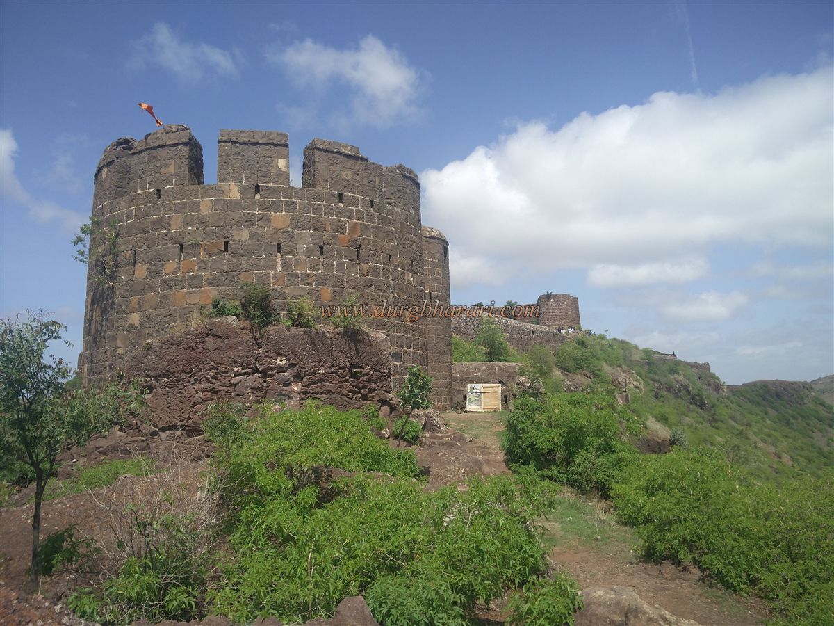
Upon entering Sonori village, one can already see the bastions and fort walls of Malhargad, along with the spires of its temples. On the way to the fort from the village, to the right, stands the grand entrance gate of Sardar Panse's mansion. Further along the path, to the left within a thicket, lies a large stepwell (barav), followed by another barav near the base of the fort. Although the fort’s summit is 3,140 feet above sea level, the actual climb from the base is about 492 feet, making it possible to reach the top in about 30 to 45 minutes.
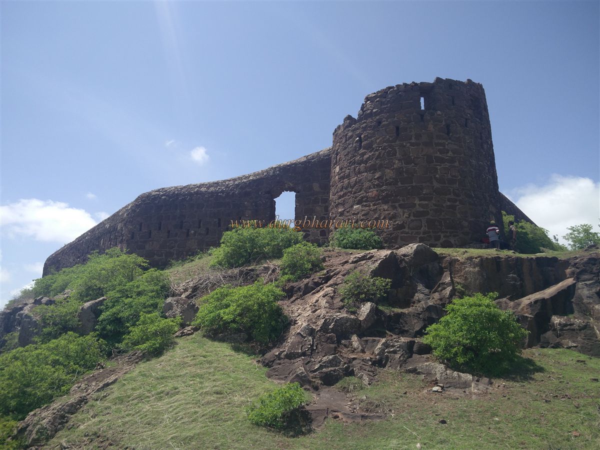
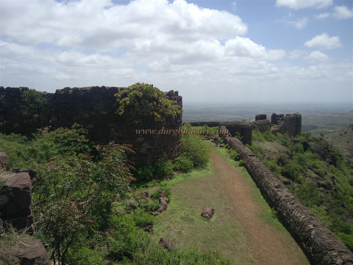
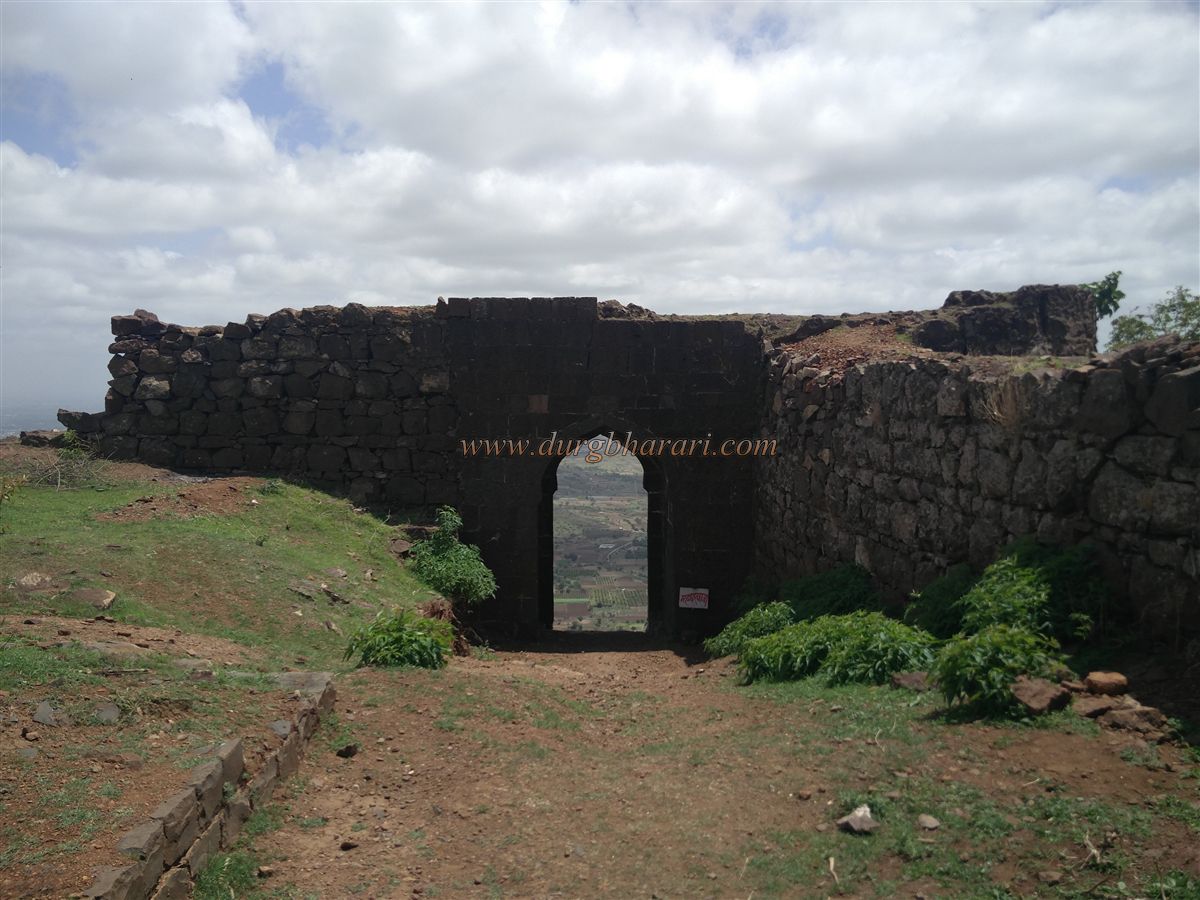
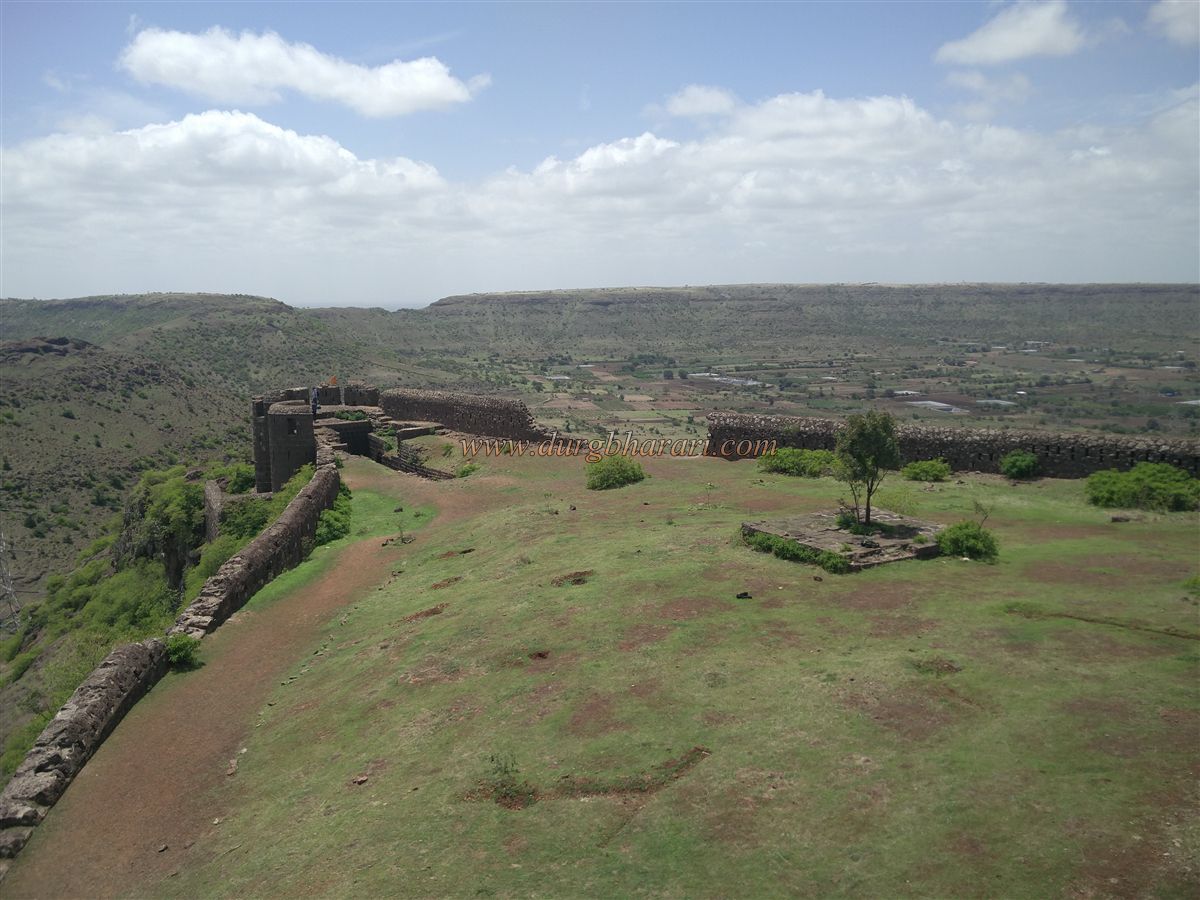
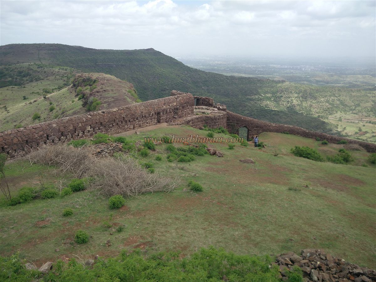
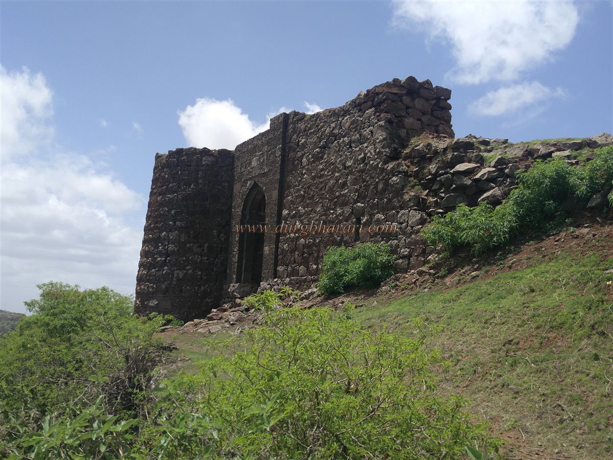
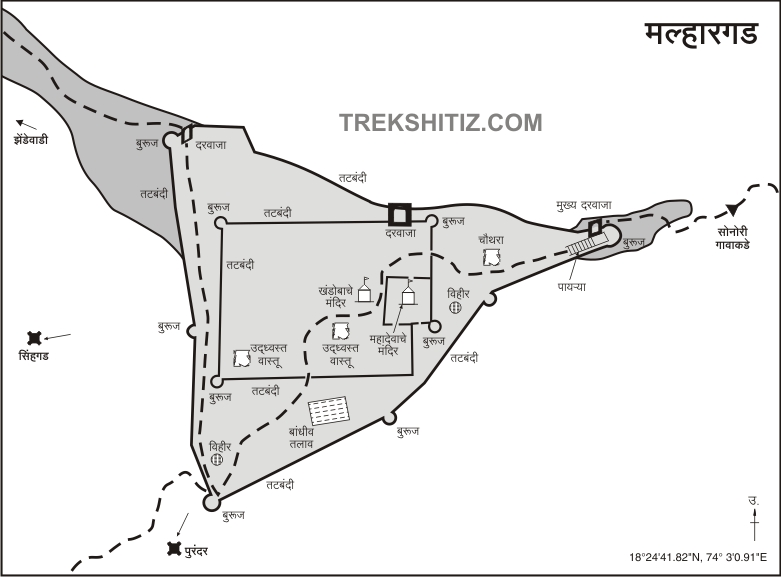
The fort has a triangular layout and is divided into two sections — the Machi (outer fortification) and the Balekilla (citadel). The entire fort spans about 5 acres, while the square-shaped citadel occupies 2 acres. The fort has three spurs descending towards Sonori, Kalewadi, and Zhendewadi villages, each with a gate. The main gate, known as the Mahadarwaja, is located on the spur facing east toward Sonori. There are nine bastions on the outer walls and five within the citadel. Although portions of the walls have crumbled, most of the fortifications remain intact.
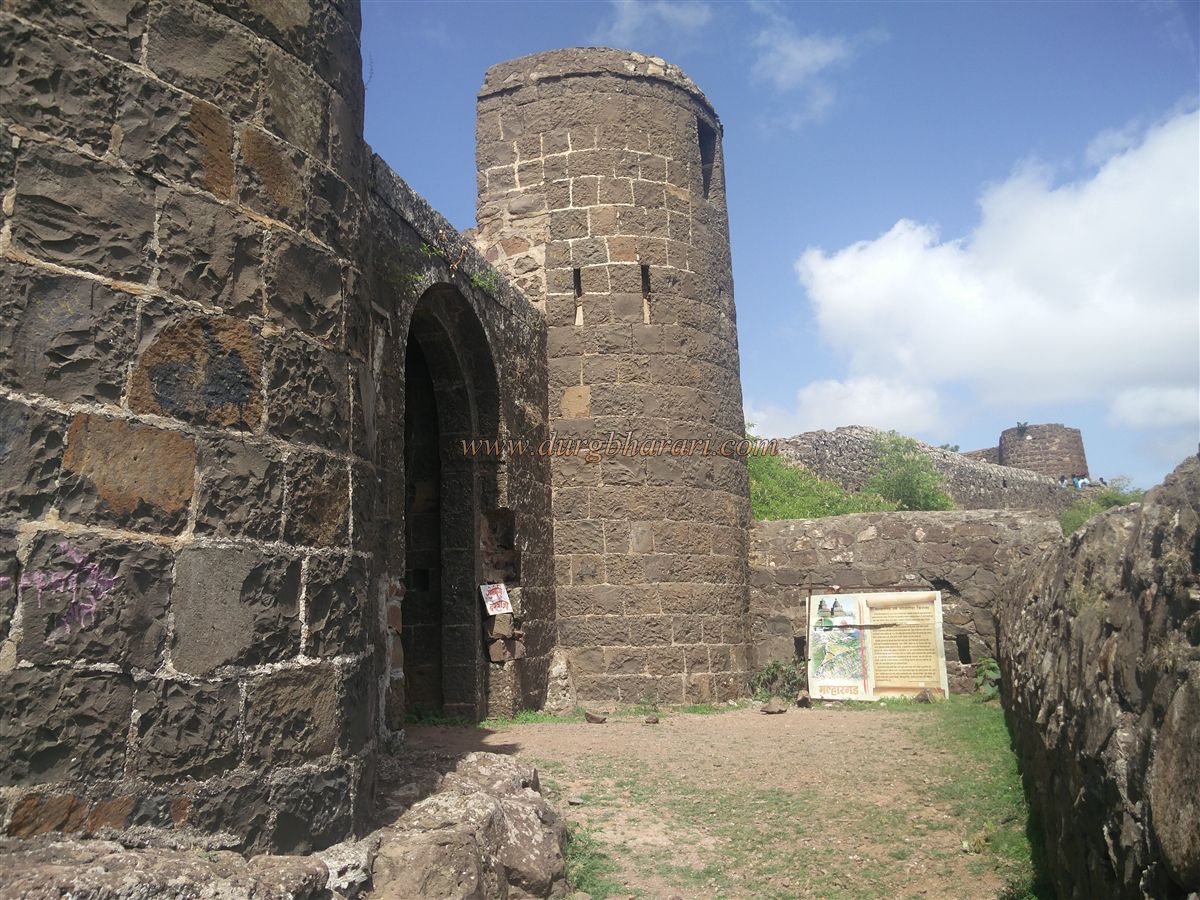
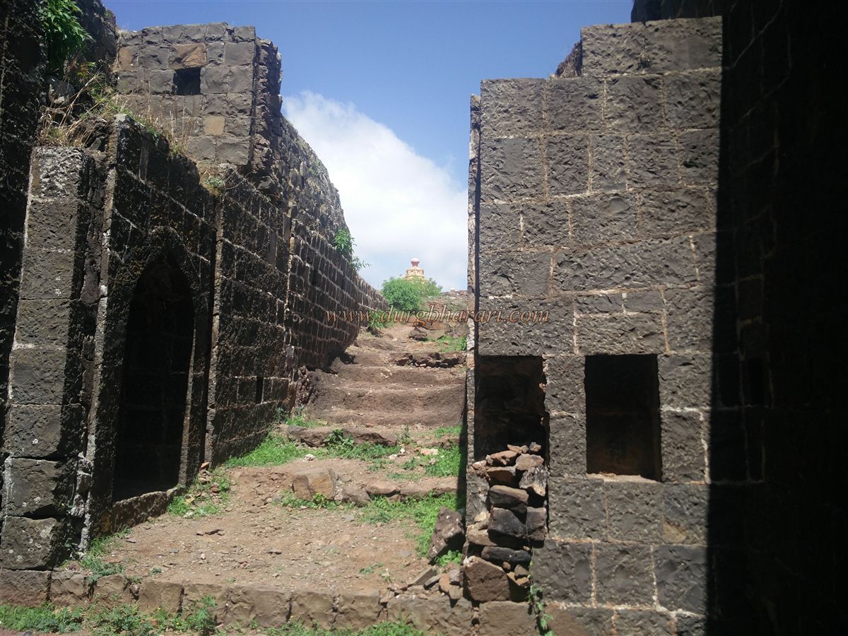
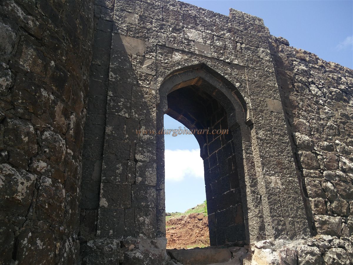
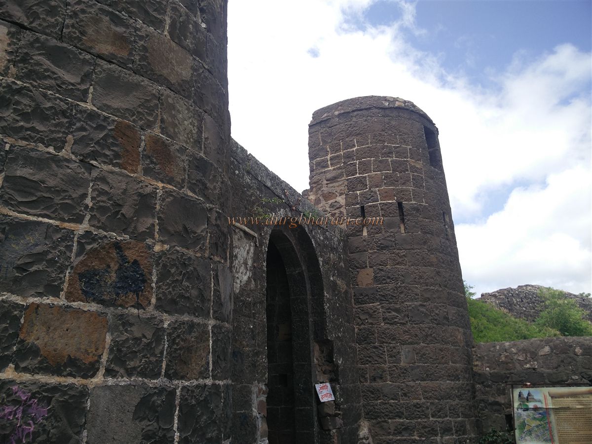
Just before entering the fort from the Sonori side, a small cave (nedhe) is visible in the rock near the bastion. The Mahadarwaja is built into the eastern bastion, and adjacent to it is another bastion. Upon entering through the gate, one sees the guard chambers and a set of stairs that pass between two fortification walls. Climbing these stairs leads to a medium-sized platform and the fortified wall of the citadel directly ahead. The entrance to the citadel is on the right side of this wall, but it's preferable to first explore the outer Machi to the left.
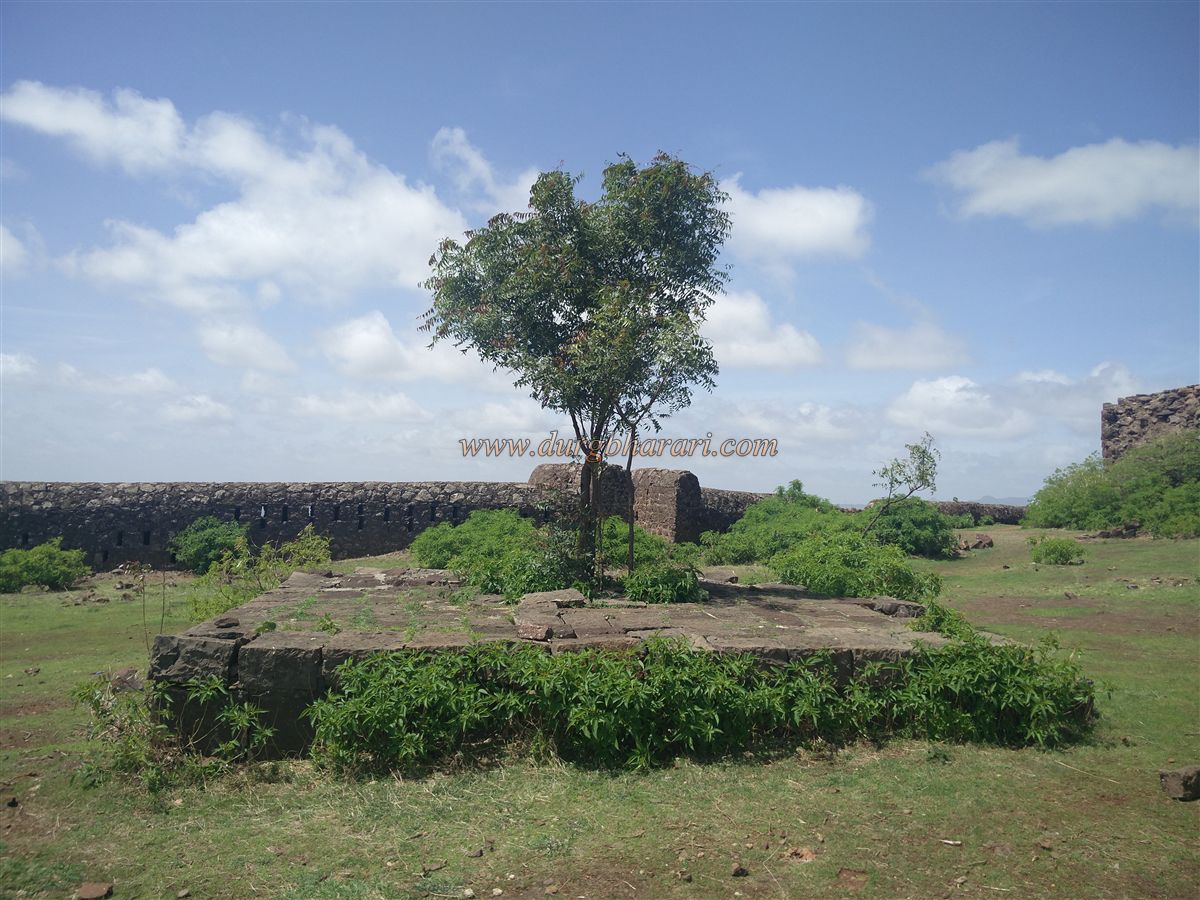
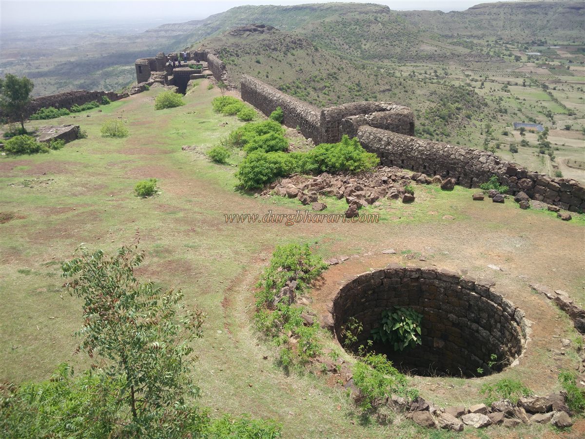
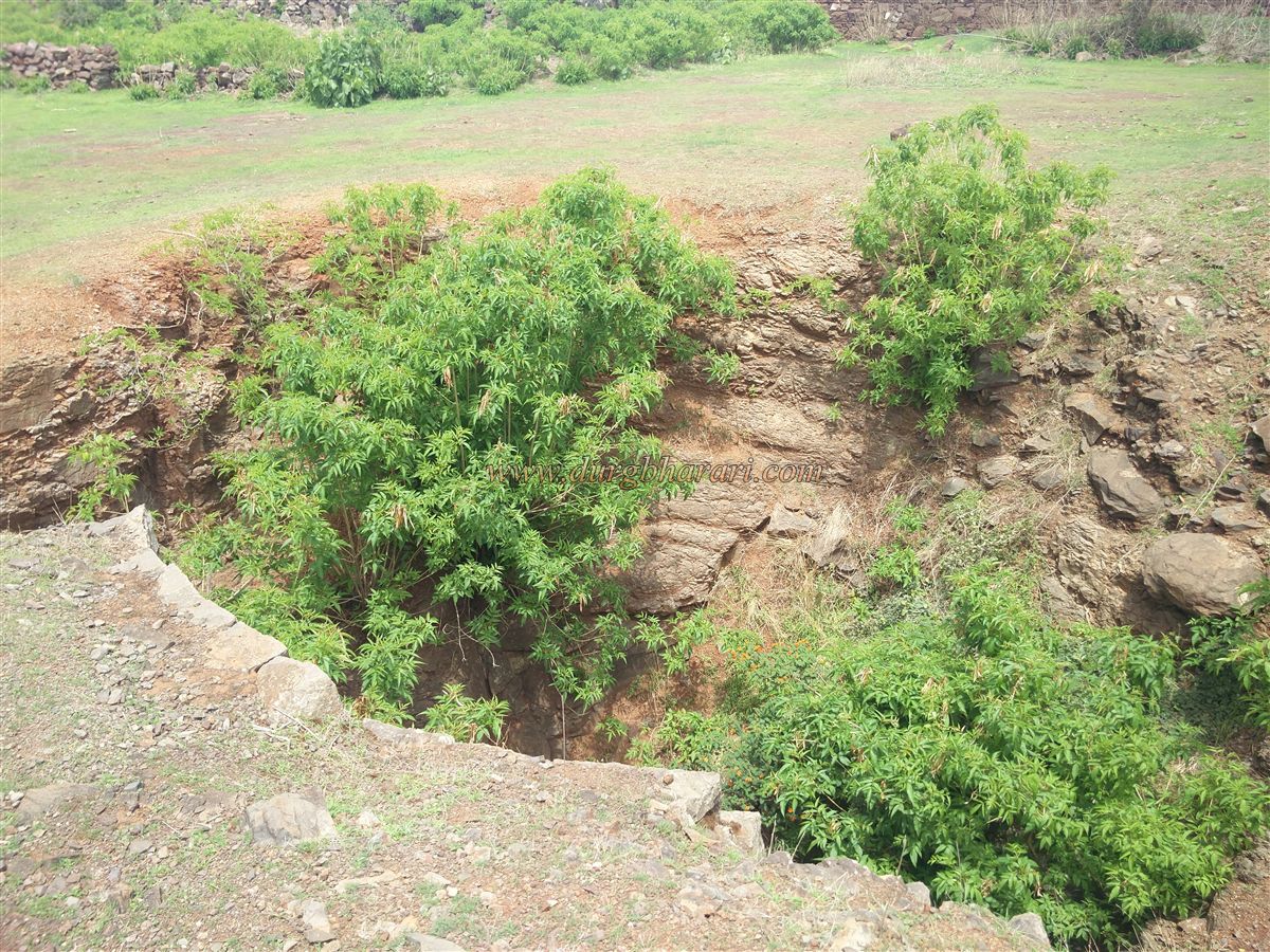
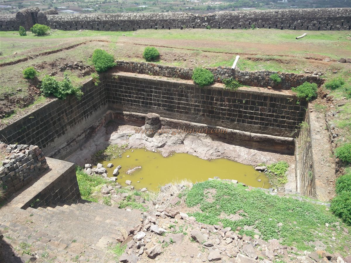
A little further from the platform lies a dried-up well. Continuing along the wall leads to a stone-built tank with steps, situated along the southern wall of the citadel. A small passage in the citadel’s wall provides access to this tank. However, the water here is mossy and not suitable for drinking. Further along, on the path leading to the bastion facing Kalewadi, is another well which does contain some potable water, but drawing it would require a rope.
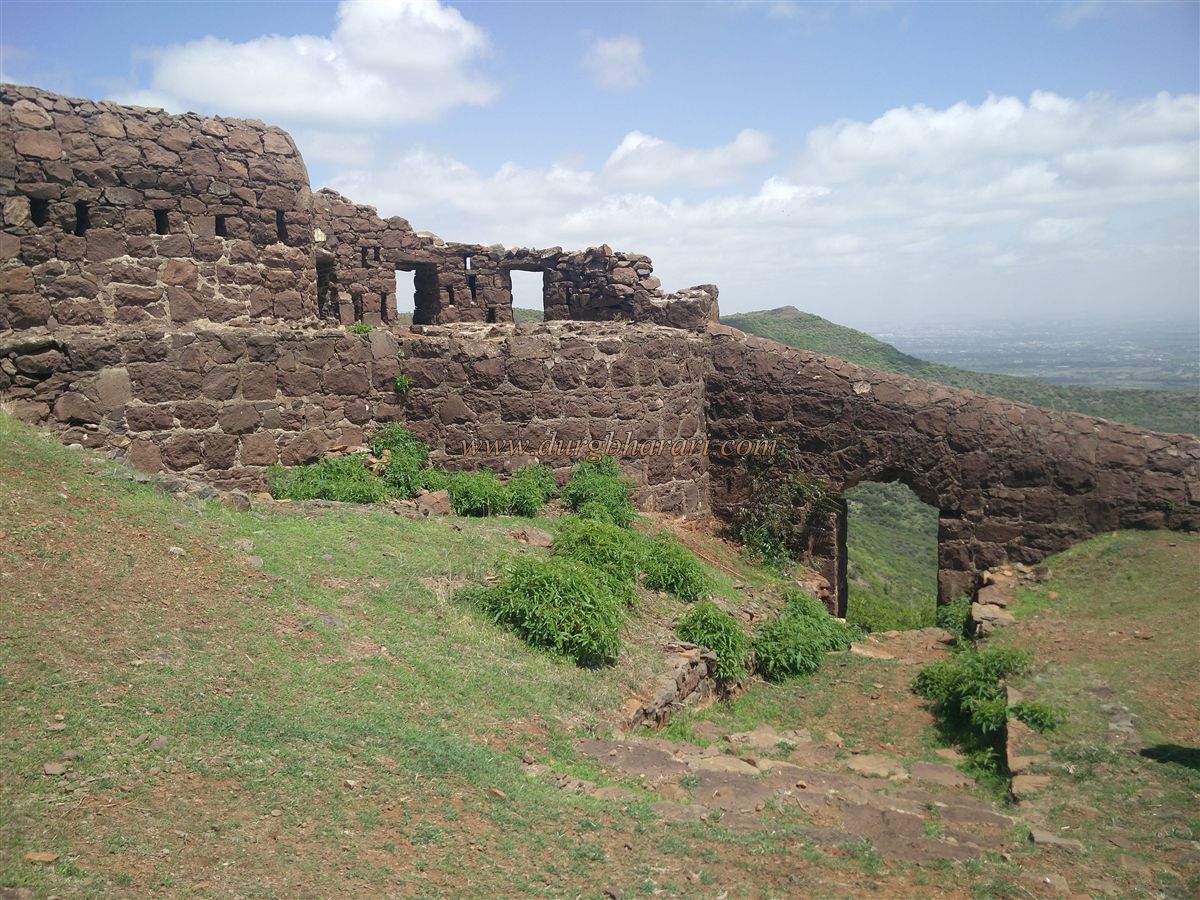
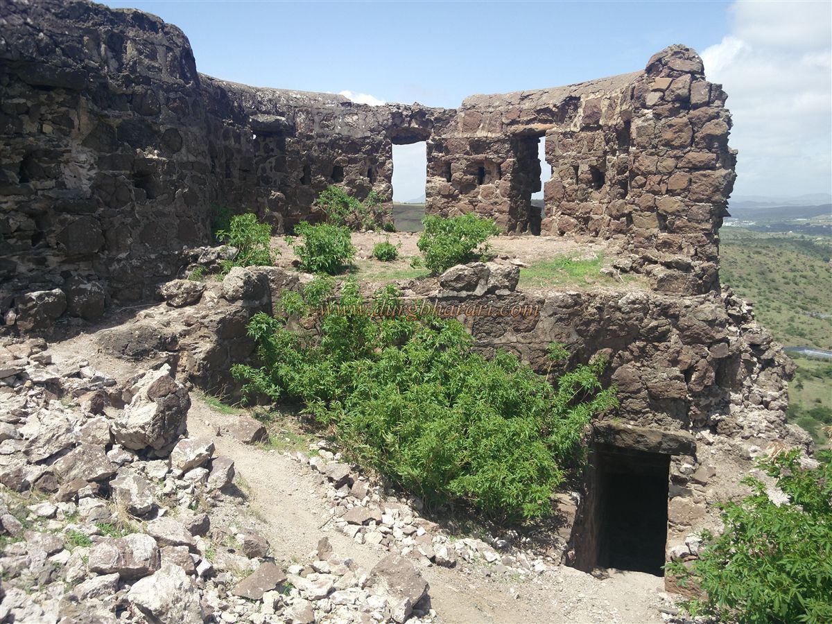
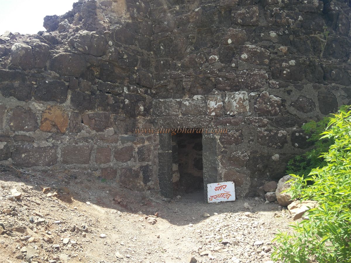
Beyond this well is a bastion on the Kalewadi spur, with a small gate allowing descent. This is the hidden entrance (chor Darwaja) used by those ascending from Kalewadi or Zhendewadi. Continuing along the wall with the citadel on the right, one comes across the ruins of various buildings. Eventually, the path reaches the northern bastion facing Zhendewadi. Below this bastion lies the third gate of the fort. A trail from Zhendewadi leads to this gate.
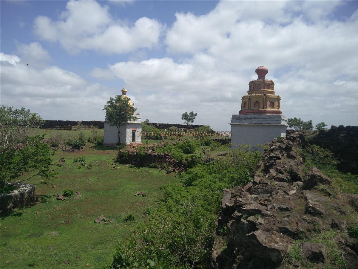
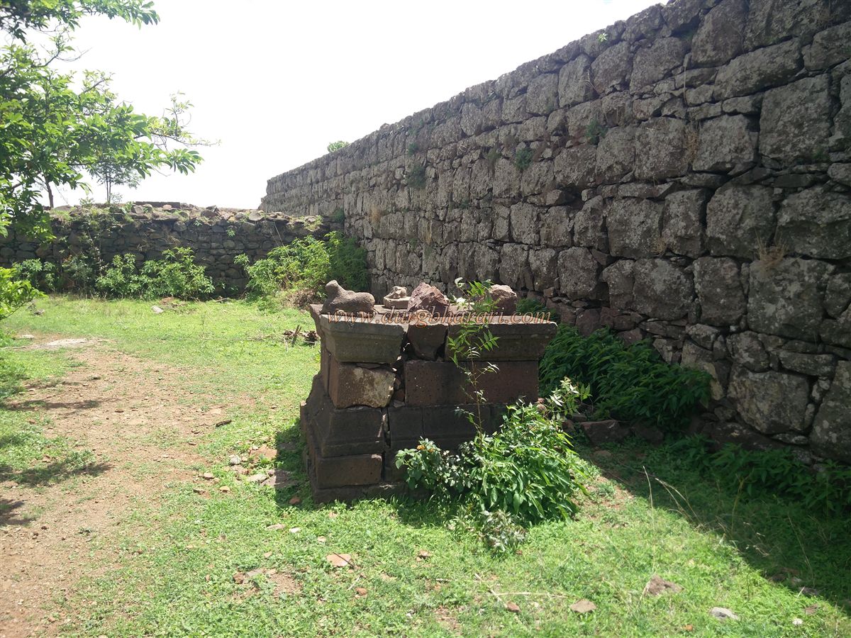
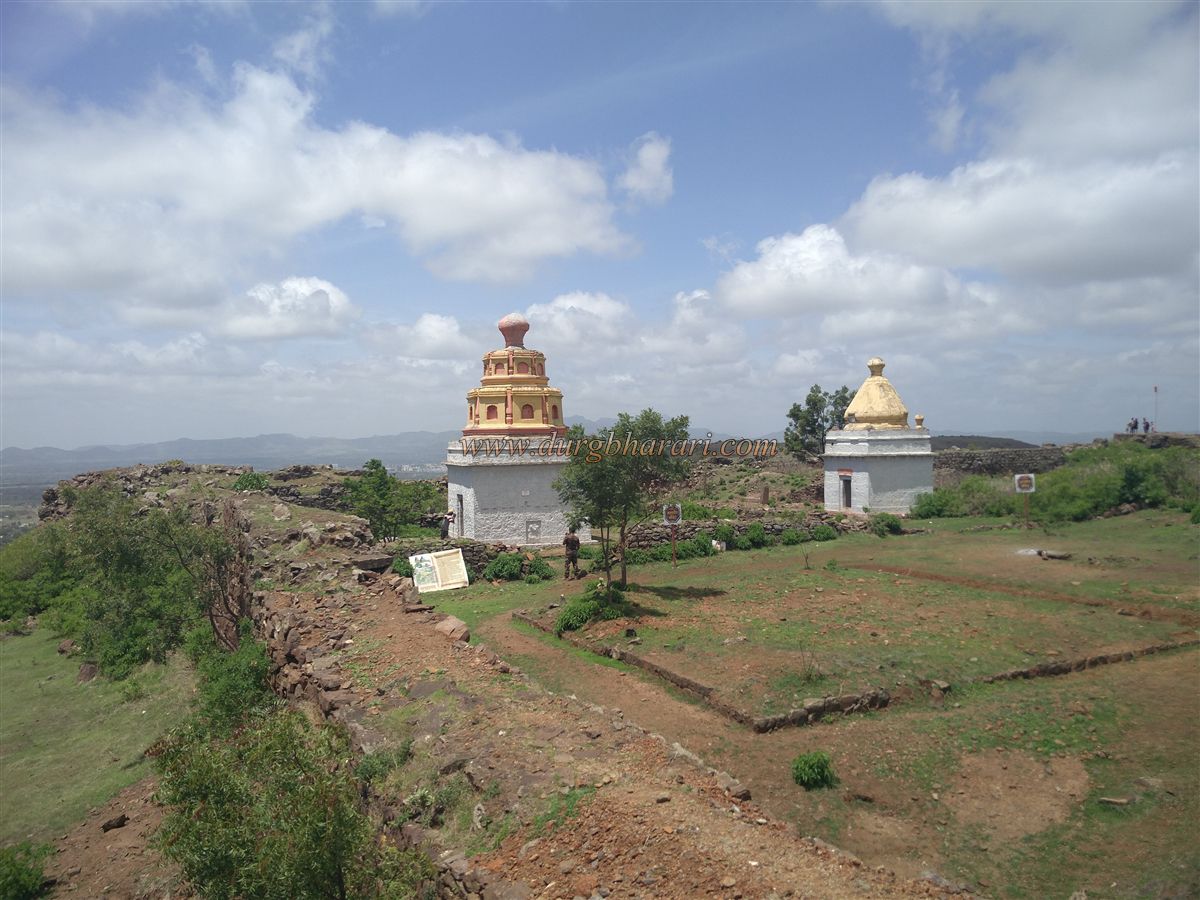
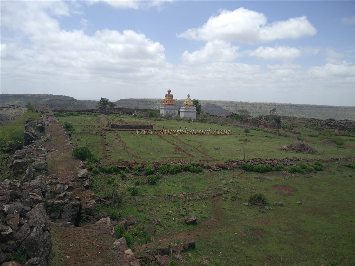
Following the path beneath the citadel’s walls toward the main gate, the entrance to the citadel appears on the right. Entering here reveals the entire area of the citadel. Inside are two temples — one small and one large. The larger temple is dedicated to Mahadev (Shiva), while the smaller one is for Malhari, or Khandoba, from whom the fort gets its name. The Shiva temple has a stone courtyard and a memorial platform (Samadhi). The Khandoba temple houses an equestrian idol of Malhari along with Mhalsa, and a few smaller idols are placed nearby.
Additionally, within the citadel are remnants of residential structures and foundations of mansions (wada). A small exit gate is present on the northern side of the citadel wall, and a carved rock-cut cistern is also visible.
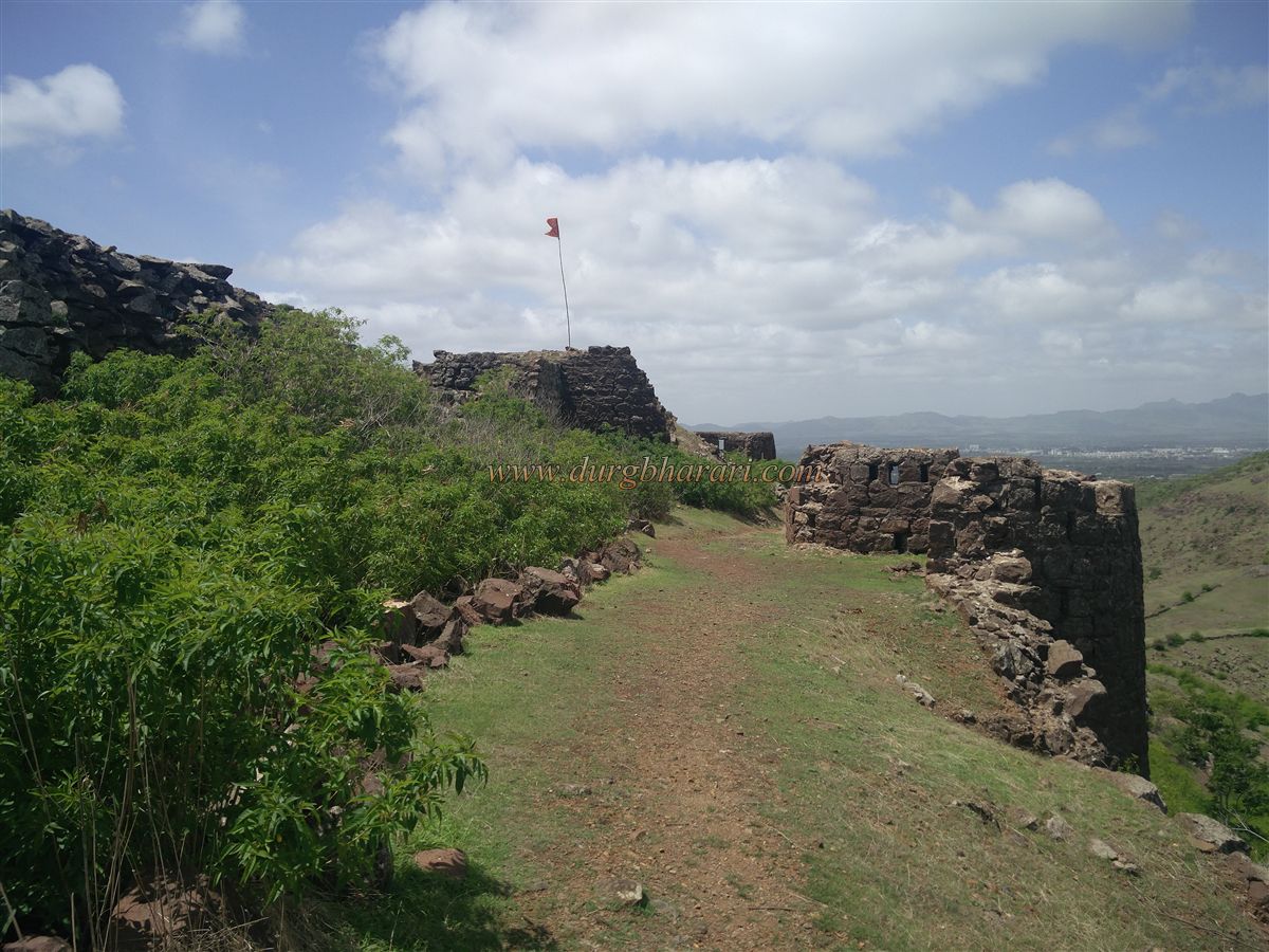
From Malhargad, one can enjoy views of Dive Ghat, Purandar, Saswad, and Jejuri. Though a small fort, a complete tour takes about an hour.
The construction of Malhargad was completed by Krishna Rao Mahadev Panse and Bhairav Yashwant Panse between 1757 and 1760. Records in the Peshwa Daptar indicate that Madhavrao I visited this fort around 1771–72. The Peshwa sanctioned an annual grant of ₹3,000 to Panse for the upkeep of the fort, as documented. During the uprising against the British, freedom fighters like Umaji Naik and Vasudev Balwant Phadke took refuge at this fort.
© Suresh Nimbalkar
GALLERY