MALANGGAD
TYPE : HILL FORT
DISTRICT : THANE
HEIGHT : 2553 FEET
GRADE : VERY HARD
Despite being very close to Mumbai, the ancient fort of Shri Malanggad in Kalyan has remained largely neglected by fort enthusiasts. The history of Thane district remains incomplete without mentioning this fort. The main reason for its neglect by fort lovers is that it is more popularly known as a religious place rather than a fort. In addition, the constant crowd of devotees and the resulting extreme filth make it less appealing. However, the fort carries a long history and still retains remnants of the past on its shoulders, making it essential for fort lovers to visit. The climb to the Balekilla requires effort and gear, turning the trek into an adventure. For this climb, we were assisted by Sudesh Nangre and Siddhesh Gotad from the mountaineering group Wild Troop, for which I am personally grateful.
...
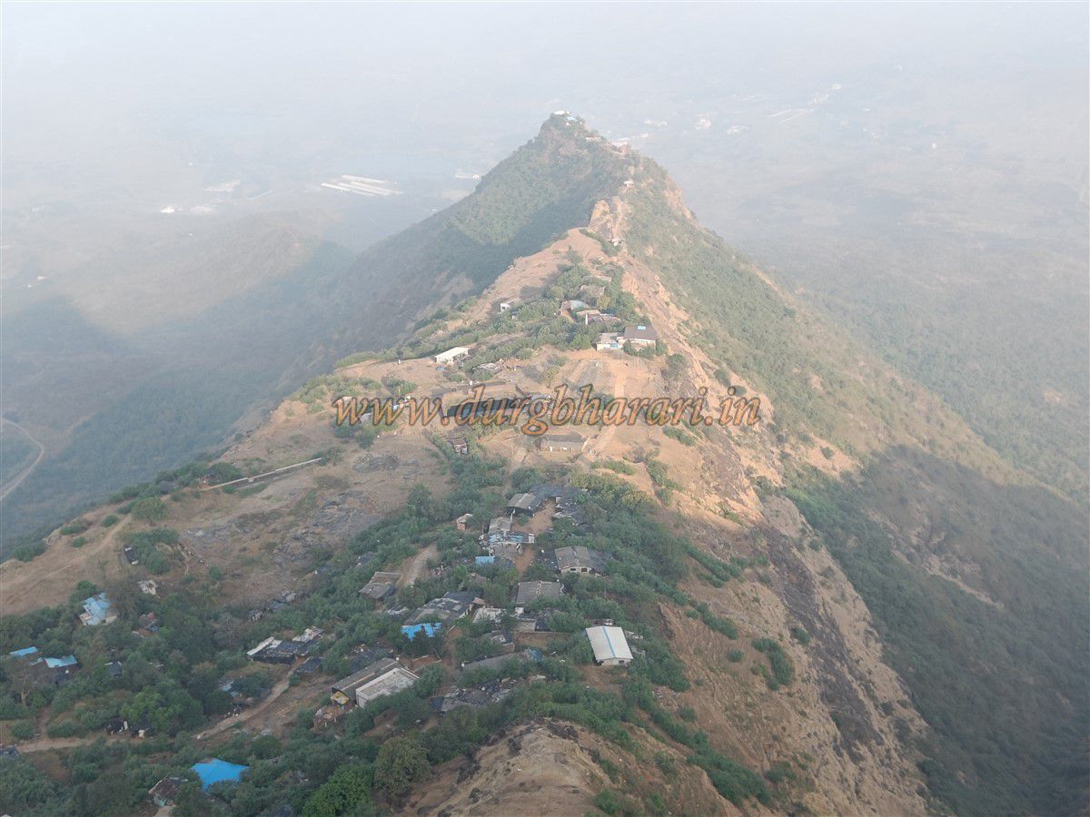
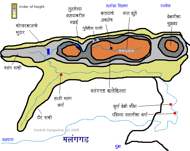
Malanggad is divided into three sections: Pir Machi, Sone Machi, and the Balekilla. The final segment, the Balekilla, requires rock-climbing equipment. While many Hindu and Muslim devotees visit the site, very few go beyond Sone Machi, and only trekkers reach the highest peak of the fort. Malanggad lies 16 km south of Kalyan and can be accessed via three main routes. One route ascends from Malangwadi at the base in Thane district, while the other two routes start from Wavanje and Shirvali (Kondpavdi) villages in Raigad district and lead up to Pir Machi. The first two routes are primarily used and have stone steps, while the third is rarely used. From Kalyan, private rickshaws and hourly buses go to Malangwadi, reaching the base in about an hour. Buses also run from Panvel to Wavanje, which is 2 km from the base, and private rickshaws are available from the village. To avoid crowds, the Wavanje route is preferable. Both routes lead to the Durga Devi temple at the start of Pir Machi.
The Durga Devi temple is the original temple on the fort. Along the path lies a Samadhi, and in the courtyard are rock-cut carvings including a Shivlinga, Nandi, snake sculpture, and footprints. The temple houses idols of Durga Devi, Vithoba, and Rukmini. After visiting the temple, a board on the left indicates the way to the ancient Vagheswari temple, which has partially collapsed. Inside are idols of Ganapati and Vagheswari Devi. Farther along is a sign pointing to the Ganesh and Maruti temples. The narrow alleys between shops and houses make it difficult to locate these temples without the signs. Between two shops is a narrow lane leading to a temple where, instead of idols, rice has been placed with silver masks of Ganapati and Maruti.
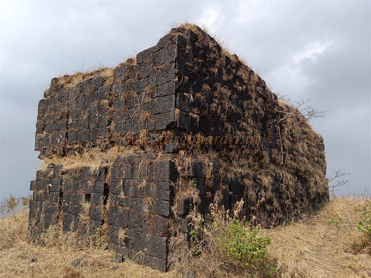
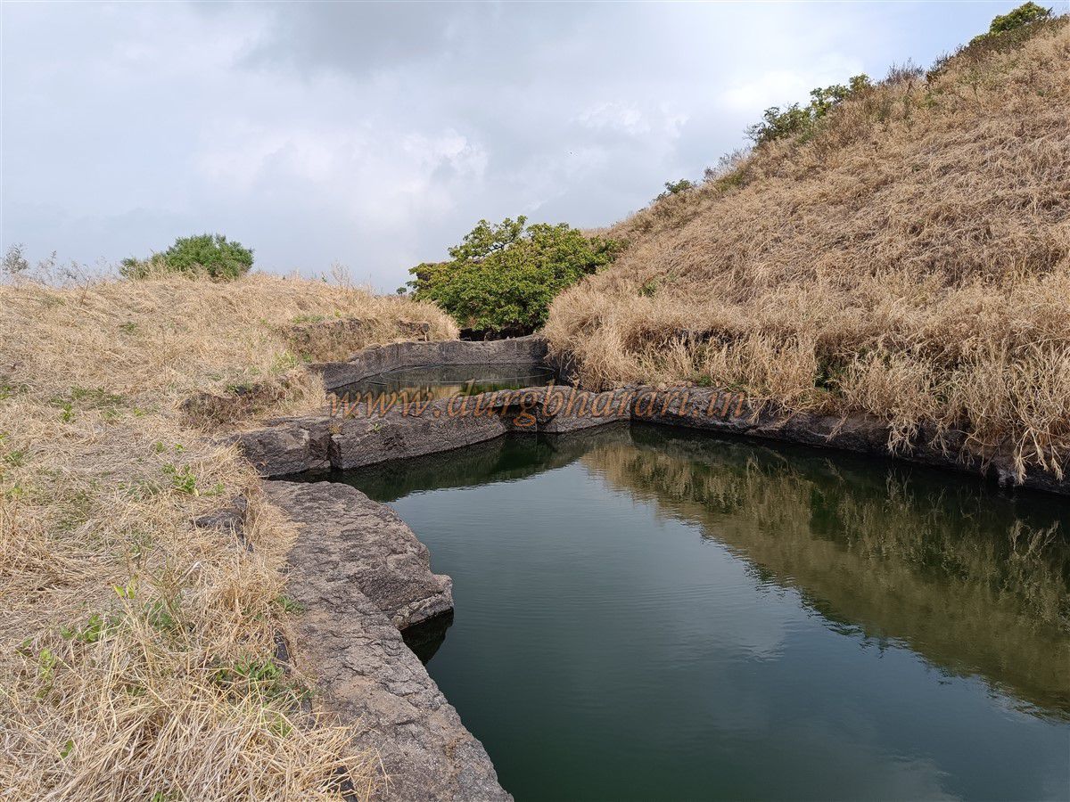
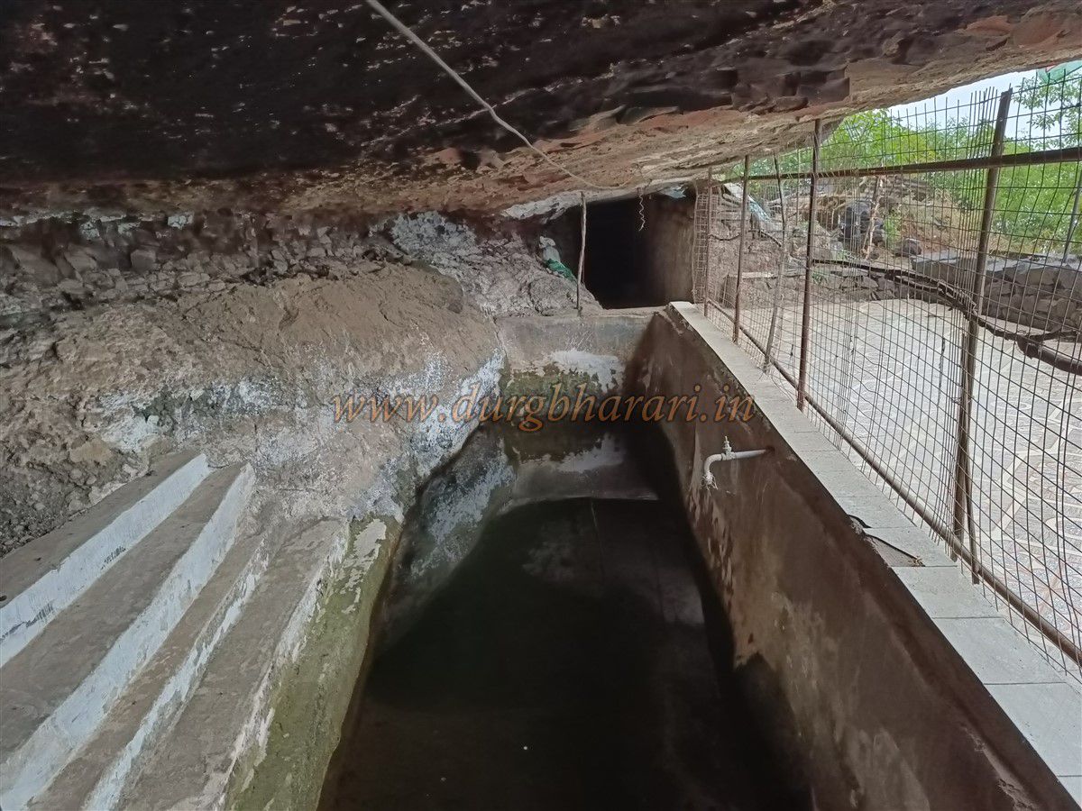
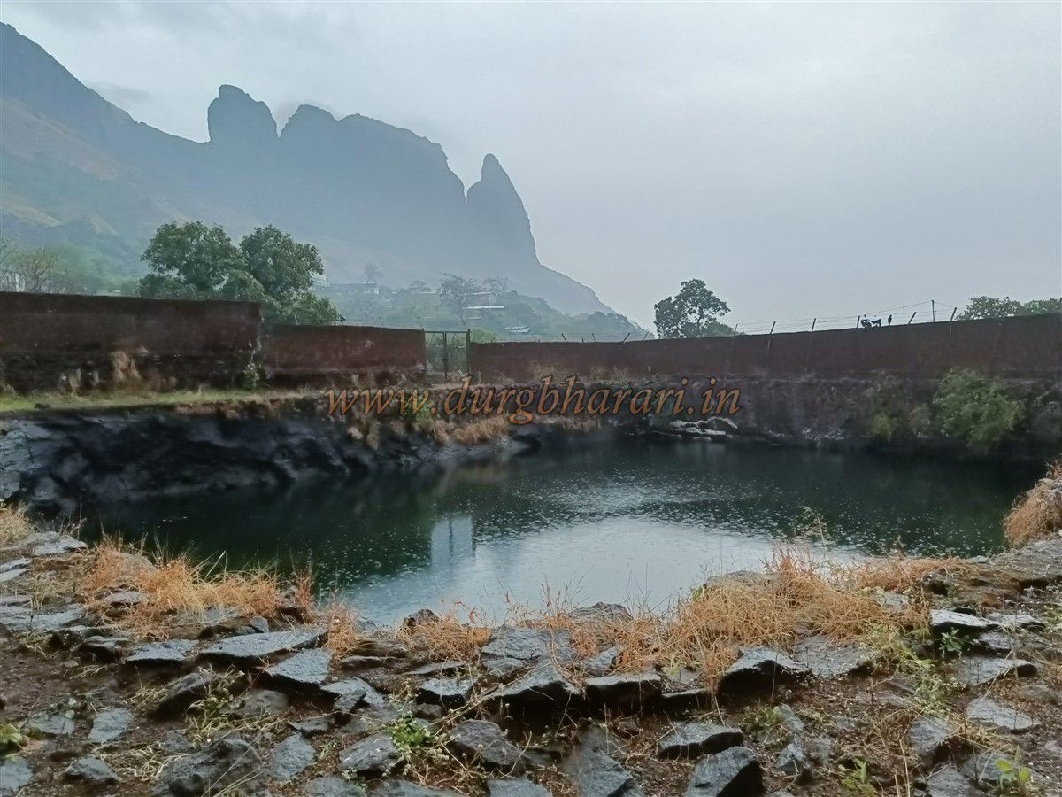
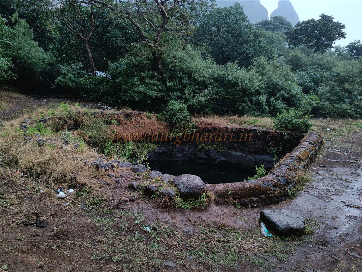
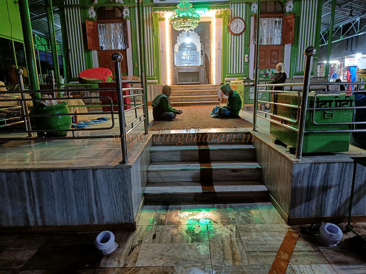
Returning from the temple and proceeding on the main path, one reaches the Samadhi temple of Shri Malang (Machhindranath), made of dressed stone. Near the entrance are two cannons, their muzzles visible above ground. Inside are two Samadhi, one small and one large. The outer walls bear carvings of peacocks and fish. To the left of the temple, a path descends to a place known as Ghodetap. This place is designed for innocent devotees, and just before reaching it, there’s a large 20x20 ft water cistern carved into rock. It is used by locals on the Machi, and a metal mesh prevents waste from entering. Following the ridge along the cliff leads to a circular rock-cut well. Continuing from there, one comes to a newly built cement dam. Past this dam, a little ahead, is a large area enclosed with bricks, covering a massive 60x60 ft. cistern carved in rock, known as the "Bada Kuva." The two earlier tanks are called "Chhota Kuva." Since there are no further remains ahead, one must return to the Samadhi temple.
The spread of the Machi is vast, and most settlements and remains on the fort must have been located here. However, widespread habitation and unauthorized constructions have engulfed most of the remnants. The other end of Pir Machi is across from the Devni pinnacle. Remains in this area include three rectangular water tanks, a Datta temple, and a Shivlinga. While descending the fort, if one walks in the opposite direction of Durga temple towards Devni pinnacle, these remnants can be explored within an hour.
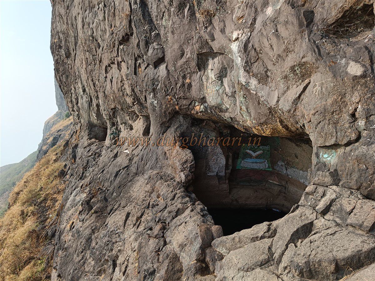
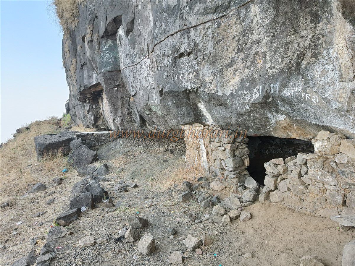
Back at the Samadhi temple, from the earlier seen lane between two shops, a path ascends towards the mountain. This steep climb takes around half an hour to reach the base of the upper cliff. From here, the path turns right, and shortly splits into two: one ascending through a gully and another hugging the cliff. While the gully leads to the upper part of the fort, one should first explore the other path. After walking for five minutes, a large cave carved into the cliff appears. Inside are two water tanks, one with potable water. A fakir currently stays here, and a tomb of a Baba has been established inside. Returning from the cave, take the gully path to continue the ascent.
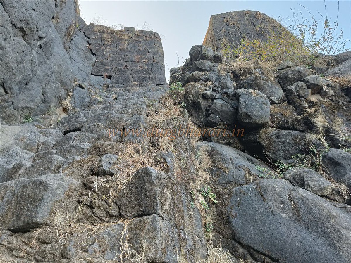
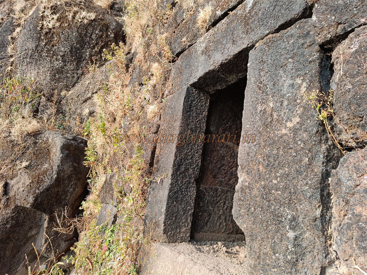
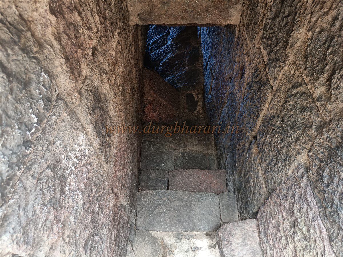
At the top of the gully, one sees two bastions and steps carved into the rock, though the archway between the bastions has completely collapsed. The steps are uneven and narrow in parts, allowing only sideways movement. Within ten minutes, one reaches Sone Machi, the second section of the fort. Right at the entrance is a structure built into the fort wall, possibly a secret doorway. About 20 feet inside, a hidden exit door becomes visible. The upper part is rock-cut while the lower part has built steps. This path, once leading to Wavanje village, is now entirely broken and unusable.
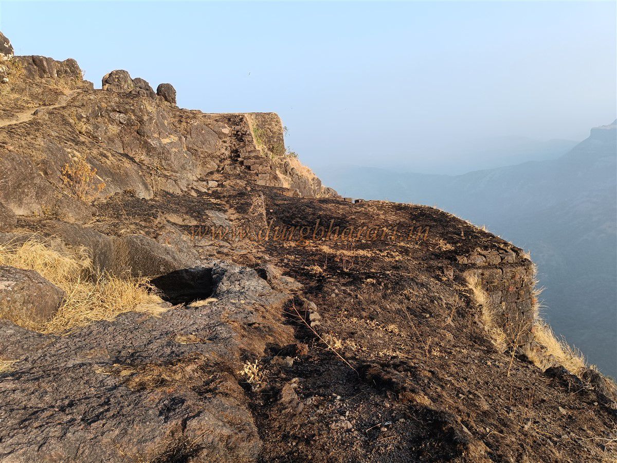
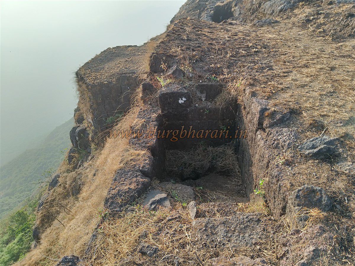
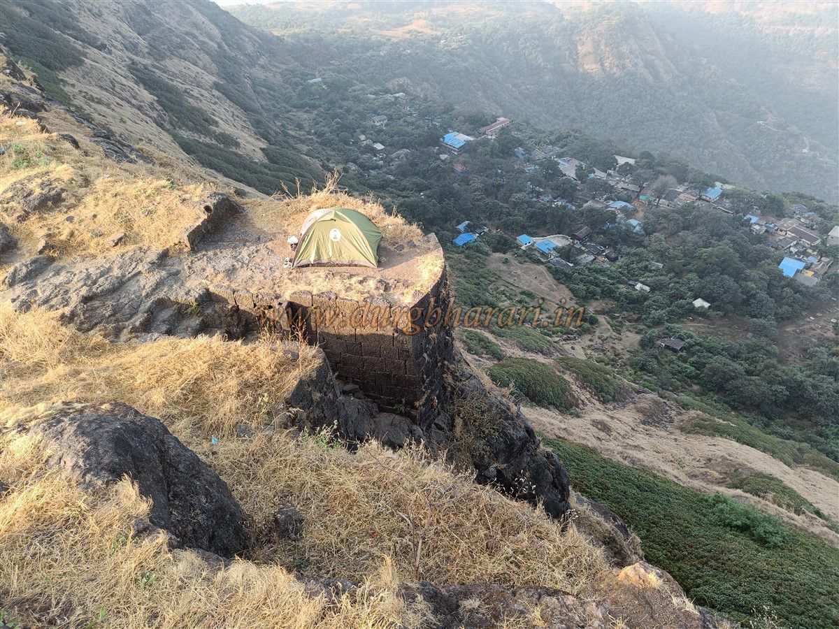
After exploring this gate and returning, one sees the Balekilla rock spires to the right and the spread of Sone Machi to the left. Sone Machi measures about 600 feet long and 200 feet wide. Since it’s not very large, it’s best to explore it first. Immediately, a sunken storage chamber filled with soil is seen, nearly buried now. Further ahead is a platform built from dressed stone and two rock-cut tanks. One contains water, though not fit for drinking. The fortification has bastions, some damaged. At one point, steps leading to the parapet are visible, and a latrine is seen on the right-side wall. At the end of the Machi is a bastion with a flagpole, and a large hole carved in the rock to erect the flag.
After exploring Sone Machi, one should begin the final leg towards the Balekilla—the rock pinnacle. On the right side of the pinnacle is a small broken tank, and ahead is a larger tank, with water that’s not potable. Returning from this point, proceed along the left side of the pinnacle. At a slightly higher elevation are three tanks carved into the rock—two medium-sized rectangular ones and a small circular tank. Moving forward, on the cliff wall to the right are steps leading to the Balekilla, but rather than taking them, continue straight ahead. After circling the rock face, three more water tanks are visible on the vertical cliff. Two of them have potable water, but the third tank is on a dangerously narrow path. The first of these tanks is inscribed with the word "Quran" in paint and holds water until May–June.
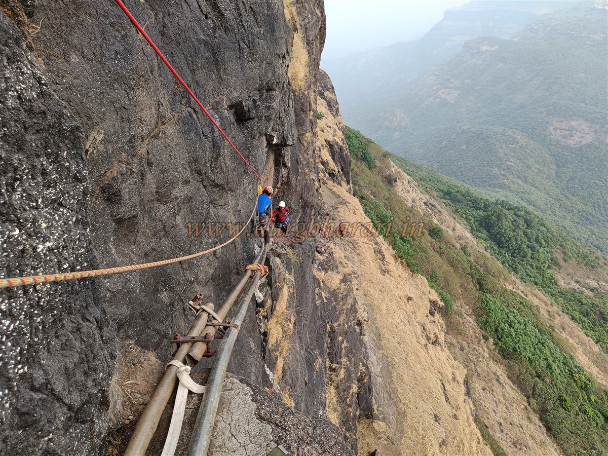
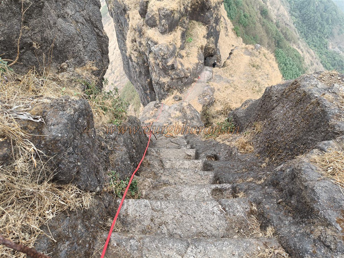
After collecting water, return and begin climbing the steps toward the Balekilla. After about 40–50 steps, the next 20 feet of steps are missing due to rock collapse. Up to this point, no climbing gear is needed, but beyond this, ropes and experience are essential. Two iron pipes have been laid horizontally across the gap, but because of the wide space between the pipe and the cliff, a rope is required for hand support. This difficult section requires mental preparation, climbing skill, and proper equipment. A man is sometimes stationed here, offering assistance for a fee, though we did not see him during our visit.
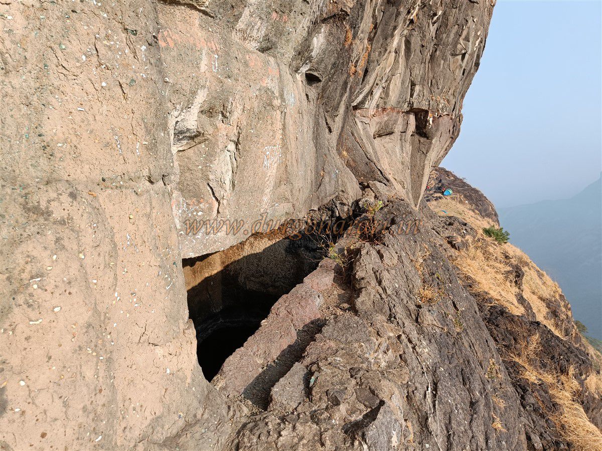
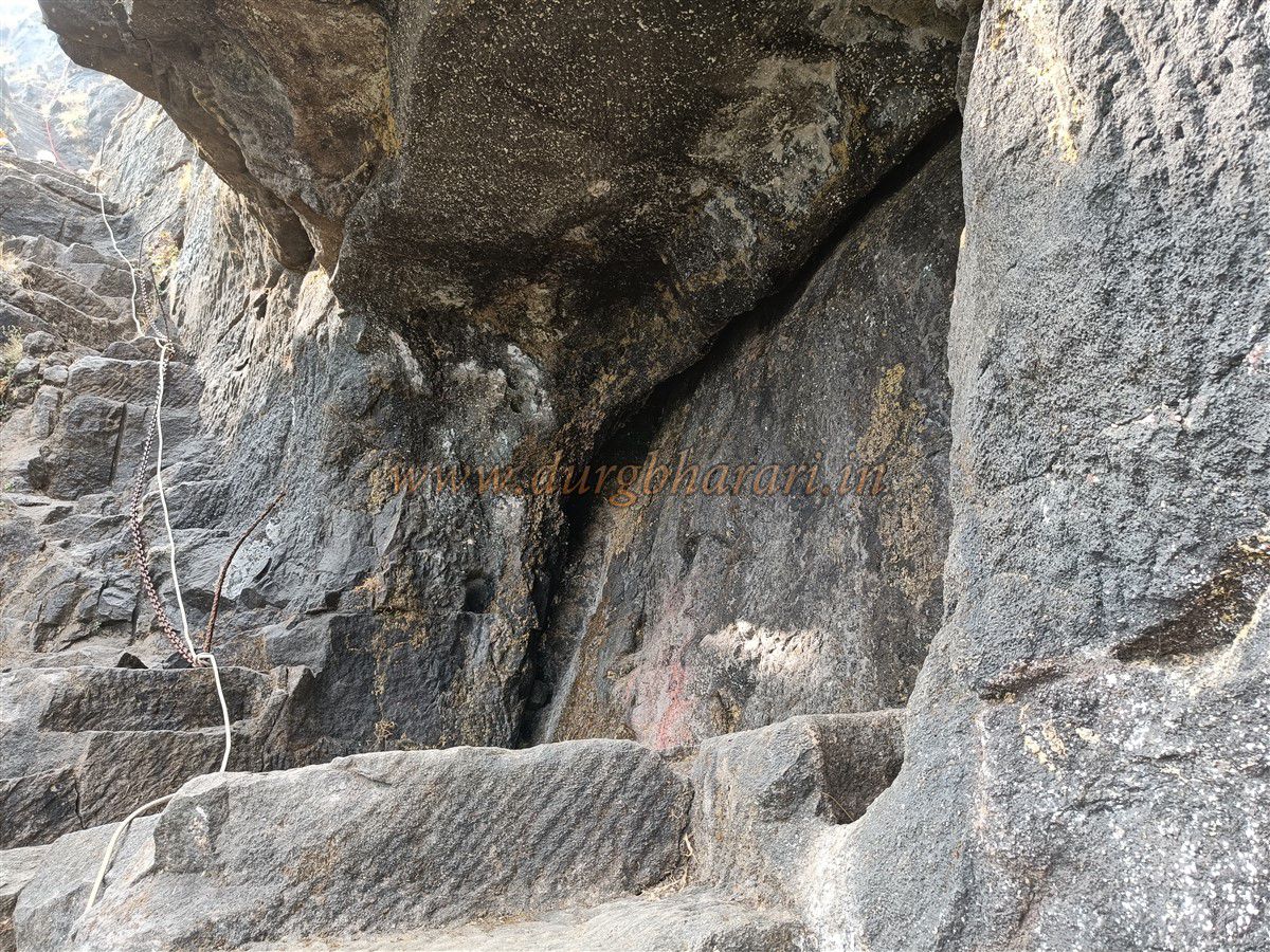
Crossing this dangerous section leads to a small cave carved into the rock, possibly a guardhouse. Inside are two carvings, one of a goddess riding a lion, and another too worn to identify—possibly Hanuman or Ganesha? A steep flight of damaged steps follows, leading to a narrow pass between two pinnacles. Steps carved into the rock go up the second pinnacle, with grooves for handholds. In some places, the steps have no railing and metal rods have been embedded for support. Two or three spots have iron chains, though they are rusted and unreliable. It is recommended to use ropes instead. With ropes, it takes about 10–15 minutes to reach the top of the fort.
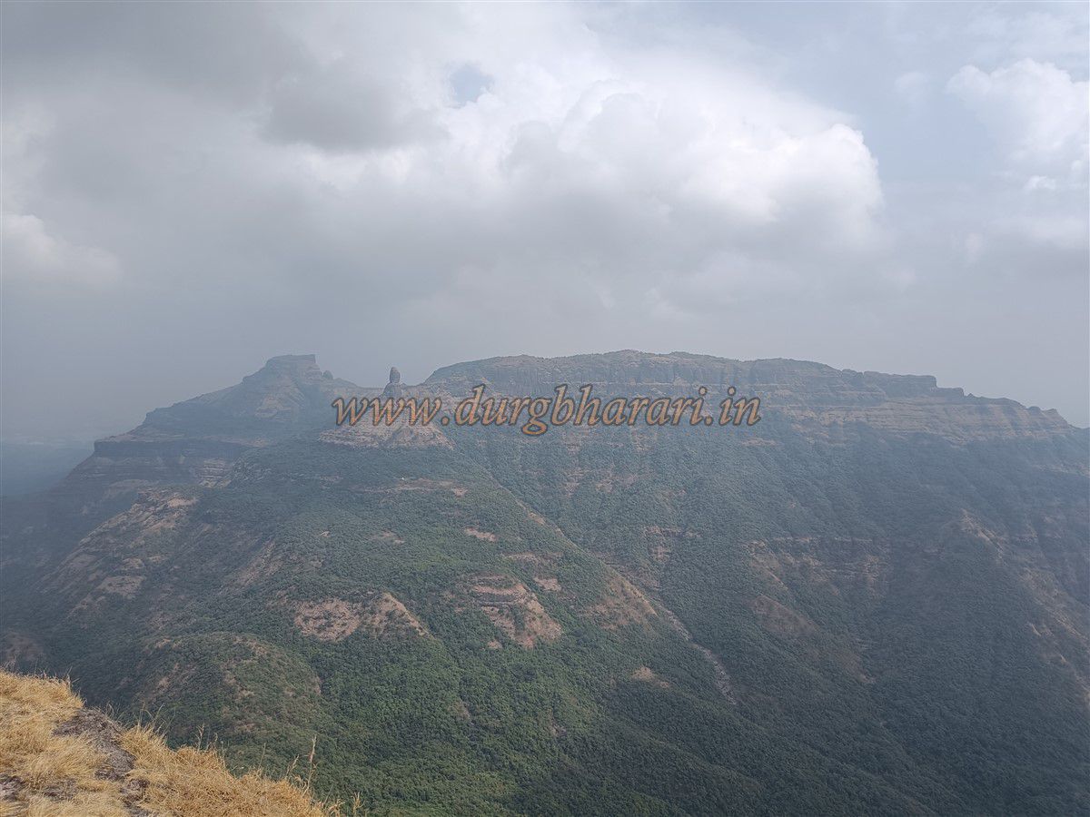
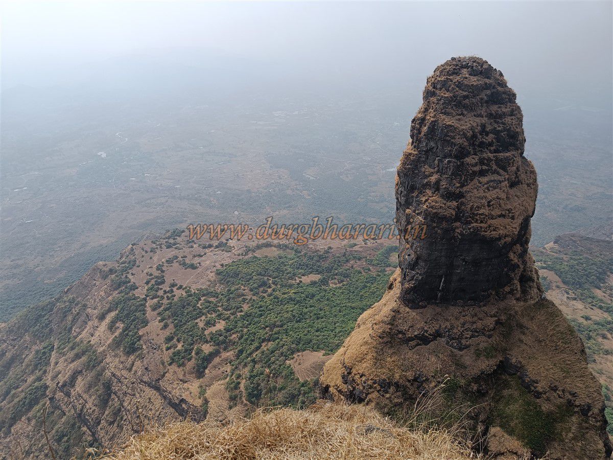
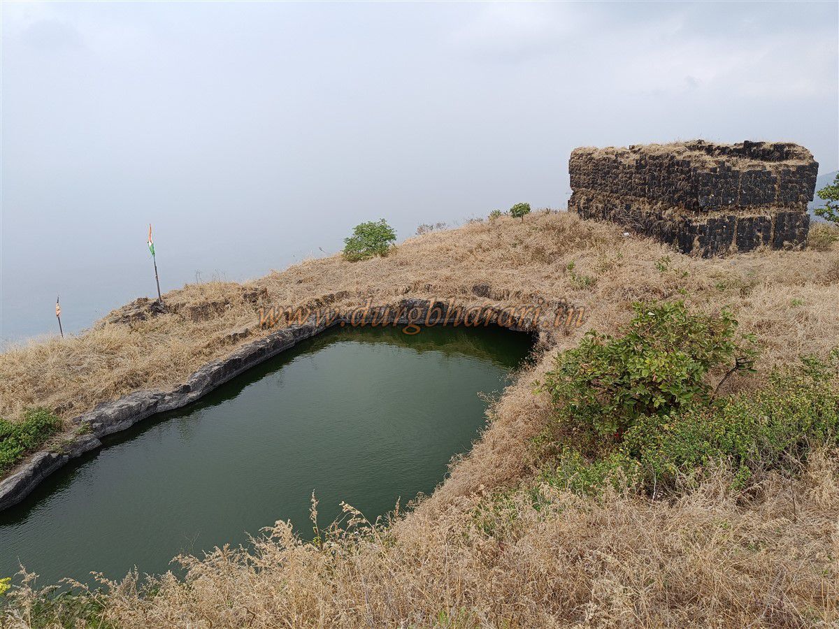
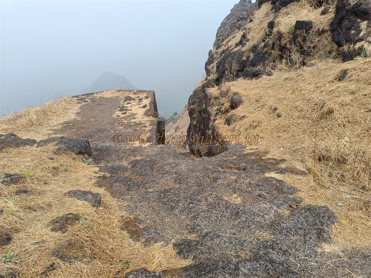
The Balekilla is formed of two pinnacle summits. The first is bare of remains. At the start of the second is a large two-storey building, with an entrance on the east wall and large windows on both sides of the upper floor. Behind the building are seven water tanks carved in sequence into the rock, all with potable water until May–June. Near the first tank is a carved trough for collecting water and a platform for the flagpole. Parts of the summit have fort walls. Walking along the tank trail leads to the other edge of the summit, across from which stands the Devni pinnacle. Below it, three tanks carved into the plateau are visible. Due to overgrowth elsewhere, no other remains are seen. This is the highest point of the fort, standing at 2552 feet above sea level. From here, one can see forts like Gorakhgad, Chanderi, Peb, Irshalgad, Prabalgad, and hills like Tahuli, Mhaismaal, Matheran, and the entire Panvel–Belapur region.
The rock-cut features suggest that Malanggad was likely built during the Shilahara period. In the 6th century, a king named Naldev Maurya ruled here. In 1657, Shivaji captured the Kalyan–Bhiwandi region, and Malanggad likely became part of Swaraj then. On March 27, 1689, Mughal commander Matabar Khan captured Kalyan and took Malanggad. In 1730, Baji Rao Peshwa launched a campaign for Sashti after capturing Kambe fort. Raoji Raut and Nanaji Deshmukh stationed forces at Malanggad’s base. During the 1738 Vasai campaign, Ramchandra Hari Patwardhan, Ramji Mahadev Bivalkar, and Khandoji Mankar were posted at the fort. In the late 17th century, fierce battles occurred between the Marathas and British on the fort. Captain Abingdon besieged Malanggad during the 1780 monsoon, cutting off all paths and using cannons to bombard Sone Machi from Pir Machi. However, the cannonballs didn’t reach the target. The fort commander sought help from Anand Rao Dhulap and Kashipant, but their 700 soldiers couldn’t reach the fort. British forces climbed to Sone Machi using ladders but were repelled by boulders thrown from above. Nana Phadnavis sent Balaji Vishwanath Pathak and Radho Vishwanath Godbole with 3000 troops to break the siege. They reached Shirwal, north of Malanggad, but failed to dislodge the British.
On September 16, a Maratha battalion attacked Pir Machi and damaged the British cannons. British reinforcements under Major Westfall destroyed a Maratha supply troop, causing a food shortage on the fort. Colonel Hartley opened safe routes via Belapur, Panvel, and Taloja, then attacked the Maratha camp at Shirwal. A second British assault under Captain Carpenter began with cannon fire, but Ketkar defended valiantly. Due to heavy losses, the British paused attacks but maintained the siege. By October, famine struck the fort. Nana Phadnavis assembled a large force with his commanders and moved toward Rajmachi, aiming for Kalyan. Hartley withdrew from Malanggad, and Marathas sent reinforcements. Though the British took the fort shortly after, repeated Maratha attacks led to its return in the 1782 Maratha–British treaty.
Believing that the fort was reclaimed through the saint’s blessings, the Peshwa appointed Kashinathpant Ketkar of Kalyan as the priest of the shrine. His descendants still serve there today. Presently, legal disputes continue in Thane’s civil court, high court, and with the charity commissioner over whether the shrine belongs to Hindus or Muslims. The Samadhi is believed to belong to Nathpanthi saint Machhindranath, and a fair is held on Magh Pournima each year. The saint’s palanquin is taken out, and offerings and prayers are conducted at the shrine.
Avoid visiting during the four months of the monsoon. Also, avoid rappelling from the pipe area as the bolts are old and weak. For peaceful exploration of the fort’s ruins, it is best to avoid festival days.
© Suresh Nimbalkar
GALLERY