MAHURGAD
TYPE : HILL FORT
DISTRICT : NANDED
HEIGHT : 1880 FEET
GRADE : MEDIUM
Shrikshetra Mahurgad located at a distance of 140 km from Nanded is a place of worship for many devotees in Maharashtra. Mahurgad is one of the Pith of the three and a half Pith of Goddess in Maharashtra. This place of Shri Renuka Devi Jagdamba is situated on a hill 2600 feet above sea level and devotees visit this place throughout the year. As Mahur village is at the end of Nanded district, to reach there one has to reach Kinwat by Nandigram Express from Mumbai and from there Mahur can be reached by S.T. buses or private vehicle at a distance of 50 km. The village of Mahur has existed since ancient times as the abode of sages and the stories of Parashuram in the Puran are connected with this region. The Pandav Leni caves of the eighth century Wakataka period can be seen here.
...
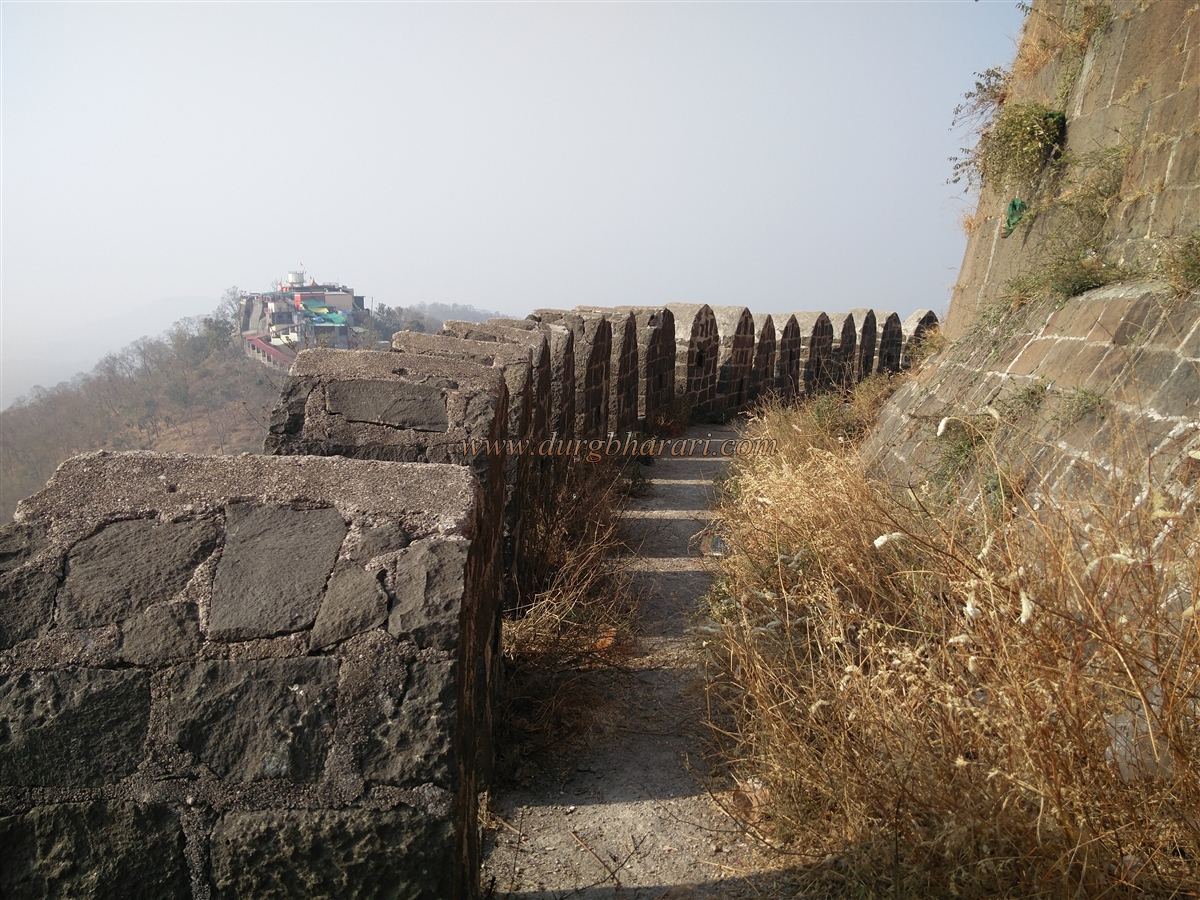
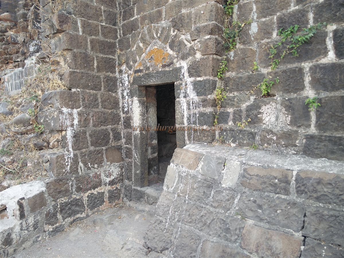
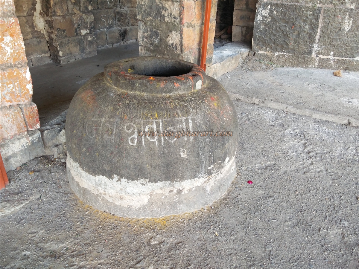
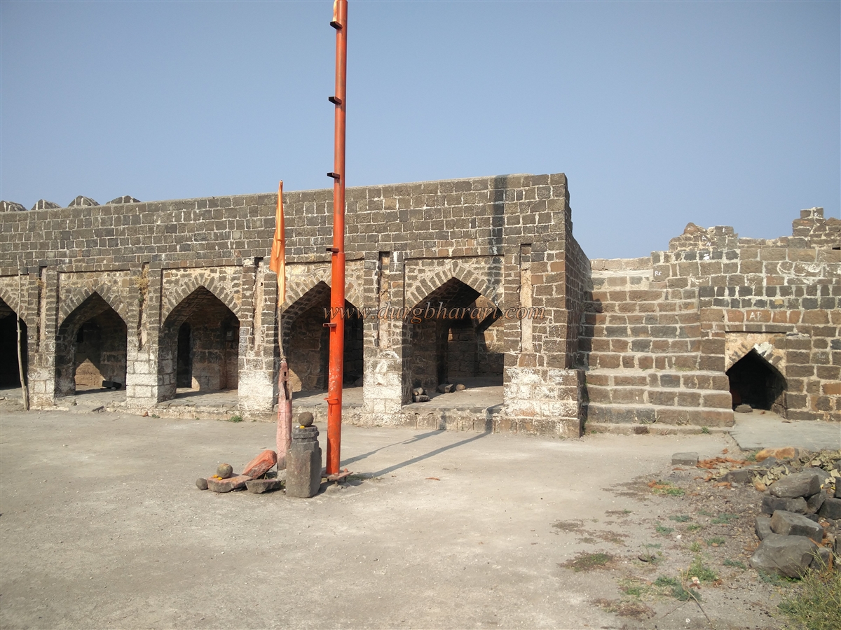
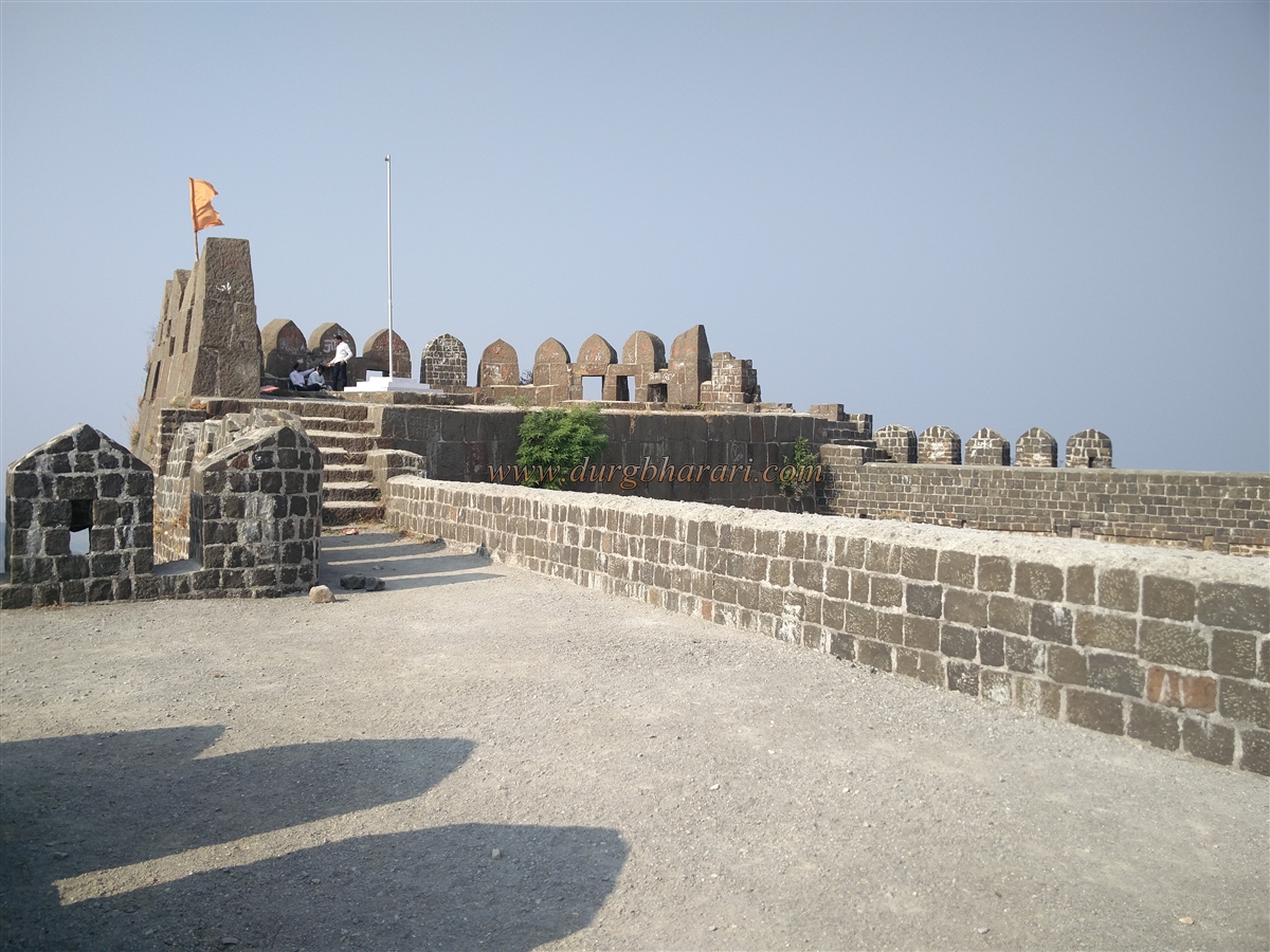
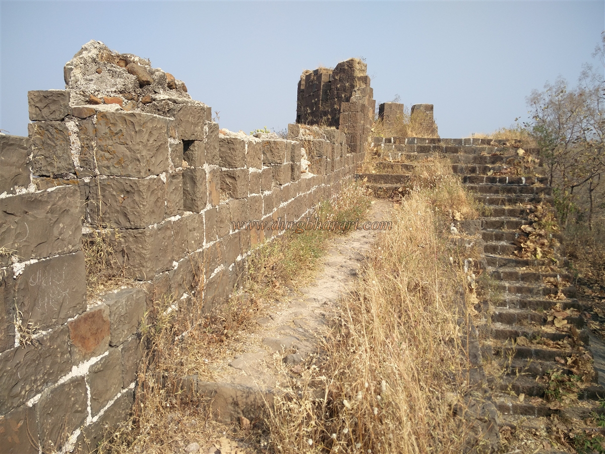
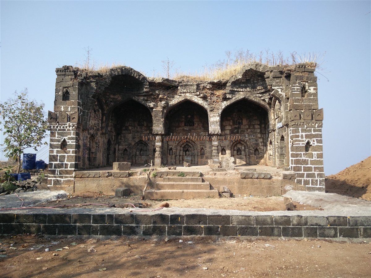
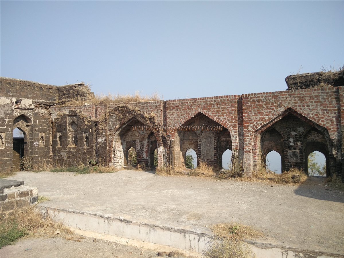
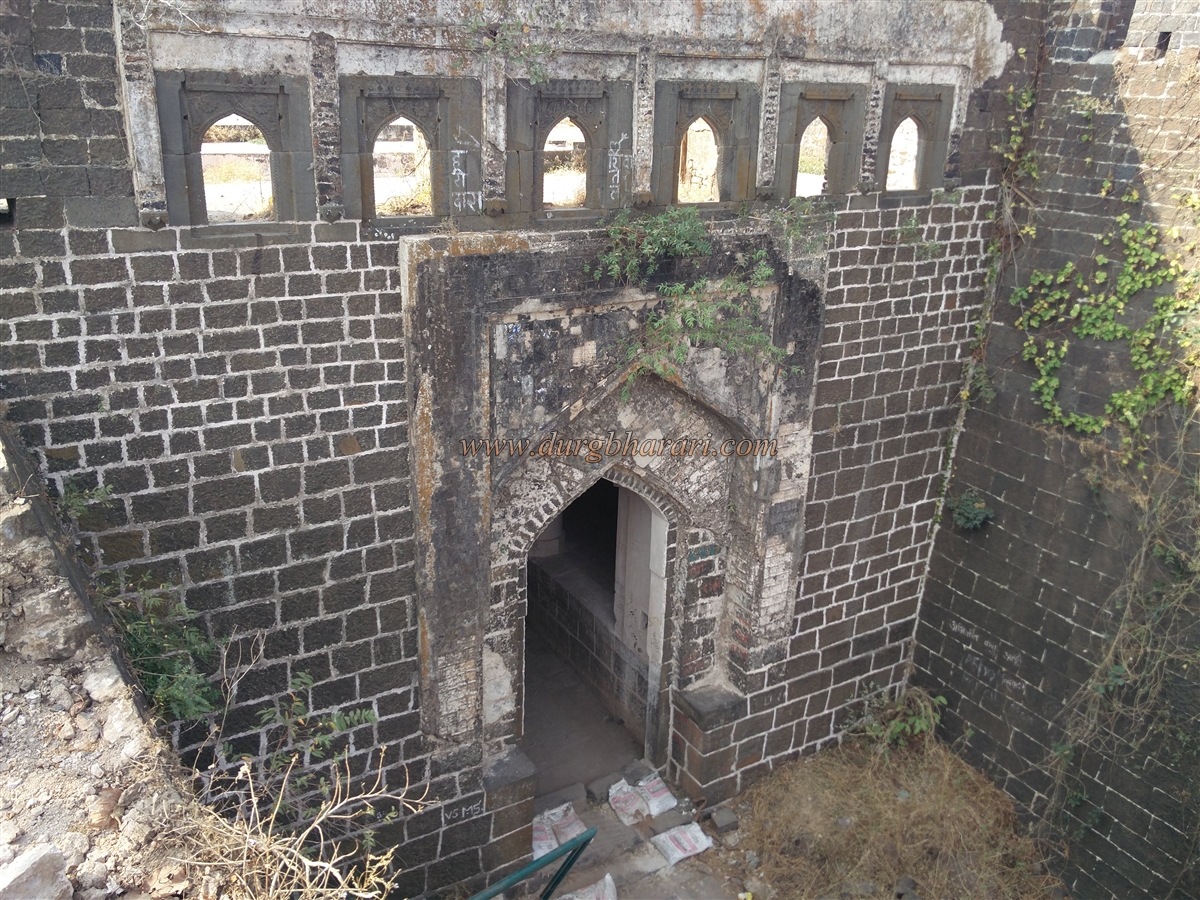
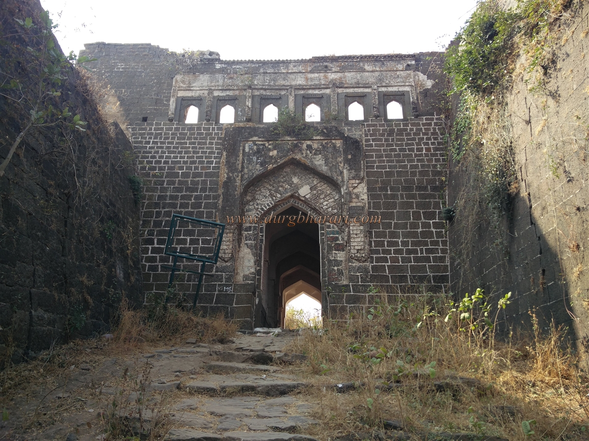
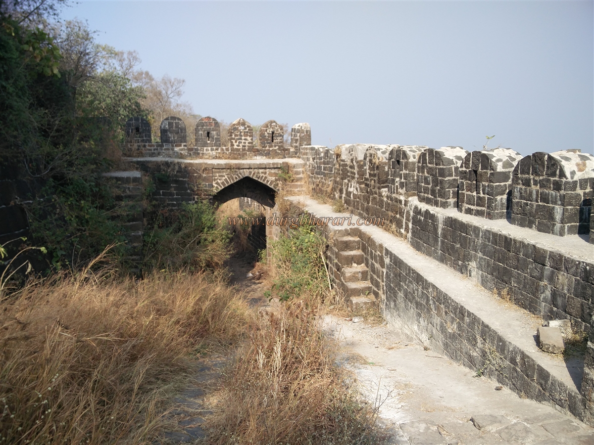
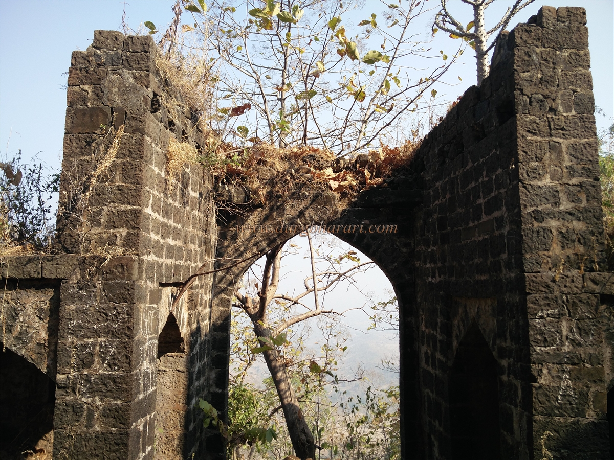
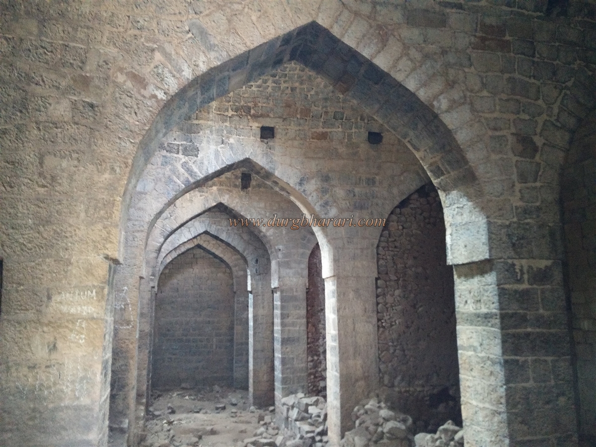
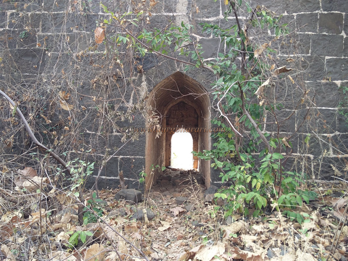
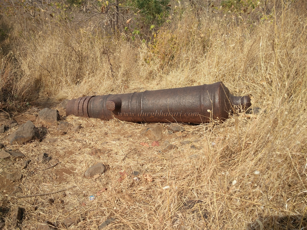
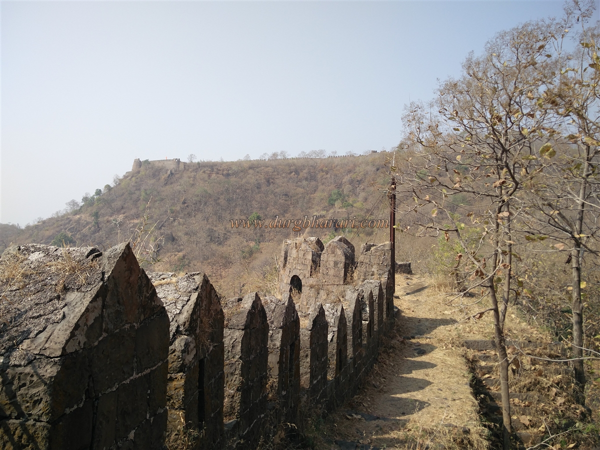
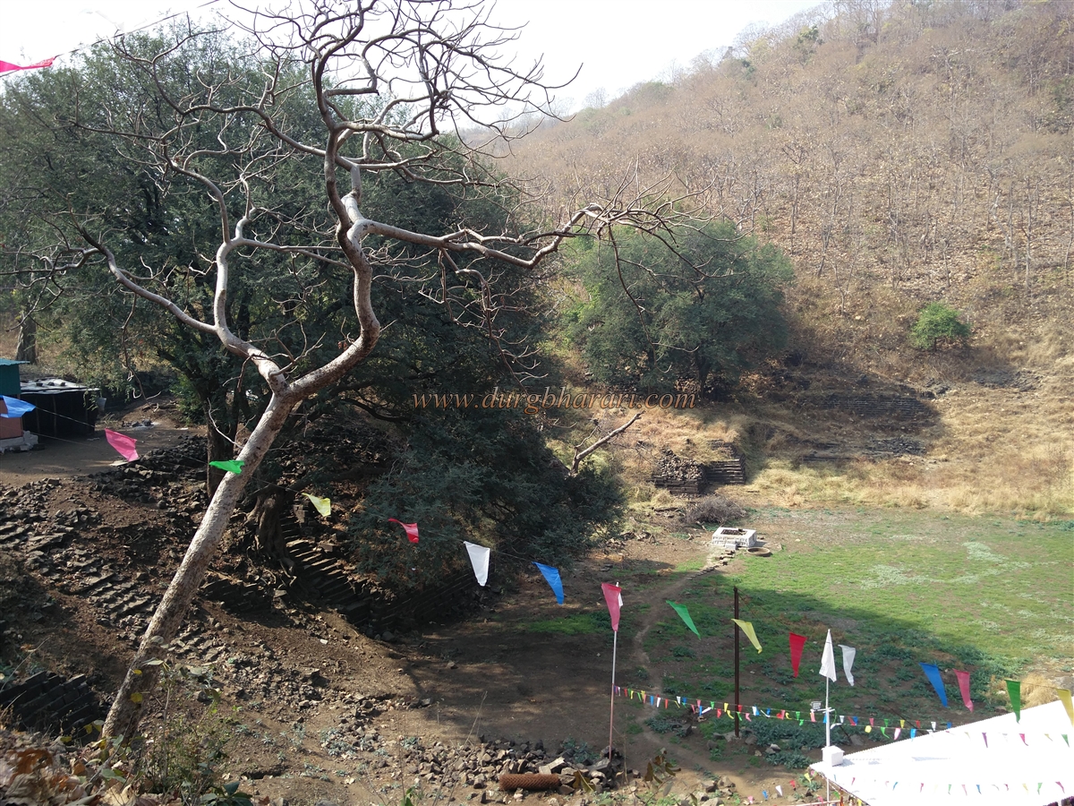
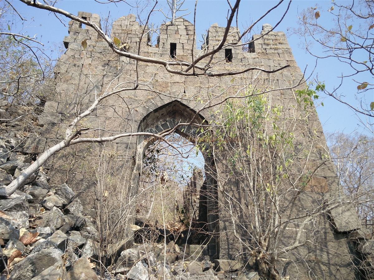
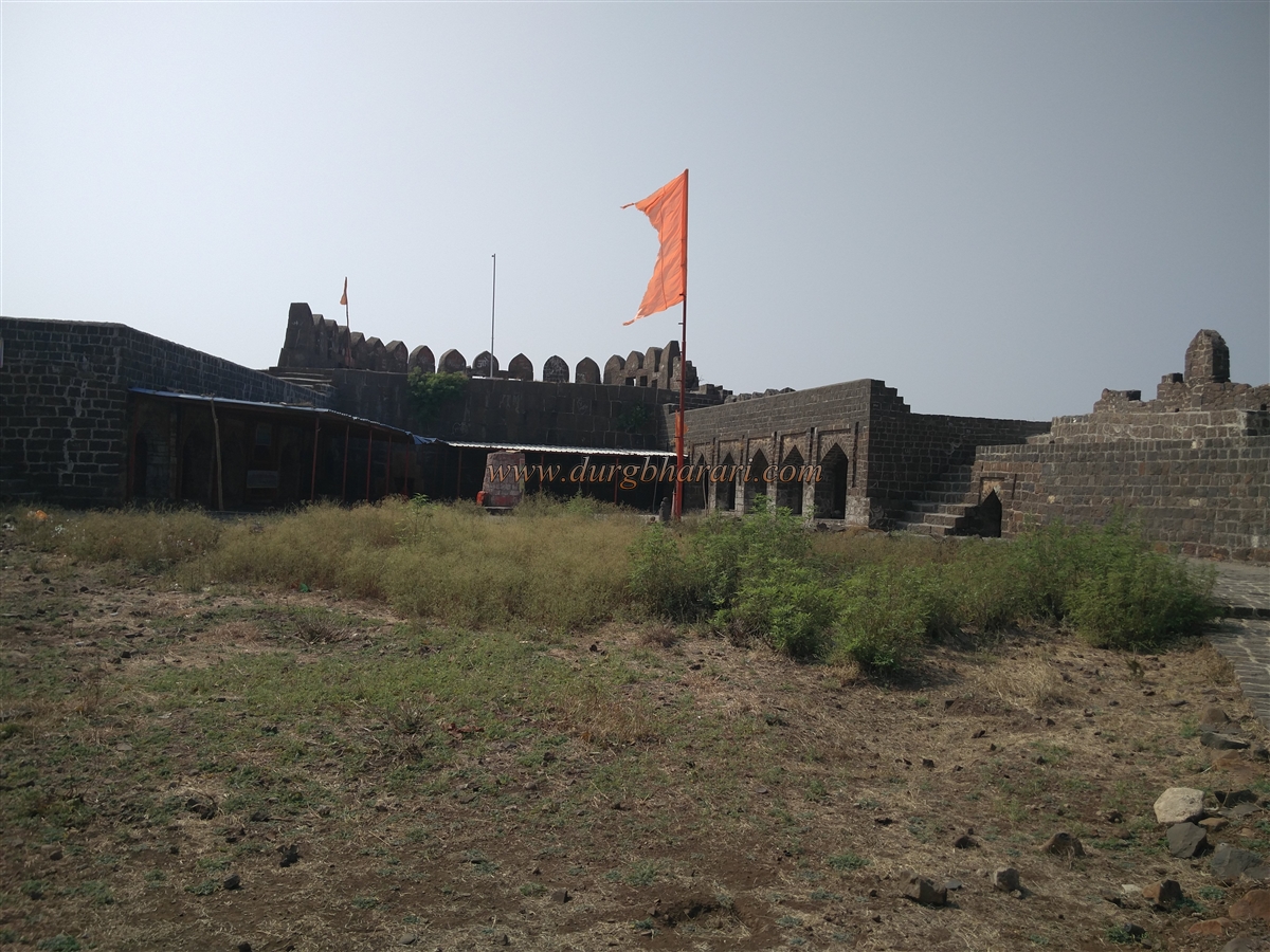
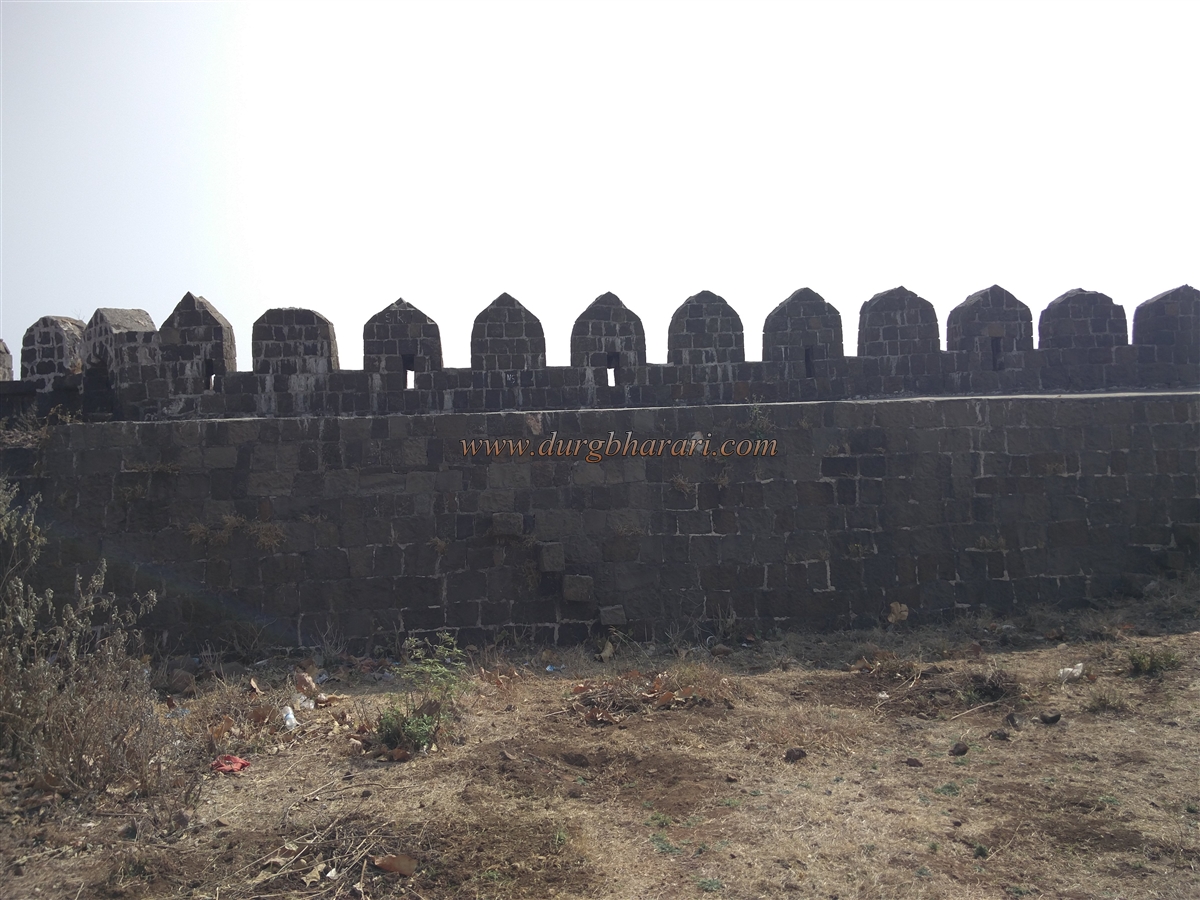
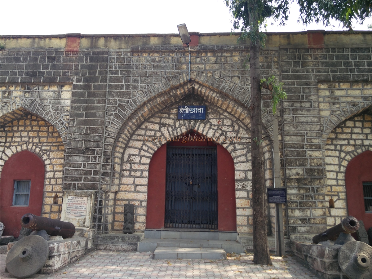
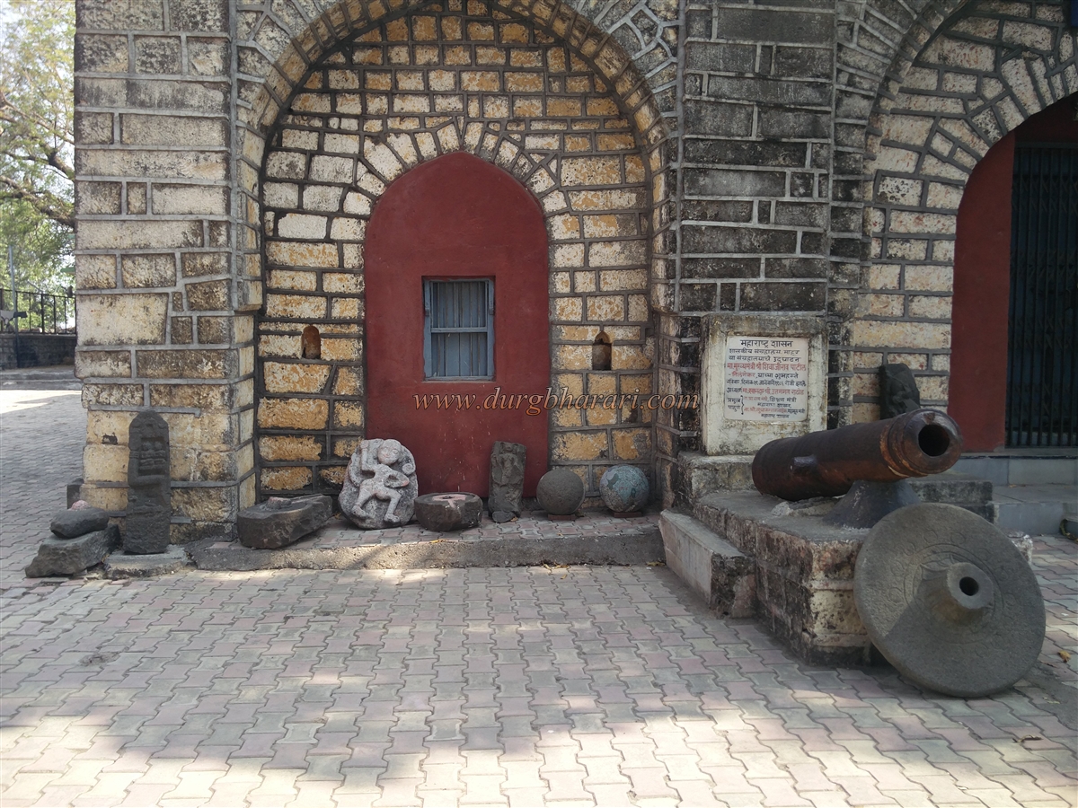
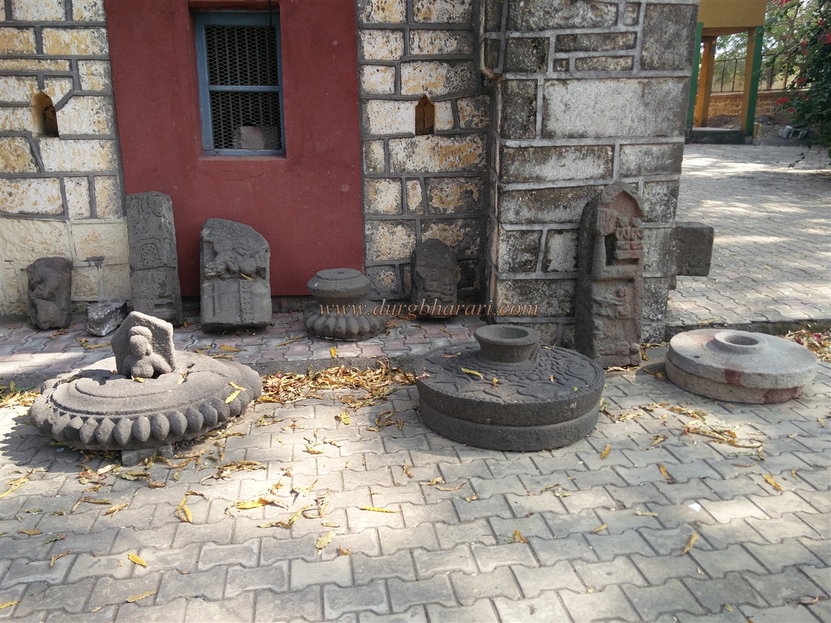
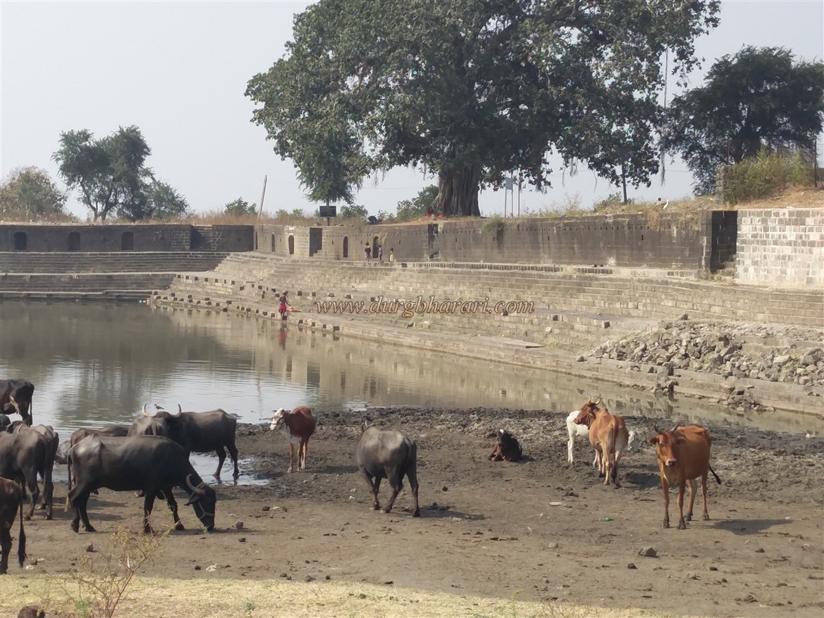
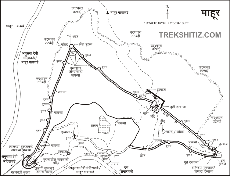
Mahur fort is 8 km from the village and there are two ways to reach the fort. The first route is to reach the Renuka Mata's Temple through the gorge. We reach Mahakali bastion in 10 minutes by following the newly constructed steps behind the shops in front. The second route is about 10 minutes straight from this shop. Here, a rampart has been broken down made to make a road to reach the place of the Mahanubhav Panth near the lake. There is an arch at the beginning of the steps. The Mahakali bastion has double ramparts and there are two small gates to enter the lower ramparts from the upper bastion. One of the gates is closed due to stones collapsing and the other door leads to the Mahakali bastion, i.e. to the fort. The height of the Mahakali bastion is 40 feet and there are two sculptures on the outside of the bastion and the idol of Goddess Mahakali is installed on one end. The stone pot near the Mahakali temple reminds us of the stone pot at Naneghat. In front of the Mahakali temple, there are arched guard rooms for the stay of the soldiers and in some places in the bastion, there are windows for observation as well as barrage for cannons. Inside the bastion, there is a ruined Deepmal in the middle and two stone cannonballs can be seen next to it. Mahakali bastion is the highest point in the fort and from here a very distant area of the fort could be seen. Mahurgad is located at an altitude of 2650 feet above sea level. The fort has 19 bastions although the bastions of Machi cannot be seen due to the forest. The fort is protected by double ramparts at the north and west sides where there are two main entrances to the fort. The double ramparts in the northern part are small in size and the double ramparts in the western part are located on the Machi of the fort. There are some structures in this part of Machi and this part is known as Dukkar Fort. From Mahakali bastion, start walking around the fort from the left ramparts through the curtain walls. The ramparts of the fort have been built in different periods using limestone and bricks. Currently, the Archaeological Department is undertaking the maintenance work of the fort and the ramparts. The steps on the ramparts of the fort are still in good condition. On the way to the Nishan bastion on the south side of this rampant, there are six more bastions on the wall and near the Nishan bastion, there is a ruined mosque. There is a small cistern in front of the mosque and flowers are carved on the outer wall of this mosque. The original pillars of the temple have been kept intact while converting the temple into a mosque. After seeing the mosque, from the ramparts, we reach the southern end of the Nishan bastion. The height of the Nishan bastion is 60 feet and the upper part of the bastion has completely collapsed. From the bastion, one can see the outer ramparts of the fort as well as the paved winding road leading to the fort and the distant region. From Nishan bastion, take the road from the ramparts to the next end, i.e. Dhan bastion on the west. The ramparts on the south side of the fort have collapsed to a great extent and from this rampart, you can reach the ruined Hawa Mahal at the Hatti Darwaza. In the center of the building is a water cistern with a fountain and on one side there is a window on the Hatti Darwaza. The building is known as Hawa Mahal because of the coolness created by the air coming from the window and the fountain in the water cistern. Seeing Hawa Mahal, we descend a few steps through the west door and come to the Hatti Darwaza. This door is built by Udajiram's son Jagjivanram. The inner quadrangle structure of the door has round pillars on both sides and an arched roof, shaped like a palace. The locals say that this place is for horse stables and in some places it is referred to as Chinese Palace. Considering the overall structure of this building, it must be used as an office. This gate of the fort is facing north and is built on the ramparts of the fort. The height of the door is such that an elephant can easily pass through it with a person sitting on it. On either side of the door are obscure carvings carved in limestone, and on the upper left side are pieces of blue Persian tiles. There are 6 windows of Hawa Mahal on the upper side of the door and there are two big bastions on either side of the door and ramparts on the front side. Below this rampart is the Machi or Dukkar Fort. It is not possible to go there as there is a lot of bush growing on this Machi but you can see the remains of Machi by standing on this rampart. Remains of a two-domed Mosques and another structure can be seen here. One of these Mosques belongs to Khudabandkhan and the other is known as Faridshahi mosque. As this is was the major road to reach the fort, a chain of gates were erected in front of the Hatti Darwaza for protection. After descending a little through the Hatti Darwaza, there is another west-facing gate of the fort on the left side and there are steps on both sides to enter this gate. In front of this gate is the third north-facing gate of the fort at some distance and there are some rooms on the right side of the gate. These rooms should be horse stables. The fourth gate on this route is on the outer rampart, facing east, but you can't get past the third gate because of the dense forests and bushes. When you come back to the fort from here, keep the ramparts on the left and walk straight ahead. On this road, you can see quadrangle structures of many ruined buildings. This place was Rani Mahal. There is a gate at the front and a few rooms at the rear of the gate, while at the eastern end of the fort next to a gate is a double bastion called Dhan. There is a door on the lower side to go to this bastion and at present, this door is closed with stones. From Dhan bastion, proceed to descend the ramparts. While we proceed further on this path, we reach the secret door under the wall. After visiting this door, go to the building inside the fort. Outside the building is a built pond which is currently dry and an arched door is in the front wall. This building is known as Palace, Ammunition Depot, or barn. The interior of this 12 feet high structure has twelve arches in a horizontal row and four in a vertical row. There are two windows on the left side wall and one window on the right side. From here, on the way back to the ramparts, you can see a 7 feet long cannon. From here, as the ramparts of the next area have collapsed, you have to come down from the ramparts and start descending the fort by the road built by the Archaeological Department. Along the way, there is a large water body called Injale or Parvesh Lake. There is a place for Mahanubhav Panth on the edge of the lake. The steps that once stood on one side of the lake have now collapsed to a great extent and the lake has dried up. The hill to the north is known as Brahmatirtha. From here, there is another path leading down to the fort, but if you go straight without going through this path, you can see the ruined structure with two bastions adjoining the ramparts. Inside this building are guardrooms. Next to this building on the left side is the second major path leading to the fort and there is a gate in the inner rampart. Since the two bastions outside the gate are built in two different periods, one is square and the other is round in shape. There is another main door in the outer ramparts, a short distance down this gate. The bastions and ramparts in this area have completely collapsed and only the door remains. After seeing both these doors and returning to the original path, your fort round is complete. It takes 5 hours to see the entire fort from the base. The fort was historically important for controlling the Painganga valley. During the Rashtrakutas, this village was known as Mahapur. Due to this, the current name Mahur has become popular. The fort on the hill near Madhapur village is today known as Mahur fort. When the fort was under the control of the Rashtrakutas, they built ramparts on the fort. Ramdevrao built the second set of ramparts on the fort and named it Ramgad. During the Yadav period, Ramgad fort was the head of the administrative division. While Adia Ballal Singh was on the throne of Shirpur, he took possession of Mahur. While the Gondwana region expanded, the first fortifications build on this fort were built by Yamaji Thakur. In the 14th century, Ramgad fort was in the possession of Gond kings. When Bahamani Sultan Allauddin Hasan Shah marched on Ramgad in 1350, King Talwar Singh averted the Bahamani crisis by paying a ransom. Then in 1412, the Bahamani Sultan Feroze Shah marched on Ramgad but he could not conquer Ramgad. In 1422, the Bahamani Sultan Ahmad Shah Wali made a surprise attack on Ramgad and conquered it. At that time, he killed Gondaraja Jaisingh and his army and forced his wife and children to convert to Islam. Ramgad fort was renamed Ahmedabad. He made this fort the chief station of South Vidarbha and appointed Khudawant Khan as its Chief. Khudawant Khan revolted against the Bahamani rule. Eventually, the Bahamani Chief Amir Barid captured the fort and killed Khudawant. On the northern part is the Mosque of Khudawant. Mahur Imadshah was conquered by Amir Barid and he annexed his kingdom. In the next period, Nizam Shah conquered Mahur fort. The Mughal Emperor Akbar captured the fort of Mahur from the Nizam in May 1529. He appointed Udajiram on Mahur with five thousand soldiers. Later the fort was occupied by this family for many generations. When Shahjahan, the son of Jahangir Badshah, revolted against his father, Udajiram was on ShahJahan's side. Against Shahjahan, Jahangir sent Prince Parvez and Mahabat Khan. At that time, with the help of Lakhuji Jadhav, Udajiram, and Adam Khan, Shahjahan left Orissa for Bengal. Aurangzeb was six years old when Shahjahan stayed at Mahur fort with Mumtaz. After Udaram, his son Jagjivanram became the fort keeper. It is mentioned that he repaired the fort. He died in 1658. He was followed by his younger son Baburao. His mother Savitribai looked after him. In Varhad province, a chief named Harchandrai revolted. This revolt was crushed by Savitribai and Harchandrai Rajput was defeated. Mughal rule continued in Varhad province. Seeing her deeds and bravery, Aurangzeb gave her the title Pandita Raibaghan. During Shivaji Maharaj’s period, Pandita Raibaghan, a Mughal stalwart who marched on Swarajya with the army of Shahistekhan on the orders of Aurangzeb, was in the battle of Umberkhind. It is mentioned that the great Bajirao Peshwa looted Mahur. In the 18th century, the fort of Mahur was conquered by Nagpurkar Bhosale from the Mughals. After that, the fort was conquered by the Nizam from the Marathas. The fort belonged to the Nizam till independence. It takes a whole day to visit Renuka Devi, Ramgad fort (Mahurgad), caves, Matrutirtha, and Hattikhana.
© Suresh Nimbalkar
GALLERY