MAHIPATGAD
TYPE : HILL FORT
DISTRICT : RATNAGIRI
HEIGHT : 2960 FEET
GRADE : MEDIUM
Like the Alang-Madan-Kulang fort trio, another such fort trio popular among trekkers is Mahipatgad, Sumargad, and Rasalgad. These forts are located along the same mountain ridge, close to one another, about 25 km from Khed, the taluka headquarters in Ratnagiri district. Of these, Mahipatgad, situated to the north, is the tallest and is completely surrounded by forest. Though it is often said that the area of this fort is about 120 acres, official forest department records mention it as 200 acres and 29 Guntha. Because these three forts are located close to each other, most fort enthusiasts cover them together in a trek.
Villages like Vadgaon, Dahivali, and Wadi Jaitapur fall in the vicinity of Mahipatgad, and routes to the fort start from Dahivali and Wadi Jaitapur. From Dahivali, the route to the fort via Wadi-Beldar takes around four hours on foot.
...
In 2019, an unpaved road was built from Wadi Jaitapur to Wadi-Beldar, making it accessible by jeep to the base of the fort. Otherwise, the 7 km uphill stretch takes around two hours to walk. This route is easier and more convenient. Wadi Beldar is a small hamlet of 10–12 houses, where food and tea are available. If one plans to stay overnight, there is a Maruti temple available.
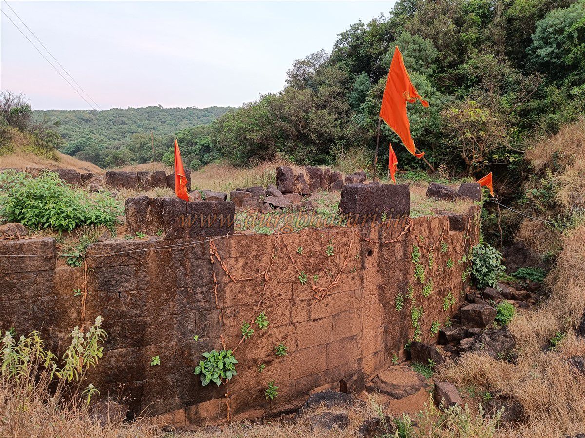
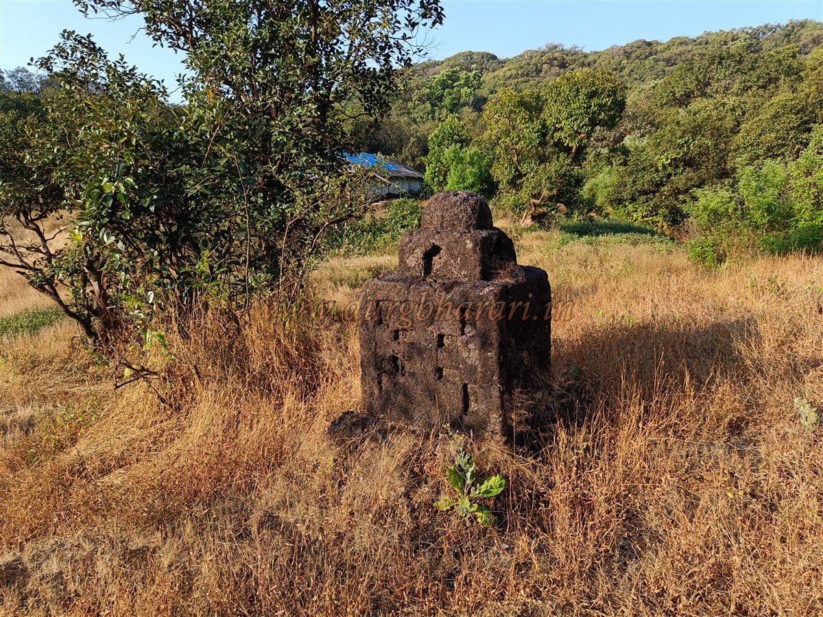
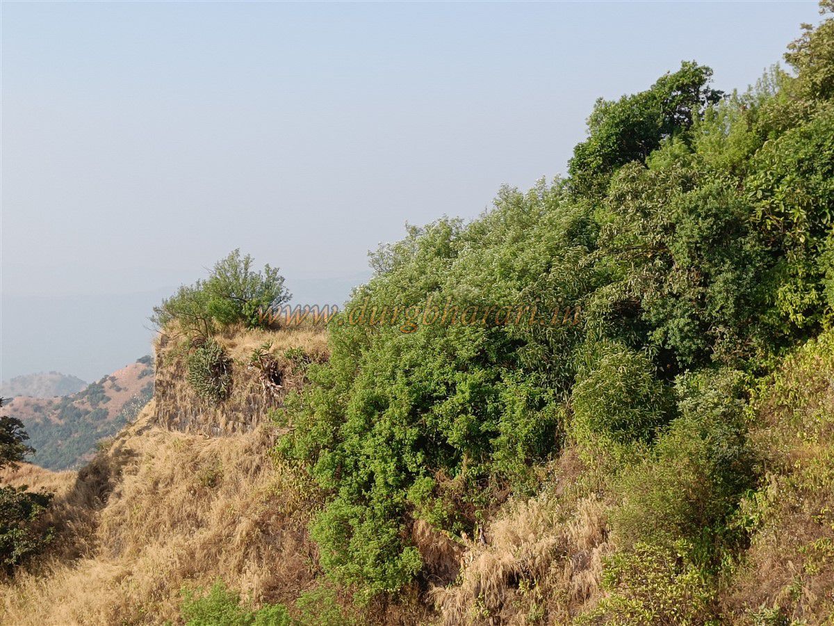
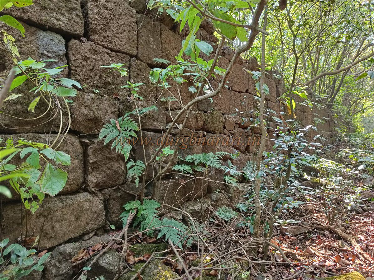
One of the ridges of the fort descends to Wadi Beldar, and the path to the fort ascends from this ridge. On this trail, there is a small well that provides water for Wadi Beldar residents, especially in summer. As there used to be electricity at the Pareshwar temple on the fort, one can follow the power lines to reach the temple. Due to the temple, the path is regularly used and well-defined. After ascending a bit, a bastion is visible on the left side. This bastion seems to keep an eye on anyone approaching from Wadi Beldar. The original entrance on this trail, called the Khed Darwaja, has now completely vanished, and no trace of it remains.
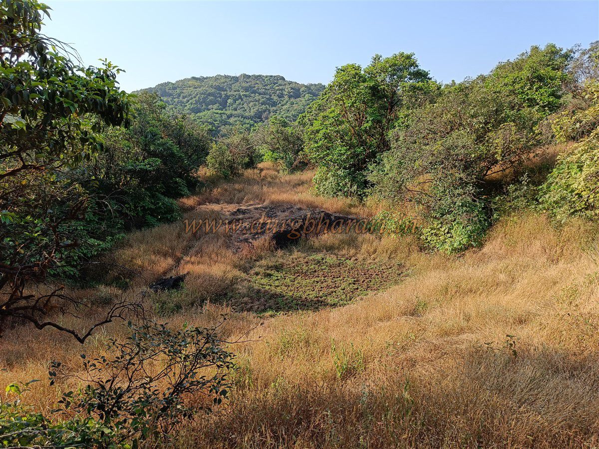
A little further along the path, one reaches a small ravine. Above this, a curved wall like a bastion is visible, and a small path leads to the bastion seen earlier on the left. This bastion offers a view of Wadi Beldar and the entire path taken to reach the fort. If one goes right from the bastion along the cliff, they reach a small stream. This is the western side of the fort, where a small Shivling and Nandi idol are placed on a platform amidst the forest. This spot, once the location of a gate, along with the water source and Shiva temple, was known as the Shivganga Gate. After visiting this area, one should return to the main trail and proceed.
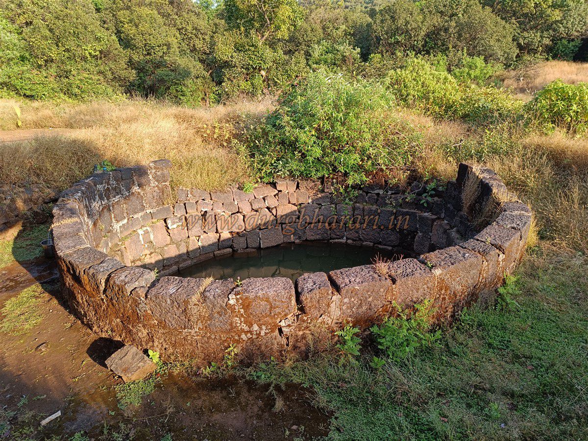
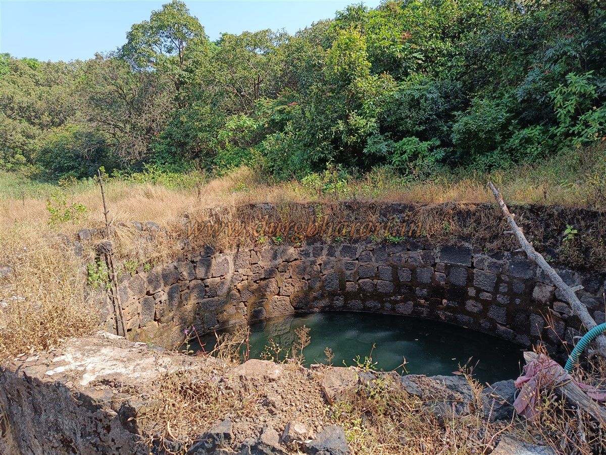
As one climbs further, it becomes clear that the curved wall seen earlier is actually a stone dam built to retain water. When the dam is full, water is channelled through a circular stone pipe. Currently, a lot of silt has accumulated in the reservoir. On the right edge of the dam, there is a large well that provides year-round water, piped down to Wadi Beldar. From the left side of the dam, a trail through the dense forest leads to the Pareshwar temple. Along this route, one sees many architectural remains hidden among the trees and a large mound of slaked lime. It takes about one hour to reach the temple from Wadi Beldar.
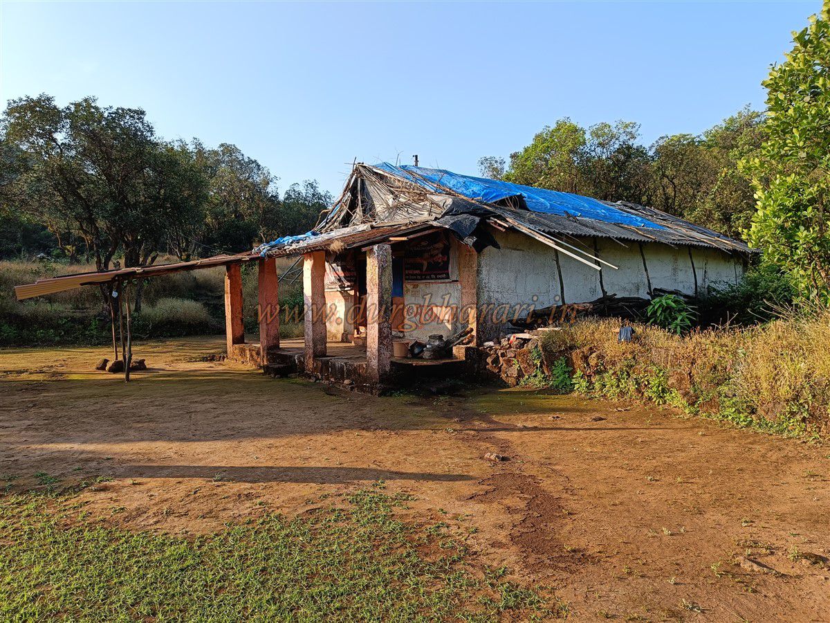
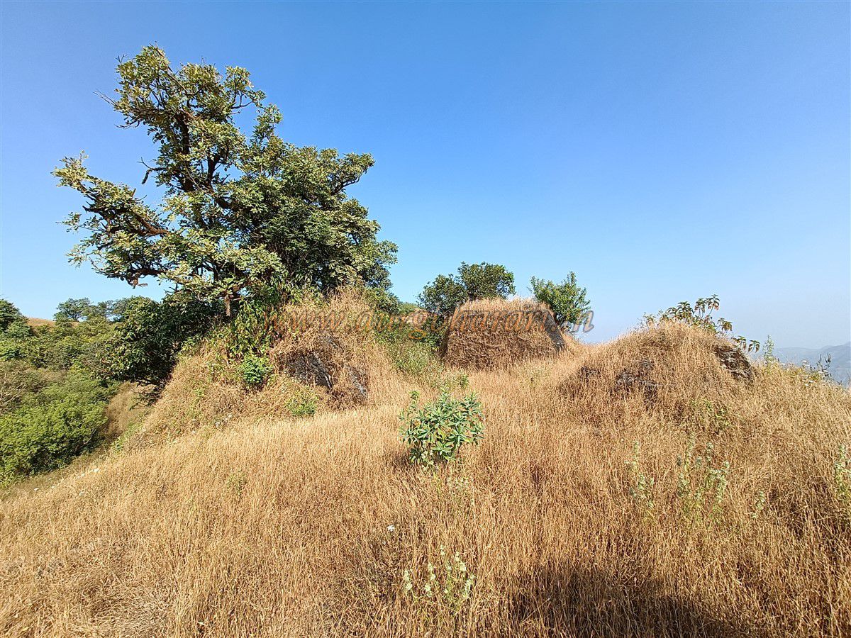
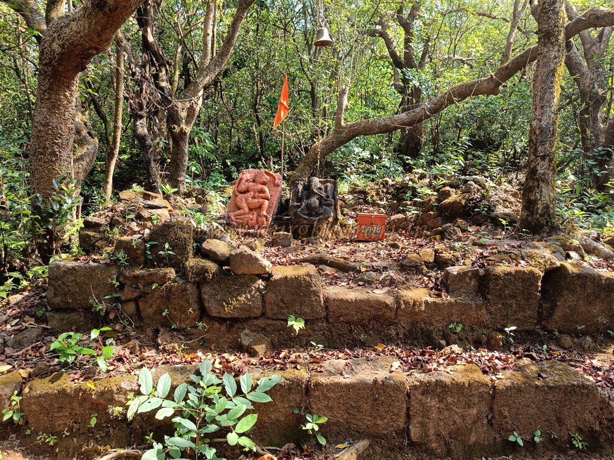
At this spot, the fort’s elevation is 2,960 feet above sea level. It is an ideal place for an overnight stay, accommodating 20 to 25 people. In front of the temple is a small well, and to the right is a dry pond. To the left of the temple is a raised platform with a few deities currently enshrined in a makeshift manner. Since the Pareshwar temple lies at the fort’s centre, trekkers usually leave their belongings there and continue exploring.
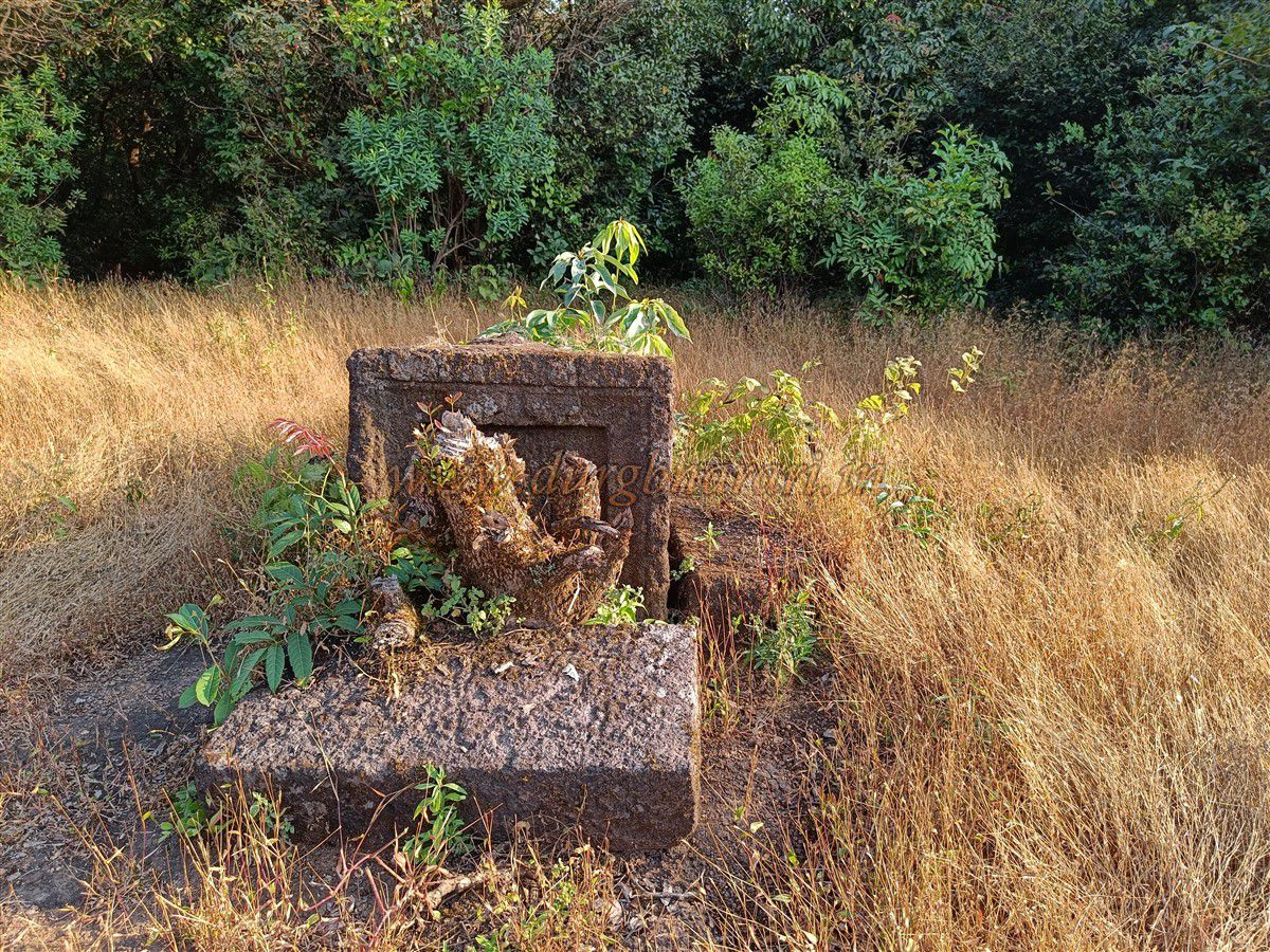
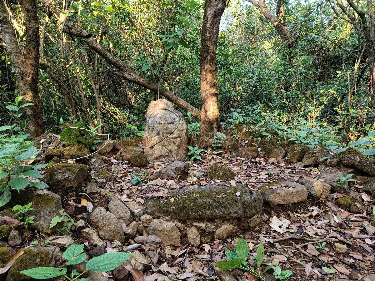
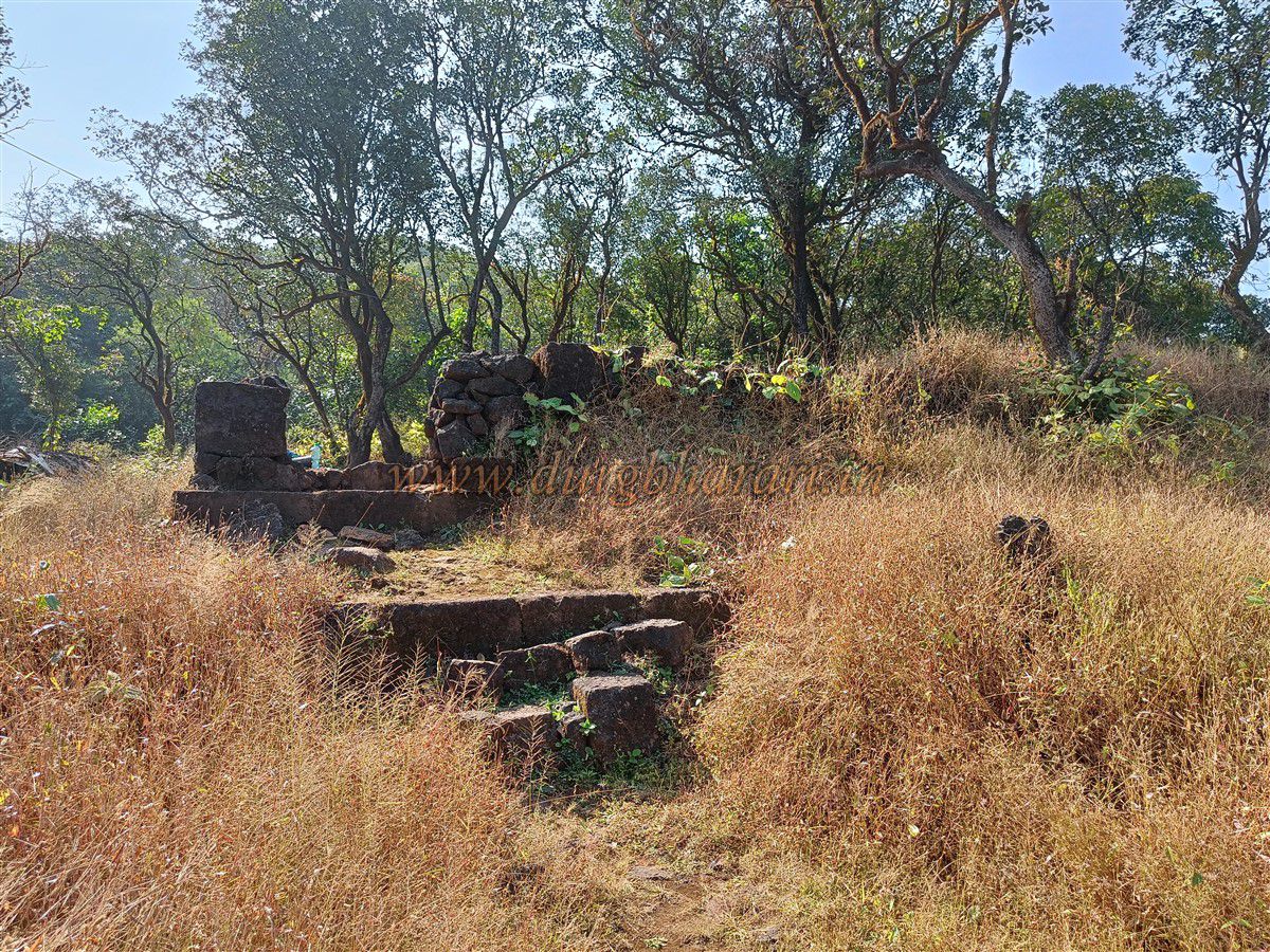
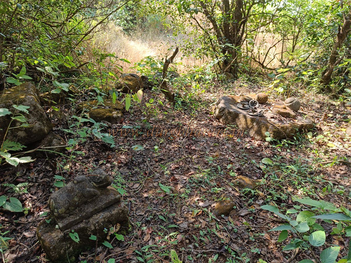
To the right of the temple, a little ahead, there are two artistically carved memorial stones (Samadhi) built in dressed stone. A trail from these memorials leads northward to the Kotwali Gate. Along this path, there is another memorial platform known locally as Holicha Maal. Walking for about 20 minutes along this trail brings you to the Kotwali Gate. Here, a broken statue of Hanuman is placed on a platform, and a descending path leads to Kotwali village. However, this trail is no longer in use and has become completely broken. Though no structural remains of the gate are visible, one can see the dressed stone fort wall and remnants of a watch post on the cliff.
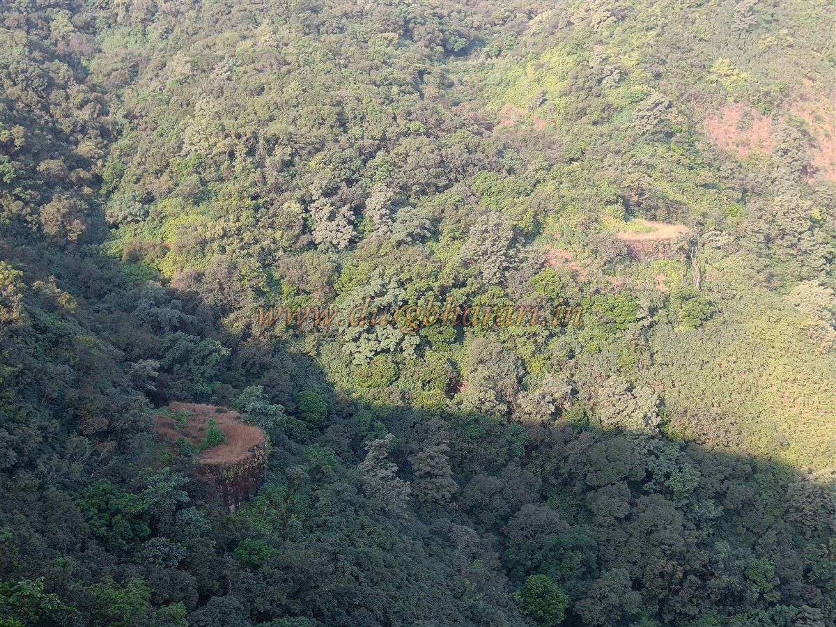
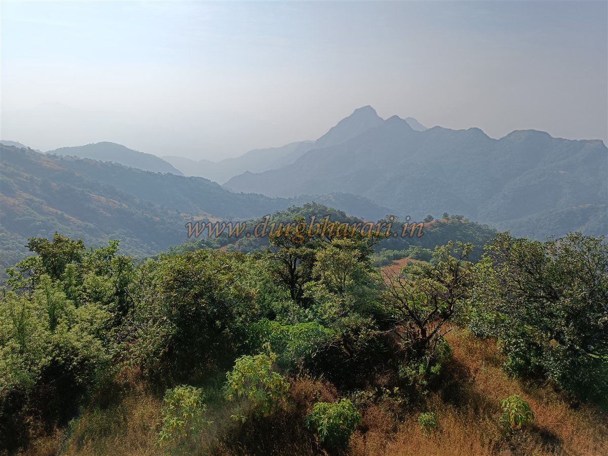
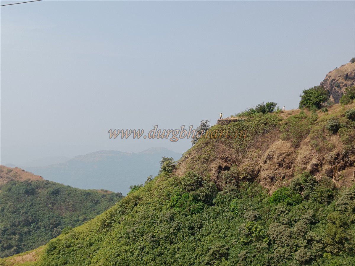
Below the gate, there are two bastions built in dressed stone, not visible from the trail, and one must climb the right-side hill to spot them. From here, one can see the Jagbudi River valley, Kotwali village in the distance, the Pratapgad–Mahabaleshwar range to the northeast, and the Hatlot Ghat, Madhu-Makrandgad, Chakdev, and Parbat forts to the east. Opposite lies the Pusati cliff, from which a path climbs up to the fort. There is a ladder installed here. Beyond this gate lies the Laldevdi Gate.
After visiting the Kotwali Gate area, one should return to the Pareshwar temple and start the next phase of exploration via the trail in front of the temple. This trail leads to the Yashwant Gate. On the way, one can spot a dry pond to the right. After about half an hour, one reaches the Yashwant Gate area. The walls here are built in dressed stone and lime mortar. Like the Kotwali Gate, two bastions are located some distance apart, and the entrance ascends between them. As there is no vegetation here, one can explore both bastions and their surroundings. No trace of the gate itself remains, but a large quantity of lime heaps is scattered around.
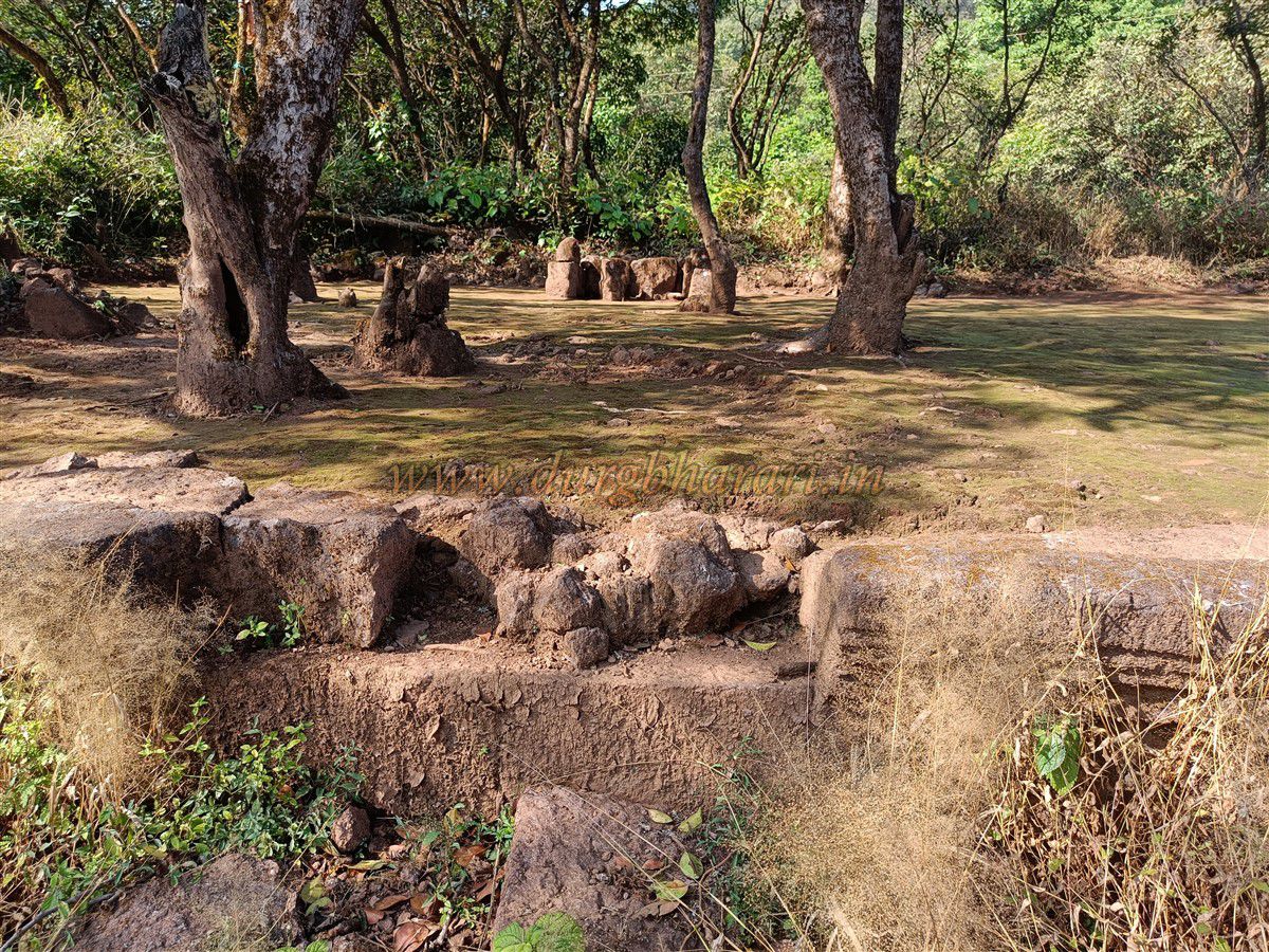
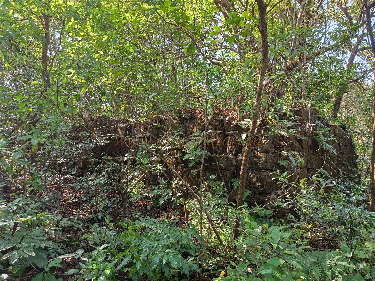
After seeing the Yashwant Gate, one should return to the Pareshwar temple, collect their belongings, and begin the descent via the trail they came up from. On the return, a large lime heap is visible to the left. A small trail enters the forest here. After walking for five minutes along this trail, one sees four straight stone walls, around 70–80 feet long and 10 feet high, built in dressed stone atop a platform. The purpose of this structure is unclear.
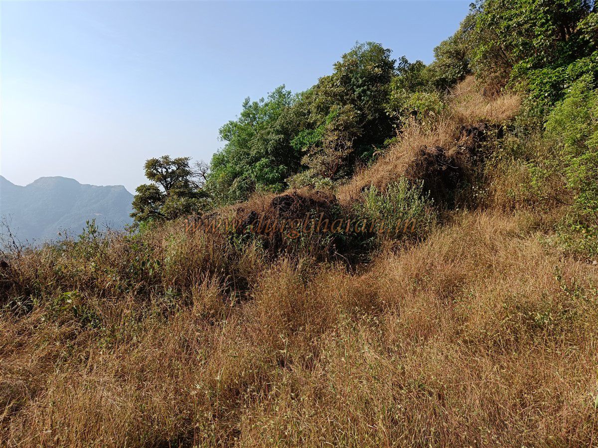
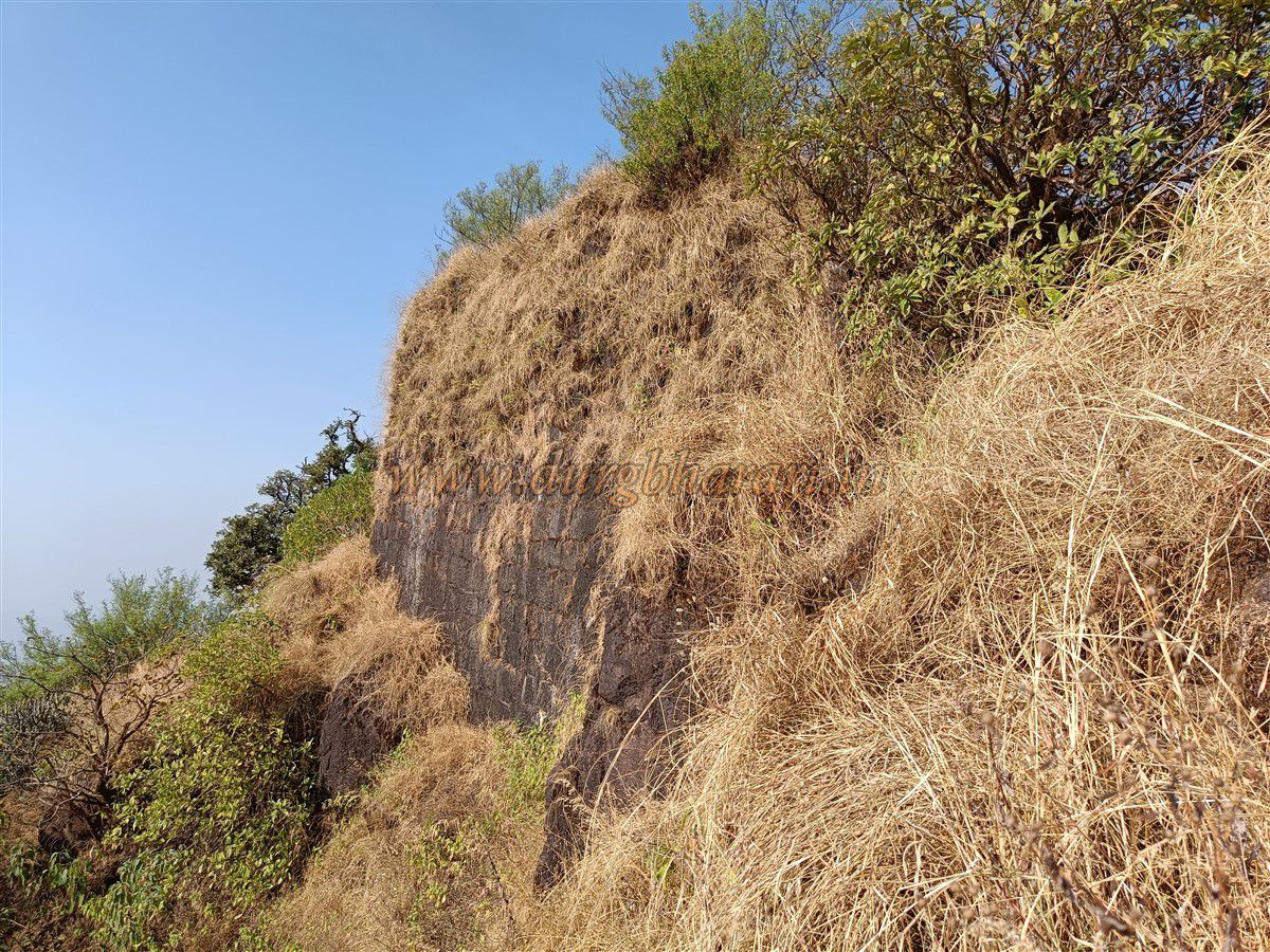
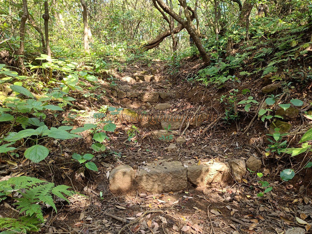
A little ahead, one sees idols of Hanuman and Ganapati placed on a platform. These idols, once housed in separate shrines, are now placed under a tree. From here, a wide stone step-path descends downward. Locals say that the Khed Gate is located at the bottom of these steps, but the cliff here seems too steep to support that. Since the cliffs surrounding Mahipatgad are steep, very little fortification is seen. However, wherever ascent is possible, fort walls have been built—most of which are now collapsed.
Looking at the fort’s construction, the heaps of lime, the lack of visible gateways, and the nearby Wadi Beldar village, it appears that this fort and its gates were never fully completed. The main reason could be the inadequate water supply for such a large fort. The fort’s plateau is like a jungle, and numerous foundations are hidden in the thick undergrowth, making them difficult to access. Many types of architectural remains lie buried in this forest, and a detailed study is needed. Because of the dense forest, it is advisable to take a local guide, though one should not expect them to show the entire fort. Many local guides refuse to take visitors to Pusati Gate or the Laldevdi Gate area and insist that there are only four gates for convenience.
The guide who accompanied us was more interested in the honorarium than in our passion for trekking or fort exploration. He was trying to rush through the fort rather than properly show it to us, but we did not give in to his tactics. A priest from Puri village visits the fort for rituals on weekends. If possible, one should try to go with him, as he knows the entire fort well. One full day is needed to explore the entire fort thoroughly. However, a basic round can be done in two to three hours.
During Shivaji Maharaj’s era, Mahipatgad became part of Swaraj around 1660–61. A record from 1671 notes that Shivaji had allocated 5,000 hons for repairs of Mahipatgad. The fort is also mentioned in the context of both Ramdas Swami and Shivaji Maharaj. A letter dated August 8, 1676, sent by Moropant Pingle to the fort’s Havaldar, Dasmaji Narsala, instructed him to make arrangements for Ramdas Swami’s stay on the fort. In July 1704, Siddi Yakut Khan of Janjira captured the fort from the Marathas. Aurangzeb renamed it Yakutgad and stationed a garrison of 1,000 troops there.
Though it's unclear when the fort returned to Maratha hands, Ramchandra Ballal was later appointed as the fort's Subhedar under Bhagwantrao Trimbak Pratinidhi. In 1862, a record notes that four cannons were stationed on the fort.
© Suresh Nimbalkar
GALLERY