MAHIMATGAD
TYPE : HILL FORT
DISTRICT : RATNAGIRI
HEIGHT : 2535 FEET
GRADE : MEDIUM
Many waterfalls can be seen on the way to the rivers that originate in the high Sahyadri mountains. Marleshwar Falls in Sangameshwar taluka is one of such beautiful inventions of nature. Many tourists visit Marleshwar Falls and the temple, but no one visits Mahimatgad, which is at a short distance from here. In ancient times, the cargo was unloaded at the port. Hillforts on the head of Sahyadri and Sagaridurg on the coast have been standing since ancient times to protect this wharf route. Mahimatgad was built to protect the ancient wharf road Kundi connecting Sangameshwar to Kolhapur markets. Looking at the water cisterns carved in the rock on the fort, it can be said that the fort was built before Shivaji Maharaj’s period. Kundi and Nigudwadi are two villages to reach the fort and the unpaved road connecting these two villages passes through the foot of the fort.
...
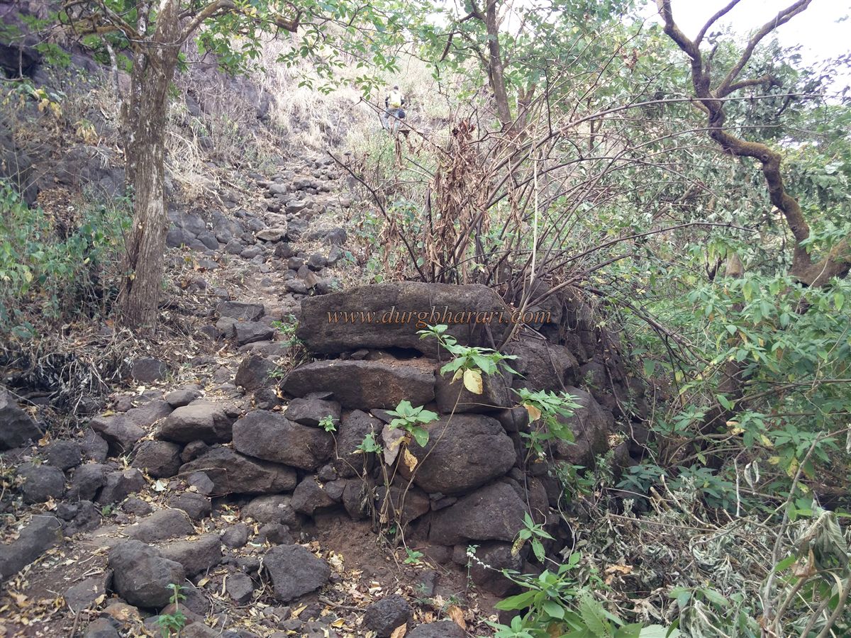
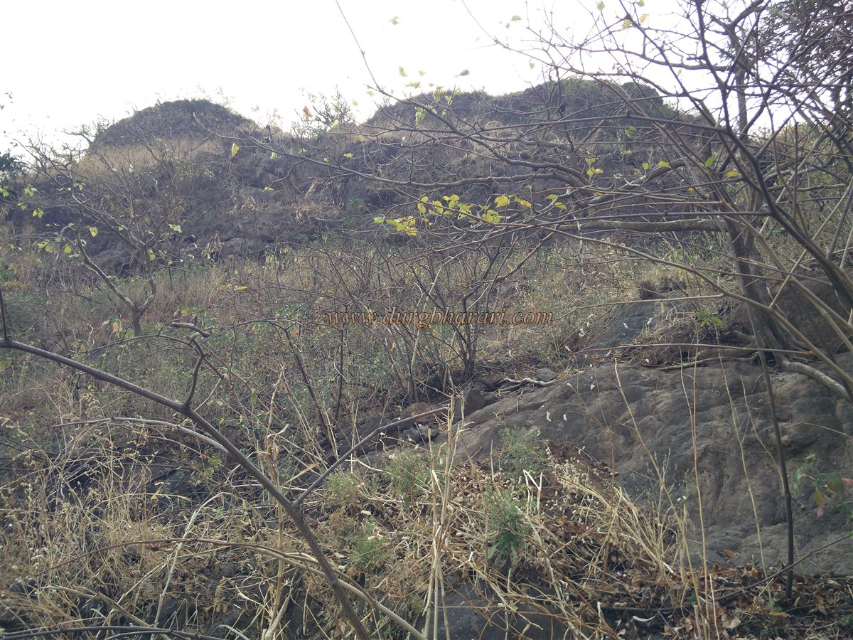
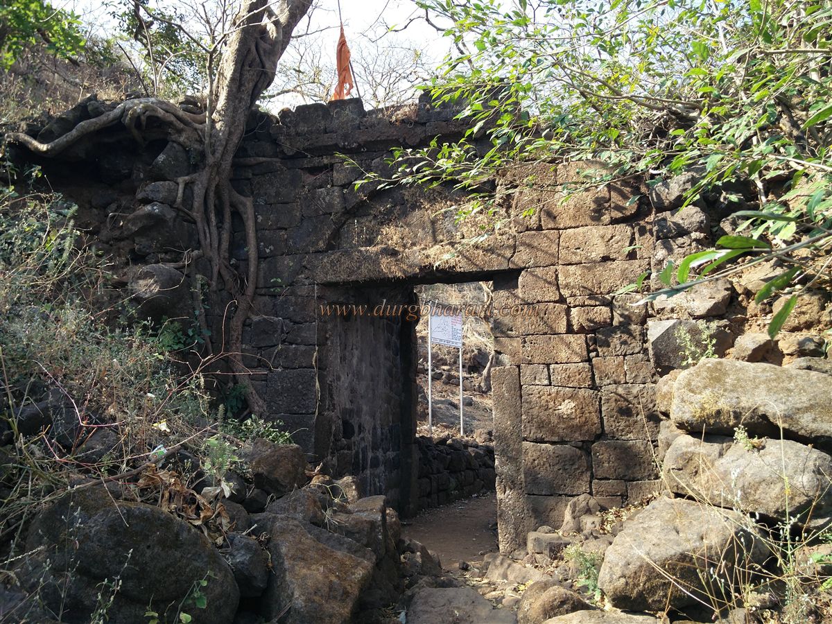
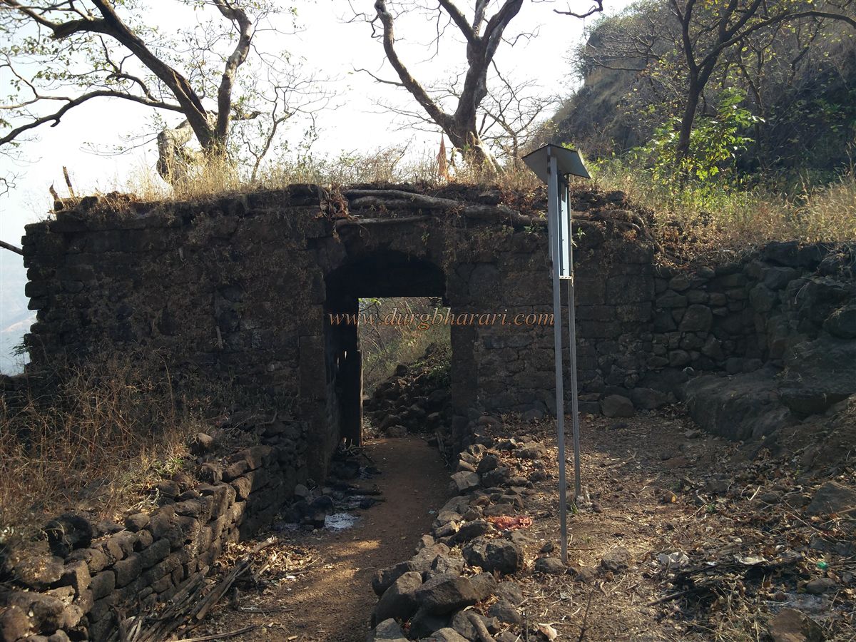
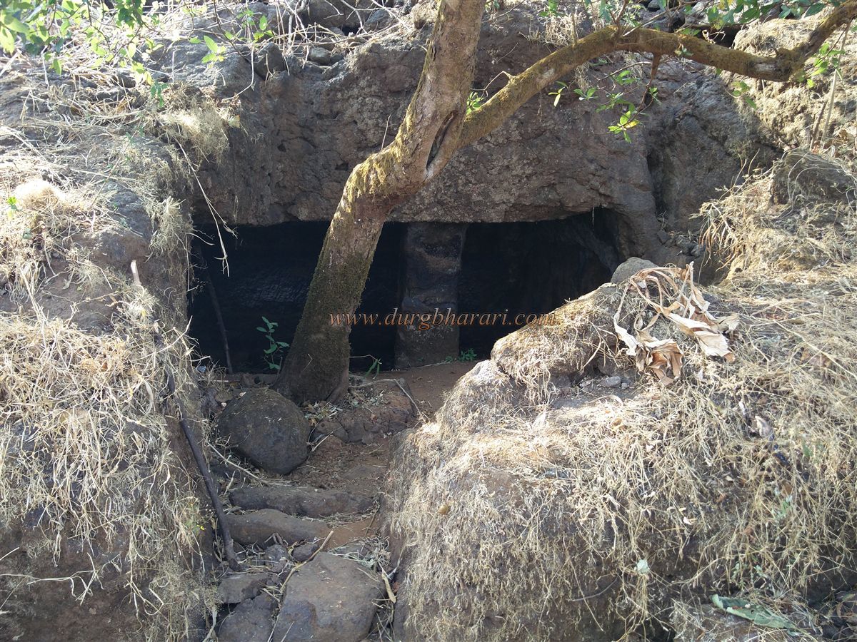
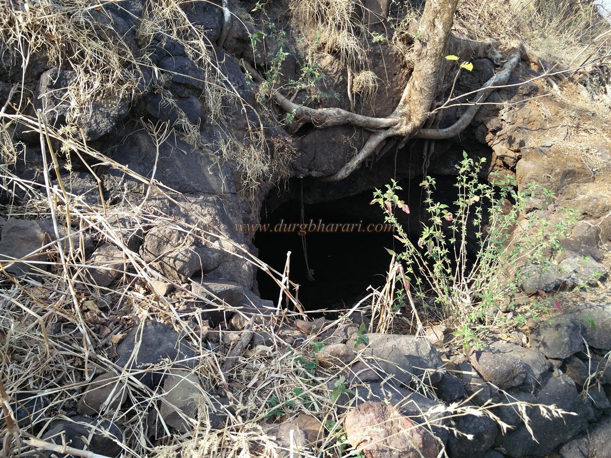
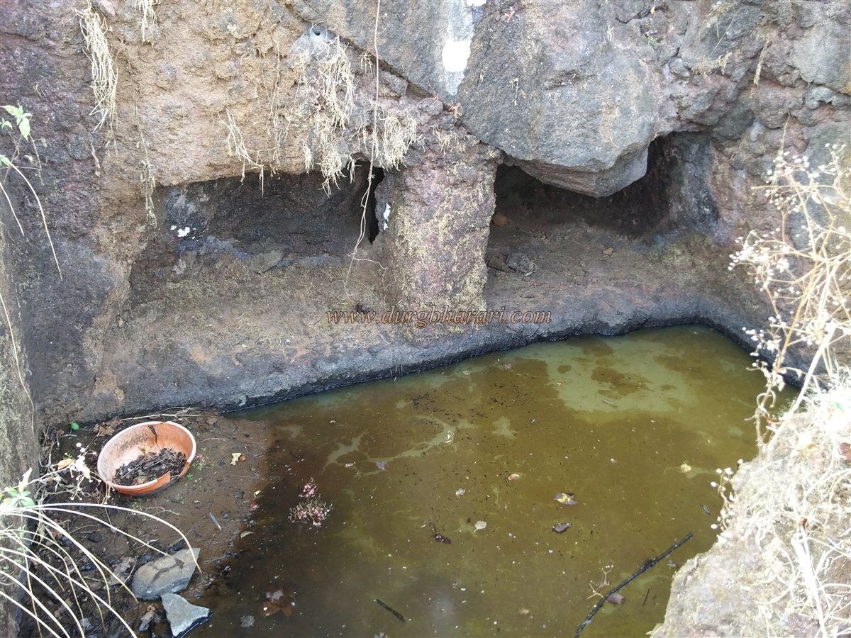
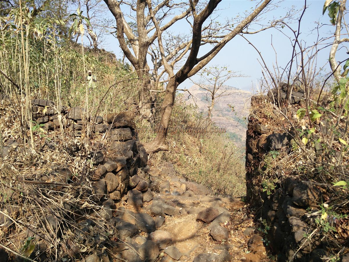
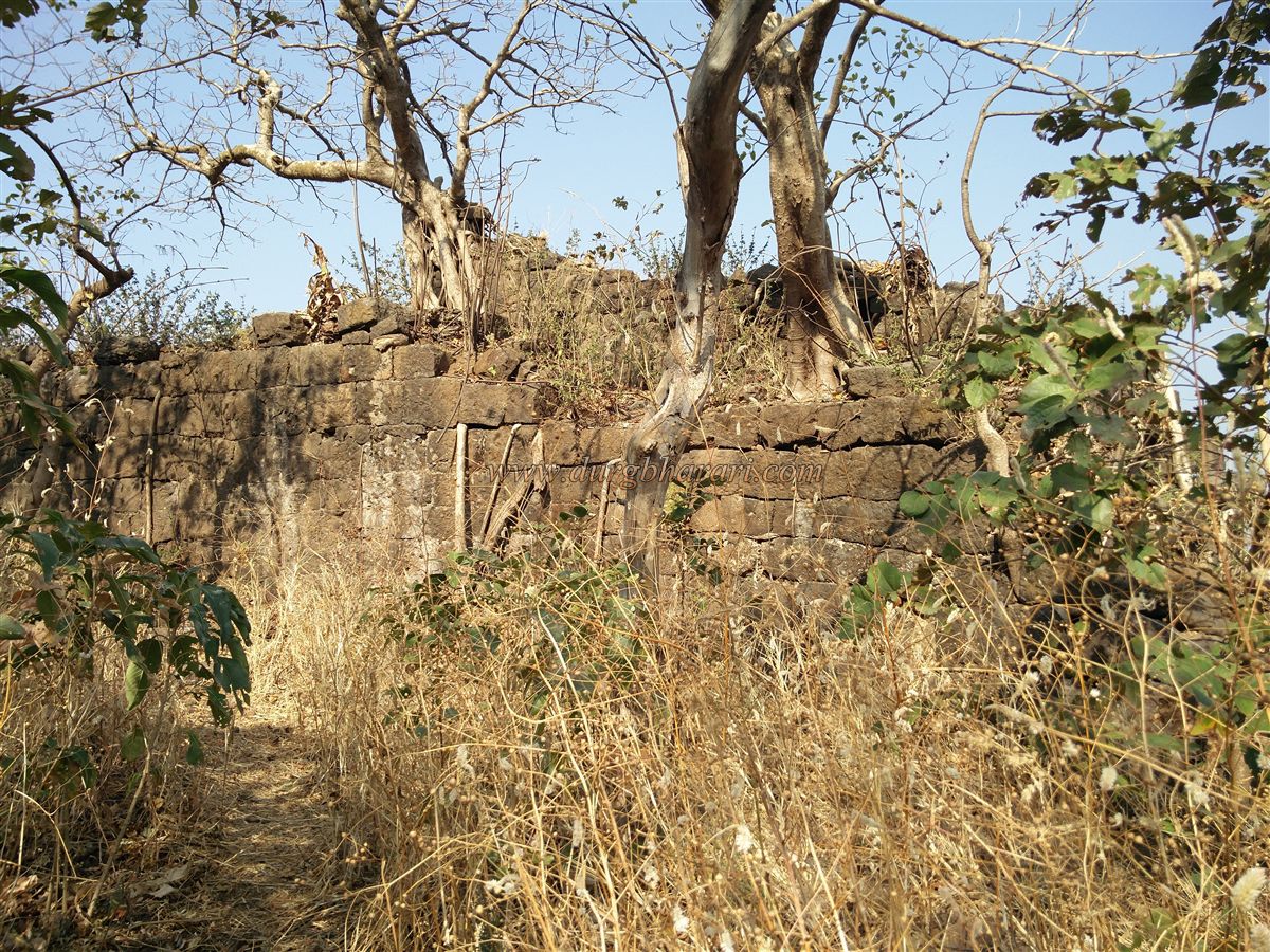
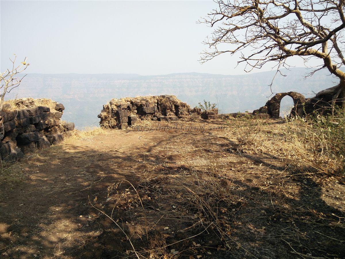
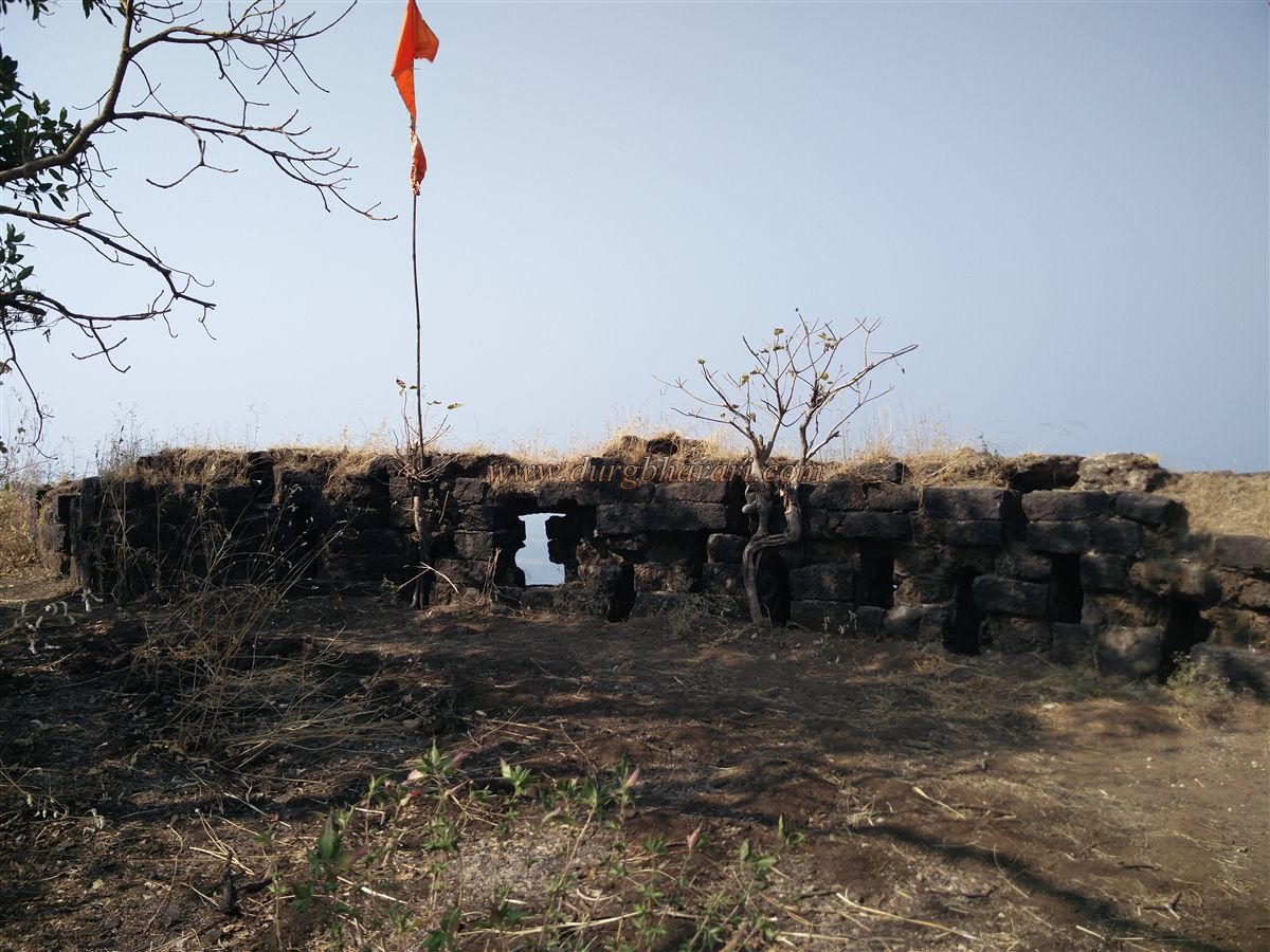
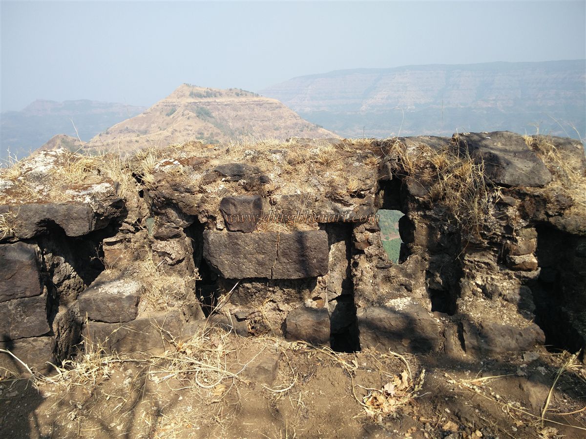
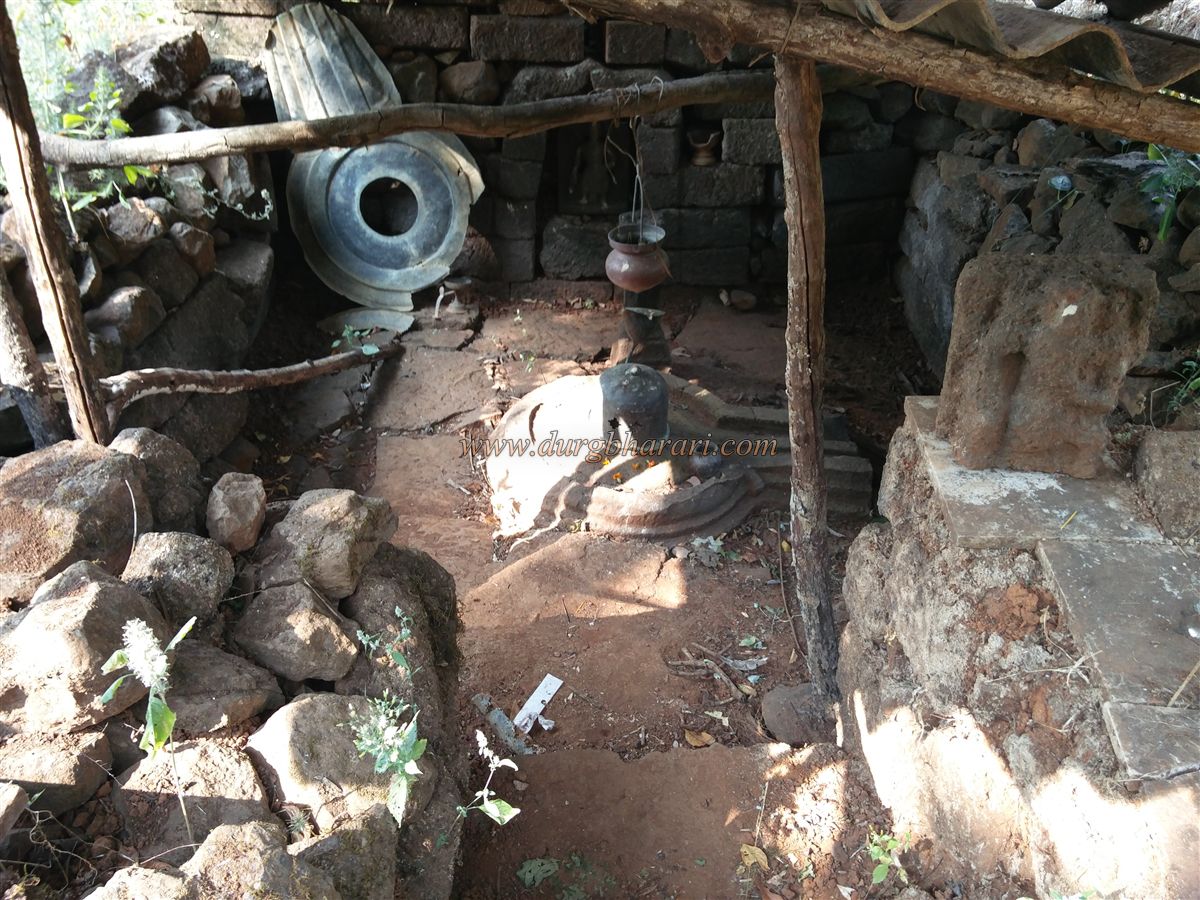
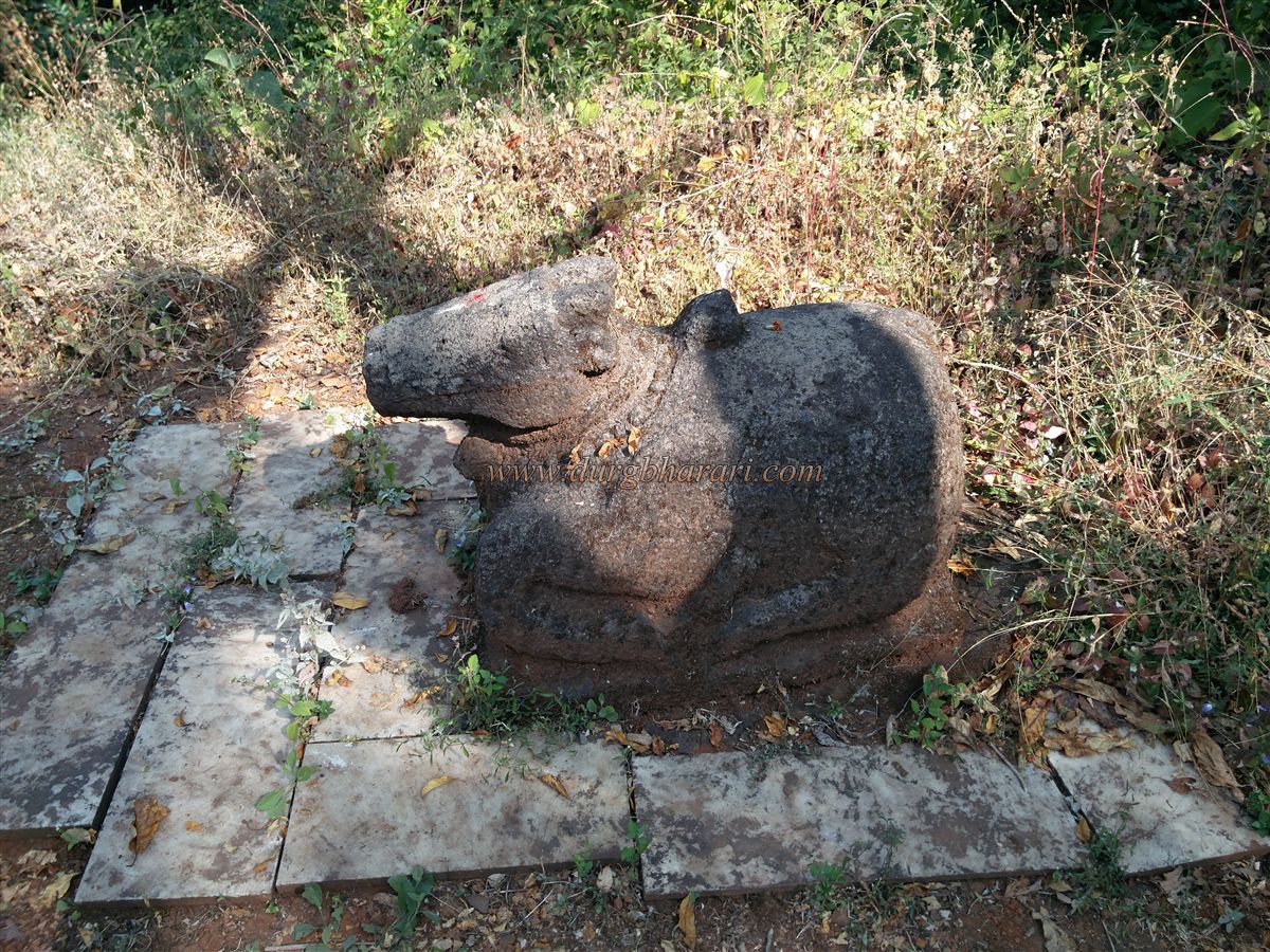
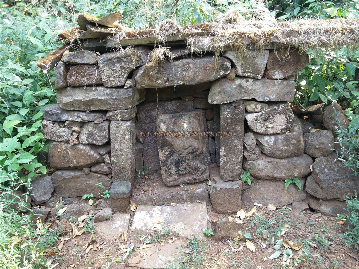
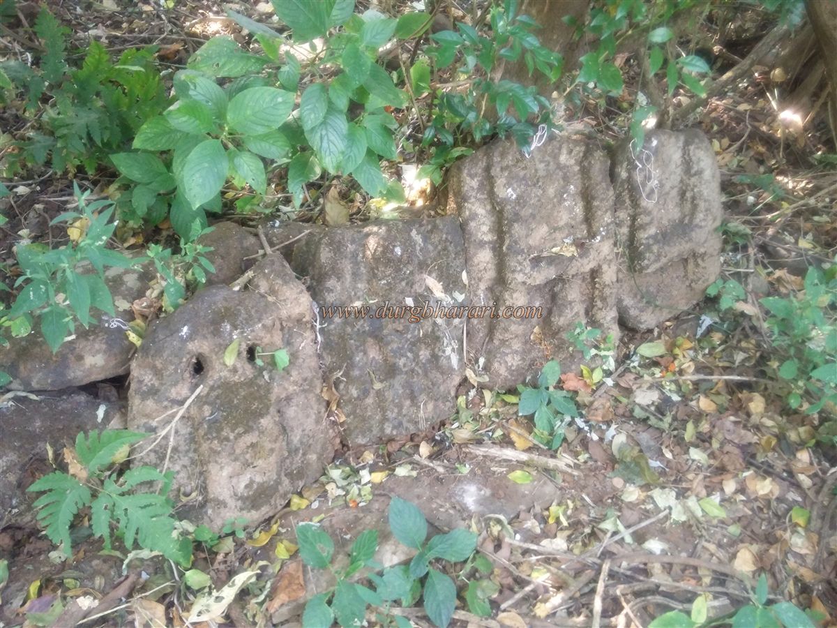
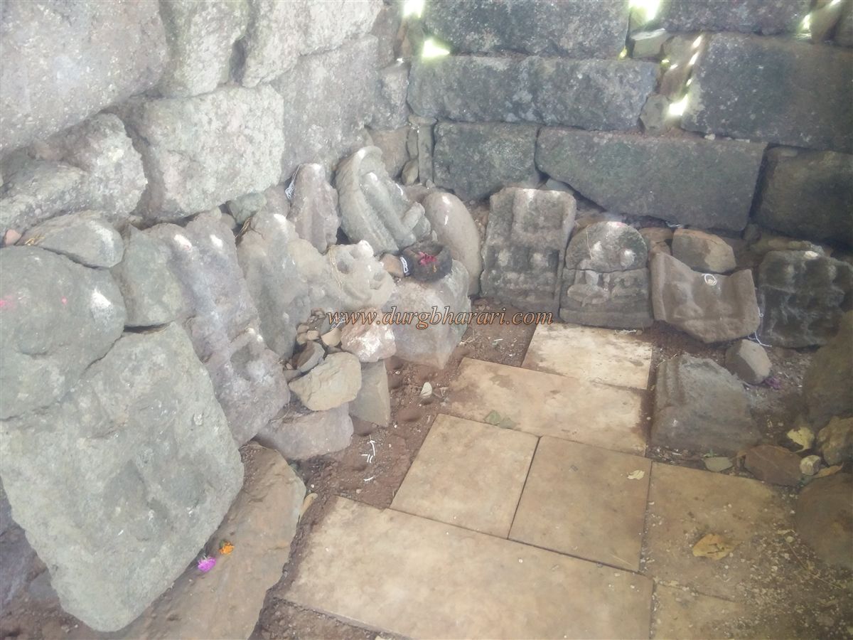
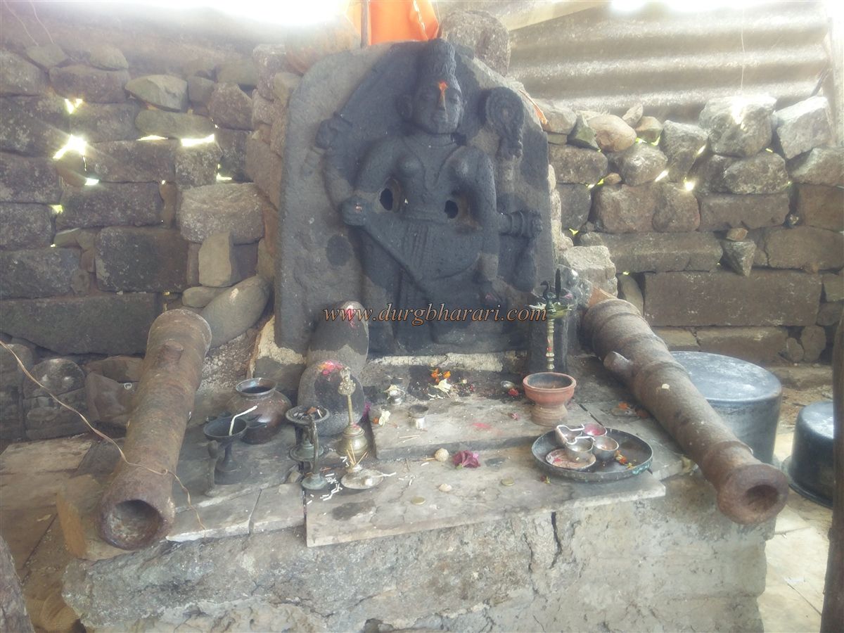
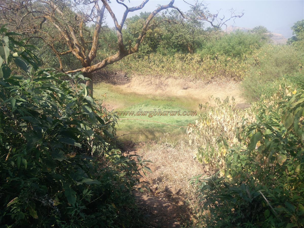
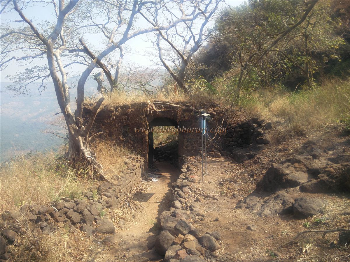
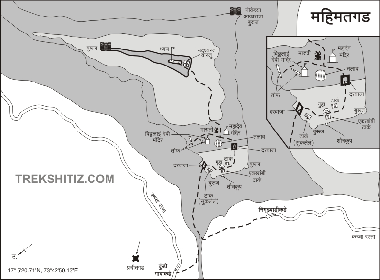
Currently (January 2019) this road is heavily damaged on both sides and if you go through Nigudwadi, you can reach half the height of the fort by private vehicle, and from there, 1.30 hours is enough to reach the fort. To reach Mahimatgad, first of all, you have to reach Devrukh, a place in Sangameshwar taluka. 10 km from Devrukh village is the Bellari village and a path from this village has a fork, the path on the left leads to Kundi village at a distance of 5 km and the path on the right leads to Nigudwadi at a distance of 2 km. If you have a private vehicle, you can cross the 4 km of unpaved road from Nigudwadi and reach half the height of the fort. Otherwise, it takes 1 hour to cross this distance on foot. This way we reach the gorge keeping the fort on the right side. From here you can see the footpath leading down to Kundi village and on the right side you can see the footpath leading to the bastion of the fort. On this road, you can see the remains of an outpost under the fort. In 15 minutes we reach the open area under the trunk leading to the bastion. The road leading to the fort from here has been beautifully nurtured by the young congregation of Nigudwadi. The road from Kundi village also comes to this place. There is a large rampart built of stone near the gate and the remnants of some structures can be seen by cutting down the bushes inside the ramparts. From here, on the right side of the road, you can see some human figures carved on the wood dedicated to God. This way we enter the fort through the east-facing gate of the fort. Inside the doorway, there are guard porches on both sides although only the quadrangle structure of this remains and the inner part of this door is enclosed by ramparts. To the left of the door is a map showing the architecture of the fort. The ramparts of the fort are still standing and cement or any other mixture has not been used to join these ramparts. There are a total of seven cisterns carved in the rock in this fort and three of them are pillared. One of the cisterns has been extinguished due to stones fallen into them and some of the cisterns are partially carved. The water in one of the cisterns is mossy but drinkable. Adjacent to the ramparts in front of the gate is a dry cistern, and behind the ramparts is a toilet. From here, one can see the fort ramparts and the bastions in them. One of the bastions has a large window but cannot be reached due to overgrown bushes. After climbing up the steps, another ruined gate of the fort comes in front. Passing through the bush to the right of the gate towards the ramparts, we reach a large circular bastion. The bastion has arched windows for guns and cannons. As we start climbing the fort this bastion and the saffron flying on it are constantly in front of our eyes. When you come to the door after seeing the bastion, you go straight ahead and you see a dry lake on the left-hand side. On the way from the lake, the road splits in two. The road on the right leads to the citadel and the road on the left leads to Mahishasurmardini Temple. At this turn, on the right side, there are two satishila and two idols near the tree. At the beginning of the road on the right, there is a small ruined Shiv temple and in front of the temple, there should be a huge Shiv temple as there are remains of a carved Nandi as well as a Deepmal scattered in the area. At the back of the temple, there is a quadrangle structure of mansion and this place should have an office of the fort or the fort keeper’s mansion. Next to the Shiv temple is a newly erected Maruti idol in a dome. From here, after climbing through the thick bushes, you come to a small plateau below the citadel. From here you can see a beautiful bastion at the other end of Machi in front. This bastion reminds us of the upper bastion of Jhunjaramachi on Torna fort. Due to the large number of thorny bushes growing on Machi, you cannot go to this or any other bastion as well as Machi. The ramparts at the bottom of the fort have completely collapsed and the gate in it has been destroyed, so you can enter the fort through the broken ramparts. There are no remains on the fort except the flagpole but from here one can see the entire fort at a glance. This triangular-shaped fort is spread over 40 acres from north to south and the height of the fort is 2530 feet above sea level. The fort has two Machi’s and the bastions at the ends of these Machi’s are still in good condition but it is not possible to reach there. Vishalgad is visible to the south and Prachitgad to the north from the citadel. After descending from the citadel and coming to Shiv Temple, the path on the left leads to Mahishasurmardini Temple. The walls of the temple are crumbling and a temporary shelter has been built on it. There is a carved idol of Mahishasurmardini in the temple and two small cannons are placed in front of the idol. Besides the idol, there are some Satishila, loose and worn idols. On the way to the front of the temple, on the left side, there is a building’s quadrangle structure hidden in a tree and a large cannon is placed in front of this structure. The ramparts of the fort on this site are still intact and to reach the top of it you have to climb through the trees. You can see 3 bastions in this rampart after searching. If you remove the bushes from here, you can easily see the ramparts and bastions from here. The fort has a total of 10 bastions although there is no way to go to any bastion except 4 bastions. So when you come to the main door from Mahishasurmardini temple, your fort round is complete. As it is not possible to go to the bastion on Machi at present, one hour is enough to see the entire fort, but if the path to the Machi is clear without any bushes, two hours are required to see the fort. The fort has remained like an outpost, Machi, citadel, ramparts, bastions, gates, water cisterns, and lakes, temples, and cannons but all these ruins are disappearing in the trees as not many people visit the fort. The Nigudwadi Coordinating Committee and the villagers have taken the initiative to conserve Mahimatgad. Under this, the footpath leading to the fort has been completely cleared and the bushes in front of the gate have been completely removed. Now their goal is to clear all the unnecessary bushes growing on the fort. Congratulations on their work!! Although there are not many records about Mahimat fort in history, on 29th April 1661, Shivaji Maharaj captured Sringarpur of Surve and at that time Mahimatgad also joined Swarajya along with Prachitgad.
© Suresh Nimbalkar
GALLERY