MADHUMAKRANDGAD
TYPE : HILL FORT
DISTRICT : SATARA
HEIGHT : 4038 FEET
GRADE : EASY
In the dense forests of Javali, nestled between the forts of Vasota and Pratapgad, lies the twin-fort complex of Madhu-Makarandgad. It is likely that this fort was constructed to guard the Hatlot Ghat, which descends from the Western Ghats into the Konkan region. This relatively unknown and hidden duo in the dense forest of Javali remains largely unexplored due to the difficulty of reaching it, placing it out of reach for casual tourists. Even seasoned fort trekkers rarely visit this place.
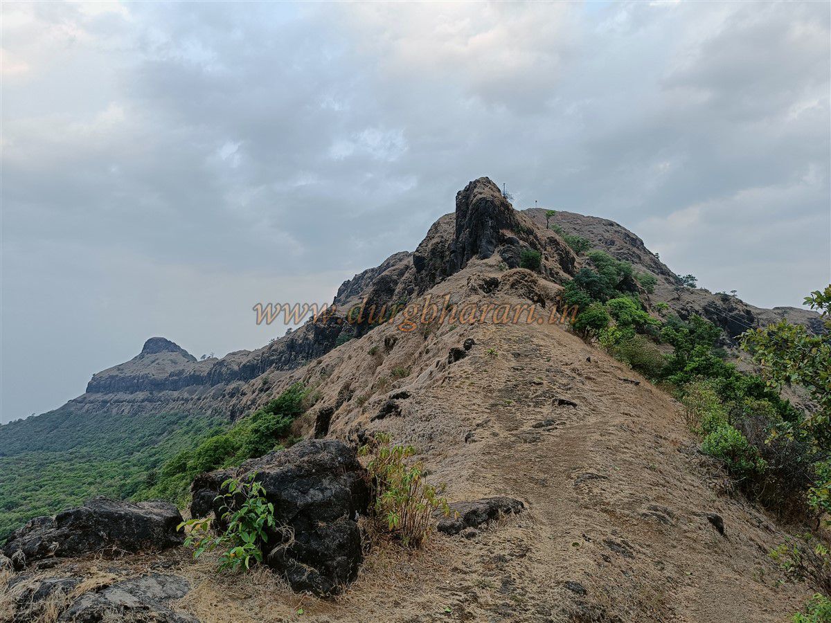
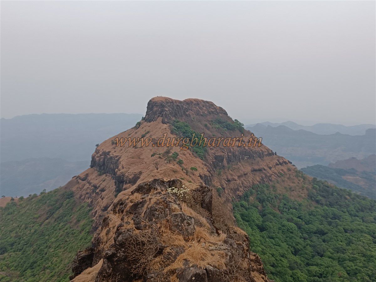
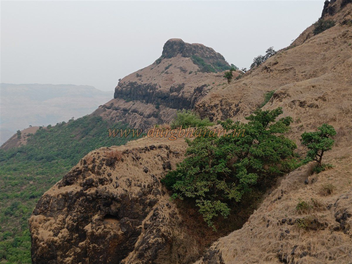
Madhu and Makrandgad are twin forts situated on an east-west mountain ridge, with Makarandgad on the eastern peak and Madhugad on the western peak. On the plateau between the forts lies the small settlement of Ghonaspur, consisting of around 20–22 families of nomadic tribes.
...
The villages of Chaturbet and Hatlot lie at the base of the mountain on either side, each providing paths to the fort. From Hatlot, one must climb a steep hill through dense forest for about an hour and a half to reach Ghonaspur. From Chaturbet, however, a dirt track leads up to the Mallikarjuna Temple at the base of the fort, provided one has a jeep-type vehicle.
Chaturbet is 31 km from Mahabaleshwar. On the Mahabaleshwar–Poladpur road, around 15 km from Mahabaleshwar, there is a left turn marked by an archway with signs for Ramvardayini Temple and Paar. This road leads straight to Chaturbet. From there, a 6 km rough road continues to Ghonaspur. Though the fort isn't visible from Chaturbet, it becomes prominent upon entering Ghonaspur, with the peaks of Madhu and Makarand clearly drawing attention.
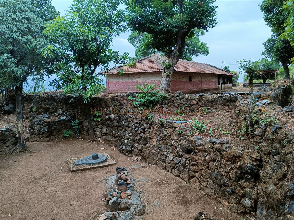
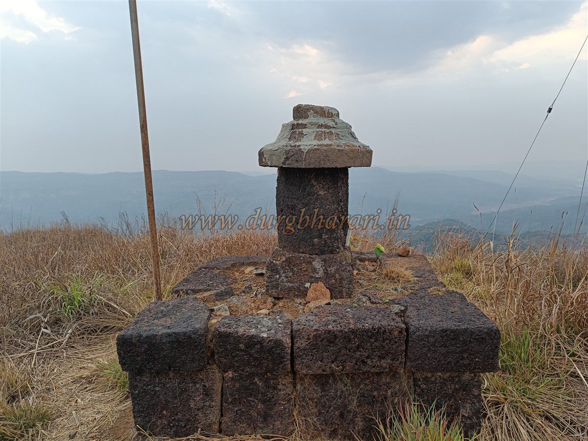
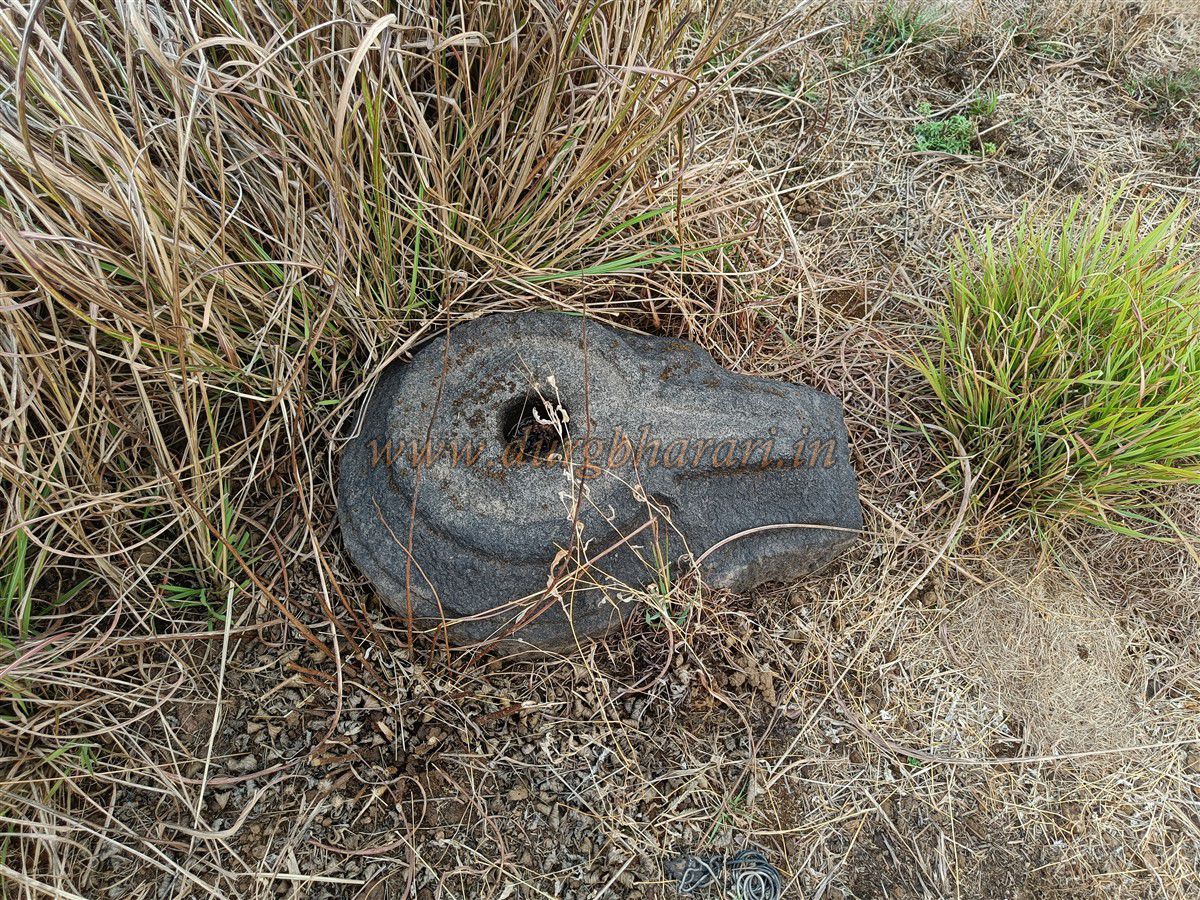
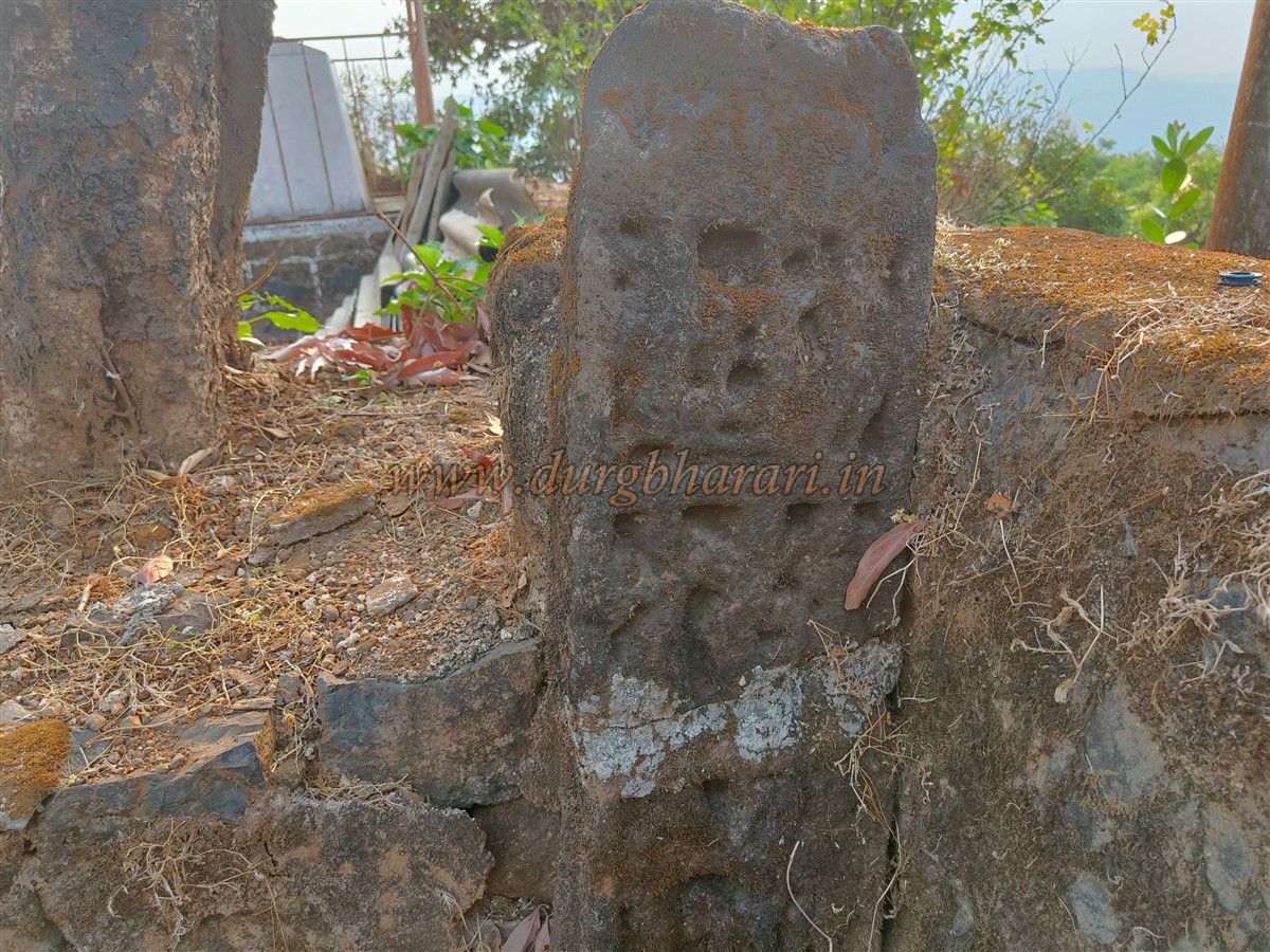
The village of Ghonaspur on the fort's shoulder may once have been the base settlement of the fort. On a slight elevation outside the village is the Mallikarjuna Temple, hidden in the thick forest, making it an ideal place for a peaceful stay in the Sahyadri. Before Shivaji Maharaj’s time, this temple was one of the seven "Shivpuris" established by Chandra Rao More. The stone-constructed, tiled temple is of medieval origin and has a virgal (hero stone) and some worn idols in its premises. In the sanctum is a square-shaped Shivling, with a sculpture of Bhairav behind it.
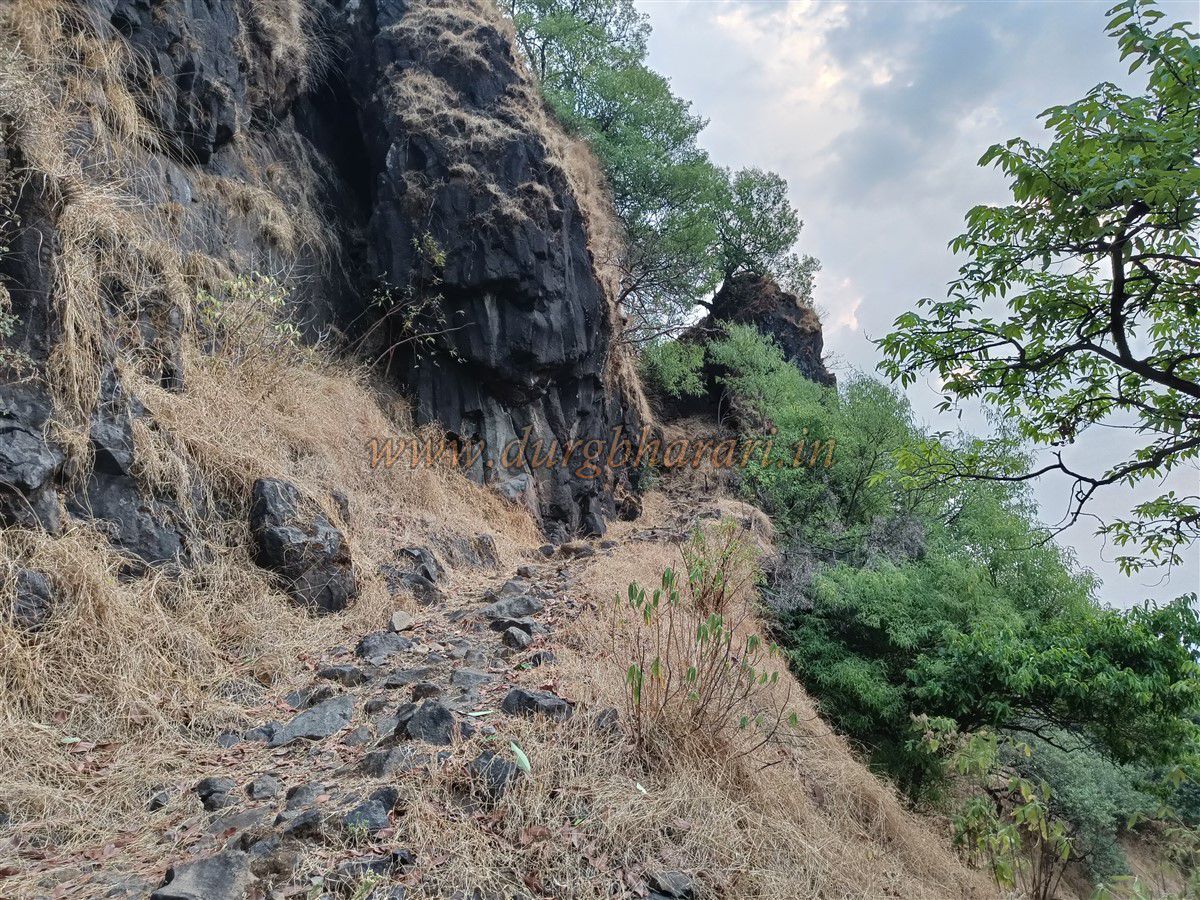
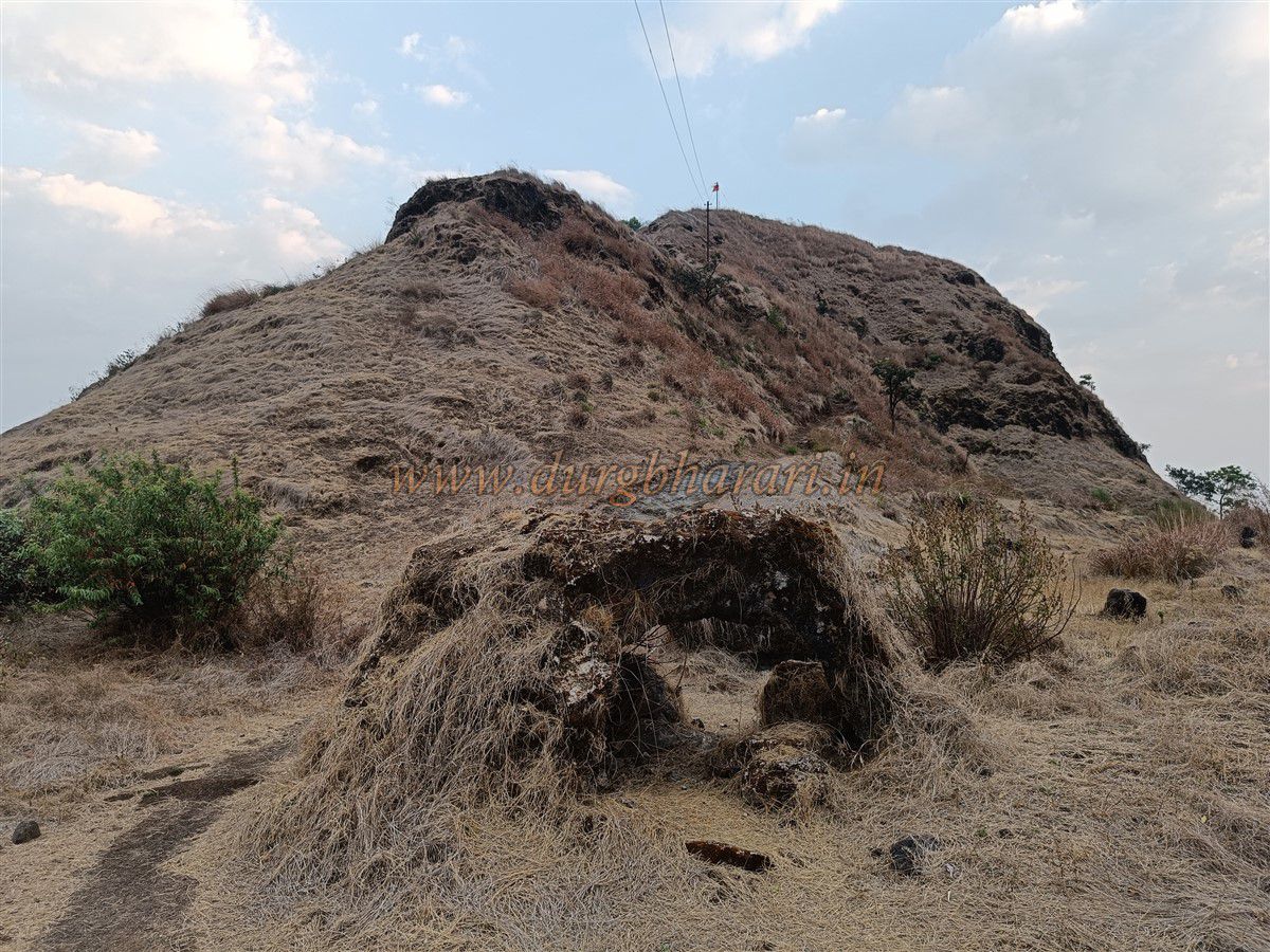
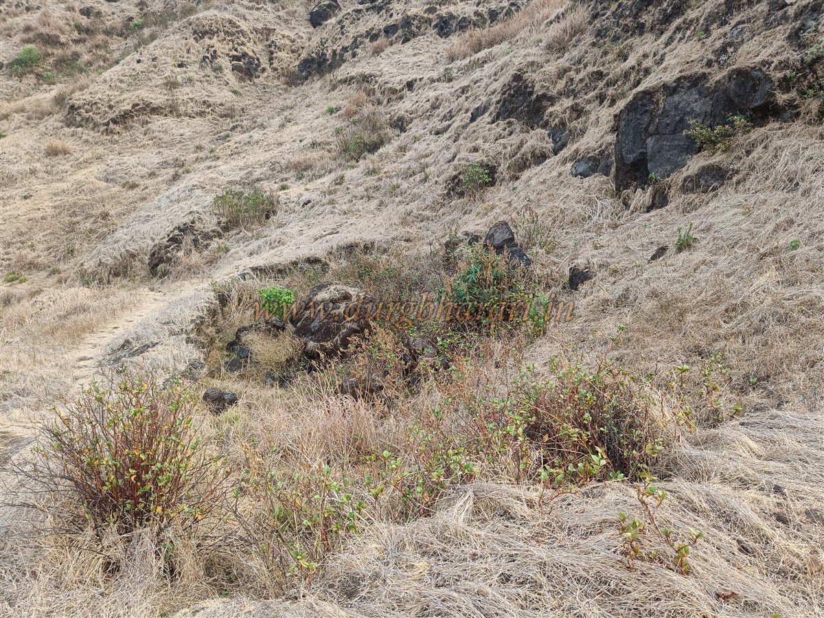
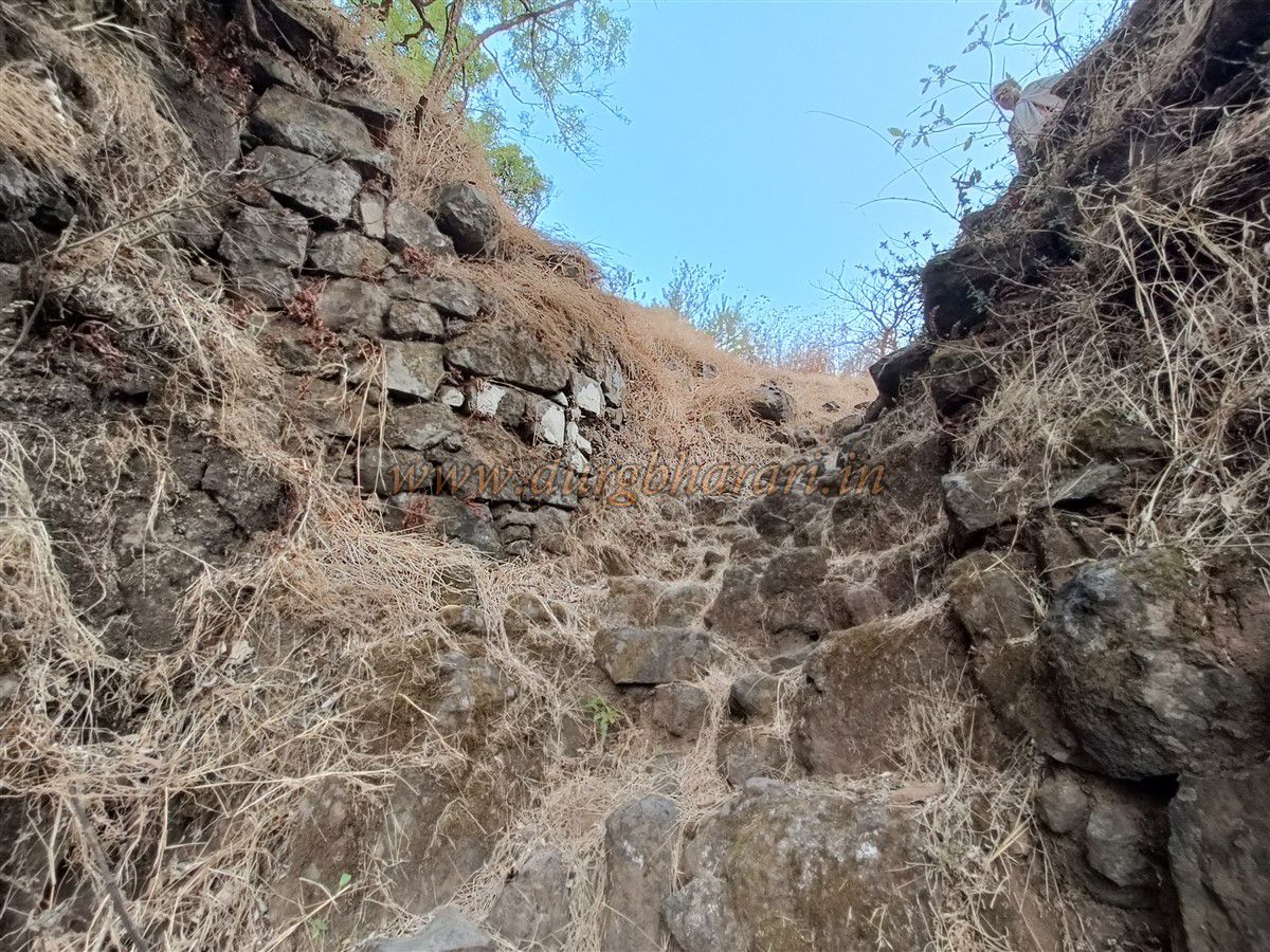
From near the Mallikarjuna Temple, a clear trail leads to the summit. Since there is no drinking water available on the fort, one must carry adequate water from the village. As you climb the path beneath Makarandgad, the ridge connecting the twin peaks comes into view. A 15-minute climb brings you to the now-ruined gateway. The gate, carved from rock, had bastions built beside it using loose stone, but most of this construction has now collapsed.
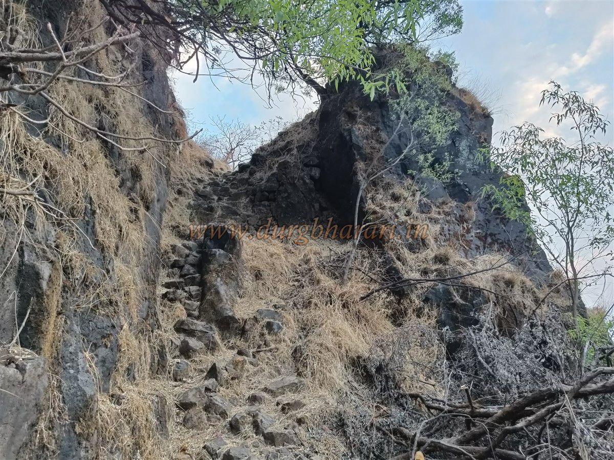
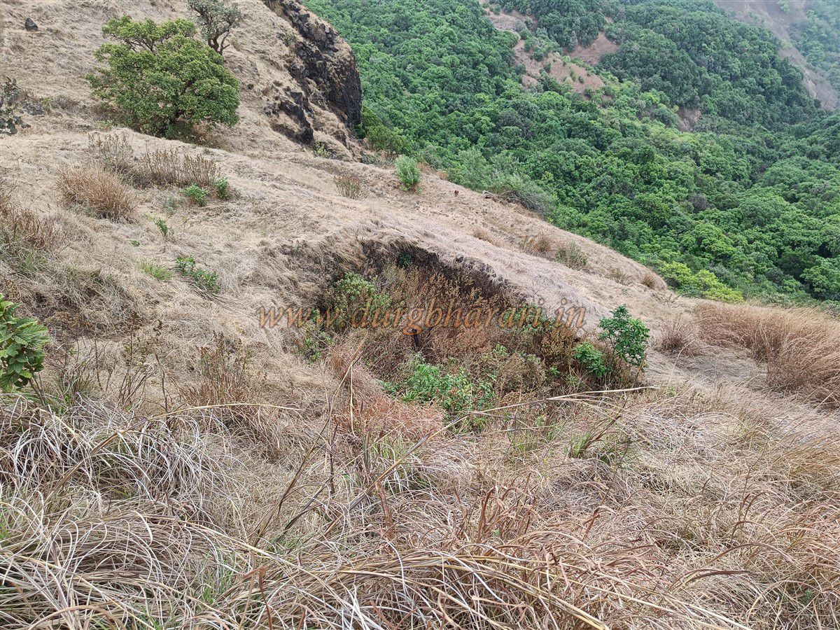
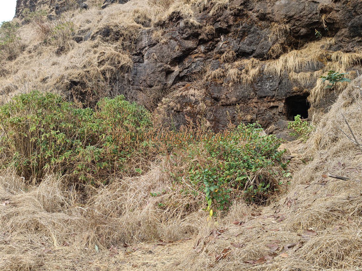
Once past the gate, two paths appear — the left path ascends to the fort summit, while the right path skirts the hill to reach the rear side. The left path should be followed to reach the top. After climbing up, on the left at the ridge’s edge is a small bastion partly carved out of the rock with some remains of masonry. A little ahead, strong winds have eroded the rock to create a natural arch — large enough for a person to crouch and pass through. On the left, a trail leads to a dry water cistern partly filled with soil. It seems to have formed as a result of stone quarrying. Nearby is a small cave in the cliff, though the path to it is broken. After seeing this, one should return to the main path and continue the ascent.
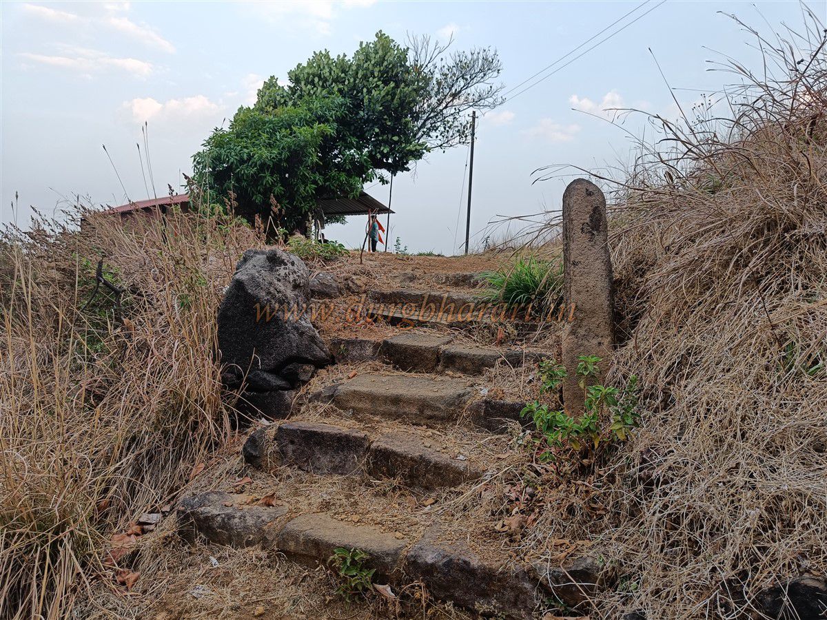
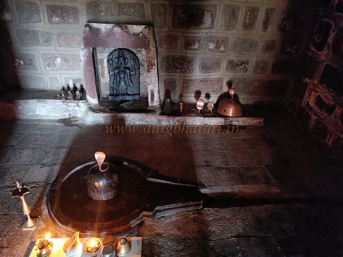
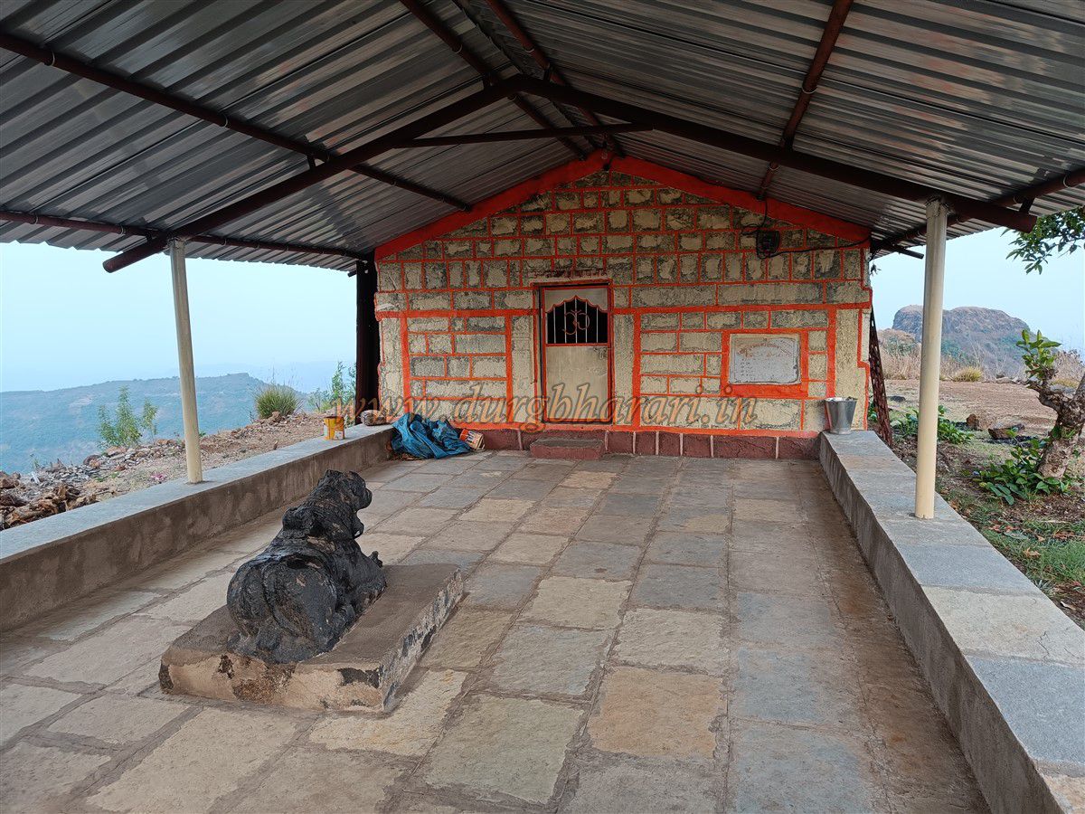
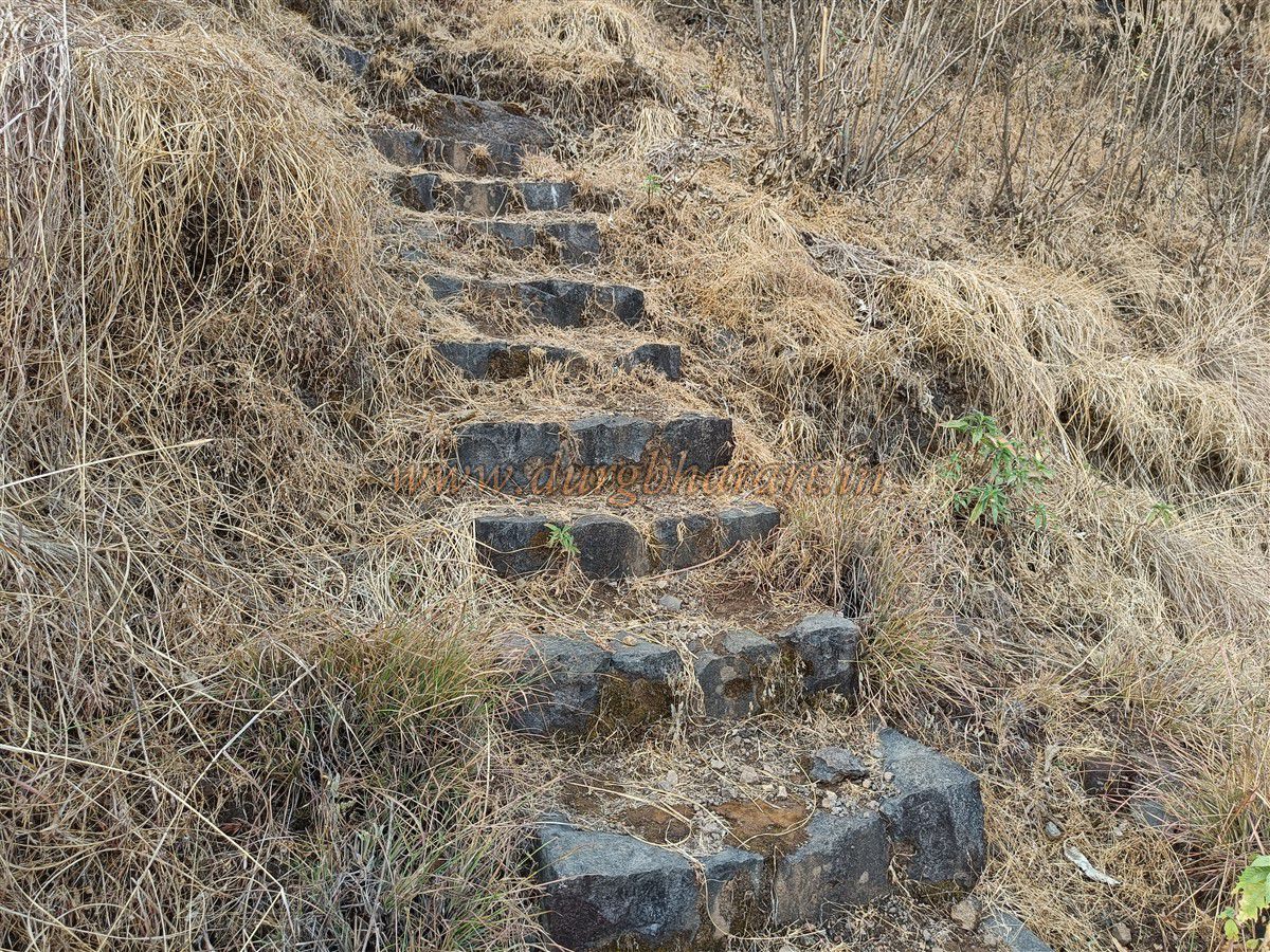
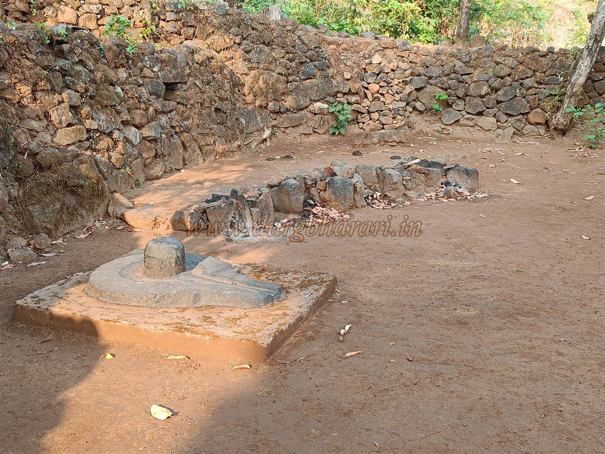
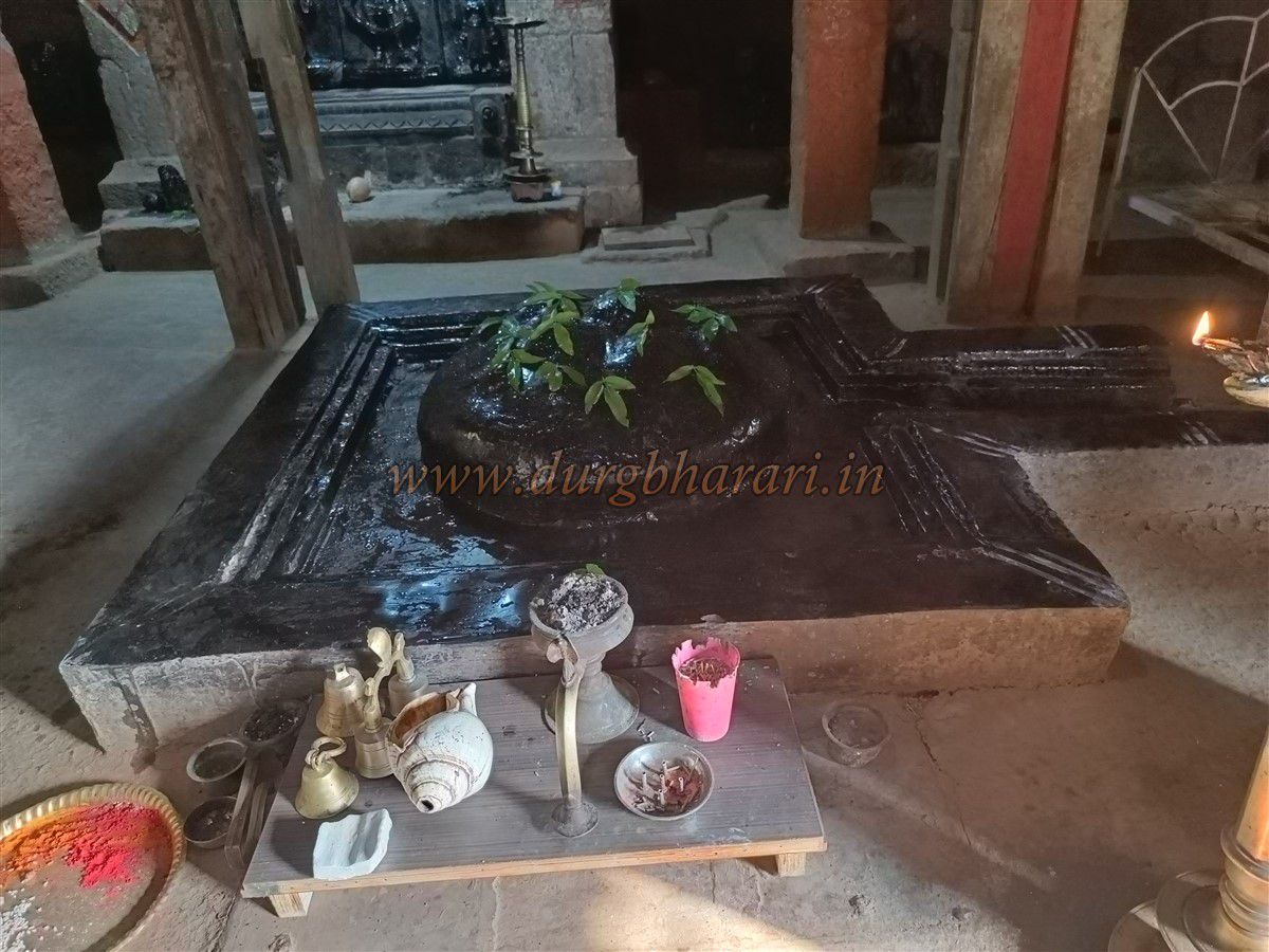
Along the way, platforms of old destroyed houses can be seen. In the final stretch, a flight of 8–10 stone steps leads to what must have been an entrance gate. Climbing these steps brings you to the top of the fort. The summit lies 4,038 feet above sea level and spans roughly three-quarters of an acre from east to west. At the centre of the summit is the shrine of Lord Mallikarjuna, with a corrugated iron shelter in front housing a Nandi idol. Inside the temple is a Shiva lingam with a copper serpent, and a black stone idol of Mallikarjuna behind it.
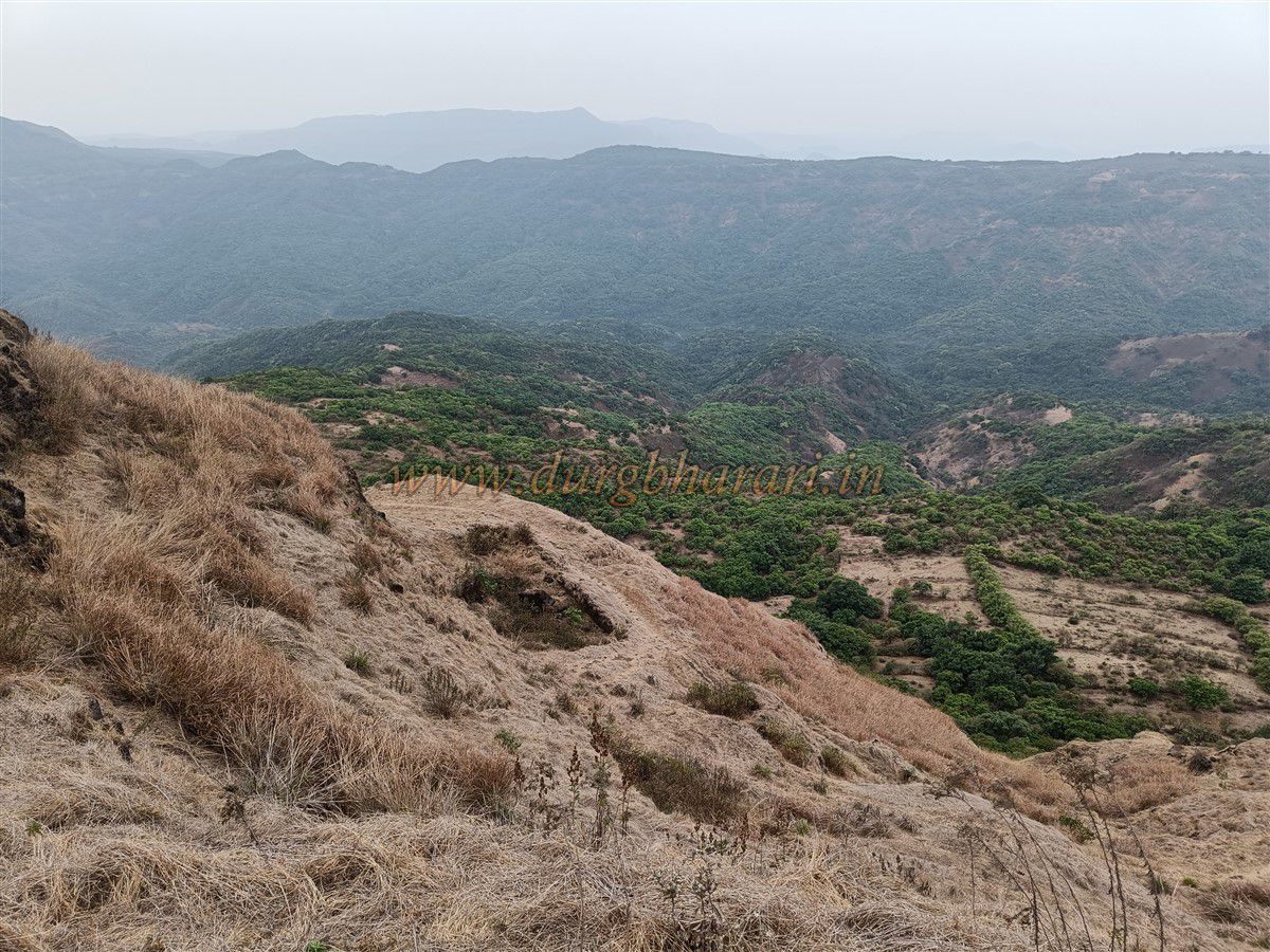
The relatively flat portion of the summit lies around this temple. In front of it is a platform with a tomb. Behind the temple, a narrow ridge extends with no significant remains, but offers a breath taking view of Madhugad. From the summit, one can see the Koyna valley to the east and Mahabaleshwar. Also visible are the forts of Pratapgad, Mahipatgad, Sumargad, Rasalgad, Mangalgad, and Mahimandon.
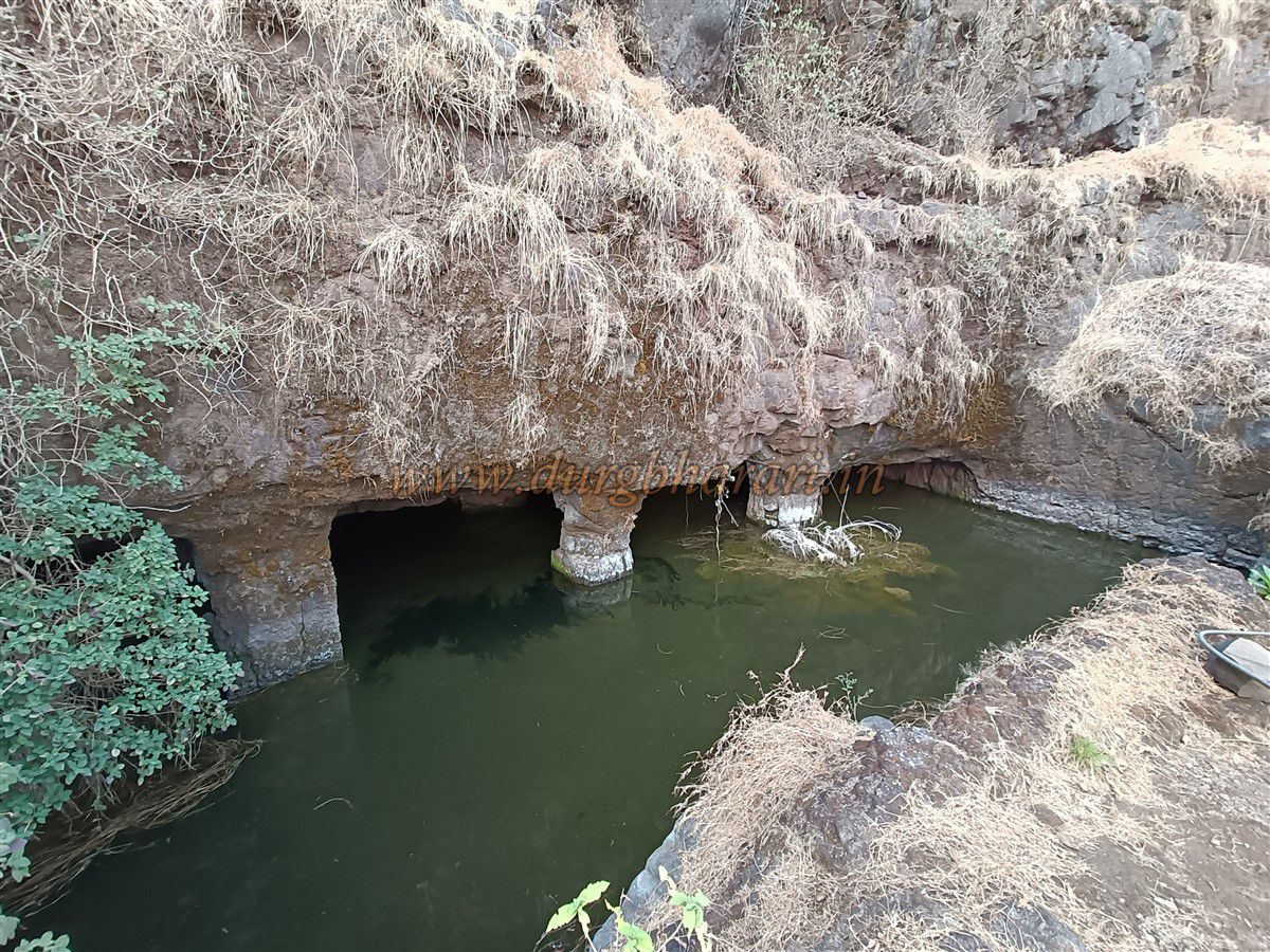
After exploring the summit, the descent should begin via the well-trodden path to the right of the temple. Some steps have been built along this route. After descending 100–125 feet, you’ll come across a water cistern carved into the rock. Though water is present, it is not potable. This cistern is supported on twelve stone pillars and features a carved image of Hanuman on its facade, confirming the fort's antiquity. From here, the path continues toward Madhugad, but the trail is broken and unused, requiring mountaineering gear and ropes for safe ascent.
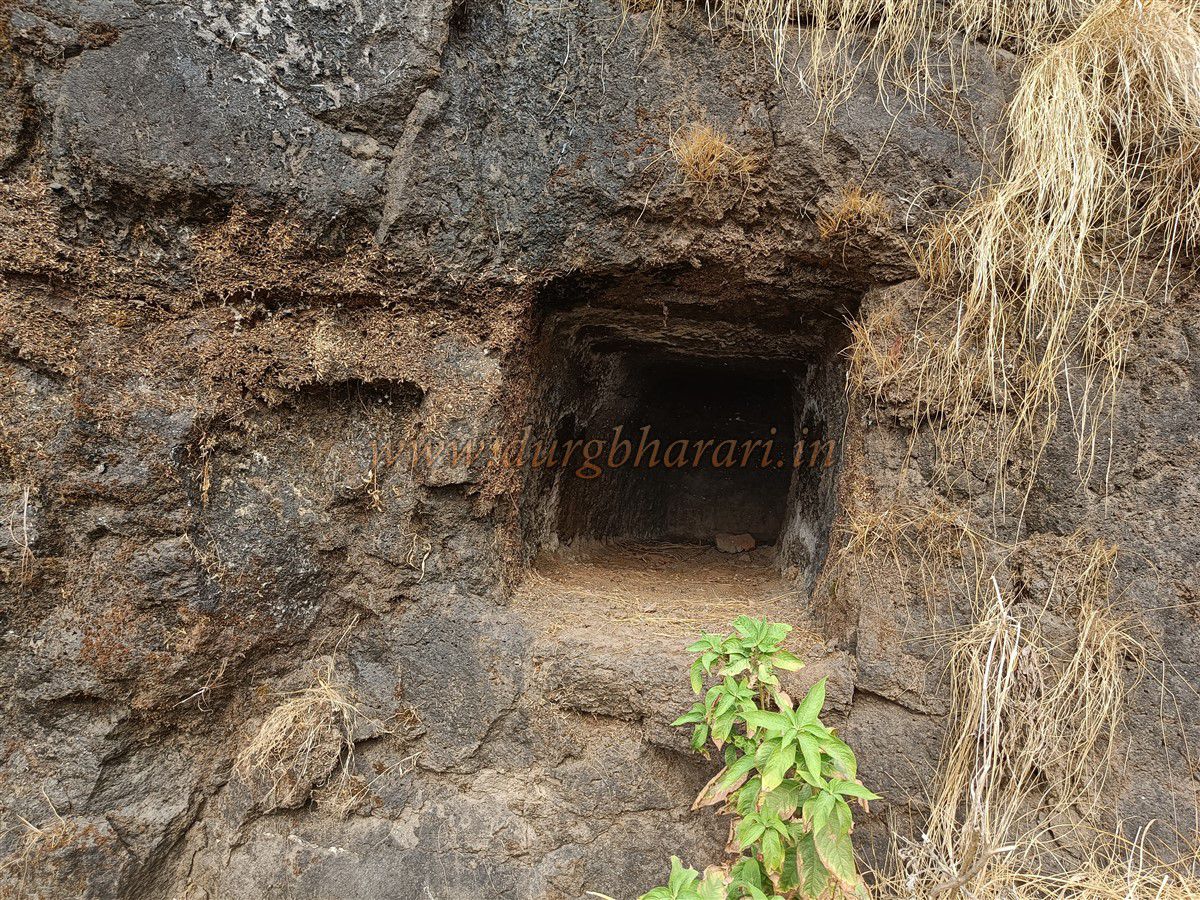
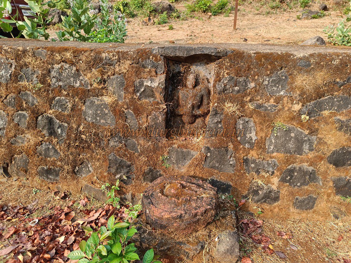
The top of Madhugad has three dry water cisterns and remnants of two or three house foundations, but nothing else. The path returning from the pillar cistern rejoins the main entry route. From here, looking left into the valley, the village of Hatlot appears like a painting. On the right side, there is a damaged cistern carved into the cliff, with a small cave above it. Returning to the gate marks the end of the trek. The entire fort can be explored in about one and a half hours.
It is not known who originally built Madhu-Makarandgad, but the pillar-supported cistern suggests the fort existed since ancient times. Before the time of Shivaji Maharaj, this region was controlled by the Shirke family and later by the More family of Javali. After being defeated in Javali, Chandra Rao More reportedly escaped via the Kondnale path beneath Makarandgad toward Raigad. After Shivaji Maharaj captured Javali in 1656, the fort came into his possession. The Satara District Gazetteer claims that the fort was constructed by Shivaji Maharaj, but the Sabhasad Bakhar mentions that Chandra Rao’s brother Hanumantrao, stationed at Chaturbet, was killed. This implies that the fort already existed and might have been repaired by Shivaji Maharaj while building Pratapgad. No mention of the fort is made in records of the battle of Pratapgad following the killing of Afzal Khan.
In May 1818, along with Pratapgad, Madhu-Makarandgad also came under British control.
Note: Ghonaspur village is strictly vegetarian, and the consumption of meat is not allowed there.
© Suresh Nimbalkar
GALLERY