MADANGAD
TYPE : HILL FORT
DISTRICT : NAGAR
HEIGHT : 4070 FEET
GRADE : VERY HARD
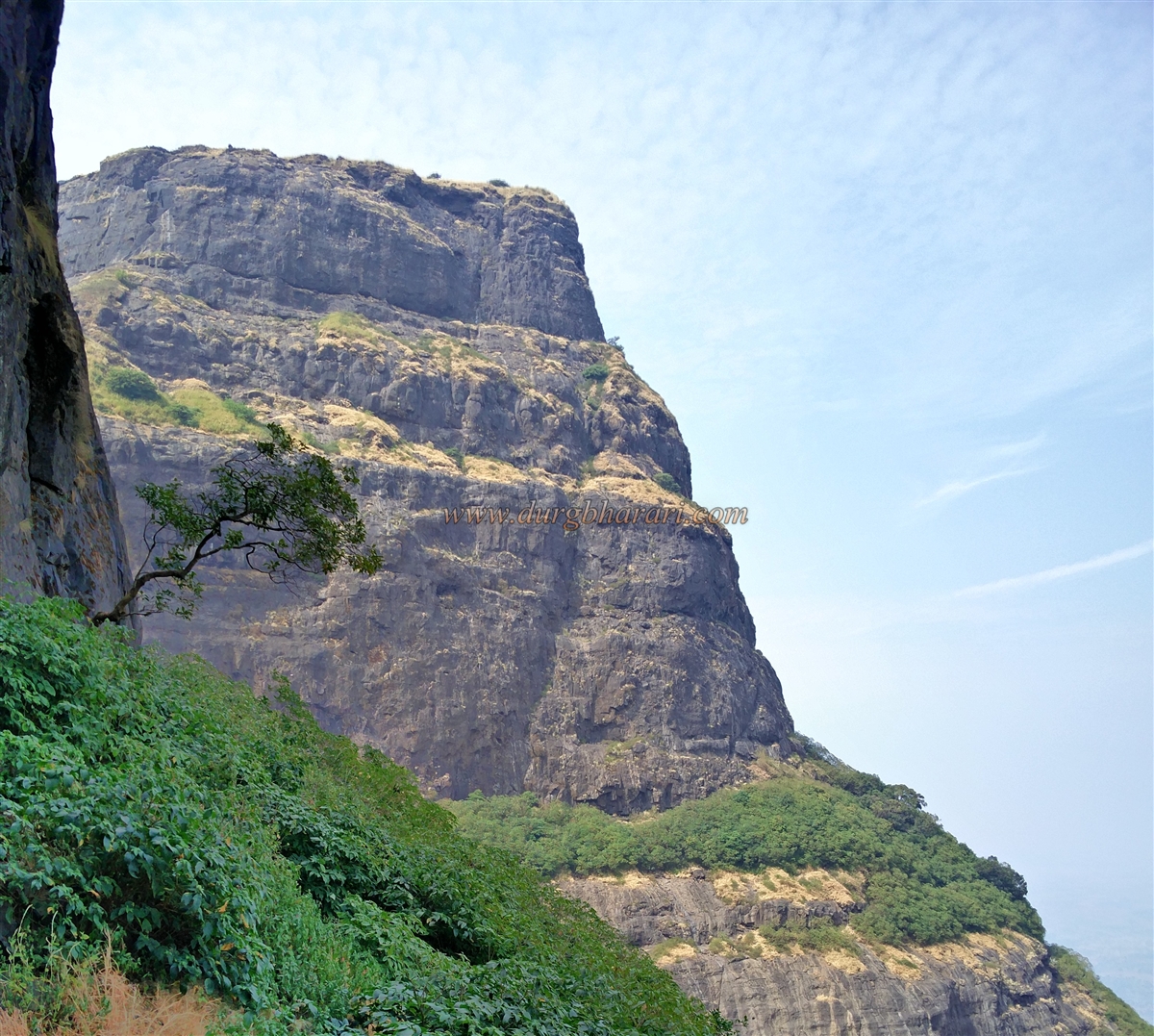
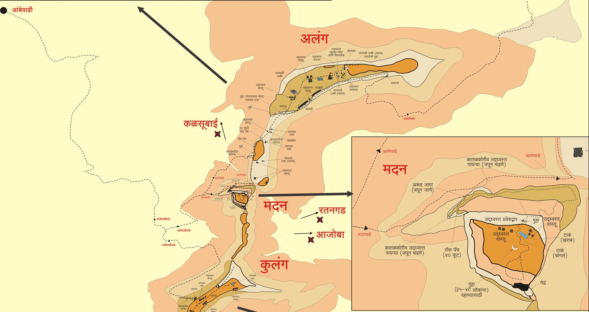
AMK means Alang-Madan-Kulang is considered to be one of the most difficult treks in Sahyadri. Madangad is the small fort in this difficult trek. The fort is very ancient and the steps leading to the fort have been broken by the British. It is important to be aware of the techniques of rock climbing as well as mountaineering equipment to reach the fort. Trekking around the fort during monsoons and subsequent months should be avoided. Currently, due to the marketing of trekking, the trek to the fort is active all year round endangering the lives of the people during monsoon seasons. To the south of Igatpuri on the Mumbai-Agra highway is the Kalsubai mountain range of the Sahyadri. Madangad stands at a distance of about 10-12 km south of Igatpuri in this mountain range.
...
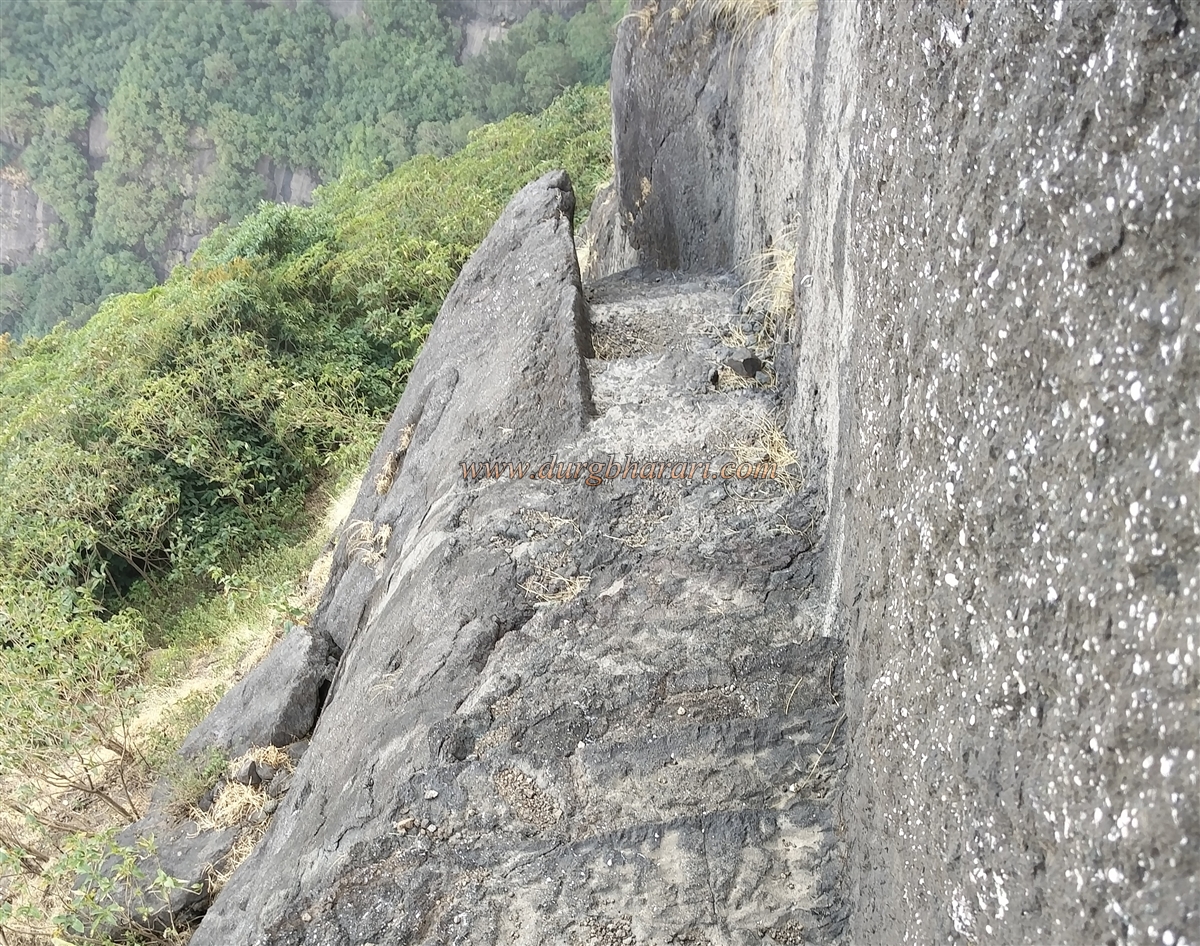
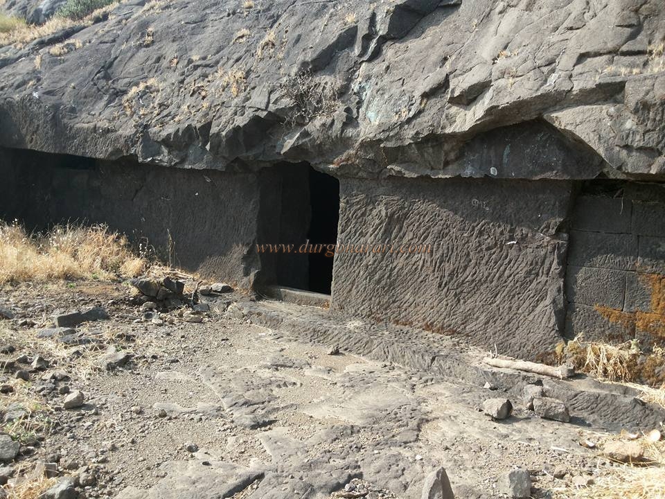
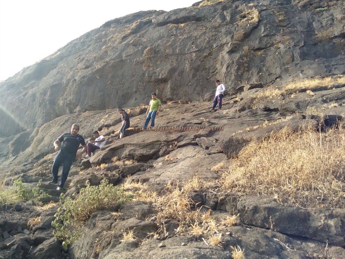
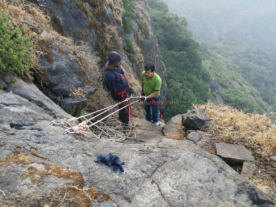
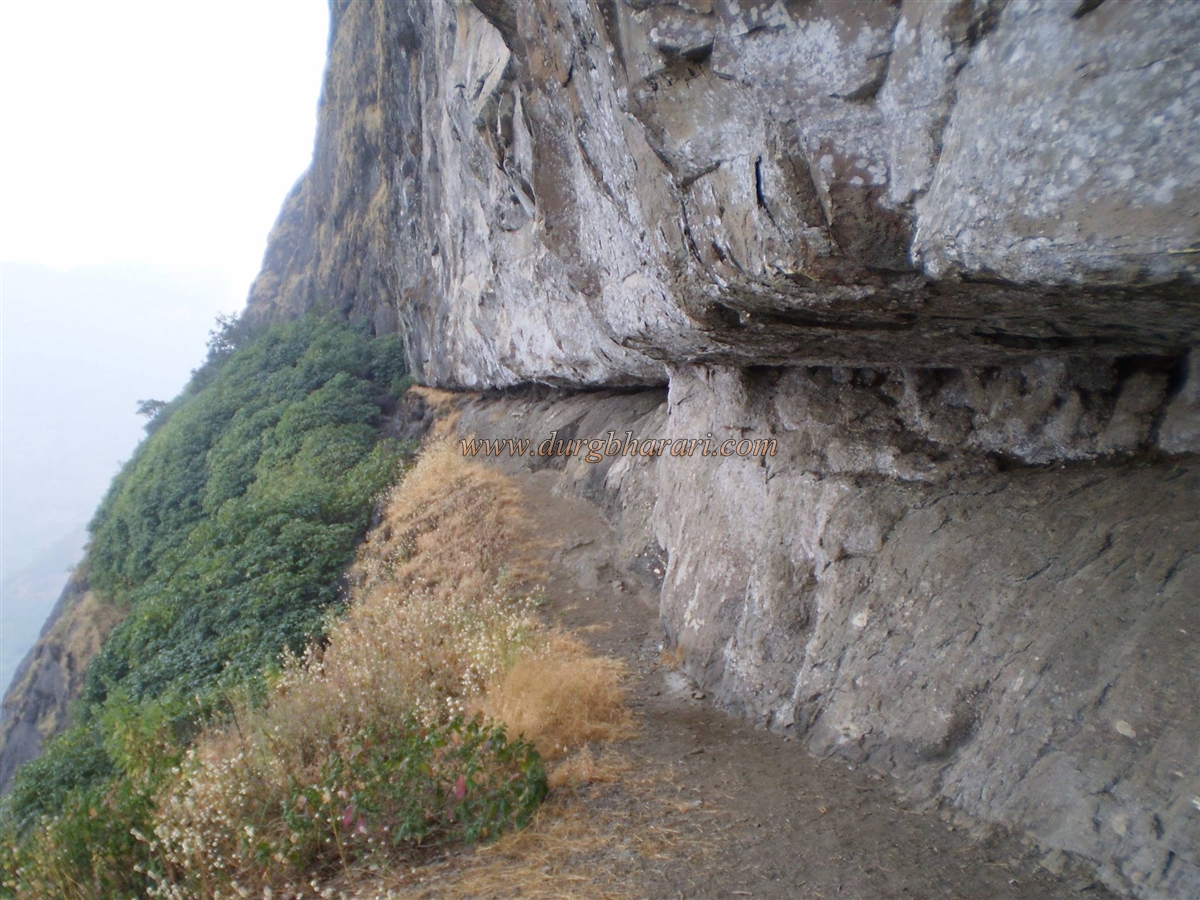
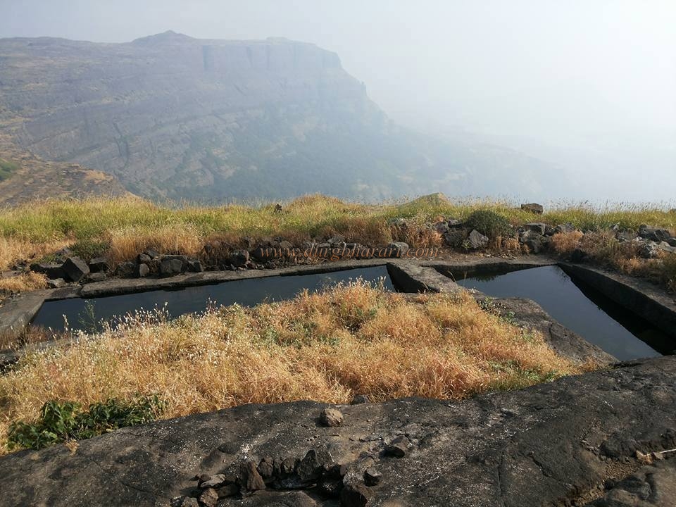
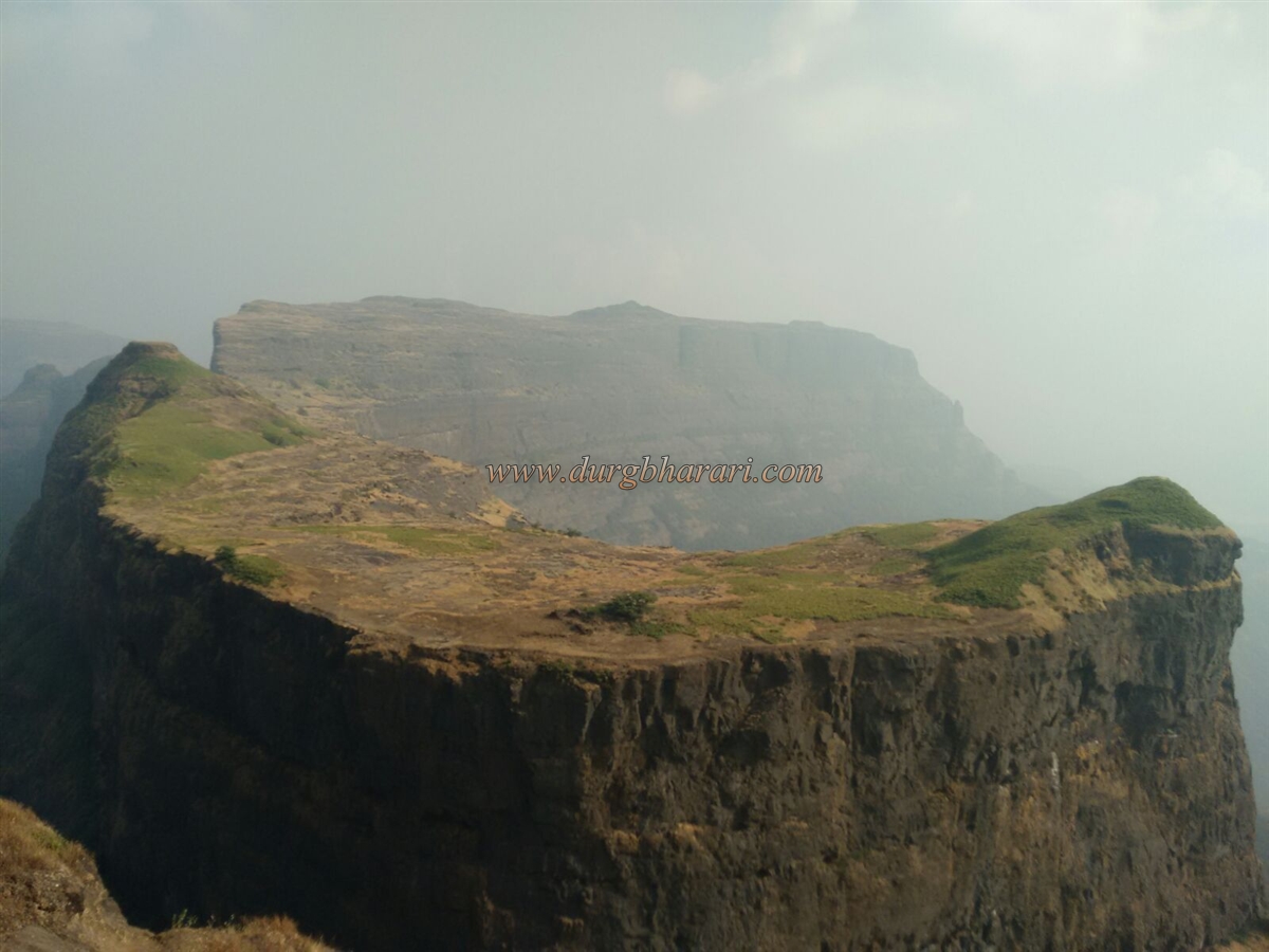
There is a village called Kurangwadi at the northern foot of Madangad. The base of Madangad can be reached from here as well as from Ambewadi village. Both these paths are very tiring and come together under the gorge of Alang and Madan. Coming from Kurangwadi, one has to reach the lower plateau first and then the upper plateau through a footpath that goes through the forest. To reach the upper plateau, one has to walk for three hours through various footpaths from Kurangwadi. When you reach the plateau, you can see Madangad on the left. After climbing this tiring path, we turn towards Madangad and come to the gorge between Alang and Madan. On reaching the gorge, Alang fort is on the left and Madan fort is on the right. It takes 4 hours to reach the gorge by both these routes. Turning to the right, the narrow path below the ridge leads to steps carved into the rock. In 1818, the British destroyed the steps of some places to break the path, making it dangerous in two places. Therefore, this stage should be passed carefully. After crossing the 10-12 foot ridge of this climb, we come under a 50 feet high ridge. This edge has been created by the British by breaking down the door here. The fort can be reached using rock climbing equipment. After crossing the 50-foot-high cliff with mountaineering equipment, a narrow path under the cliff leads to steps carved into the cliff again. This footpath takes you directly to the top of the fort. On this path, you come across another collapsed gate of the fort and a small cave. There are two water cisterns carved in the rock at the top of the road and one of them has potable water. This is the only water facility on the fort and as this cistern is in the open, the water in it must be evaporating in the summer season. One and a half hours is enough to reach the fort from the gorge. The head of the fort is small and the surface of the land is not plain. There is a cave that can easily accommodate 15-20 people under the hilltop. Nedhe is a naturally formed fissure in the rock at the top of the fort. Except for a few quadrangle structures of houses on the surface of the head, no other remains can be seen. From the highest part of the fort, one can see Kalsubai Range, Alanggad, and Kulanggad. From here Pabargad, Ratangad, Bhairavgad, Harishchandragad, and Siddhagad can be easily identified. If the weather is clean, Balwantgad, Tringalwadi, Kavanai, Aad, and Patta are also visible. Due to the strategic location of Madangad, it was convenient to observe the Chendha-Mendha Ghat as well as the upper area of Kasara Ghat. Although the history of the fort is not available today, it must be related to the Alang-Kulang fort. Considering that this province was under the control of Marathas in 1760, this fort should also be under their control. In 1818, the fort was conquered by the army of Colonel McDowell, a British officer. In ancient times, the goods from the port of Konkan were transported through the wharf to the markets of Junnar, Paithan, and Nashik. This route has been in use since the Satvahana period. Akole, Sangamner, and Sinnar were important stops on the route from Newase to Ratangad. Shiv temples and markets on this route still bear witness to this. Ratangad, Alang, Madan, and Kulang forts were built during the Yadav period. A full day of planning is required to explore Madangad. The path to Madangad passes through the forest of Alang-Kulang as well as through the forest of Karvi. To avoid mislead footpath in the forest it is necessary to take a local guide with yourself on this trek.
© Suresh Nimbalkar
GALLERY