LONZA
TYPE : HILL FORT
DISTRICT : AURANGABAD
HEIGHT : 1575 FEET
GRADE : EASY
There are several forts in the Satmala hill range from Pitalkhora to Ajanta in Aurangabad district. However, except for well-known ones like Daulatabad and Antur, most other forts remain unfamiliar. Some have even faded from public memory over time. One such forgotten fort is Lonja Fort. Although Aurangabad is recognized as a tourist district in Maharashtra, the condition of roads — except for a few main highways connecting key tourist destinations — is extremely poor. As a result, few people visit these forts.
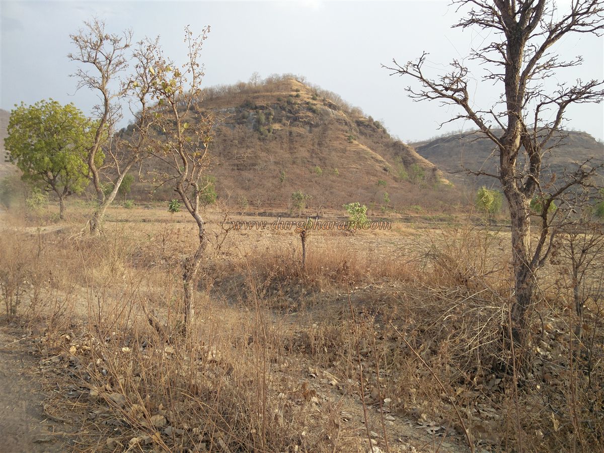
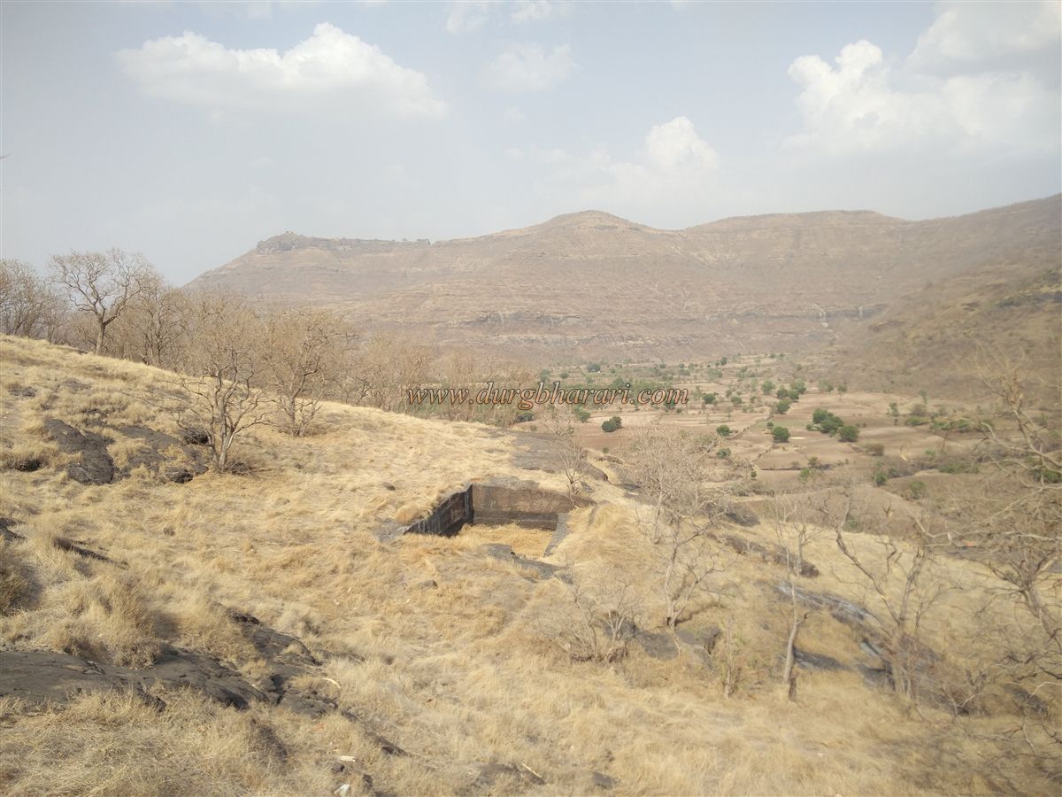
Located in Kannad Taluka, this fort is adorned with caves and water tanks and bears architectural resemblance to the nearby Sutonda Fort. In the surrounding region, it was once known as Mahadev Taka. Having lost its identity as a fort and completely faded from memory, Lonja Fort was reintroduced to the public by Mr Rajan Mahajan and Mr Hemant Pokharnkar. If traveling by private vehicle, one can visit both Sutonda and Lonja Forts in a single day and proceed to stay overnight at Antur Fort.
...
To visit Lonja Fort, you need to reach Pangra, the village at its base. Given the terrible road conditions, the best route from Mumbai or Pune is via Chalisgaon. The distance from Chalisgaon to Pangra is 25 km, and one can travel via the Chalisgaon–Nagad route to reach the base. If coming from Aurangabad, it’s about 100 km, and the route is Aurangabad–Verul–Kannad–Nagad–Pangra, taking approximately 5 hours. On the road from Nagad to Banoti, about 1 km from Nagad, there is a turn on the right with a signboard that reads “Mahadev Taka.” Since the fort is more commonly known in the region by that name, ask for directions to “Mahadev Taka” when inquiring. Lonja Fort is about 7 km from this junction. Pangra village is 5 km from the turnoff. Vehicles can only reach up to Pangra, so without a personal vehicle, the rest must be covered on foot.
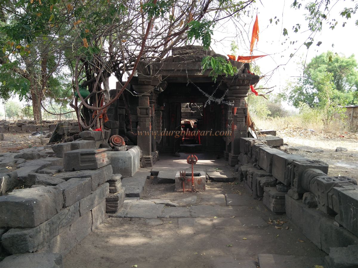
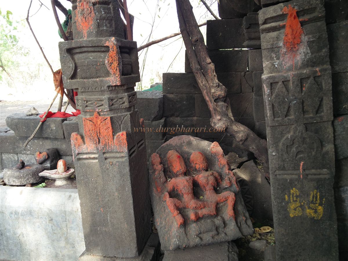
From Pangra, a road to the right leads 2 km to an ashram beside a lake. Along this route, on the left, you'll see the ruins of an ancient Shiva temple. The Sabhamandap is completely collapsed, and the sanctum is barely standing. Though dilapidated, the carvings on the remnants are worth seeing.
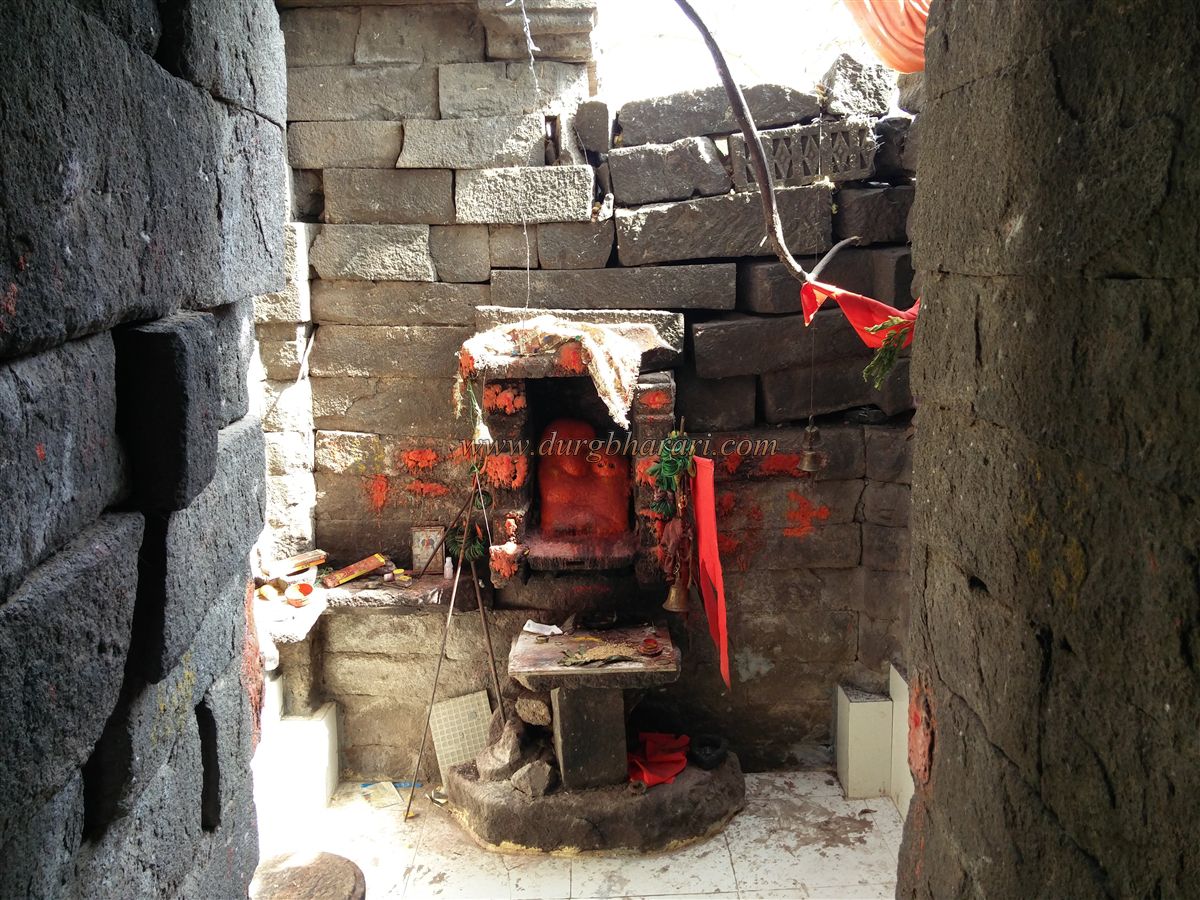
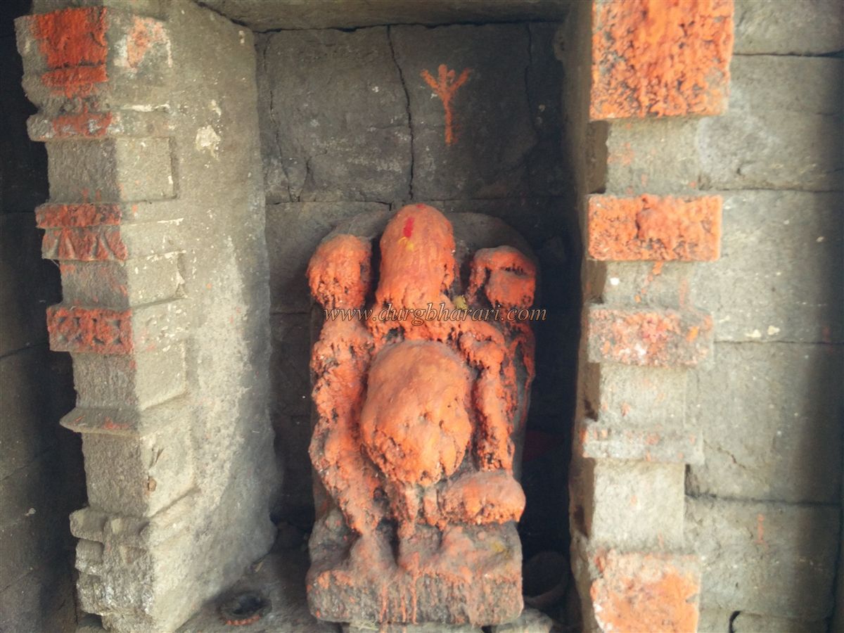
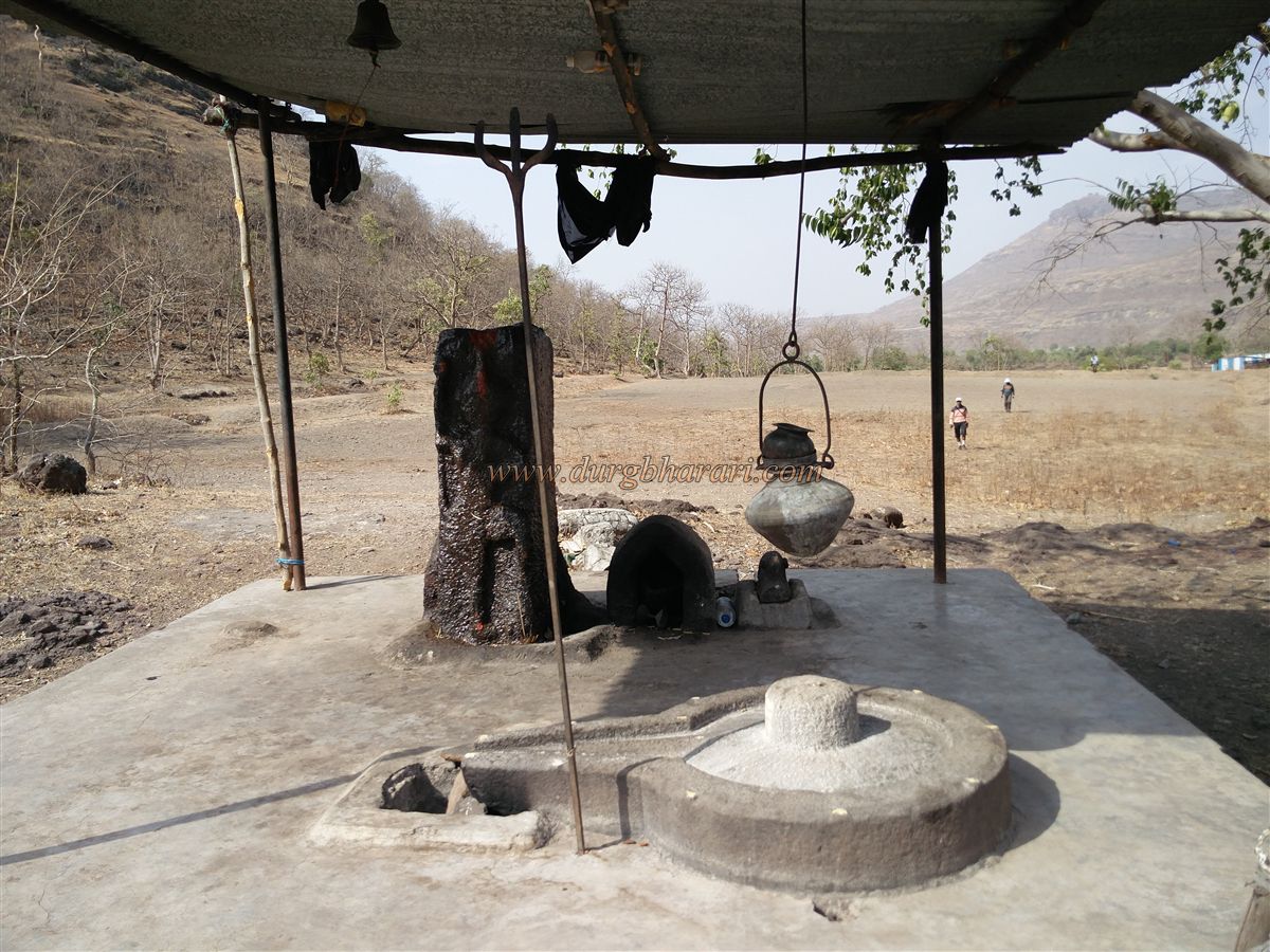
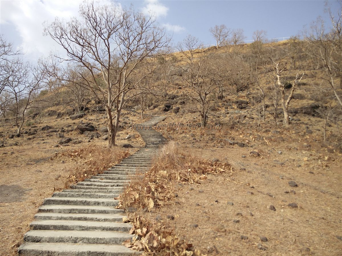
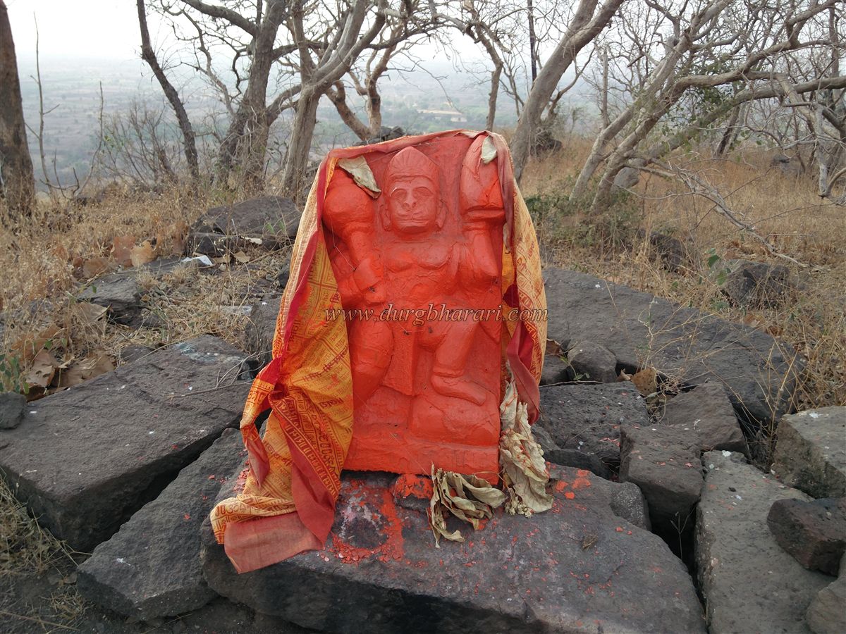
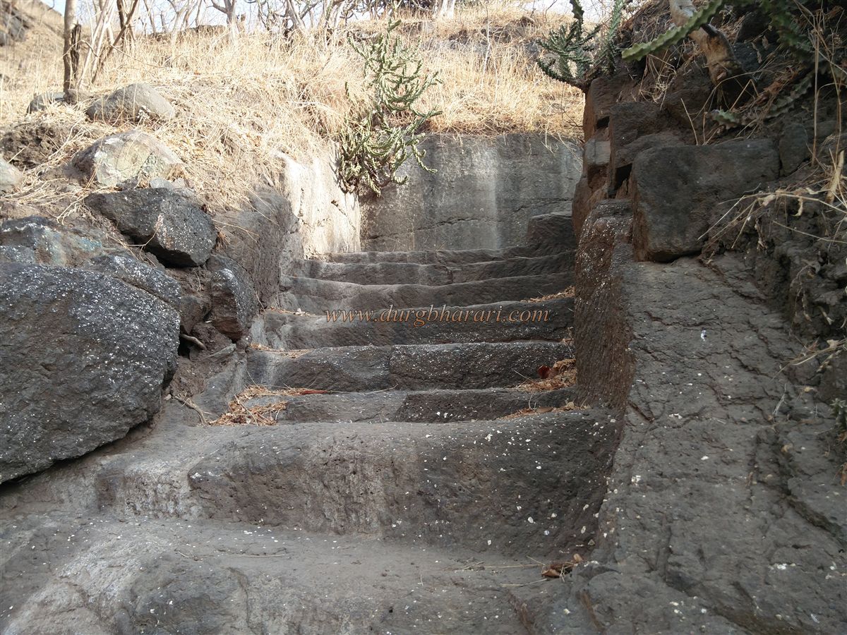
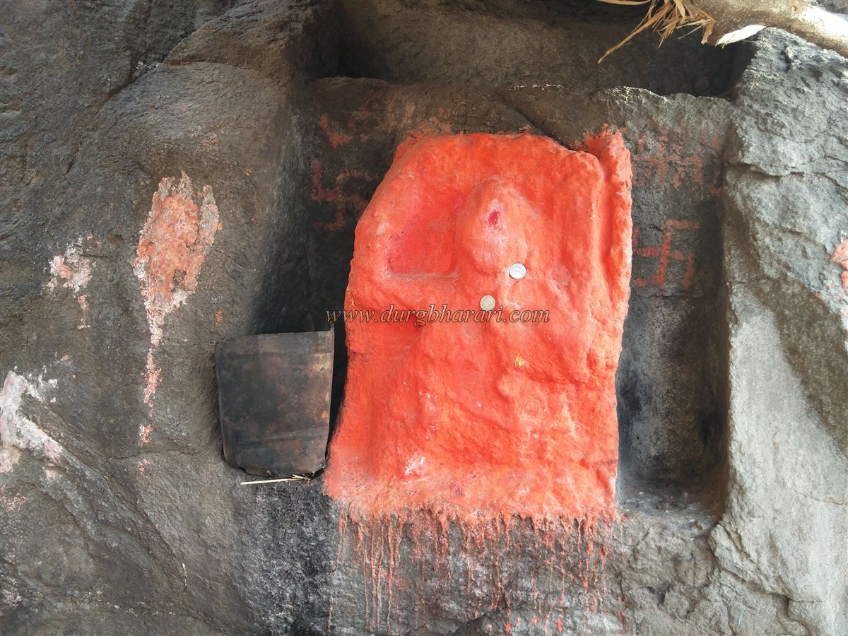
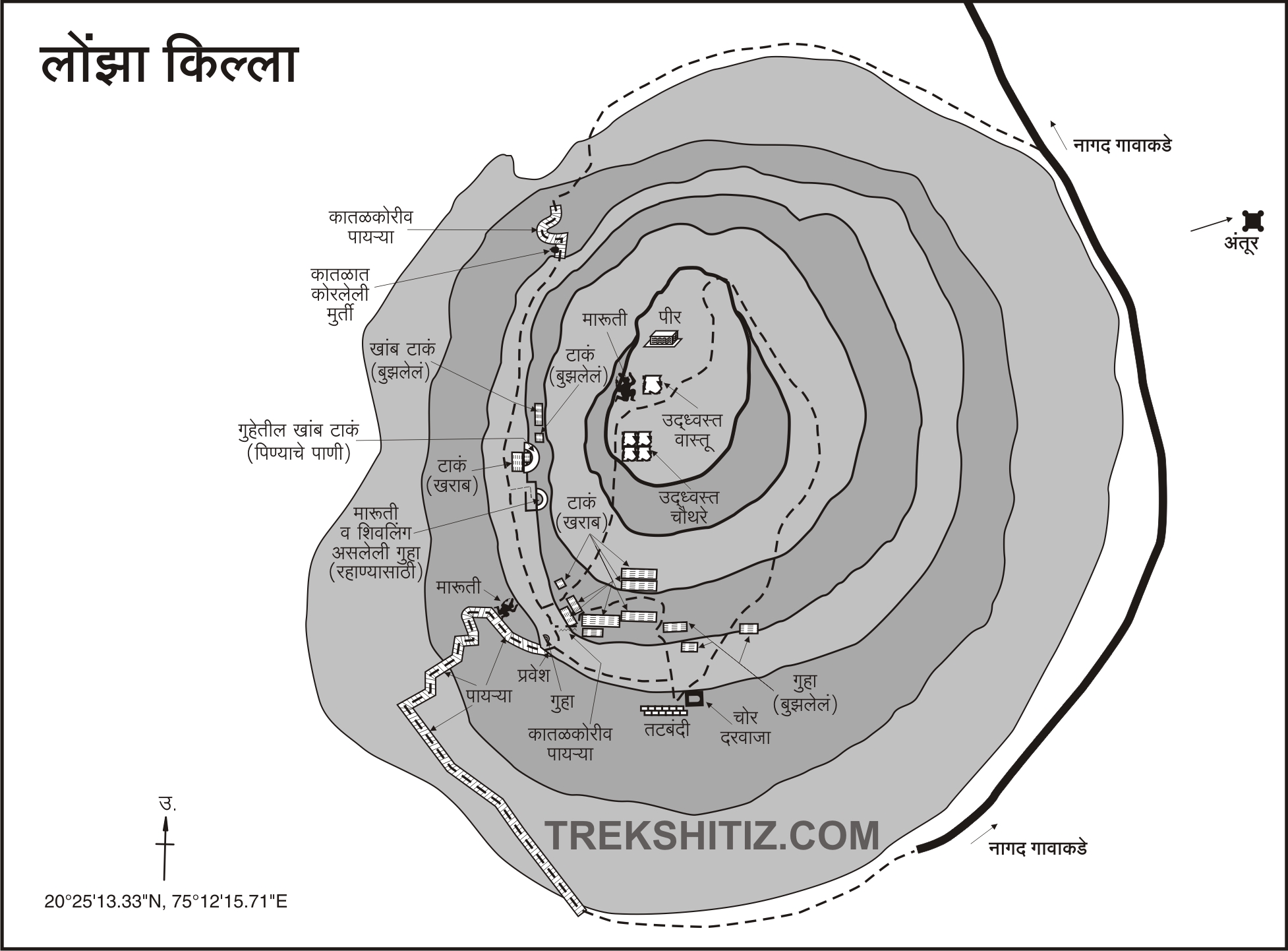
Lonja Fort sits on a tall hill separated from the main range. From the ashram, a cement stairway leads up to the fort. Along this path is a small tin-roofed shelter with a Shiva Lingam and an idol of Shani. There are two paths to the top; the one from the ashram is mainly used. The second path ascends from the opposite side and leads through a crumbled gate. The stairway leads to a pass in about 10 minutes. Remnants of a ruined fort wall are visible above. Where the steps turn right, there is a worn-out, sindoor-smeared idol of Hanuman. From here, climbing another 25–30 steps leads through the ruined gateway into the fort. It takes about 30 minutes to reach this point from the base.
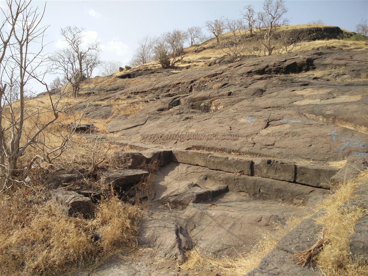
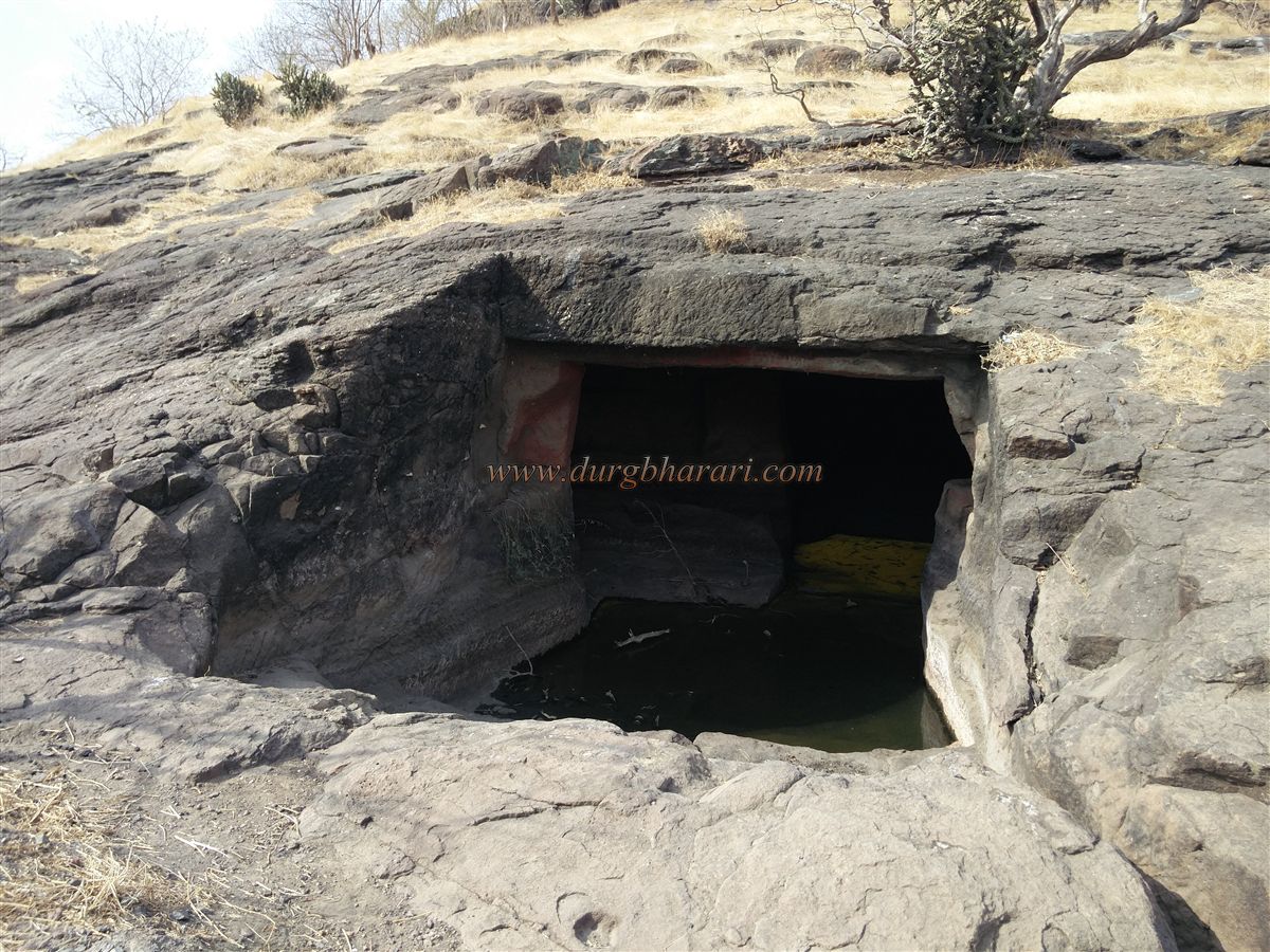
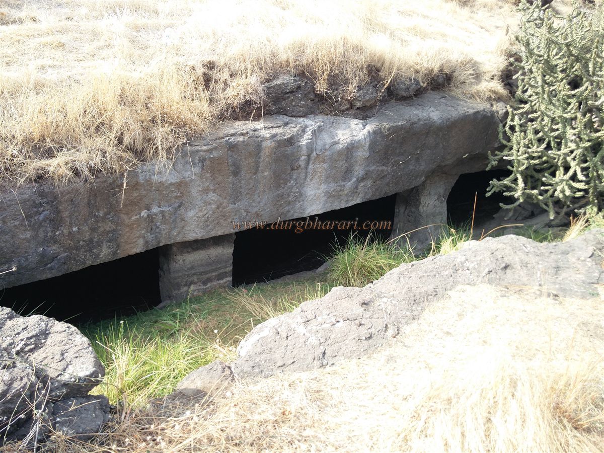
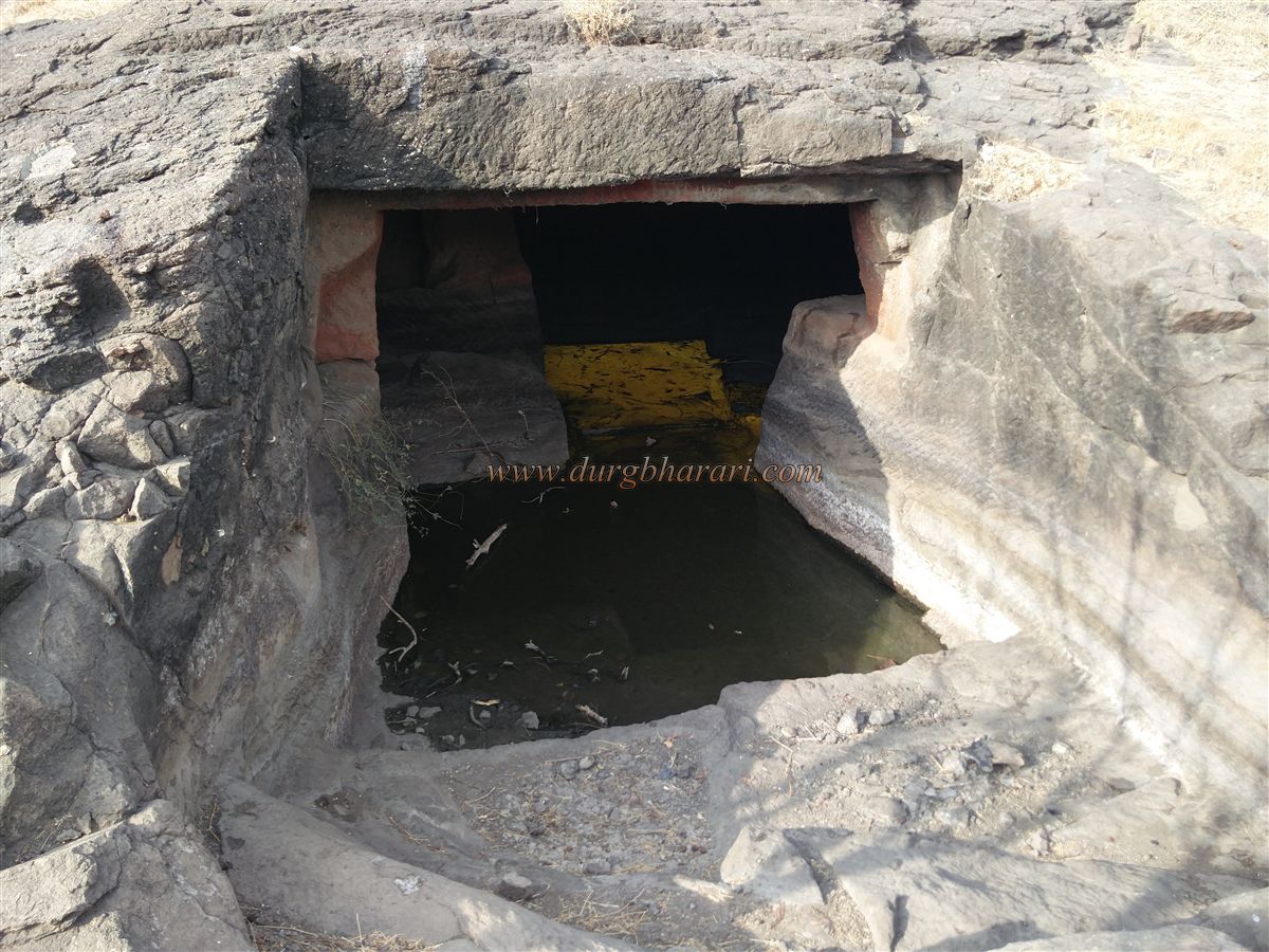
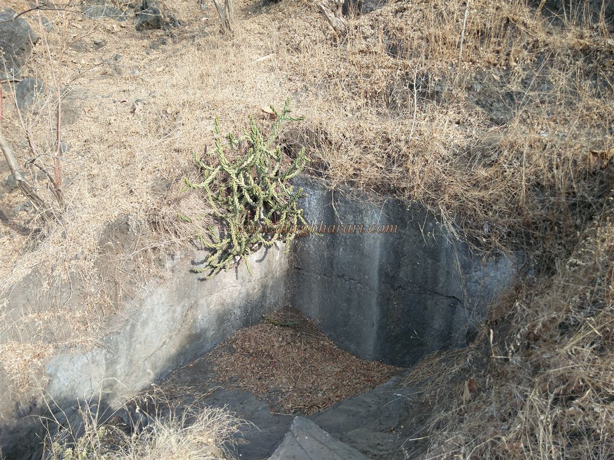
The western-facing entrance is completely destroyed, with only the lower portion remaining. The round-shaped fort, located 1571 feet above sea level, covers an area of about 8 acres. Upon entering, you immediately see a cave with two chambers cut into the rock, holding water. To the right of this cave is another cistern, followed by two more large rock-cut tanks, one above the other. Above these are three more tanks in succession, and further up are two massive ones. Around these tanks, holes have been carved into the ground to place lids, and channels have been dug above to collect rainwater.
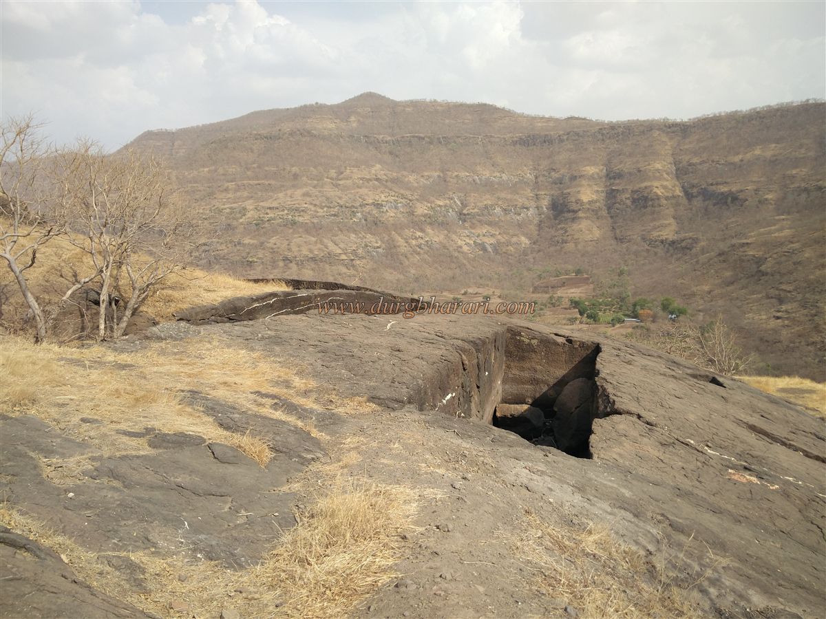
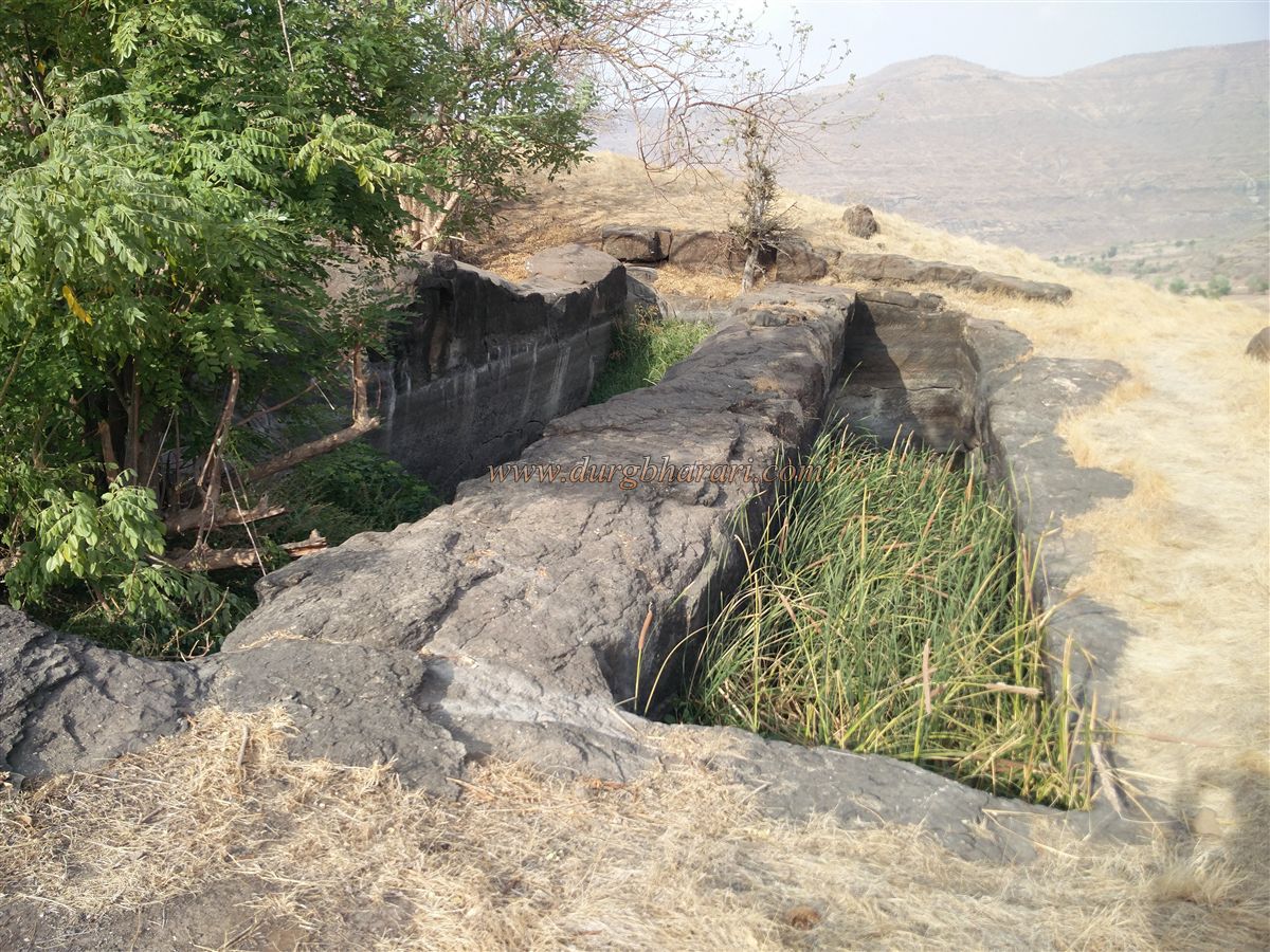
Below these tanks is a square dry tank, and on the way there is a small cave-like cistern with pillars. Nearby, remnants of fort walls can be seen. Apart from the first cave filled with water, ten tanks can be seen in this part of the fort. Continuing from the square tank, circling the top of the hill, one comes across another large cave cistern with pillars beneath a tree on the slope. This tank is gradually filling with soil from the hill above.
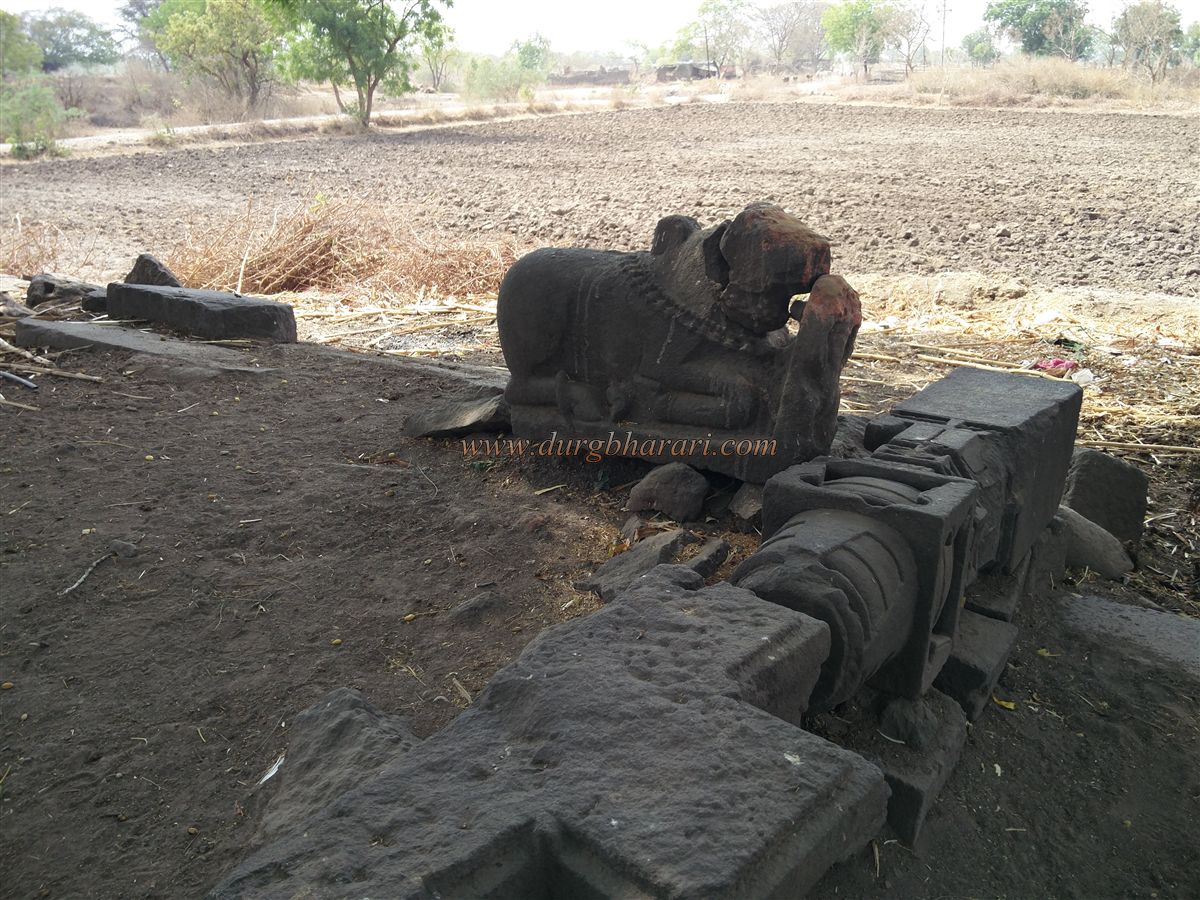
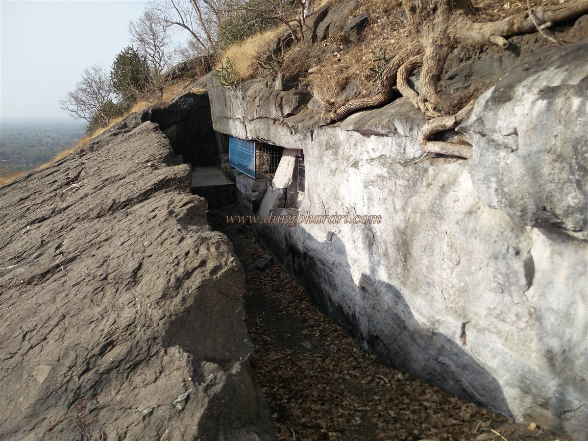
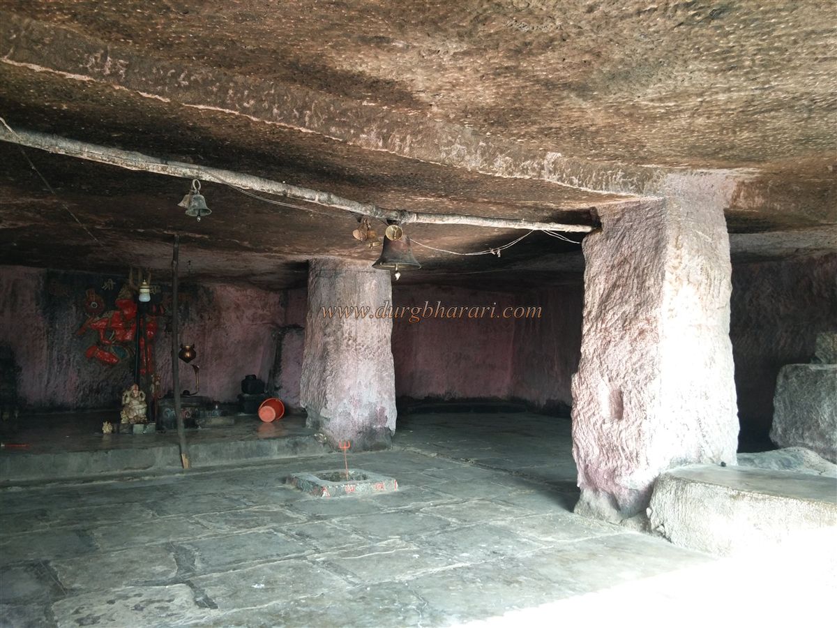
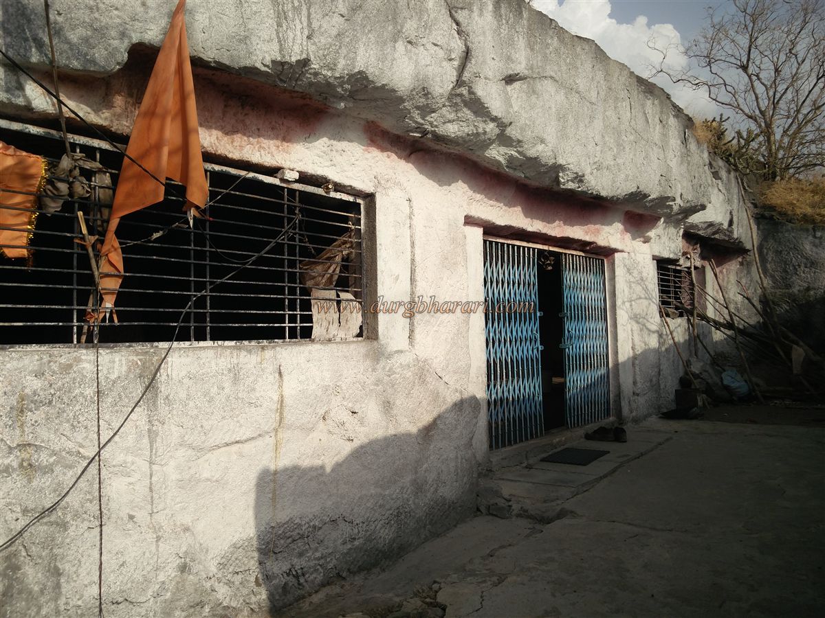
After viewing this tank, take the path to the summit of the hill. There are two platforms of old structures and wall remains. One platform has a grave, and nearby stands a Hanuman idol. On descending toward the entrance, two house foundations can be seen. A worn path to the left from the entrance is protected by an iron railing. Proceeding along this trail, a little ahead on the right is a spacious cave carved into the rock with four pillars. The cave is approximately 40x38 feet and 6 feet in height. It has been carved by hollowing the front rock inward to form the entry path, making it appear like a solid wall from the front with an entryway.
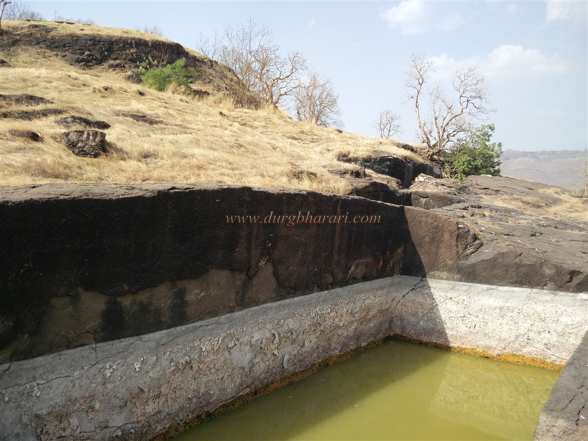
Cement frames and iron grilles installed on the windows and doors give the cave a modern appearance. Inside is a Shiva Lingam, a carved image of Hanuman on the wall, and a built homa-kunda (sacred fire pit). A sadhu currently resides in the cave, which can accommodate 25–30 people. Next to the cave is a large five-pillared baramahi (12-month) cistern, used for drinking water. Above it is another dry tank, and nearby is a five-pillared cave measuring about 100 feet in length.
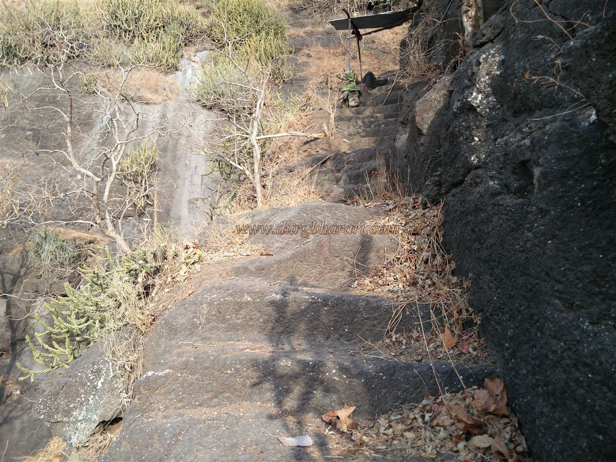
After visiting these caves, return to the main path by the railing and proceed ahead. Soon you'll reach a rock-cut stairway leading toward Nagad village. Though the Nagad Gate of the fort has disappeared over time, the stonework and remnants here suggest that an entrance once existed. A few steps down, on the left side of the path, there’s a worn, sindoor-coated idol carved into the rock. Further down are more rock-cut steps leading toward Nagad village.
This concludes the fort visit. It takes about an hour to explore the entire fort. From Lonja Fort, one can see Antur Fort to the north. Though it's difficult to determine when exactly the fort was built, its geographical location, layout, and the style of fortification suggest it may have been constructed as a watch post before the medieval period.
Devgiri in Aurangabad district was the capital of the Yadav during their reign, a chain of forts was built along the routes to the capital for surveillance. As Antur was an important fort in this area, Lonja may have been constructed as one of the outposts to guard access routes and assist in its protection. According to senior cave scholar Dr. Dawood Dalvi, this is a Hinayana Buddhist cave dating to the 4th or 5th century. Due to the decline of Buddhism and lack of financial support, the cave appears incomplete. This suggests that the history of this fort goes back as far as the 4th century.
After the defeat of the Yadav, Devgiri lost its importance, and so did the forts built for surveillance. Located off the main routes, these forts gradually faded from public memory. Though the hill is commonly known as Mahadev Taka hill, the Aurangabad Gazetteer refers to it as Lonja, hence the fort has been named Lonja Fort.
© Suresh Nimbalkar
GALLERY