KURDUGAD
TYPE : HILL FORT
DISTRICT : RAIGAD
HEIGHT : 1800 FEET
GRADE : MEDIUM
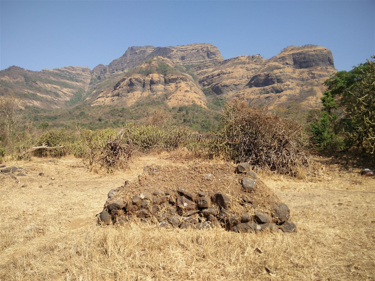
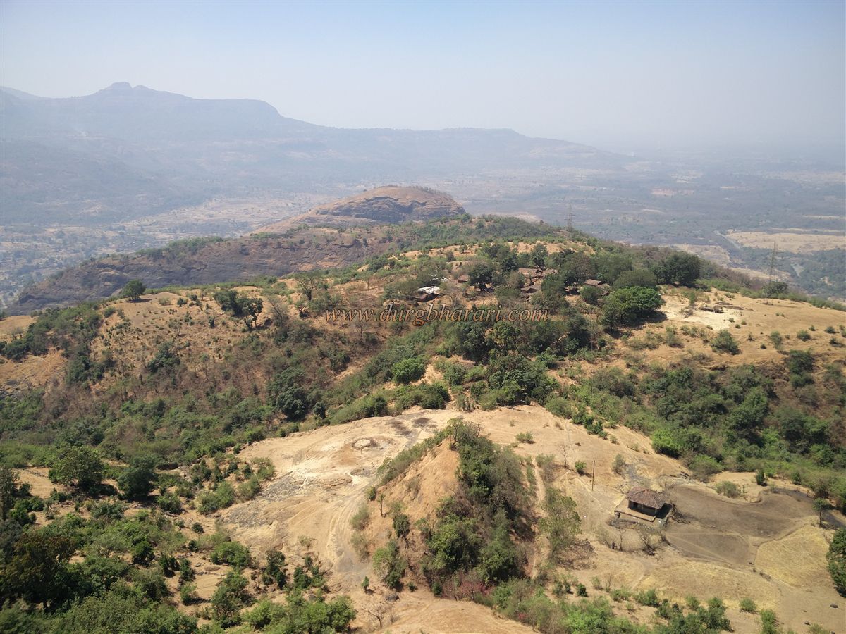
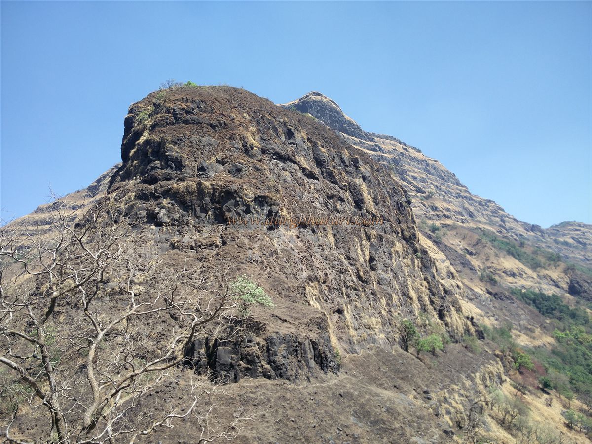
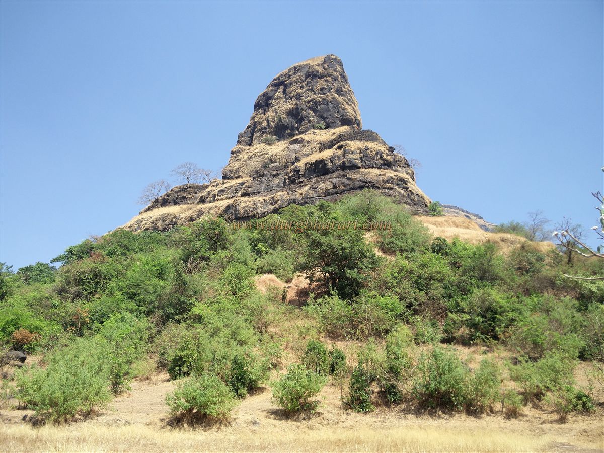
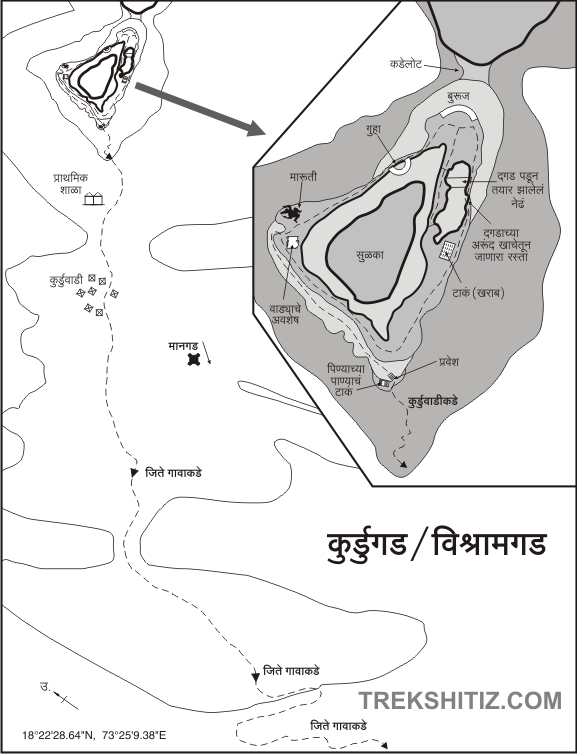
The Sahyadri range extending from the border of Pune and Raigad districts always attracts trekkers towards it. From this part of the Sahyadri, many wharves can be seen descending to the Konkan. Goods landing on the Konkan coast used to pass through various ferries to the markets on the wharves. Trade has been going on along the Kundalika river since ancient times. Goods coming here used to go to the market on the wharf through Tamhini Ghat. The fort Kurdugad (Vishramgad) was built to protect the trade routes of the Tamhini Ghat. Kurdugad aka Vishramgad fort is located on the border of the Raigad and Pune districts at the start of Tamhani Ghat. Kurdugad fort or Vishramgad with a cone-shaped head is not in the main range of the Sahyadri but is situated on a stream that descends from the Sahyadri to the Konkan.
...
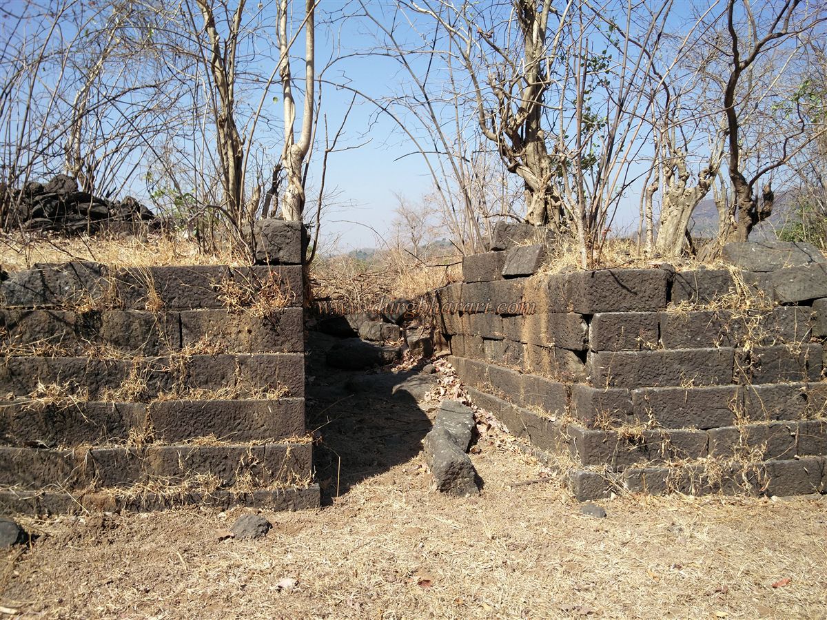
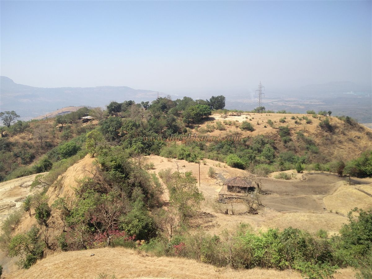
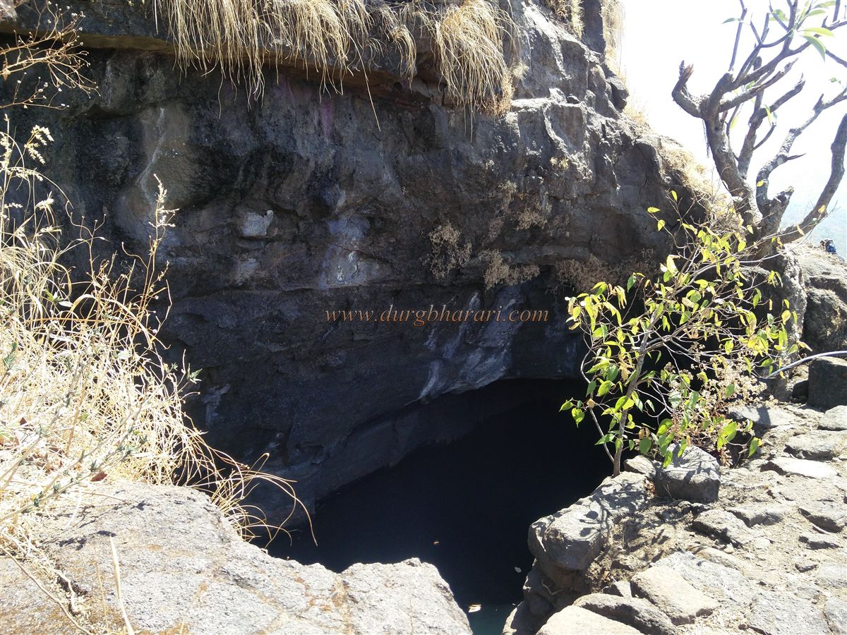
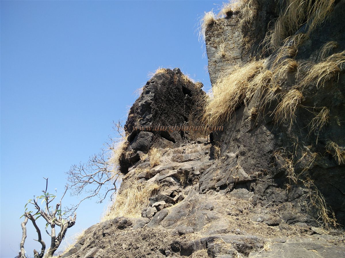
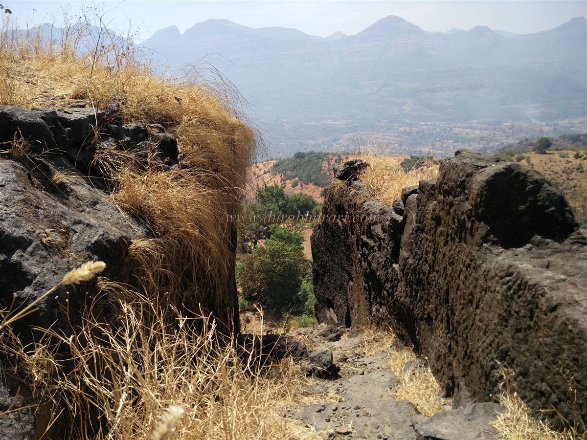
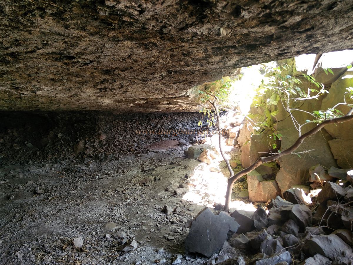
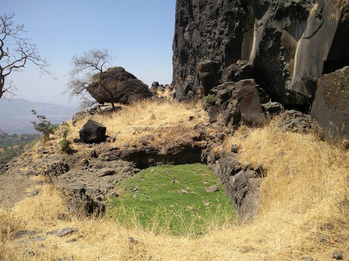
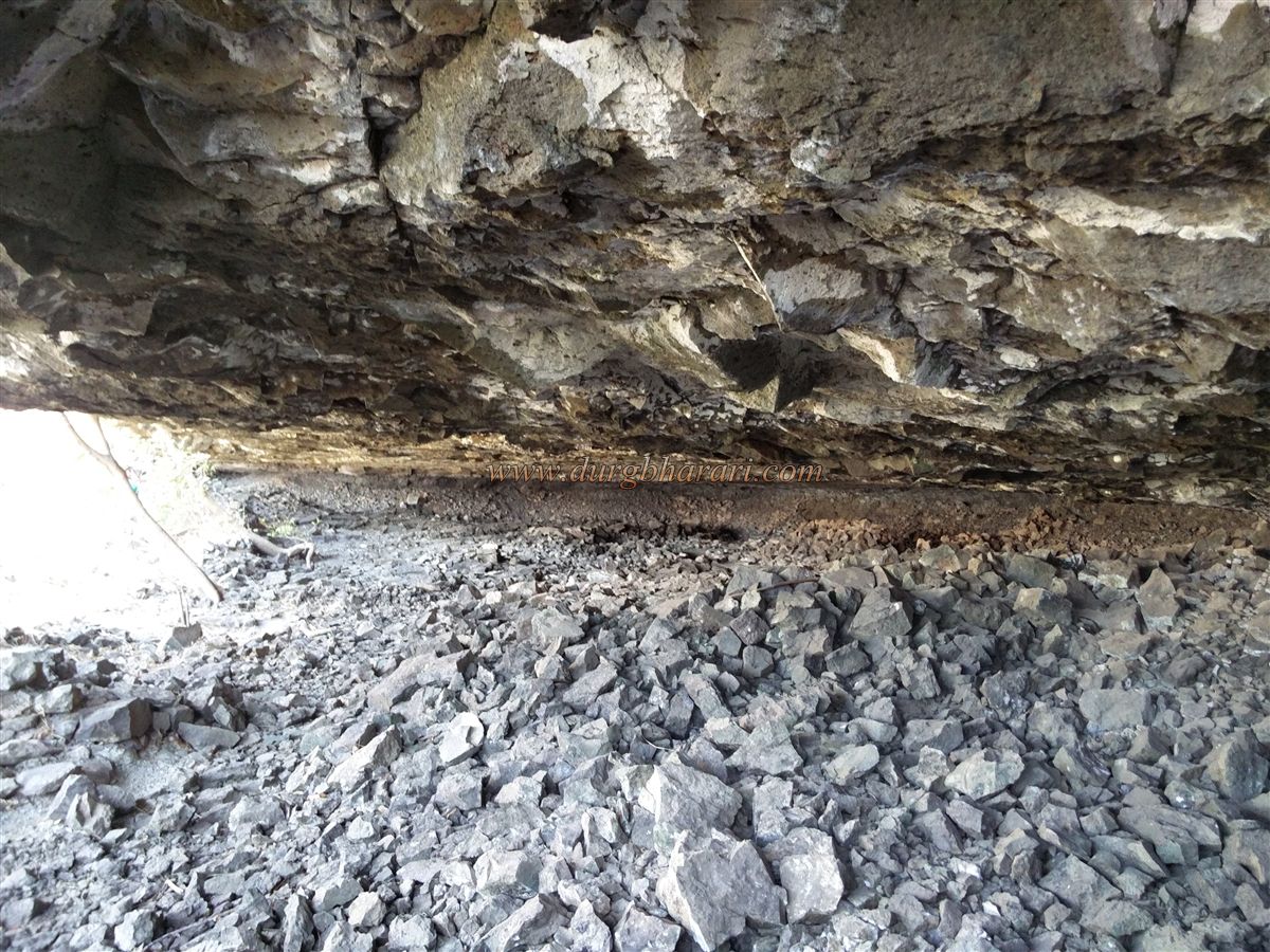
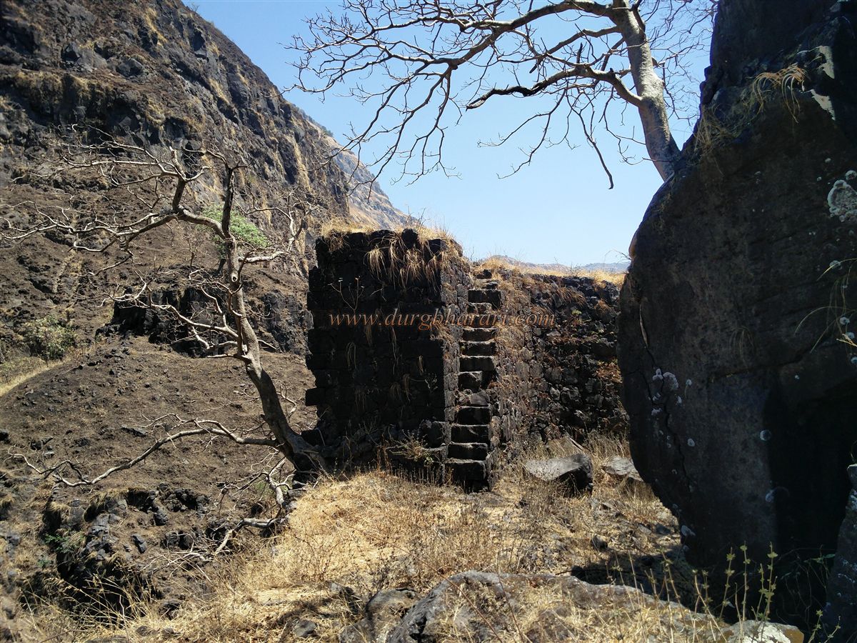
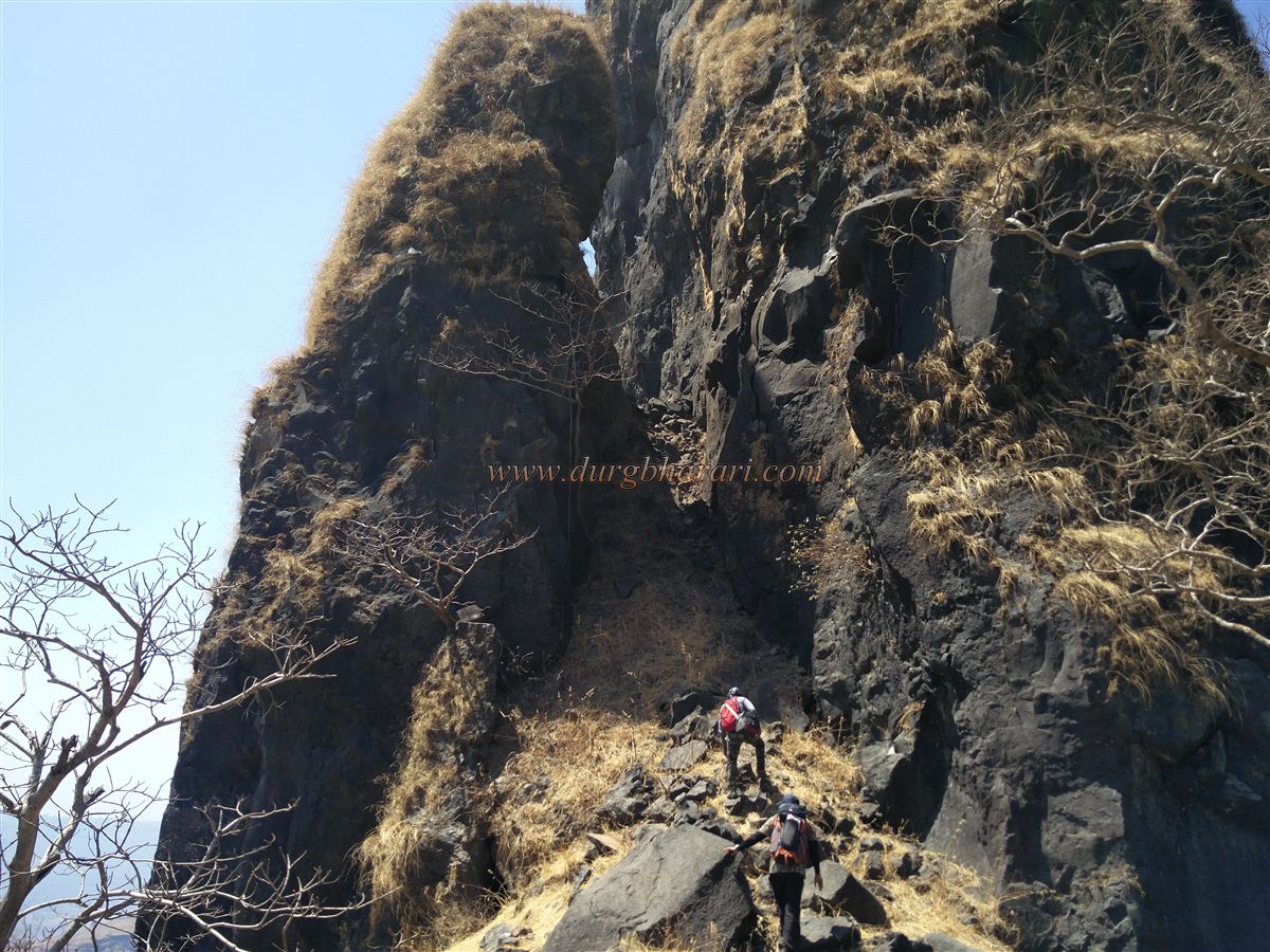
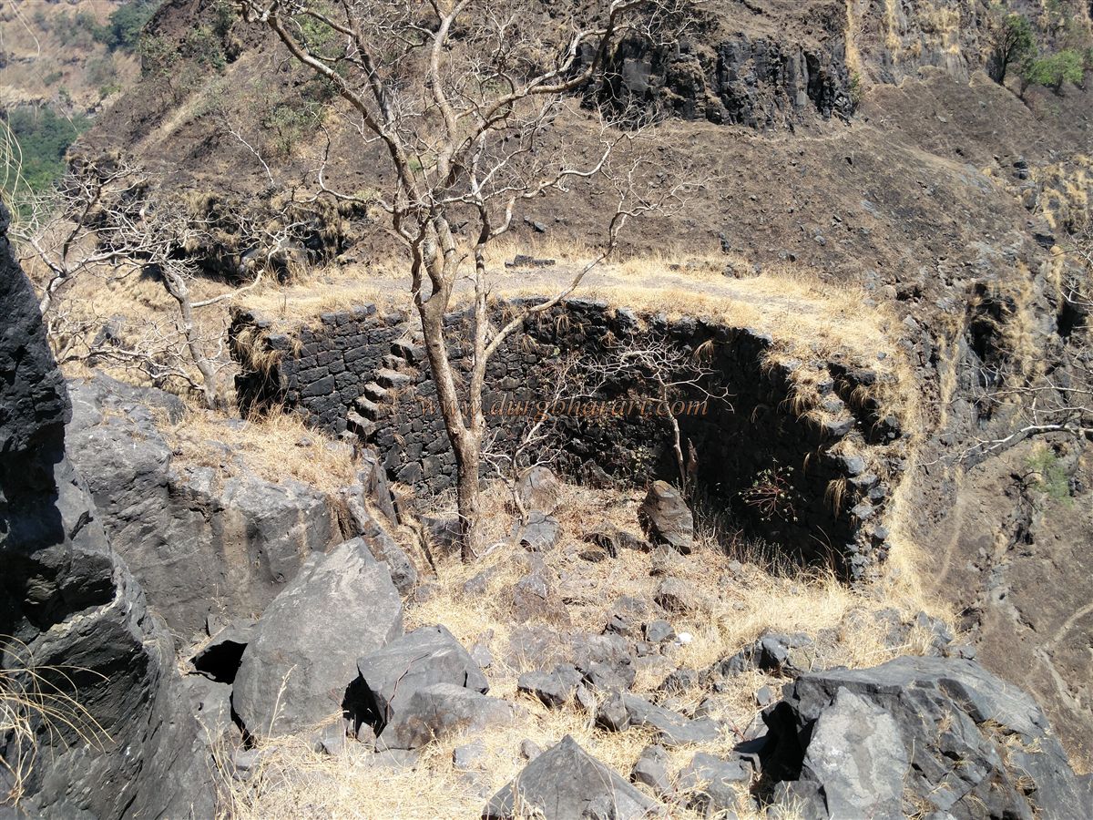
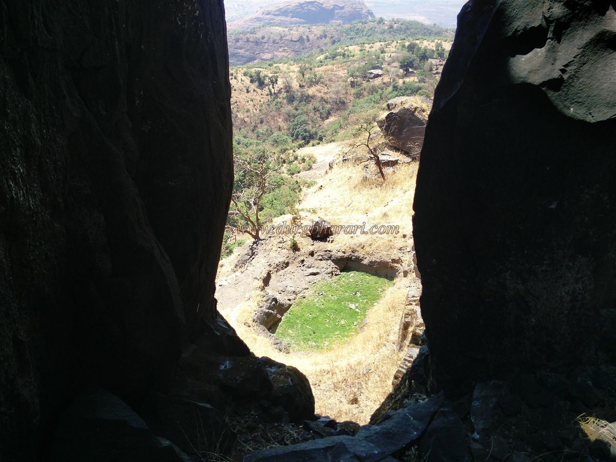
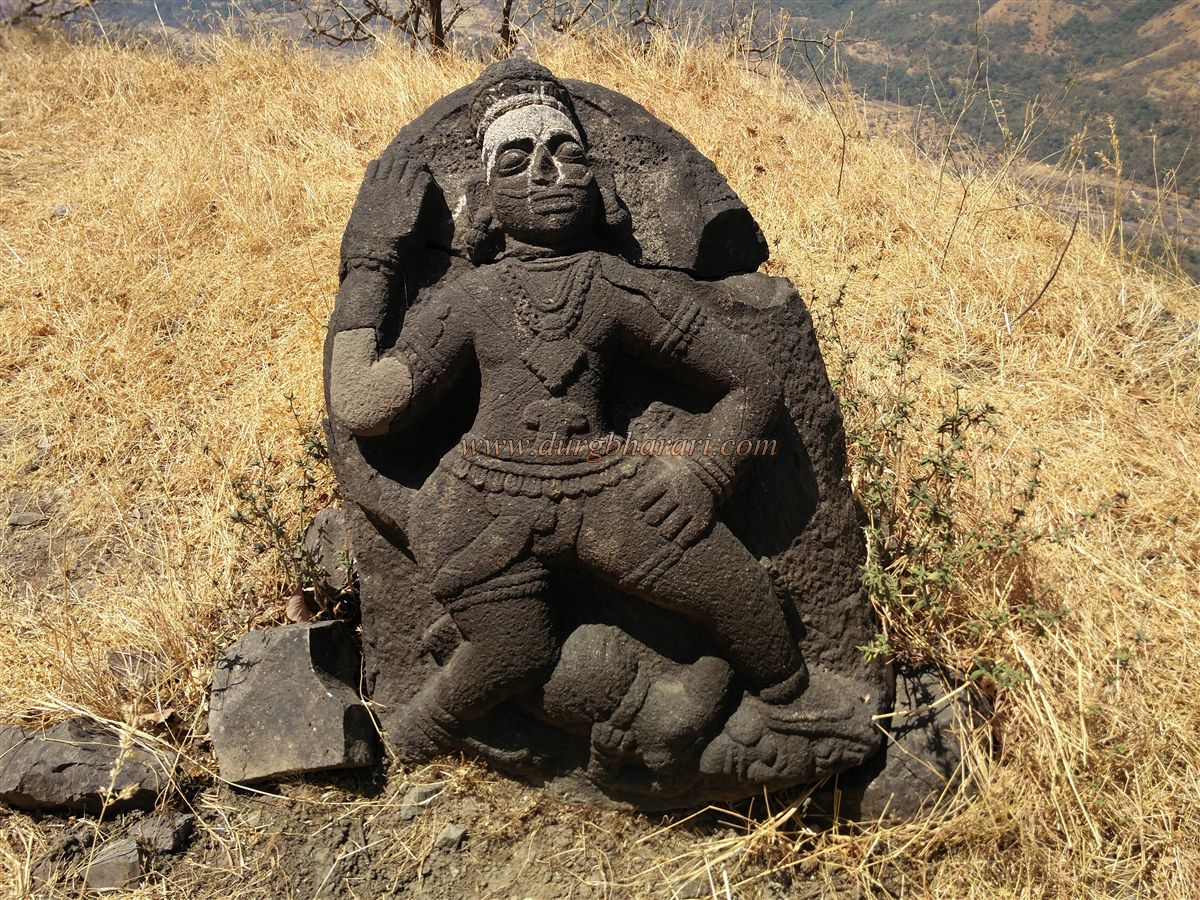
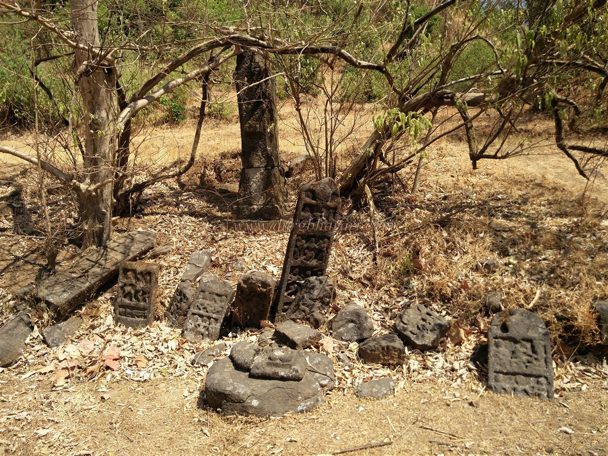
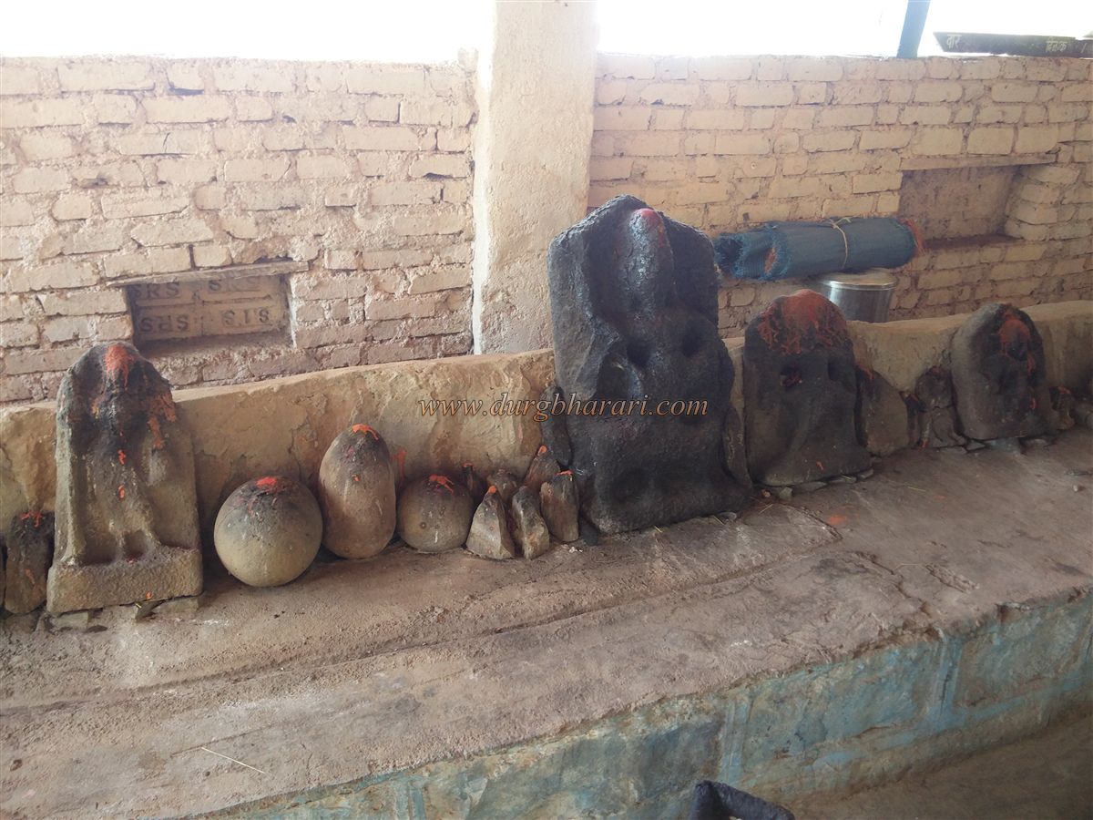
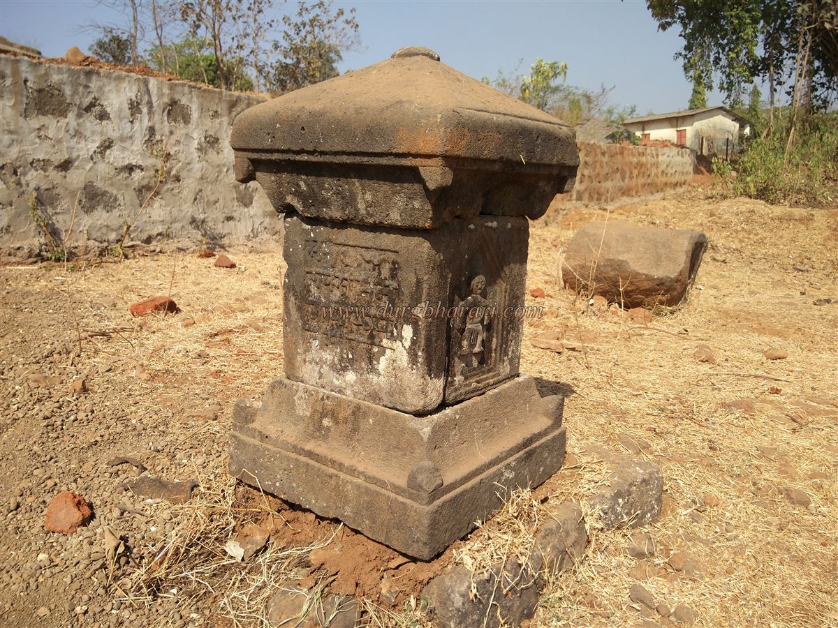
Kurdugad is about 2200 feet above sea level and was built around the 11th century during the Shilahar dynasty. Kurdugad, which was not much known, belonged to the family of Pasalkar of Mose Valley during the contemporary period of Shivaji Maharaj. As Baji Pasalkar used Kurdugad for rest, this fort is also called Vishramgad. Umbardi is a village at the foot of the fort at a distance of 126 km from Pune via Mulshi-Vile-Jite-Umbardi and 146 km from Mumbai via Panvel-Pali-Kolad-Bagad MIDC-Tasgaon-Kandalgaon-Bamanwadi. There is currently a road leading from Umbardi to the fort. Just outside the village, there is an ancient and somewhat ruined black stone Shiv temple. The plateau begins as you walk past the temple. There is a small pond on this plateau and a very large settlement remains can be found. Mention of these remains is nowhere to be found. The remains include a long stone wall, an arch of a mansion’s door, a carved stone foundation of a house and a temple, and much more. The rocky climb of the fort begins in fifteen to twenty minutes. The footpath of the fort is well paved. As there is a small settlement called Kurdupeth on the fort, the footpath is in daily use. The electricity poles are placed from the foothills to Kurdupeth. If we follow them, we will reach Kurdupeth in about an hour and a half. The path is very tiring. The lofty cone of Vishramgad stands behind the village and its bastion is visible from the village. From Kurdupeth to the fort, just five minutes to the left is the recently restored temple of Goddess Kurdai with a tiled roof. Vishramgad must have got the name Kurdugad after Kurdai Goddess. There is an idol of Goddess in the temple and outside the temple, there is a hero stone, Deepmal, and a sculpture of Goddess Gajantalakshmi. Fifteen minutes from the temple we come to the gate of the fort. Before the entrance of the fort, there is a perennial water cistern on the left side, and water is supplied to the village of Kurdupeth from here. You enter the fort through the ruined entrance by climbing the steps carved in the rock. From here, the path turns and leads to the Hanuman Buruj on the north side. When you come here, you first see the quadrangle structure of a ruined building. In front of him, there is a carved 4 feet high worn out idol of Maruti with a dagger on his waist and crushing the monster under his feet. On the south side corner of the pinnacle, a small square-shaped cave can be seen at a height of 90 feet above the fort, but the path leading to it has collapsed. It is not possible to go there without mountaineering equipment. The specialty of Kurdugad is the natural cave in the belly of its pinnacle. The roof slowly collapsed, creating a cave. This cave of large expansion is not usable as it is not on the ground level. This cave filled with stones can easily accommodate two hundred people. A drinking water cistern and some constructions are found in the vicinity of this cave. At the back of the fort, there is a bastion with a deep ravine beneath it. This bastion reminds us of the bastion at the top of the Ghangad fort. The fort itself has two pinnacles, the largest of which is the head of the fort. There is no particular path to reach this pinnacle. You can go around the entire pinnacle but in some places, the path has collapsed. Another small pinnacle is attached to this main pinnacle at the head of the fort. Between these two pinnacles is a slippery slope and after crossing it we reach a natural gorge. This is a difficult and slippery road and you have to be careful as there are beehives here. From here, the long-distance of Konkan is visible. At the foot of the pinnacle, you can see the ruins of the fort as well as the ramparts. Seeing the pinnacle and moving forward from here, you can see a huge rock collapsed in the path. It is dangerous to move on from here. You have to crawl across a path between the small narrow gorge and the huge rock. It is better to go back to the idol of Hanuman rather than crawling through this path. From here, take a detour to the pinnacle and come forward. In this area, you can see a bastion and many ruins of construction. A little further from here, you can see one water cistern. There is also a big natural cave on this side and this cave can easily accommodate 50 people. Seeing this, when you come back to the entrance, your fort round is complete. The perimeter of the fort is small. The fort has got natural protection as it has vertical cliffs on three sides. The fort has a total of four bastions, three of which are carved out of the rock. The entire region can be seen from the fort. It takes an hour to walk around the entire fort. This fort was used to reside army during the Maratha period. There is an important legend about this fort in history. There is a gorge in the southern part of Kurdugad. Currently, the way to this gorge is broken. An ascetic monk was living here. He had a Shivling arrow. Realizing that a person who had been worshiping him for twelve years would get the kingdom, Baji Pasalkar got the arrow and present it to Shivaji Maharaj. After the death of Shivaji Raje, this arrow was brought to Sinhagad with Rajaram Maharaj and after his death, it was in the Samadhi temple of Rajaram Maharaj at Sinhagad for 250 years. A Shivling is known in history as Chandrasekhar Ban. Now this Shivling is kept for worship in the temple of Satara. After Shivaji Maharaj's expedition in 1670 to capture the forts which had to be given to the Mughals according to the Purandar treaty, after conquering Mahuligad in June, Karnala, Kohoj, and Kurdugad were annexed into the Maratha Empire. Veer Baji Pasalkar, Yesaji Kank, Baji's servant Yelya Mang, Ananta Khursule, Janjiya Siddi, Thorale Bajirao Khandoji Mankar, Amrita Pasalkar, Nana Fadnis, Ramaji Karkhanis are associated with this fort for some reason. In the Maratha War of 1818, Captain Sopit of the 9th Regiment of Pune, along with a detachment, came from Dev Khind and suddenly attacked and captured the fort. At that time there was a fort keeper and 40 soldiers on the fort. Captain Sopit found a large stock of grains on the fort.
© Suresh Nimbalkar
GALLERY