KULANG
TYPE : HILL FORT
DISTRICT : NASHIK
HEIGHT : 4165 FEET
GRADE : HARD
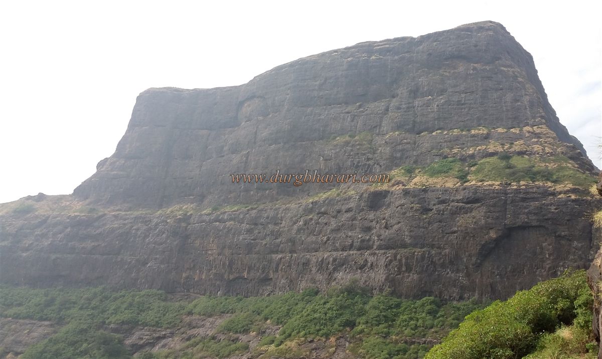
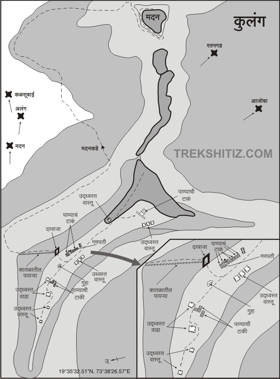
Kulanggad, one of the tallest forts in the Sahyadri with a height of 4822 feet, is one of the most difficult forts in the Sahyadri between Alang, Madan, and Kulang. Of these, one can walk to Kulanggad, but to reach Alang, Madan fort, one must be aware of the technique of rock climbing and have the equipment required for it. Kulang is located 10-12 km west of Kalsubai peak and 10-12 km south of Igatpuri. The Mumbai-Agra National Highway passes through Kasara Ghat. On this highway, south of Igatpuri is the range of Kalsubai of Sahyadri. The highest peak of Kalsubai is on this east-west range. This range starts from Kulang fort. The forts in this range are inaccessible and their climb is breathtaking. At the northern foot of Kulanggad is a village called Kurangwadi. The base of Kulanggad can be reached from here as well as from Ambewadi.
...
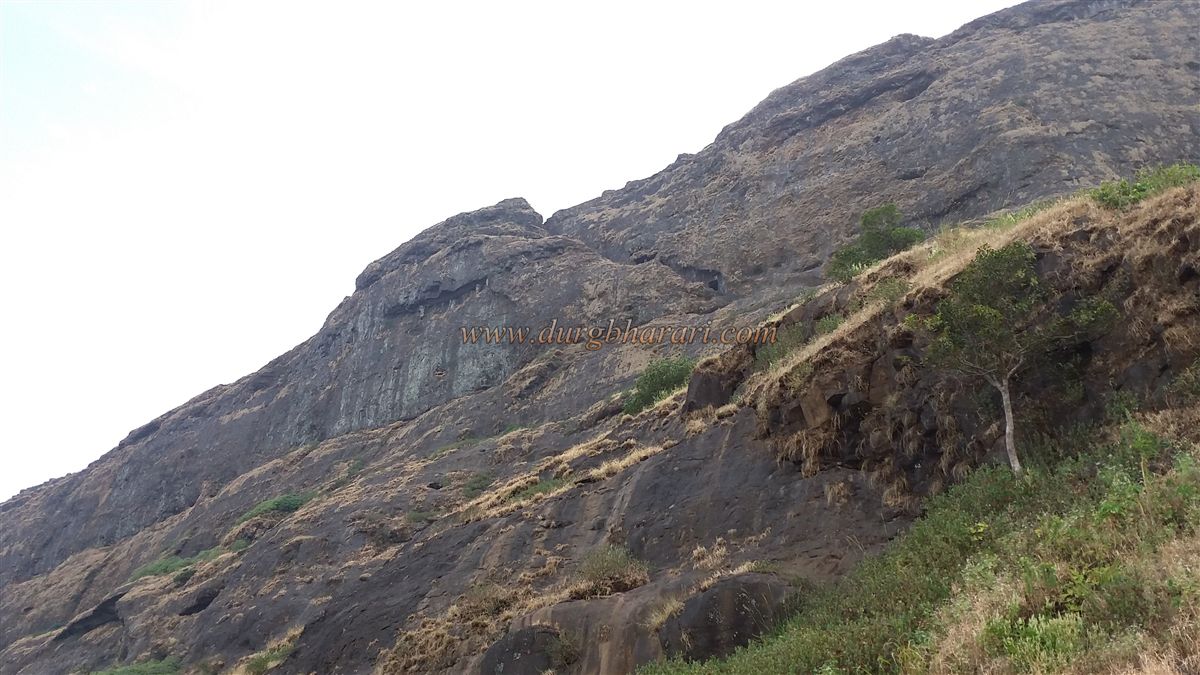
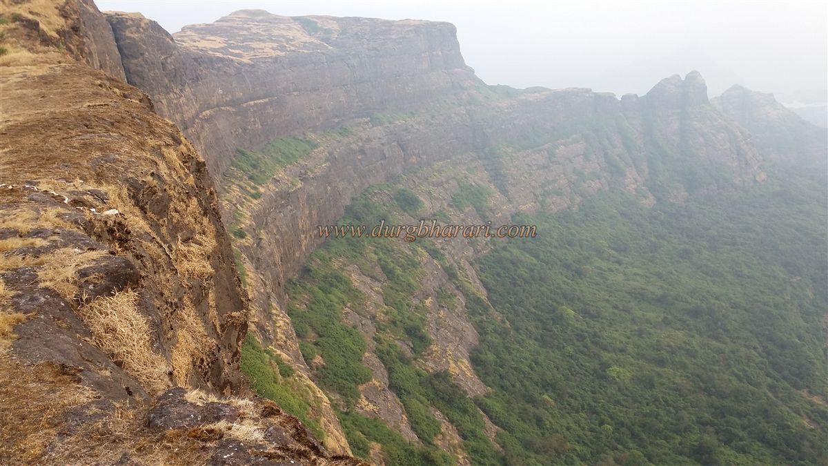
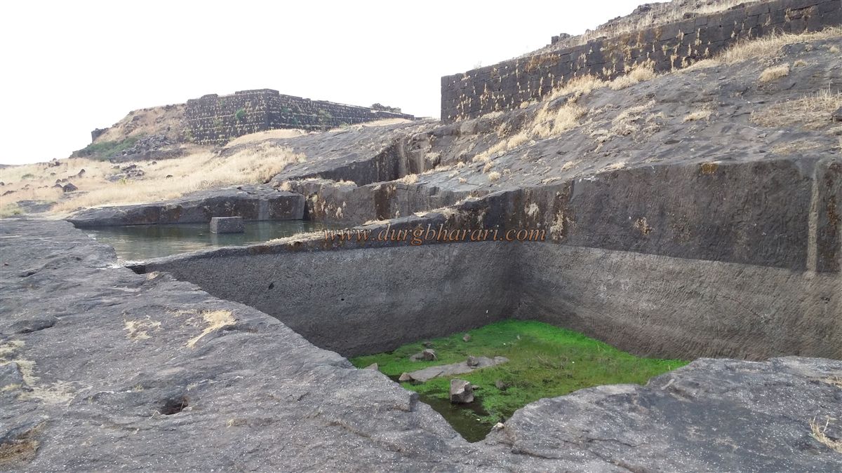
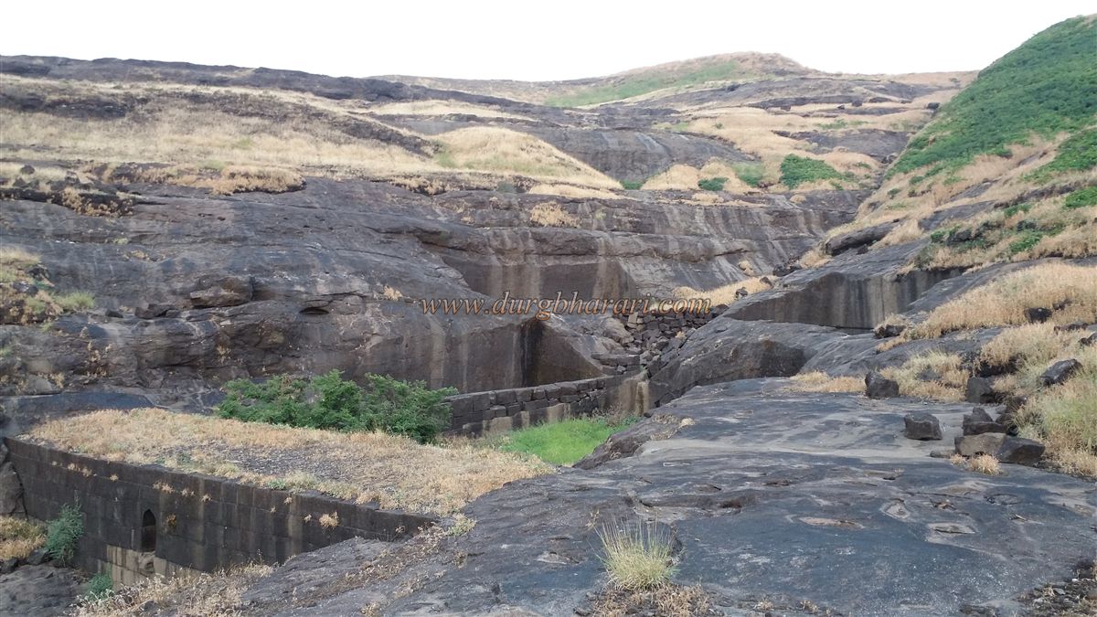
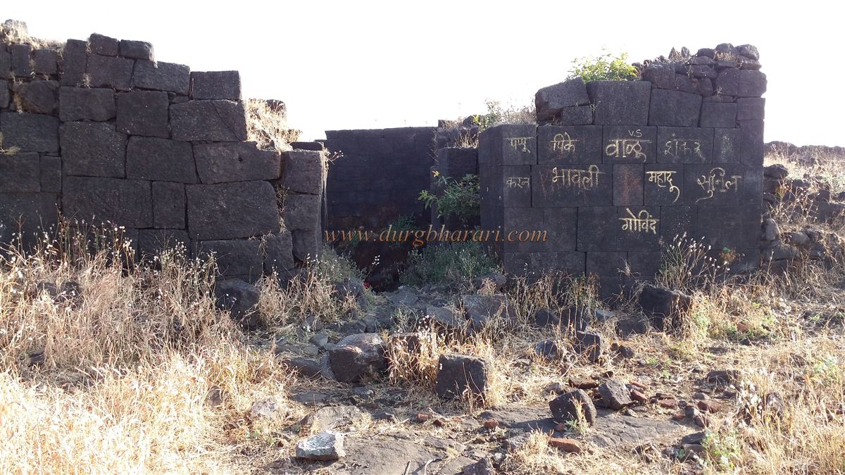
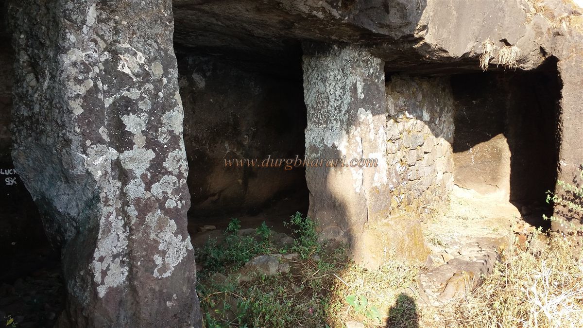
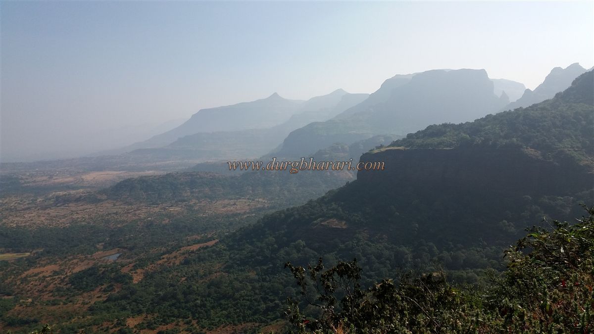
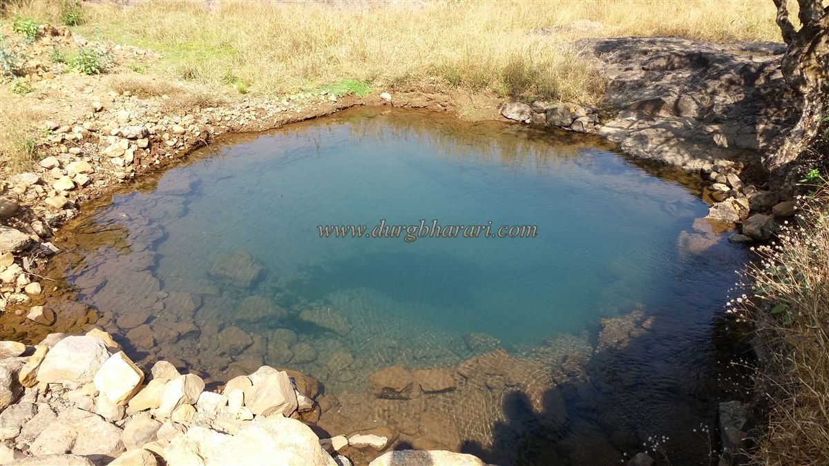
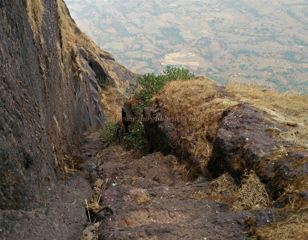
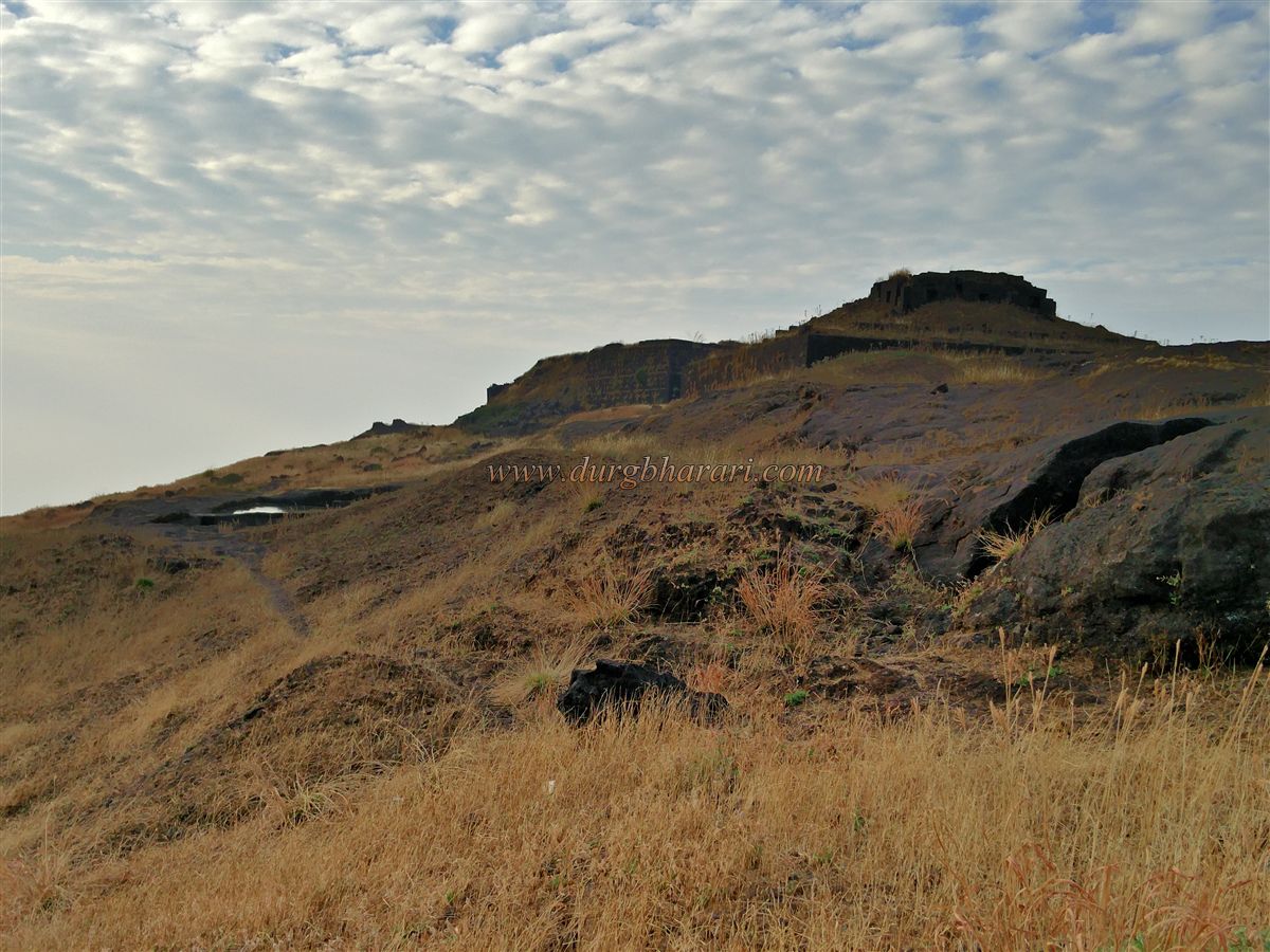
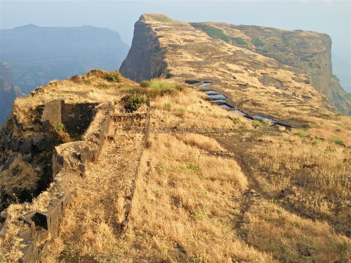
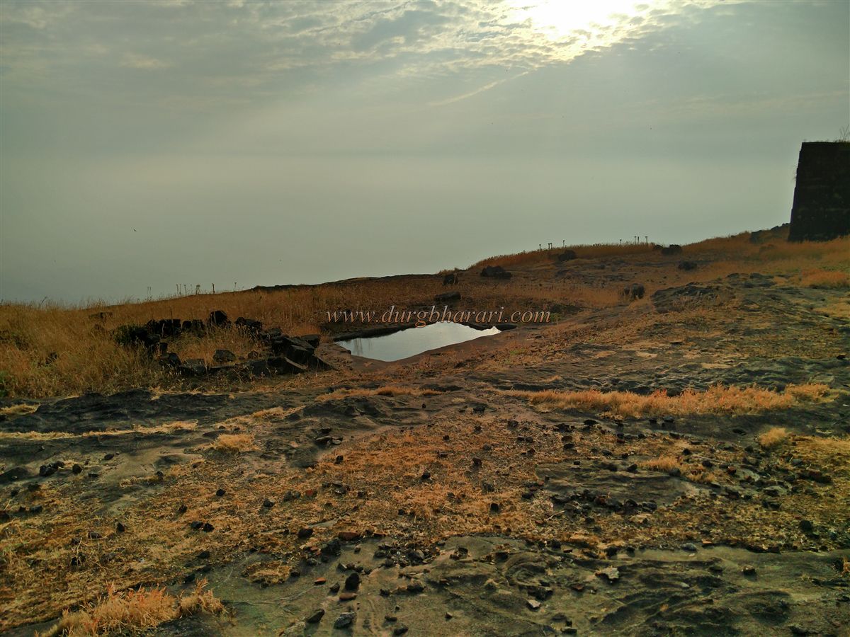
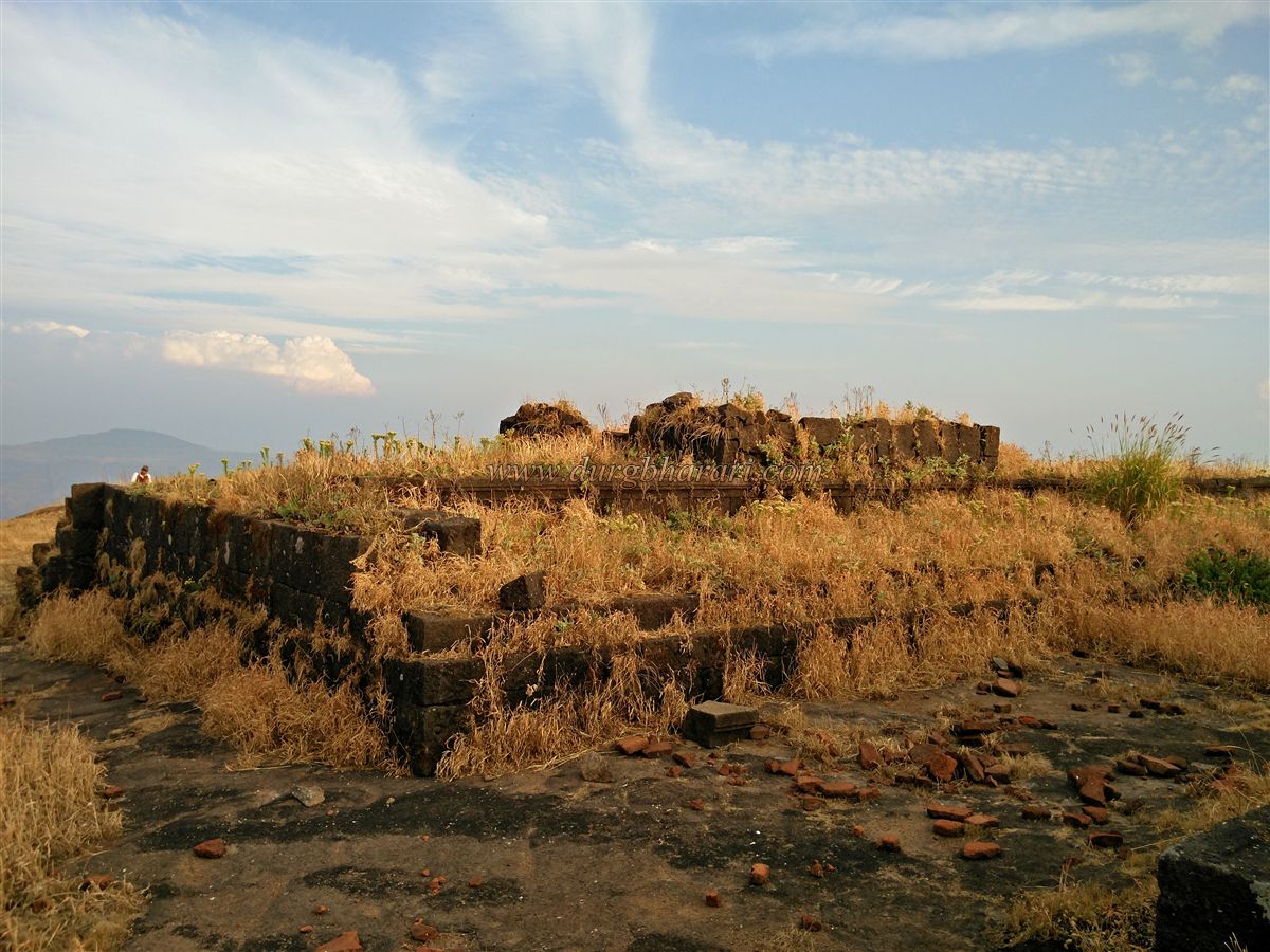
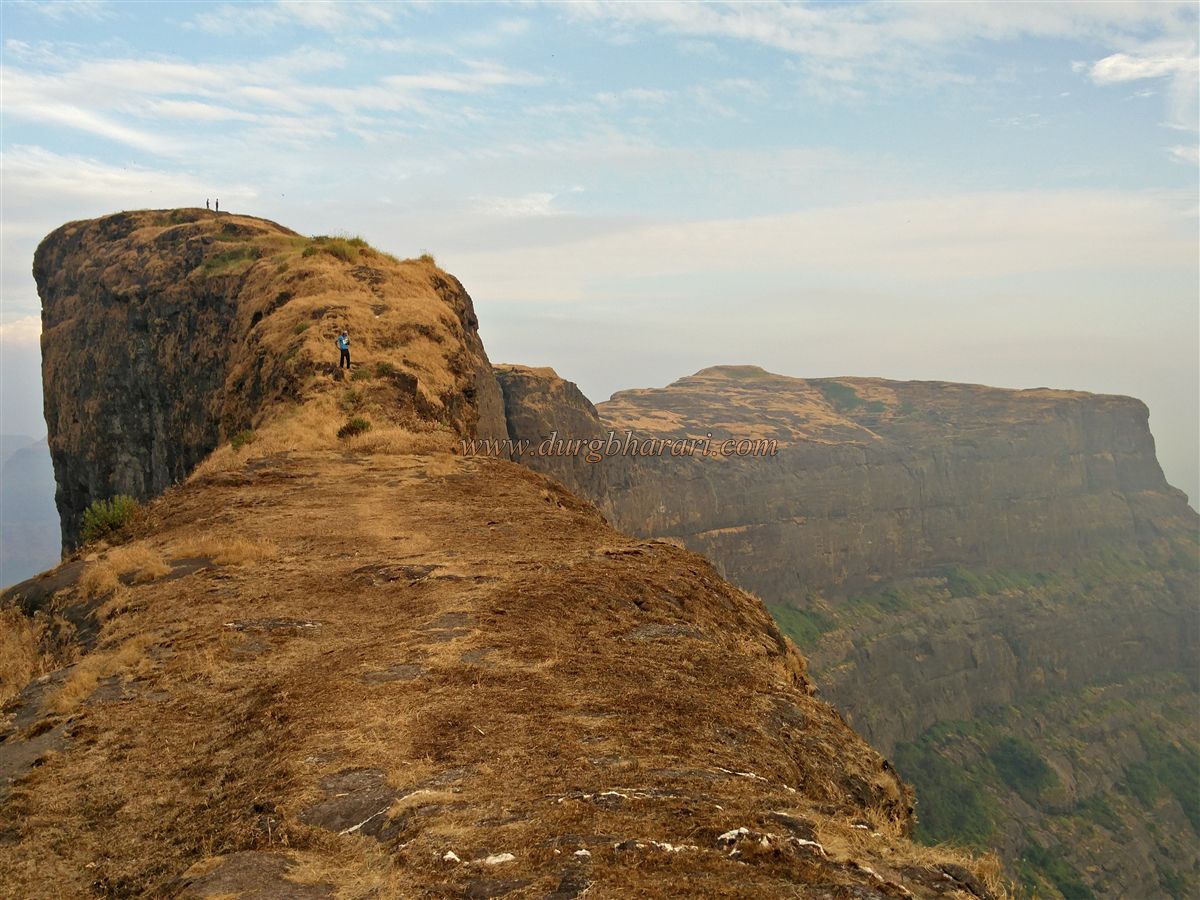
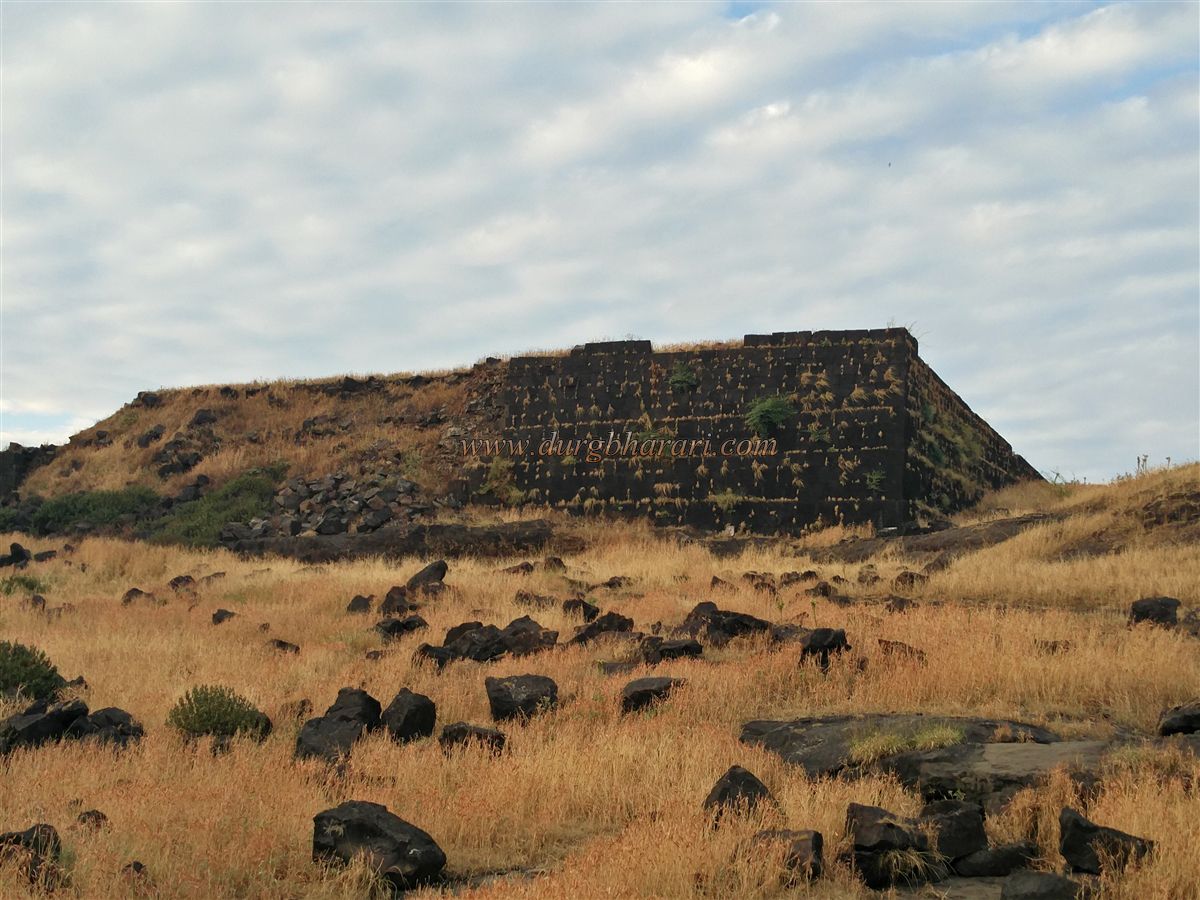
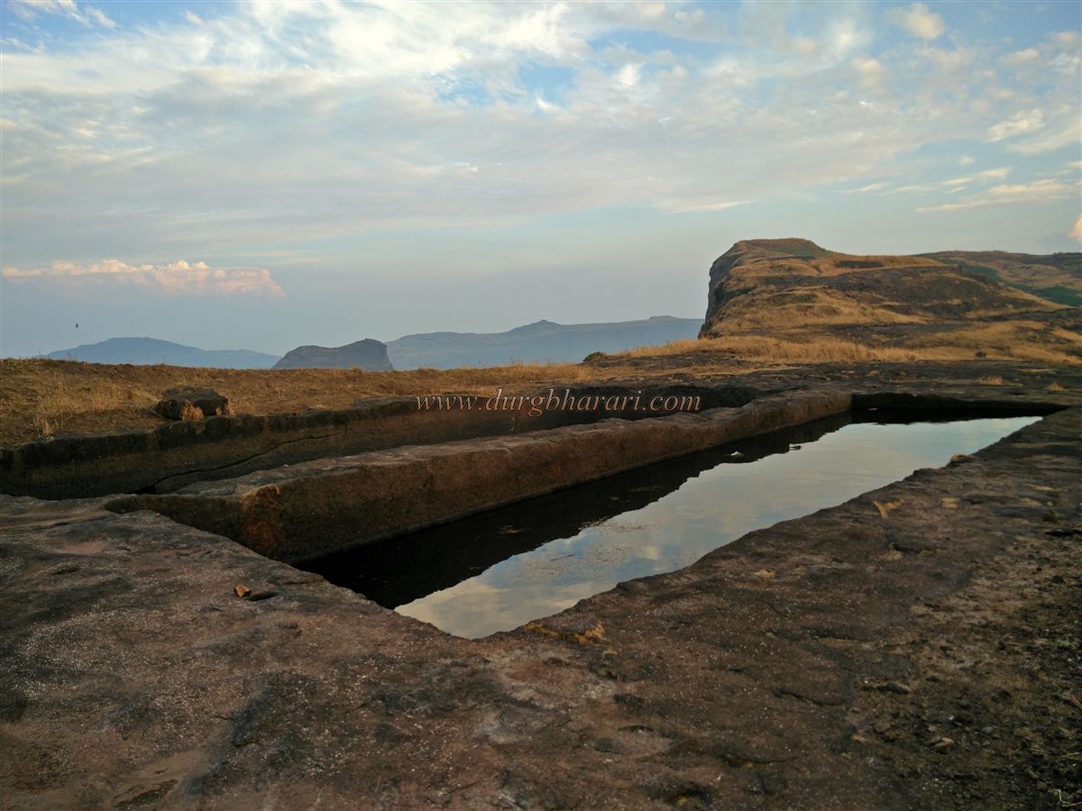
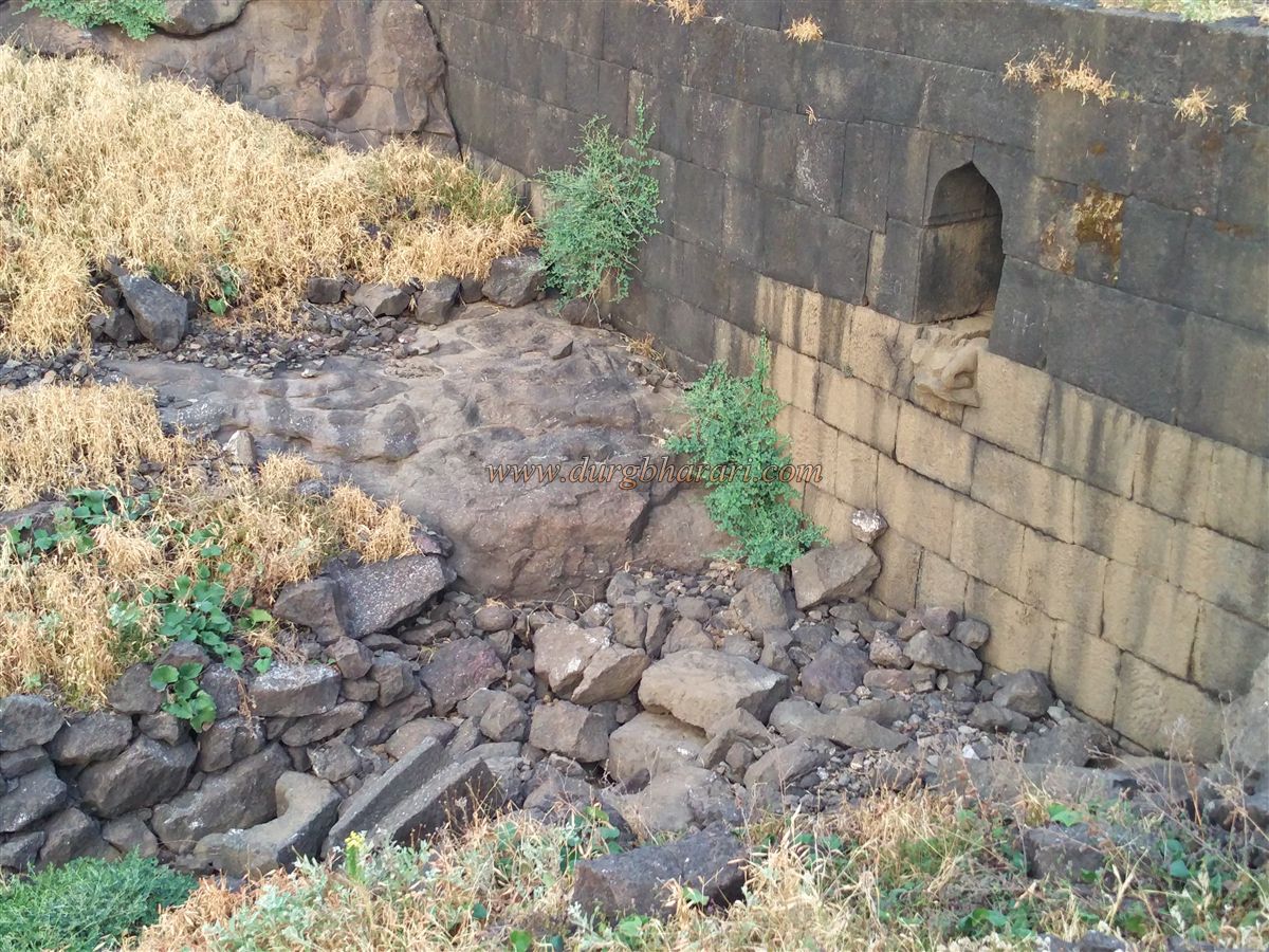
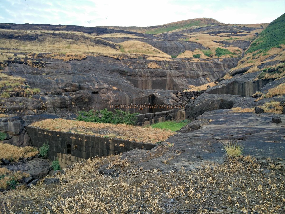
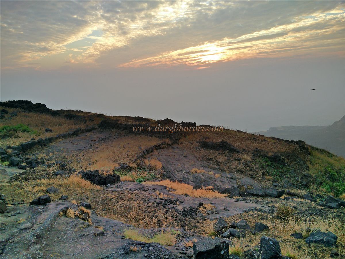
. It is the largest fort in the Alang, Kulang, and Madan ranges. It has two parts - Kulang and Chota Kulang. Chhota Kulang is a small part of the west. To the east of the fort are the forts of Madan and Alang. The upper plateau can be reached by footpath from the lower forest through Kulangwadi village at the foot of the fort. To reach Kulanggad, one has to reach the lower plateau first. To reach the plateau, one has to walk for two-hours from Kulangwadi. When you come to the plateau, Madangad and its adjacent pinnacles and the Kulang fort are breathtaking. Madangad can be seen on the left while keeping the hill of Kulang in front. Kulang Fort is climbed from the hill which descends on the right side of Kulang. After climbing this breathtaking path, we come to the edge of Kulang. Here, there are some steeply carved steps. The British cannons of 1818 had broken these steps at some places, so this path is dangerous and care is to be taken. Its steep 80 degree angled steps are shocking. We enter the fort by climbing these steps. The second gate of Kulang and the adjoining ramparts are still in good condition. Upon reaching the fort through the gate, a path turns right. A little further along this path are three caves carved into the rock. The middle cave is large and has two rooms inside. These caves are perfect for a stay. A little further along the footpath near the cave, you can see 2-3 large cisterns of water carved in the rock. Although there is water in this cistern, it is not drinkable. On the upper side of these cisterns, you can see the quadrangle structure of 2 big mansions. The straight path from here takes you to the western end of Kulang fort. The western end of the fort is surrounded by a bastion. The hill in front of here is Chhota Kulang and in the distance, you can see the road coming from Ghatghar village and the reservoir of Wilson Dam. From here, we would walk back to the group caves and start our next fort round in the direction of the cistern on the slope in front. In five minutes we reach a group of ten cisterns on Kulang. The water in this cistern is clean and drinkable. Shivling is carved on the edge of one of these cisterns. After seeing the cistern and going straight, in 15 minutes we reach a gorge near the fort. The reservoir has a dam to block the flow of water from the upper side and cisterns are also built near it. So that the water would first collect in the cistern and when the cistern was full, a drain would be built to take out the water from it. At present, this stone drain has broken down. When you come to the eastern end of the fort after seeing the dam, you can see the remains of many houses here. The fort should be inhabited by a large number of people as well as some important people must also be living on the fort. An amazing view of the Kalsubai Range can be seen from this place. Madangad, which is at a very close distance, keeps us hooked. To its right marks the huge expanse of Alanggad. In the distance, the peak of Kalsubai can be seen. Pabargad, Ratangad, Katrabai, Bhairavgad, Harishchandra, Siddhagad as well as Balwantgad, Trngalwadi as well as Kavnai Aad, and Patta can be seen in clear weather were also seen. Due to the strategic location of Kulanggad, it was important to observe the Chendya-Mendha Ghat as well as the Kasaraghat route. There is no information available about the history of this fort, so we do not know who built it, etc. This fort was never owned by Shivaji Maharaj and was conquered by the Marathas in the year 1760. It was later conquered by Colonel McDowell's forces in 1818, and the fort's steps were blown up to make the fort permanently useless. One day planning is required to see Kulangad which always attracts trekkers. It is necessary to take a guide for this trek because the footpaths here confuse the newcomers. The route through the belly of Alang-Kulang passes through the dense forest of Karvi so there is a strong possibility of getting lost.
© Suresh Nimbalkar
GALLERY