KORLAI
TYPE : COASTAL FORT
DISTRICT : RAIGAD
HEIGHT : 295 FEET
GRADE : EASY
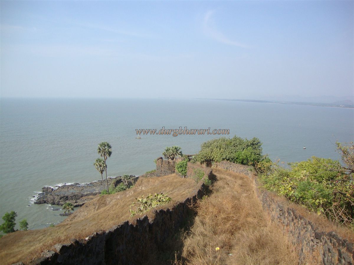
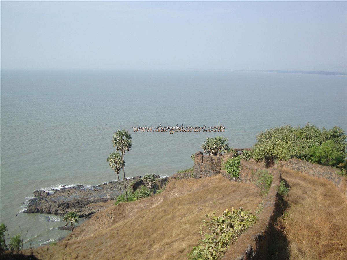
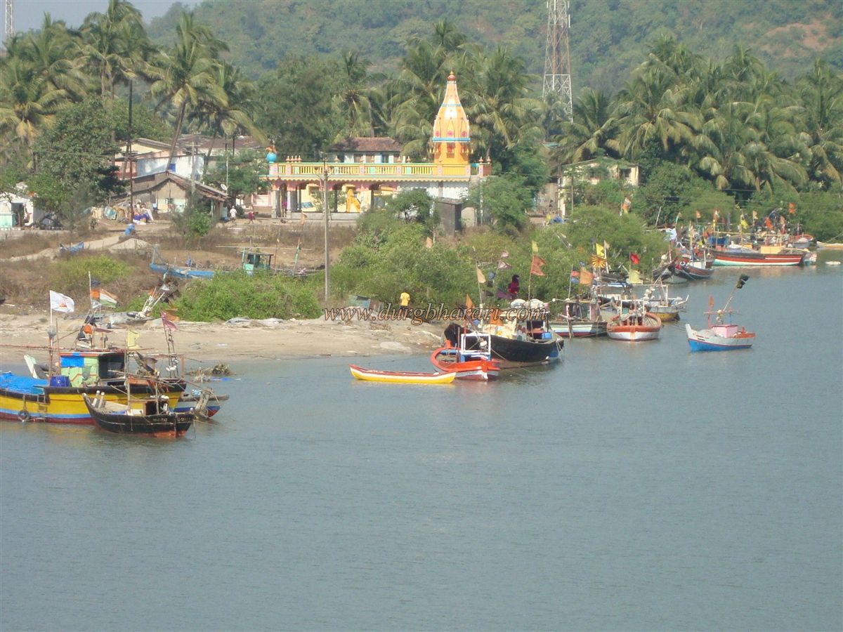
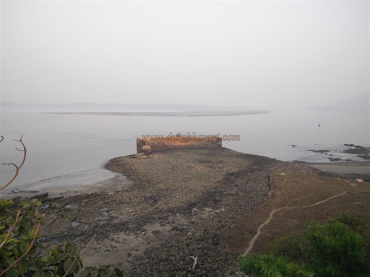
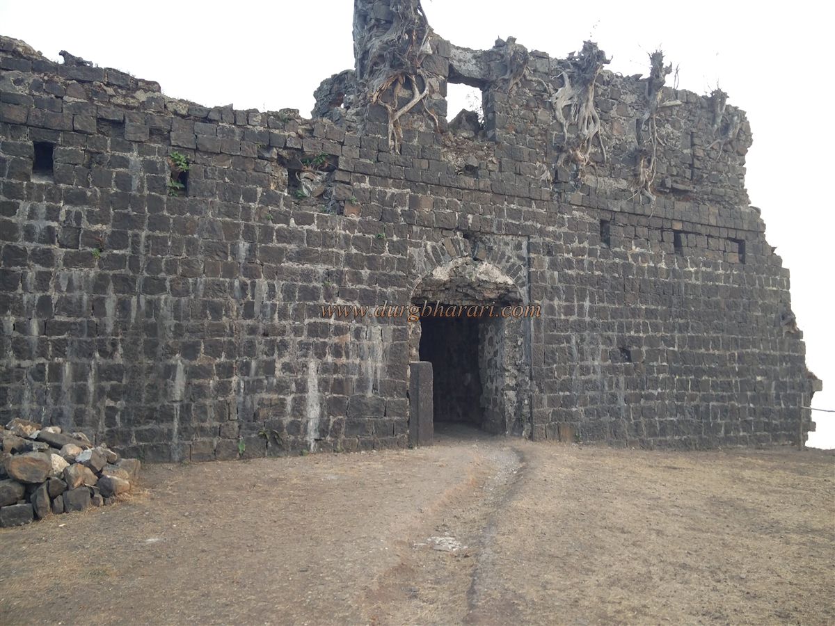
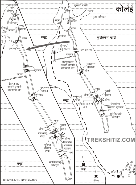
Korlai Fort is located 24 km south of Alibag. From Revdanda, after crossing the bridge over the Kundalika estuary, you reach the fishing village at the base of Korlai. The fort is built between Kulaba and Murud at the mouth of the Kundalika River. It stands on a small hill surrounded on three sides by the sea, and its design is unique. The entire fort is divided into eight sections and has 11 gates. To the south, a narrow strip of land connects it to the mainland. From this headland, a vehicle track leads from Korlai village to the fort.
Pandit Mahadev Shastri Joshi, in his book Maharashtrache Dharatitrathe, writes: “Where the Kundalika embraced the Sindhu Sagar, at this confluence of love stands this sacred guardian!” The fort lies on a narrow hill, about 1 km in length and around 100 feet in width, stretching north to south.
...
At a height of 300 feet, it can be reached by three routes — one from the south through the village, another from the west via the lighthouse, and a third from the northern tip after crossing the lighthouse. To the west of the fort lies the vast Arabian Sea, and to the east is the Kundalika estuary.
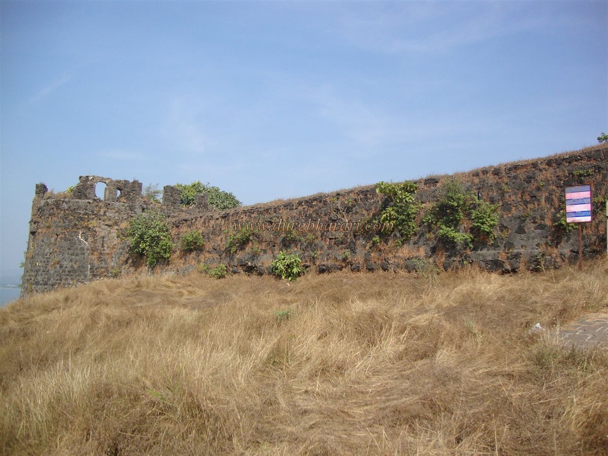
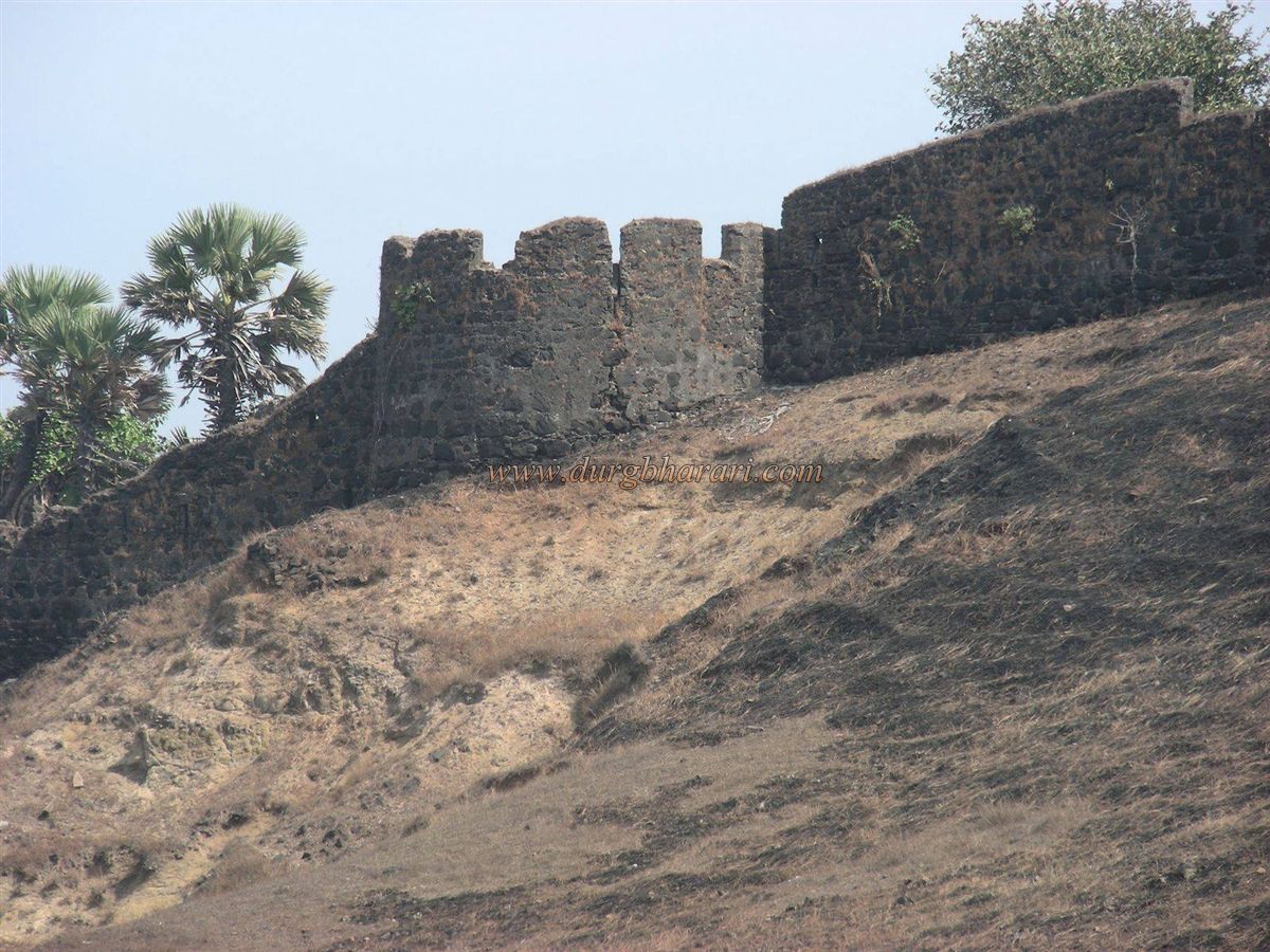
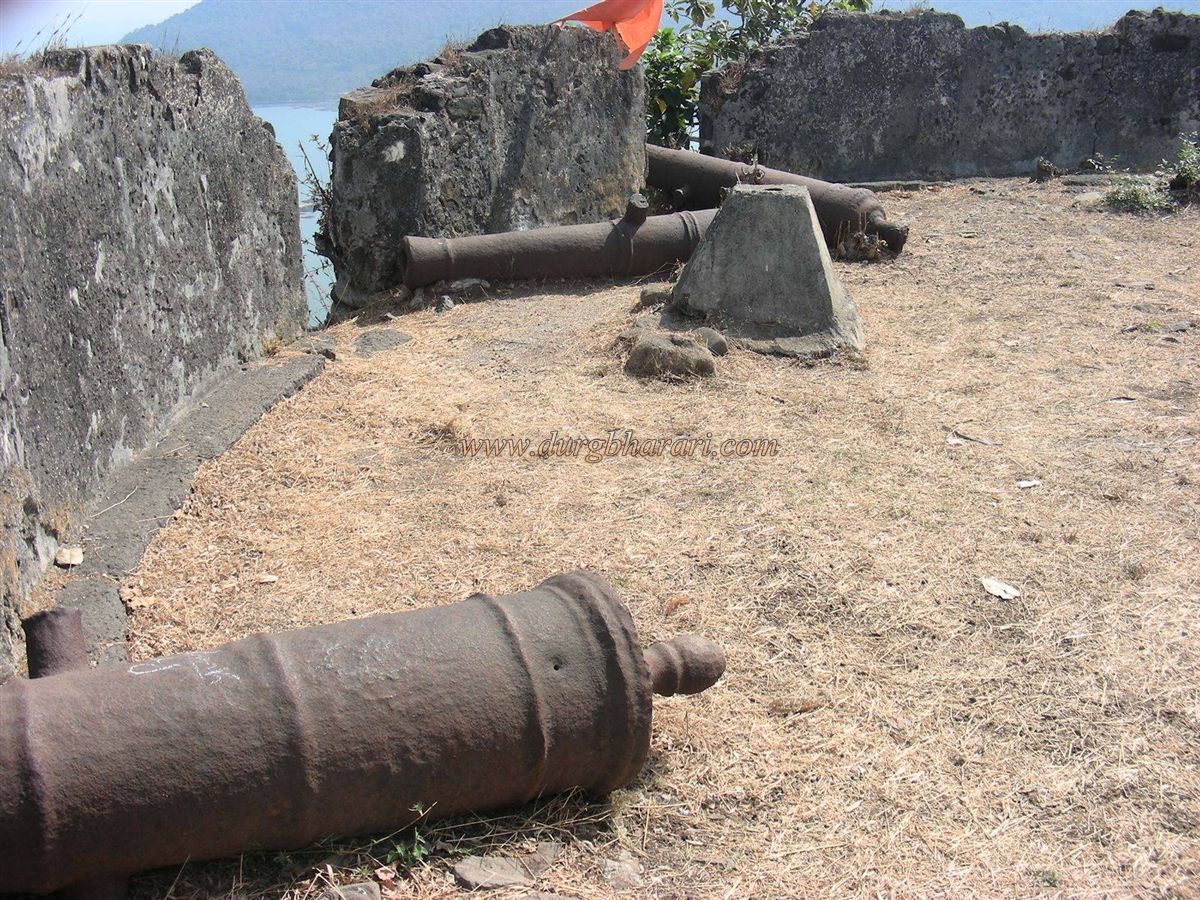
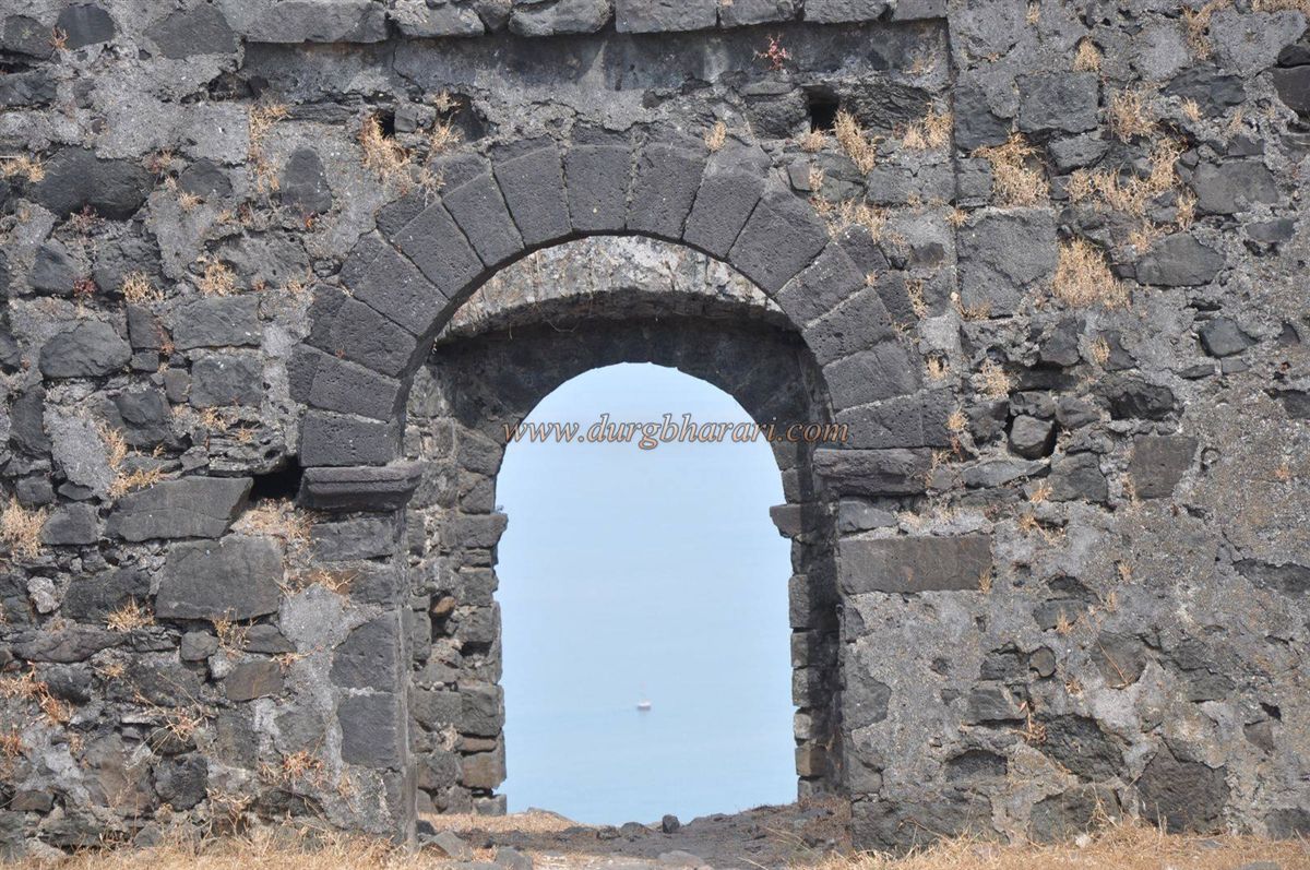
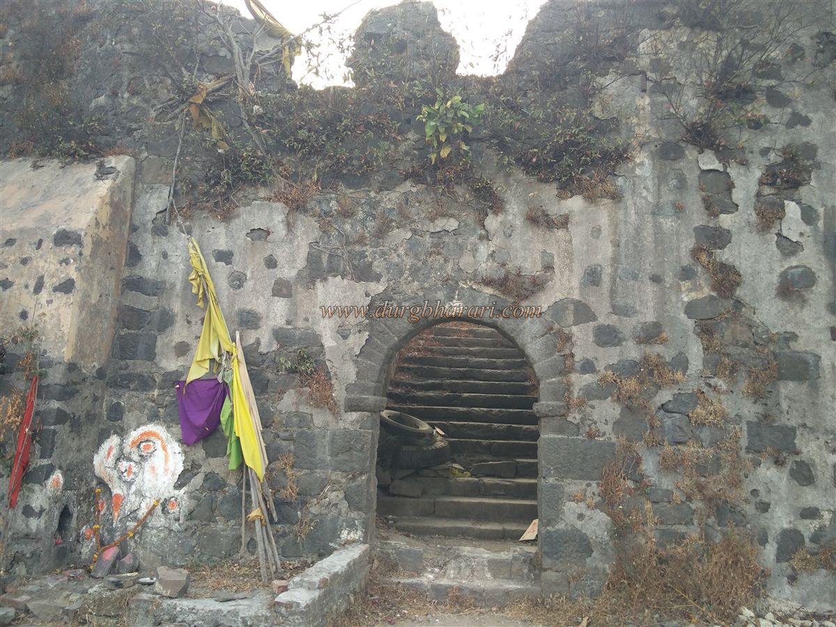
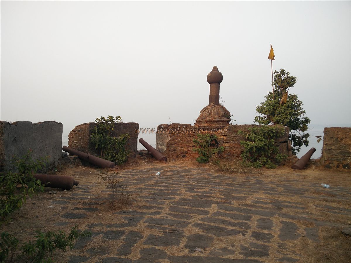
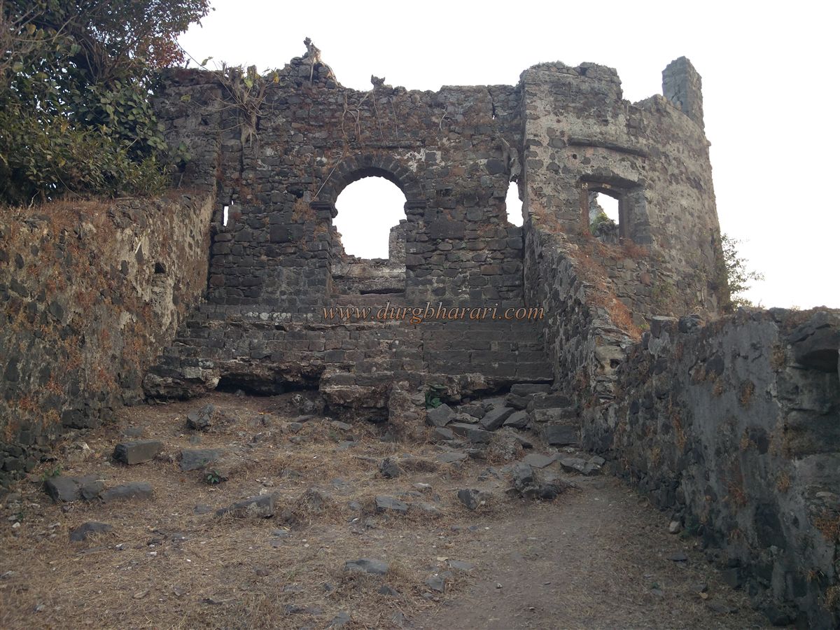
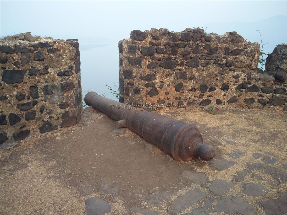
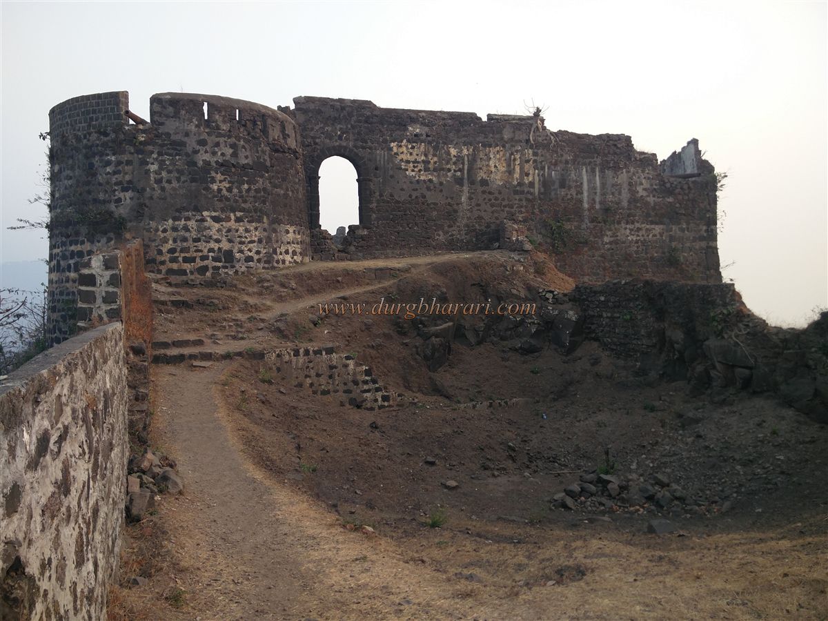
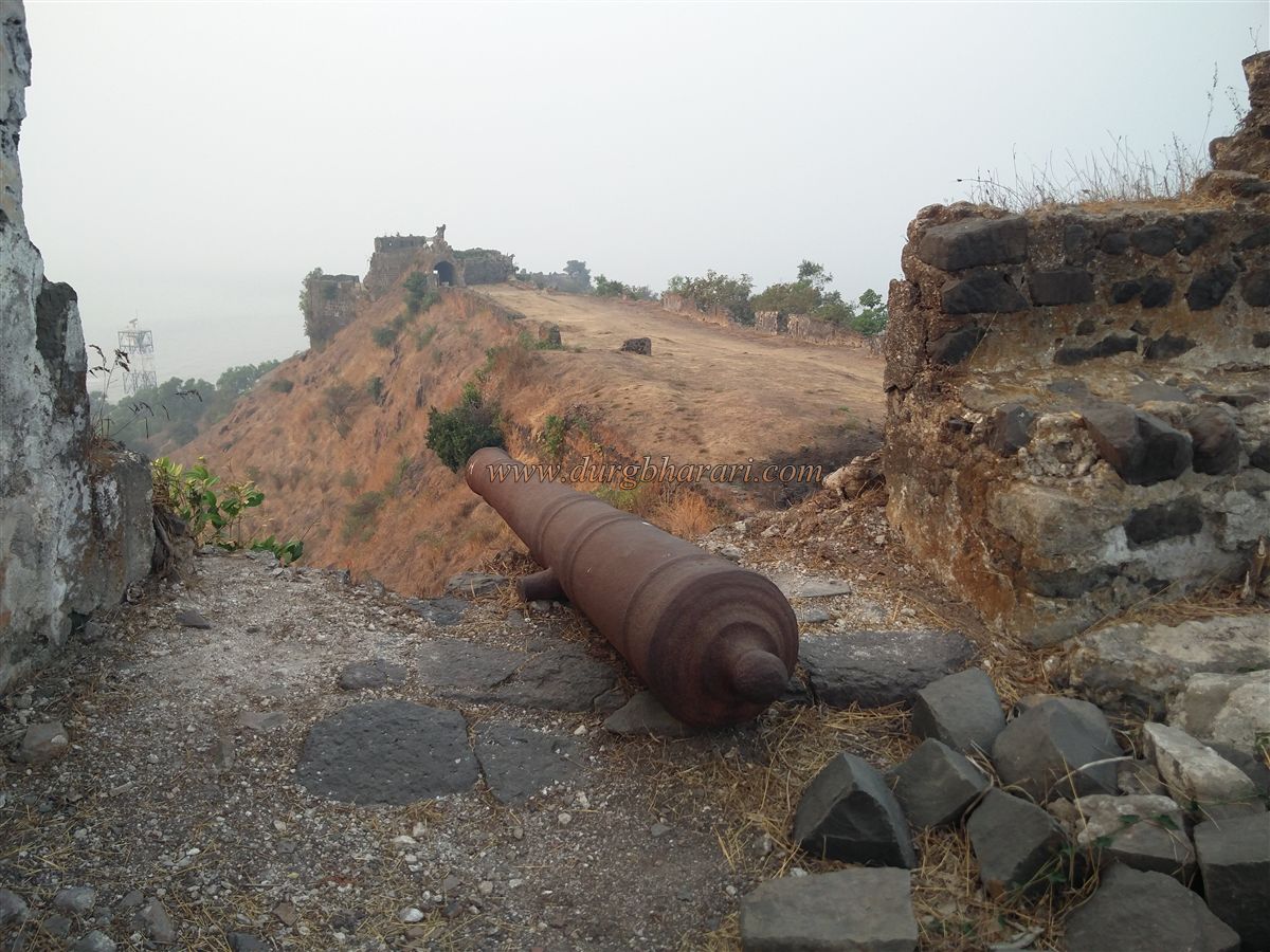
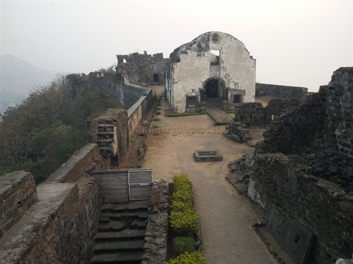
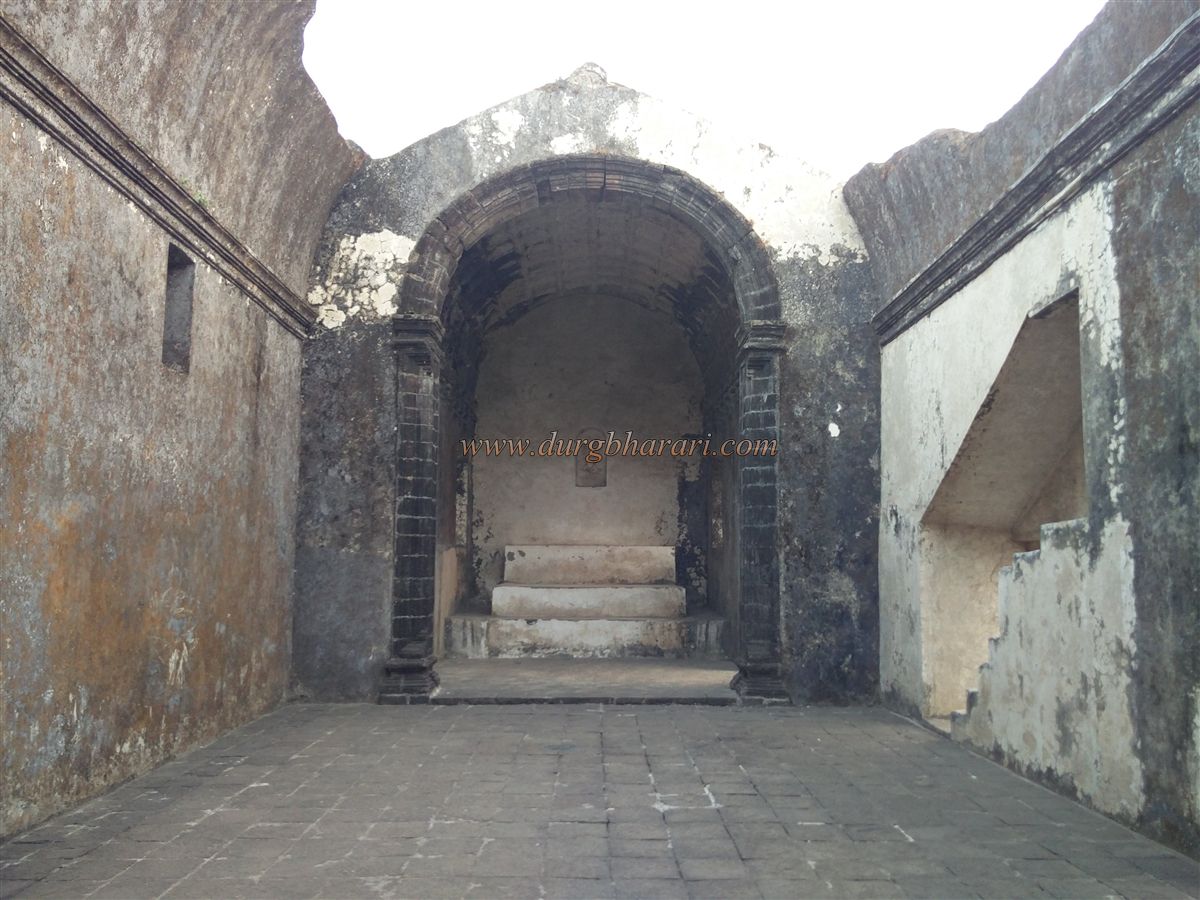
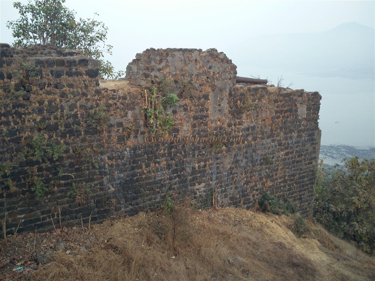
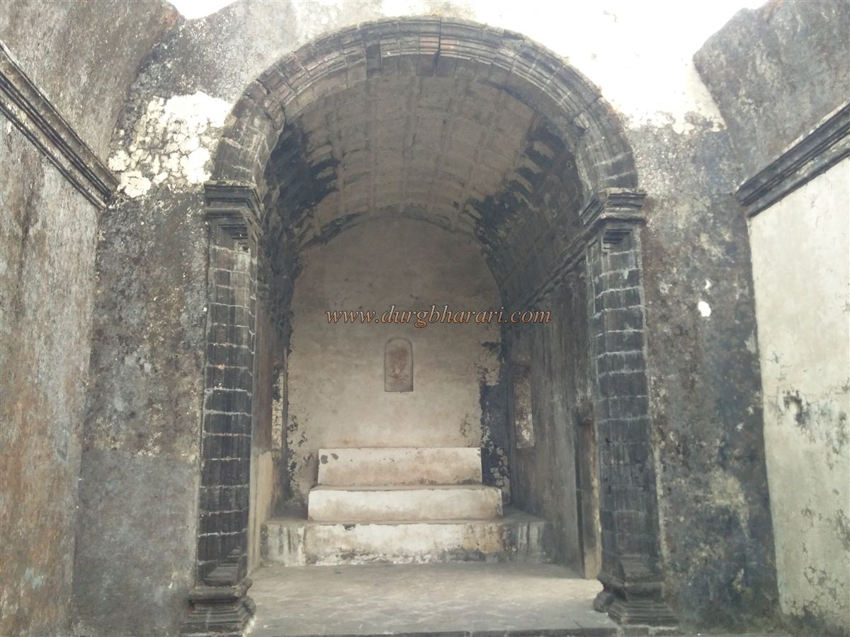
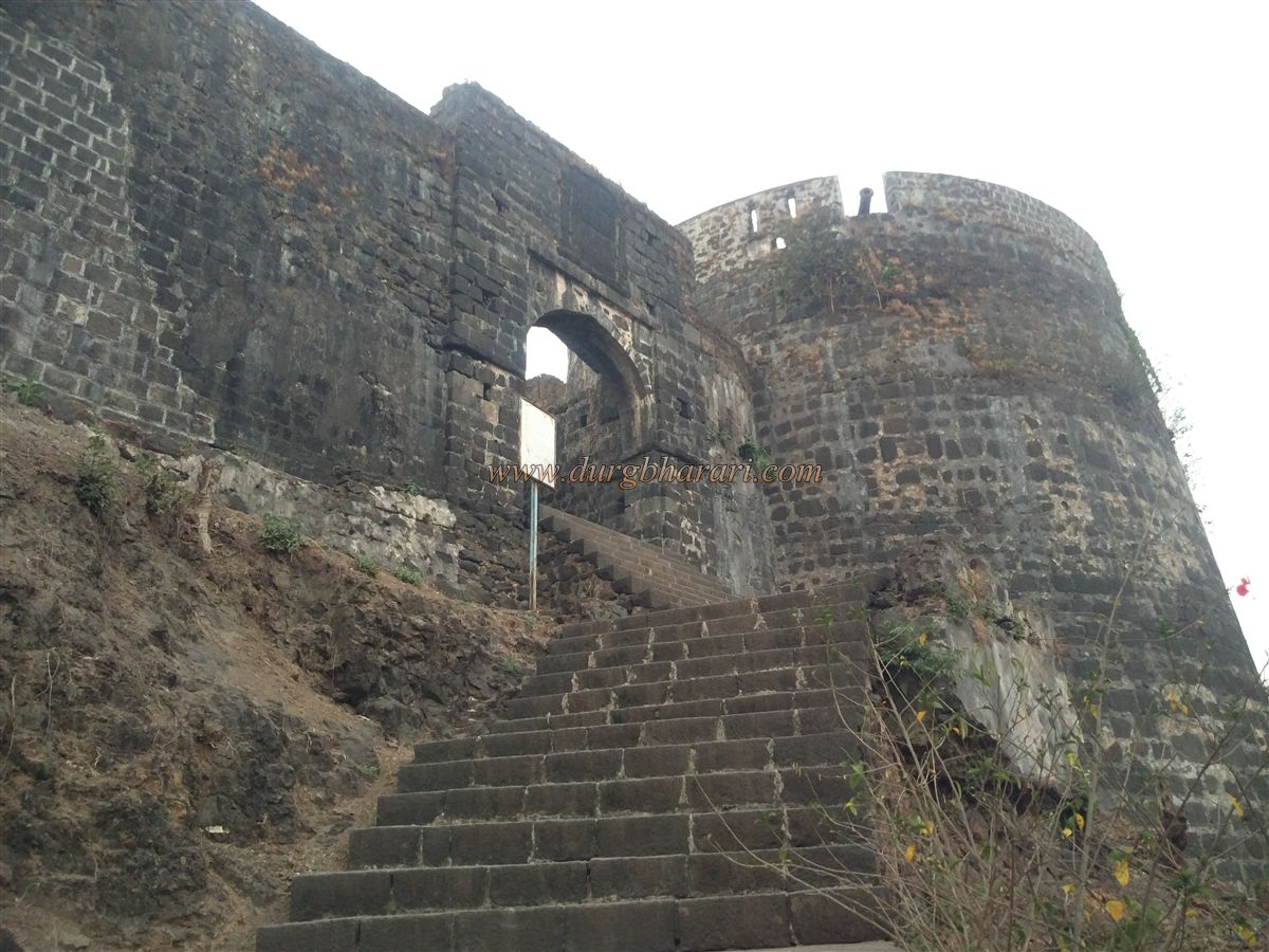
From the southern end, after the Koli settlement in Korlai ends, a footpath climbs up from the east side of the ridge. This path reaches the fort walls in about 20–30 minutes. The entrance, facing east, is flanked by two bastions: the sea-facing one is called St. Diageo, and the estuary-facing one is called St. Francisco. In this section of the citadel, a few ruins remain. Below the main citadel on the western side near the walls is an ammunition store, while some cannons are placed along the western and northern walls. This is the highest part of the fort, enclosed on all sides by fortifications. Above the steps lies an inscribed stone, and in front is the ruined structure of a church.
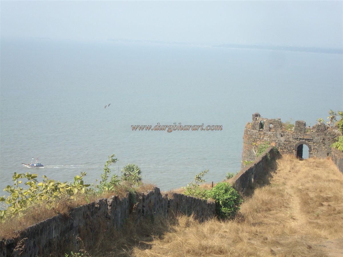
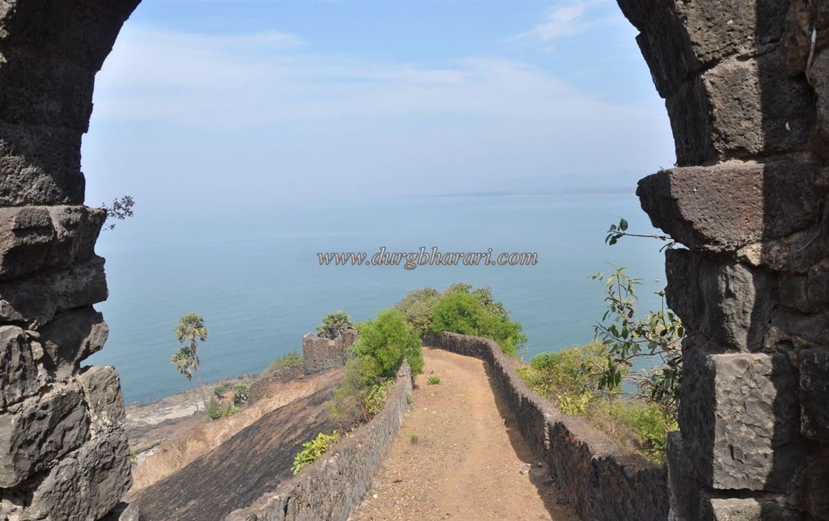
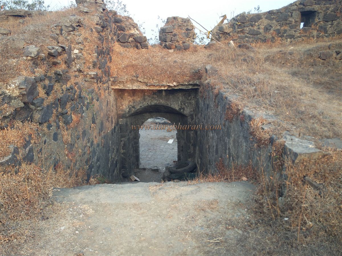
Behind this Portuguese-built church is a gate in the fort wall that leads to the southern tip of the fort. This entrance is protected by a pentagonal bastion. From here, you can see both the eastern and western shores as well as Korlai village. Returning to the church, an inscription in Portuguese can be seen above the northern door. Beside it is a drinking water cistern, fully covered from above, with small openings to draw water. Without a bucket and rope, fetching water is impossible. This cistern also supplies water to the lighthouse below. Nearby is a small Mahadev temple, with two Vrindavan in front.
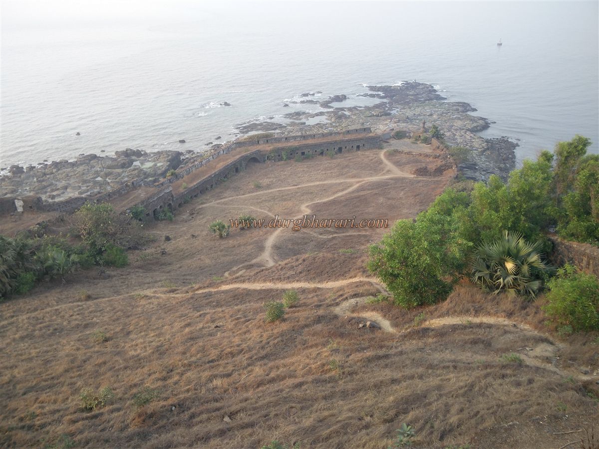
Proceeding ahead, a small door in the left wall leads to newly built steps going down to the lighthouse. Passing through two gates, you reach the base, where the Dindi Gate lies to the west and the Darya Gate to the east. Outside the Darya Gate, there is a jetty, where ships were once repaired. Inside the walls near this area, a series of rooms once housed soldiers. On the right-hand bastion are cannons, and next to it stands the “Cross Battery,” though it’s cross emblem has disappeared with time.
From the Dindi Gate, a walk along the seashore leads to the lighthouse. From here, the fort walls are clearly visible.
In 1521, Nizamshah of Ahmednagar granted permission to the Portuguese official Diego Lopes de Sequeira to build a fort near Chaul village. The Portuguese began work on the opposite bank of the creek near Revdanda and constructed their first strong jetty on the north shore of Korlai. According to Gemelli Careri in his book Churchill’s Collection of Voyages, Nizam-ul-Mulk allowed the Portuguese to build Chaul Fort in exchange for supplying 300 Persian or Arabian horses at reasonable prices. Revdanda became one of the main Portuguese bases, with a strong fort.
In 1594, after the death of the first Burhan Nizam, instability arose. The Portuguese tried to build fortifications on the Chaul rock, but Husain Nizam opposed them and decided to build a fort himself. In a clash, both sides suffered, leading to a treaty where the Nizam agreed not to build a fort and the Portuguese promised no maritime harassment. However, the second Burhan Nizam ignored this and built a strong fort. At one point, the Nizam’s commander Fateh Khan fired cannons on Revdanda to challenge the Portuguese. The Portuguese, lacking reinforcements, called for more troops and launched a counterattack on Korlai. They entered the settlement below the fort and killed one of the Nizam’s elephants. In the ensuing battle, the Nizam’s forces were defeated, and on 13 September 1594, the fort fell to the Portuguese.
After capturing it, they demolished much of the structure, keeping only the citadel. A 1602 record claims that the fort held 8,000 people and 70 cannons, but this is likely an exaggeration, as such a small fort could not accommodate so many, nor does it have adequate water facilities.
In 1683, Sambhaji Maharaj’s attempt to capture Korlai failed. Later, in 1739, Chimaji Appa sent Subhanji Mankar to attack the fort. He laid a siege so tight that the Portuguese surrendered. The Marathas then used the fort for manufacturing cannons and renamed the bastions: St. Thiago became Pusti Bastion, St. Francisco Xavier became Ganesh Bastion, St. Pedro became the Western Bastion, St. Ignacio became La Devi Bastion, St. Philip became Chauburji Bastion, and the remaining two were named Ram Bastion and Paan Bastion.
© Suresh Nimbalkar
GALLERY