KONDHAVI
TYPE : HILL FORT
DISTRICT : RATNAGIRI
HEIGHT : 830 FEET
GRADE : EASY
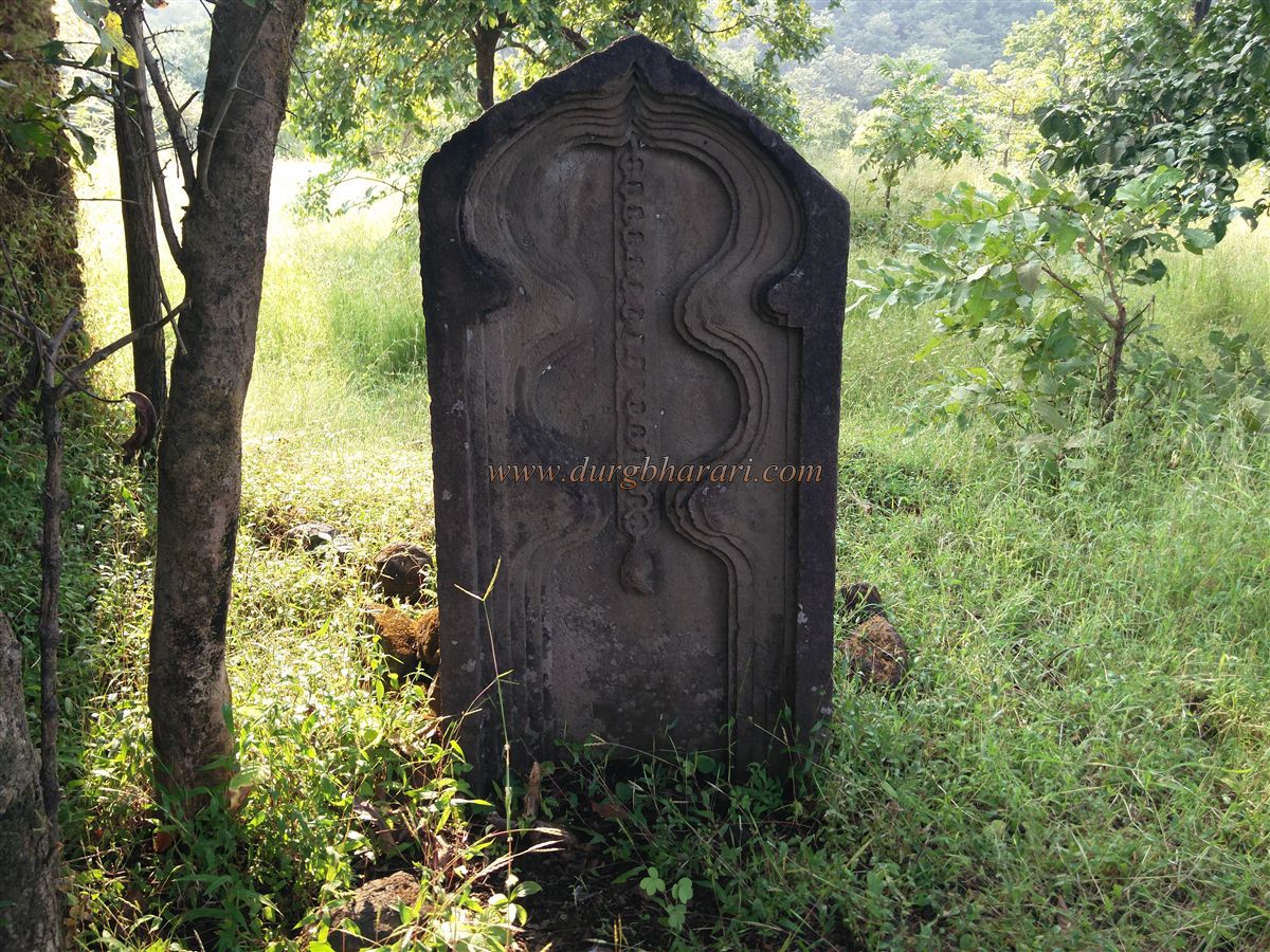
Kondhavi is an ancient village in the Kashedi Ghat in Poladpur taluka, to the south of Raigad district. The antiquities of the village are the Satishila, hero stones, carved idols, and carved pillars of the temple. To the west of Kondhavi village is the Ambenali Ghat leading to Satara and Mahabaleshwar and a small wharf route is present between Kondhavi and Devpur which meets the Main Wharf. The Kondhavi fort must have been built to protect this wharf. To reach Kondhavi fort, reach Poladpur on the Mumbai-Goa highway. On the way from Poladpur to Khed Chiplun, 6 km from Kashedi Ghat is the Kondhvi fork. Talyachi Wadi aka Kondhavi village is at a distance of 4 km from this fork. After entering the village, there is a paved road on the right side to reach the fort.
...
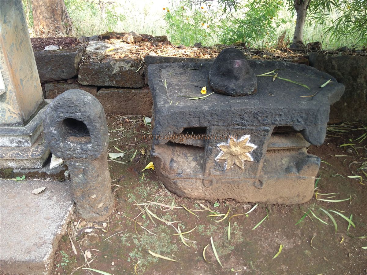
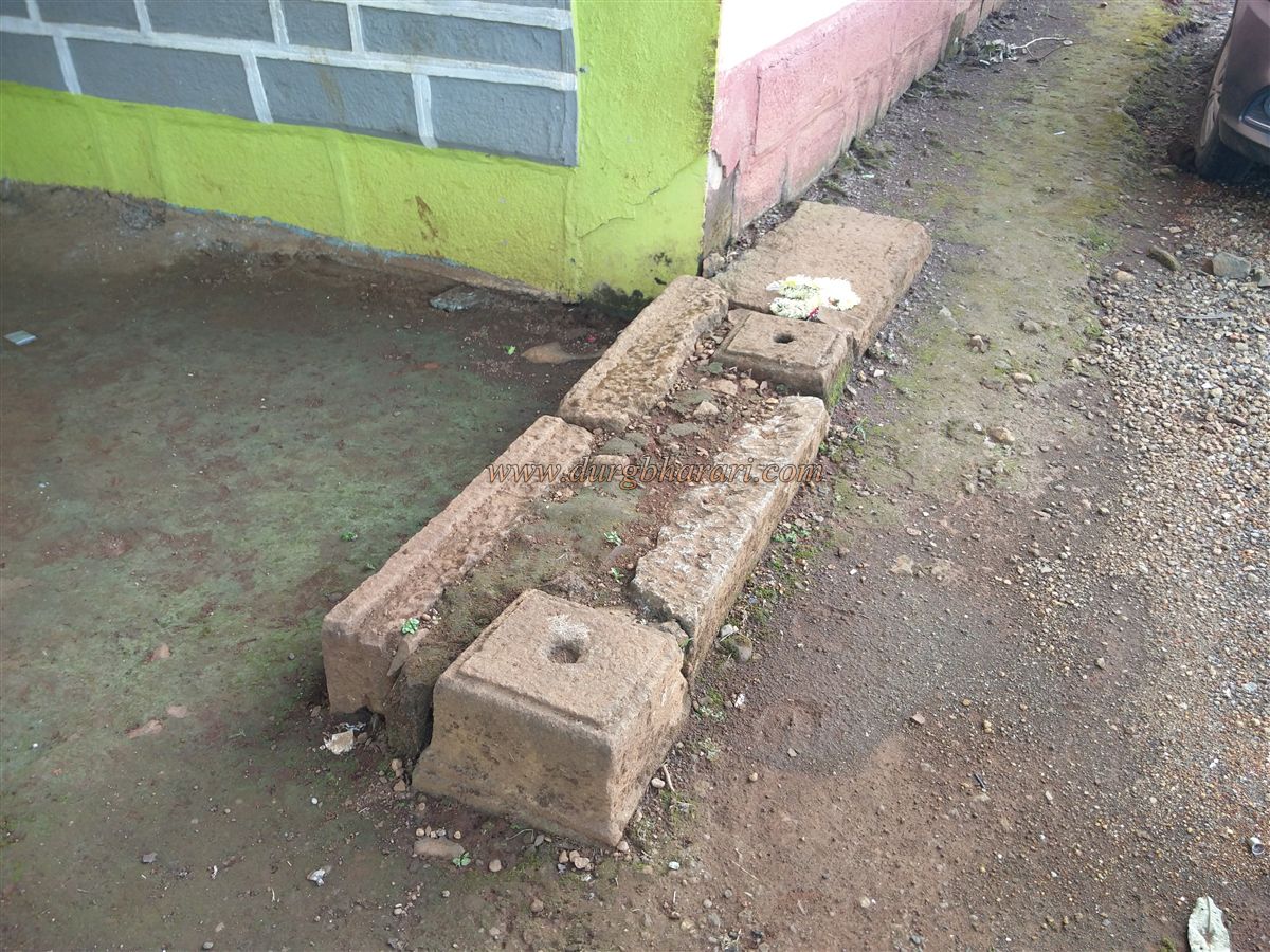
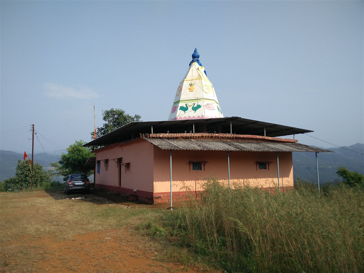
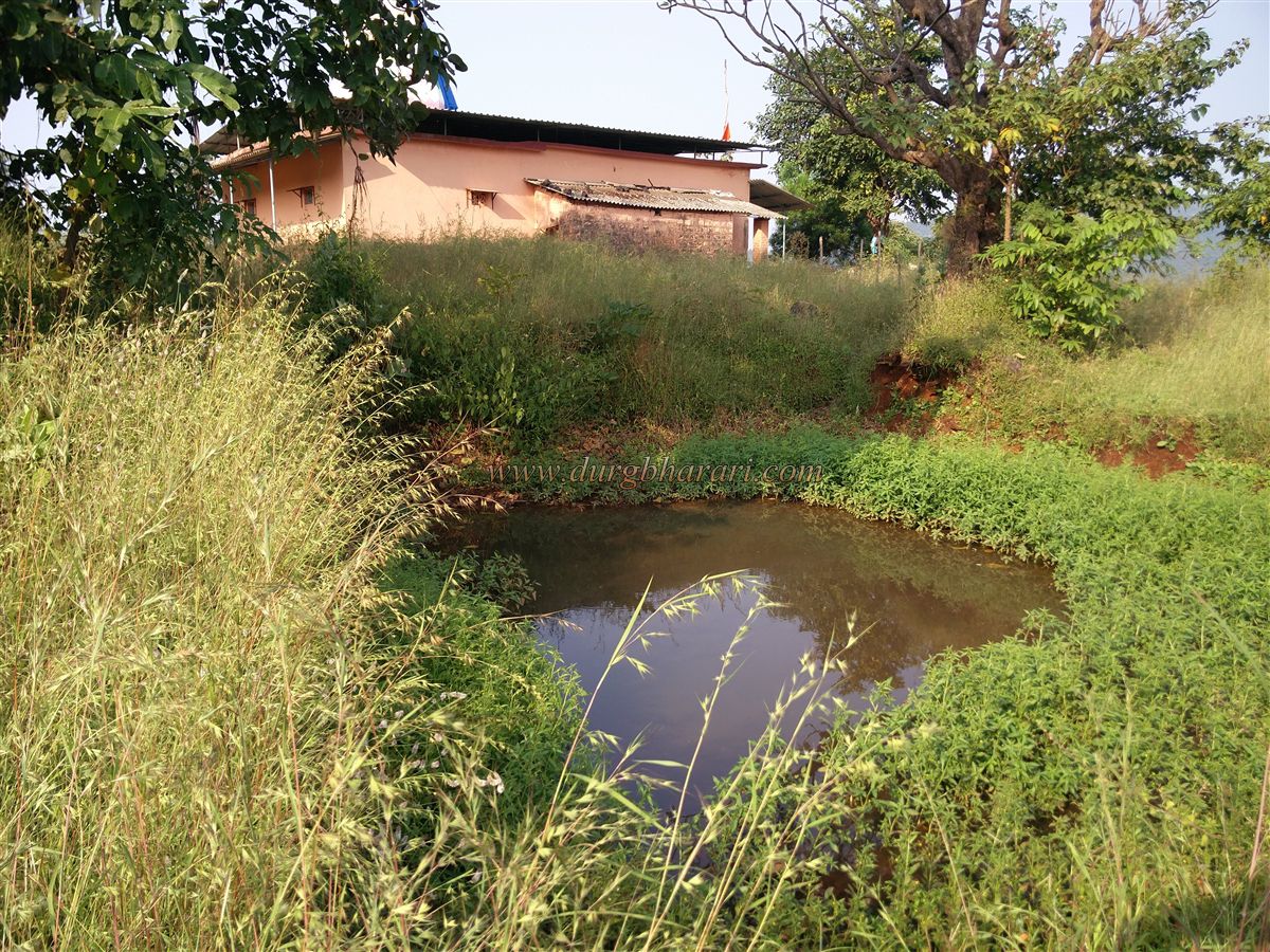
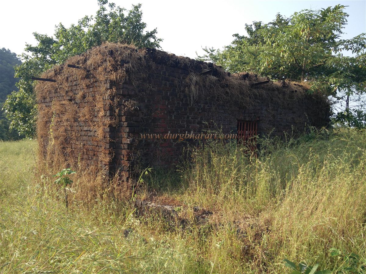
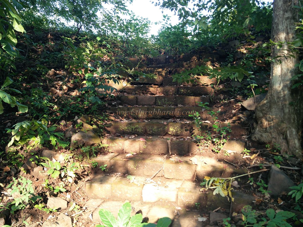
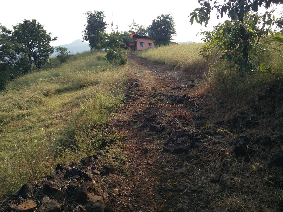
The ramparts and gates of the fort have been destroyed and by this road, we reach the temple of Athgaon Bhairavnath at the top of the fort. The height of the fort is 790 feet above sea level. This fort is of normal circular shape and is spread from south to north. The area of the fort is spread over 5 acres. There are carved and wrought stones of the old temple in the premises of the new temple. The Bhairav temple has been newly renovated and the stone carvings of Bhairoba and Bhairi Devi and an idol of Mahishasur Mardini can be seen on the temple premises. There are eight villages like Kondhavi, Phanaskonda, Ganjwane, Khadpi, Dhamandevi, Cholai, Khadakwana, and Goldara around the hill of the fort. Due to these eight villages, the temple is known as ‘Aathgaon Bhairavnath’. There is a footpath in front of the temple to come from the village. There is a small water cistern at the back of the temple but it holds water only till December. In the next part of the cistern, there are sloping ramparts. On the right side of the temple is a newly built room on an old quadrangle structure with the idol of Navanath inside it. There is a 4 X 2 feet sculpture at the back of this room but I don't know what it is. In front of this sculpture, at some distance, the remains of two broken structures can be seen. After seeing the sculpture and walking some distance on the paved road, one can see the idol of Hanuman on a quadrangle structure on the left side of the road. To the right of this quadrangle is a muddy lake with 16 steps built of stone to descend into it. This is where your fort round ends as other remains on the fort are destroyed. Rasalgad, Sumargad, and Mahipatgad forts are visible in front of the temple. Half an hour is enough to see the fort. Kondhavi was a province during the Adilshahi period and it was governed from Kondhavi fort. Poladjung was the fort keeper of Kondhavi fort. There is a tomb of Poladjung in Poladpur village and it is said that Poladpur is named after him. During the Shivaji Maharaj period, this region was under the control of Chandrarao More of Jawali. In 1778-79, 244 villages in Raigad were divided into six parishes namely Kondhavi, Mahad, Birwadi, Tudil, Vinhere, and Valan. Of these, four villages, Umrath, Dhawale, Khopdi, and Dandke in Kondhavi Pargana, were under the control of Pantpratinidhi.
© Suresh Nimbalkar
GALLERY