KOLKEWADI
TYPE : HILL FORT
DISTRICT : RATNAGIRI
HEIGHT : 1830 FEET
GRADE : HARD
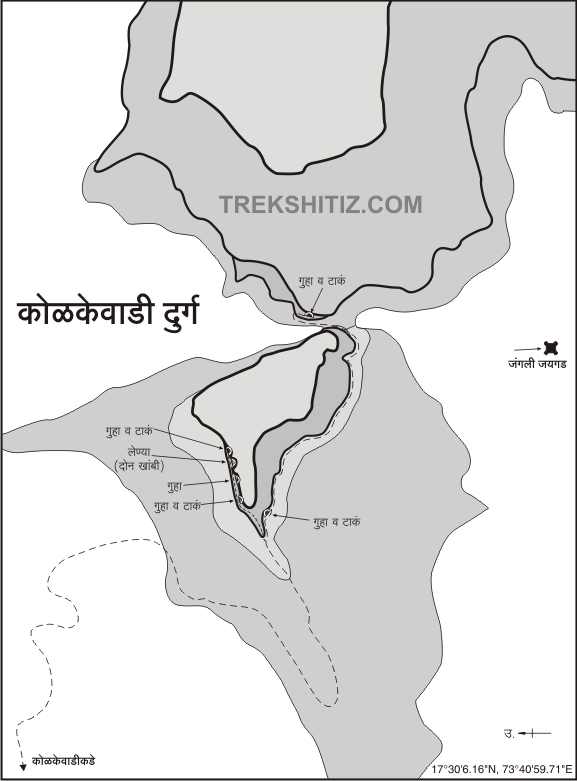
Many forts in Konkan have been destroyed over time and today they are only left in the pages of history. But forts like Barwai and Kolkewadi don’t event appear in the pages of history. Kolkewadi fort is one such fort that was destroyed before Shivaji Maharaj’s period and is mentioned only in the book “Daspaticha Etihas”. Today, there are no remnants of the fort, such as bastions and ramparts, although a few caves, water cisterns, and sparse remains of a structure can be seen. Since very few people visit the fort, there is no clear way to go up the fort. The paths on the fort are in danger due to frequent earthquakes in the area. Therefore, one should not go to the fort without having a guide. Suresh Kokare and his two children in Dhangarwadi settlement under the fort know the whole fort, so it is advisable to take them with you to see the fort.
...
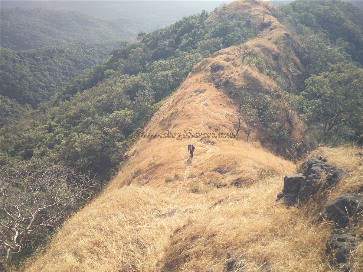
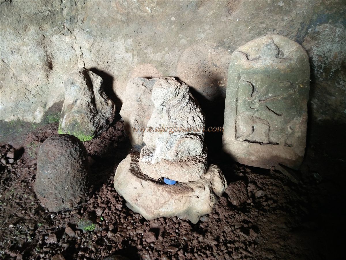
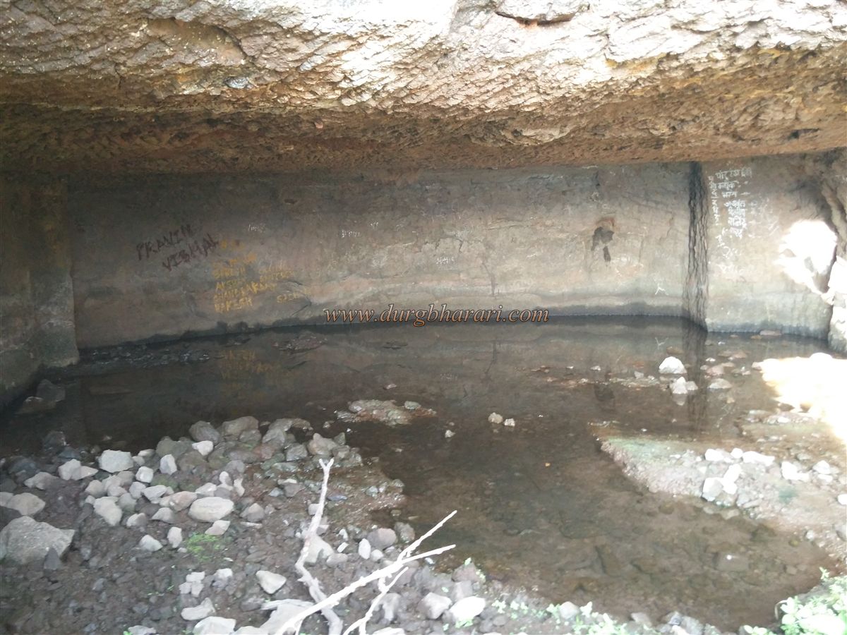
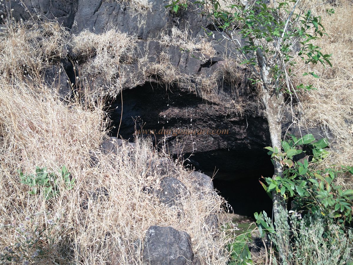
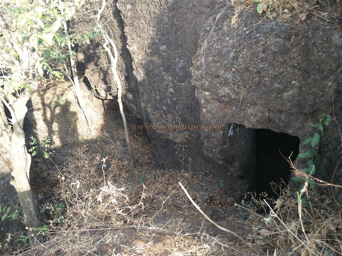
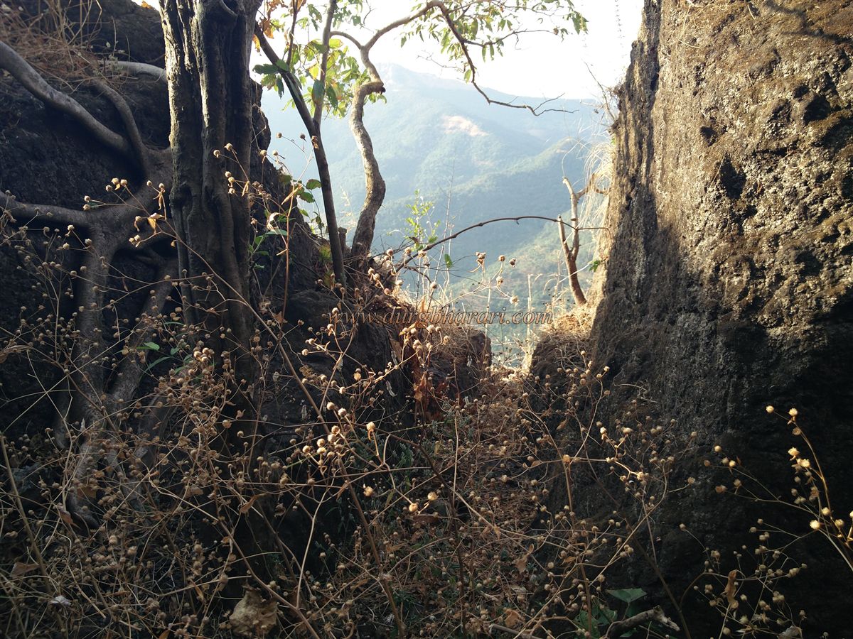
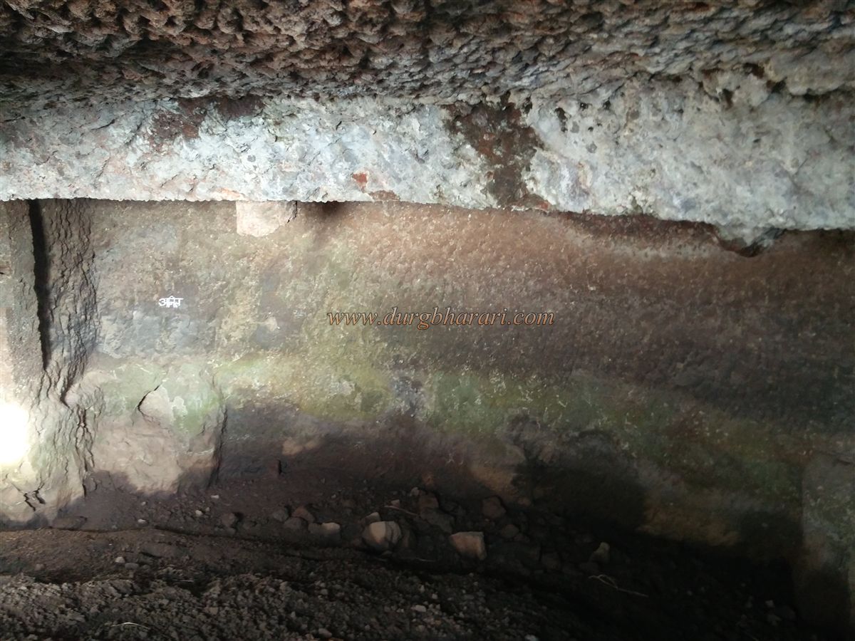
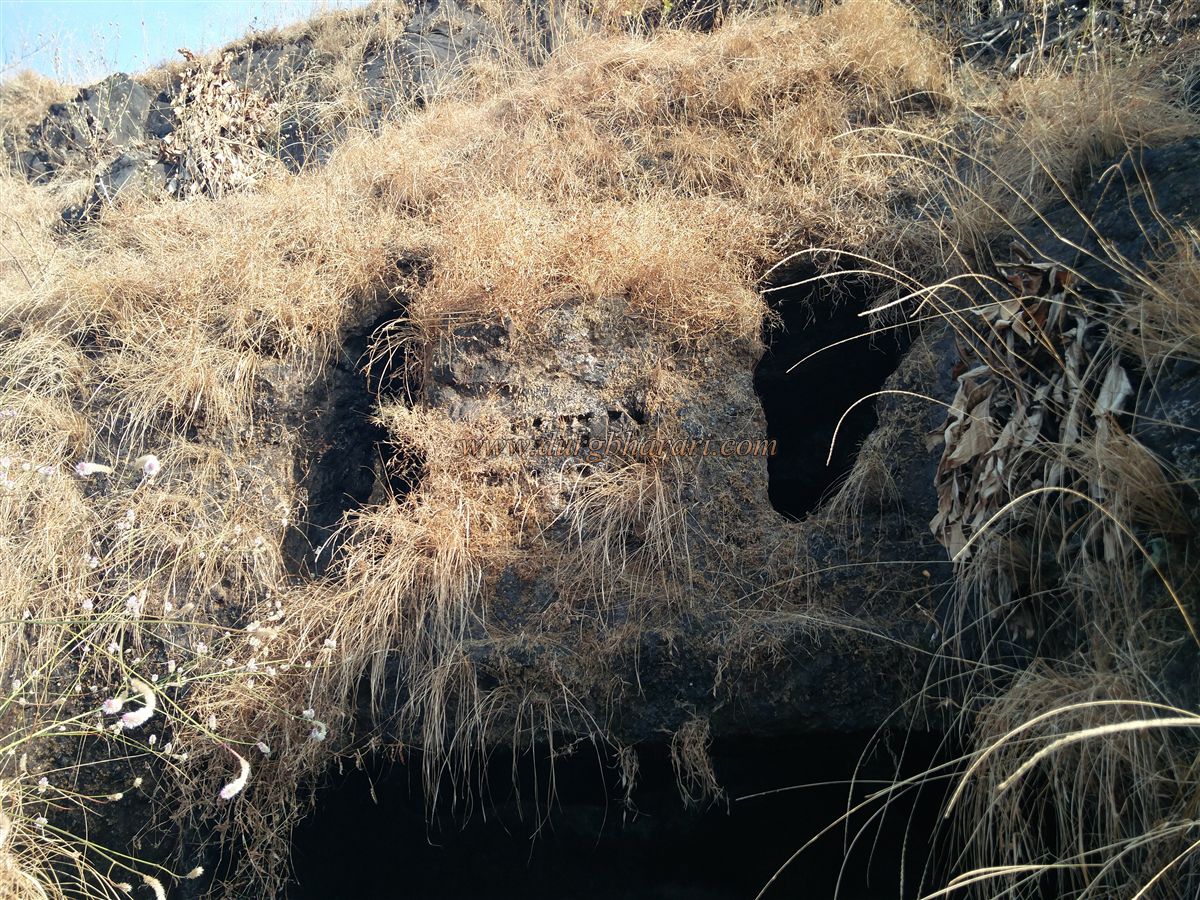
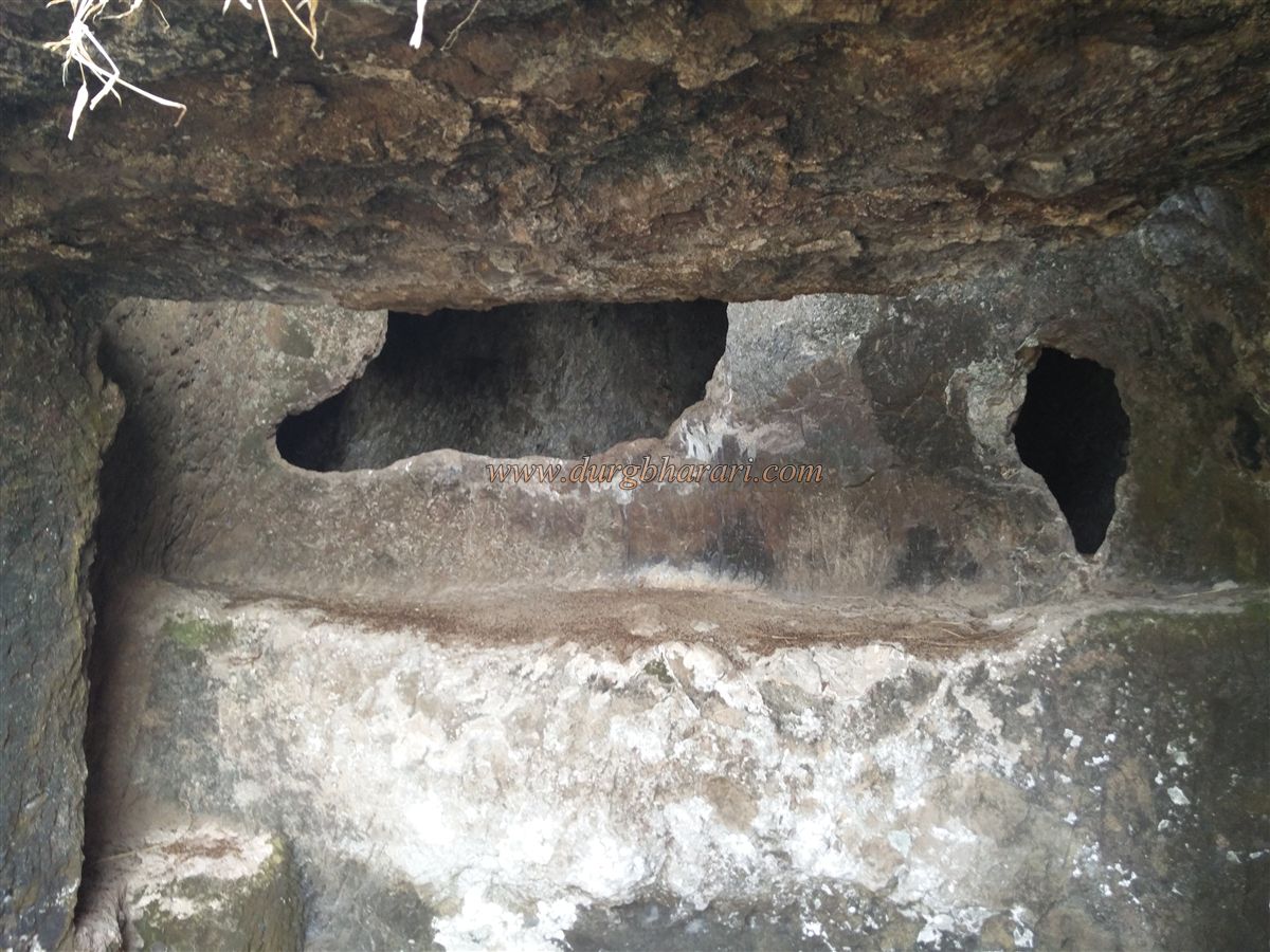
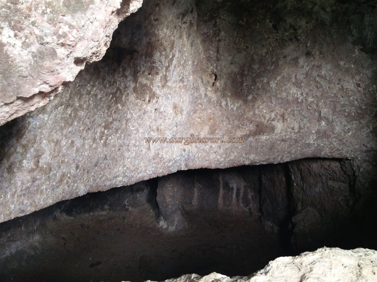
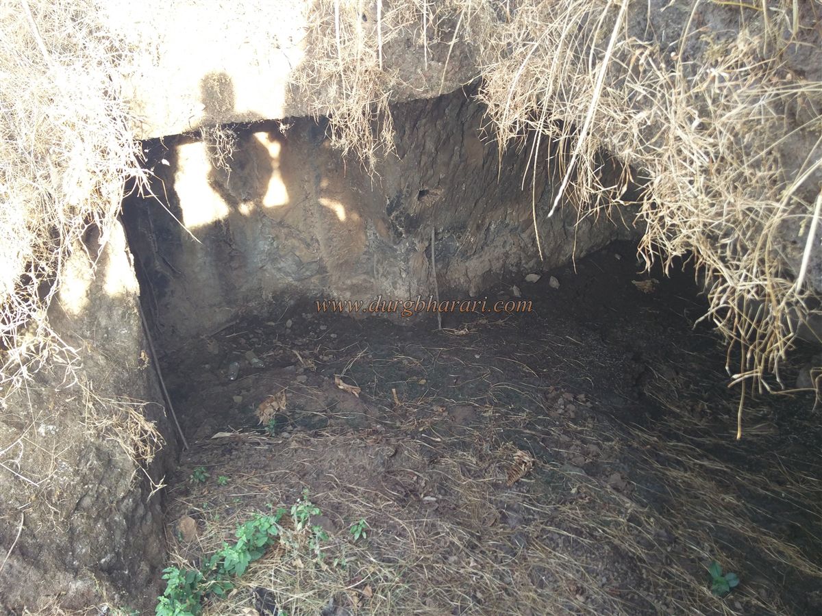
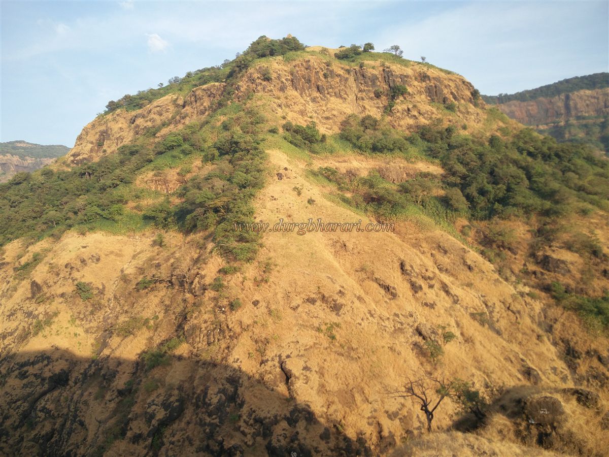
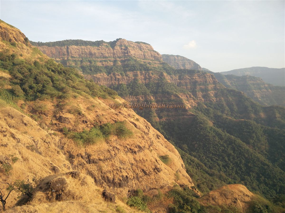
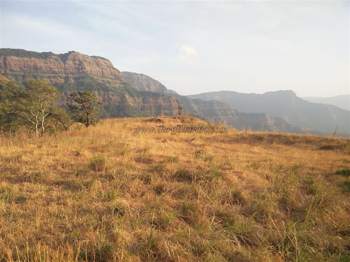
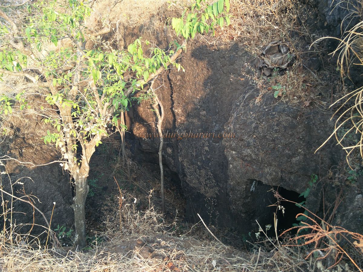
Kolkewadi dam is at a distance of 10 km from Chiplun city. At the back of this dam is the Kolkewadi fort on a hill separated from the main range of the Sahyadri. To reach Kolkewadi fort, one has to reach Dhangarwada at the end of Kolkewadi village from Alore village on Chiplun Karad road. Since buses are coming from Chiplun S.T. Depot to Buddhawadi in Kolkewadi, many people suggest reaching Dhangarwada from Buddhawadi but this route is very inconvenient. If you go this way, you have to walk a long distance to cross the water body of Kolkewadi dam, so it takes one hour extra to reach the fort and you can't even get through Buddhawadi. Another way to reach the fort is Alore-Hasrewadi-Jambharai-Dhangarwada. If you have a private vehicle, you can take this route directly to the bridge at Dhangarwada. There is a path leading to the fort from the hill behind Suresh Kokare's house at the end of Dhangarwada. Ascending the hill, you can see the unpaved road on the other side of the hill. This unpaved road, which was constructed for vehicles under the Employment Guarantee Scheme, is now being converted into a paved footpath. At the end of the road, a footpath enters the forest on the right. This path to the fort passes through dense Karvi forest. Crossing this forest, we come to a small plateau in front of the hillside of the fort. In the rainy season, the villagers bring cattle here for grazing. From here, the actual path through which the entire Kolkewadi fort could be seen begins. We climb the fort on the way to the trunk and reach the hill of the fort. There is a footpath to the fort on the left side and the valley on the right side. Leaving the original path, one can see a large cave carved in the rock at a distance of about 20-22 feet. The mouth of the cave is small and water has accumulated in the cave due to leakage. The water is potable and is the only source available on the fort. In one corner of the cave are the remains of a broken Nandi found on the fort. The path gets difficult from this cave. After seeing the cave, come back to the original path and start climbing the trunk. The path is steep and has grass growing on it, so climb very carefully. The road has been given more security by digging trenches in two-three places. When you reach the upper part of the trunk, you can see a path sticking to the left side and moving forward. As you proceed along this path, keeping the edges to the right and the valley to the left, you will see two caves carved in the rock. The inner cave has a small door and steps to go to the bottom. As the mouth of this cave is on the west side, a protective wall of the outer cave has been constructed to protect the inner cave from wind and rain and although, the water accumulated in the outer cave has taken out this door. There are still some caves remaining here and to see these caves, you have to do some rock climbing through the cistern and proceed. The cave at the front of the cistern is filled with a large amount of soil and the cistern in the next part of the cave is also filled with soil. Next to this cave is the largest cave on the fort divided into two parts. In the facade of this cave, there are two windows carved on the door, and in the center of them is a mesh carving. The mezzanine floor is carved near this window on the inside of the cave. The inner cave is separated from the outside by a steep wall and has two vents to let in light. There is a way to get to the inner cave through another cave next door. The inner cave is inhabited by a large number of bats and the whole cave stinks because of them. All these caves are partially carved caves and may have been used later for the fort. After seeing the cave, turn back and come to the trunk and walk towards the top of the fort. This path is very narrow and steep and slippery with grass so usually, no one goes up from here. The head of the fort is 1860 feet above sea level and is very steep. There are two quadrangle structures, one small and one large, hidden in the grass on the top of the fort. There is a valley on the other side of the fort and behind it lies the Sahyadri range. There is a slippery slope to reach the valley from the top and another path is to reach this valley is from the cave we saw first which was filled with water. After climbing the hill in the main range of Sahyadri from the valley, a water cistern carved in the rock can be seen. The water in it is drinkable. You have to walk for 45 minutes to see this cistern and also the road is dangerous, so you should complete your fort round on the head of the fort. There is a fort called Jangli Jaigad on the hill on the right side. From the fort, the Kolkewadi dam and the Sahyadri range look as beautiful as a picture. It takes 5 hours to see the fort and walk back to the foothills of the fort. Considering the location of this fort on the hill which is separated from the Sahyadri mountain range, this fort must have been used for the protection and surveillance of Tiware Ghat which connects Desh and the Konkan. Kolkewadi fort is mentioned in the book “Daspaticha Etihas” at Pedhambe. The fort was under the control of Bararao Koli during the Bahamani dynasty in the 13th century. Bararao had control over the area around the fort. Barwai fort in this area was their headquarters. Along with this fort, Kolkewadi fort was also in the possession of Bararao. The Bahamani Sultan undertook three expeditions to defeat Bararao. Around 1380, Sheikh Akus Khan of the first expedition was defeated at Konkanwavi-Pofli near Sonpaya in Kumbharli Ghat, while Bhai Khan of the second expedition was also defeated at Dalvatne. In the third expedition, Chief Bahadur Sheikh was also killed near Chiplun. Today, Bahadur Sheikh Naka of Chiplun is known by the name of this Chief. Eventually, the Bahamani chiefs resorted to discrimination and Madhavrao Ravirao Shinde tied up with the enemy. Eventually, the kingdom of Bararao sank and the sultan gave twenty-four villages to Shinde. The wives of these twelve Rao went to Sati at Kalmani.
© Suresh Nimbalkar
GALLERY