KOHOJ
TYPE : HILL FORT
DISTRICT : PALGHAR
HEIGHT : 1880 FEET
GRADE : MEDIUM
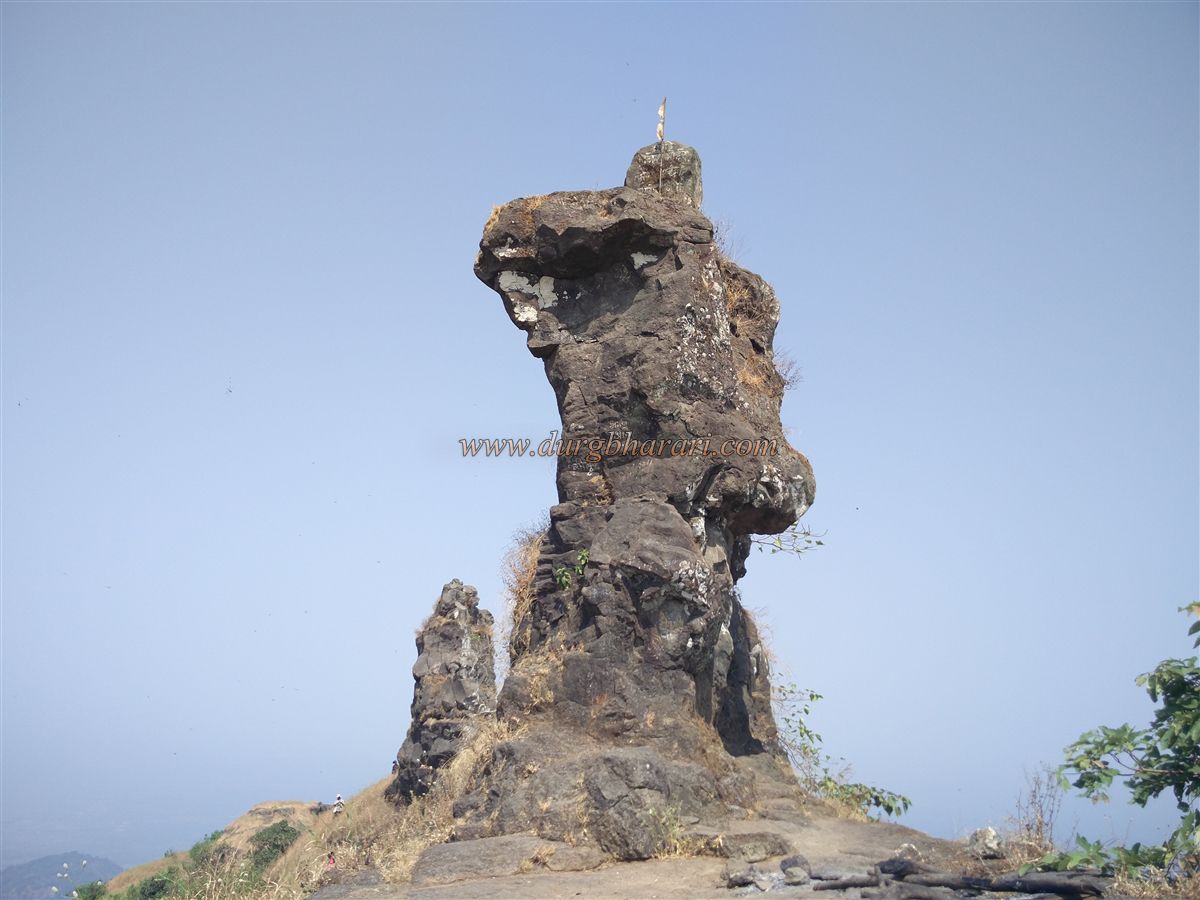
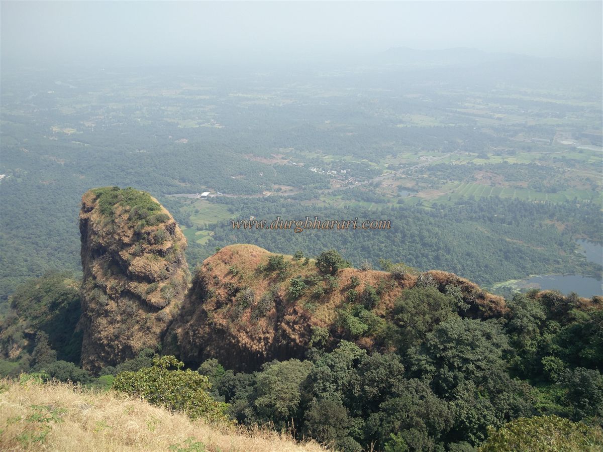
Mumbai divides the Konkan region into two parts — North Konkan and South Konkan. The stretch from Vasai to Daman is known as North Konkan, while the stretch from Alibag to Karwar is called South Konkan. Blessed with natural beauty and located close to Mumbai, North Konkan has many places for one-day excursions. One such place is the Kohoj Fort, located on the Wada–Manor route. The main attraction of this fort is a naturally formed rock resembling the shape of a human figure. While traveling from Manor to Wada, this stone figure catches your attention.
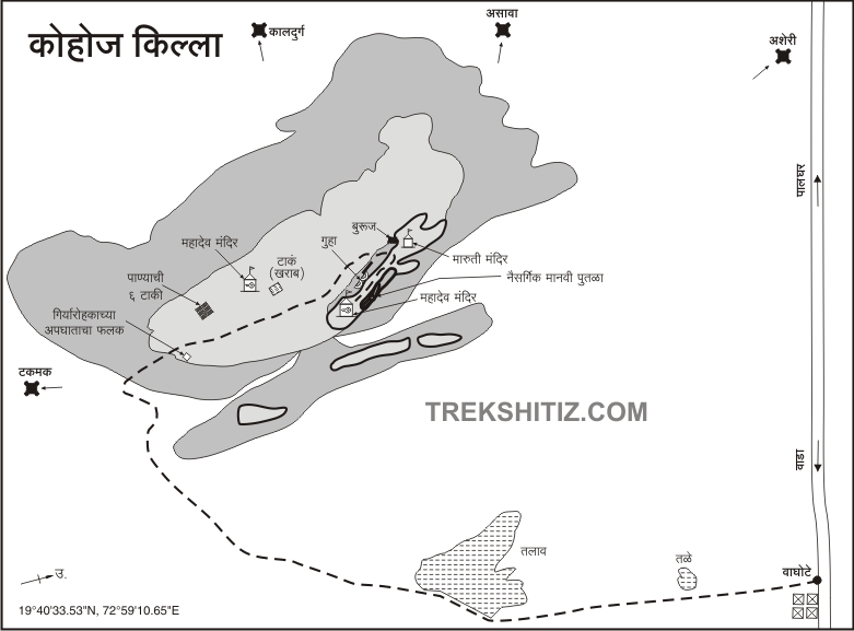
The fort is situated in the newly formed Palghar district (earlier part of Thane district), on a hill surrounded by dense forests, near the confluence of the Deharja and Vaitarna rivers. To visit Kohoj Fort, the nearest railway station is Palghar on the Western Railway, and Manor on the Mumbai–Ahmedabad route is the nearest town.
...
Due to the Shiva temple atop the fort, a large fair is held here during Mahashivratri, attracting villagers from nearby areas. There are four main routes to the fort from the villages of Nane, Sange, Gorhe, and Vaghote, but trekkers mainly use the paths from Vaghote and Nane. Rickshaws are available from Mastan Naka in Manor to both these villages.
Vaghote, located on the highway about 10 km from Manor, is preferred by most trekkers as Nane is situated further inside from the main road. However, taking the Vaghote route means missing the sight of a cannon brought down from the fort to Nane village, now placed on a platform in the village square.
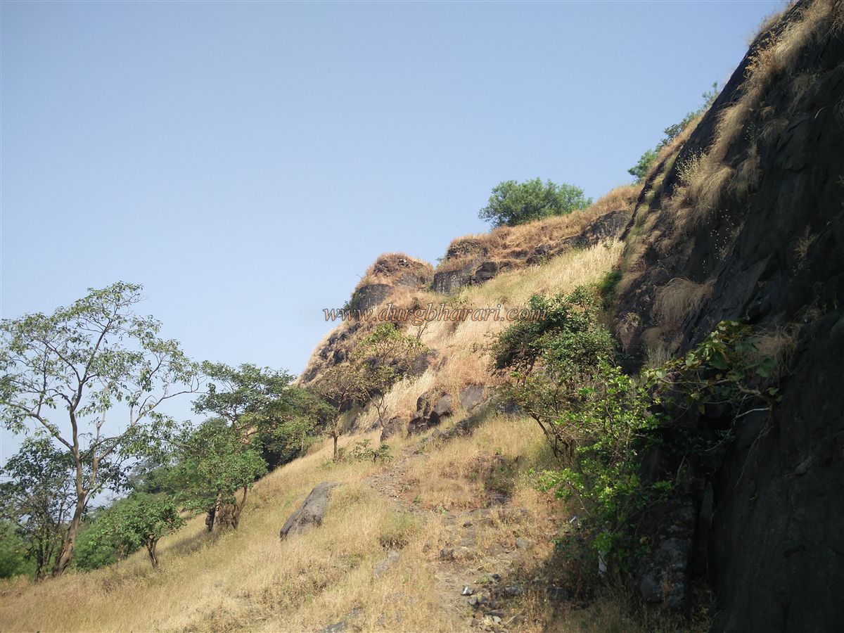
From Vaghote, crossing the Manor–Wada road towards the fort, on the left side of the trail, there is a rock-cut water cistern. To the right of this cistern, a path crosses the fields to a small hillock. After crossing this hillock, you reach a water dam, and the fort trail starts from the dam wall. Since there is no water on the way up and it takes about two hours to reach the top, it is best to fill your water bottles here. Several trails branch off inside, and after the monsoon, the grass makes them less visible, so hiring a local guide is advisable. The trail is shaded with trees, protecting you from the sun, but the steep climbs can be tiring.
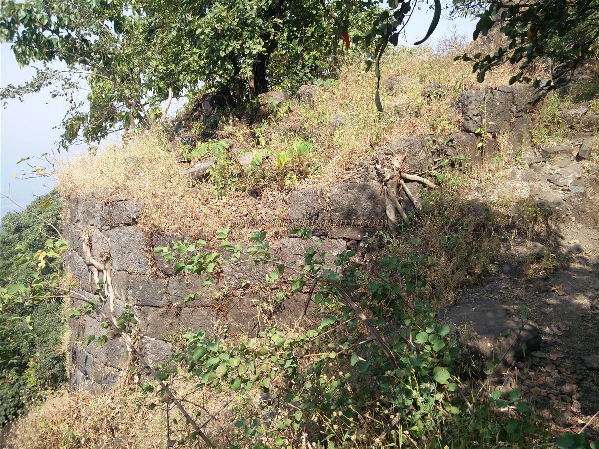
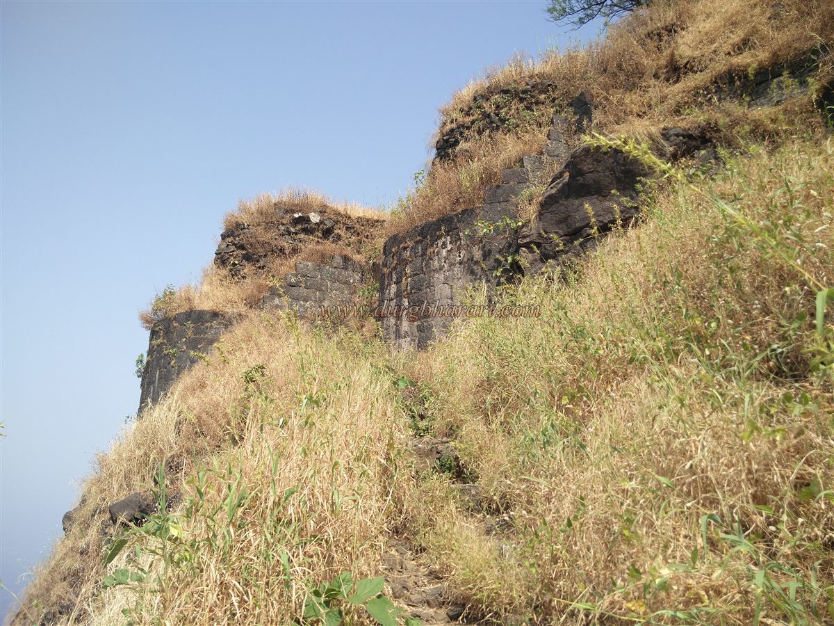
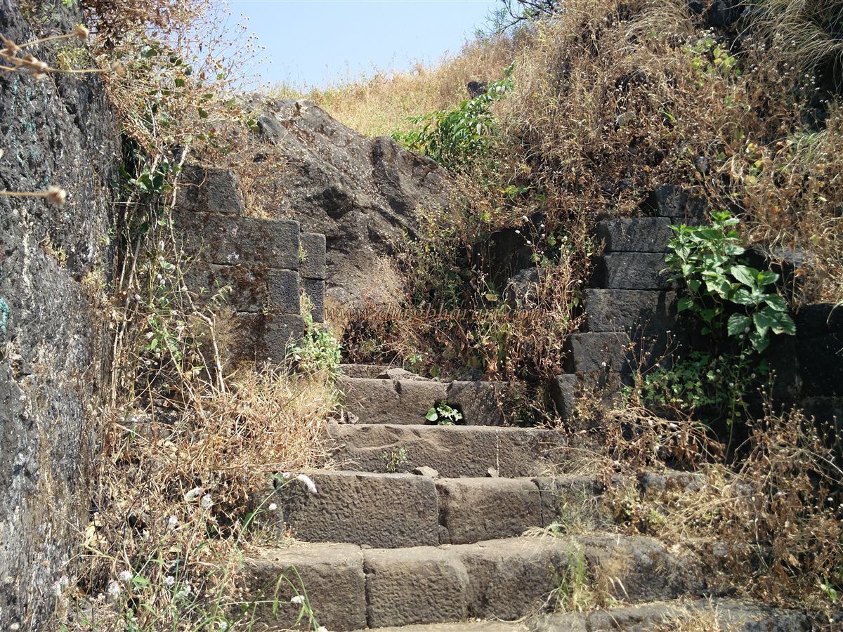
The path leads to a pass below a mountain spur, where the trail from Nane also meets. From here, climbing further along the ridge, you come across some ruined steps. On the left, hidden in the bushes, are remains of a bastion and broken fort walls — possibly the first entrance of the fort. Passing through these ruins and climbing a bit more, you reach an open plateau and enter the fort through an east-facing broken gateway. Below the plateau, you can see a bastion and well-built fort walls to the left, which might have been the second gate. It takes about one and a half hours from the base to reach this plateau.
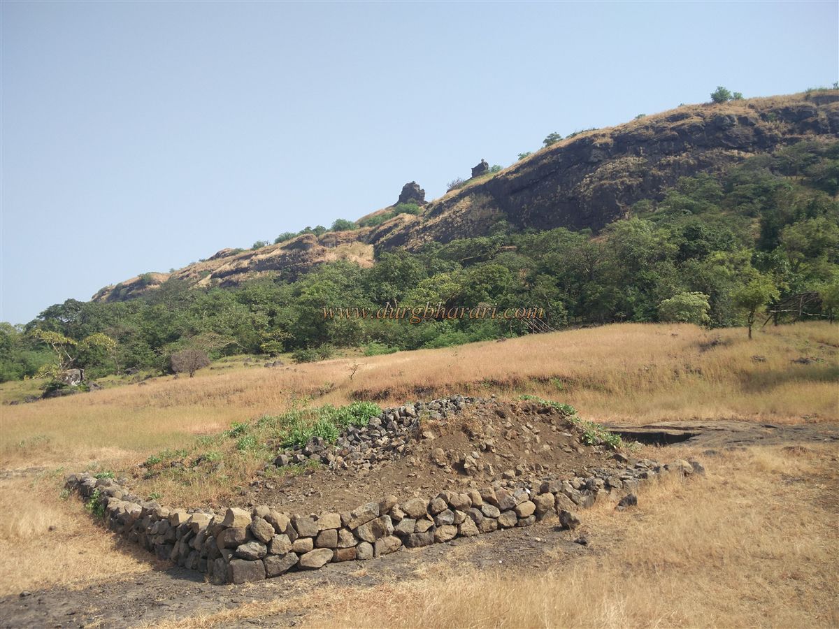
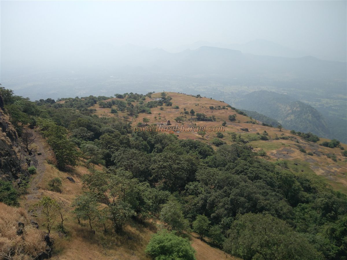
Kohoj Fort stands 1,770 feet above sea level and is divided into two parts — the machi (lower fortification) and the balekilla (citadel). The machi is a spacious plateau, and the entire fort complex covers about 60 acres, stretching north to south. At the entrance on the machi, to the left, are remains of a mansion with four bastions in its surrounding wall and three ruined structures inside. From here, the fortification on the tip of the citadel is visible.
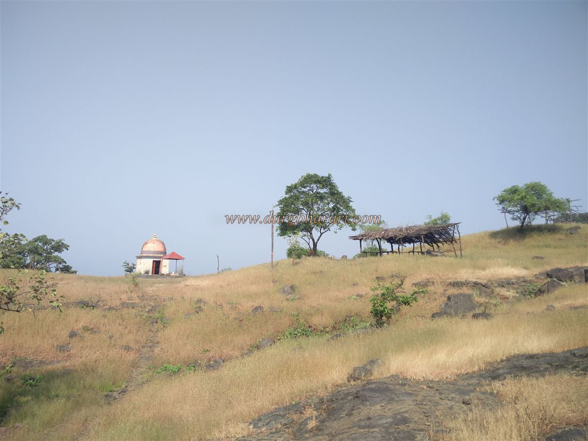
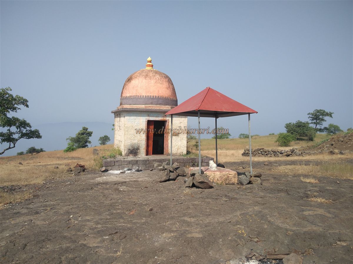
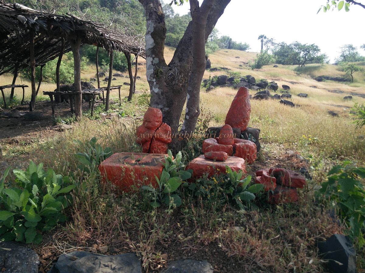
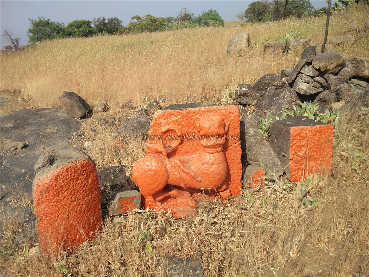
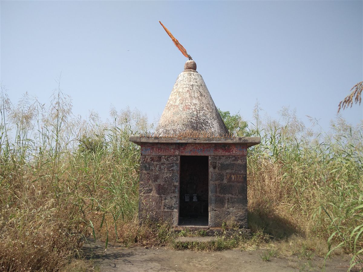
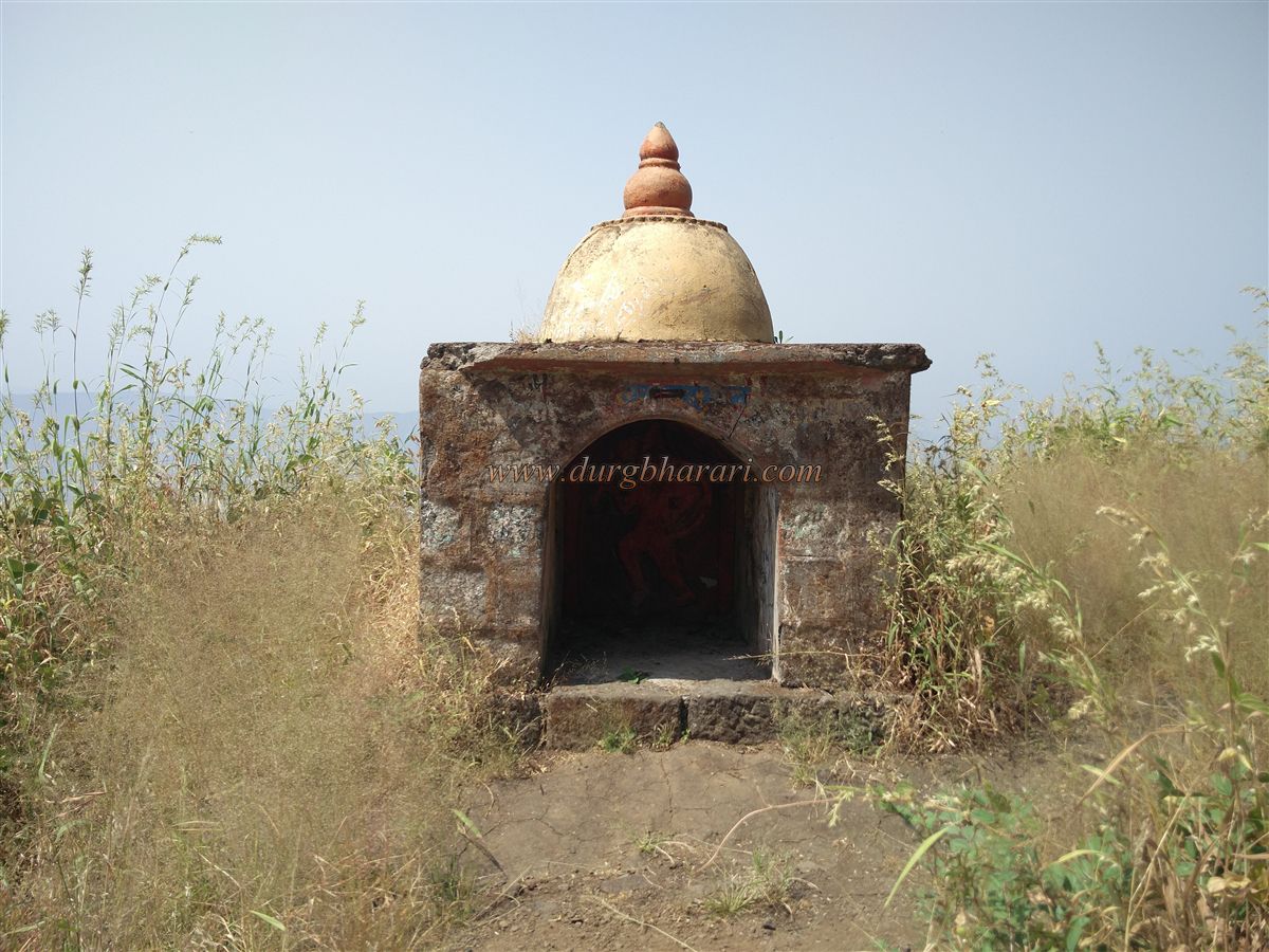
Going straight along the path leads to a small newly built Shiva temple, known as Kusumeshwar. On the rear wall of the temple, a stone idol of Goddess Kohojai is installed. In front of the temple, under a tree, are broken idols smeared with vermillion and a stone memorial with footprints carved into it. On the right of the temple, two large rock-cut water tanks can be seen, though the water is not drinkable. Nearby are scattered ruins of structures. A little behind the temple is a vermillion-smeared vyal (mythical beast) carving.
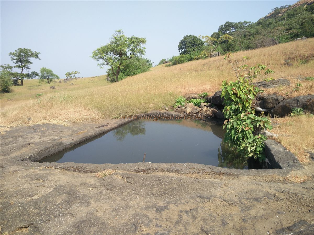
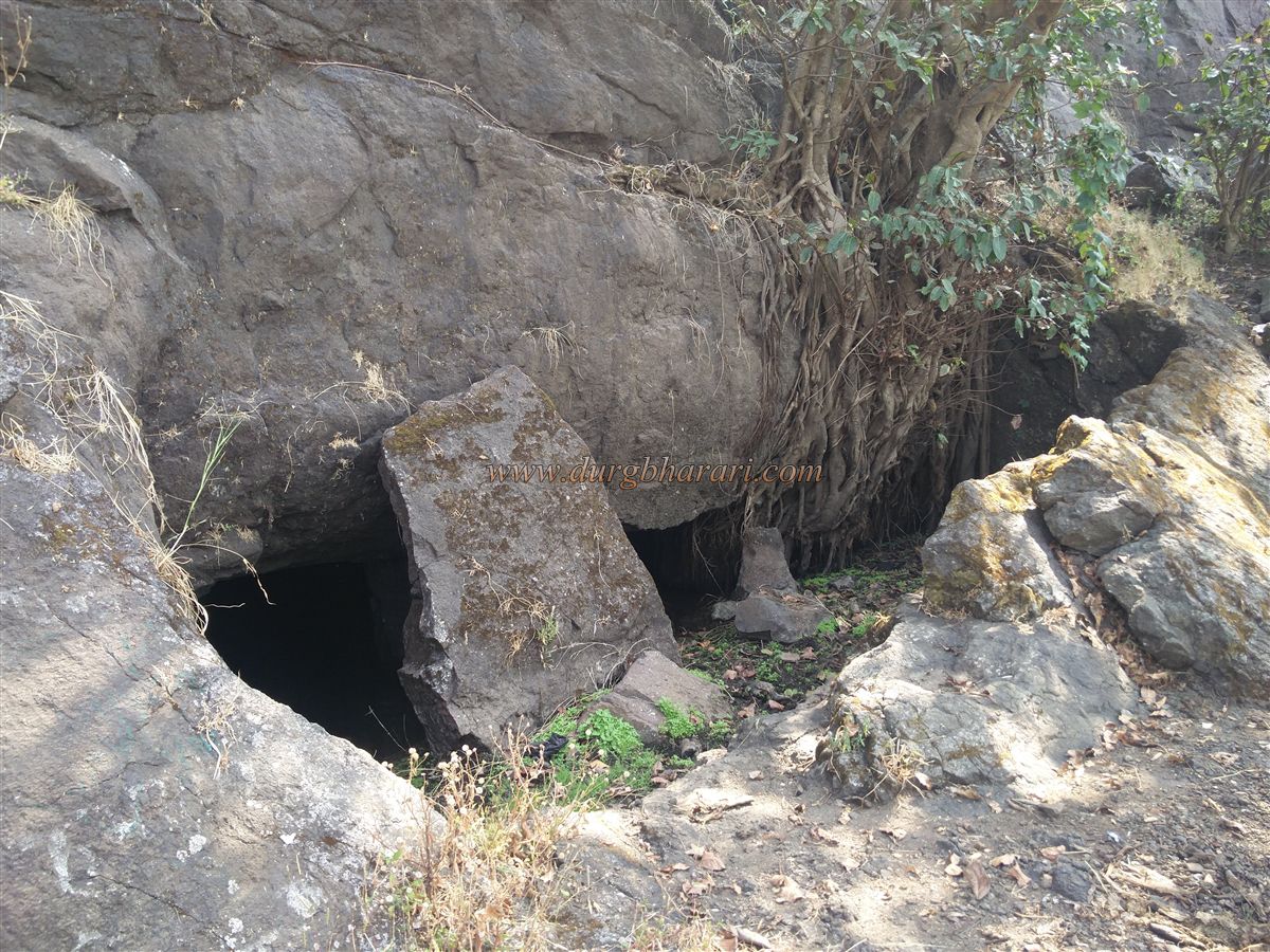
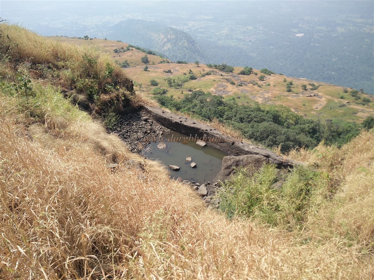
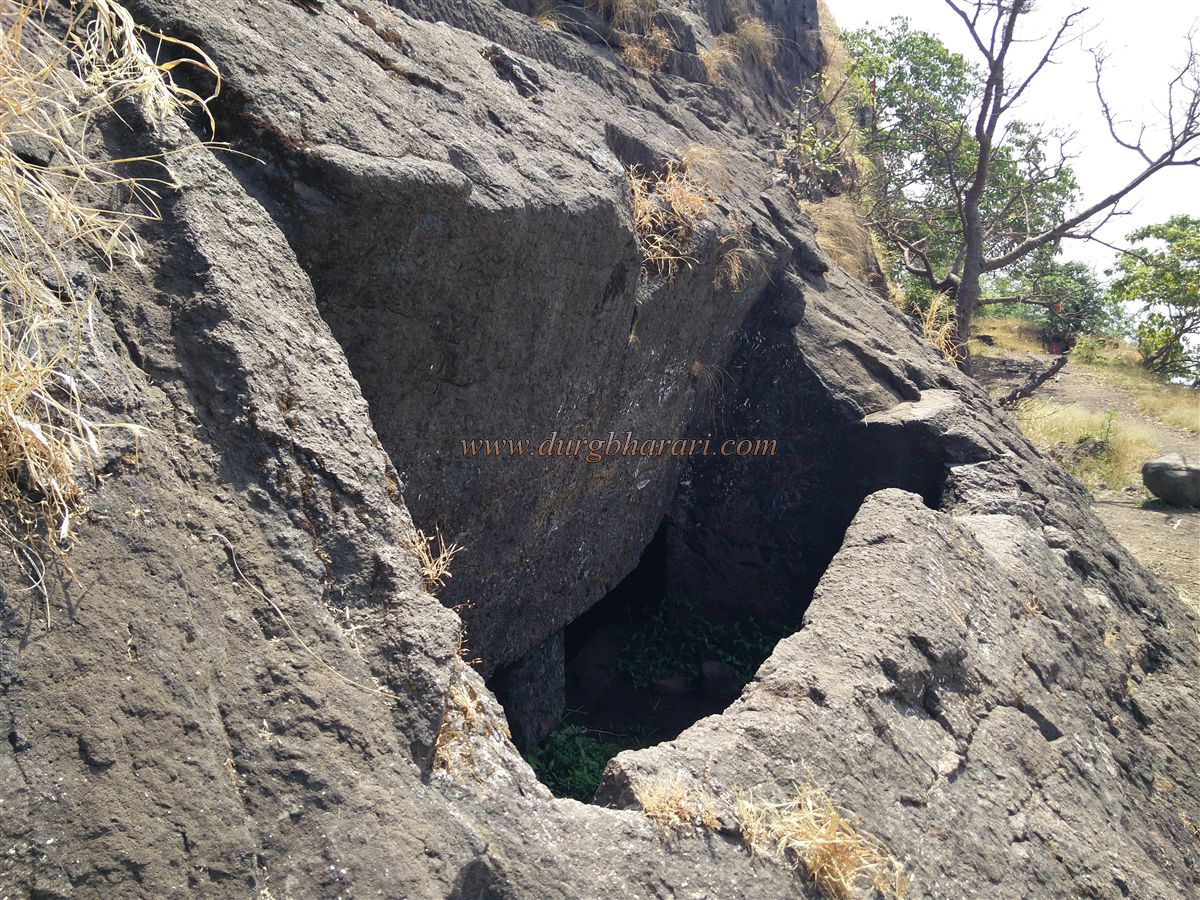
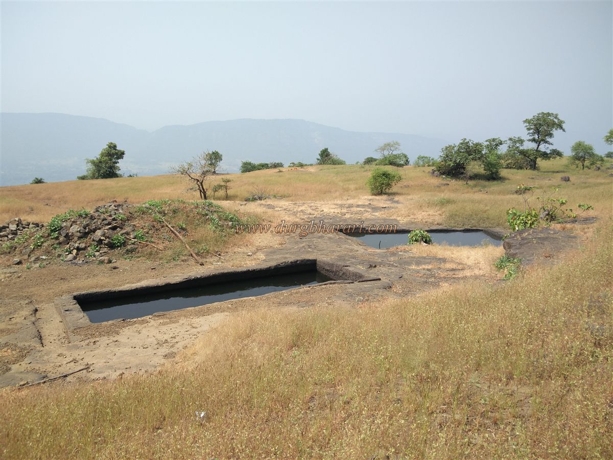
Taking the path from the temple to the tip of the machi leads to seven rock-cut cisterns, of which one contains potable water. Since there are no proper shelters on the fort, this spot can serve as a camping area. The abundance of ruins suggests the area was once heavily inhabited.
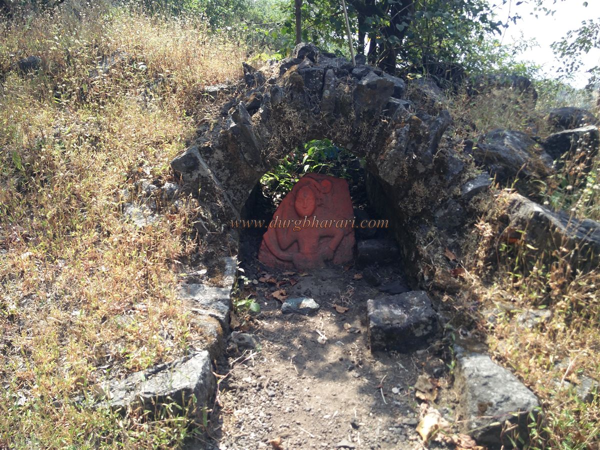
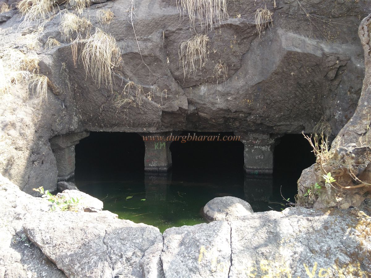
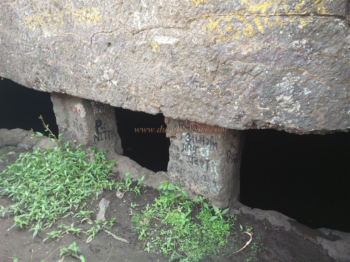
From the temple, the path to the right leads up to the balekilla. The walls, bastions, and the gateway between two bastions can be seen clearly. Entering past the lower bastion, you find the first north-facing gate of the citadel, now in ruins. On top of the bastion is a small shrine housing a broken idol of Hanuman. The lower part of the citadel is enclosed by walls on the left, and to the right are three ancient rock-cut cisterns, indicating the fort’s antiquity. Two cisterns are in poor condition, but the third holds cold, tasty water.
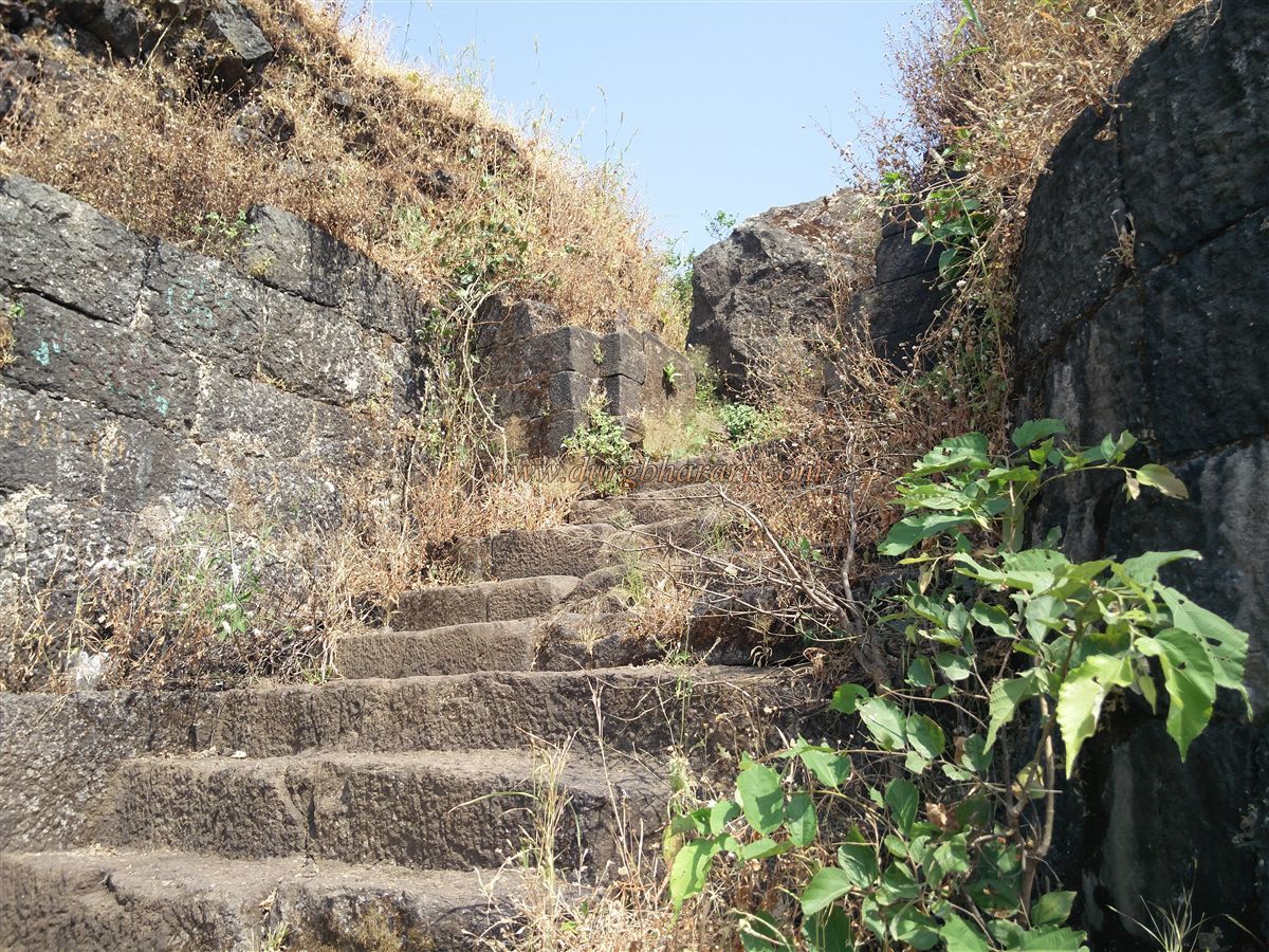
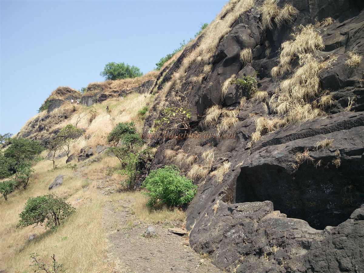
Climbing further via rock-cut steps brings you to the upper west-facing gate of the citadel, built between two bastions. The steps and arch here still remain, though a large stone has collapsed into the guardroom beside it. From the bastion near the gate, a huge rock-cut tank is visible on the hillside. Steps carved into the rock lead to it, but it is currently dry.
On the way to the top of the citadel, there is a small dome-shaped shrine with an idol of Maruti. Two pinnacles stand in the center of the citadel, with paths leading left and right. Taking the left path leads to the northern tip of the fort, offering views of Gambhirgad and the Surya river valley to the north, Asherigad to the northwest, Kaldurg to the west, Tandulwadi to the southwest, Takmak to the south, and Mahuli to the southeast.
From here, passing under the pinnacles towards the southern tip, you again see the large rock-cut tank near the gate. At the southern end is the naturally formed human-shaped pinnacle — its rounded rock head gives it the appearance of a sculpture. A small newly built temple with an idol of Lord Krishna stands nearby. Just ahead, large rock slabs appear stacked upon each other. The adjacent pinnacle, clinging to the fort, is known as Nagnath Ling, but reaching it requires rock climbing skills.
The entire fort, including the machi and citadel, can be explored in about one and a half hours. The descent begins from the left path down from the citadel.
Although little historical record exists, the rock-cut cisterns indicate the fort’s ancient origins. In the early 16th century, the Portuguese took control of the region from the Sultan of Gujarat and repaired the fort. Around 1657, Shivaji Maharaj captured Kohoj and incorporated it into Swarajya. Under the Treaty of Purandar, Kohoj was one of the forts handed to the Mughals, but on June 11, 1670, the Marathas regained it. In 1688, during Sambhaji Maharaj’s reign, Mughal officer and Jawhar’s landlord Vikram Patangrao seized the fort. In 1737, during the Maratha campaign against the Portuguese in Bassein, the region came under Maratha control. Finally, in 1818, like many other forts, Kohoj fell into British hands.
© Suresh Nimbalkar
GALLERY