KENJALGAD
TYPE : HILL FORT
DISTRICT : SATARA
HEIGHT : 4170 FEET
GRADE : MEDIUM
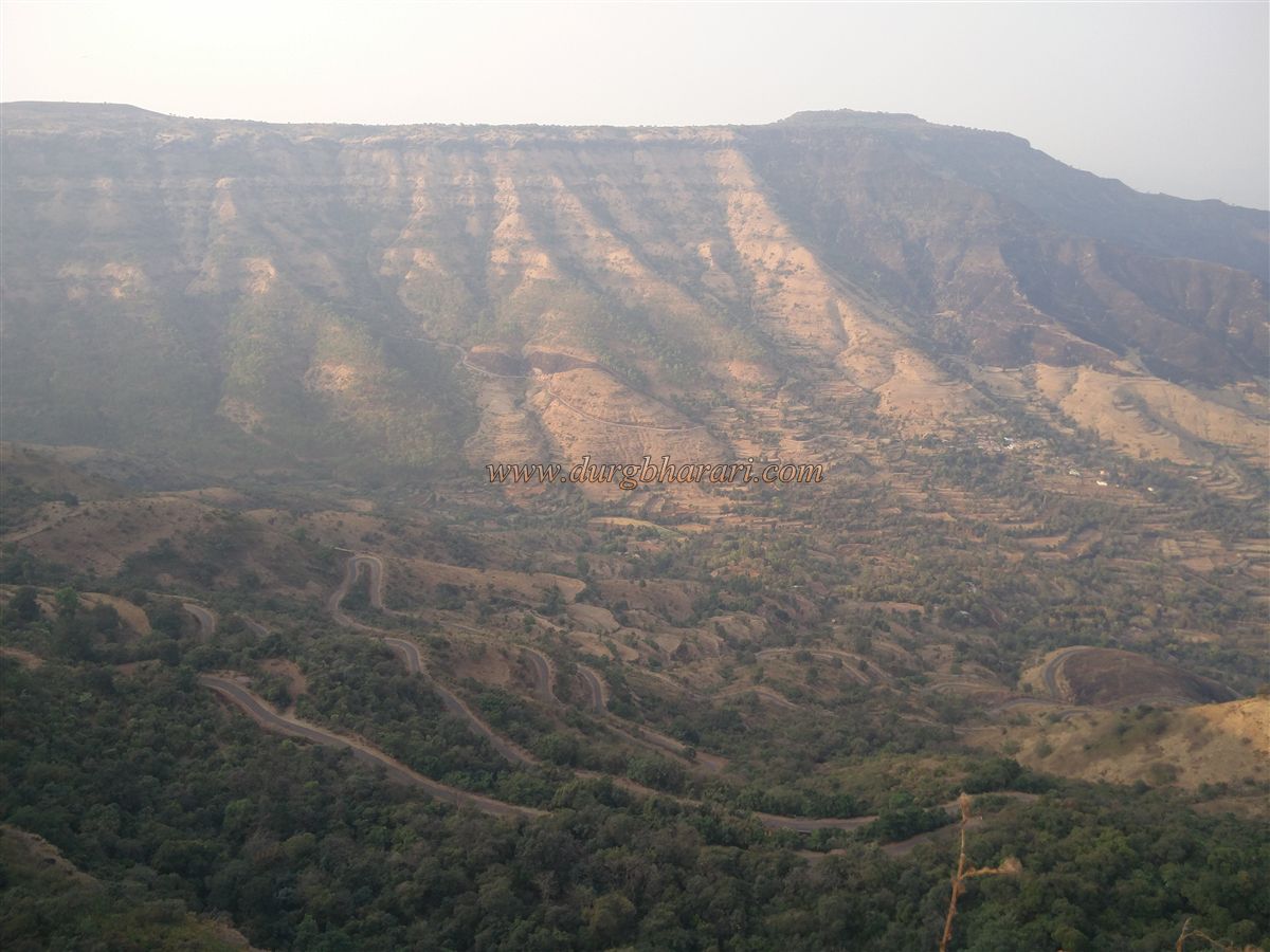
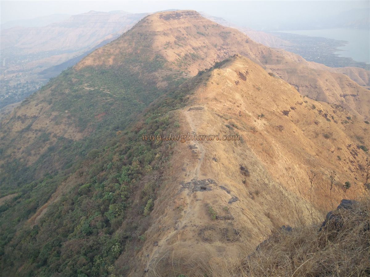
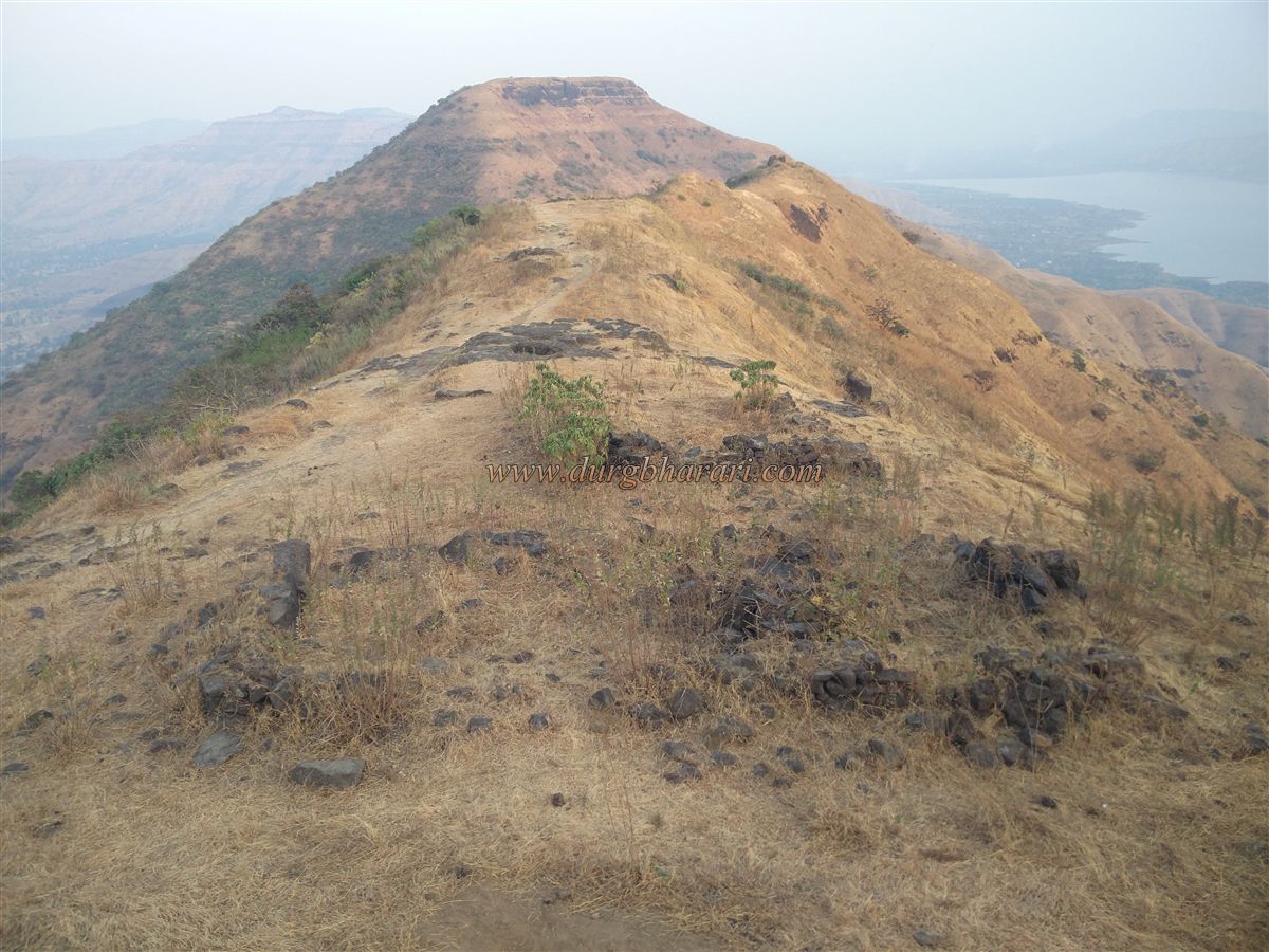
While climbing the Rayareshwar Plateau, the cap-shaped pinnacle on the top of Mandhardev in the Shambhu Mahadev mountain range in the east attracts our attention. This pinnacle on Mandhardev is the fort Kenjalgad aka Mohangad. Rayareshwar and Kenjalgad, situated on the same mountain range, are separated by a single gorge. The Rayareshwar Plateau falls in Pune district and Kenjalgad in Satara district. Geographically, this fort is located in the Wai province of Satara district and is a part of Hirdas Maval. To reach the fort from Pune, there is a path from Pune-Bhor-Ambavade-Vadtumbi-Korle-Oholi-Kenjalmachi. If you come from Bhor, first take the turn of Kenjalgad and then the road leading to Rayareshwar from the gorge. As there is a paved road to the Oholi settlement on the Machi of the fort, one can go directly to the Machi of the fort by private vehicle.
...
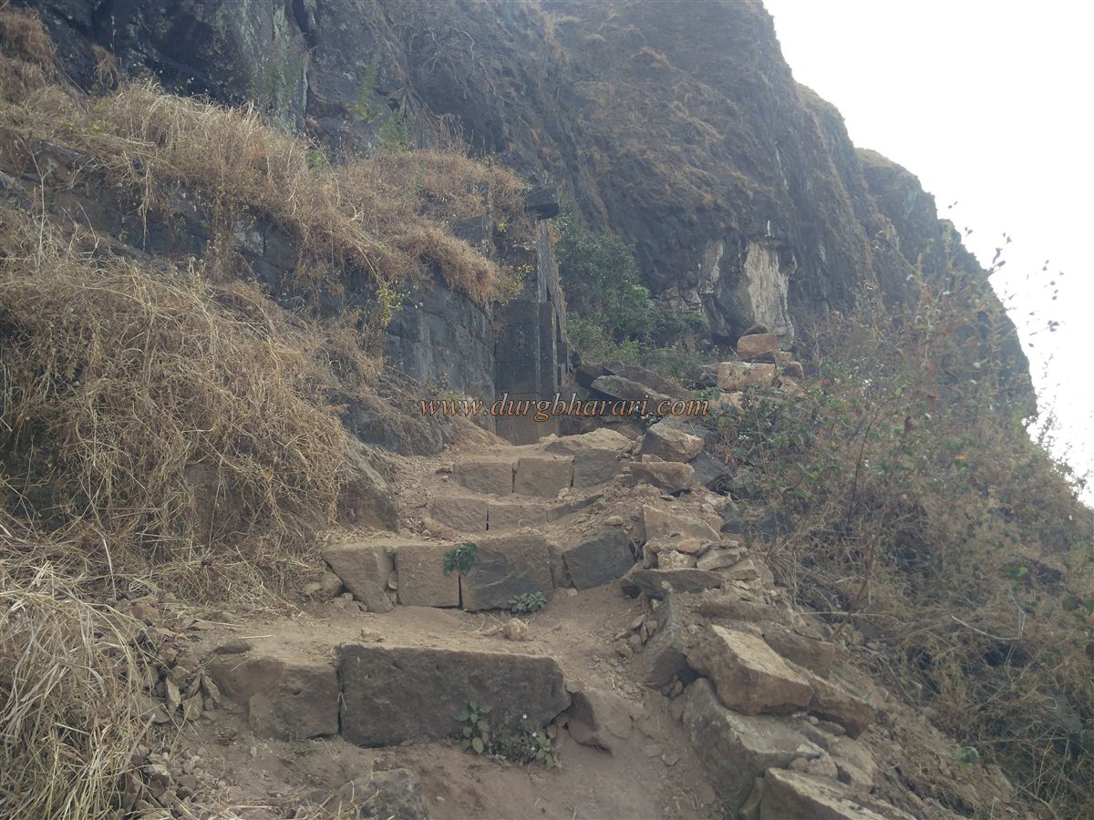
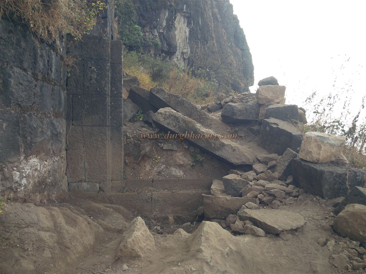
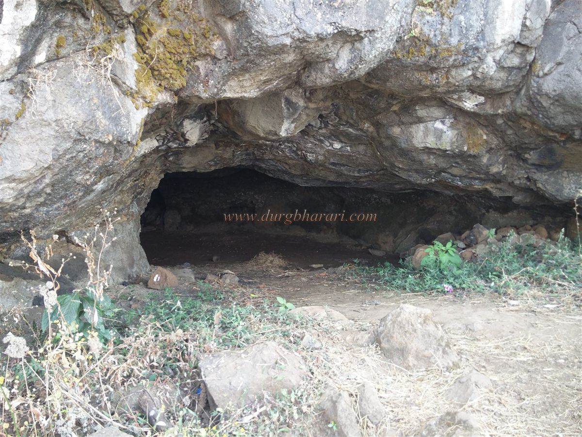
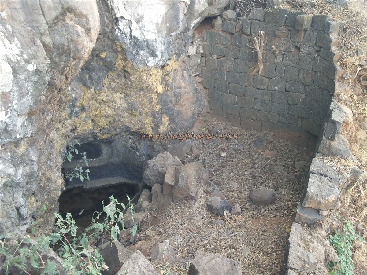
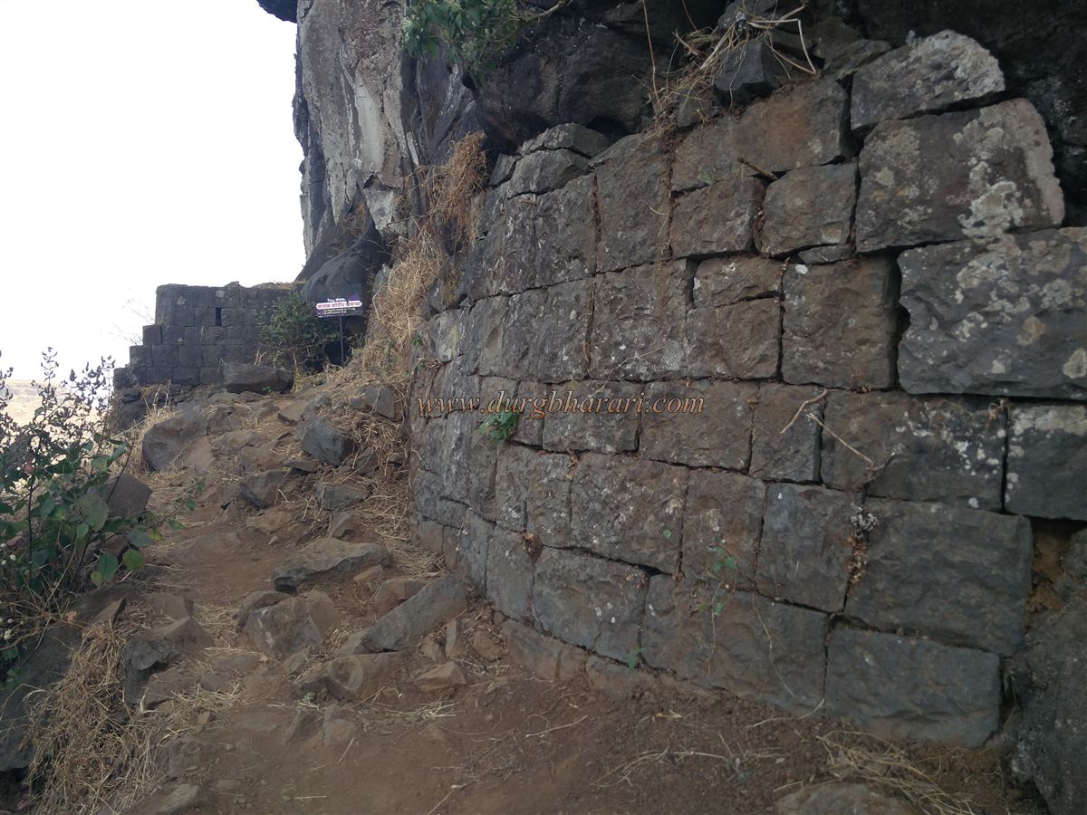
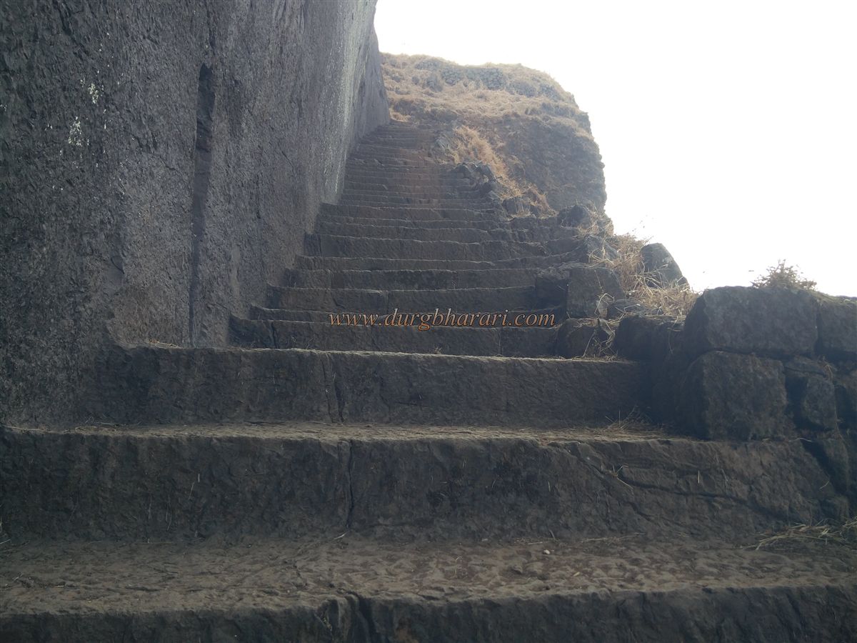
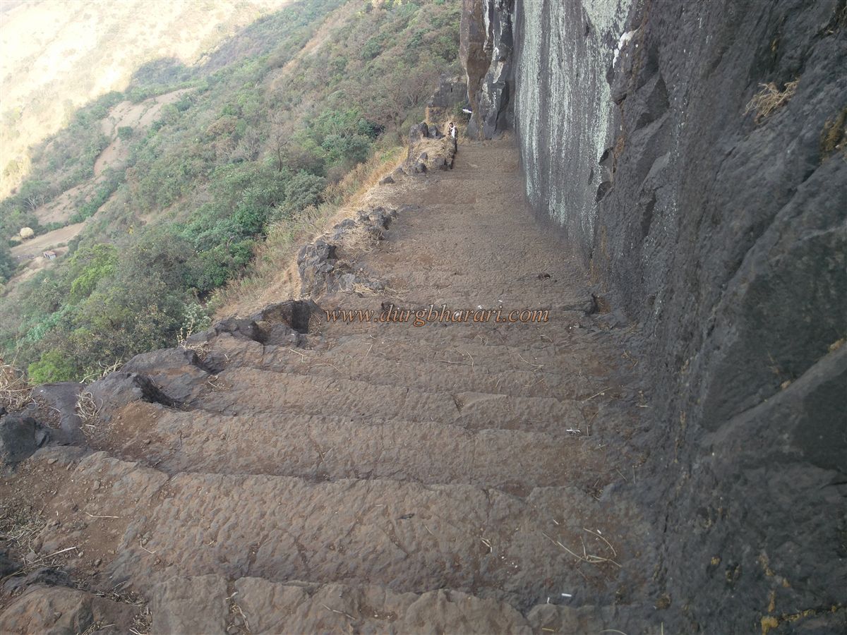
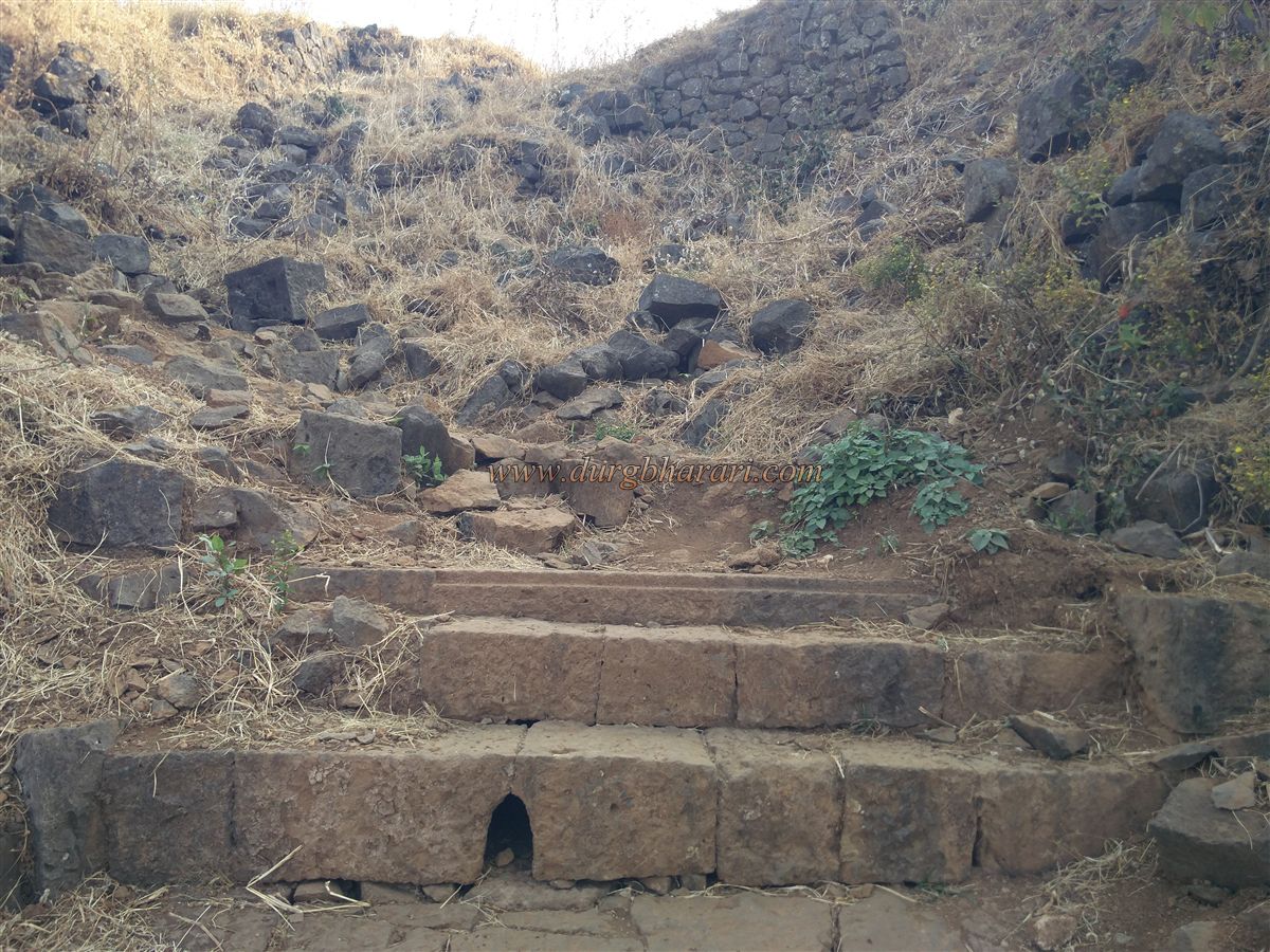
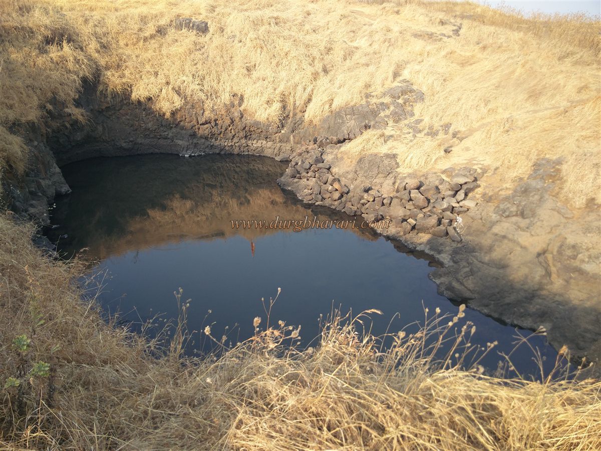
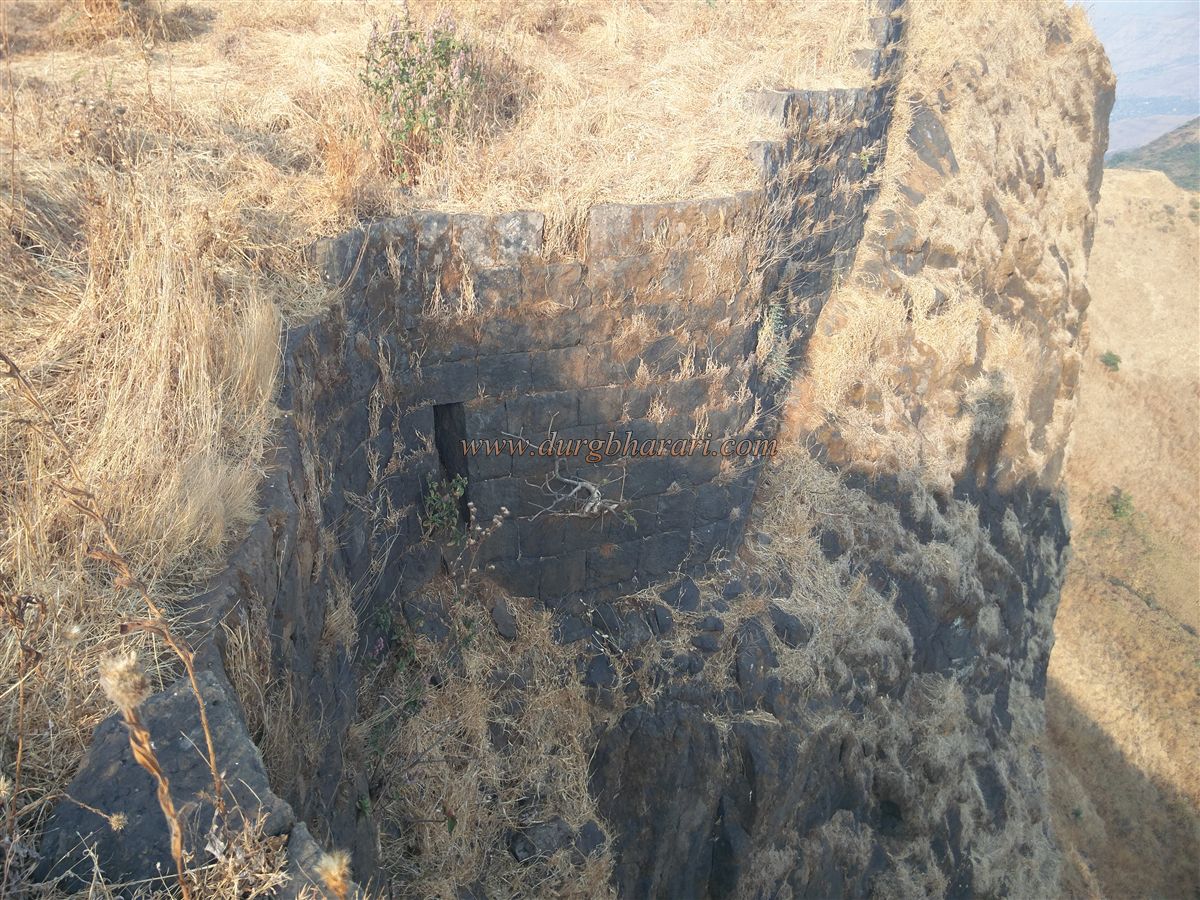
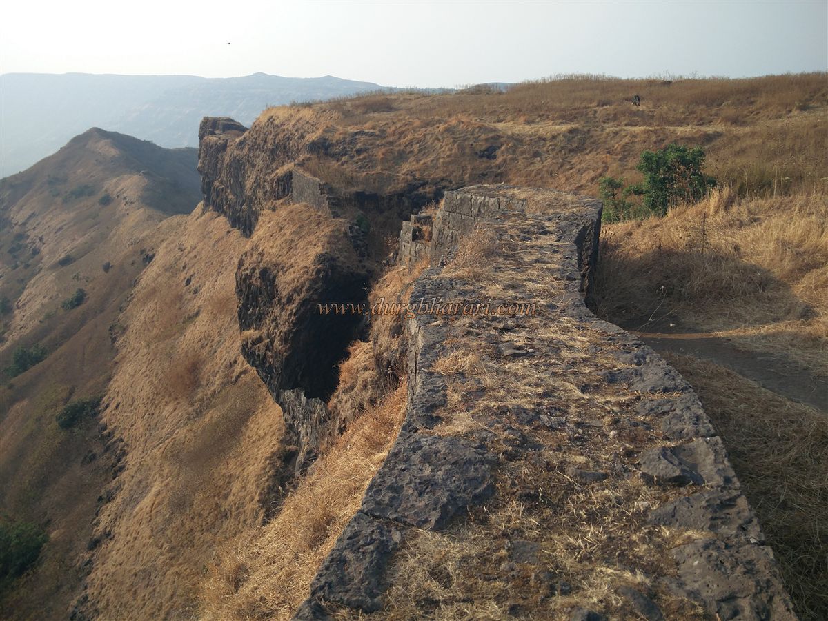
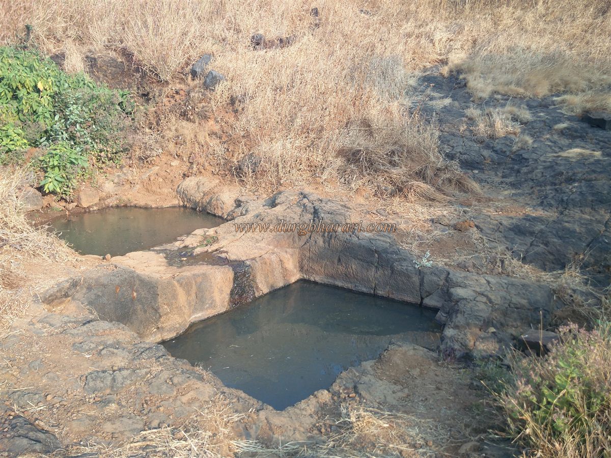
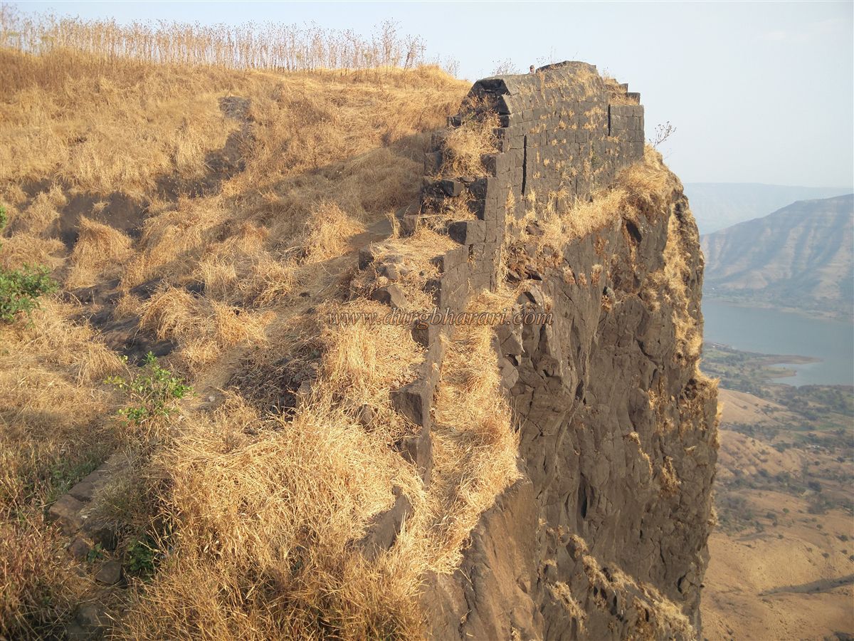
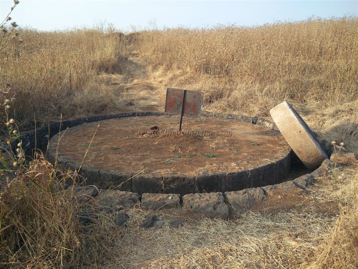
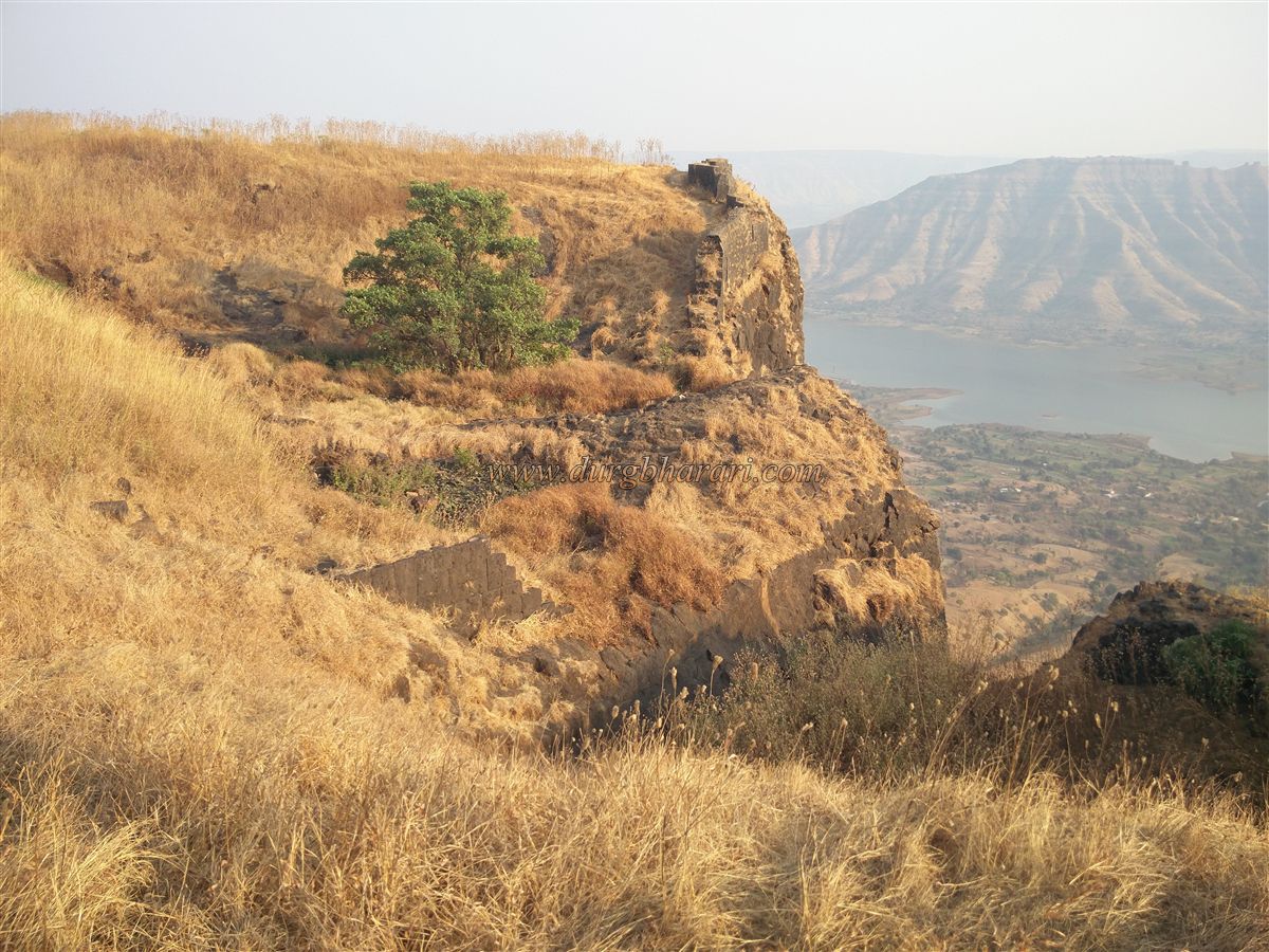
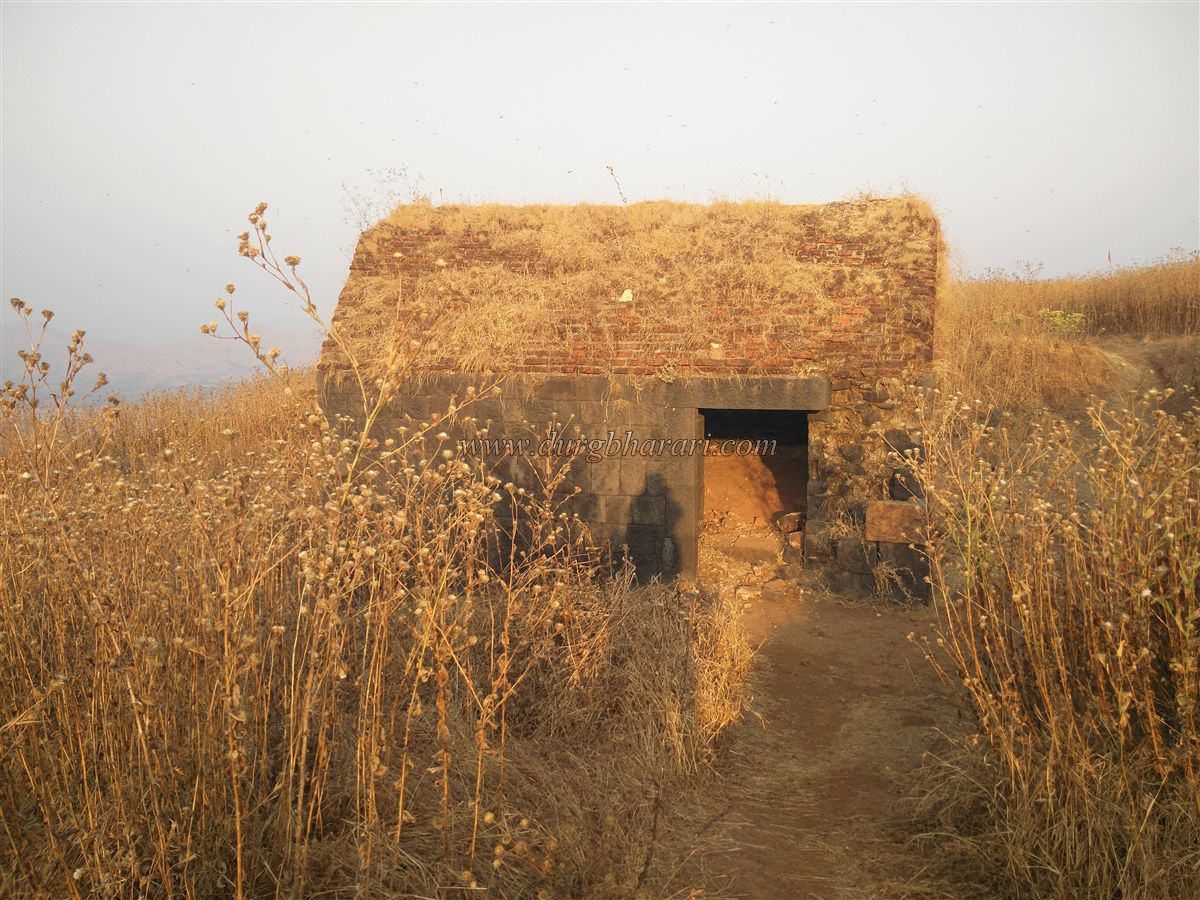
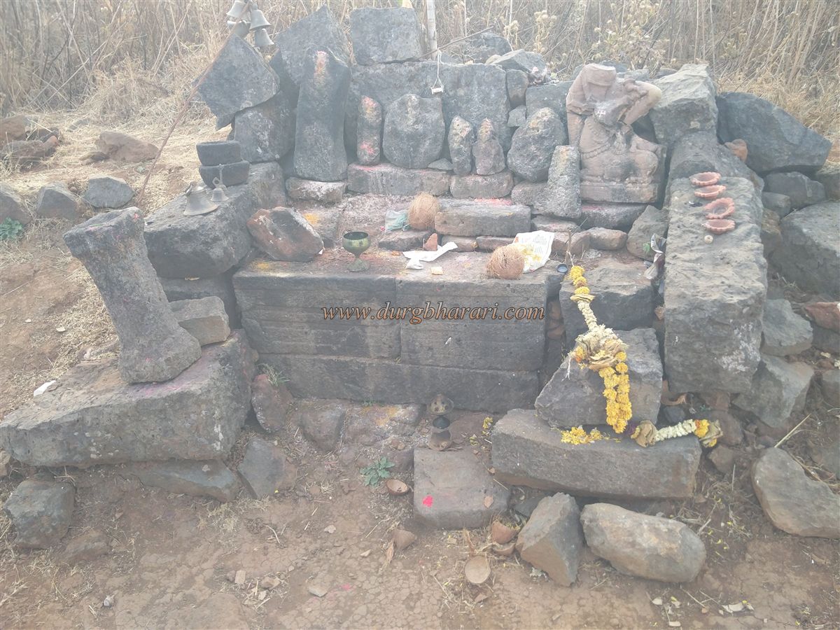
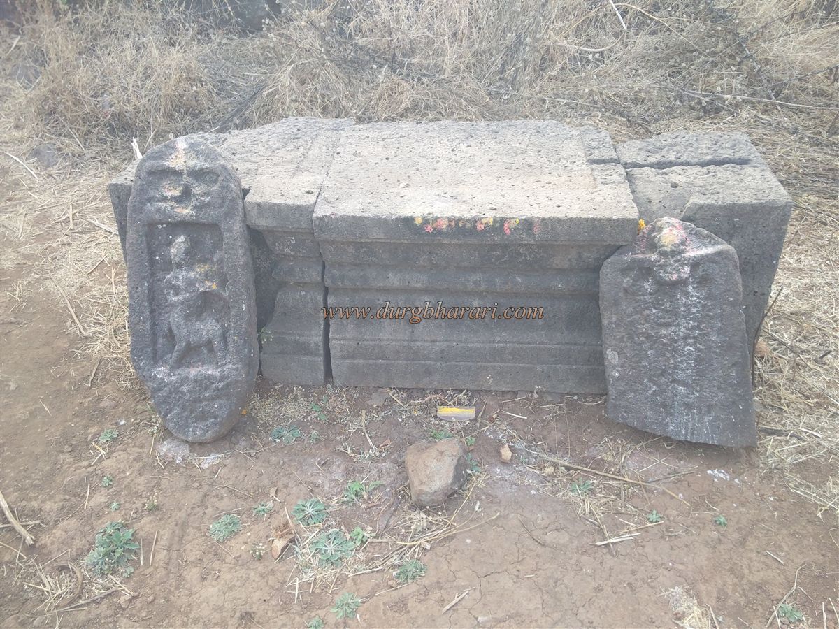
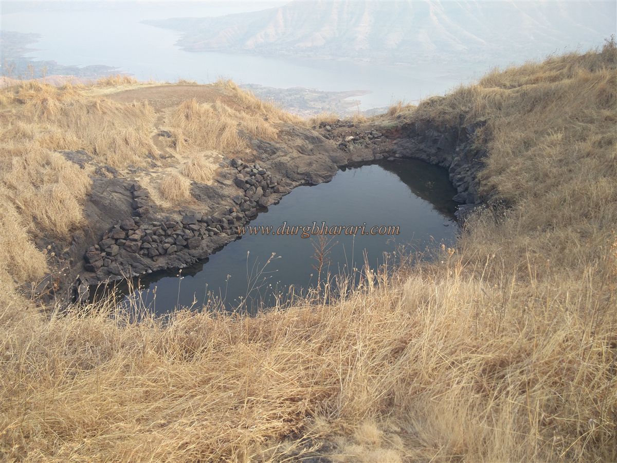
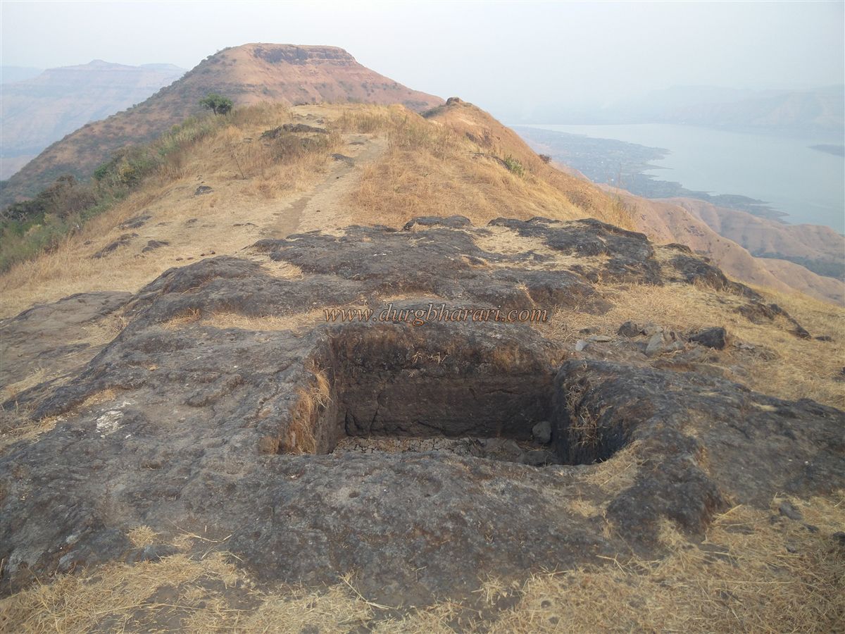
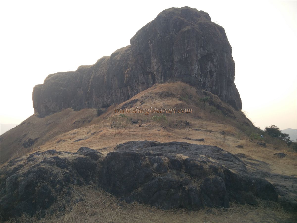
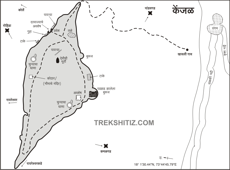
Oholi settlement is situated on the Machi on the east side of the fort and the head of the fort is spread east-west on the rear side of the settlement. There are 10-12 houses and schools in the Oholi area on Machi and the Kenjalai temple here can accommodate 8-10 people. There is a steep path to reach the fort through the bushes at the back of the settlement and after half a climb the path turns left. It is very important to remember this path and if you go straight, you have to climb the path with steep climb and erosion and you can see the remains on the machi on the east side of the fort. After about 10 minutes of climbing through the forest, the path turns left and comes to a steep slope on the east side of the fort. Upon entering Machi, you can see a quadrangle structure in front. On the way to the fort, after crossing this structure, one can see a cistern carved in the rock and quadrangle structures of three buildings. There should be a fort checkpost as well as few soldiers on this machi as a document mentions that there is an army camp on the east machi of the fort. Leaving this hill on the left side of the fort, we reach the ruined gate facing east at the bottom of the fort. The upper arch of the door has been demolished and half of the frame remains. There is a porch on the inside the door and the part on the ridge has collapsed with the ramparts. In some places, it is mentioned as Ghalai or Ghali Darwaza on the fort but it is not possible to say for sure whether it should be the same. Upon entering the fort, one path is seen going straight to the ridge, while the other path is seen turning left and going to the top of the fort. The entire area is enclosed by a rampart, and a straight path leads to a large cave carved deep out of the rock. This cave is filled with a large amount of soil. There is a small door on the inside of the cave and there is a room on either side of this door. As this door is filled with soil, you have to crawl your way in. After visiting the cave, there are water cisterns carved in the rock and a high rampart wall has been built outside this cistern. When you see the cistern, turn back and head towards the top of the fort. The way to the top of the fort is 50-55 high steps carved in the rock on the vertical ridge and these steps are the special attraction of the fort. There is a 200 feet high cliff in a straight line and a path of steps has been carved in this cliff. The door at the end of the stairs, the bastion, and the ramparts are completely demolished and only the door threshold and the door frame can be seen. Climb these steps to enter the fort. The top of the fort is 4185 feet above sea level and is spread over 9 acres from east to west. After entering the fort, you should start your fort round from the ramparts on the left side. On the way to the east end of the fort, you can see a long quadrangle structure and two dry cisterns carved in the rock. This cistern should be carved to remove stones for embankment and not to store water. From here, on the left side of the bank, there is a large pond carved out of the rock on the hillside adjacent to the bank. The water of this pond is potable. Next to the pond is another dry pond at some distance. The ramparts at the front of the lake are still very much intact and as the soil has accumulated near the ramparts, it is not easily visible. The ramparts have holes for sewage and a dilapidated latrine. From here, we reach the fort on the west side of the fort. These ramparts have vents for firing cannons as well as barrages for firing guns. There are three cisterns carved in the rock on the next slope of the ramparts, one of which is extinguished with soil, while the other two cisterns have water but it is not drinkable. There should be another large pond on this slope as the ramparts on this slope have been destroyed on a large scale by the water of the pond. After climbing some of the steps on the right side of the road, you come to a hill in the middle of the fort. There is a lime mortar at this place and in the next part of it, there are a brick structure and a fallen structure that was plastered with lime. Some mud pipes can be seen in the remains of this building. This building should have a water supply facility for the hamamkhana(Bathroom) as well as for the fort. The next part of the building has the largest lake on the fort and is now completely dry. From here we turn back and through the edge of the ramparts, we come to the western bastion of the fort. In this part of the bastion, some fallen structures can be seen. From this bastion, the entire path coming from Rayareshwar as well as the Rayareshwar plateau can be seen. Your return journey begins from the other side of the ramparts. On this road, you can see the ammunition depot of the fort. The walls of this depot are made of wrought stone and the roof is round but made of bricks so that the water does not get collected. There is a path at the bottom of the ground for laying a wooden pillar on the ground to prevent the gunpowder from getting cold due to the moisture of the ground. From here, you can see another dry lake on the left. Next to the lake is another limestone morter. Considering the two limestone morter on the fort and the large water reserves, the fort should’ve had a large population. After seeing the limestone morter we come to the courtyard of a ruined temple. There are some wrought stones and an idol on one of the quadrangle structures with broken remains of Mahishasurmardini idol made of reddish stone on this structure. Adjacent to it there is another small quadrangle structure carved out of stone and there are two hero stones near this structure. Adjacent to the temple, there is a large quadrangle structure of a building hidden in the grass and most of the remains of this building still exist. This building should be the fort’s office or the mansion of the fort keeper. After seeing the mansion, you come to the place where you enter the top of the fort and your journey is completed. From the top of the fort, Khavli village and Valaki river can be seen below, while Kamalgad, Panchgani, and Mahabaleshwar plateaus can be seen to the south. One hour is enough to explore the entire fort. Known by various names like Mohangad, Gherkhelaj, Kenjalgad, or Khelja, this fort is believed to have been built by Bhoj Raja in the 12th century. The carved steps of the fort and the excavated caves at the bottom give evidence of its antiquity. After that Nizamshahi, Adilshahi should have ruled over this fort but there is no mention of it. Then in 1648, Kenjalgad came under the rule of Adilshahi. After the assassination of Afzal Khan, all the forts in the Wai area except Kenjalgad were under the control of Shivaji Maharaj till 1674. When Shivaji Maharaj sent Marathi troops to capture Kenjalgad, Gangaji Vishwasrao Kirdat was the fort keeper of Kenjalgad. He was killed while resisting the Marathas and on 24th April 1674 Kenjalgad came under the control of the Marathas. Later in 1701, the fort came under the control of the Mughals but the Marathas recaptured it within a year. On March 26, 1818, General Prizler, a British officer, captured Kenjalgad. Kenjalgad is one of the few forts in Satara province which had resisted the British. From these forts, cannons were fired at the British army but today no cannon can be seen on the fort. Exactly what happened to the cannons on the fort in this area is the subject of a study. The English officer Elphinstone, while writing about the fort, says that if the fort is well fought, the enemy is impregnable.
© Suresh Nimbalkar
gallery