KAVLYA
TYPE : HILL FORT
DISTRICT : PUNE
HEIGHT : 2070 FEET
GRADE : MEDIUM
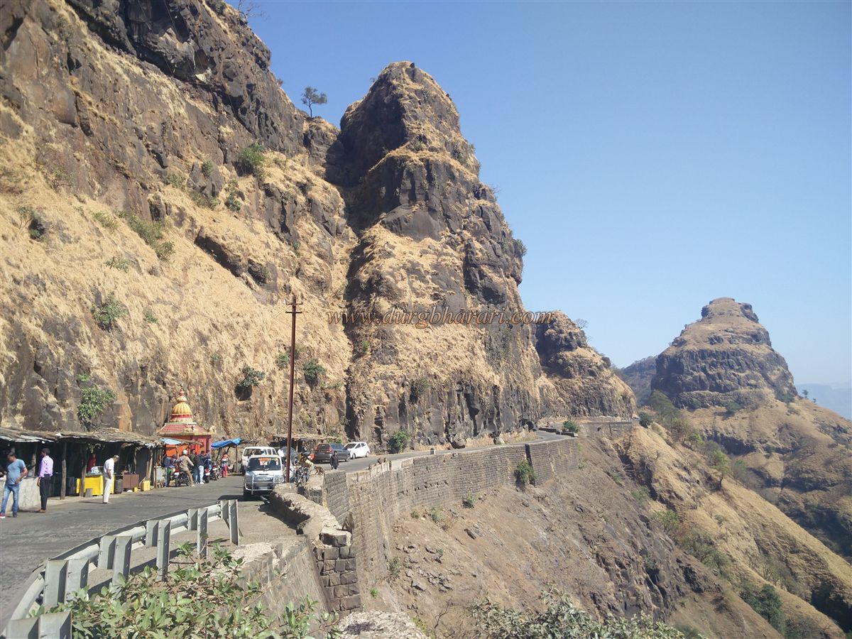
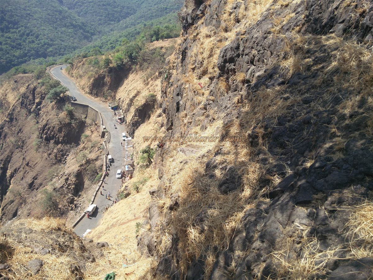
During the monsoons, Warandha Ghat is a favorite tourist destination. During the monsoons, this wharf is rushing with tourists but very few people visit Kavlya aka Kaula fort, which is the guard of Warandha Ghat. Varandha wharf routes have been a trade route since ancient times connecting Raigad in the Konkan and Pune on the Ghats. The Kavlya fort was built to protect the Warandha Ghat, which has been in use since ancient times. Due to the continuous use of the Warandha wharf route, the British converted this route into a paved road in 1857. To visit Kavlya Fort, first, you have to reach Warandha Ghat. The distance from Pune to Warandha Ghat via Bhor is 105 km but the road from Bhor to Warandha Ghat is in very bad conditions. It is convenient for Mumbaikars to go to Warandha Ghat by goa highway and this distance is 192 km.
...
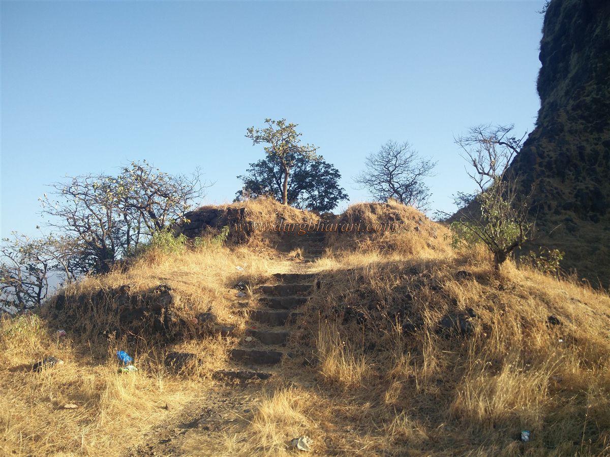
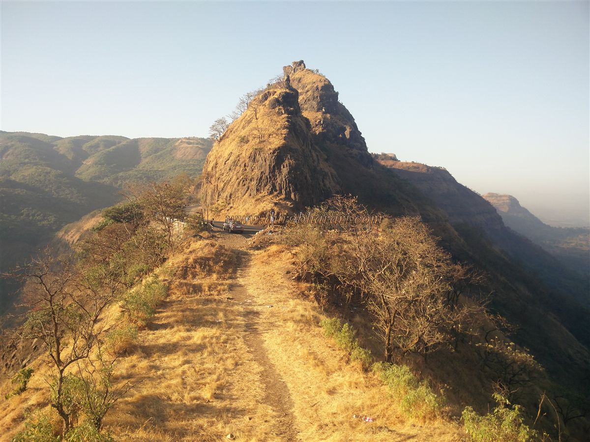
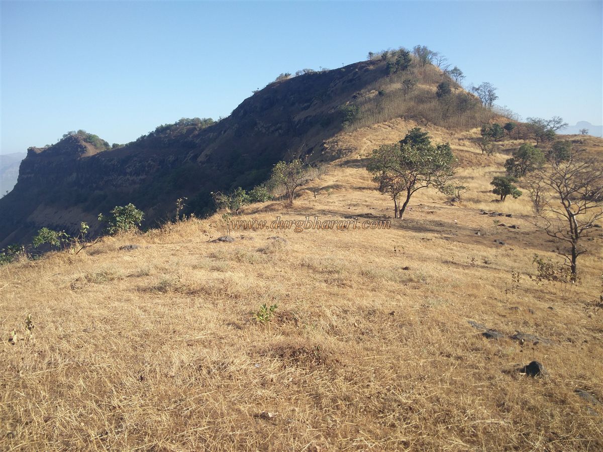
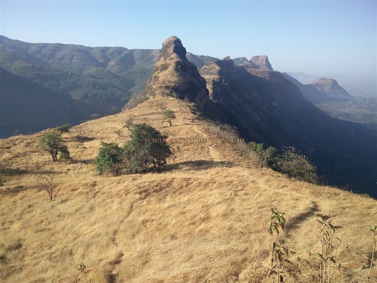
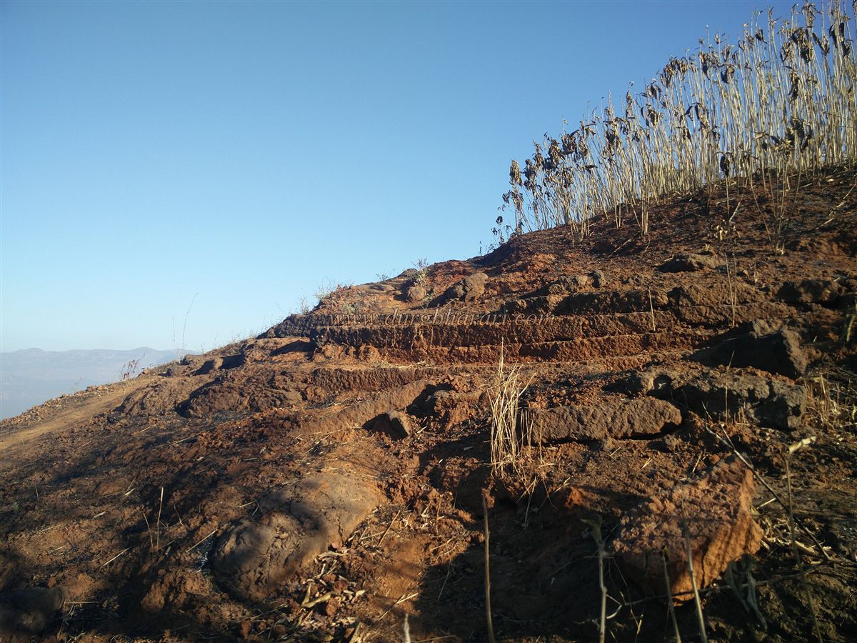
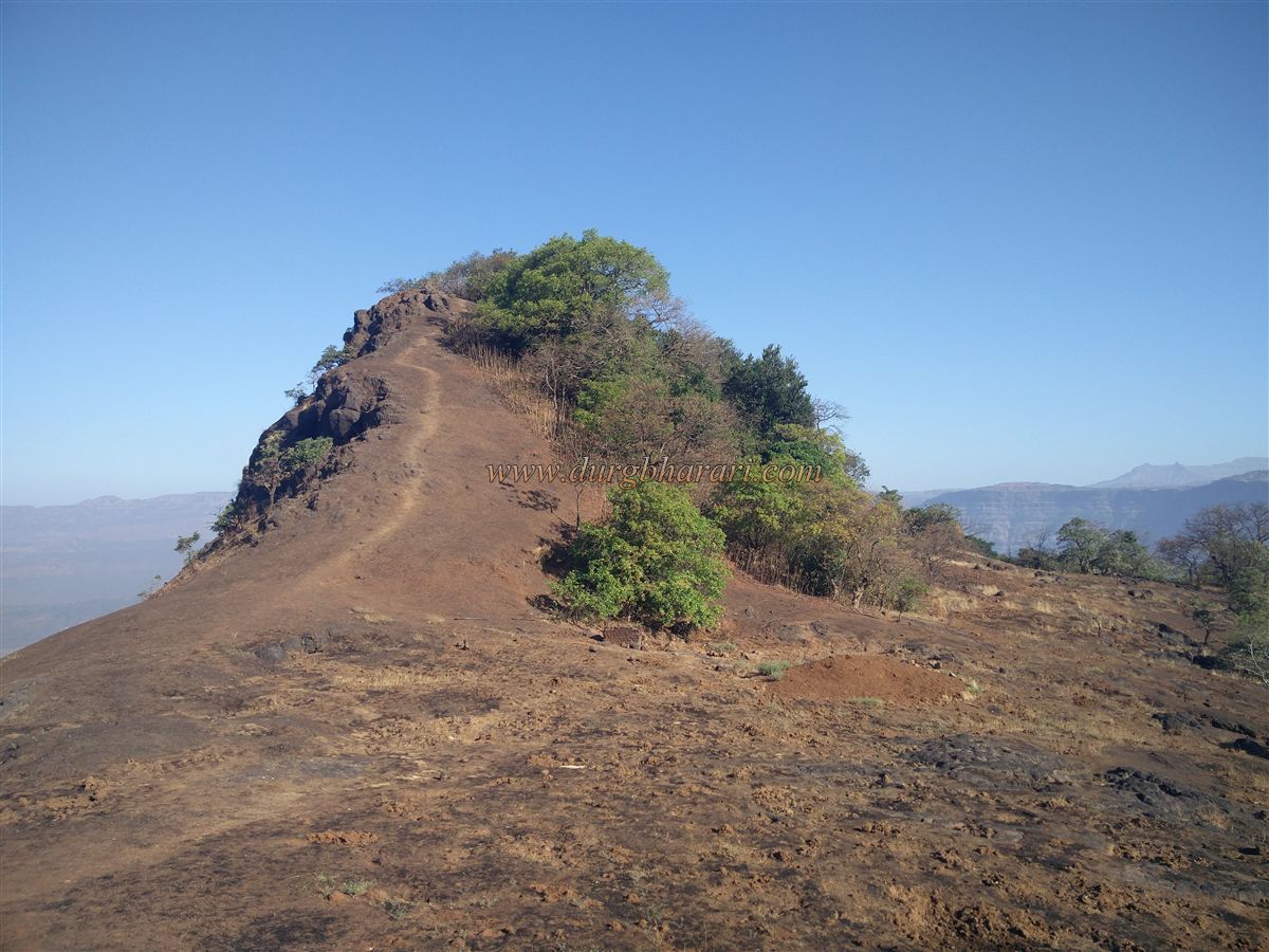
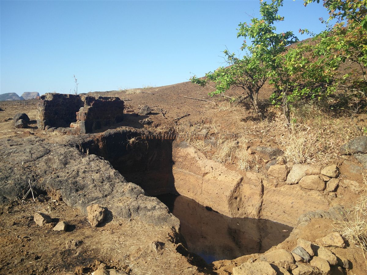
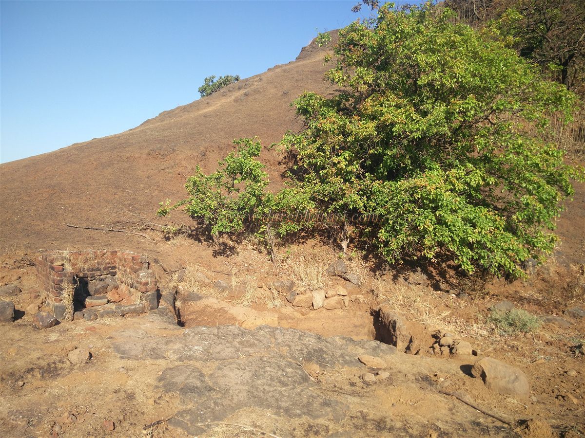
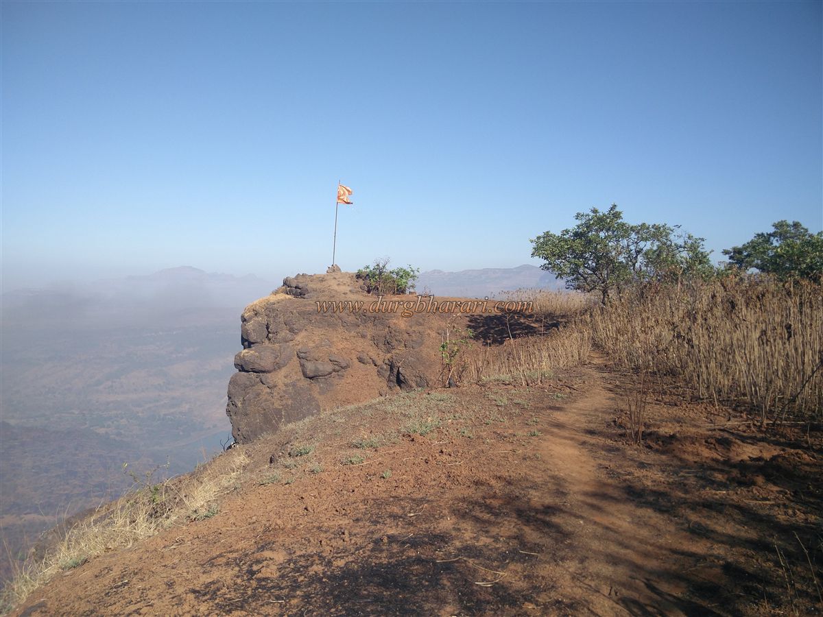
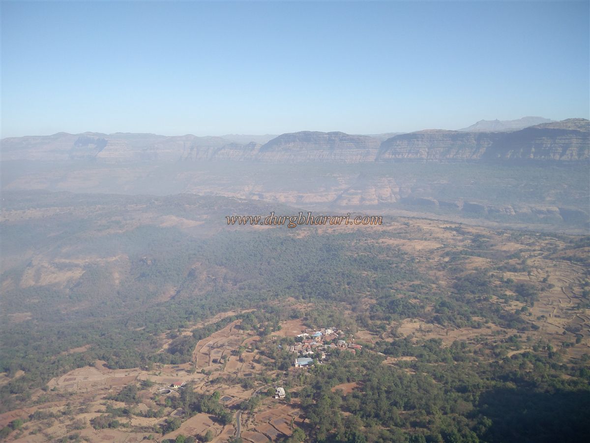
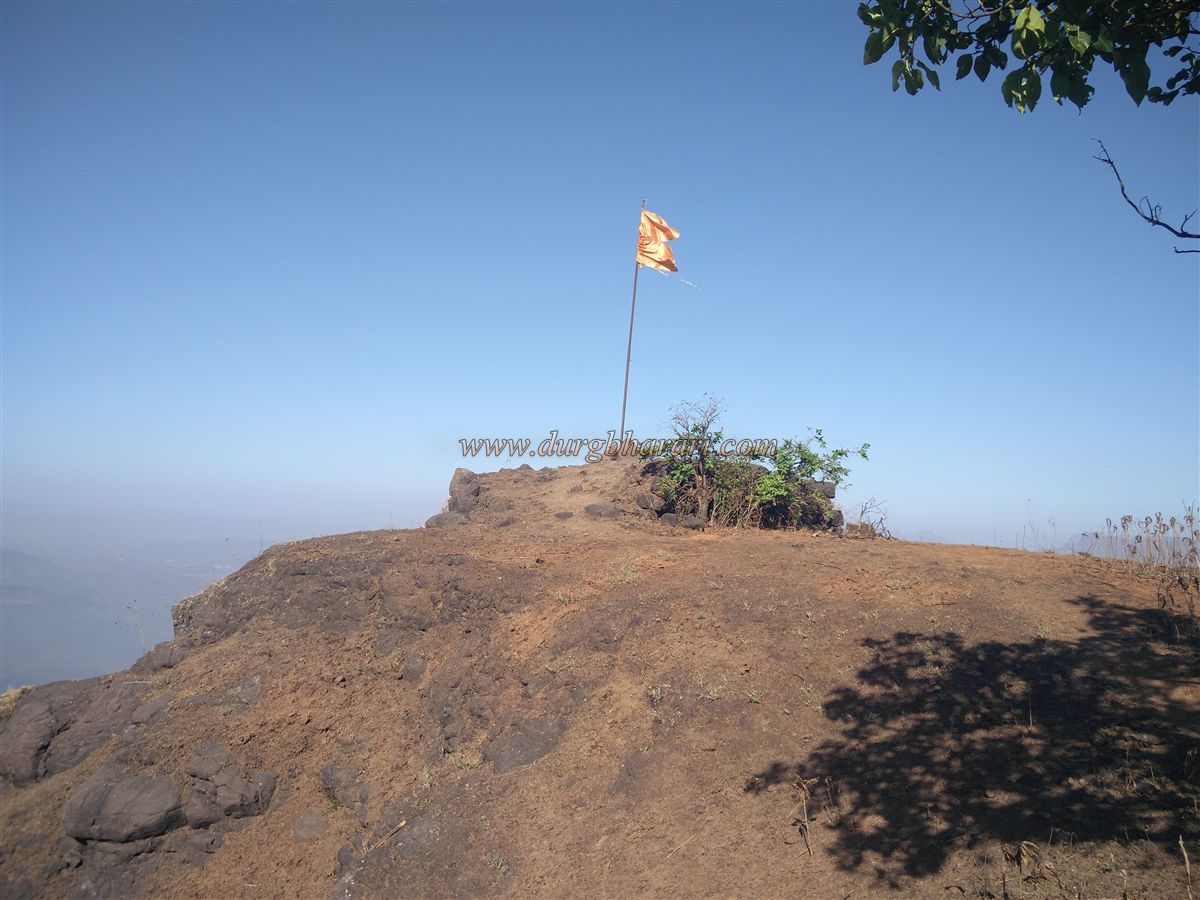
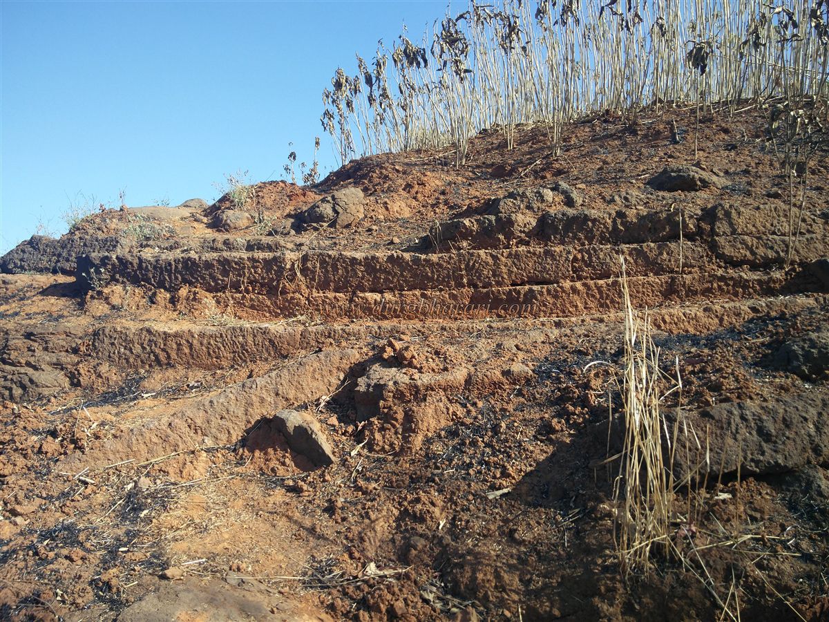
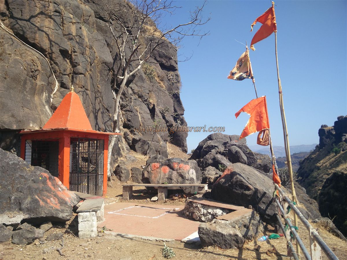
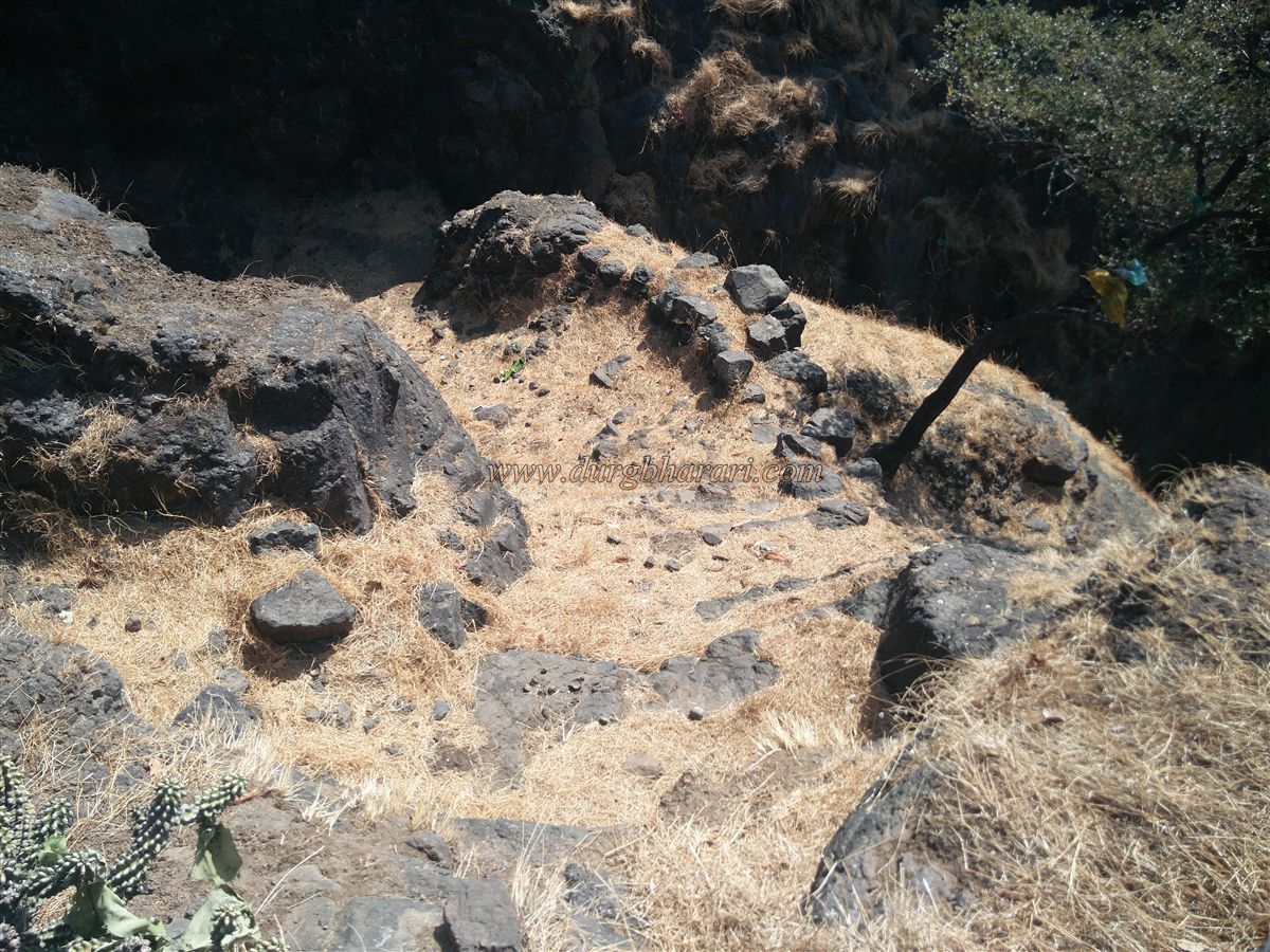
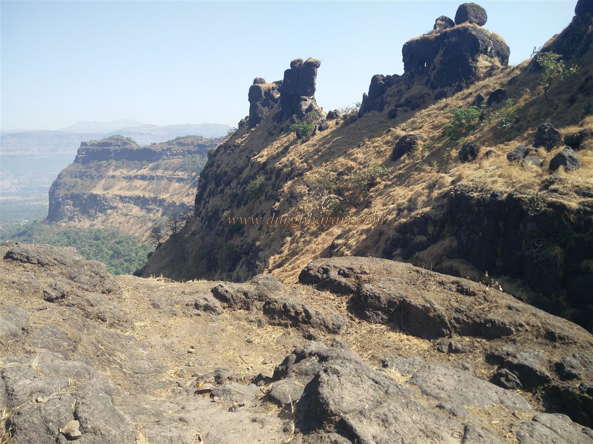
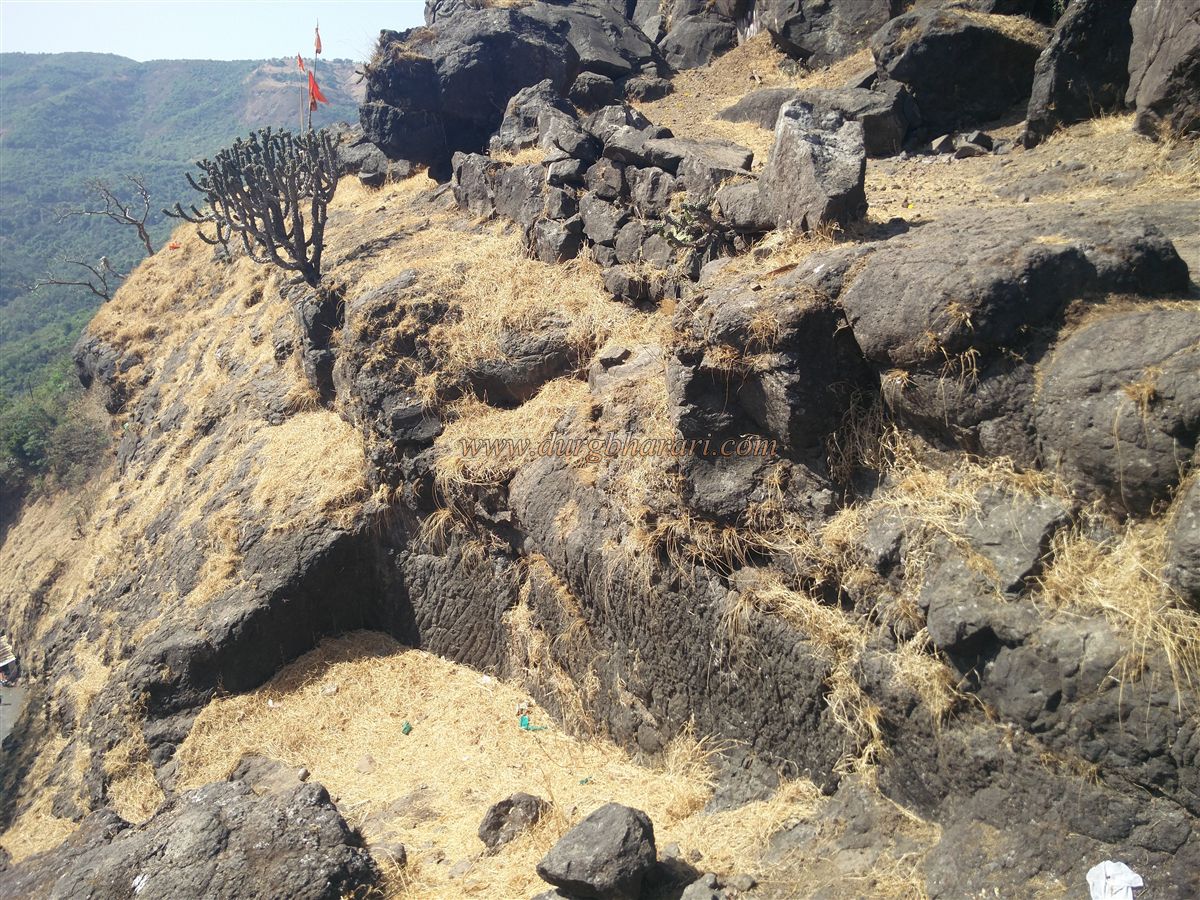
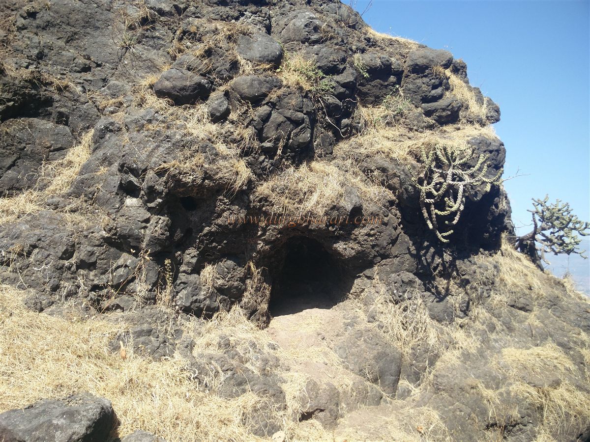
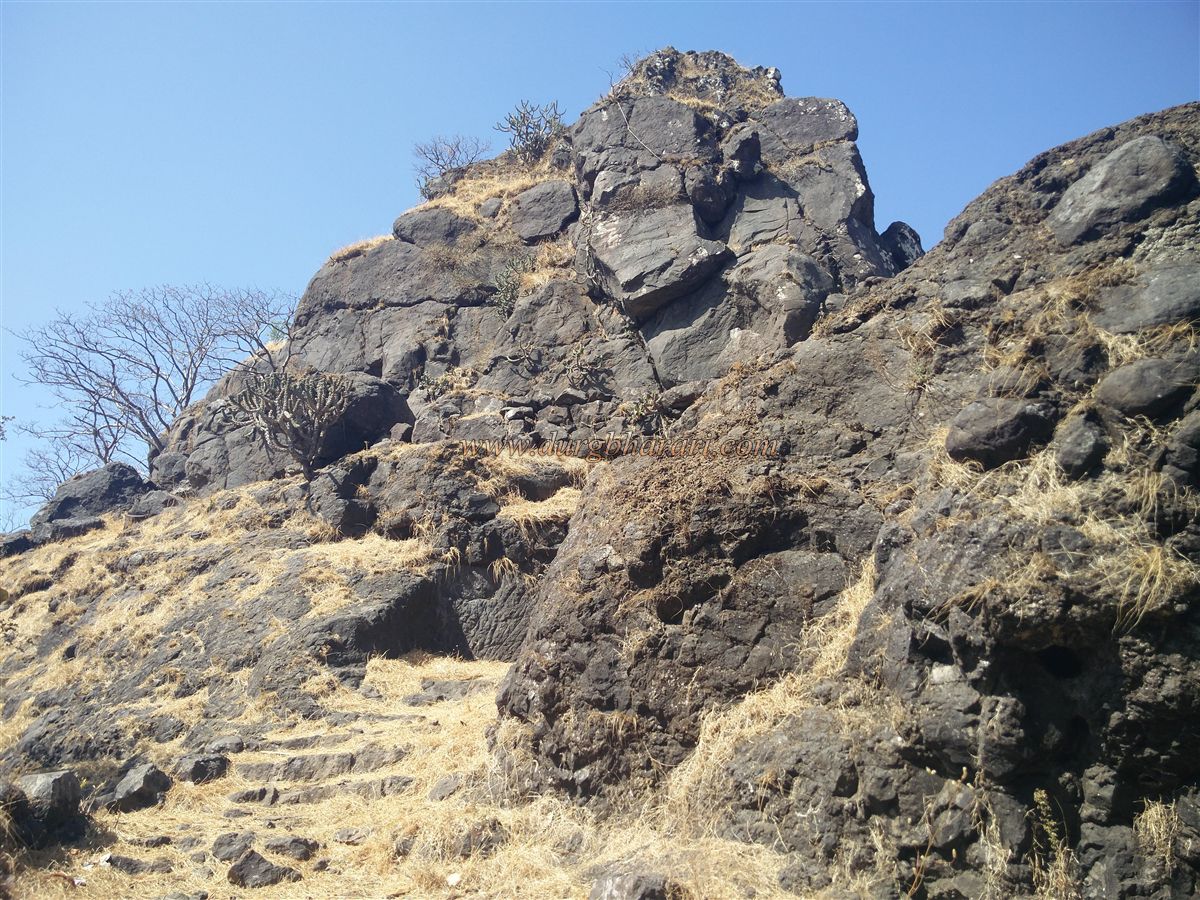
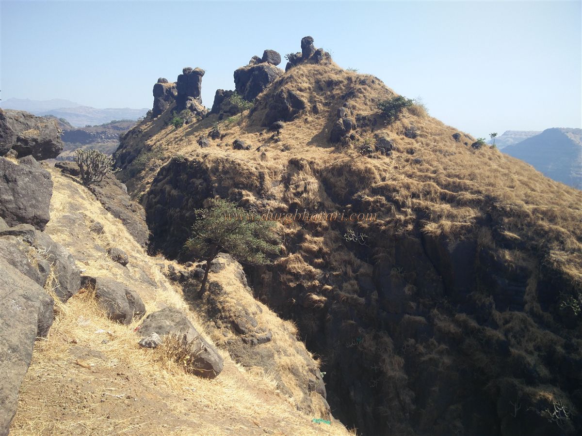
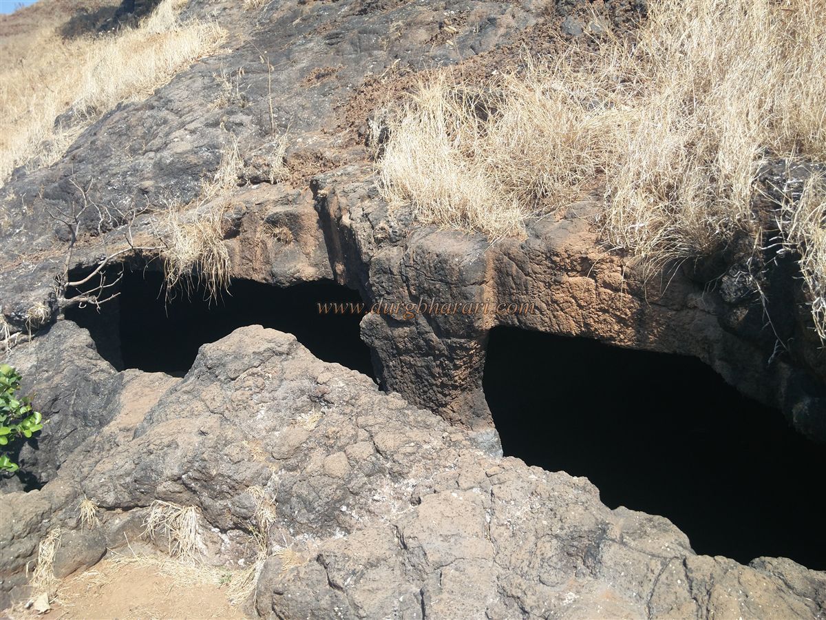
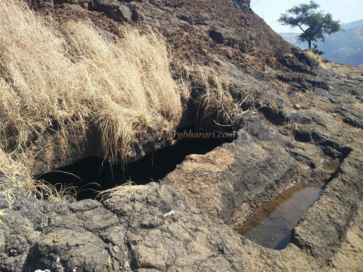
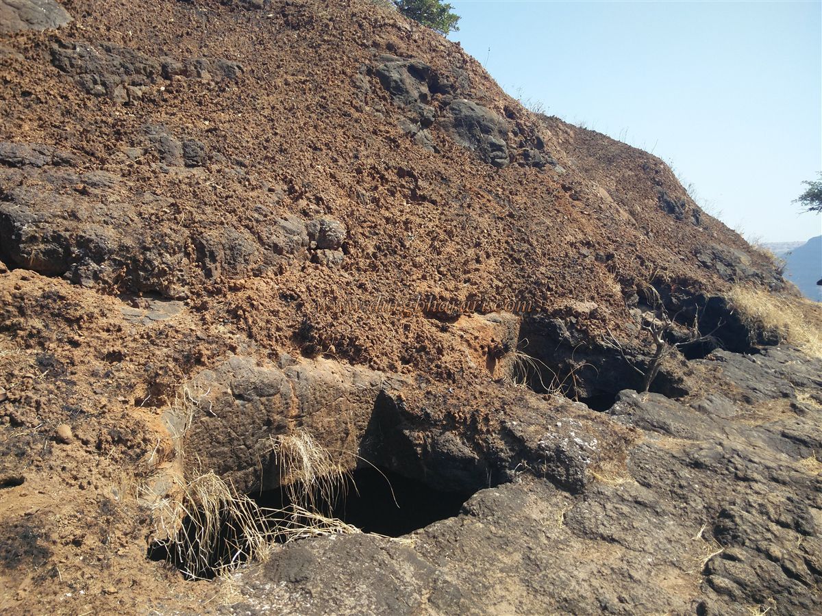
At the top of Warandha Ghat, the trunk of the mountain with the Kavlya fort is spread from south to north and this fort stands on the north side of this trunk. After coming up from Warandha Ghat via Mahad, there is a path to reach Kavalya Fort in the gorge where the boundaries of Pune district and Raigad district meet. While constructing Warandha Ghat, this gorge has been widened. On the other side of the gorge, on the road, there is a temple of Waghjai and a small food court. You can drive in this gorge to the Waghjai temple. Since there is no potable water on the fort in summer, one should start climbing the fort with enough water. At the beginning of the journey, there are 15-20 steps in two stages. After climbing these steps, we reach a quadrangle structure. 10-12 steps are descending on the left side and there are circular constructions of the bastion on the lower side. As the fort is very far from here, considering the overall structure of the place, it seems that there should be a checkpost on the way to the fort or the wharf. From here, you can see the straight path with the valley on the left. This path is well paved as the villagers cut the grass on the hill for their cattle. After walking for about 15 minutes along this path, you climb a small hill and come to a small surface. From this surface, the saffron flag can be seen fluttering on the bastion at the end of the fort on the far right while a pinnacle can be seen on the left. The fort is in the direction of the bastion therefore, we should start our journey in that direction. There is a small surface at the top of the hill in front. While descending this level and crossing the next hill, the remains of the ramparts can be seen. After crossing this hill, on the way down, you can see some ruined ramparts towards the edge of the valley. After seeing the ramparts and crossing the next hill, we come to the main level of the fort. There are two cisterns carved in the rock at this place, one of which is extinguished with soil while the other cistern has been removed and cleaned by the trekkers. There is water in this cistern but it is not drinkable as of now. There is a pinnacle at the back of the cistern and a small stone wall has been built to prevent the soil from entering the cistern but at present, this wall is also buried under the soil coming from the pinnacle. Adjacent to the cistern is a crumbling newly built brick dome with an idol in it. The surface area here is plain up to a great extent although a large number of trees are growing here and most of the remains have disappeared in this forest. The saffron flag, visible from the entrance to the fort, is on the bastion on the pinnacle behind the cistern. To reach this bastion, you have to climb the hummock behind the cistern. On the hummock, you can see a quadrangle structure built out of wrought stone hidden in the Karvi trees. The height of the fort from this place is 1980 feet. After crossing the quadrangle structure, you can see the saffron flag fluttering on the bastion at the end of the fort. When you reach here, on the bastion with the saffron flag, your fort round is complete. It takes an hour to reach this bastion from the gorge of the wharf. From the bastion, one can see Varandhaghat, Madheghat, Gopyaghat, and Shevatyaghat spread in the Sahyadri range, while Rajgad, Torna, Raigad forts, and Shivtharghal area can also be seen. There are two ways to get back to the cistern from here. Either turn back the way you came or walk down a path to the right from the bastion. After descending through the thick bushes along this path, in 10 minutes we turn to the right side of the hill and come to the water cistern. From here, one can return to the Waghjai temple through the gorge. In many places, I read that the Kavlya Fort was divided into two parts due to the Warandha Ghat. The first part we see now in the northern part of the fort, while the southern part is on the upper side of the Waghjai temple in the wharves. As you leave the Waghjai temple and proceed towards Bhor, after 200 ft. you can see a path on the right side of the road. After walking on this path for 7-8 minutes, the path splits into two forks on the right and left. A little further on, on the left, you will see eight cisterns of potable water, one after the other, carved into the rock. One of the cisterns is a joint cistern and a ditch has been dug on the front side of this cistern for animals to drink from it. Since the food vendors in the wharves use this water, the way to the cistern is well paved. After seeing the cistern, turn back and come forward on the left footpath, from here you reach the Waghjai temple. This is the original place of Goddess Waghjai and the locals have built a small cement temple here. There is a carved path in the front of the temple to go down and there are small carved porches on both sides of this path. This route is easily accessible from the other side of the wharf. While walking in this part of the fort, you will not see any remnants like ramparts, bastions, or quadrangle structures showing signs of forts. So as there are no remnants of the fort in this place, should there be a fort here? This place is not a fort but it seems to be a part of the wharf route. Your visit to this part of the fort is completed in half an hour. Two and a half hours are enough to explore both parts of the fort. Kavlya fort is of double importance as it is a defensive fort of Raigad. The Kavlya must have been used to guard the Chandrarao More mansion at the top of Shivtharghal as well as to spy on the enemy from afar and to make contact with other forts under the influence of Raigad. Sachin Joshi, a researcher in the Department of Archeology at Deccan College, has suggested that Jaslodgad aka Mohangad is a hill of Janani since before Shivaji Maharaj’s times, but some senior historians believe that the fort at present should be Jaslodgad-Mohangad. Jaslodgad aka Mohangad is mentioned in a letter written by Shivaji Maharaj to Bajiprabhu Deshpande on 13 May 1659. It shows that Pilaji Bhosale was appointed as the fort keeper along with 25 soldiers to restore the barren lands of Jaslodgad. In this letter, he writes to Bajiprabhu that the fort has been renamed as Mohangad and suggested to leave the fort only after constructing the fort keeper’s mansion, a shelter for the soldiers, and strengthening the fort.
© Suresh Nimbalkar
GALLERY