KANHERGAD
TYPE : HILL FORT
DISTRICT : JALGAON
HEIGHT : 2250 FEET
GRADE : HARD
Near Chalisgaon in Jalgaon district, within the Gautala Wildlife Sanctuary, stands the famous and grand Yadav-era temple of Patnadevi. Since this temple is the family deity for most of the people in the region, it is always bustling with visitors. However, a short distance away from the temple, the ancient Mahadev temple and the Kanhergad Fort remain far removed from all this commotion.
To visit this fort behind the Mahadev temple, one must first reach the Gautala Wildlife Sanctuary. The sanctuary is 18 km from Chalisgaon and about 250 km from Mumbai. Entry to the sanctuary is allowed from 6 a.m. to 6 p.m. About 1.5 km inside the sanctuary entrance, there is a signboard pointing to the Mahadev temple on the right, and from there, a footpath leads to the temple. Following this path, you reach the Mahadev temple within a few minutes.
...
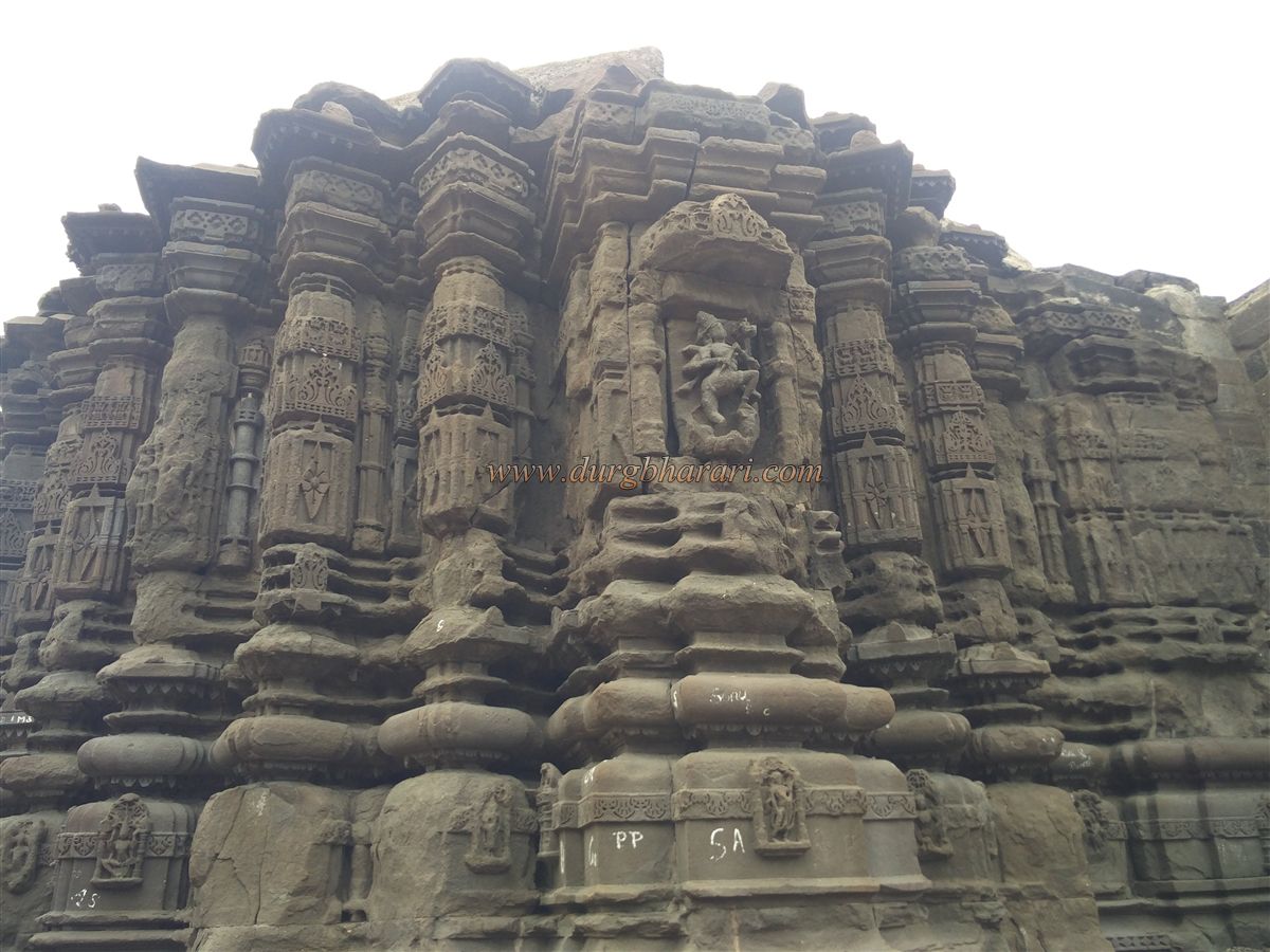
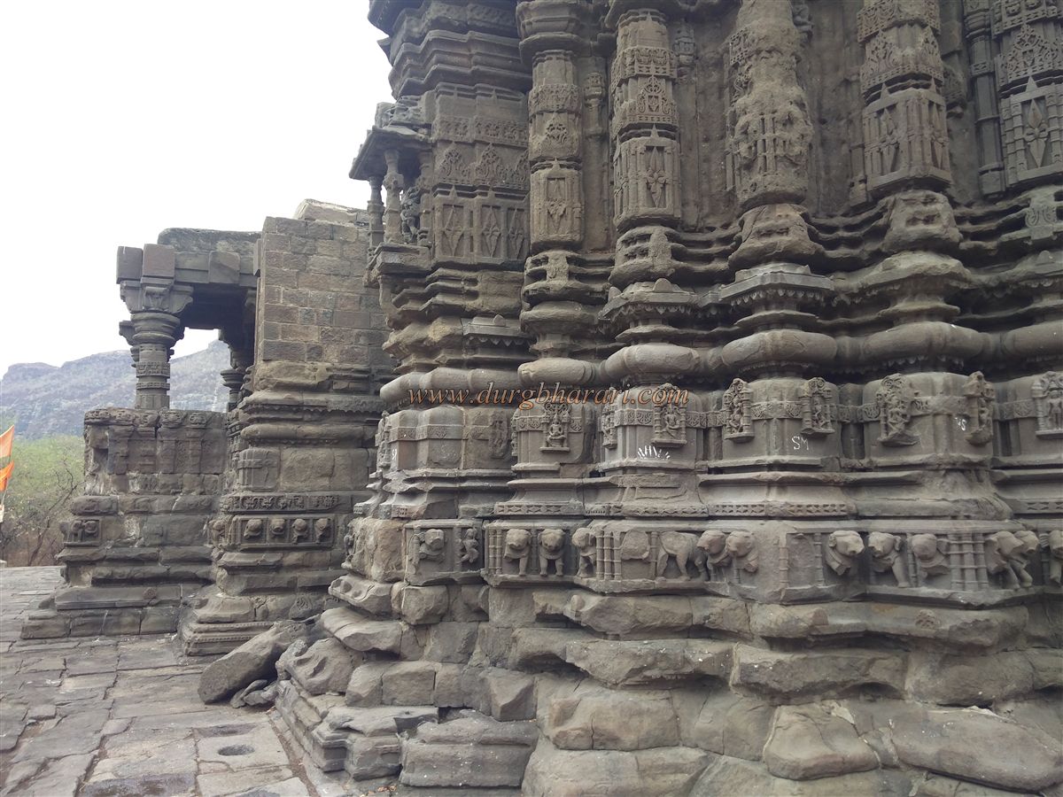
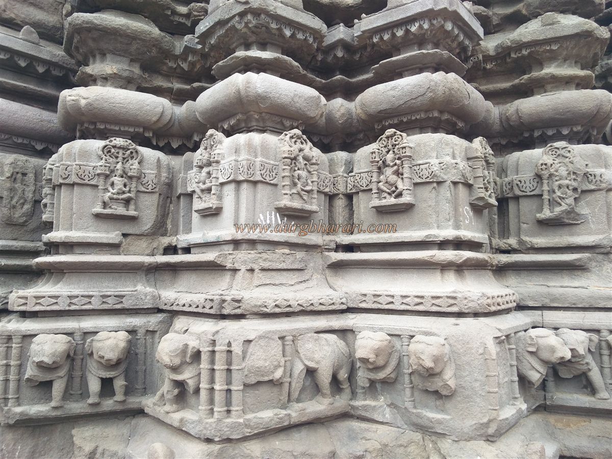
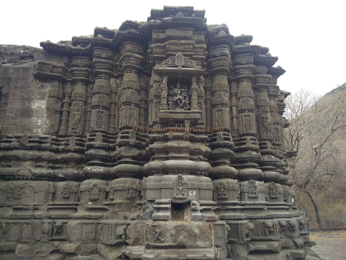
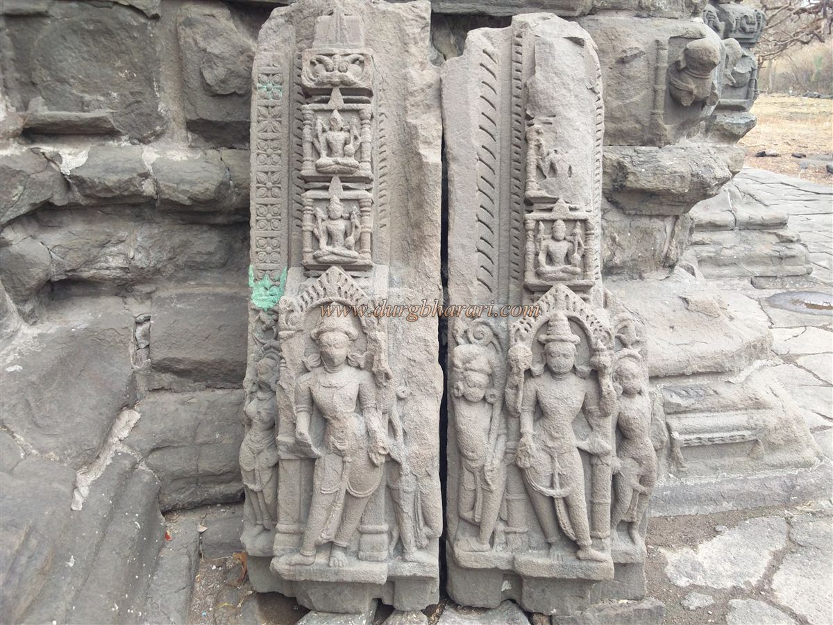
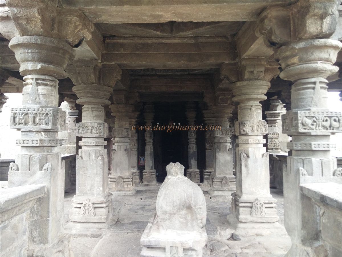
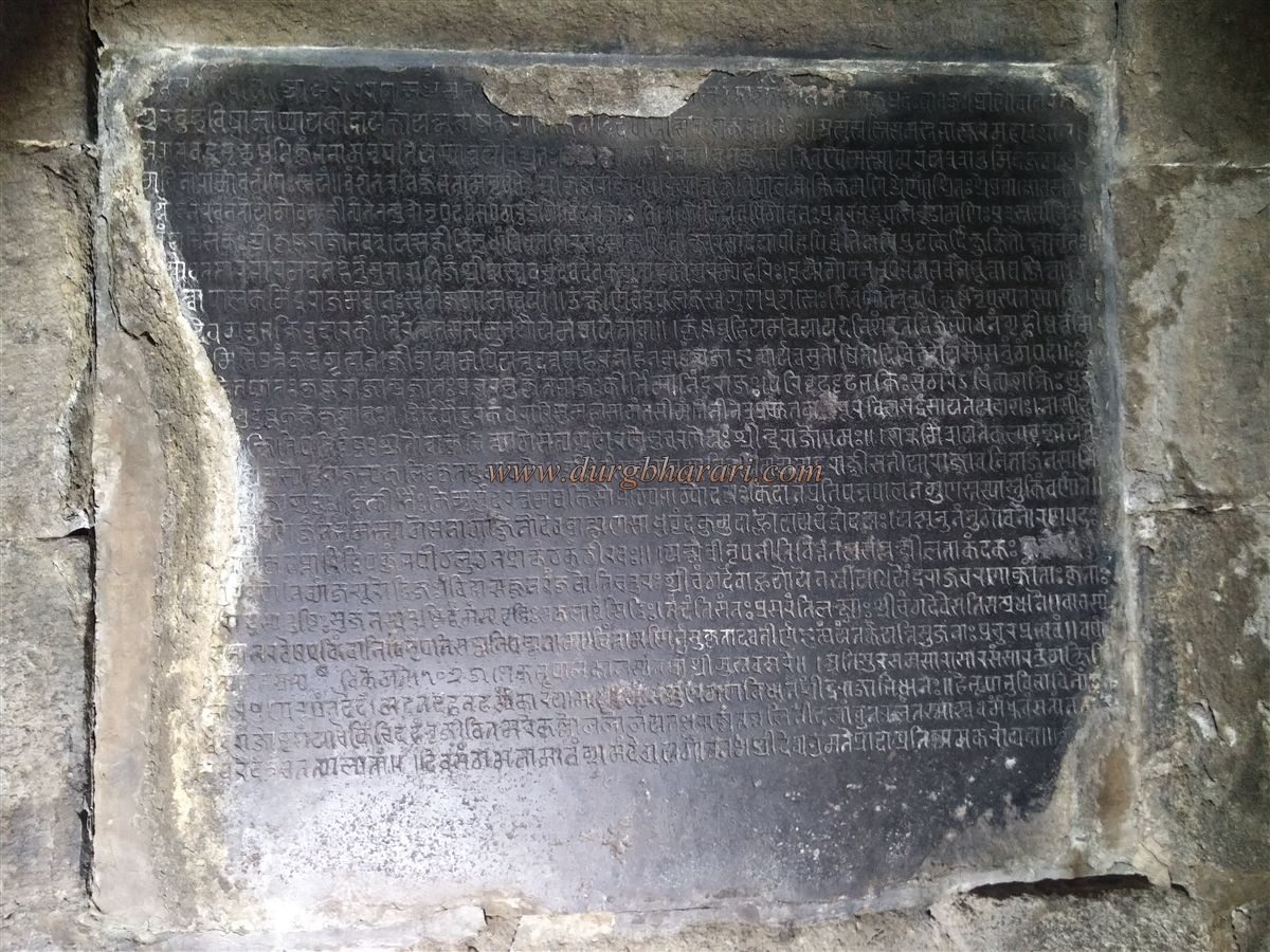
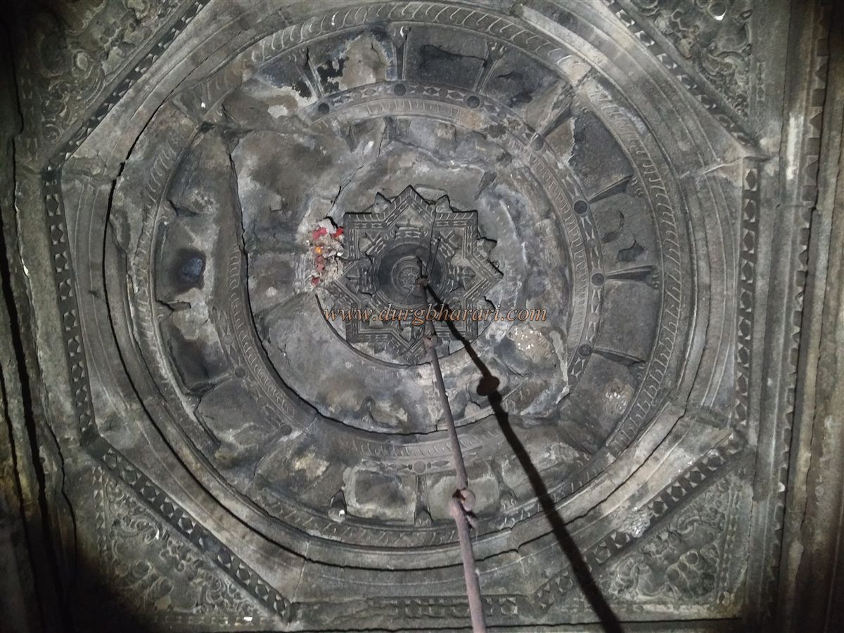
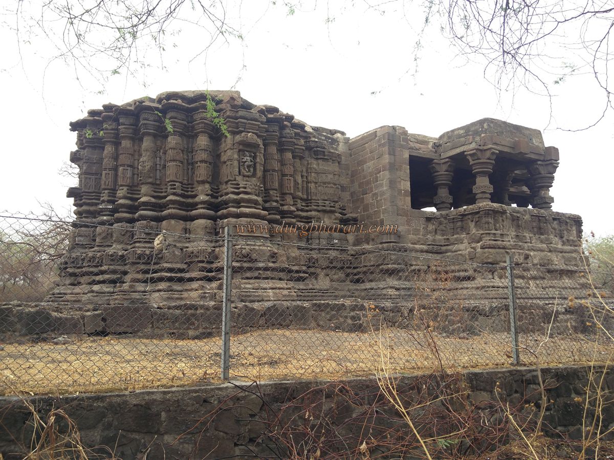
Looking at the carved stones and other remains around the temple, it is evident that this was once a temple complex with a large settlement, not just a single shrine. The temple has been declared a protected monument by the Archaeological Survey of India. Built facing east on an 8-foot-high paved stone platform, it measures 75 x 36 x 18 feet and has three sections: the porch (Mukhmandap), the hall (Sabhamandap), and the sanctum (Garbhagriha). The temple base has a gajapristhika (elephant-back-shaped plinth), though much of its sculpture is heavily weathered. Inside the sanctum is a Shivling, with Ganesha carved on the lintel of the doorway and doorkeepers on the lower sides. In the Sabhamandap, the left wall bears a Sanskrit inscription in Devanagari script, and in the center is a statue of Nandi. A beautiful lotus is carved on the ceiling, and many figures are sculpted on the outer walls.
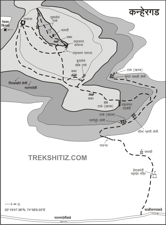
Behind the temple lies the mountain of Kanhergad. A horizontal footpath appears when you go behind the temple. Following it to the left, you will see another path branching to the right, where a small cemented memorial canopy (samadhi chhatri) stands on a stone platform—this is the key landmark for reaching the fort. From here, a trail climbs the mountain for 10 minutes, leading to another horizontal path. Turning right, you reach the Nagarjun Cave, a Jain rock-cut shrine, in 5–10 minutes. It takes about half an hour to reach here from the Mahadev temple.
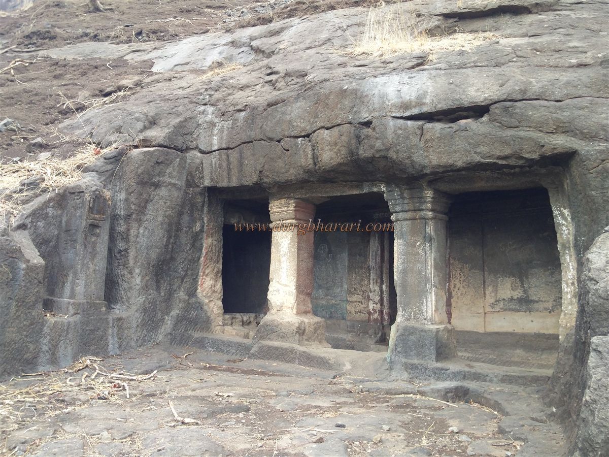
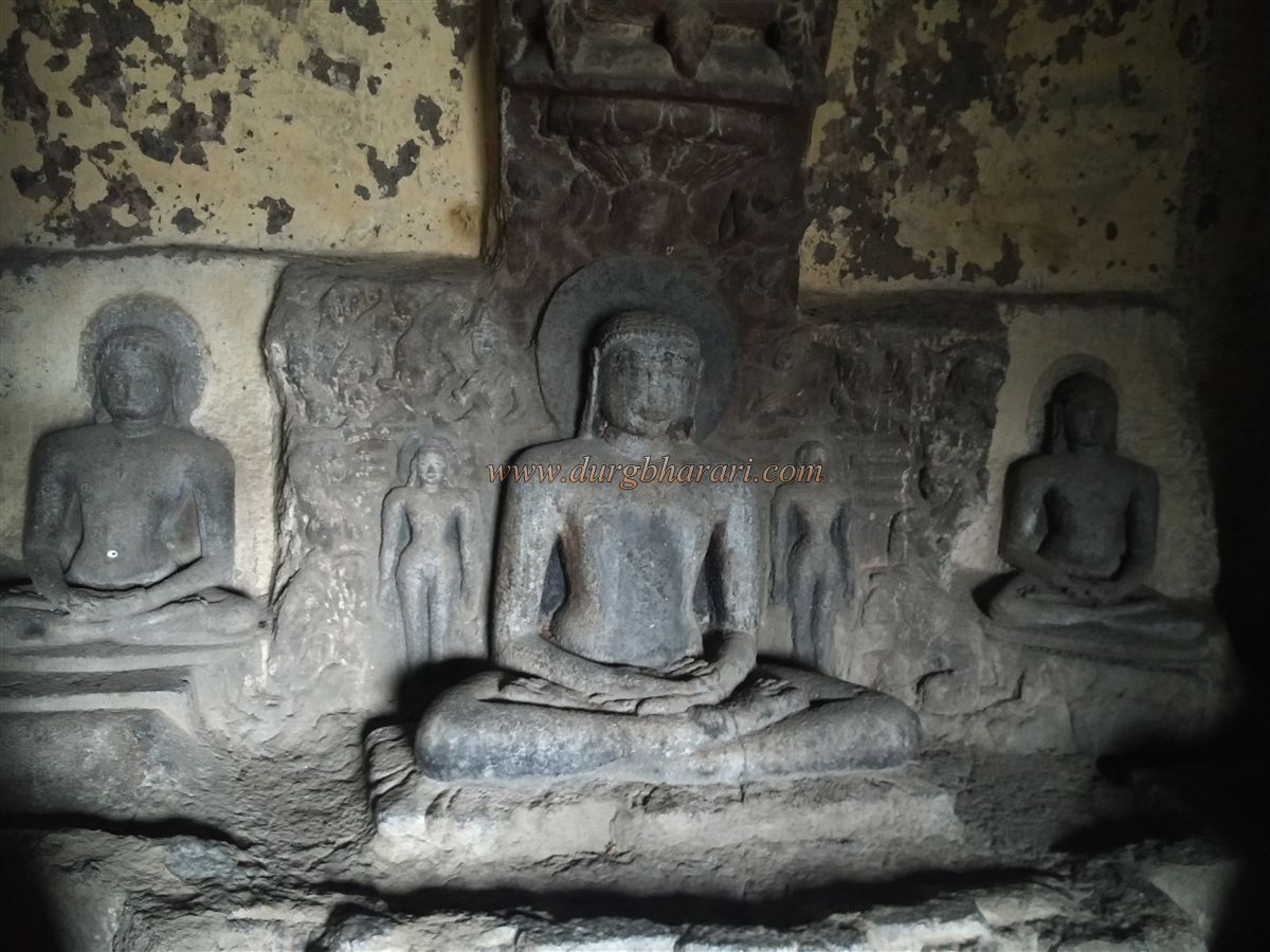
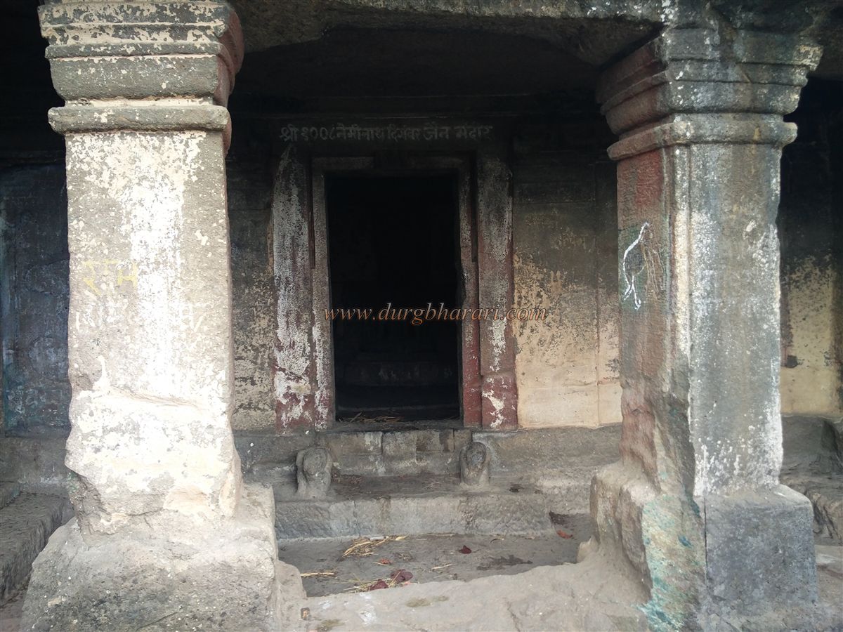
Carved in the late 9th century, these Jain caves have three chambers and an unfinished victory pillar (kirttistambh) outside. The veranda, supported by two pillars, has a room on the left and a water cistern carved into the rock on the right. On the lintel of the hall’s doorway is a figure of a Tirthankar, with elephant heads carved on either side below. The wall opposite the hall has an image of Lord Mahavir in a lotus posture, flanked by four other Tirthankaras. On the left wall is a 4-foot-high image of Gomateshwar with celestial musicians and attendants carved around it. At the base of one pillar is a carving of Goddess Ambika.
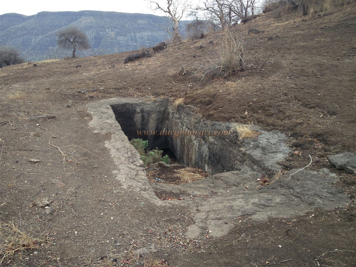
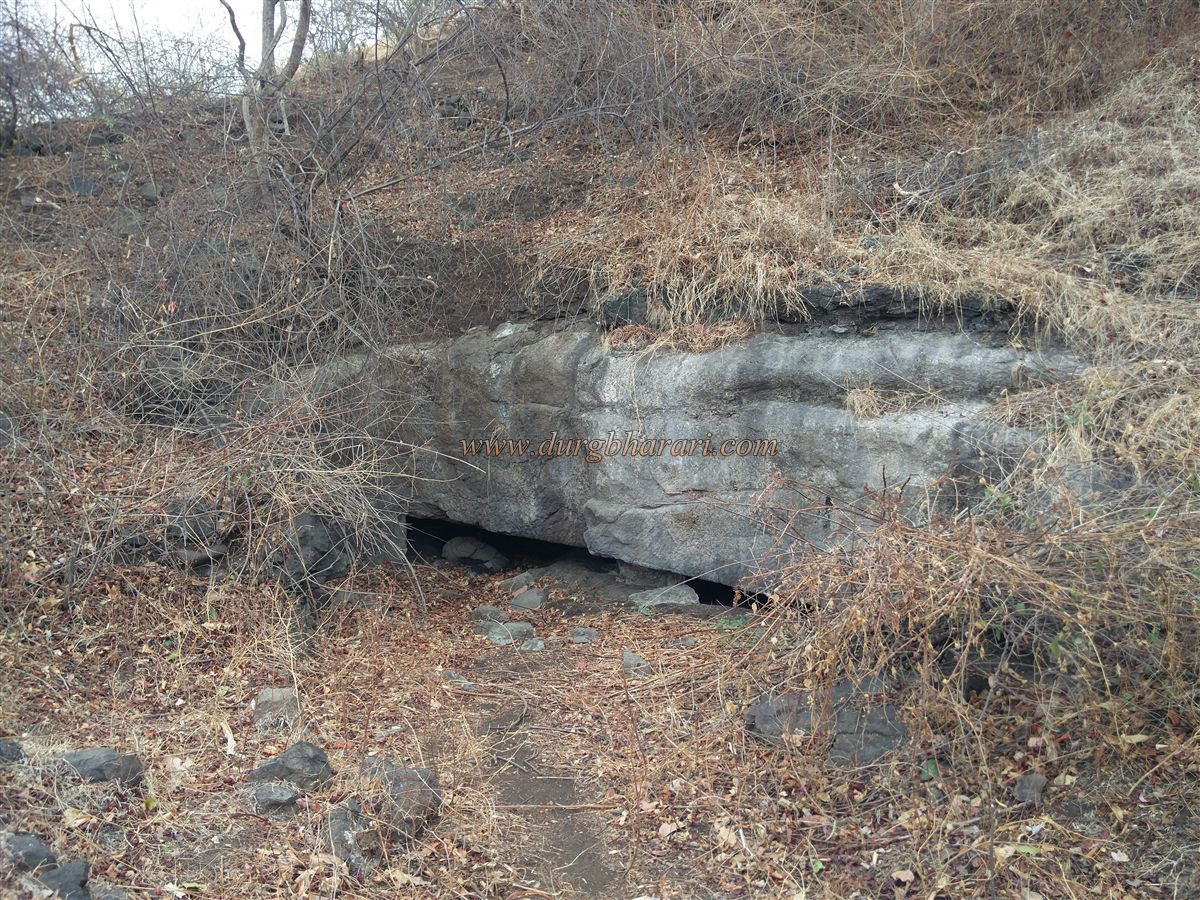
Continuing straight ahead from Nagarjun Cave leads to the second cave, Sita Nhani. This 18-foot-wide cave is supported by two pillars, with a dry rock-cut water tank on the right side of the veranda. There is no notable carving inside. Moving ahead, you reach a spur descending from Kanhergad, where remains of fortification walls can be seen underfoot. On the left is a 25-foot-high rock step—climbing it gives entry to the fort. But before going up, it’s worth visiting the Shringar Chavdi caves.
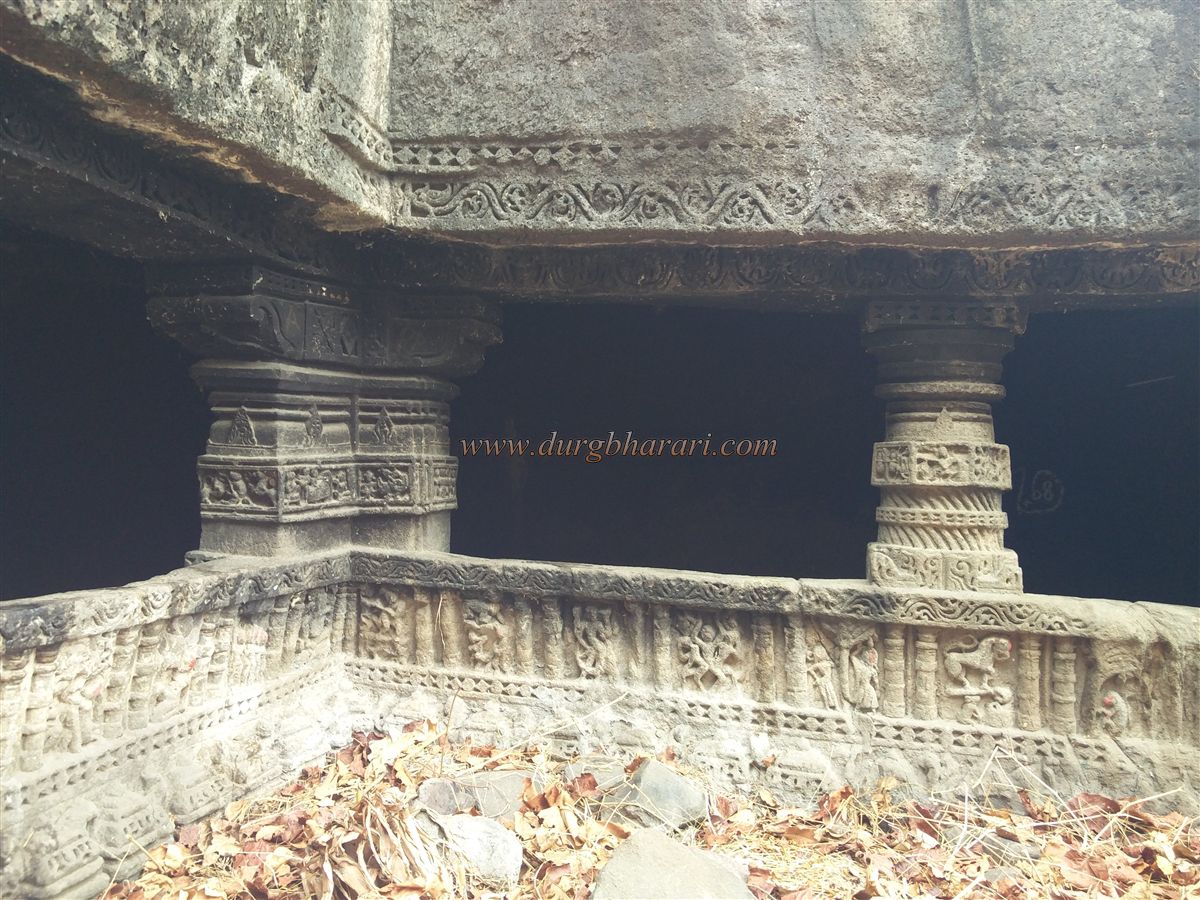
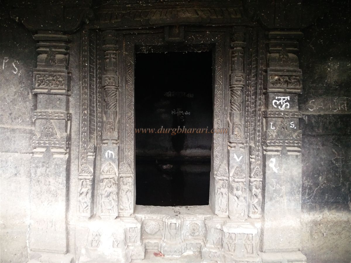
Following the path around the mountain, you reach a gorge between two hills. Slightly climbing inside, you see a small rock-cut cistern and above it, a cave. Known as Shringar Chavdi, this Hindu cave dates to around the 11th century. The veranda, supported by five ornate pillars, is cut in a rectangular shape, and its outer wall is carved with panels from the Ramayana and the Dashavatar. The doorway of the hall is richly decorated, with doorkeepers and lotus flowers carved below. The hall is water-filled, with no visible idols.
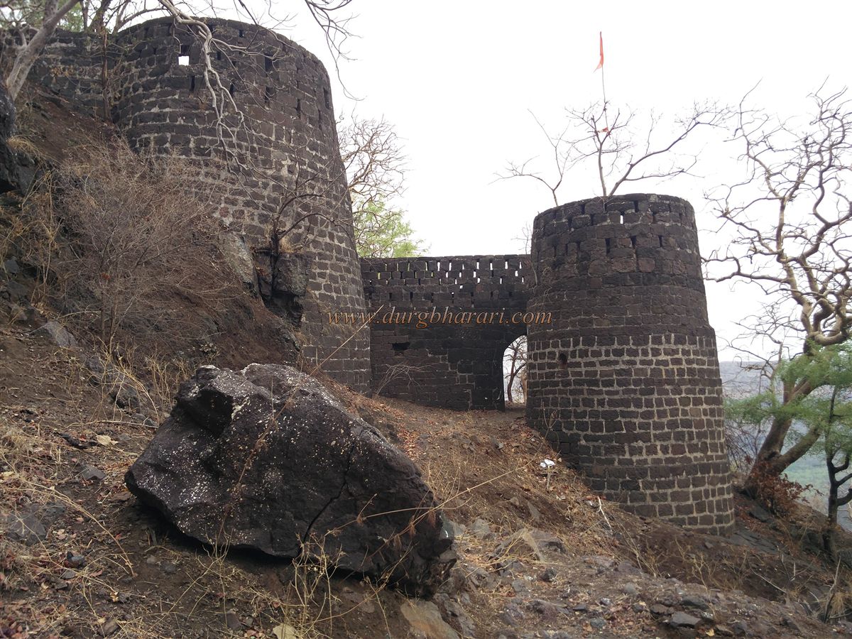
Returning to the rock step, climbing the 25-foot face gives entry to the fort’s main plateau (machi) from the right. At the edge of the cliff are the remains of the base of a completely destroyed gate. In front rises the citadel (balekilla) of Kanhergad, shaped like a cap.
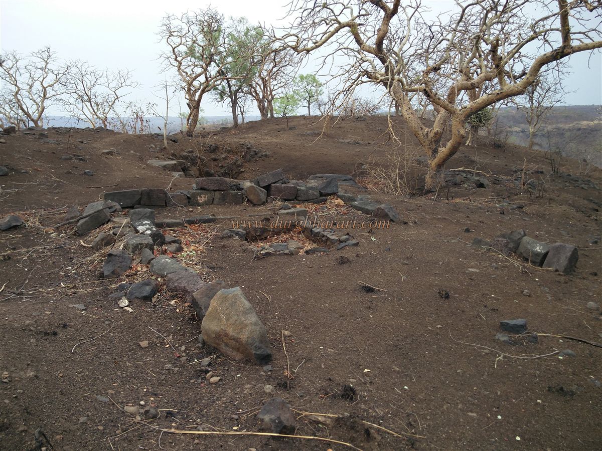
The fort stands at 2,255 feet above sea level, with the plateau and narrow citadel stretching about 25 acres from south to north. On the way to the citadel, you pass a rock-cut pillar cistern whose inner portion is obscured by silt. Further along are a grave and the remains of houses. At the foot of the citadel is a stagnant water tank and two rock-cut cisterns, both heavily silted. Above them is another grave. A path here encircles the citadel—taking the left branch gives views of the Patnadevi temple and forest rest houses.
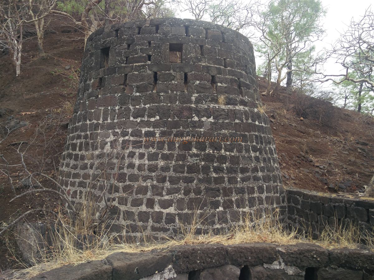
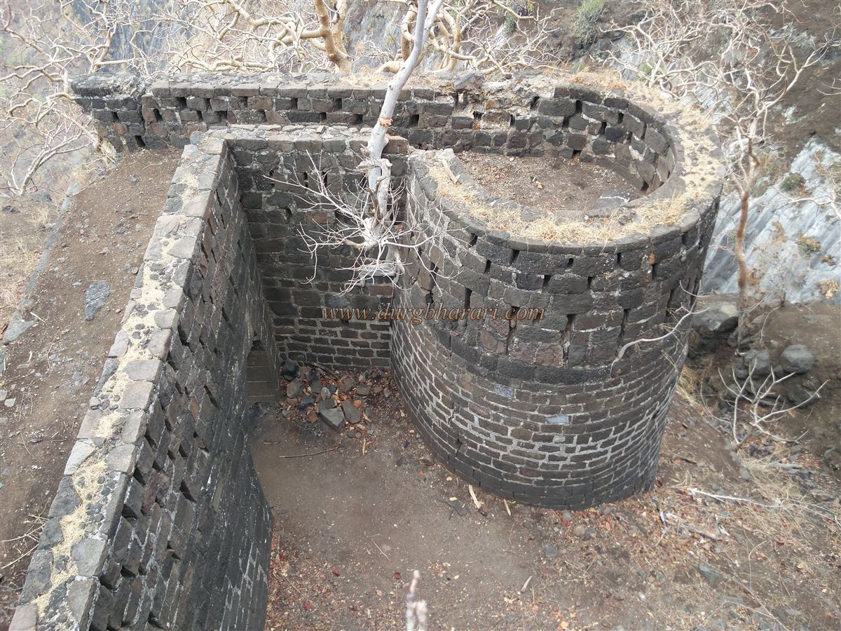
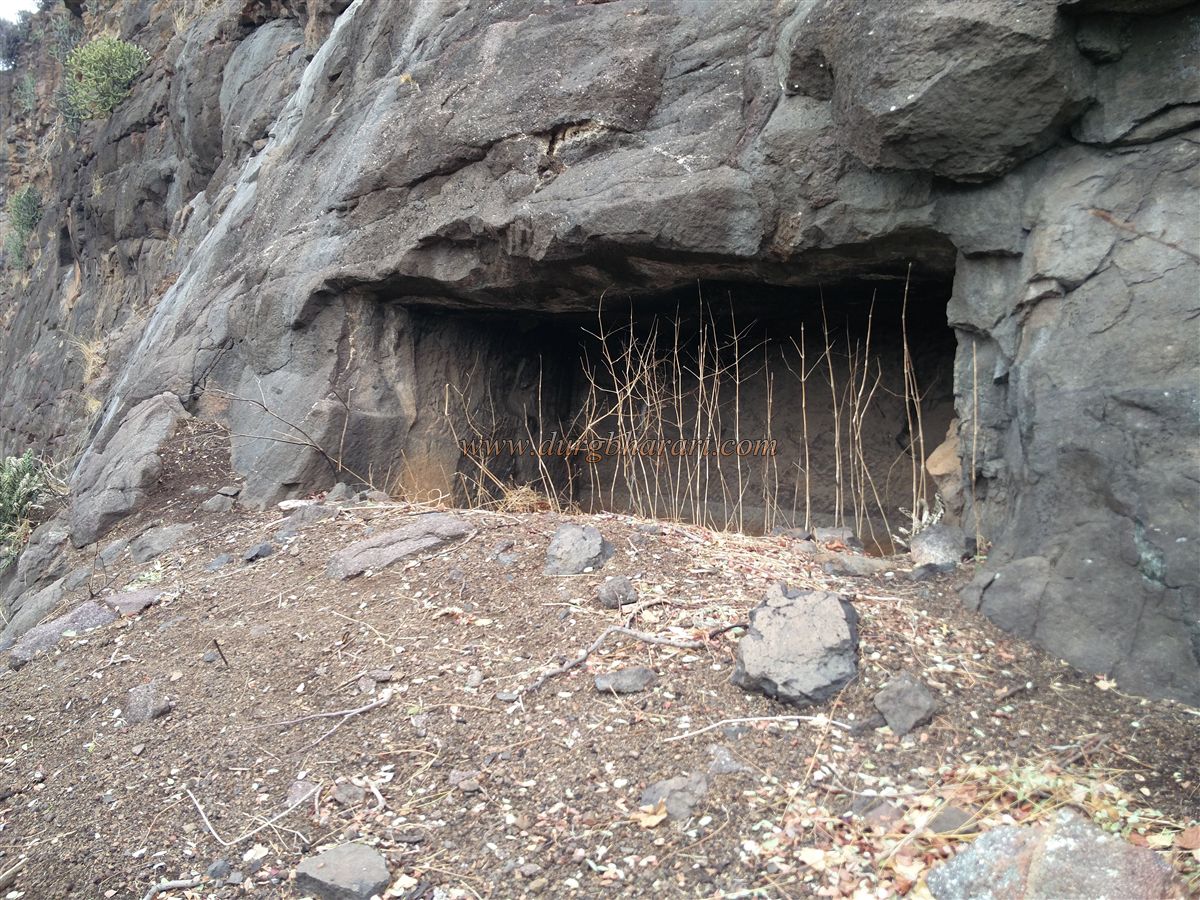
At the end of this path, on the slope, is the west-facing gate of the fort, with an adjacent bastion and sentry rooms still intact. Outside the gate is a rock-cut groove, likely marking an earlier gateway. Inside, a slippery path climbs to the citadel, passing a rock-cut pillar cistern and a cave above it. The water here is potable. From this point, a short rock climb leads to the summit—best attempted only by experienced trekkers. Others should use the worn path from the stagnant tank area.
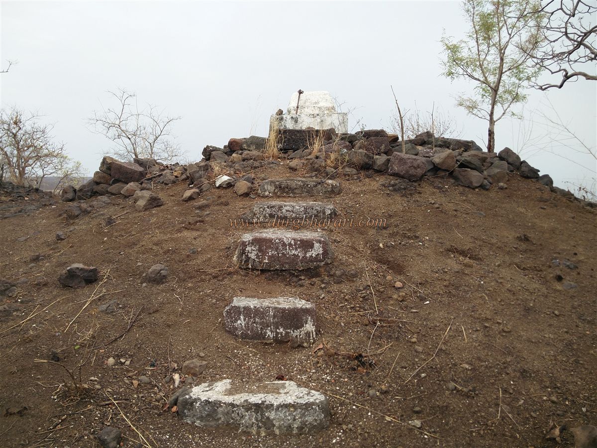
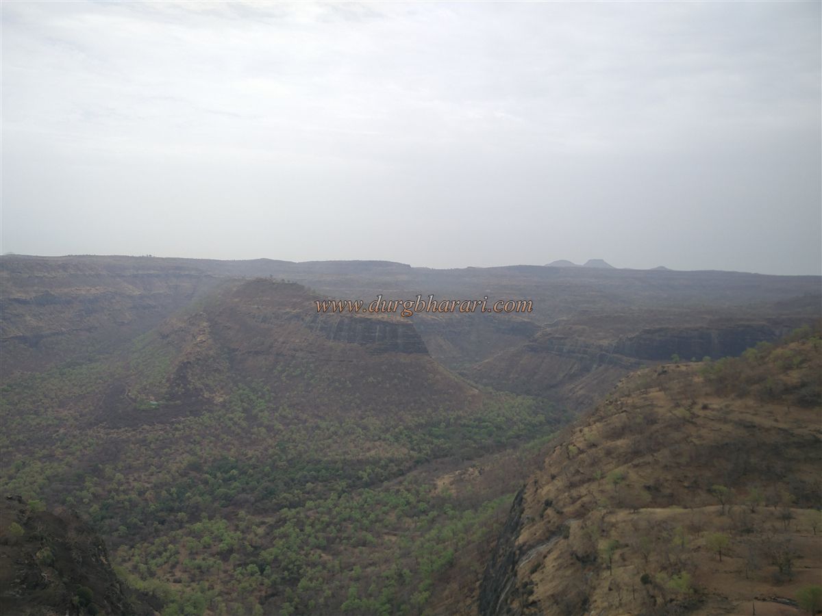
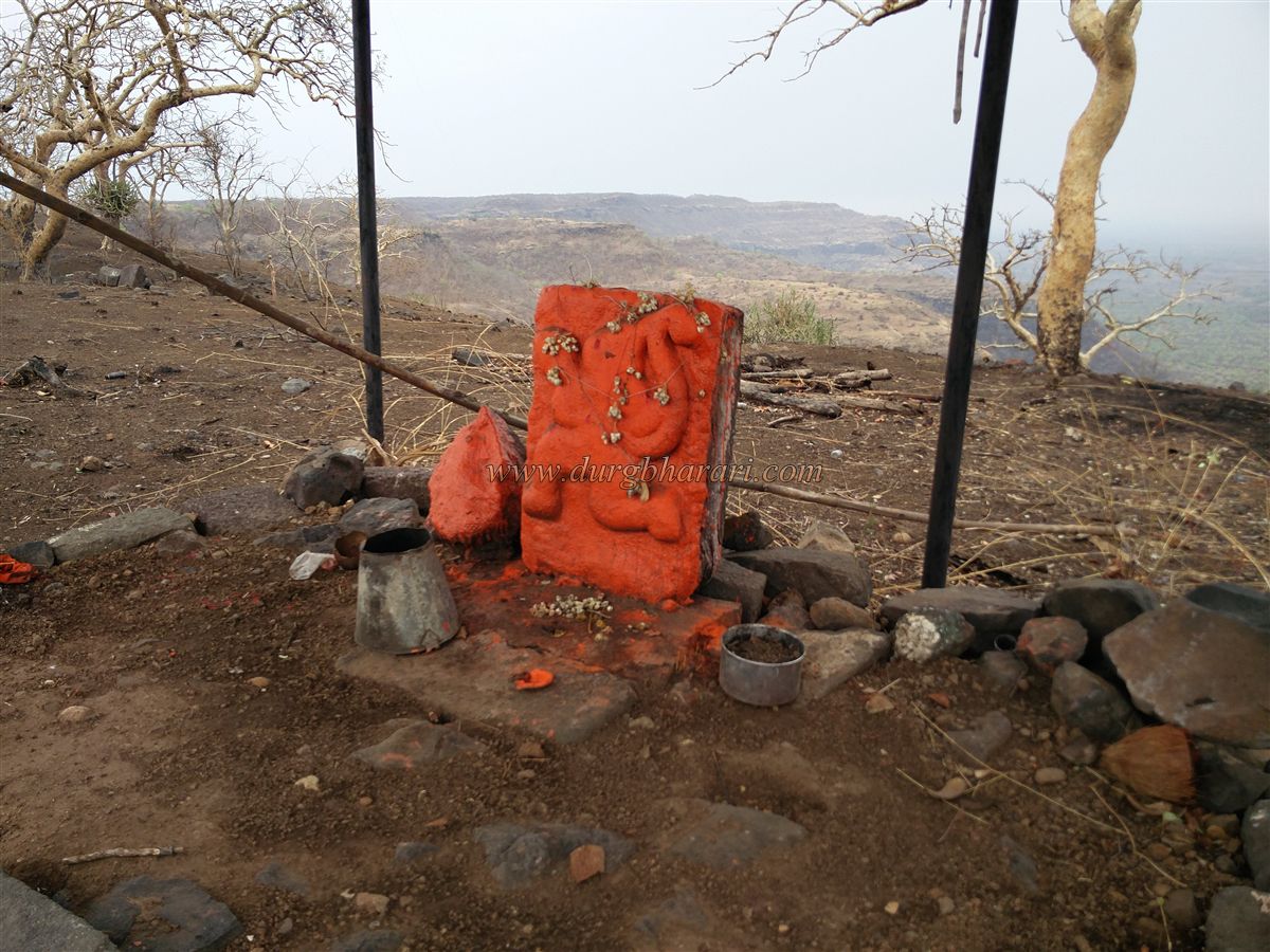
The summit is very small, with a silted cistern, a grave, a courtyard base of a mansion, remnants of houses, and a Maruti idol kept under a tin shelter. From here you can see the Pitalkhora caves and, beyond them, the rectangular summit of Pedka fort.
Descending by the path near the grave leads past ruins of a gate, some steps, and the citadel’s fortifications, finally returning to the stagnant tank where the tour began. A full exploration of Kanhergad and its caves takes about three hours. Drinking water is available at only one spot on the fort, so visitors should carry their own supply.
The Pitalkhora caves nearby were carved in the 5th–6th century during the Vakataka period, likely when the fort was first built. Historically, from 1000 to 1216 CE, this region was ruled by the Nikumbh dynasty with their capital at Patan. Around 1216–17 CE, the fort passed into Yadav control, when the area was known as Vijjalgad. The mathematician Bhaskarcharya, discoverer of the concept of zero, was born and lived here from 1114 to 1185 CE, and his work Leelavati, a section of Siddhanta Shiromani, is famous in mathematics.
On the Ashadhi Amavasya of Shaka 1150 (1228 CE), which coincided with a solar eclipse, the Patnadevi temple was opened to the public by Yadav rulers Khemchandra and Govindraja Maurya, as recorded in the Sant Janardan Charitra. By 1300 CE, the Faruqi dynasty ruled here; around 1600 CE, under Mughal emperor Shah Jahan, the fort and surrounding area came under Mughal control. Although records do not state exactly when the Marathas captured it, the fort remained in their possession from 1752 to 1818 CE, when it was surrendered without resistance to the British.
© Suresh Nimbalkar
GALLERY