KANDHAR
TYPE : GROUND FORT
DISTRICT : NANDEED
HEIGHT : 0
GRADE : EASY
Kandhar village is situated at the end of the Balaghat range, in the valley of the Manyad River. In the 4th century, the Kakatiya dynasty built Kandhar Fort and made it their capital. Later, it also served as the capital of the Rashtrakutas. They established the city of Kandharpur and constructed the Jagattunga Lake, which remains the oldest water reservoir in Maharashtra today. The remnants of the water supply system can still be seen in various places on Kandhar Fort.
During the Rashtrakut era, the fort was known as Krishnadurg. From the 4th century to the 18th century, it passed under the control of various dynasties. The structures and modifications made by these rulers are still visible today. The fort contains numerous architectural remains, showcasing a diversity of construction styles.
Currently, the fort is under the care of the Archaeological Department.
...
Exploring the fort and its surrounding areas takes an entire day. The nearest city to reach Kandhar is Nanded, which is well connected by road and rail to the rest of India. From Nanded, several state transport and private vehicles are available to reach Kandhar.
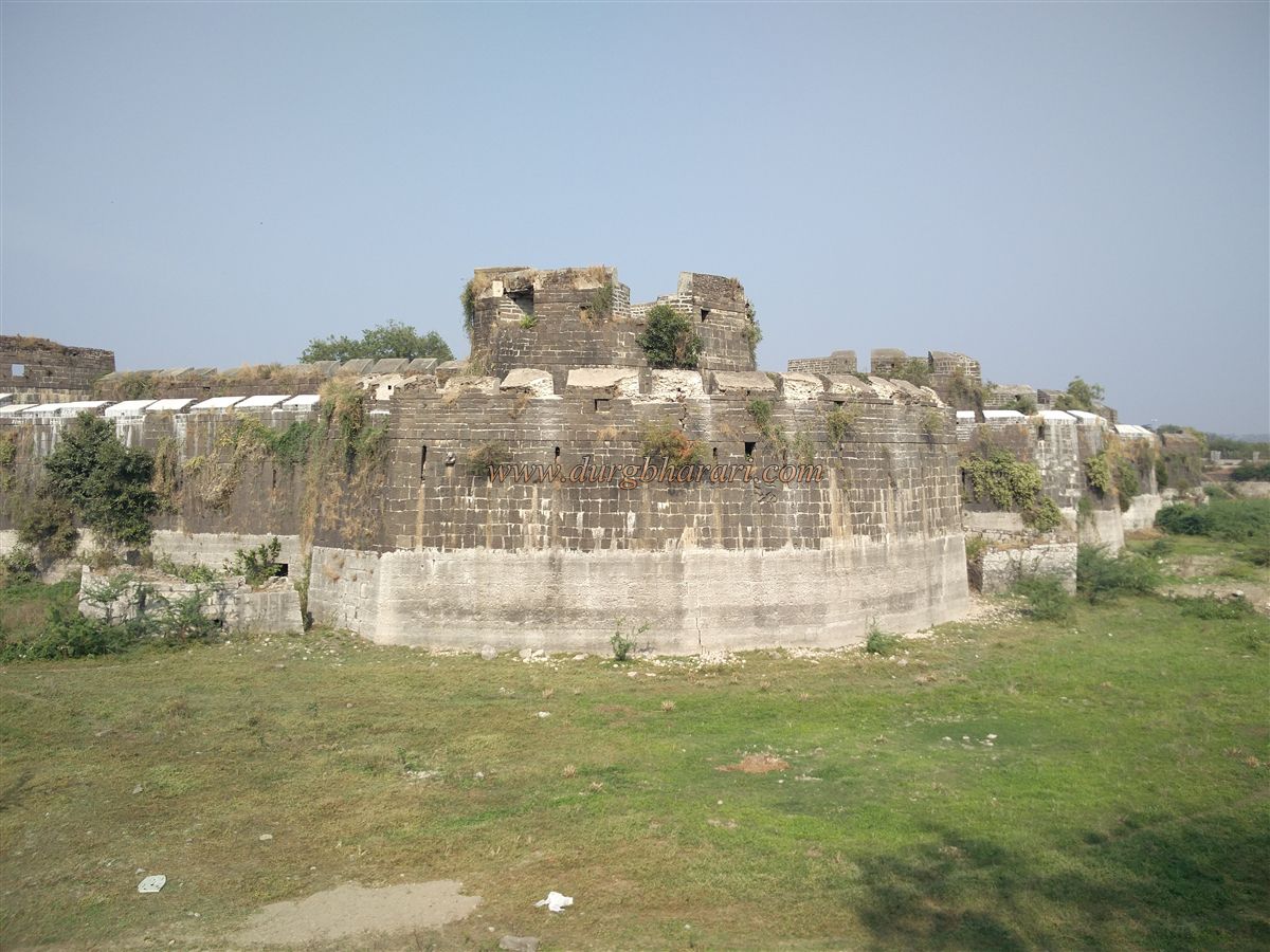
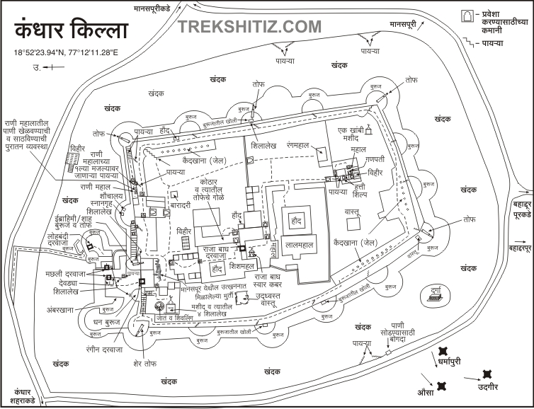
The Kandhar Bhuikot (ground fort) is located 4 km from Kandhar town. Since it is a ground fort, a moat was dug around it for protection. The moat walls are built with dressed stone, more than 12 feet thick to prevent water seepage. The moat is 140 feet wide and 50 feet deep. In addition to storing rainwater, water from Jagattunga Lake was also directed into the moat via specially constructed channels and vents, which are still visible today. Steps were built at intervals for cleaning and repairs.
On the village side, there is a ruined north-facing entrance to the moat. In earlier times, a drawbridge provided access to the fort, but now the Archaeological Department has built a permanent path. Entering the moat, one passes under an arch built by the department. On the left is a square well, and to the south of the moat lies a dargah.
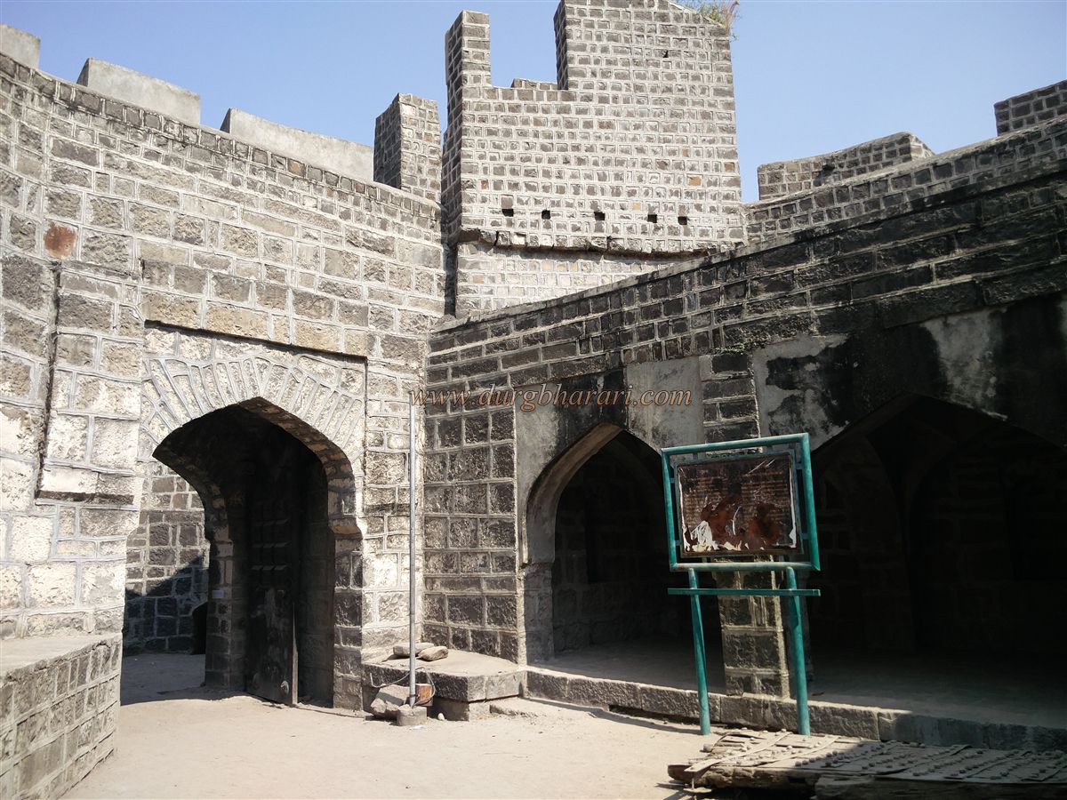
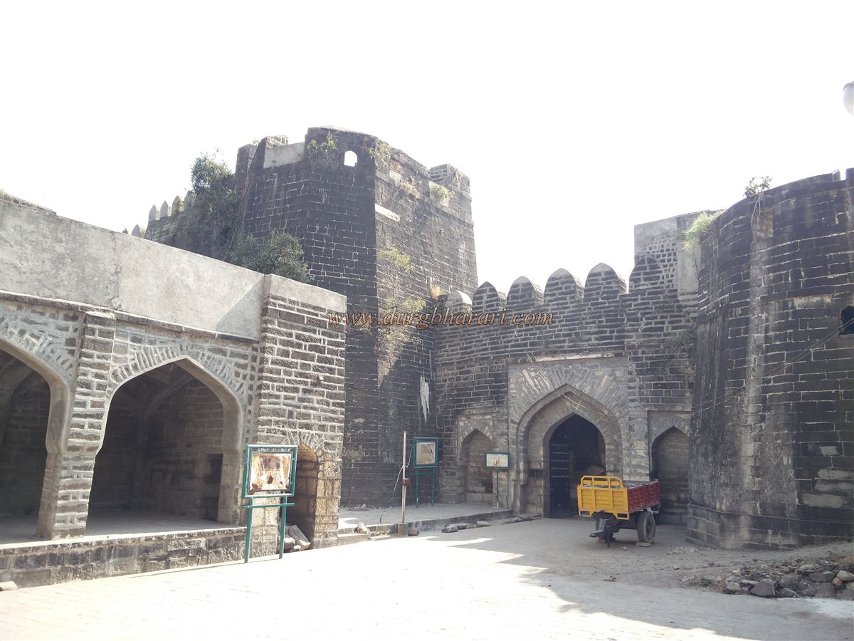
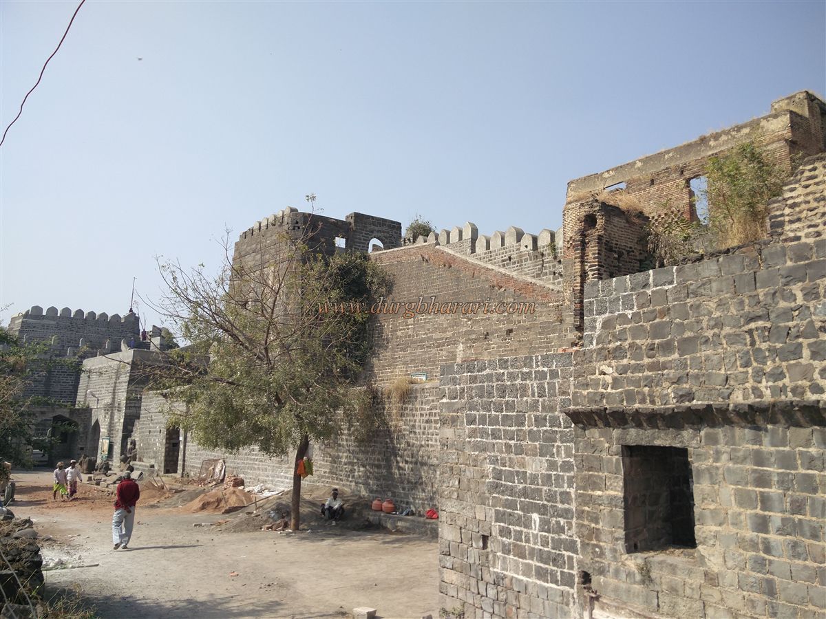
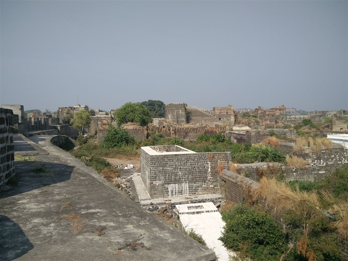
The fort is rectangular in shape, spread over 22 acres including the moat, with the fortified area covering 8 acres. After crossing the moat, a north-facing iron-studded Lohbandi gate is seen. A wall, called a jibhi, stands in front of it to block direct attacks. The Lohbandi gate is 12 feet high and 10 feet wide, though the original has collapsed inward; the department has installed a new one, open from 9:30 am to 5:00 pm.
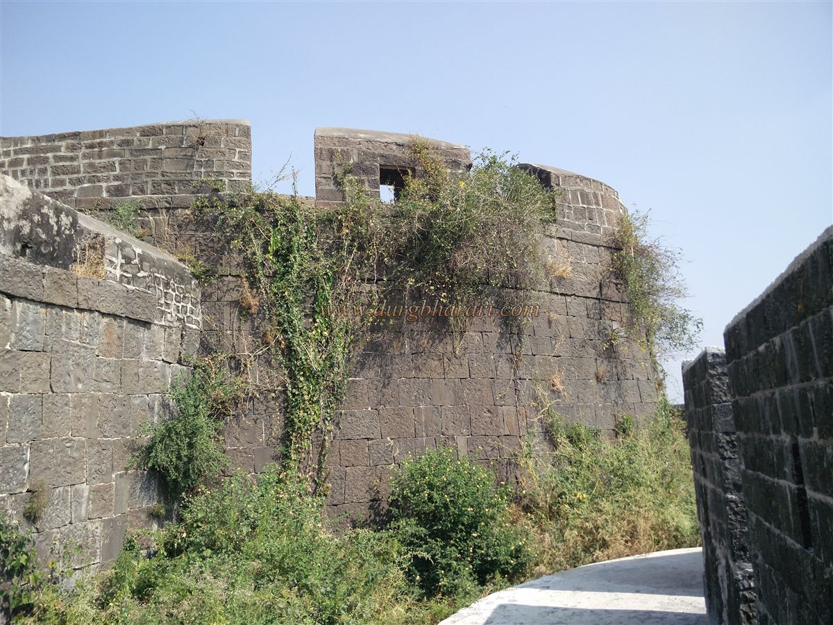
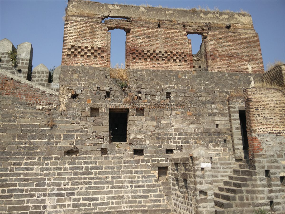
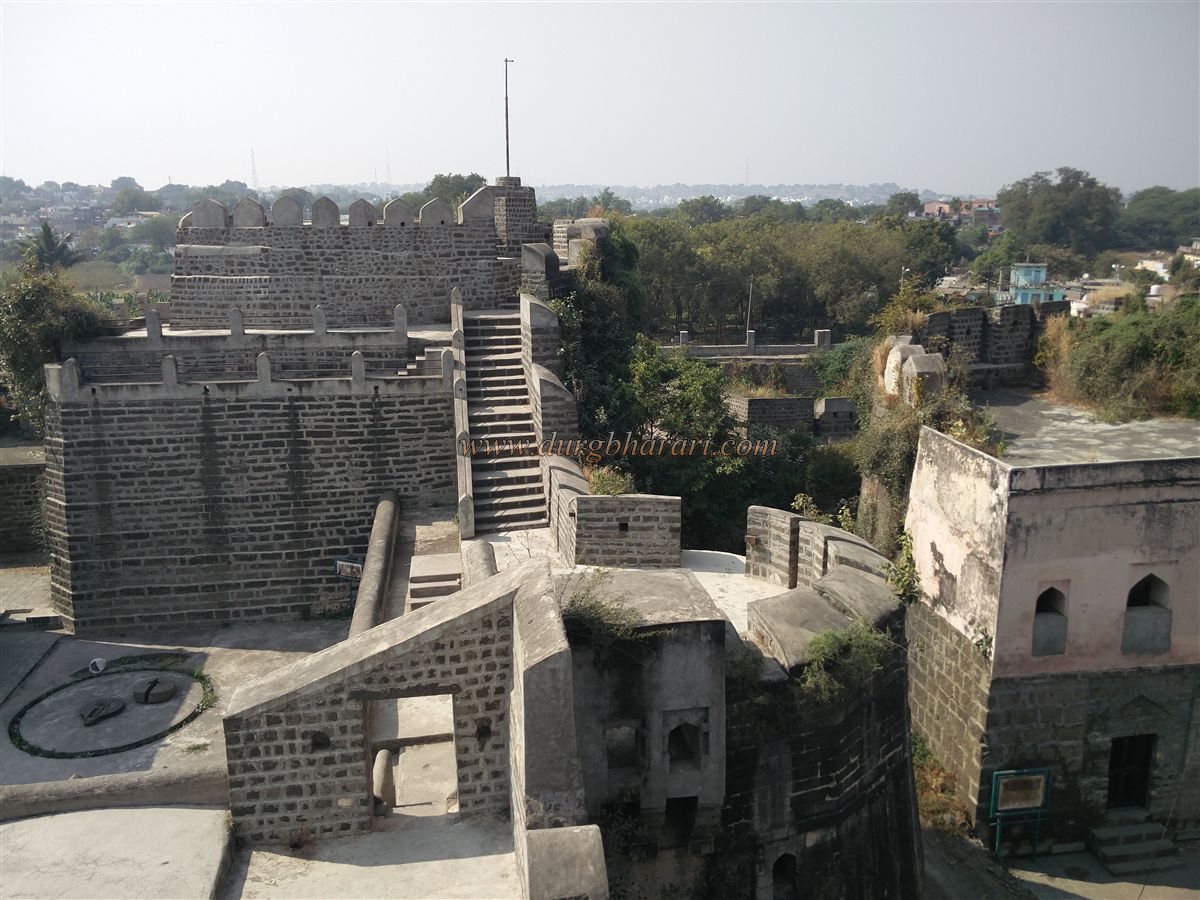
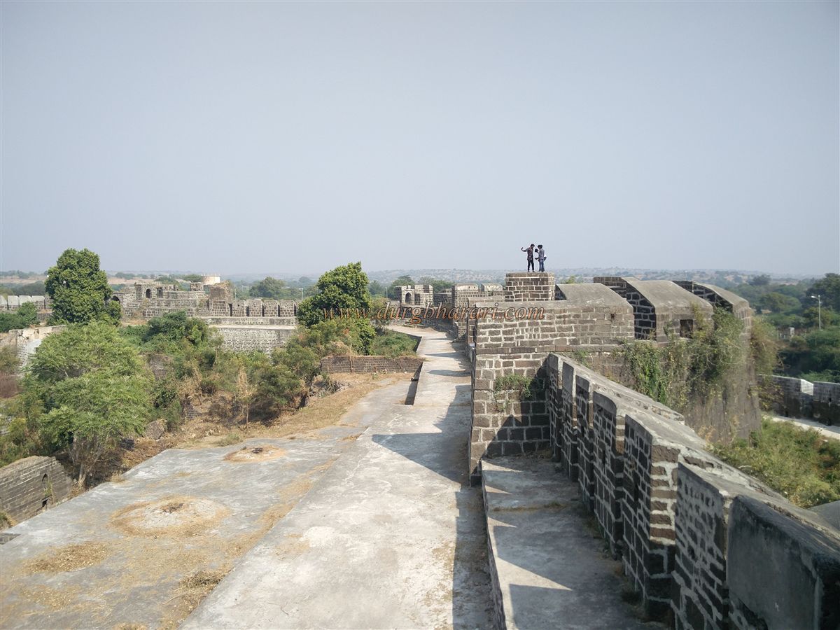
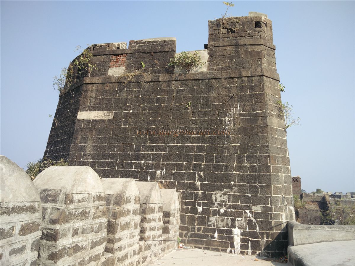
The fort has double fortification walls: the outer wall is 40 feet high and 12 feet wide; the inner is 60 feet high and 12 feet wide, separated by about 15 feet. The outer wall has 18 bastions, the inner has 16, totalling 34.
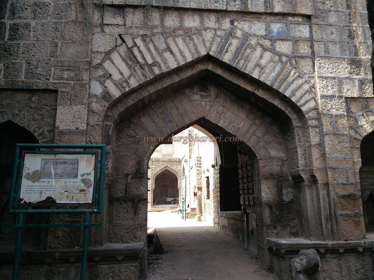
Beyond the Lohbandi gate is the second entrance, Machhli Gate, named for the two fish carved on its domed ceiling. It is 15 feet high and 8 feet wide, with Persian inscriptions from the eras of Muhammad Tughlaq (1344 CE) and Burhan Nizam Shah (1527 CE).
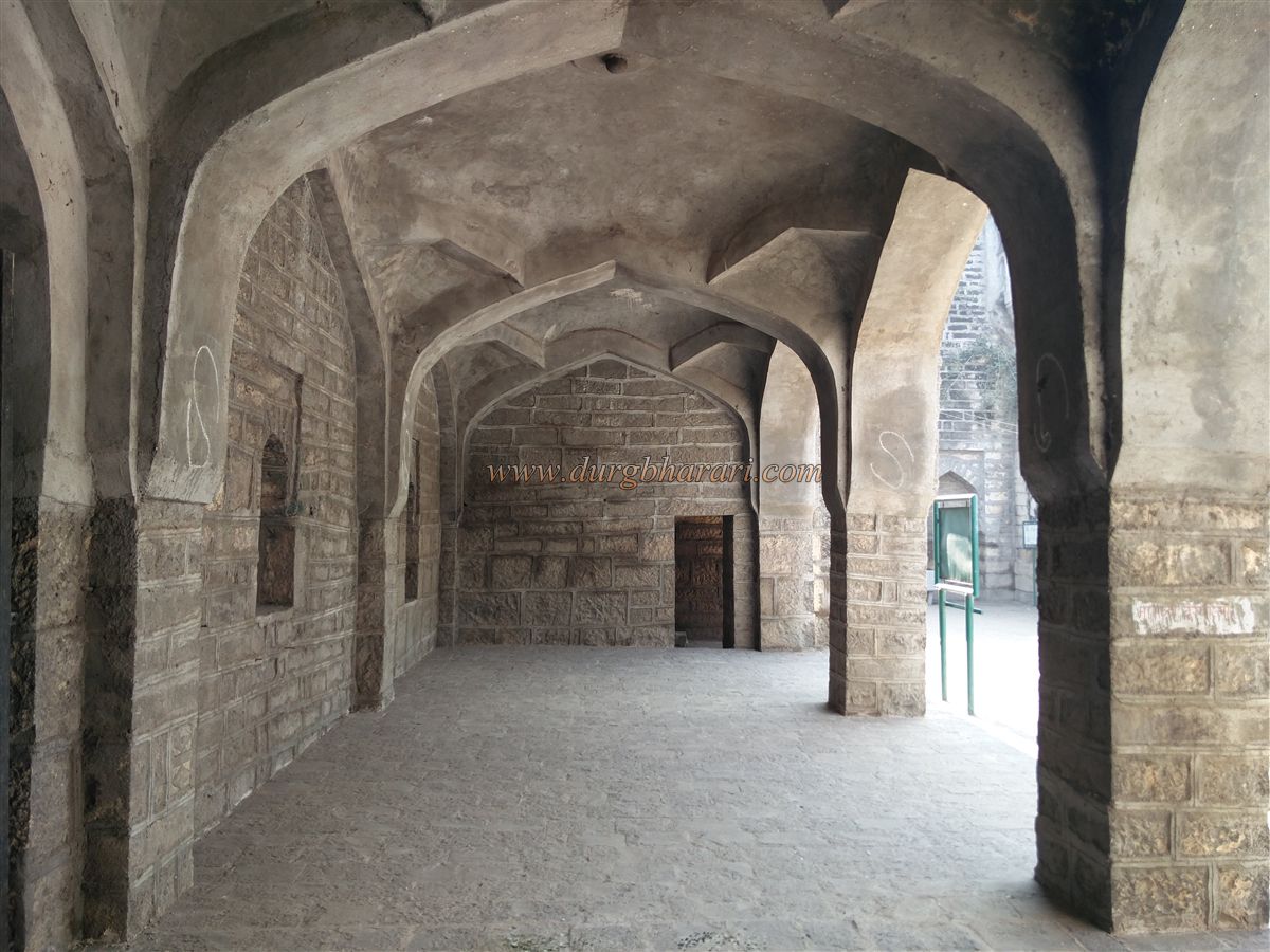
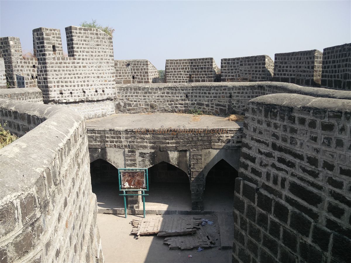
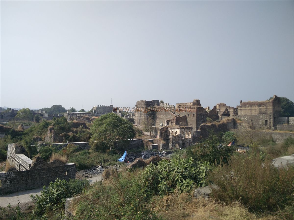
Inside lies a courtyard with a broken cannon, six devadyas (arches), and stairs to the ramparts. The Amberkhana building, possibly an administrative office, now houses the Archaeology Department office. Behind it is a watchtower with an arched room on top.
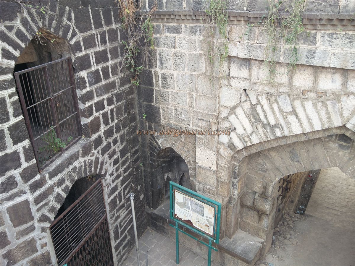
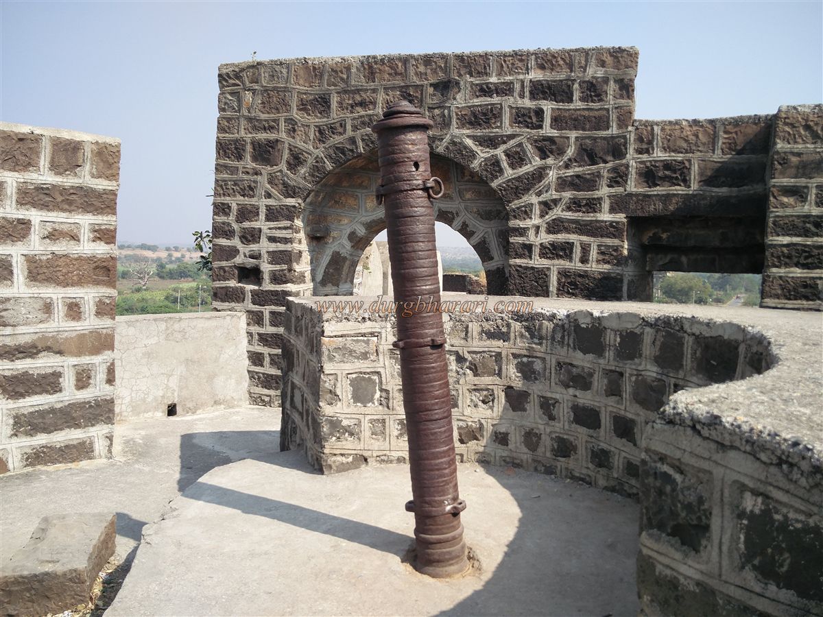
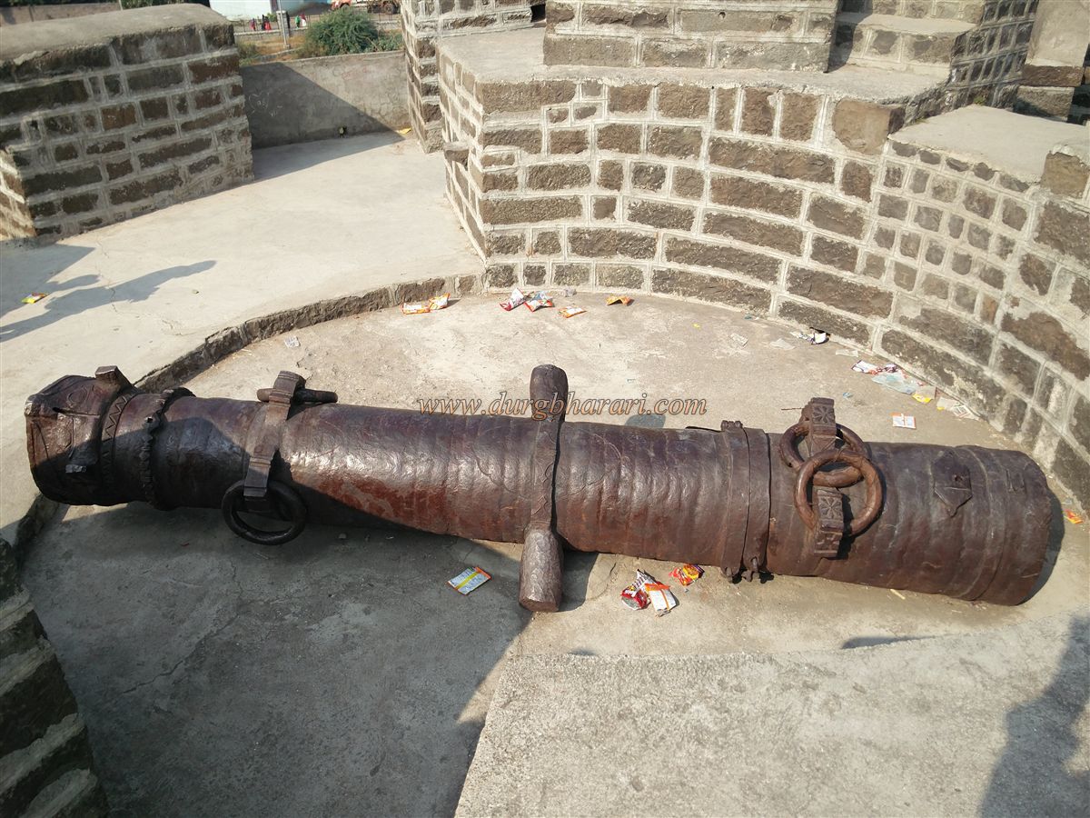
Walking along the walls, one can see carvings, inscriptions, wells, and steps leading into the moat. A medium-sized cannon is mounted on a bastion near Machhli Gate.
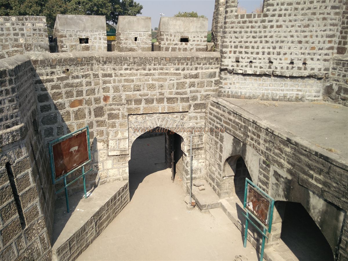
Further inside is Rangin Gate (also called Mahakali Gate), adorned with colourful carvings. The right bastion is Mahakali or Dhan Bastion, with an inscription encouraging soldiers toward victory. The left is Shaha Bastion or Ibrahim Bastion, strengthened by Bahadur Shah during Aurangzeb’s rule.
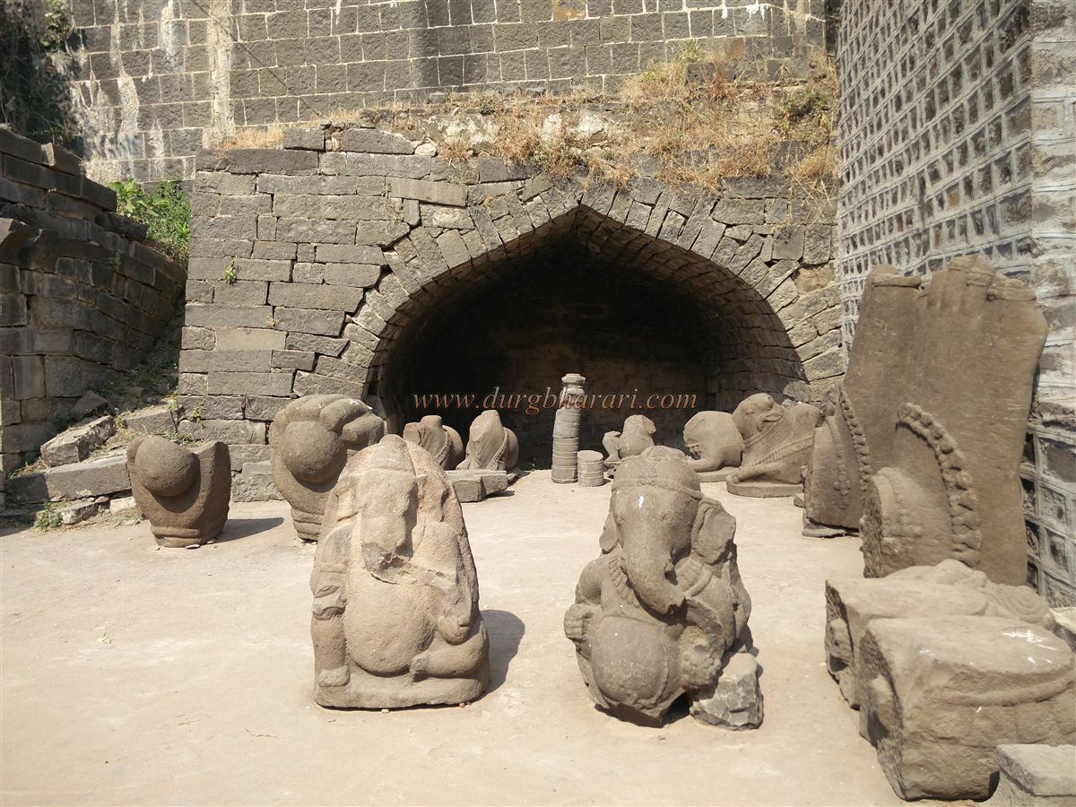
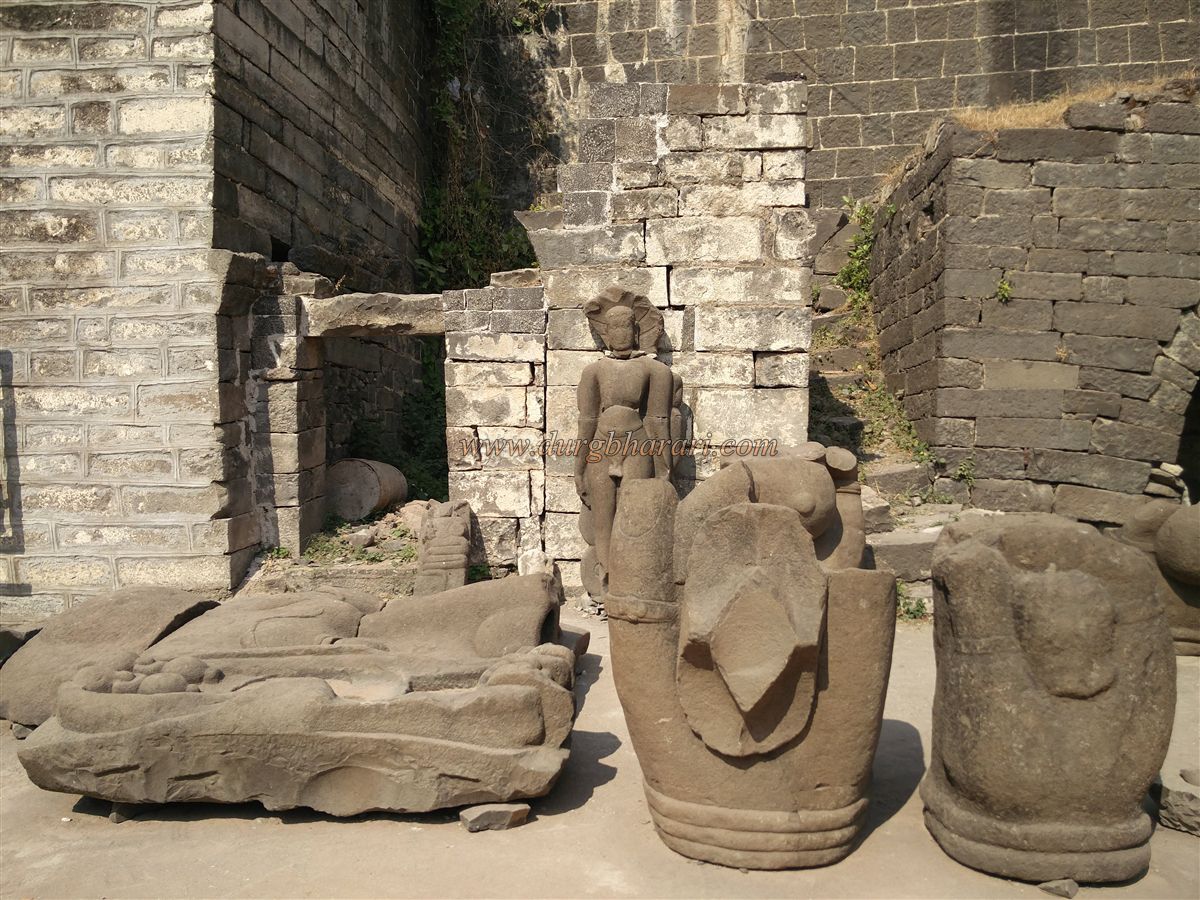
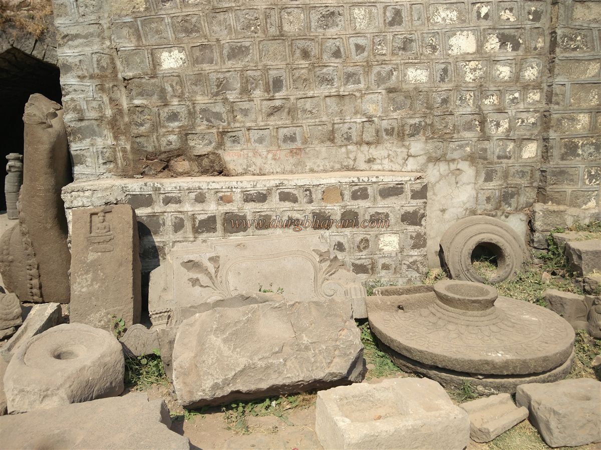
Archaeological excavations in 1960 unearthed Buddhist and Jain sculptures, including a 62-foot-high broken Kshetrapal statue from the 8th century, and many other artefacts now kept here.
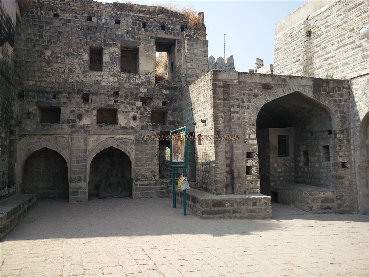
Past these is the fort mosque, built during the Nizam’s time by demolishing a Shiva temple. Despite alterations, the original serpent carvings remain. The mosque, with three domes and four Persian inscriptions, has a tank in front.
Nearby is Ambari Bastion, the largest in the fort, rebuilt by Malik Ambar. From here, one can see the entire inner fort. It houses the massive 15-foot-long iron Bangdi cannon, decorated with a tiger head carving.
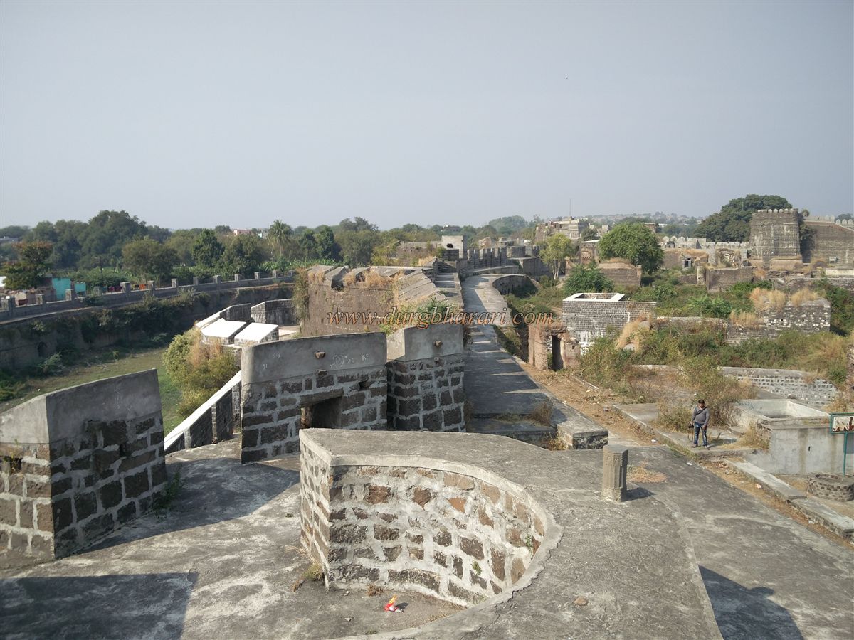
From Ambari Bastion, walking north leads to Shahi Hamamkhana (royal bathhouse) near the second bastion. Although the main palace already had a royal bathhouse (Hamamkhana), another Hamamkhana was constructed separately within the fort. The copper pipes used in this bathhouse are still visible today. From here, the next bastion contains a storeroom. Beneath the following bastion, in the moat, stands a small shrine (dargah) built on a platform, giving the bastion the name Darga Bastion. From this bastion, one can view both the moat-side shrine and the tunnel built into the moat wall that once brought water from outside into the fort.
From Darga Bastion, looking left toward the rampart, one can see the roof of the Amberkhana (granary). The roof has two square and four circular skylights, each three feet in diameter, allowing sunlight inside. The Amberkhana itself is 20 feet tall. The northern end of the Amberkhana reaches Bahadarpur Bastion, named for its view toward Bahadarpur village. This bastion has a cannon and a storeroom.
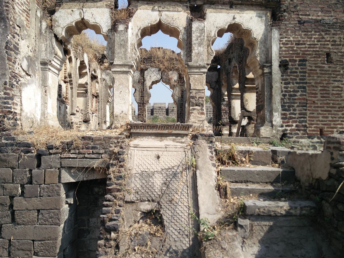
Walking west from the rampart, one passes the royal court (Durbar) area and, beside it, a building with stairs leading down. At the base is a 5-by-3-foot doorway opening into eight arched halls. Small windows measuring 3 by 2 feet allow airflow. This space was the women’s seating area for court functions, with three guardrooms just outside. The Durbar structure is rectangular and parallel to the ramparts.
Continuing past two more bastions along the western rampart brings you to Mansapur Bastion, which also houses a cannon and a storeroom. Southward from here, the next bastion has a Persian inscription on a chamber beneath it, and a Bangadi cannon mounted on top. Further along, after one more bastion, is the southernmost end of the western rampart, holding another massive cannon.
Beside this bastion, along the wall, stands another Amberkhana, with nine circular skylights of three feet in diameter and a height of 15 feet. In front of this bastion, attached to the fort wall, is the three-story Rani Mahal (Queen’s Palace). Access is through a staircase from the rampart, leading to the first floor. Inside are many halls with niches, tanks, bathing rooms, toilets, and copper pipes that once carried water.
Beyond the Rani Mahal lies the Raj Mahal (King’s Palace), stretching up to Shaha Bastion. The route to this bastion passes through two arched gateways and a Persian inscription. On the bastion it is another inscription and an upturned Bangadi cannon. Both the Rani Mahal and Raj Mahal are secured by gates on three sides to separate them from the rest of the fort.
Descending from here leads back to the Rangin Gate, completing the inner fort wall circuit. At the base of Shaha Bastion near the stairs are remnants of ancient structures.
From Rangin Gate, a square stepped well marks the starting point for exploring the inner fort. Excavations here uncovered a public Hamamkhana. Beside it stands the two-story ruined Nakshi Mahal, containing five tanks, bathing rooms, and toilets, built by Mughal noble Bahadur Khan.
Through the nearby doorway lies the royal garden (Shahi Udyan), whose fountains once sprayed water through copper pipes—many of which survive today. The opposite gate of the garden is called Rajabagh Gate, dating to the Rashtrakut period. Its tiger sculpture later inspired the names Vyaghra Gate and Bagh Gate.
Beside Bagh Gate stands the two-story Sheesh Mahal (Glass Palace), measuring 15 by 10 feet, with niches carved in lime plaster, inlaid with colourful glass and mirrors. On its eastern wall, a small waterfall was created, fed by water through a copper pipe still in place.
To the left of Bagh Gate, an arched passage leads to a water tank, while to the left stands a square, arched ammunition store containing cannonballs of various sizes.
Outside Bagh Gate to the right is a dome-roofed Dargah (10 by 10 by 10 feet), the tomb of a Sufi saint, with nearby arched structures and a two-story palace full of niches. Opposite stands a Rajasthani-style chhatri (canopy pavilion).
Exiting through the complex’s arches, the left side has horse stables, while the right opens into the courtyard of a palace built during the Nizam’s rule, with a decorative drainage channel leading from its lake. On its southern wall was once a pigeon house (Kabootarkhana) with many niches.
Outside the Lal Mahal, opposite the right-side gate, lies the Paris Well, with stairways decorated with elephant carvings. Instead of descending, a left-hand doorway leads into a courtyard with the east-facing, two-story JalMahal (Water Palace), built in the Rashtrakut period as a summer retreat. Measuring 18 by 11 by 12 feet, it has three windows facing the well, allowing cool breezes inside. Although the upper section is now gone, the stone doorframe inside still bears carvings of Lord Ganesha and flowers.
Beside the main JalMahal is a smaller one with a north-facing door and a single window. From here, walking toward the ramparts brings you to the Khambi Masjid (Pillar Mosque). Behind it, along the wall, are horse stables.
Returning to the well’s entrance and exiting, a platform with two flanking buildings opens into a courtyard. This is the Rang Mahal, once used for music and dance performances. Leaving through its front gate, one arrives at the Baradari pavilion opposite the Rani Mahal. On the southern side of the Amberkhana is a room that can be reached by climbing five steps. This is known as the Baradari Mahal. Its northern wall is fitted with 12 arched windows, each with carved trellises for ventilation. The other three sides have no windows. On the southern side of the Baradari Mahal, there are remains of various structures. On the bastions here, stone carvings of Sharabh, elephants, and monkeys can still be seen.
The ancient name of Kandhar was Panchalapuri. According to legend, during the time of the Pandavas, the marriage of Draupadi took place here. Ancient remains are found in the region even today. In ancient times, Kandhar was ruled by the Nanda dynasty and the Kakatiya dynasty. In the 4th century, the Kakatiyas made Kandhar their capital and constructed the fort and the Jagattunga Samudra (lake). From the 8th to the 10th century, it was under the rule of the Rashtrakutas. During their reign, Kandhar was called Krishnapur.
In the nearby village of Bahadarpura, a stone inscription from the 10th century has been found, which records a grant made by the Rashtrakut king Krishna III to the Mahadev temple. In the 10th and 11th centuries, Kandhar was a prosperous city. This is evident from the inscriptions found in the Mallinath Jain temple in Malgund, Karnataka, which mention several markets of this region, such as the Gem Market, the Pottery Market, and the Elephant Market. Kandhar and the surrounding region were known for sugarcane, betel leaves, cotton, and elephants.
Later, it came under the rule of the Yadavas of Devgiri. In 1312, Malik Kafur, the commander of Allauddin Khilji, defeated Ramchandra Yadav of Devgiri, bringing Kandhar under the Delhi Sultanate. In the mid-14th century, Kandhar became part of the Bahmani kingdom. After the fall of the Bahmani Sultanate, it came under the rule of the Adil Shahi dynasty of Bijapur. In 1609, Malik Ambar, the prime minister of the Nizam Shahi dynasty, strengthened the fortifications of Kandhar Fort.
In 1656, when Aurangzeb invaded the Adil Shahi territories, he captured Kandhar and built a large garden here, known as Aurangzeb’s Garden. In 1672, Bahadur Khan of the Mughal Empire renovated the Shah Bastion of Kandhar Fort. Later, during the decline of the Mughal Empire, Kandhar came under the rule of the Asaf Jahi Nizam of Hyderabad.
The Archaeological Department has discovered many ancient artifacts here, including stone inscriptions, sculptures, and remains of temples from the Rashtrakut period. Among these is a broken statue of Kshetrapal, which is 62 feet tall and dates back to the 8th century. The fort has four main gates. The northern gate is called the Nagarkhana Gate. Above it is a small chamber from where, in earlier times, drummers would play the Nagara (drum) to announce important events. On the bastions and walls near the gates, Persian inscriptions from the Mughal period are found, which record details of repairs and construction works. The southern gate is known as the Machali Gate. The other two gates are the Fateh Gate on the east and the Sardar Gate on the west.
Inside the fort are several important structures such as the Amberkhana (granary), Baradari Mahal, royal palaces, a mosque, and stepwell. The Amberkhana has three large domed halls, each used for storing grain. These halls are built with thick stone walls, ensuring that the grain stored inside would remain safe for years without spoiling. The royal palaces inside the fort were built during the Bahmani and Mughal periods, and traces of their fine architecture are still visible. The mosque here has a spacious courtyard and intricately carved arches.
To the south of the fort is the Jagattunga Samudra, a large artificial lake built in the Rashtrakut period. Even today, it serves as the main water source for the town. The embankment of the lake is constructed from large dressed stone blocks. On the eastern bank of the lake is a stone pavilion with steps leading down to the water, possibly used for royal leisure activities.
The carvings found on the bastions of the fort are particularly noteworthy. Figures of Sharabh, elephants, monkeys, and other animals are depicted with remarkable artistic skill, and despite the passage of centuries, the details are still sharp and clear. The fort’s ramparts are lined with battlements and bastions at regular intervals, making it a strong defensive structure in its time.
Today, Kandhar Fort stands as an important historical monument in Nanded district, reflecting the glory of different dynasties — from the Rashtrakutas to the Bahmani, Adilshahi, Mughals, and Nizam. Its walls, gates, palaces, and carvings silently narrate the story of its long and eventful past.
© Suresh Nimbalkar
GALLERY