KALDURG
TYPE : HILL FORT
DISTRICT : PALGHAR
HEIGHT : 1510 FEET
GRADE : MEDIUM
Due to Mumbai, the Konkan province is divided into North Konkan and South Konkan. Vasai to Daman belt is known as North Konkan and the Alibag to Karwar belt is known as South Konkan. Despite the gift of natural beauty, this area near Mumbai has not developed much for tourism. In the former Thane district of North Konkan and now in the newly formed Palghar district, a watchtower called Kaldurg was built near the confluence of the Surya and Vaitarna rivers in the Chahad ghat on the Palghar-Manor road. To visit Kaldurg fort Palghar is the nearest railway station on Western Railway and by road Manor on Mumbai-Ahmedabad highway. Waghoba Gorge on the Palghar Manor route is 7 km from the Palghar railway station and 14 km from the Manor on the Mumbai-Ahmedabad highway. Entering the wharf from the side of Manor, a beautiful view of the fort can be seen.
...
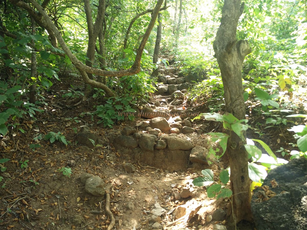
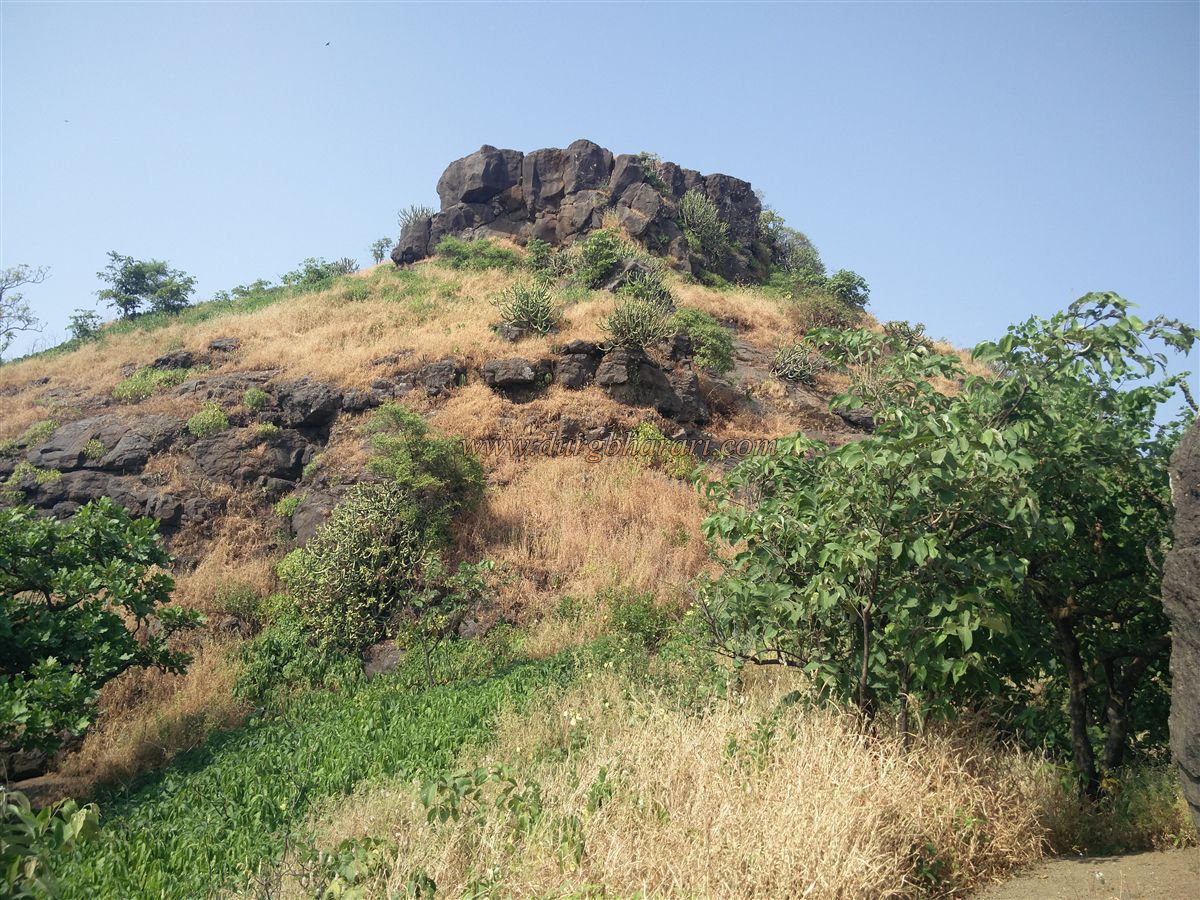
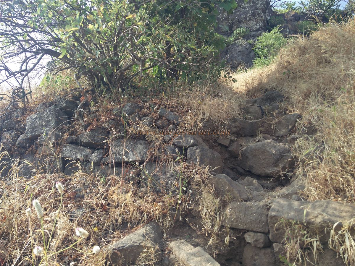
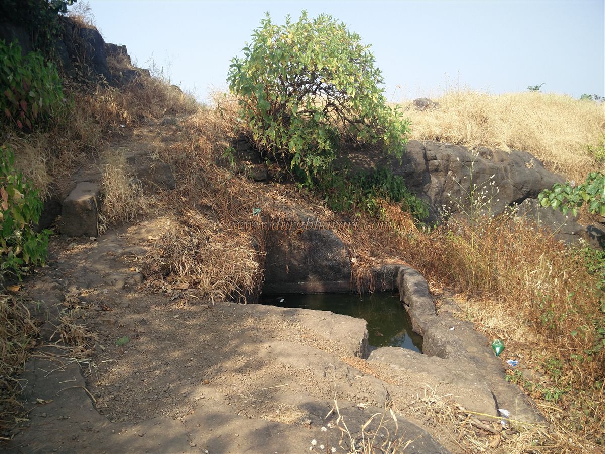
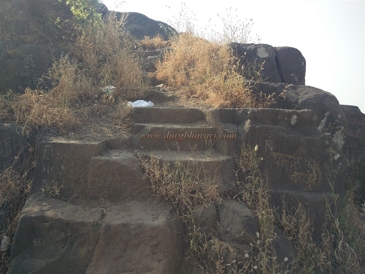
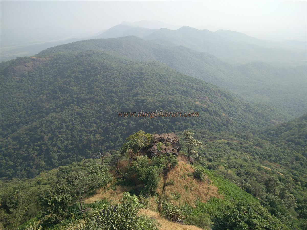
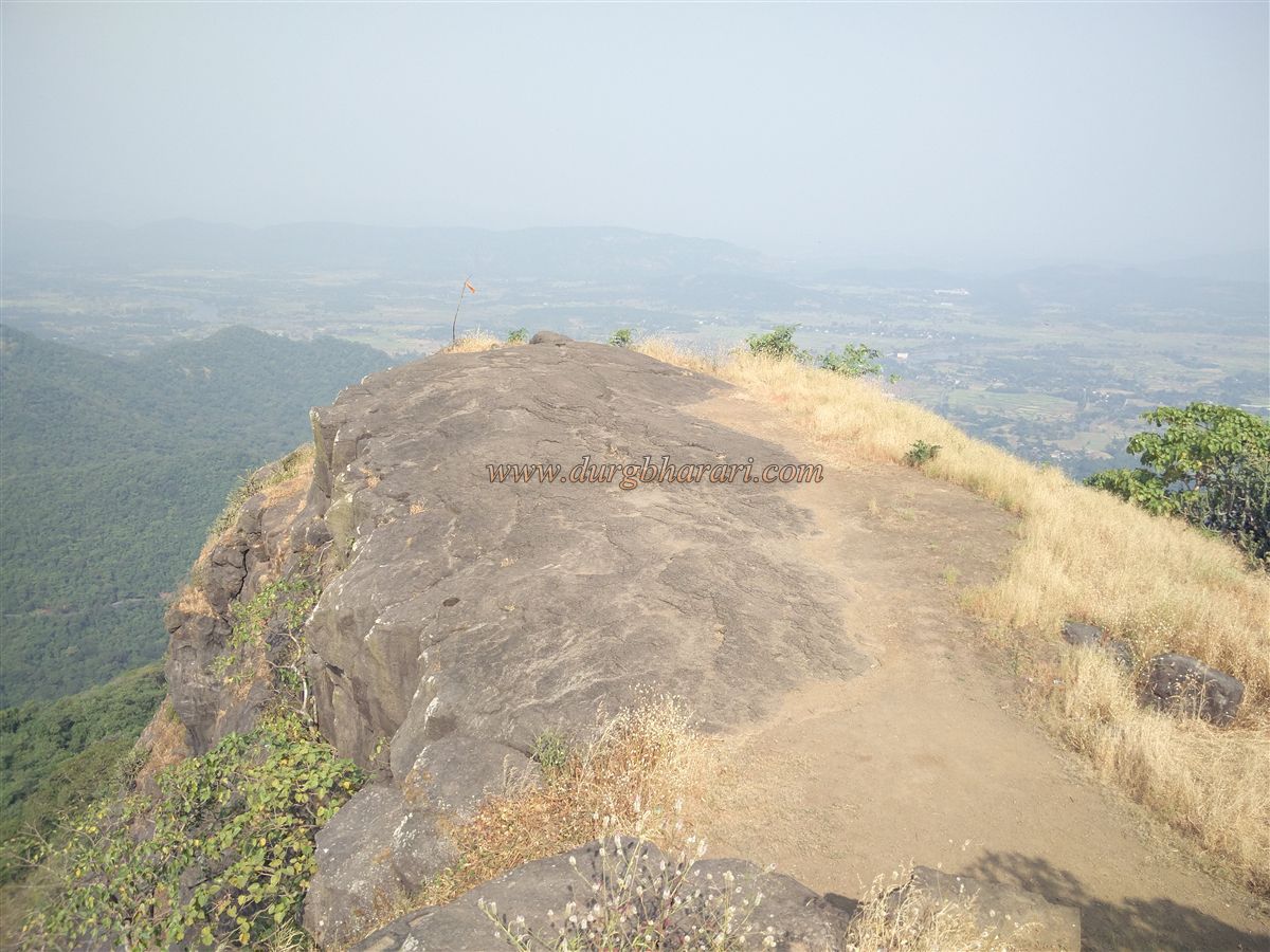
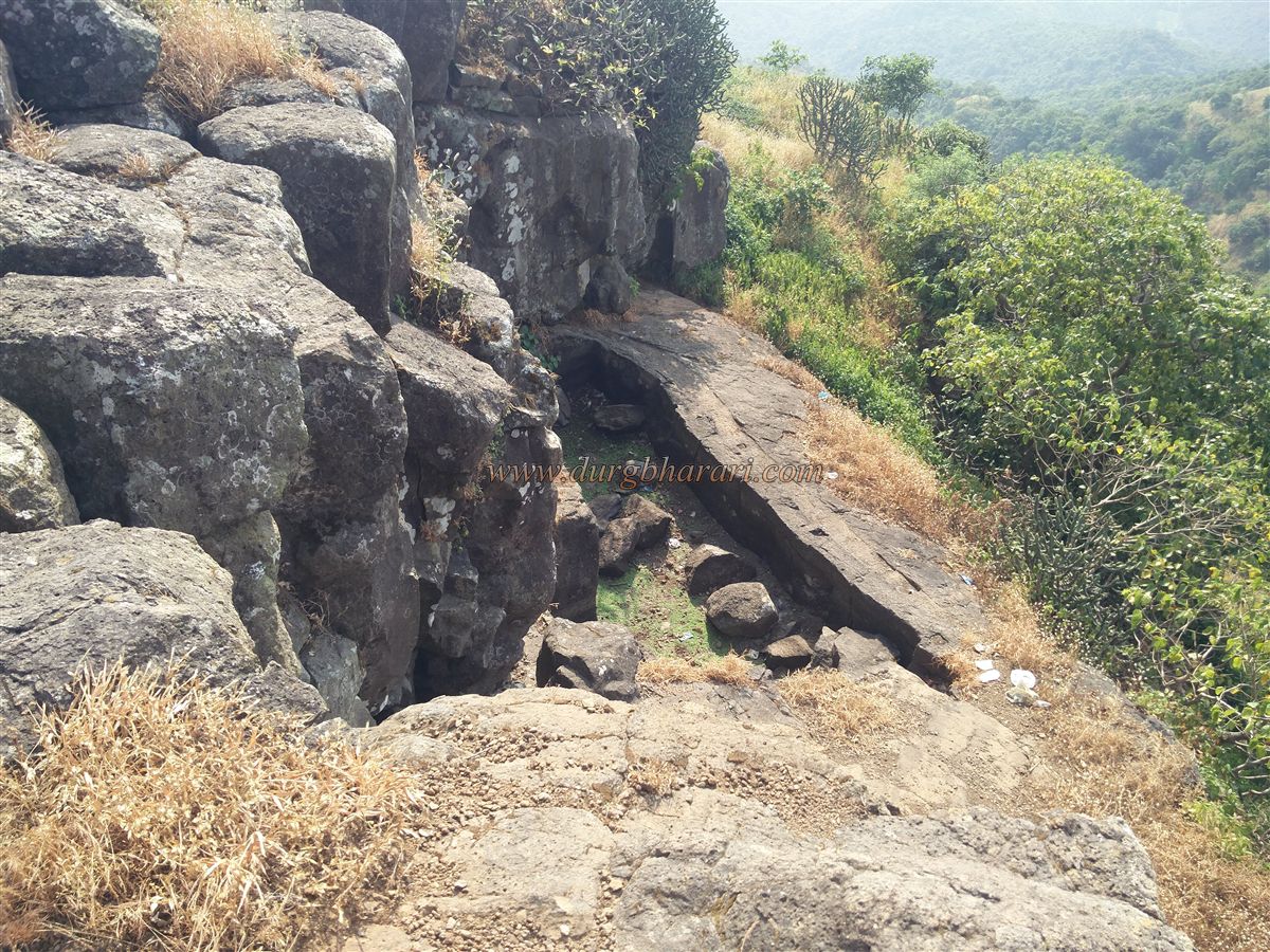
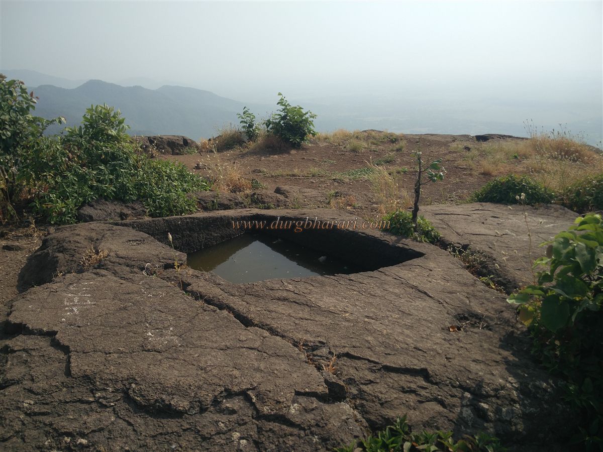
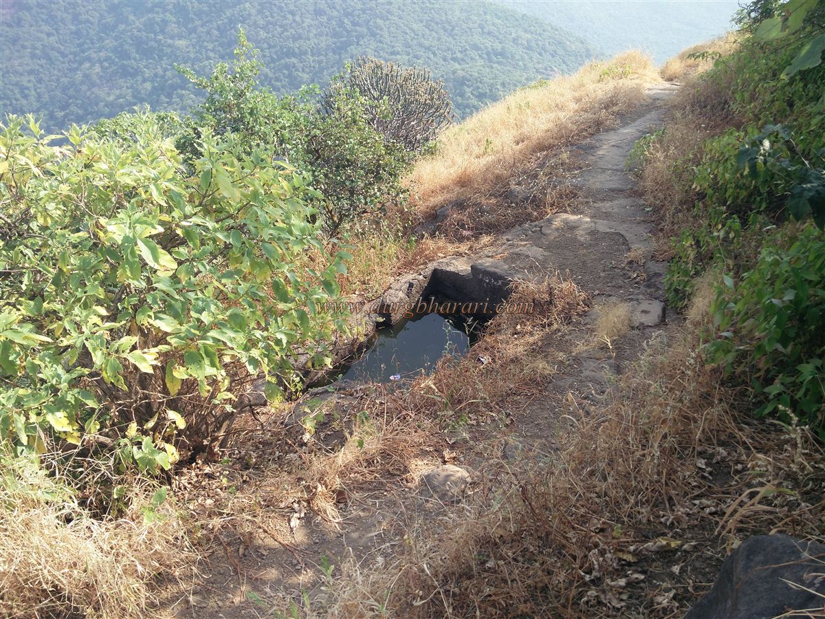
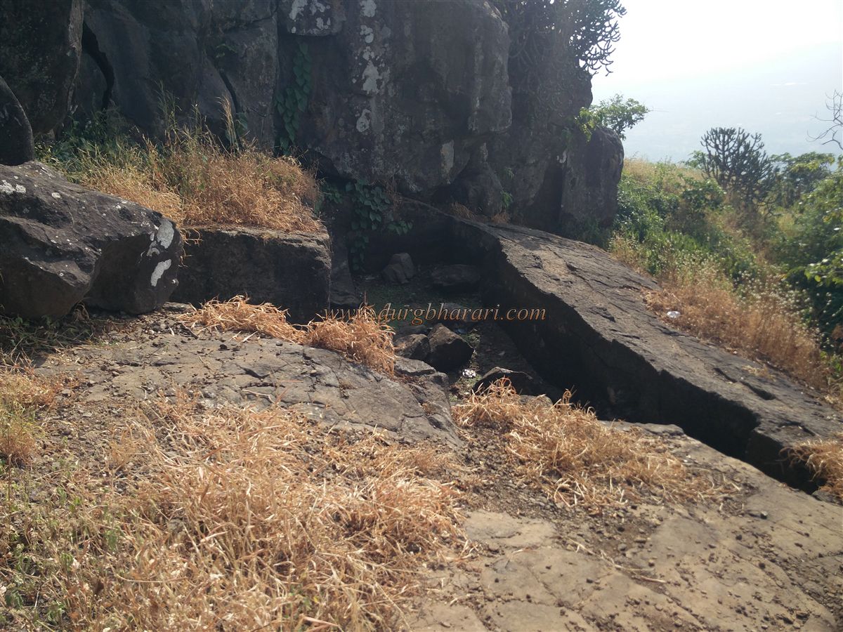
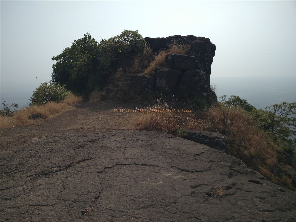
The hill of the fort is spread from south to north and the height of the fort is 1386 feet from the sea level, but we cross the 400 feet high hill up to Waghoba gorge by car. There is a small temple of Waghoba in the gorge of Chahad Ghat and there are a large number of monkeys here. There is a hand pump of water behind the temple and as there is no water on the fort, water should be filled from here before starting the trek. Near the pump, some stone steps are visible. This is where the path to the fort begins. The fort is divided into two-part citadel & plateau and this steep path leads straight up to the top. As the road passes through dense forests, the sun won’t bother you but also the fort is not visible while moving through this path. In about half an hour we reach a small surface below the fort. In this place, small cisterns carved in the rock filled with soil can be seen. For the first time since leaving the foothills, the fort is seen on the left towards the eastern direction. The top of the fort is square and has slopes on all four sides. After coming forward from this level, this path starts to climb the fort on the left side of the gorge. Fifteen minutes uphill, you see a small pinnacle on the right and the top of the fort on the left. After seeing the pinnacle, we enter the fort from the ruined ramparts. At this place, you can see 10x6 feet deep cisterns carved in the rock on the hillside. Even if there is water in the cistern, it is not drinkable. After seeing the cisterns, you enter the fort after climbing eight to ten steps. This part of the fort is made entirely of rock and many holes are carved on the edge of this rock. There is a facility to build a shelter for the guards by putting wood in the pit on the side of the hill. There is another descending path in front of the path we came up from. After descending this path, we come to the largest but currently dry cistern on the fort. When you come back to the descending path, you can see four or five steps leading to the top of the fort on one side and a large round hole carved in the rock at the other end. This should be the place to hoist the flag on the fort. After descending some distance along the footpath adjacent to this gorge, we come to the temple of Meghoba. In this place, you can see broken Shivlings, Nandi, a stone basin, and some idols in the yard. After seeing this, we turn back and climb the four steps we saw earlier to reach the highest part of the fort. This place also has many holes carved on the edge of the cliff like the previous path. Another small cistern of mossy water can be seen at the top of the fort. The fort has a total of four cisterns, one on the plateau and three on the head of the fort. One and a half hours is enough to reach here from Waghoba gorge. Through this part of the fort to the north are Asava fort, Asheri to the northeast, Kohoj and Surya-vaitarna river confluence to the east, Takmak to the southeast, Tandulwadi to the south, and Palghar city to the west. Kaldurg fort is mentioned in history as Kalmegh and Nandimal. Although there is no reference to the construction of the fort, the fort belonging to the Bimb king of Mahim may have been built during his reign or earlier. The fort was later captured by the Portuguese. Later, during the reign of Sambhaji Maharaj this fort came under the control of Marathas for some time but it was recaptured by the Portuguese. This fort came under the control of Marathas during the Vasai campaign from 1737 to 1739.
© Suresh Nimbalkar
GALLERY