JUNGLI JAIGAD
TYPE : HILL FORT
DISTRICT : SATARA
HEIGHT : 2985 FEET
GRADE : HARD
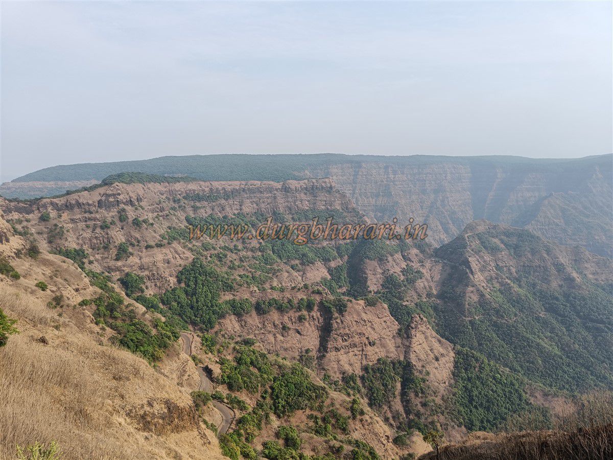
There are two forts named Jaigad in Maharashtra. One is the sea fort Jaigad in Ratnagiri district, and the other is the forest-hidden “Jangli Jaigad” in the dense jungles of Satara. Due to the thick forest, sunlight cannot reach the ground even in peak summer, and the surrounding forest itself forms a natural fortification—this is the fort’s true treasure. The original historical name of this fort is unknown, but because of the surrounding dense forest, it must have been named Jangli Jaigad. It is not well-known, and because it lies within a protected area that requires effort to reach, very few fort enthusiasts visit it.
To reach Jangli Jaigad, travel on the Chiplun–Patan–Karad road. From Chiplun, 43 km away is Koynanagar village. From Koynanagar, Navja village is 19 km further, and buses as well as private jeeps are available to reach it.
...
The entire area, including Jangli Jaigad and nearby villages, is under the Koyna Project and the Forest Department’s protection. By paying the required Forest Department fee and taking a local guide from Navja village, you can easily trek to the fort. Koyna Forest Department office contact: (02372-284091). From Karad to Chiplun, there is the Koynanagar–Helwak route via Kumbharli Ghat, and another ghat route through Navja via Panchdhara tunnel descending to Kolkewadi village. For security reasons, this ghat is closed to private vehicles.
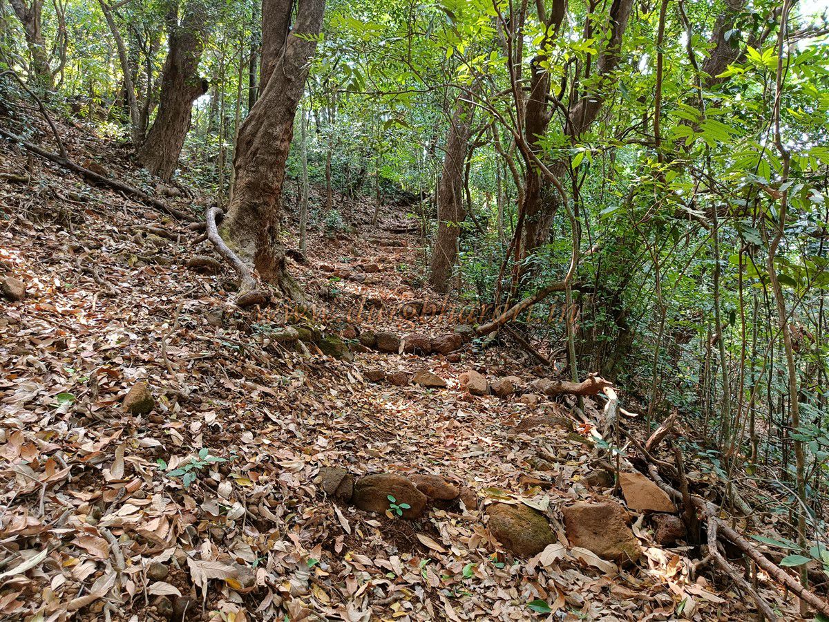
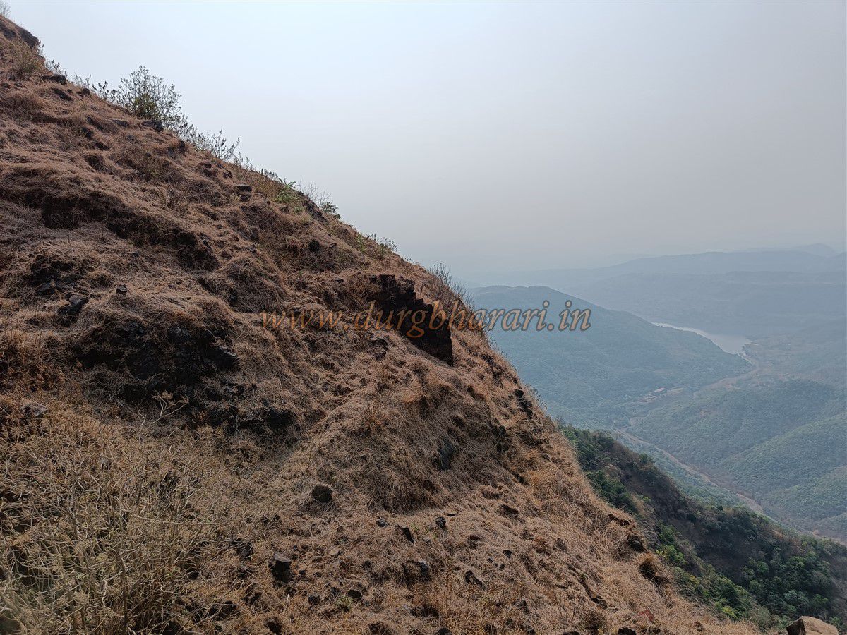
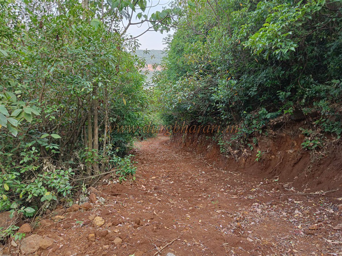
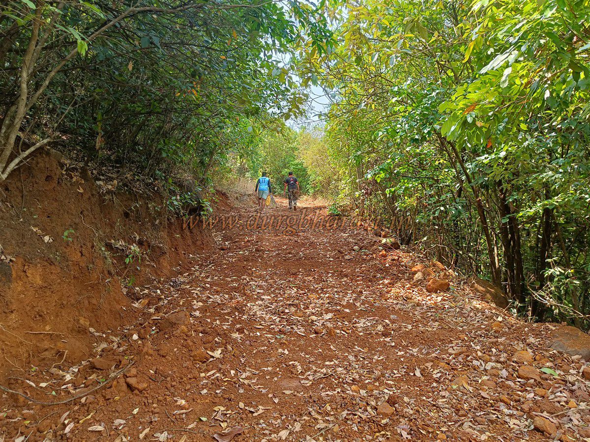
From Navja village, 6 km along the same road is the path to Jangli Jaigad. If you have a private vehicle, it reduces the walking distance. There are no signboards marking the path to the fort, and although the trail is visible, it branches off into two or three smaller tracks in the forest, so a local guide is essential. Since there is no water on the fort, carry enough water from the village, and begin your trek towards Panchdhara tunnel. About 3 km from Navja, there is a checkpoint, and after another 3 km, a dirt track on the left leads into the hills—this is the start of the climb. This is the only access route; from the Konkan side, the cliffs are sheer and impassable.
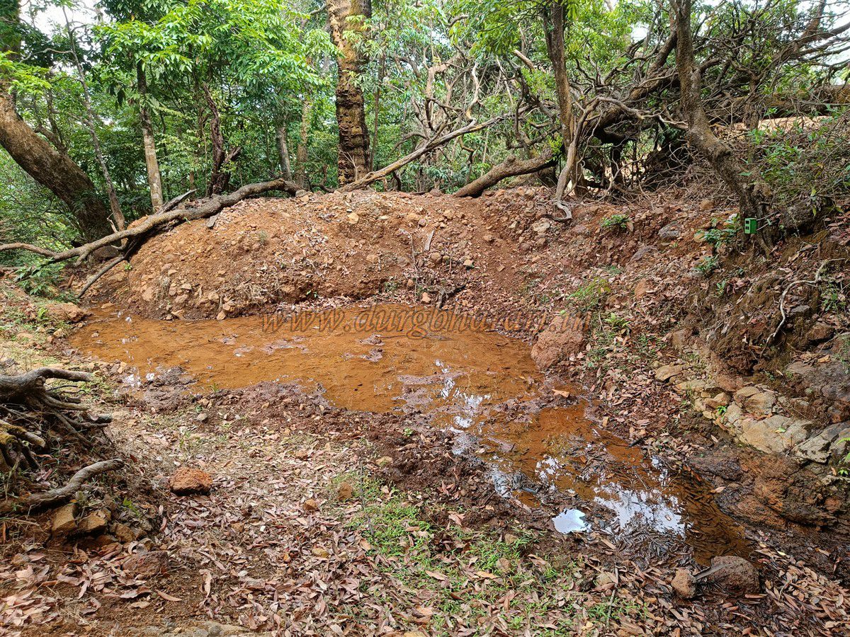
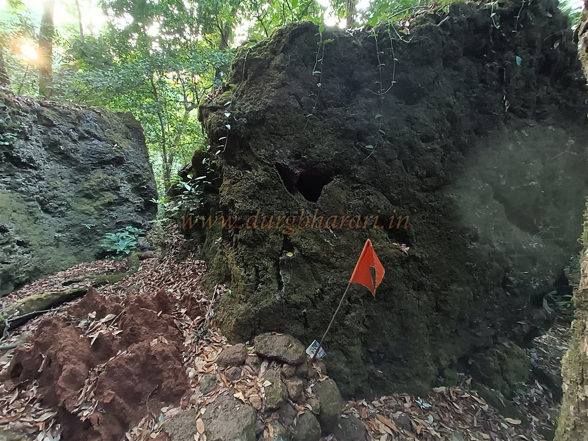
Following the forest trail for about half an hour, you reach a spring—the only water source in this part of the forest, so wild animals frequent it. Above the spring, the Forest Department has built a stone platform for resting. Locals call this spot “Ghodatale.” Some say that during British times, officers would leave their horses here and continue on foot to the fort, but this seems doubtful since horses could still go further along the path.
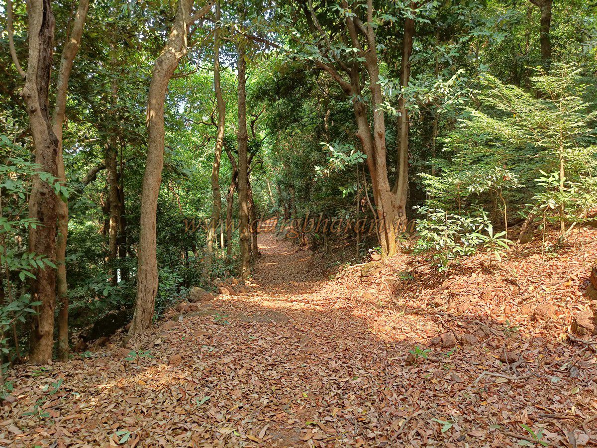
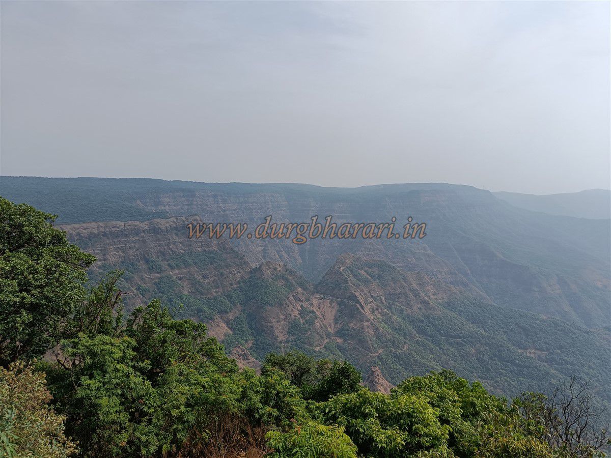
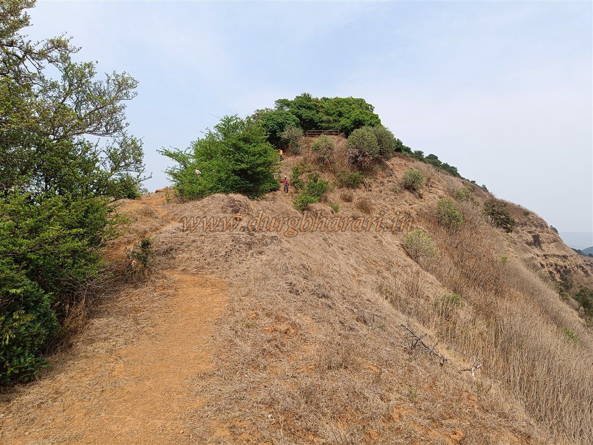
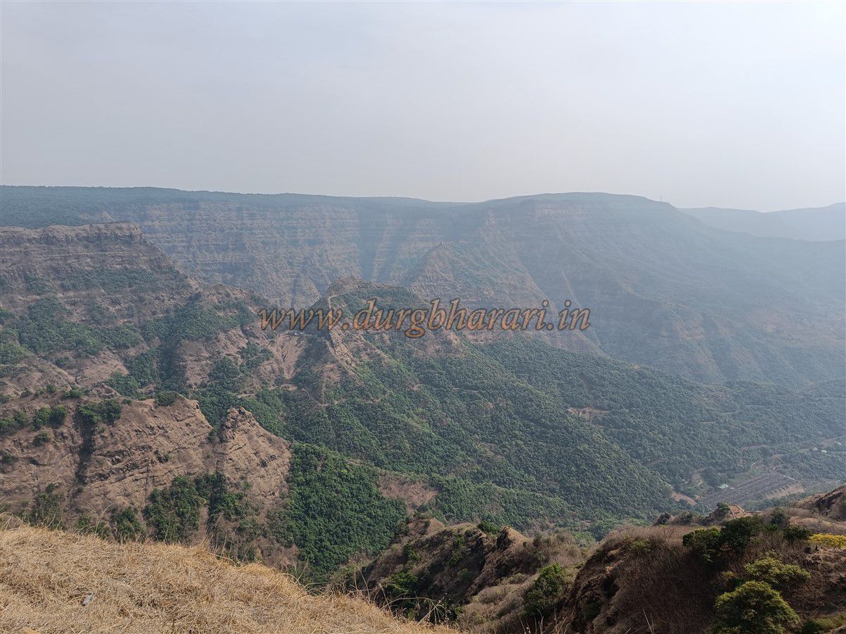
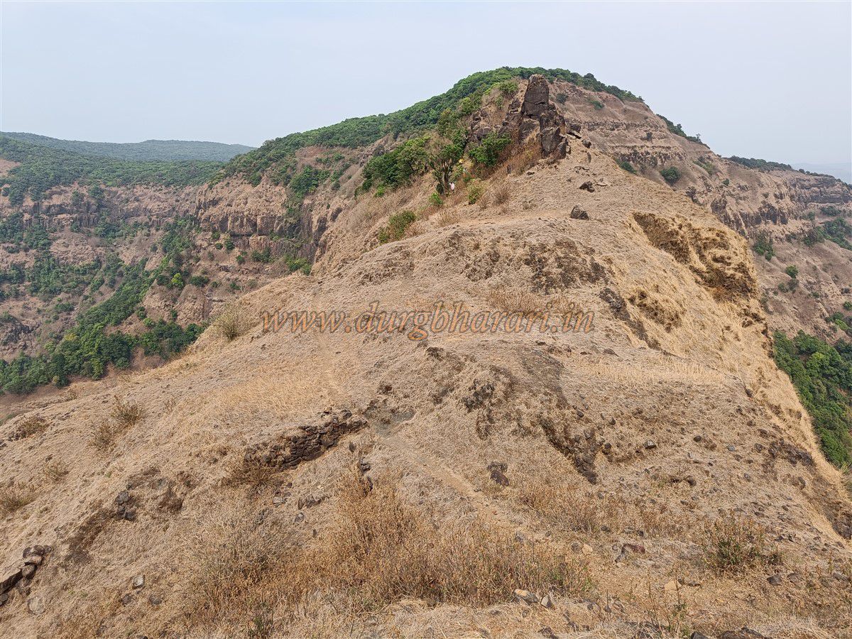
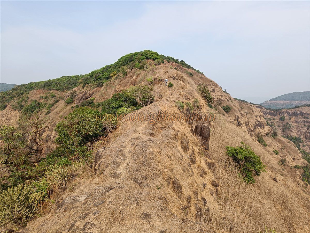
About 20 minutes ahead, the trail forks: the right goes to Dicholi village, while the straight, upward path leads to the fort. Here, the hill ridge narrows. On the left side of the path, on a cliff edge, there is a small circular bastion with steps—probably used for watch duty. The ridge then begins to slope downwards, with iron railings installed on the left for safety. In one spot, there are remains of structures and marks of stone-cutting. At the tip of this ridge, surrounded by deep valleys, the bare, exposed hill of Jangli Jaigad comes into view. It takes about half an hour to reach this point from Ghodatale.
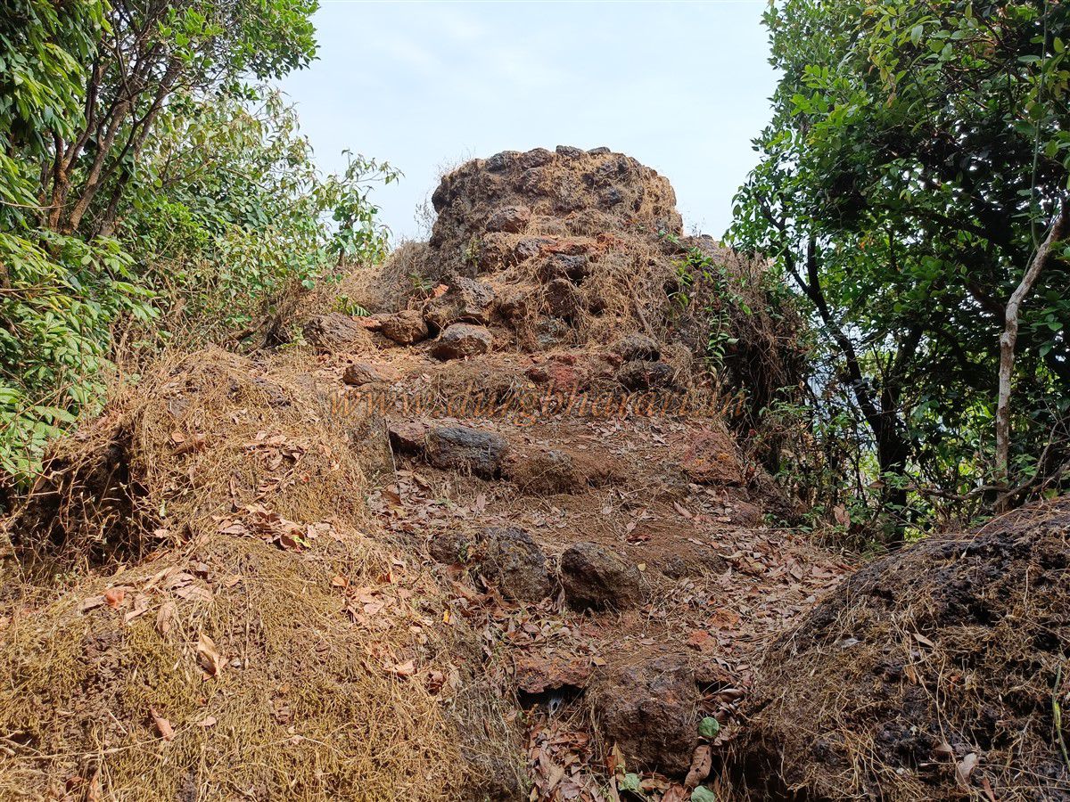
The fort hill is connected to the Sahyadri main range by a narrow neck. A slender ridge trail leads to the fort and must be crossed carefully. After stepping over one or two small mounds on the ridge, you reach a deep trench-like cut made for defence between the fort hill and the ridge. To prevent erosion, stone walls were built on both sides, but nature has taken its toll. The fort’s gateway and bastion on the far side have collapsed, with stones fallen into the trench. On the right slope of the trench, a laterite stone wall can still be seen.
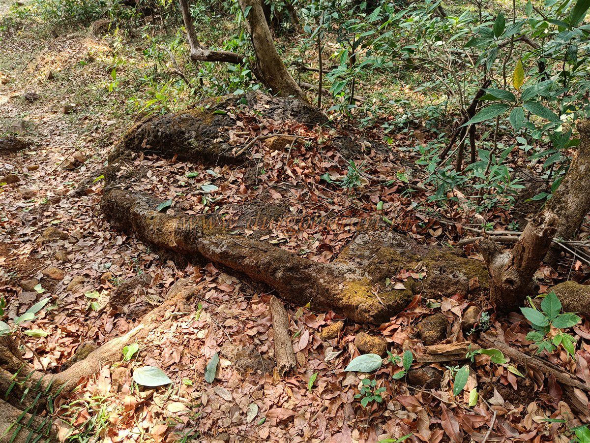
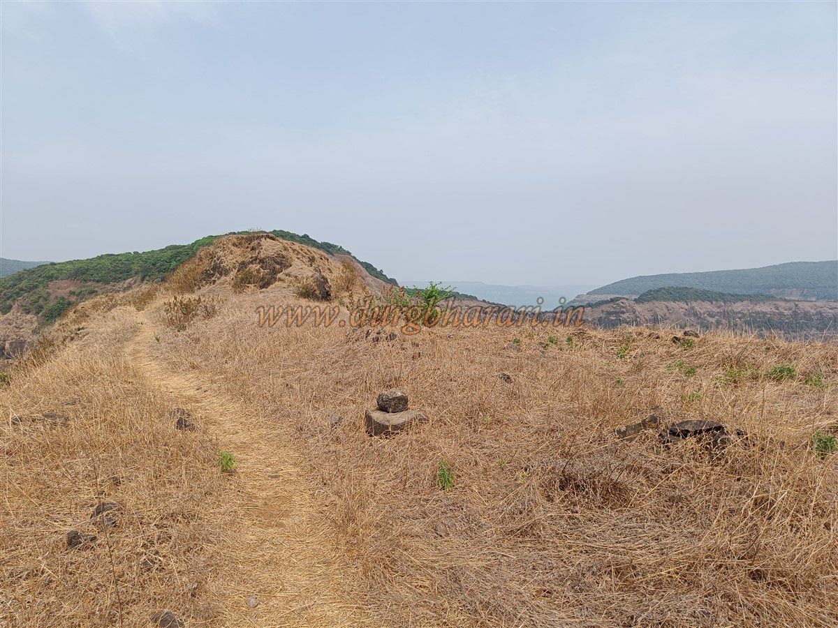
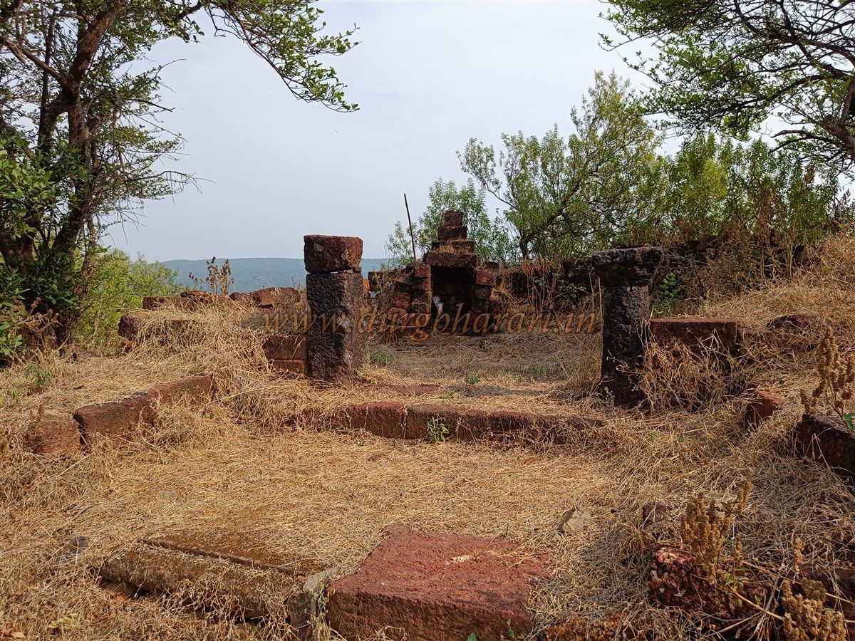
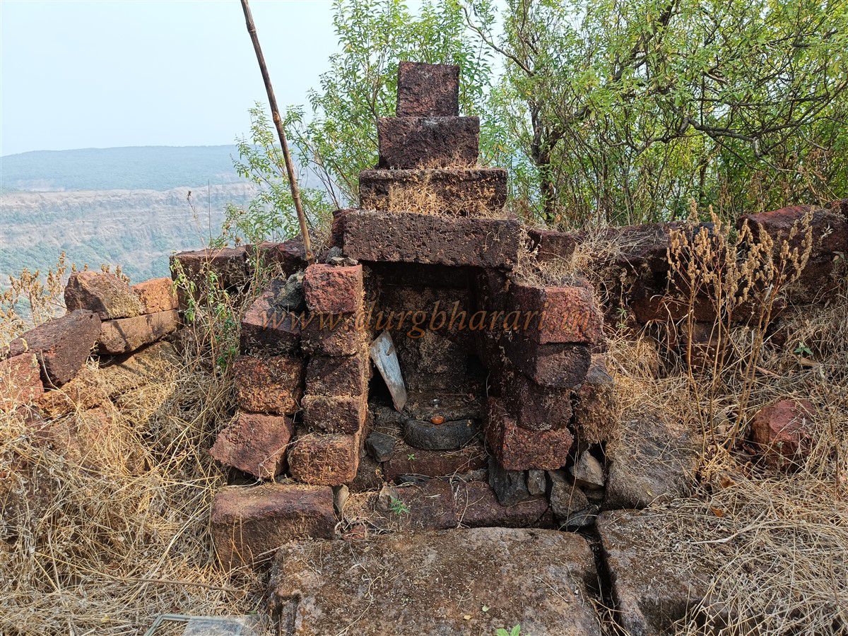
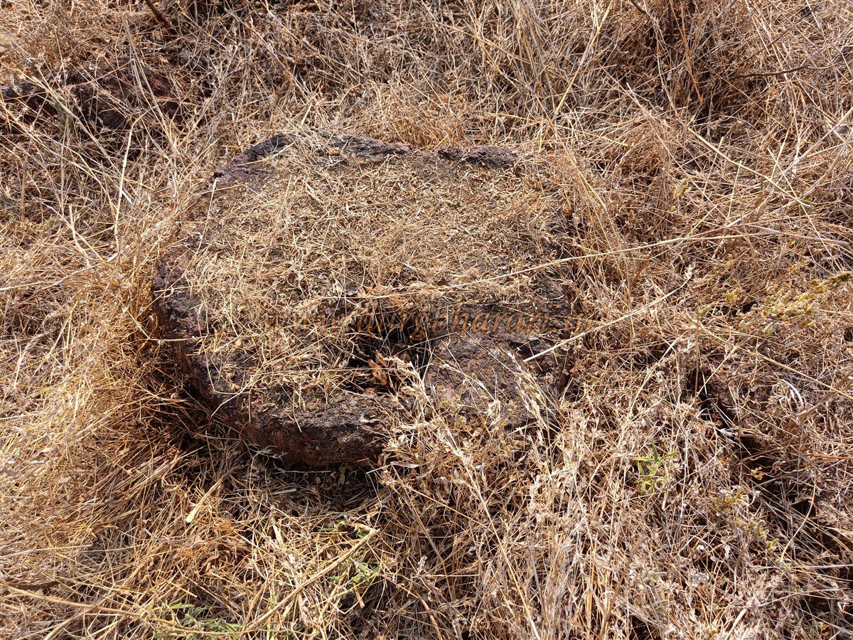
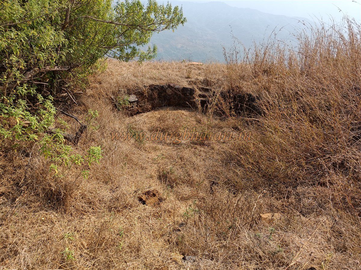
Climbing the opposite hill, the base of a circular bastion appears, and you enter the fort through the ruins. The fort’s top is a narrow ridge with deep valleys on both sides, so apart from the entrance area, there is no other fortification. The summit is at 2,985 feet above sea level and spreads about 4 acres east-west. Towards the far end, the trail winds past two small rock pinnacles. There are remains of a structure and further ahead, a ruined temple with a heavily weathered idol of the fort’s deity in its niche. In front are two parts of a deepmala (lamp pillar) and a stone vessel.
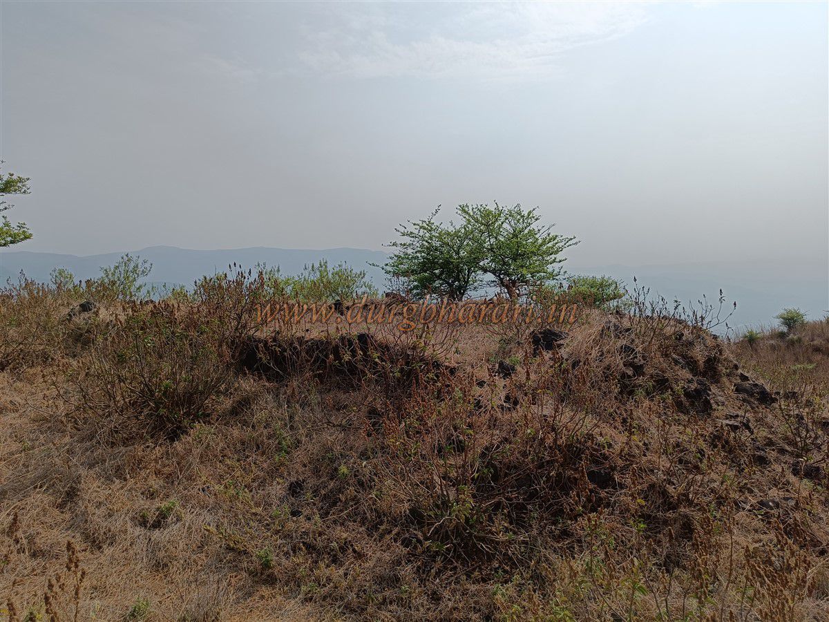
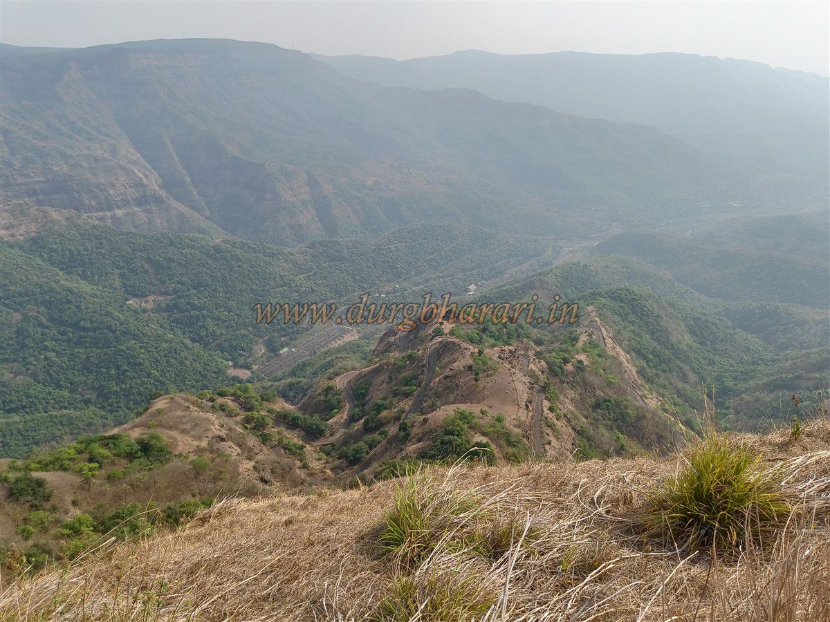
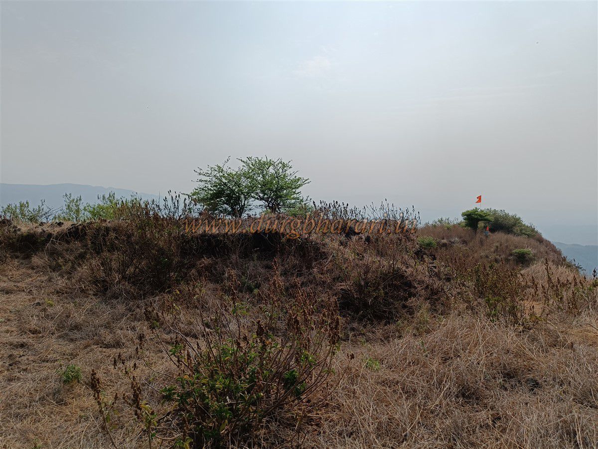
Climbing further, you pass between two bastions—one mostly destroyed, the other square-shaped and partly intact. Nearby are the remains of a large mansion, with some walls still standing. Behind it, on the slope, is a laterite stone well now filled with soil. The area is overgrown with grass hiding more ruins. This is the fort’s western end, where a saffron flag is hoisted. From here, you can see the entire Tal Konkan region and forts like Kolkewadi, Barwai, Vasota, Mahimandangad, Makrandgad, Rasalgad, Sumargad, Mahipatgad, and Bhairavgad. Judging by its location, this was likely a key lookout fort to monitor Kumbharli Ghat and the surrounding area. The whole fort can be explored in half an hour, but the round trip from the base takes about three to three-and-a-half hours.
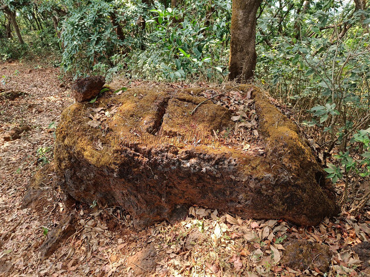
On the way back to Navja, just before the village is the holy site of Ramban. Here, a rough laterite stone slab measuring 7 x 7 feet has a triangular arrow-shaped groove 4 feet high, with a cavity inside holding a live water spring said never to dry. However, when we visited in April, it had dried up. Locals say that if someone wearing shoes or having eaten meat touches the stone, the spring temporarily stops flowing. As laterite is porous, rainwater likely seeps into this cavity and stays for a time. Since the stone is deep in the forest with no sunlight, evaporation is minimal, helping the water last longer.
Jangli Jaigad was probably built to watch over Kumbharli Ghat and Tal Konkan. After Chandrarao More’s territory of Javli was captured, this region came under Shivaji Maharaj’s rule. Helwak village near the fort was the market and administrative centre, and Jangli Jaigad was part of the Helwak Mahal. In 1758–59, Khandoji Mankar, a Peshwa sardar, took the fort from the Pant Pratinidhi, but the Peshwas later returned it. In 1810, during Parashuram Pant Pratinidhi tenure, Peshwa general Bapu Gokhale captured the fort from the representative’s dependant, Tai Telin. Finally, in 1818, during the Anglo-Maratha War, Colonel Hewett’s forces captured it.
There are no staying facilities on the fort, but Navja village offers homestay and meals. Contacts in Navja: Akshay Shelar – 7741811041, Ranjit Kadam – 9322068941.
© Suresh Nimbalkar
GALLERY