JIVDHAN
TYPE : HILL FORT
DISTRICT : PUNE
HEIGHT : 3720 फुट
GRADE : HARD
The wharf routes, which run from the Konkan to the top of the wharf for trade and transportation have existed for two thousand years. These routes are present in many places along with the Sahyadri range. The then kings built these wharf routes for trade. Satvahan was the first dynasty in Maharashtra. Satvahana king Gautamiputra Satkarni destroyed the Shak dynasty and established his dominance over the Junnar area. During the reign of Satvahan, forts were started to build on the shoulders of Sahyadri in Maharashtra and the whole Sahyadri was adorned with forts. Between 250 BC and 250 AD, these Satvahana kings broke the hills near Junnar and built the Naneghat connecting Konkan and Desh, and to protect this wharf route, they constructed forts of Jivdhan, Chavand, Hadsar, Nimgiri, and Shivneri on the banks of river Kukdi.
...
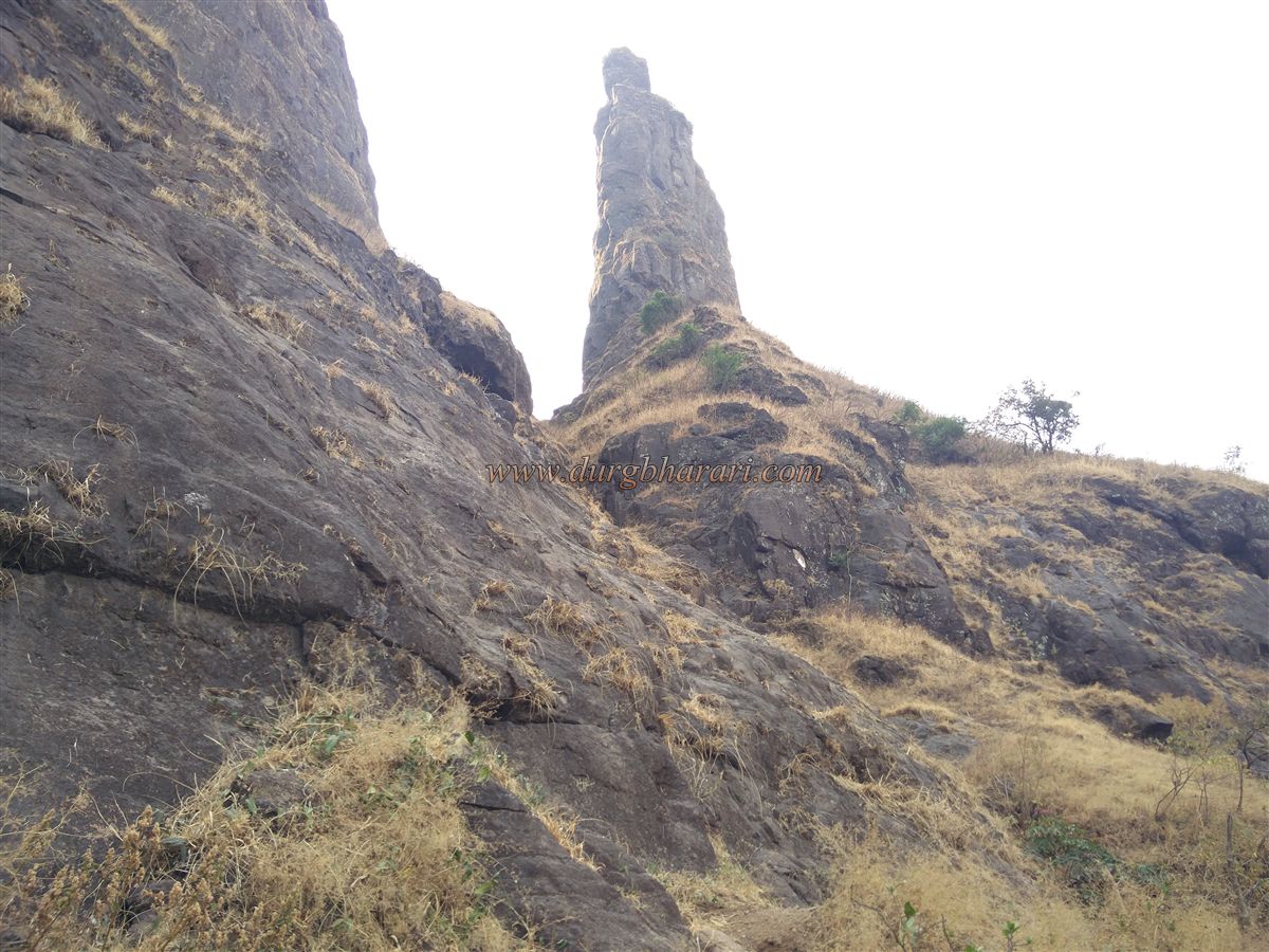
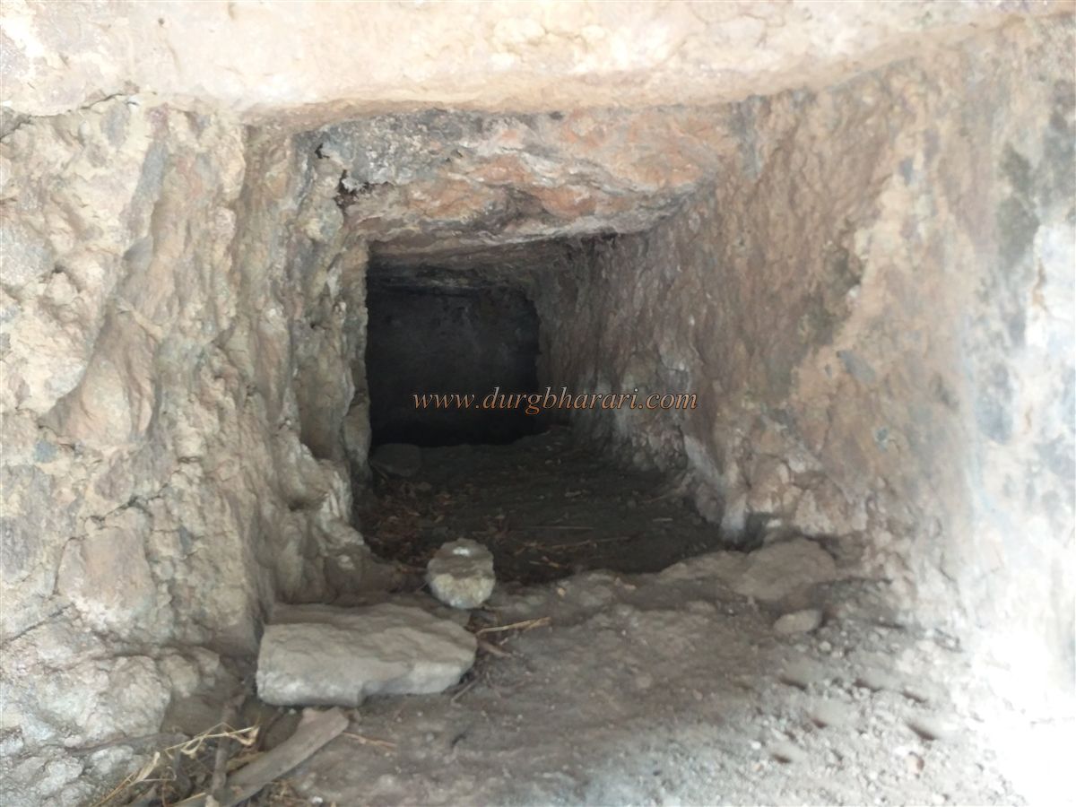
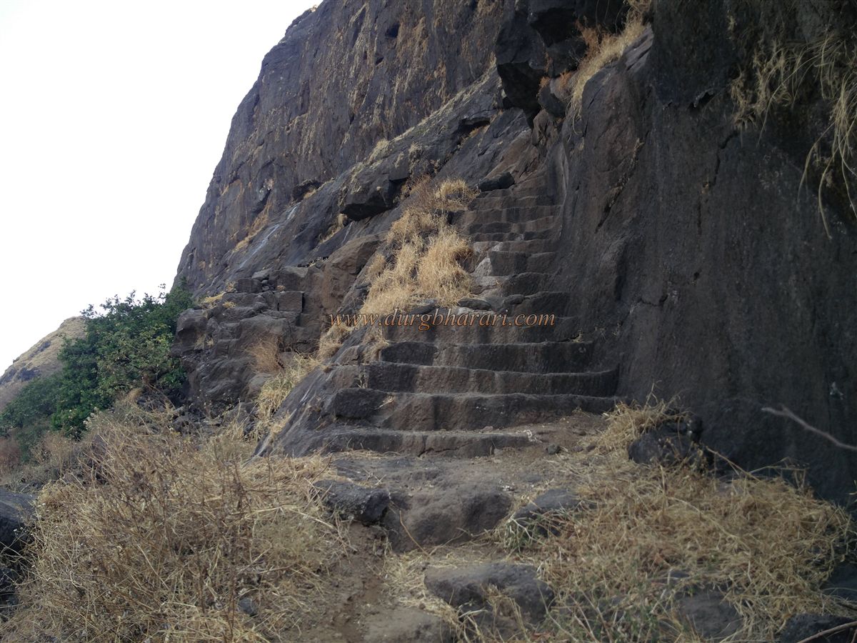
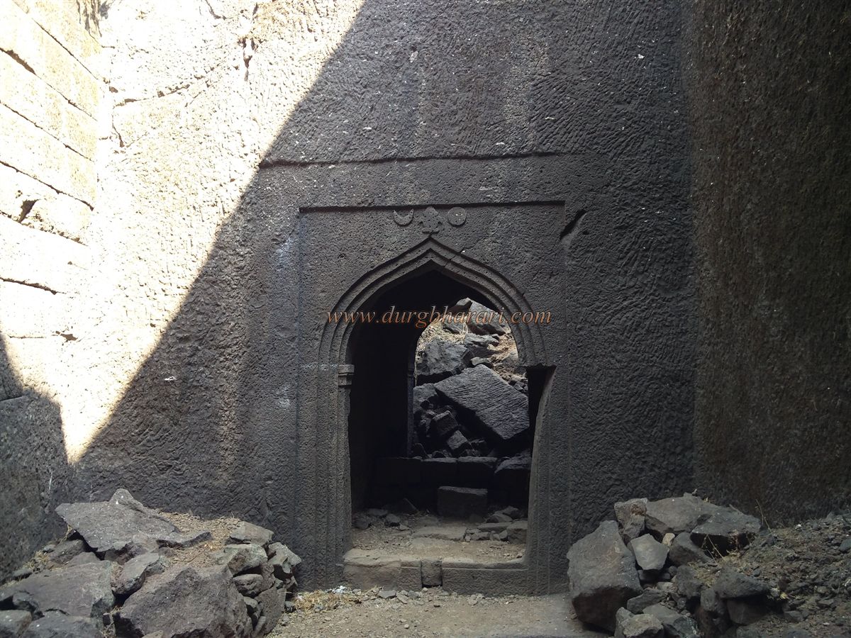
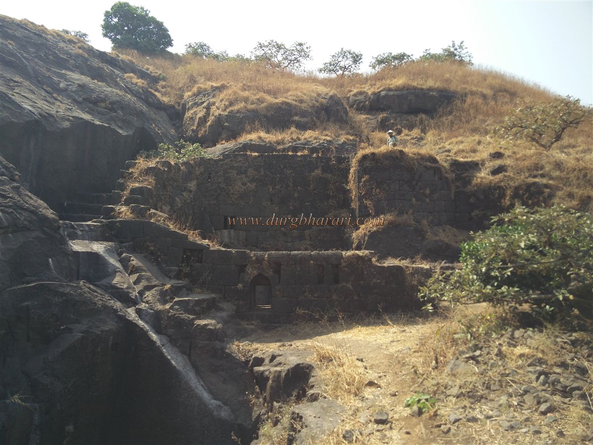
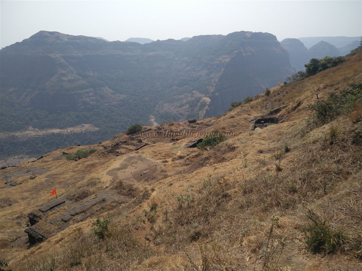
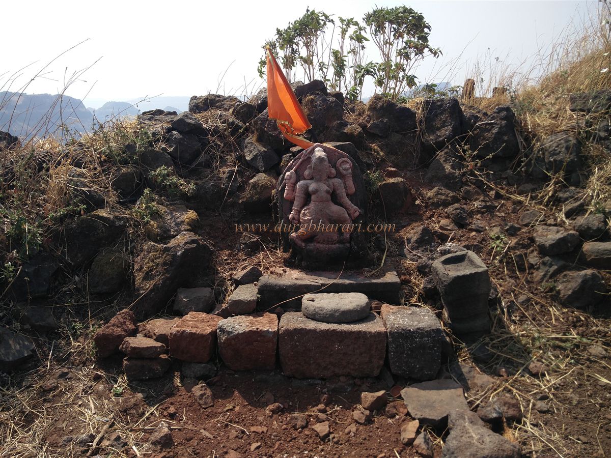
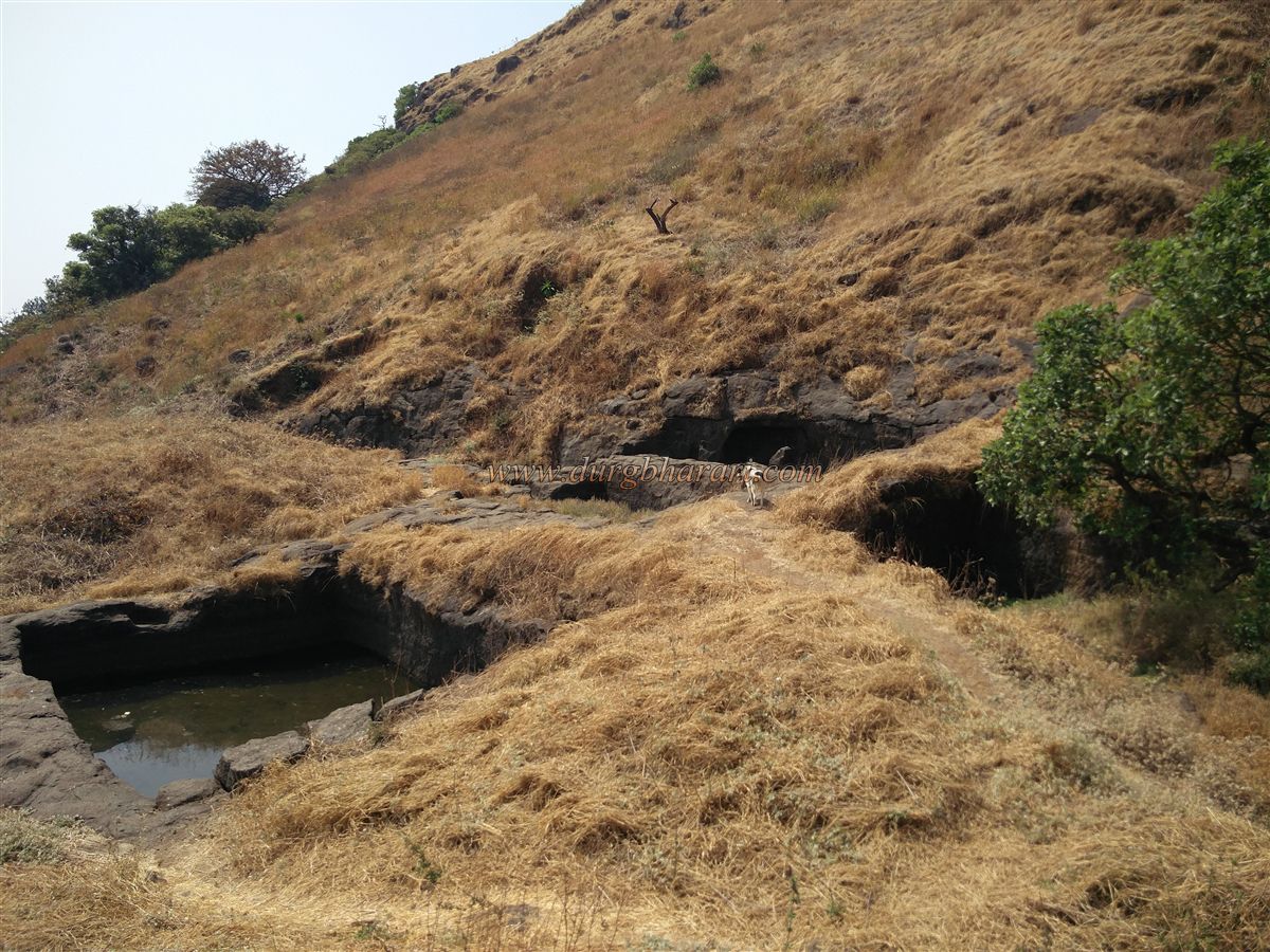
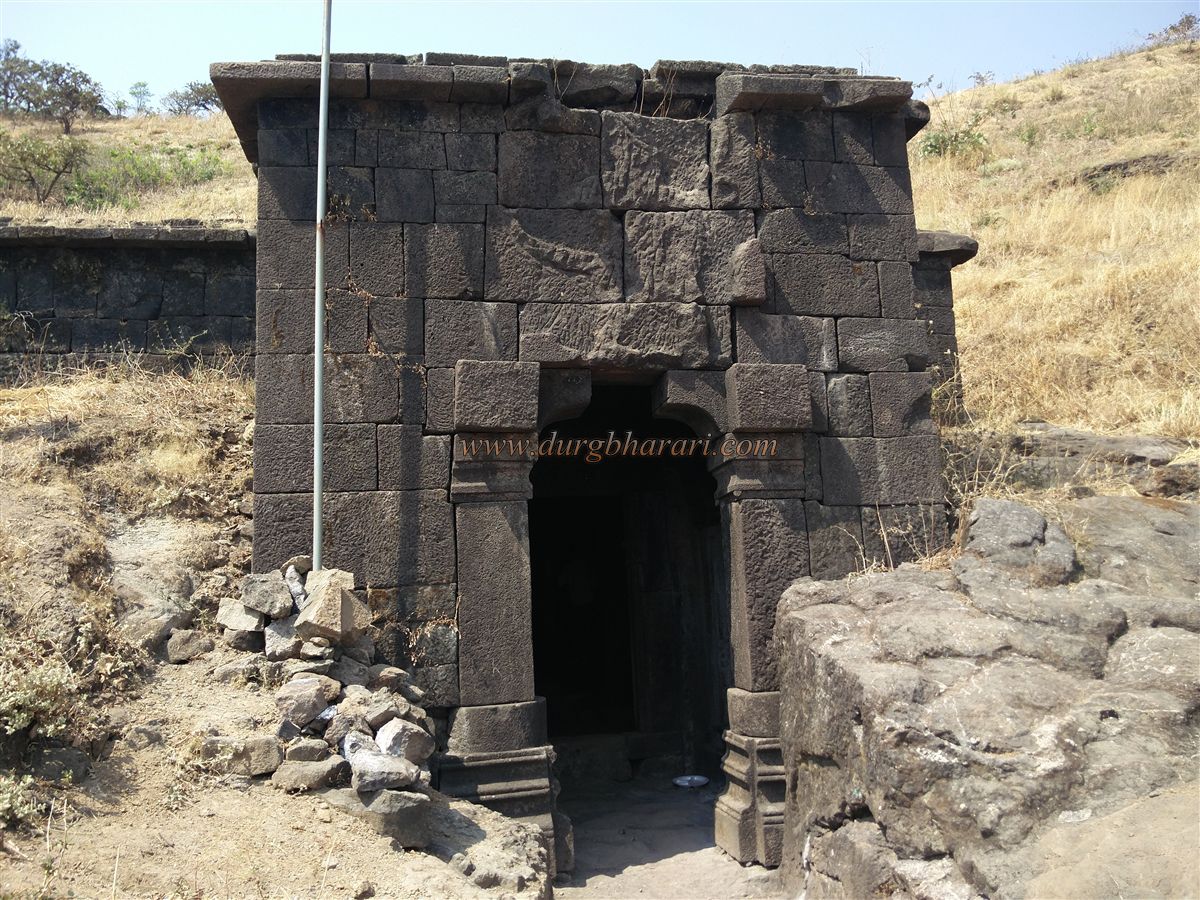
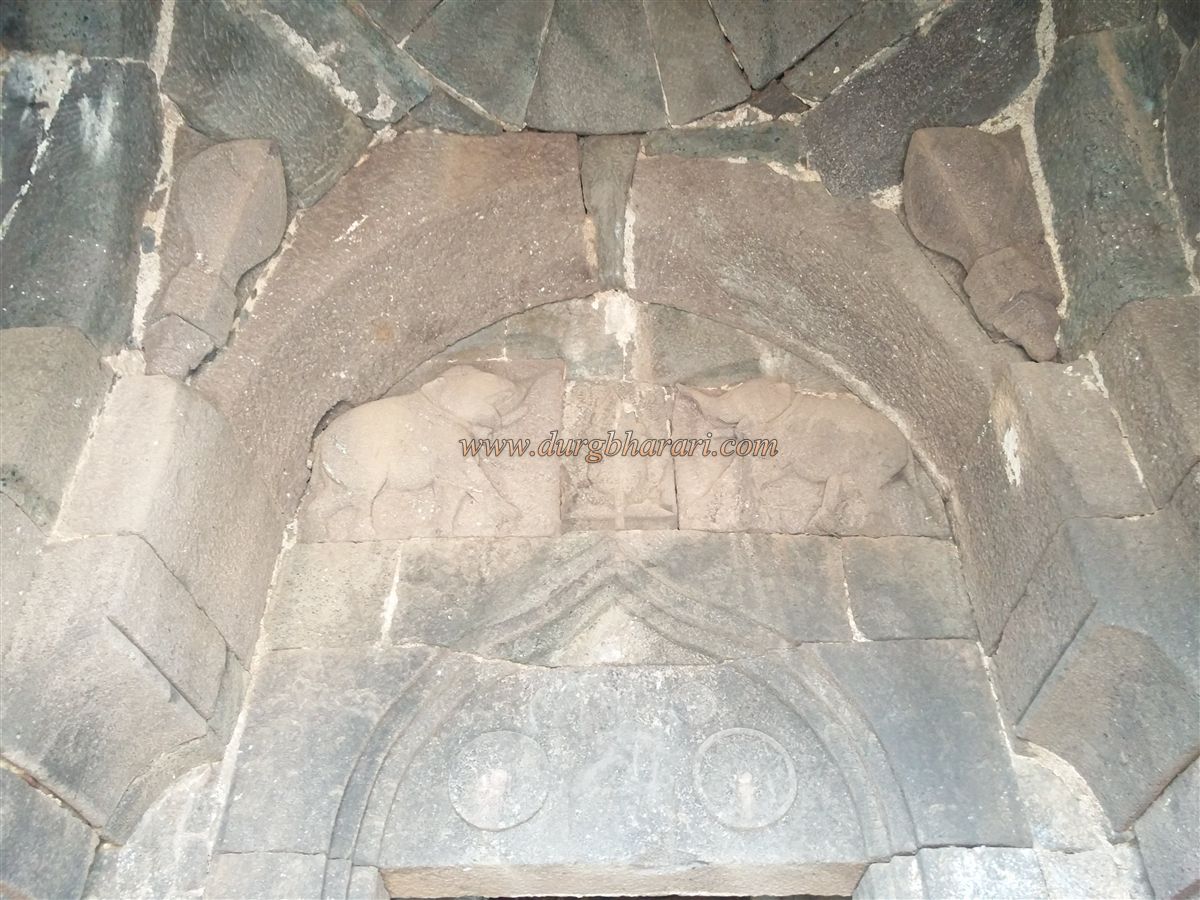
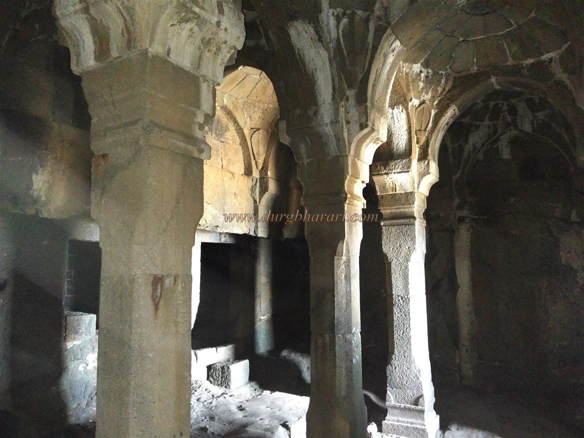
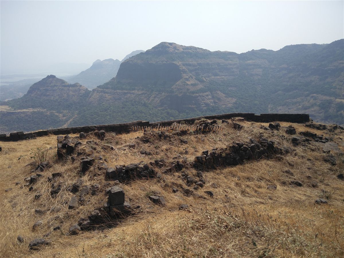
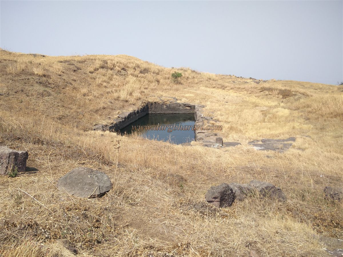
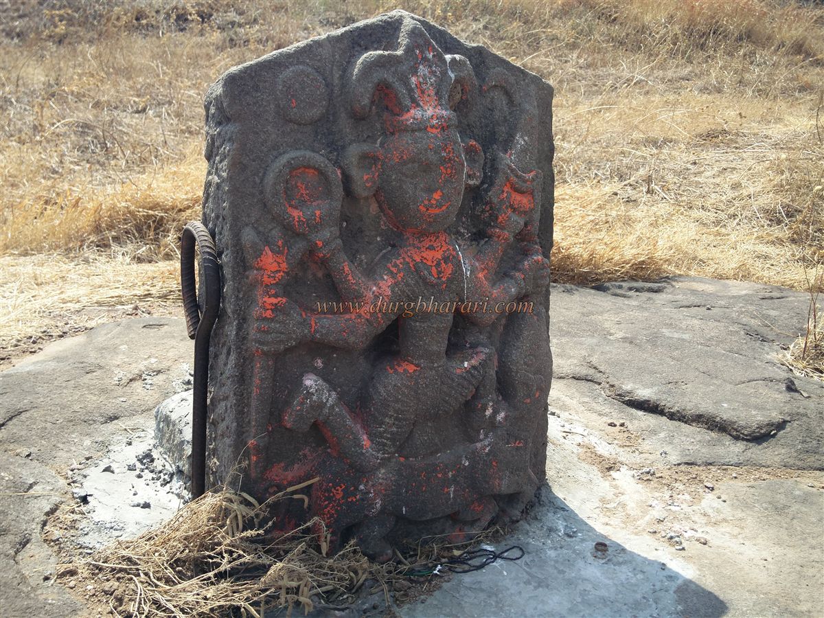
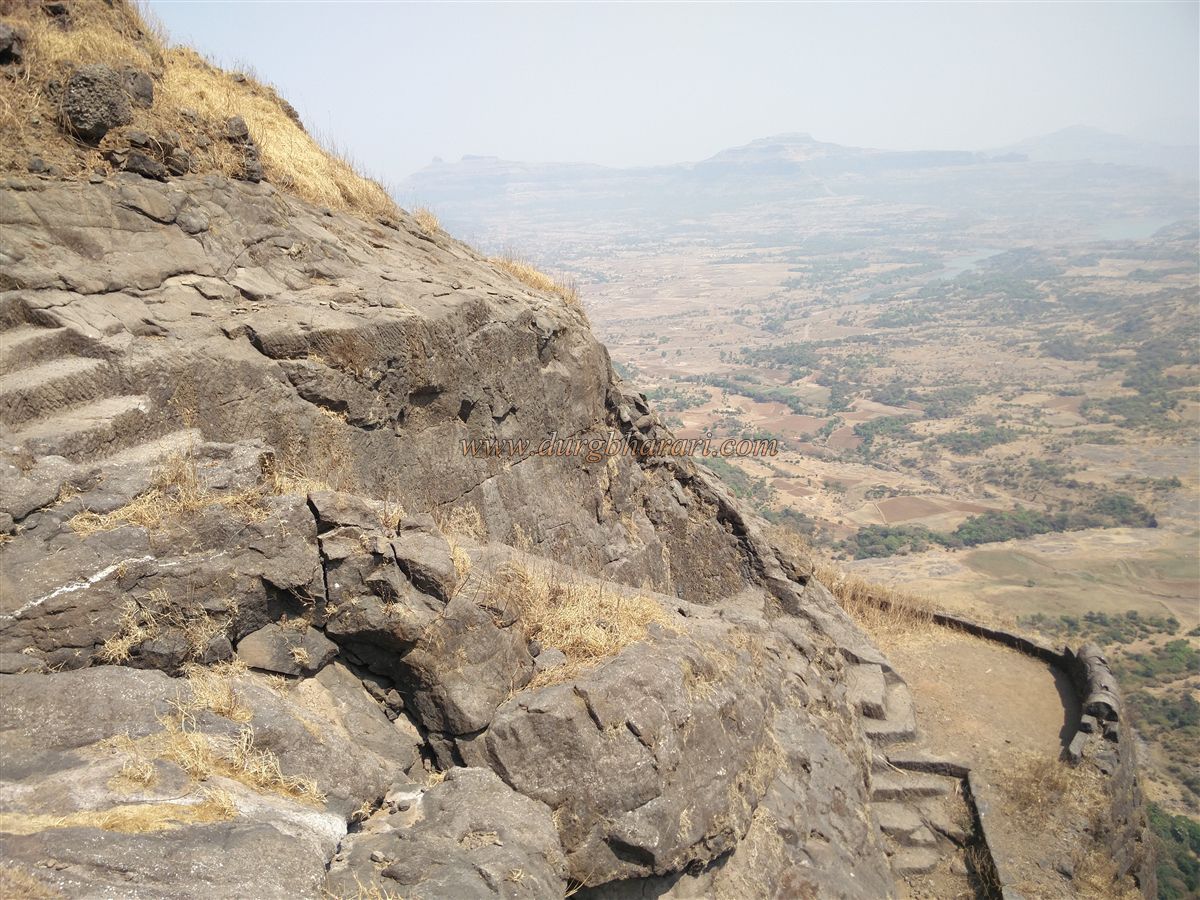
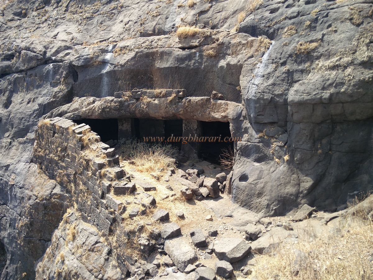
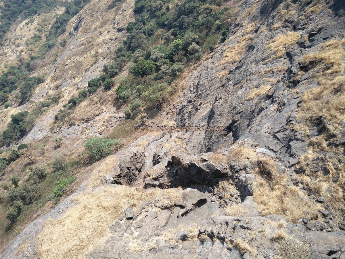
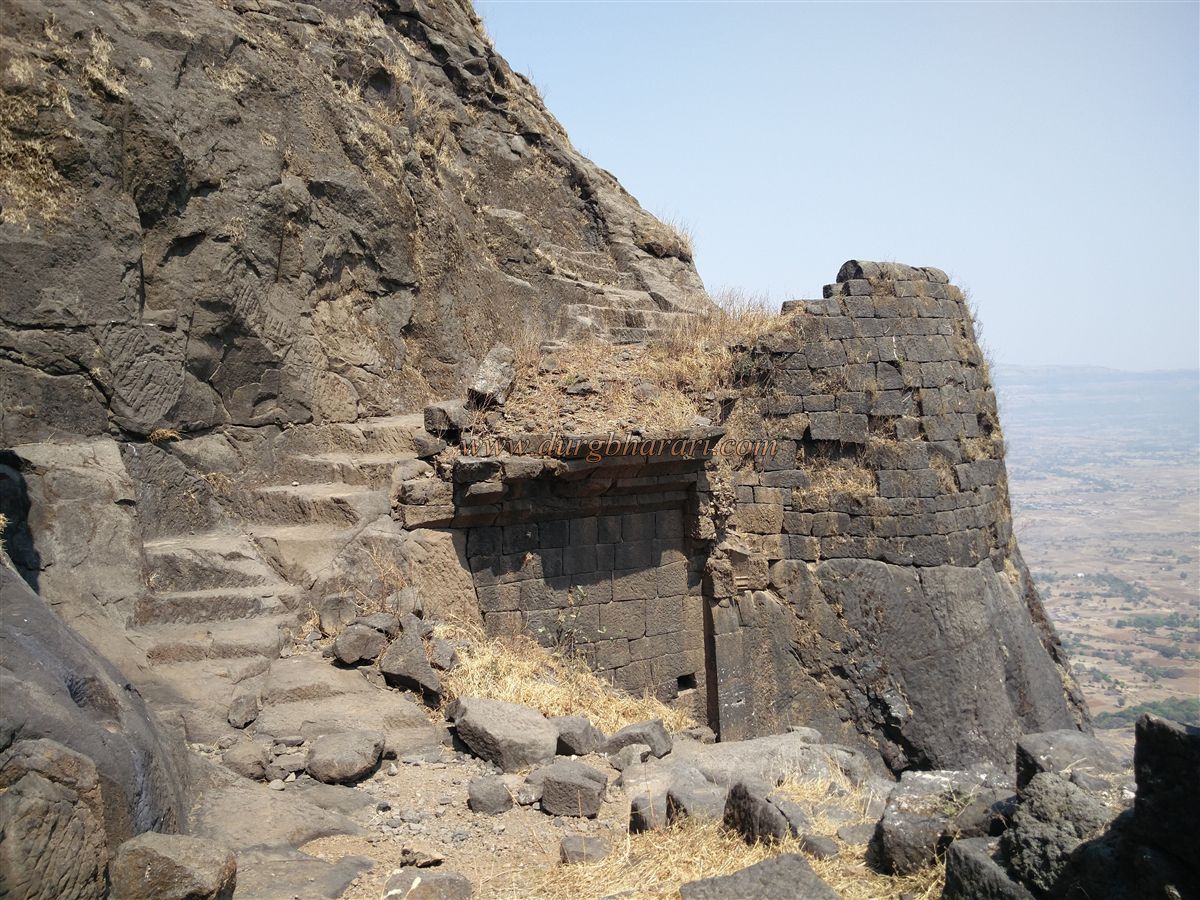
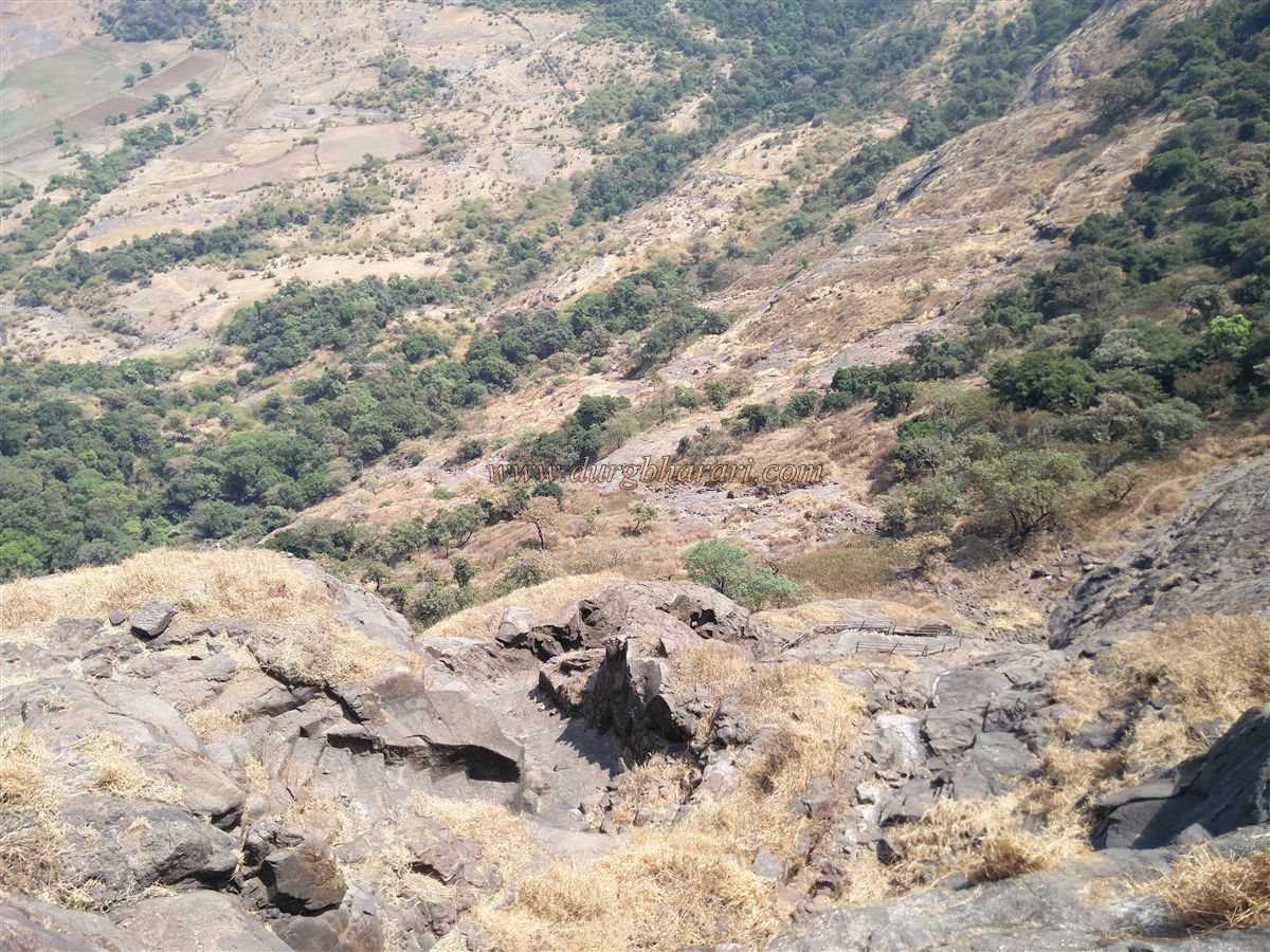
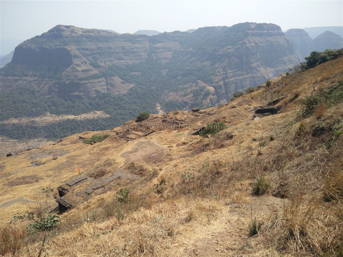
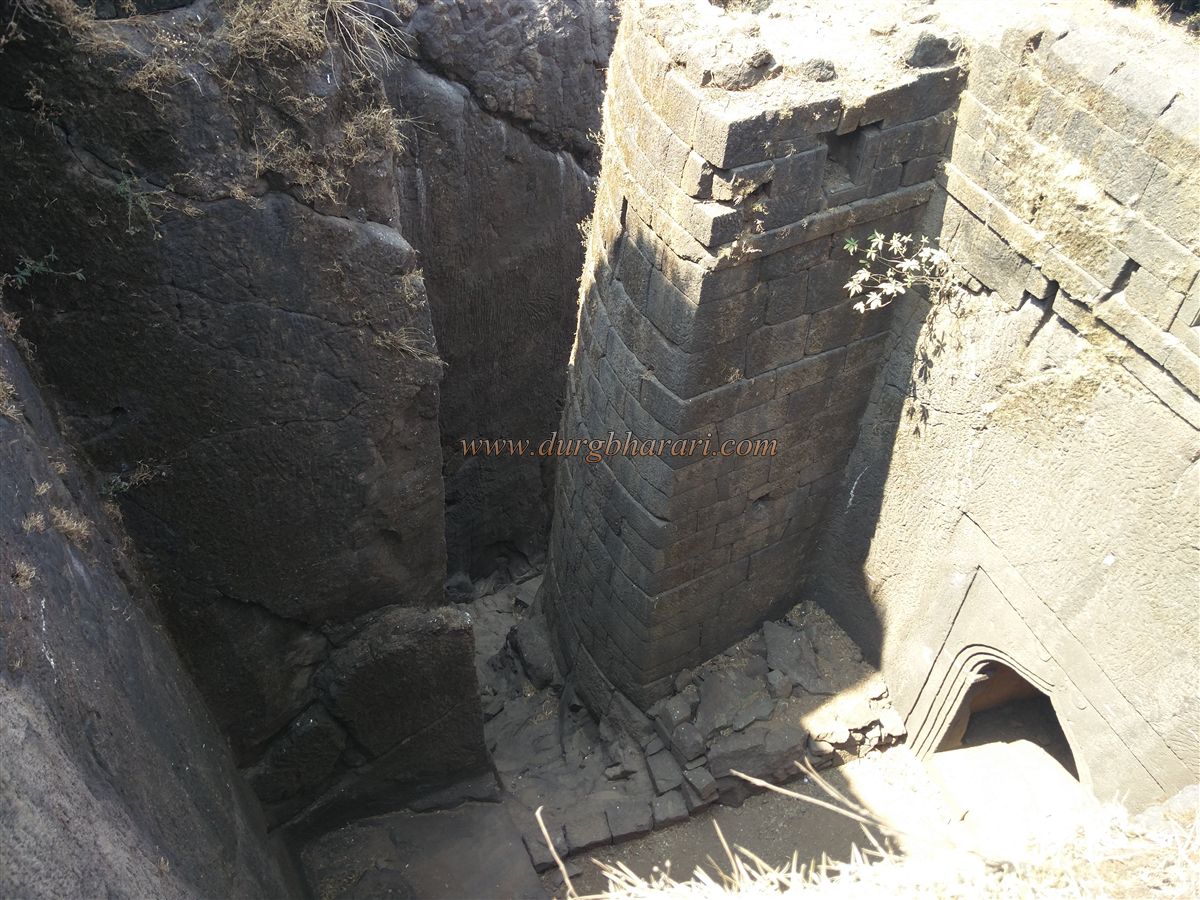
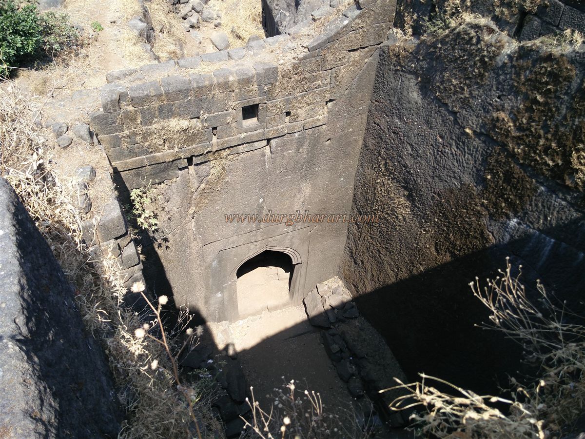
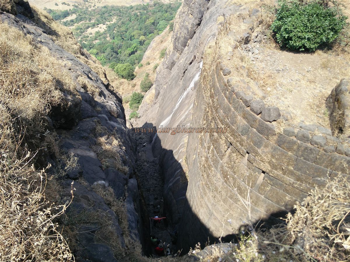
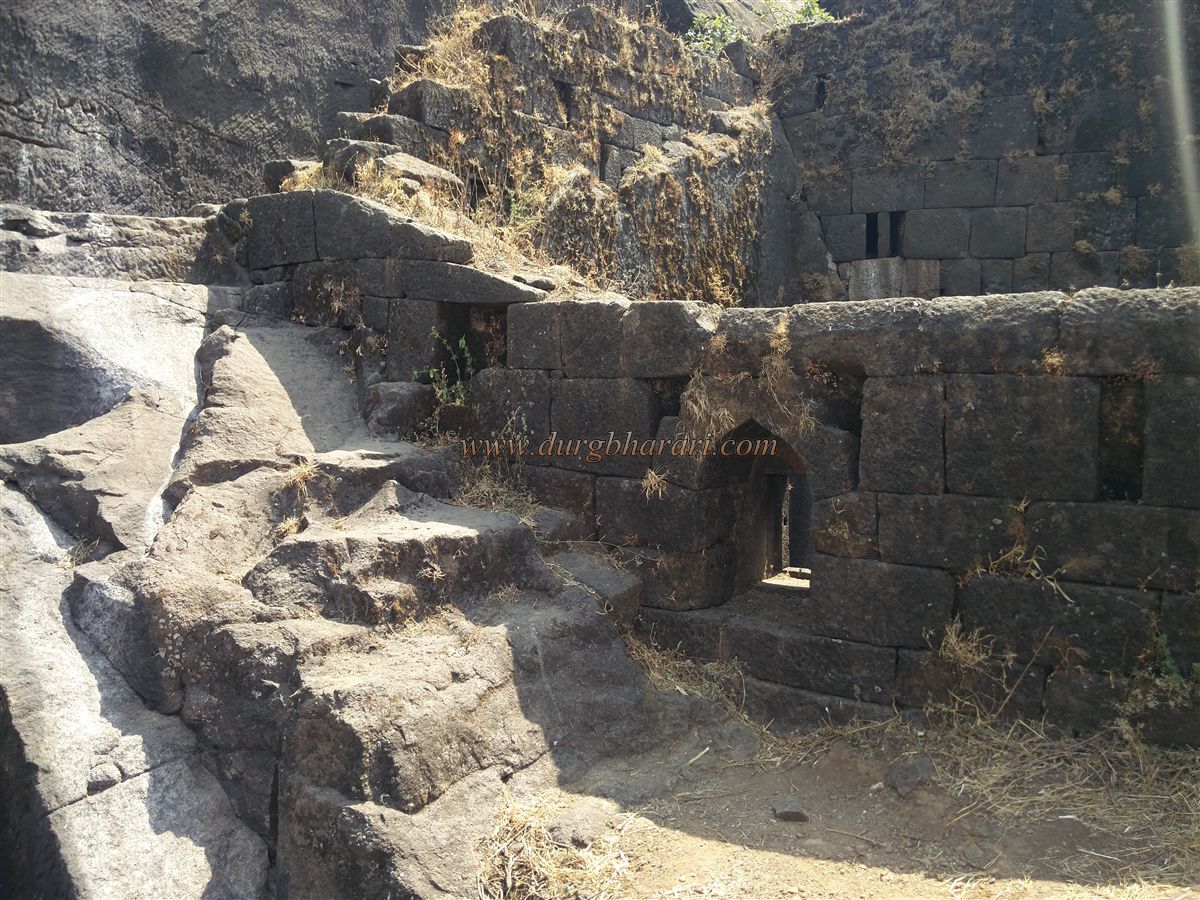
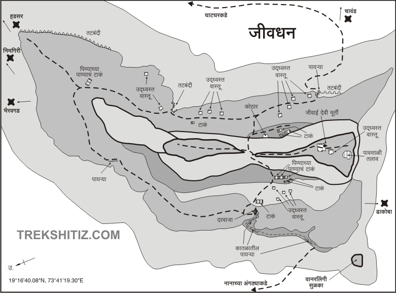
Naneghat's neighboring fort is Jivdhan. There are two main gates to the fort and the road leading to Naneghat is known as Kalyan Darwaza while the road passing through Ghatghar village is known as Junnar Darwaza. Out of these, the path of Kalyan Darwaza comes up from the gorge while the path from Junnar Darwaza comes up through the ridge. It takes a bit of rock climbing to get up from both of these paths. If you want to come to Jivdhan fort from Mumbai, you should come to Vaishakhare village via Kalyan Murbad. From here we climb Naneghat and reach the plateau at the foot of Jivdhan. If you want to come to Jivdhan from Pune, you have to come to Ghatghar village which is 25 km from Pune-Junnar road. Naneghat is at a distance of 5 km from Ghatghar village. If you have your vehicle, you can reach the base of Jivdhan with it. On the way from Naneghat Plateau towards Vanderling pinnacle, a path leads to the forest on the left. Climbing up this path, we reach the hill of the fort. There are 25-30 steps here carved in the rock. When you reach the steep wall of the fort, one way to the right side of this wall leads to Vanderlingi pinnacle, while the way to the left side leads to the gorge with the steps of the fort. From here, first of all, go to Vanderlingi pinnacle. There is a small ridge between the Vanderlingi pinnacle and the fort wall. At the base of the pinnacle is a seven feet long cave and there is another cave of size 10x8 feet at the inner end. After you see the pinnacle, come back to the path and go towards the gorge and climb the steps carved in the rock. The steps, which are 10 feet long and 1.5 feet high, are worn out and have collapsed in some places. When Jivdhan was captured by the British in 1818, these steps were demolished and the west gate was blocked. Even today, you can see traces of landmines as you climb the stairs. After climbing these 50-60 carved steps, we come to a halt at a steep stage. There are signs of a mine being planted here and the steps on this path are broken. This broken area has to be crossed with the support of holes in it. Otherwise, this part could also be crossed with the help of locals and their climbing equipment. After climbing about 250 steps from the mouth of the gorge, the ramparts of the fort are visible. Considering the similarities between the entrances of Jivdhan, Hudsar, and Chavand forts, it is clear that these three forts were built in the same period. The gate of the fort is at a right angle to the steps and a bastion is built on the left side of the road to protect the gate. Therefore, even if we climb the stairs, we cannot see the gate of the fort. The gate of the fort is facing south and its surroundings are enclosed with rocks. On the stone arch of the door, the urn is carved in the center, the sun is carved on the right side and the moon is carved on the left side. The upper part of the door has vents and barrage. This door was blocked by big stones, but in 2012 these rocks were removed and the path was cleared. Inside the door, on the right, you can still see a half-buried cave with rocks. After this, you enter the fort by climbing a few steps. Jivdhan fort is 3754 feet above sea level and is spread over an area of 65 acres. It takes four hours to reach here from Naneghat and 1.5 hours from the plateau. The ramparts of the fort are visible in the vicinity of the gate. On the left side of the stairs is the path leading to the ramparts and on the right side, the path leads to the hill in the middle of the fort. This hill is the stronghold of the fort. On the way up the hill, the first thing you see is a square-shaped cistern. Next to it is a group of five cisterns at some distance, two of which are large and the remaining three cisterns are small. At the bottom of this cistern, the remains of a mansion can be seen on Machi. If you want to see the Vanderling pinnacle closely, you have to go to this part of Machi, otherwise, there are no other ruins here except the remains of a mansion. From here, on reaching the top of the hill, the path turns right and left, and descends towards the Junnar Darwaza. As there are no remains on the left side of the fort, go towards the right. On the way, first of all, there is an idol of Goddess Jivabai on a small quadrangle structure. The fort got the name 'Jivdhan' from the name of this goddess. At the rear of the idol, two Samadhi’s appear at some distance. In the next part of this Samadhi, there is a small rainwater harvesting lake at some distance and the tip of the Vanderling pinnacle can be seen and the way ahead goes down to Machi. Return from here to the main road and descend towards Junnar Darwaza. On the right is a group of five cisterns and on the left is a stone structure. This structure is a partially excavated cave with some constructions done in the facade. There is a sculpture of Gajalaxmi on the inside of the cave and as it is dark inside one has to use the flashlight. On the inside of this building, there are three rooms one after the other and in the middle part, there are other rooms on the left as well as on the right side. There are five warehouses in total. Out of these, the 2 rooms on the outer side have roofs with lotus chandeliers, and snakes are carved on the top of the pillars in the corner. On the upper side of the third carved room is the hill of the citadel and on the wall of the outer room are arched doors and windows. This excavation in the belly of Jivdhan must have been constructed in the Satvahana period. This building is known to the locals as Dhanyakothi. During the Maratha-British war in 1818, a fire broke out in the storehouse, and all the grains were set on fire. The locals say that the soft soil under the feet in the inner barn present today is the ashes of the grain of that time. When you come out of this room and go down to the right side towards Junnar Darwaza, you can see a large number of remains scattered everywhere. In this area, the remains of a courtyard, as well as a large mansion, can be seen. The main settlement of the fort should be in this area. The Junnar Darwaza of the fort has completely collapsed and the construction of ramparts and bastions in this area remains on a large scale. Above the door, in a cave, there is a pillared water cistern carved in the rock dating back to the Satvahan period. There is a rampart in front of this cistern. Going down a few steps from here, you can see the guardrooms carved in the rock. Some water has accumulated in this room. This path with steps carved in the rock has been destroyed by the British by planting a mine, the signs of this are still visible today. The stairway is broken in two places and the forest department has installed iron ladders there and protective iron fences at dangerous places. This makes it easier to get to the top. After seeing all this, one should start the fort round from the top of the Junnar Darwaza towards the southern ramparts. This way you can take a detour around the Machi. The ramparts on the south side of the fort are remaining up to a great extent and in this way, you can see some small dried cisterns, joint cisterns, and soldiers' houses. On the south side of the fort, there is a large cistern carved in the rock, and on the edge of this cistern, there is a carved idol. Due to the construction of this fort for the protection of Naneghat, there are 22 guard posts in the direction of Naneghat. To make it easier to walk here, steps have been dug in many places along the ramparts. This way we come to Kalyan Darwaza and our journey is completed. When this fort was first seen by Major Eldridge after the British took possession of this fort, he wrote an article in the Bombay Courier on May 16, 1818. The path to the fort climbs like a ladder through a steep slope. There is a steep pinnacle separated from the northwest fort and there is a very deep ravine in front of it. If a stone is thrown down from the edge of the fort, it falls directly down to the bottom of the fort two thousand feet below. Seeing this fort, one realizes that there is nothing exaggerated in this description. From the east end of the fort, Vanderling pinnacle of 400 feet catches the eye, while from the citadel of the fort, Siddhagad. It takes two hours to walk around the entire fort. Some important political developments took place on this fort during Nizam's rule. Malik Ahmed, who established Nizamshahi after the fall of the Bahmani Empire in 1485, captured the North Konkan and Pune provinces and captured this fort in 1487. On 17th June 1663, the Mughals and the Adilshahis came together and conquered the Nizamshahi and imprisoned him. At that time, a descendant of Nizamshahi, Murtuza was imprisoned in this fort. Shahaji Raja released him and took him to Pemgiri fort near Sangamner. Shahaji Raja tried to create this independent state on the pretext of maintaining Nizamshahi but he did not succeed. Unable to withstand the huge forces of the north, Shahaji Raja made a treaty with the Mughals in which Jivdhan and four other forts had to be given to the Mughals. The fort was captured by the British in 1819 after defeating the Marathas.
© Suresh Nimbalkar
GALLERY