JAWALYA
TYPE : hill FORT
DISTRICT : NASHIK
HEIGHT : 4170 FEET
GRADE : HARD
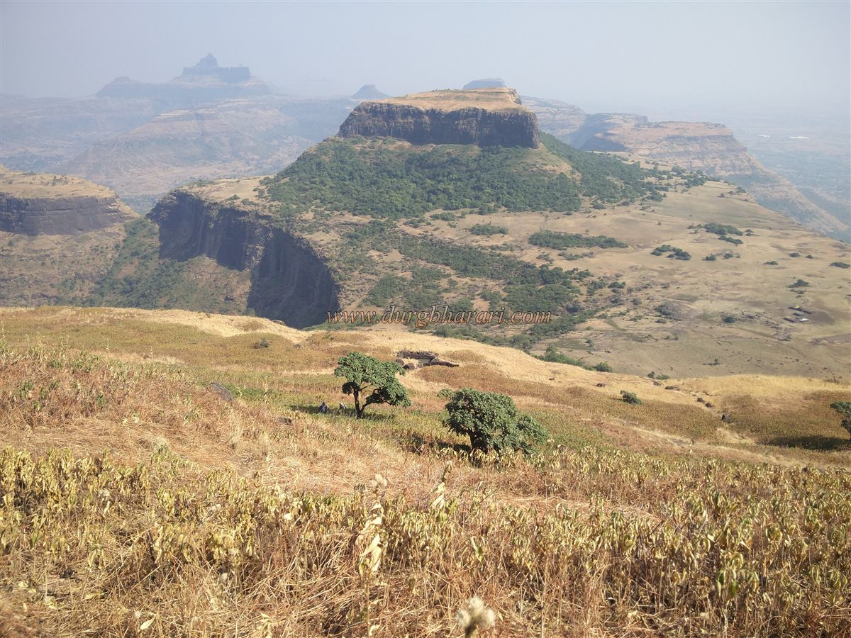
The fort diversity found in Maharashtra is not found anywhere else and that is why Maharashtra is known as the land of forts. In Kalvan taluka of Nashik district, near Ravalya in Satmal mountain range, you can see two such forts on a plateau. These forts are about 3.5 km in length and 1.5 km wide and are located on a large plateau. Both of these forts are independent. The distance between these two forts is about 1 km. After ascending the Plateau, one can see both these forts in one day. Mulane and Babapur are the villages at the foot of both the forts. Apart from this, one can also reach the plateau below the fort through Mulane village. The distance from Nashik to Wani via Babapur pass is 53 km and this distance from Wani is 9 km. If you come to this gorge from Wani via Babapur, the road on the left leads to Markandeya fort and the road on the right leads to the lower plateau near Ravalya.
...
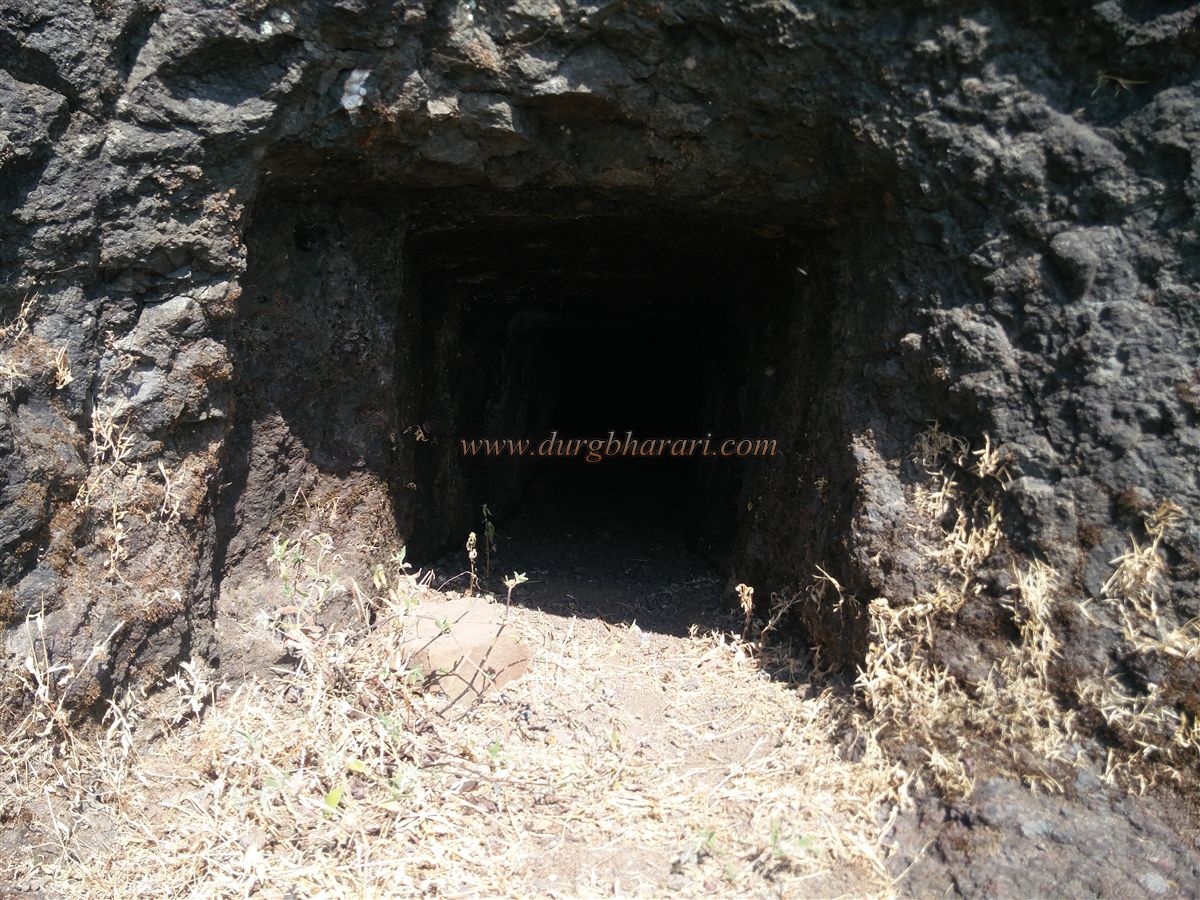
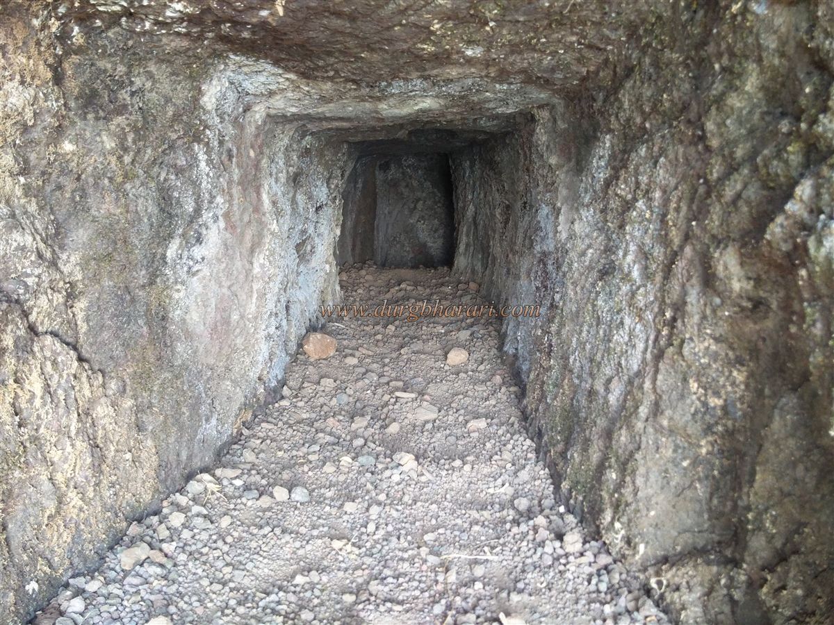
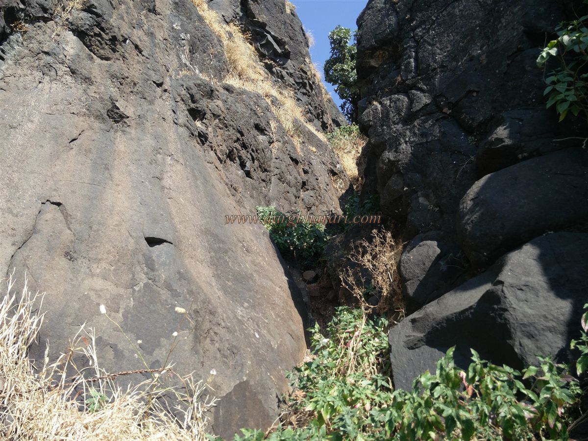
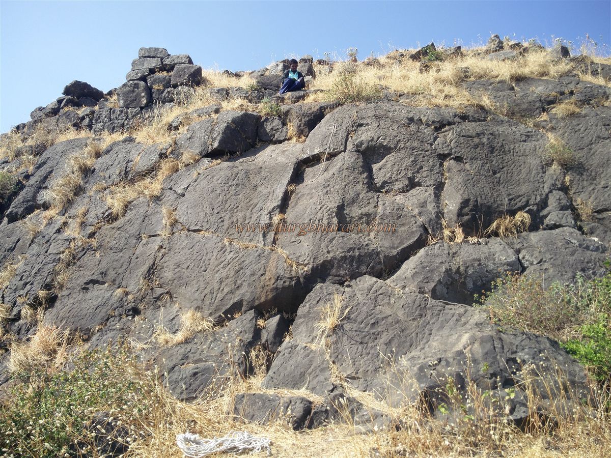
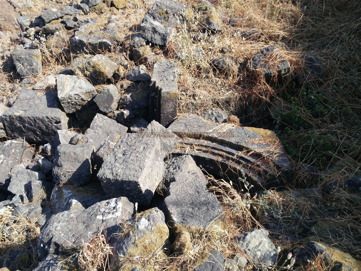
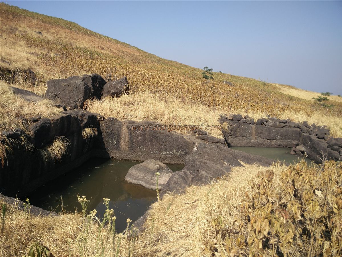
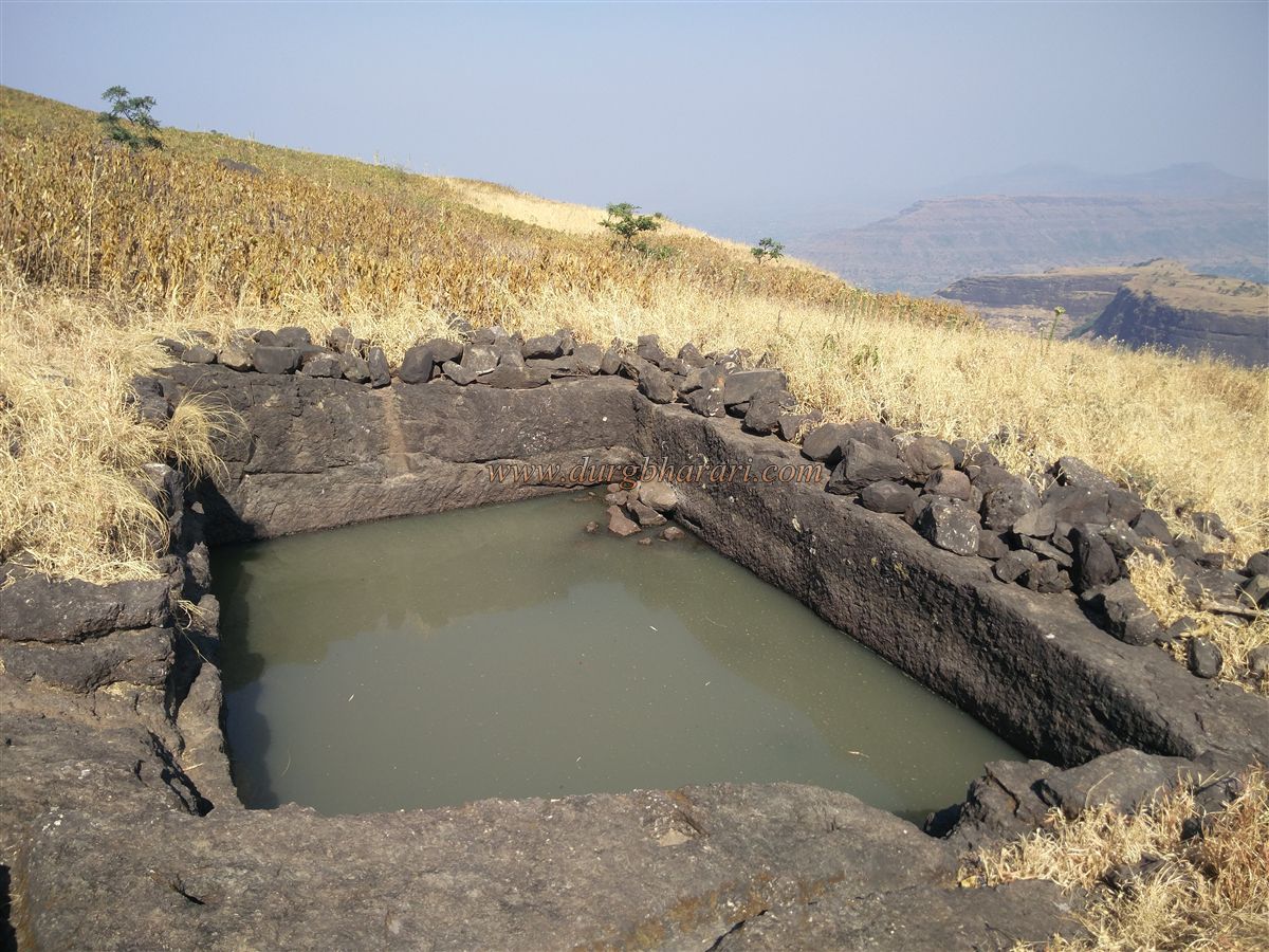
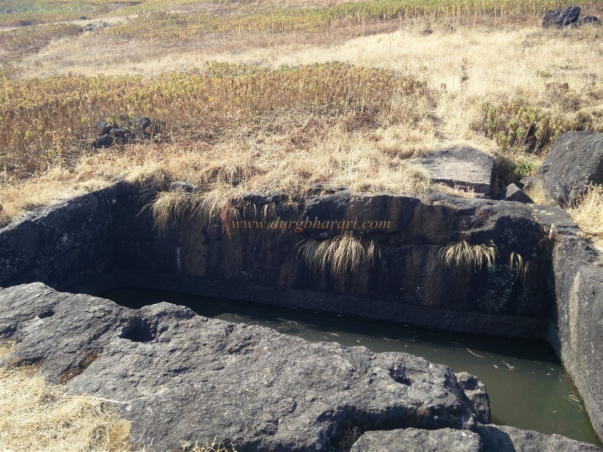
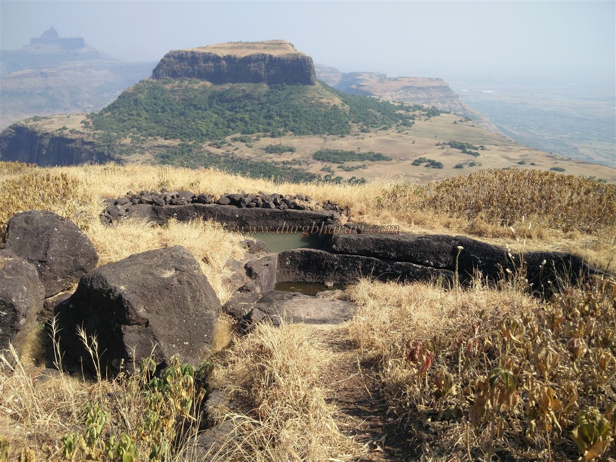
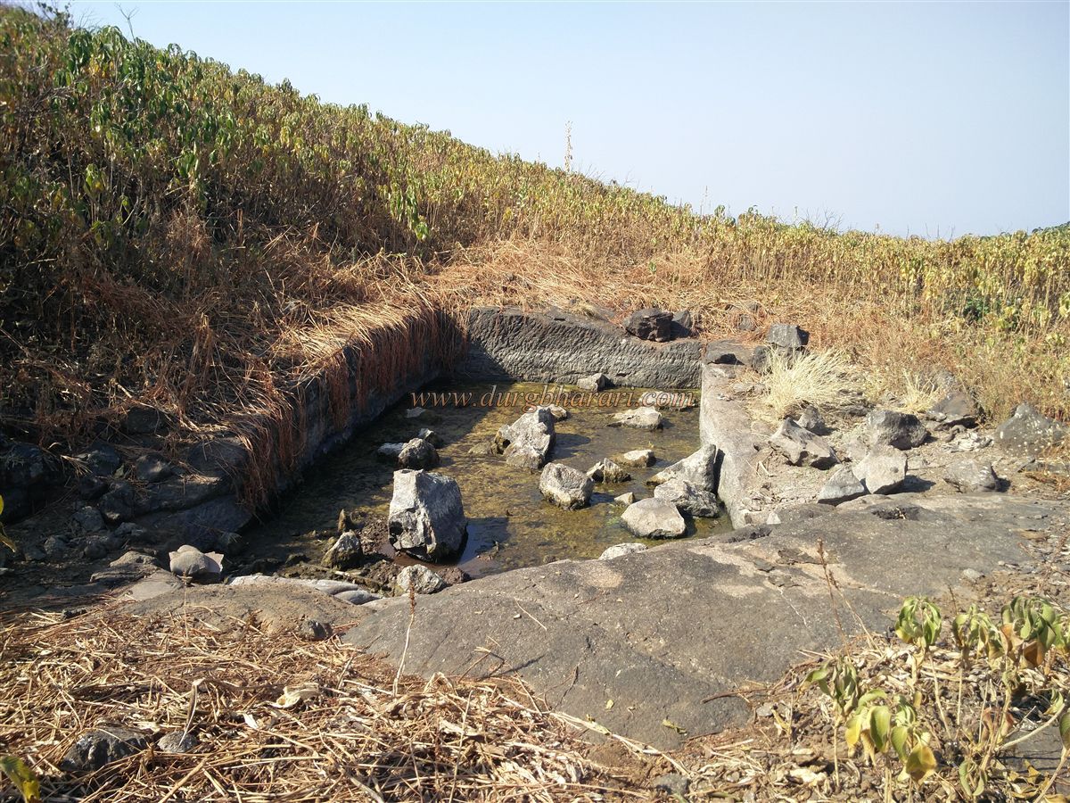
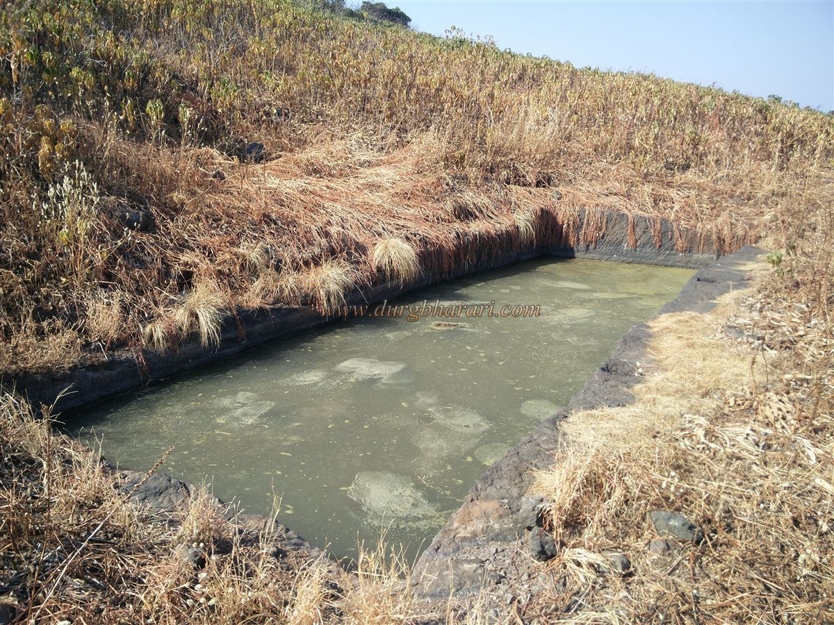
The forest department has set up a tourist shelter in the gorge and provided parking facilities. There is no possibility of getting lost as there is a road leading to the plateau if you want to see both the forts properly, it is better to take an experienced guide from Babapur village. Therefore, in a short time, the entire fort and all its remains can be seen. When you start climbing the plateau from the right trunk, you can see the other half of the plateau in front of you in about half an hour. On the right side of the road, you can see the remains of a door. It takes about an hour to reach the plateau through the gorge. To avoid confusion in identifying the forts of Ravalya and Javlya, keep in mind the Javlya fort on the side of Markanda and the Ravalya fort on the side of Dhodap. On reaching the plateau, one sees a nearby triangular fort in front. You have to go to the other end of the fort through the path from the east to reach the fort. From here, on the right as well as on the left, there is a path to go to the ravine near Ravalya and Javlya. If you go from the left, you can walk around the entire Javlya fort and see all the remnants on the plateau. Both of these paths are visible. In some places on the plateau, you can see the remains of the architecture hidden in the bushes. Turning to the fort, one can see 8-10 tombs and carved stones on the east side. On the other side of the road, there are small water cisterns carved in the rock. This is the only potable water cistern on the fort and the water in this cistern is sufficient throughout the year. There is a stone basin on the edge of the cistern and at some distance, you can see carved Nandi and Shivling. There is another excavated cistern on the upper side of the previous cistern and the water collected in this cistern is drained into the lower cistern. There are 4-5 houses on the plateau in front of the cistern and this settlement is known as the Tiwari settlement. The Tiwari is currently staying in Nashik with the cowherds from the village under the fort during the monsoons. At other times these houses are empty so it is a good place to stay. It takes about an hour to reach here from the plateau. On the way to these houses, a path leads to the forest under the nearby stream on the right. There is an excavated cistern on this road and the water in it is not drinkable as it is not in use. After climbing this steep path in the forest, we reach the gorge in half an hour. Here a cave has been carved through which one has to crawl your way inside the cave. As you crawl your way to the other side, you see the other face of the cave. After visiting the cave and returning to the gorge we reach the top of the gorge by easy rock climbing. There is a 20 feet high cliff in front of it and there is a path leading to the fort after climbing this cliff. The ruined ramparts of the fort can be seen above the cliffs. The rope is bolted to the cliff and you must use it to climb the cliff. The local climbers can climb the fort without ropes, but it is necessary to use ropes for safety. After crossing this cliff, we reach the top of the fort. After climbing a little uphill from here, we take the path on the right to the other side of the fort. There is a large amount of grass growing on the head and quadrangle structures of many buildings can be seen hidden in this grass. On the right side of the path, you can see the ruined and half-buried gate of the fort facing north. The remains show the semicircular arch of the door as well as the stone hinges of the door. There are bastions on both sides of the door, one of which has a deep excavation with the lure of hidden treasures inside. On the lower side of the door, broken carved steps can be seen. Near the door, you can see three cisterns carved in the rock. One of the cisterns is extinguished with soil and the other consists of potable water. The path from this cistern turns towards the top of the fort. After a 5 minute steep climb, you will see two water cisterns on the right and left side of the road. The water in both these cisterns is mossy. The path straight up from this cistern leads to the highest peak of the fort. The height of the fort is 4170 feet above sea level and the triangular-shaped fort is spread over an area of 22 acres. Although there are no remnants on the top, 8-10 forts like Saptashringigad, Kanhergad, Mohandar, Dhodap, Kanchana, Koldher, Rajdher, Indrai can be seen. After completing the trek and going back the way we came from, your fort round is completed. One and a half hours is enough to complete the fort round. In 1635-36, Shah Jahan sent three chiefs, Khanduran, Khanjaman, and Dilerkhan, to overthrow the Nizamshahi rulers. Dillerkhan was responsible for taking care of the forts in the Nashik-Trimbak area. Both these forts were conquered in 1636 by Sardar Alavardikhan under Dilerkhan. This is mentioned in the inscription on the gate of Ravalya fort and also in the book Badshahnama, these forts are mentioned as Rola-Jola. In the year 1670, when Shivaji Maharaj looted Surat for the second time in November, this fort was included in the Swarajya. According to the description of sabhasad bakhar, the siege of these forts laid by Diller Khan in 1671 was broken by the army sent by Moropant. Mahabatkhan, however, laid siege and conquered the fort. During the Peshwa period, this fort came under Swarajya again. In 1818, Captain Briggs captured the fort on behalf of the British. In 1819, McIntosh, a British officer, demolished the fort's steps and ramparts with a cannon.
© Suresh Nimbalkar
GALLERY