JANJALA
TYPE : HILL FORT
DISTRICT : AURANGABAD
HEIGHT : 2180 FEET
GRADE : EASY
Aurangabad is known as the tourism capital of Maharashtra. In this tourism capital lies Janjala Fort, also known as Vaishagad or Taltamcha Fort. Historians have differing opinions about when and by whom this fort was built. Bearing witness to hundreds of years of history since the Vakataka period in the 5th century CE, this fort remains neglected even today.
To reach Janjala Fort from Aurangabad by private vehicle, travel on the Aurangabad–Ajintha–Jalgaon road to reach Phardapur, which is 105 km from Aurangabad. From Phardapur, Soygaon, the taluka town, is 15 km away. From Soygaon, after visiting Vetalwadi Fort, proceed via the Haldaghat route to Undangaon, 14 km away. From here, travel about 12 km to Ambhai village. After visiting the ancient Shiva temple there, continue 10 km further to Janzale village.
...
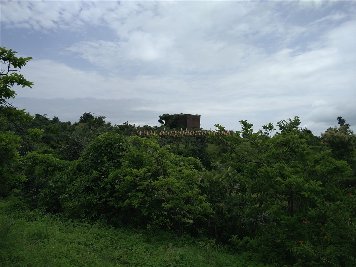
This village is situated at the height of the fort, and the fort is located 2 km behind the village. It takes about 30 minutes to reach the fort from Janzale village by footpath. Since the fort lies in the vicinity of Janzale village, it is known by that name.
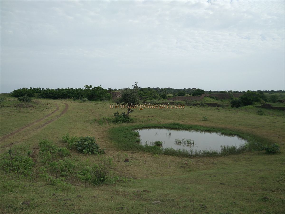
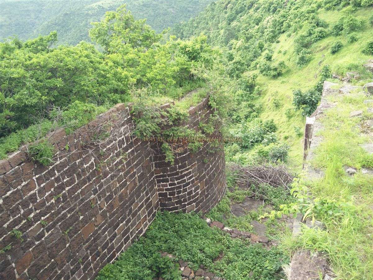
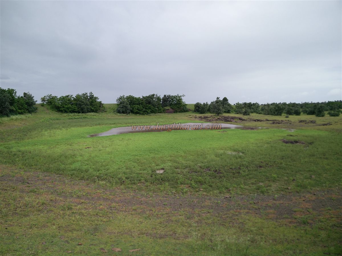
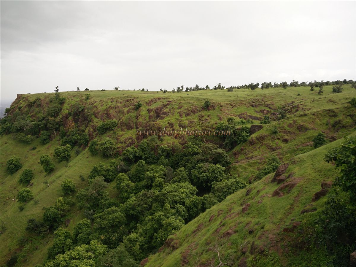
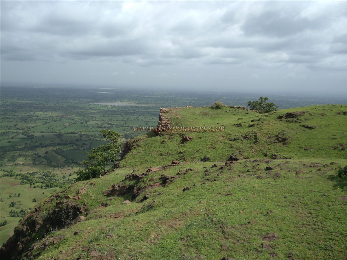
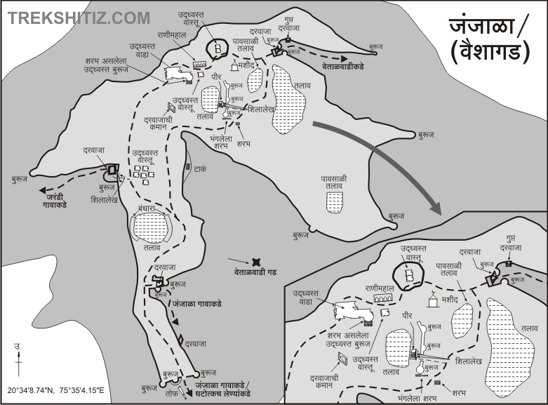
Situated at about 3,000 feet above sea level, this vast fort covers an area of 110 acres and is scattered with ruins. The fort is a land fort on the village side, while the other three sides are hill fortifications. There are a total of three main gates: the Vetalwadi Gate to the east, coming from near the Vetalwadi Dam; the Janjala Gate to the south, towards Janzale village; and the Jarandi Gate to the west, from the base village Jarandi. In addition, the fort has two secret gates, strong fort walls, and many bastions. Although there are five gates in total, when approaching from Janzale village, one enters through a broken section of the southern fort wall. The area outside this wall is deep and may have contained a moat.
Many accounts mention an 8-foot cannon in the fields outside the fort wall, but locals say that after the cannon from Antur Fort was stolen, the Archaeology Department removed the Janjala cannon and took it to Aurangabad.
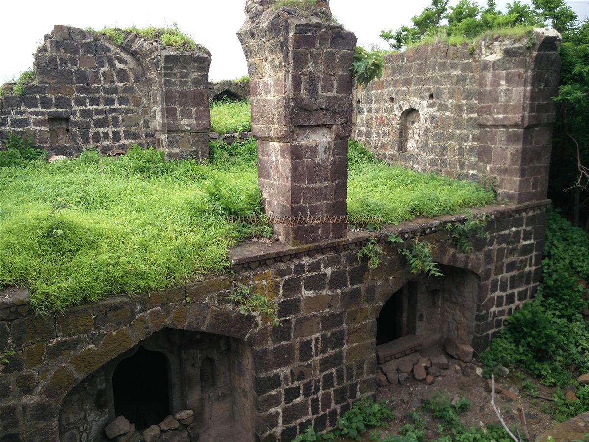
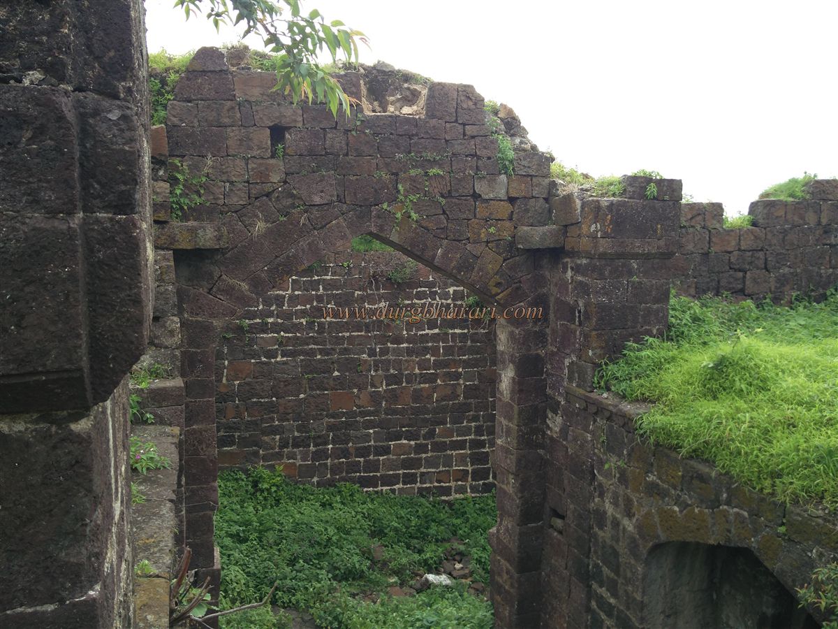
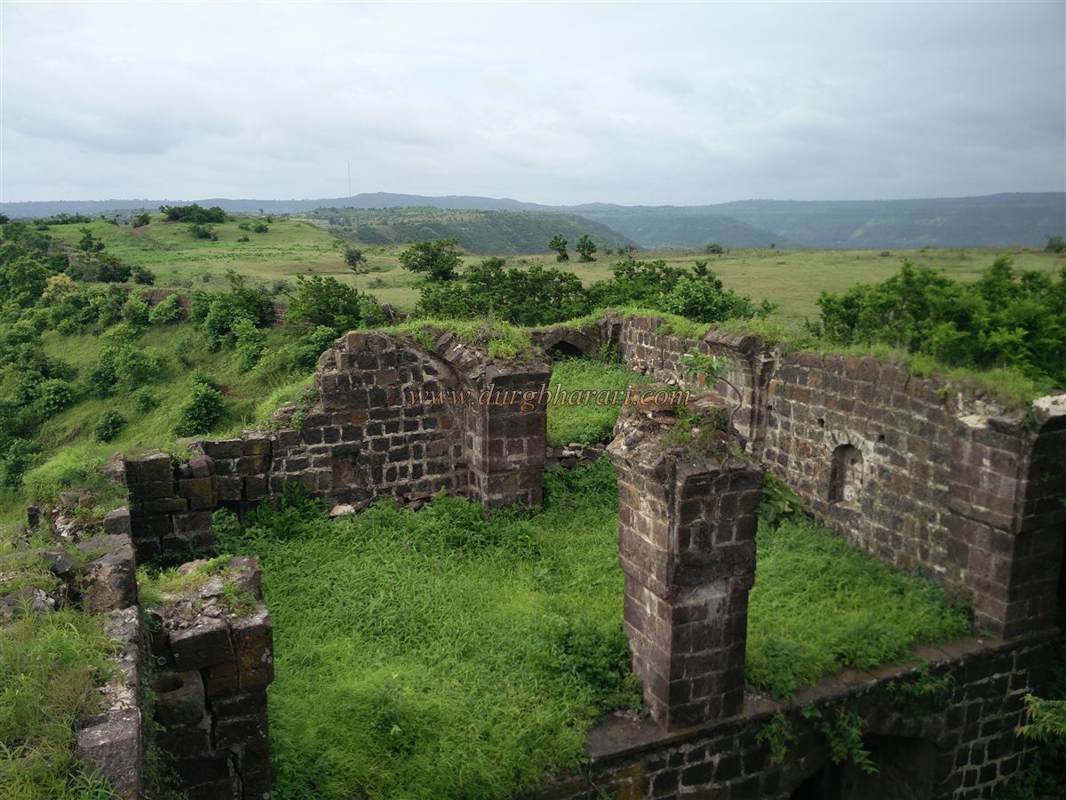
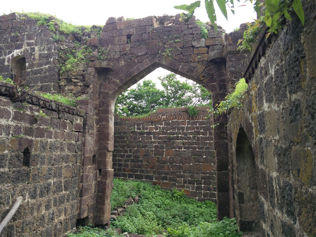
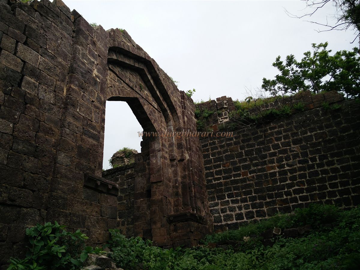
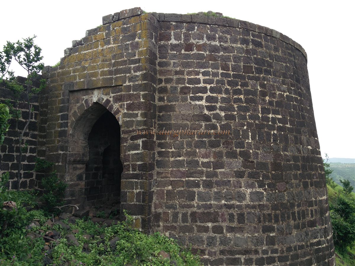
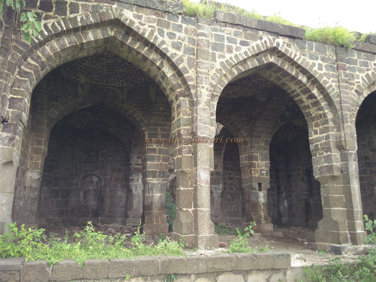
Upon entering through the ruined wall, there is an arch-like window in the fort wall to the right, from where one can see Vetalwadi Fort and the dam in the distance. The fort plateau is spacious and covered in vegetation. Further ahead, to the right, is the east-facing 22-foot-high Janjala Gate, with another inner gate behind it. The arches of both gates still survive, and inside are two-story guardrooms and storerooms. The path between the two gates is paved with stone, and outside the gate are stones with carved designs.
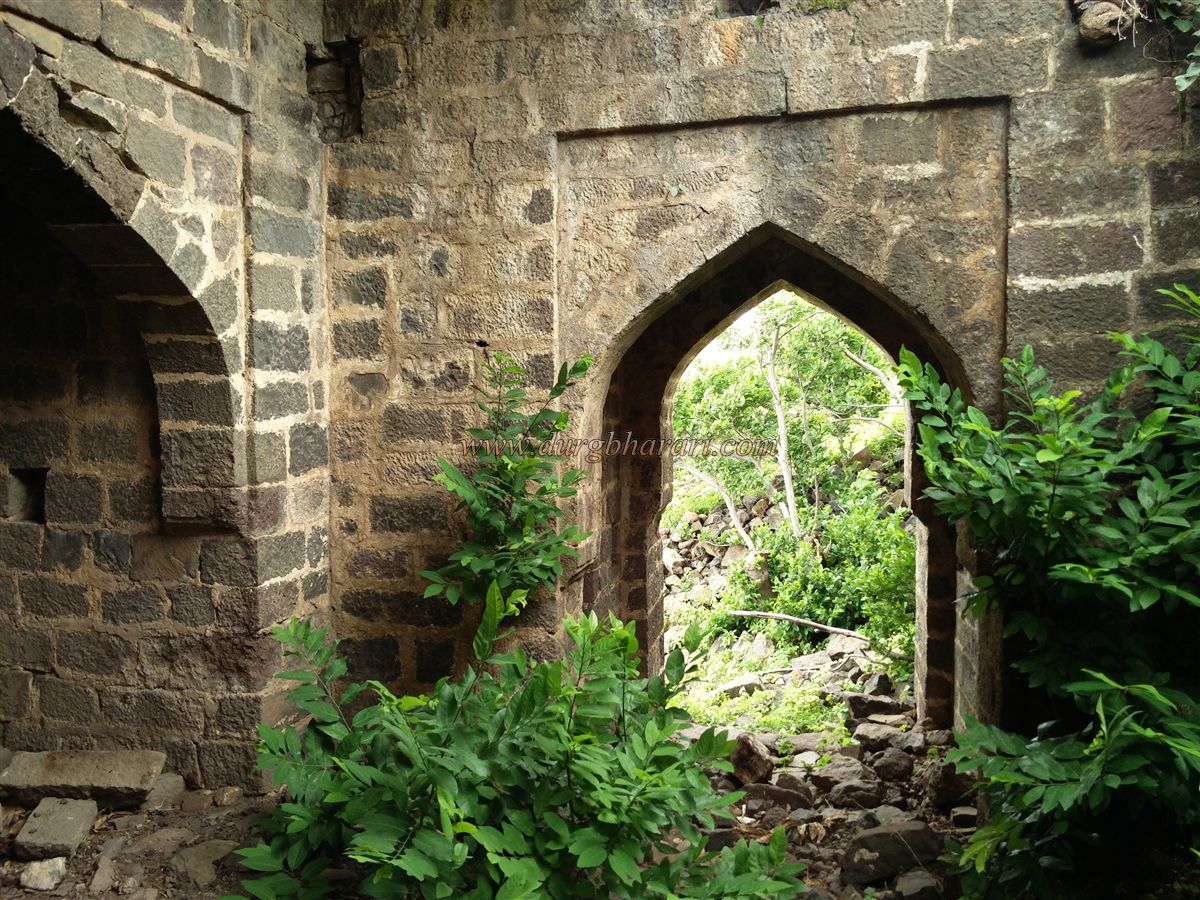
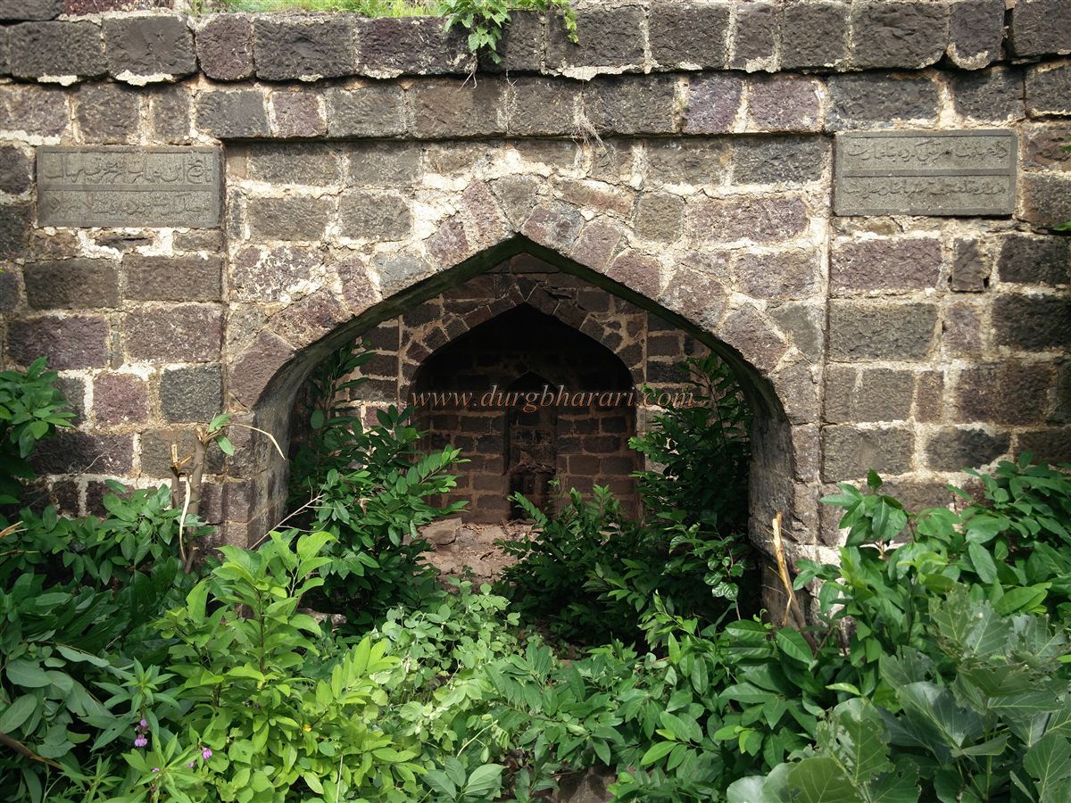
Continuing along the footpath, a massive constructed tank appears on the left. The tank no longer holds water due to its collapsed construction. After crossing it, to the left is the north-facing Jarandi Gate. The path from Jarandi village to the west enters the fort through this gate, which also has two gates with guardrooms in between. This gate is built within a bastion, and inside, next to the arch, are two stones inscribed with Persian text in two lines each.
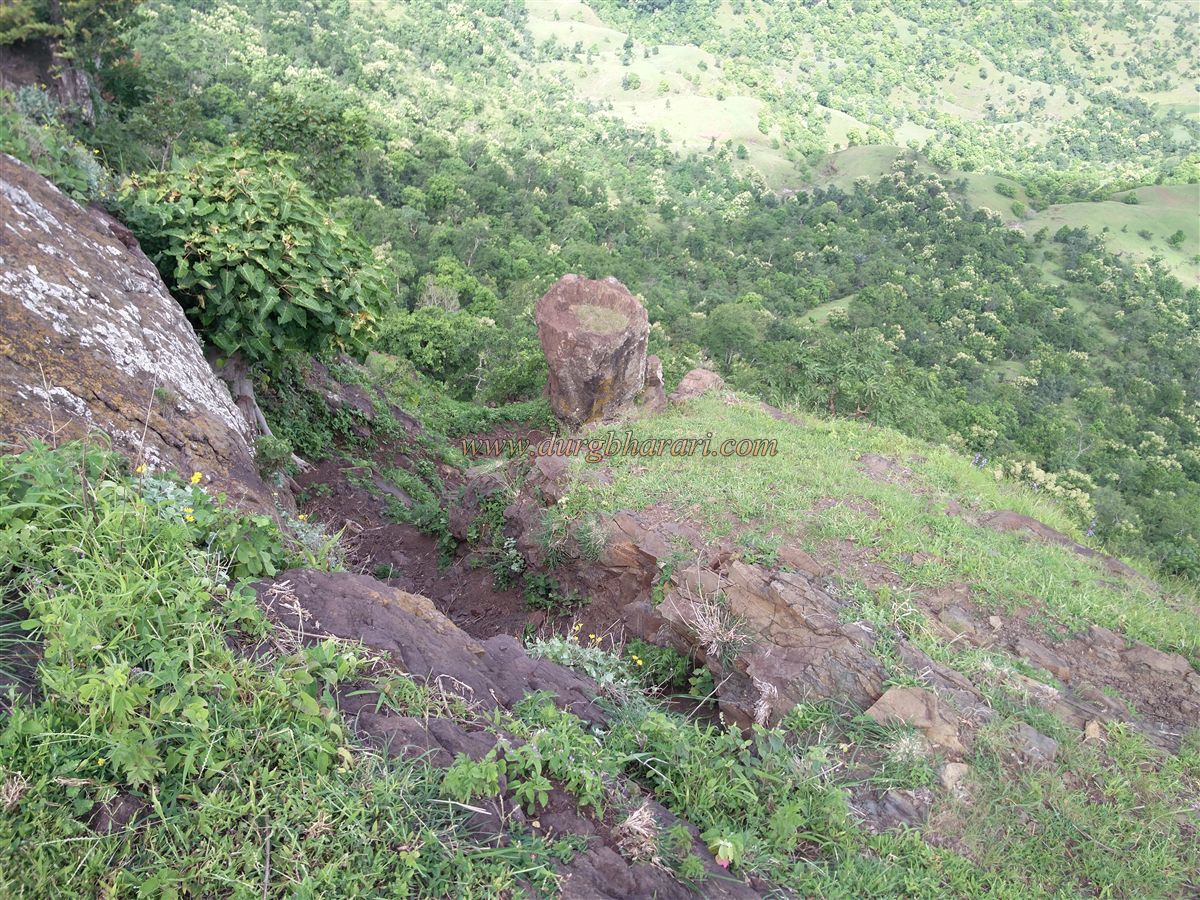
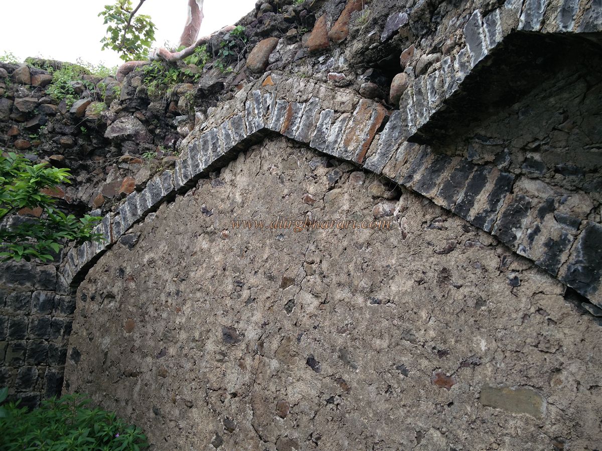
From here, one can begin a circuit along the fort wall to the left. Along the way, there is a reservoir built to store water, supported by the wall. The route then leads to the bastion at the edge towards Jarandi village. Continuing along the wall, a secret path descending from the fort becomes visible. This section lacks Persian-style fort walls, but each end has circular bastions.
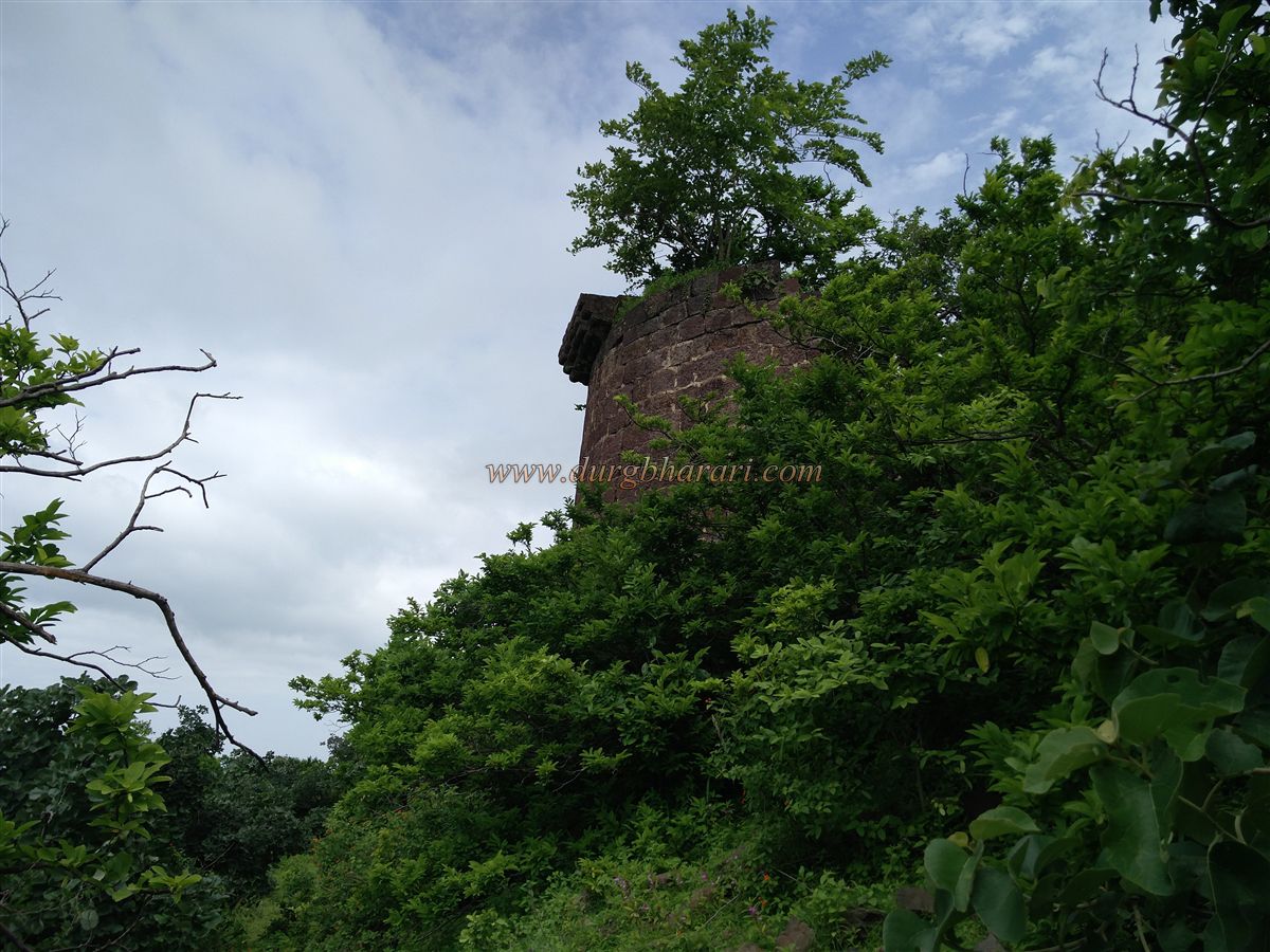
Further along, to the right, is a raised mound with the remains of a structure. Completing the circuit brings you to the eastern side of the fort, where a narrow spur contains a secret gate. This marks the start of the return journey. Turning back, one sees a wooded hill with a mosque of three arches on top. Without going there, turning left leads to the east-facing Vetalwadi Gate, hidden in dense vegetation.
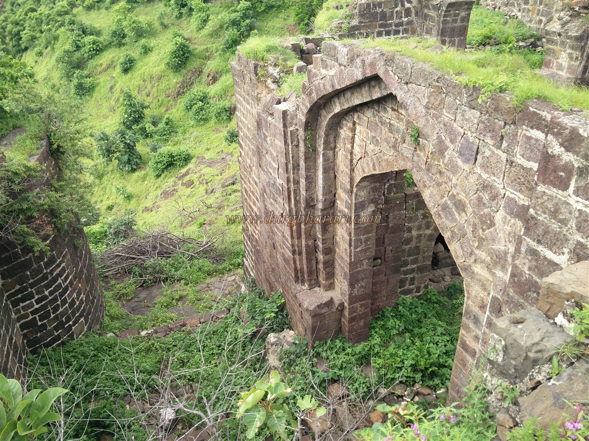
This 15-foot-high gate has a collapsed arch. Inside are guardrooms, and the path from the guardrooms to outside is paved with stone. The outer side has carvings. Judging by its construction, this may be the oldest gate on the fort. Dense vegetation makes it difficult to view the ruins here. Inside, next to the wall, is a ruined storehouse. The path descending from this gate leads to Vetalwadi village near the dam. From outside the gate, one can see the long wall of the northern spur and its secret gate.
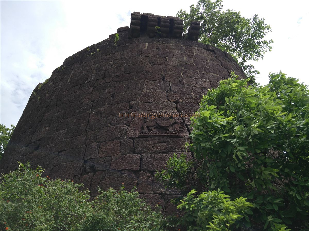
Continuing towards the mound on the fort, to the left is the second largest tank on the fort. Following the path straight instead of climbing the mound, two ruined bastions appear. Among the scattered stones beneath one bastion is a broken stone sculpture of a sharabh (mythical creature) in two pieces. The head and torso are carved on one stone, while the legs and claws appear on another. Opposite is another fallen sharabh sculpture. Between these two bastions is a saint’s tomb, with two Persian inscriptions carved in three lines each. Behind the shrine is the third tank on the fort, covered in moss and with undrinkable water.
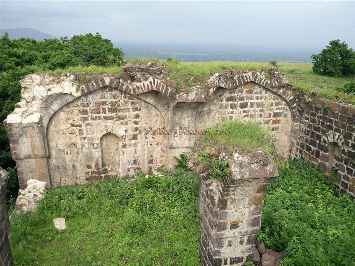
Circling around the shrine to the right leads to an arch. Seeing this arch and the earlier bastions with sharabh carvings suggests that this hill was the citadel (balekilla), likely housing the royal family’s buildings. The path around the hill leads to the ruins seen behind the shrine. Dense vegetation makes finding and viewing these ruins difficult. The first visible structure has a window and dome, and one must enter through the window as the front is inaccessible. Inside, going left, there is a decorated bastion with a unique sharabh sculpture visible from the outside. This sharabh has horns, sharp claws on three legs, a captured elephant in its front leg, bells around its neck, a cloth like a bull’s drape on its back, and a tufted tail.
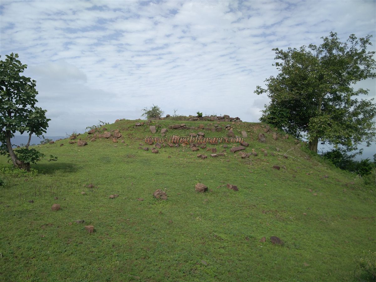
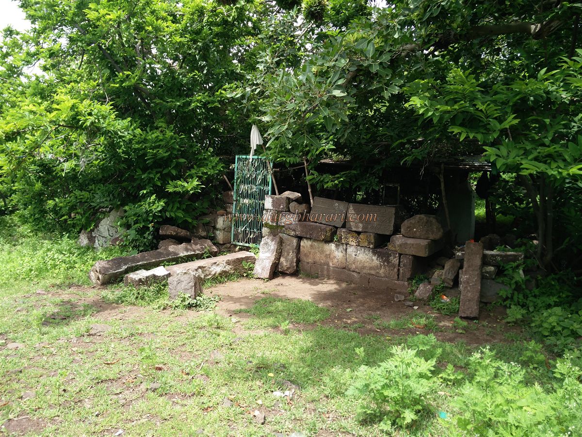
Walking further right through dense vegetation brings you to the Amberkhana or Queen’s Palace, with multiple arches. The upper part has collapsed, and the ruins are hard to distinguish due to vegetation. Opposite are remains of two more buildings. On the mound ahead of the palace is a mosque, the highest point on the fort, offering views of the entire fort and surrounding area. Descending from the mosque to the path between the tanks leads back to Janzale village in about ten minutes, completing the circuit of the fort.
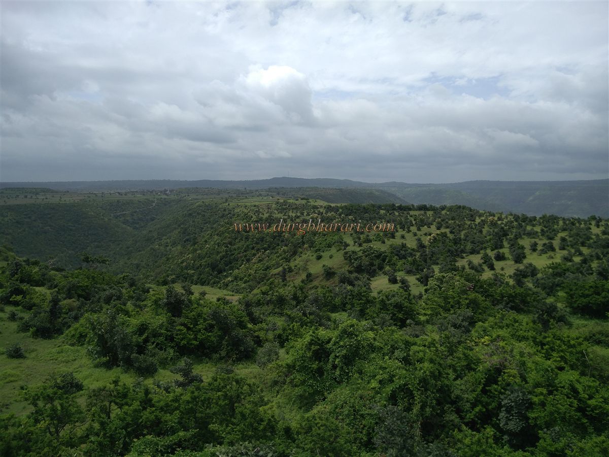
Given the size of the fort, its ruins, and three tanks, it appears to have been a bustling place in its time. Exploring the entire fort takes 3–4 hours. From here, the Ghatotkach Caves are about 45 minutes away; visiting the caves takes about half an hour, and returning to Janzale village takes another 45 minutes.
The ancient name of Janzale village was Janjala. In the Ghatotkach Caves inscriptions, there is mention of the princess of Ashmak. It is known that Varahadev, minister of a Vakataka king, excavated these caves in the 5th century CE. In 1553 CE, Burhan Nizam Shah of Ahmadnagar captured the fort, and in 1631 CE, Shah Jahan took control of it. Today, the fort is under the Forest Department, and cutting trees is prohibited, resulting in unchecked vegetation that is gradually consuming the ruins.
© Suresh Nimbalkar
GALLERY