JAIGAD
TYPE : COASTAL FORT
DISTRICT : RATNAGIRI
HEIGHT : 195 FEET
GRADE : EASY
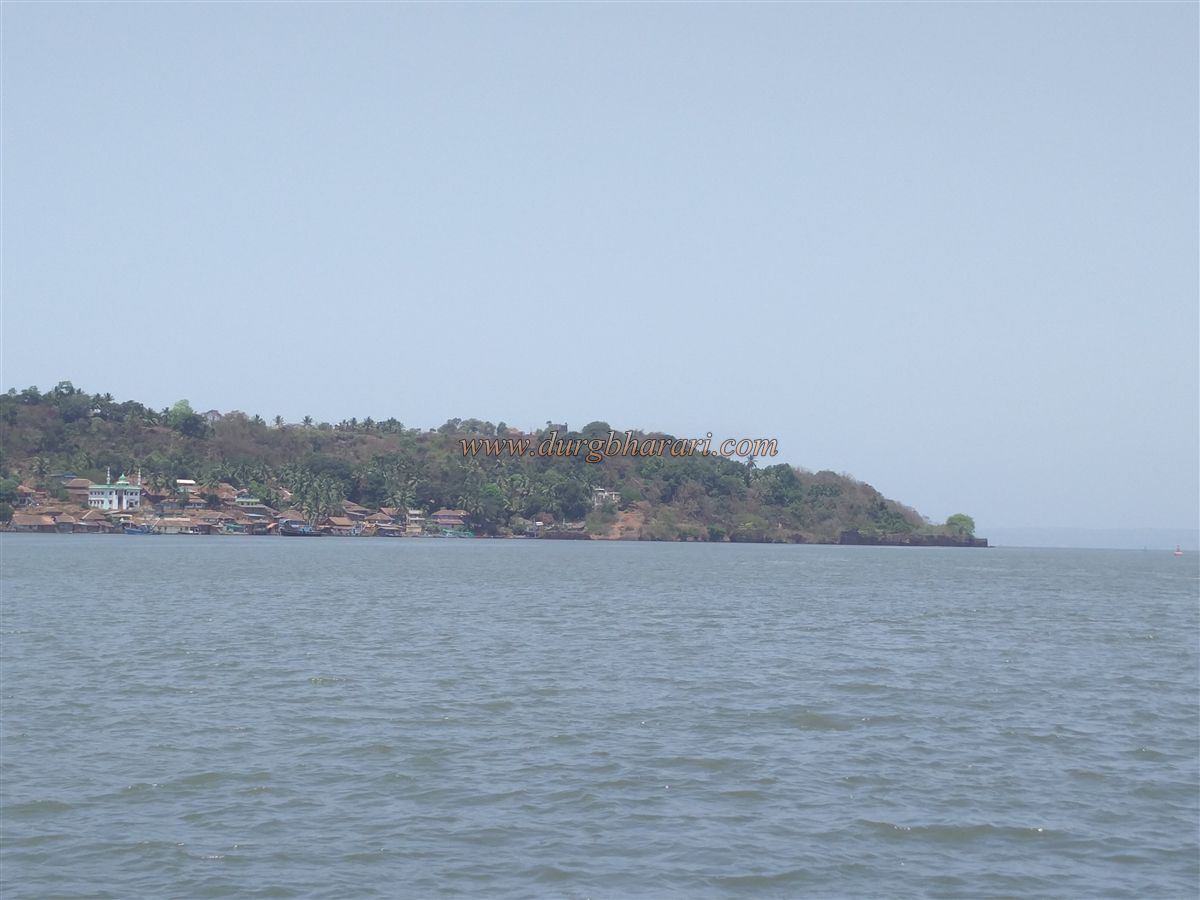
Maharashtra is blessed with a beautiful 720 km long coastline. To protect this coastline, many forts were built both out in the sea and along the shore during various reigns. To monitor the trade passing through Jaigad Creek in the Arabian Sea, Vijaydurg was built to the north of the creek and Jaigad to the south. This pair of forts in Ratnagiri district is situated on the slopes at the mouth of the Shastri River, with Jaigad citadel constructed on a 200-foot-high hill adjoining the sea. Just as hill forts are separated by a pass, these two forts are separated by the channel of the Shastri River. Jaigad is the last village in Ratnagiri taluka, and across the creek begins Guhagar taluka. When Mumbai–Goa maritime trade was active, Jaigad was an important port. On the Mumbai–Goa highway, after crossing Sangameshwar, a turn at Nivali leads to Jaigad, 44 km away. One can also reach Jaigad from Ratnagiri via Ganapatipule and Malgund, covering a distance of 45 km. The village of Jaigad is located on the southern slope of the fort, and from the police outpost at the village fork, the citadel gate can be reached by car within five minutes.
...
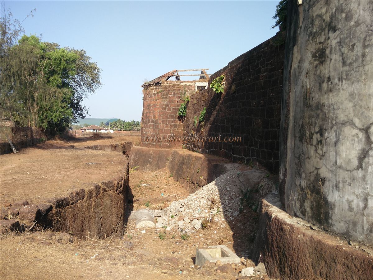
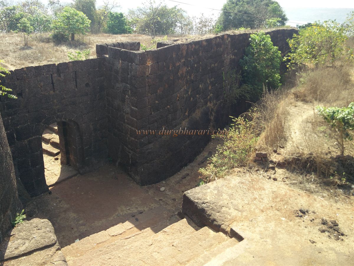
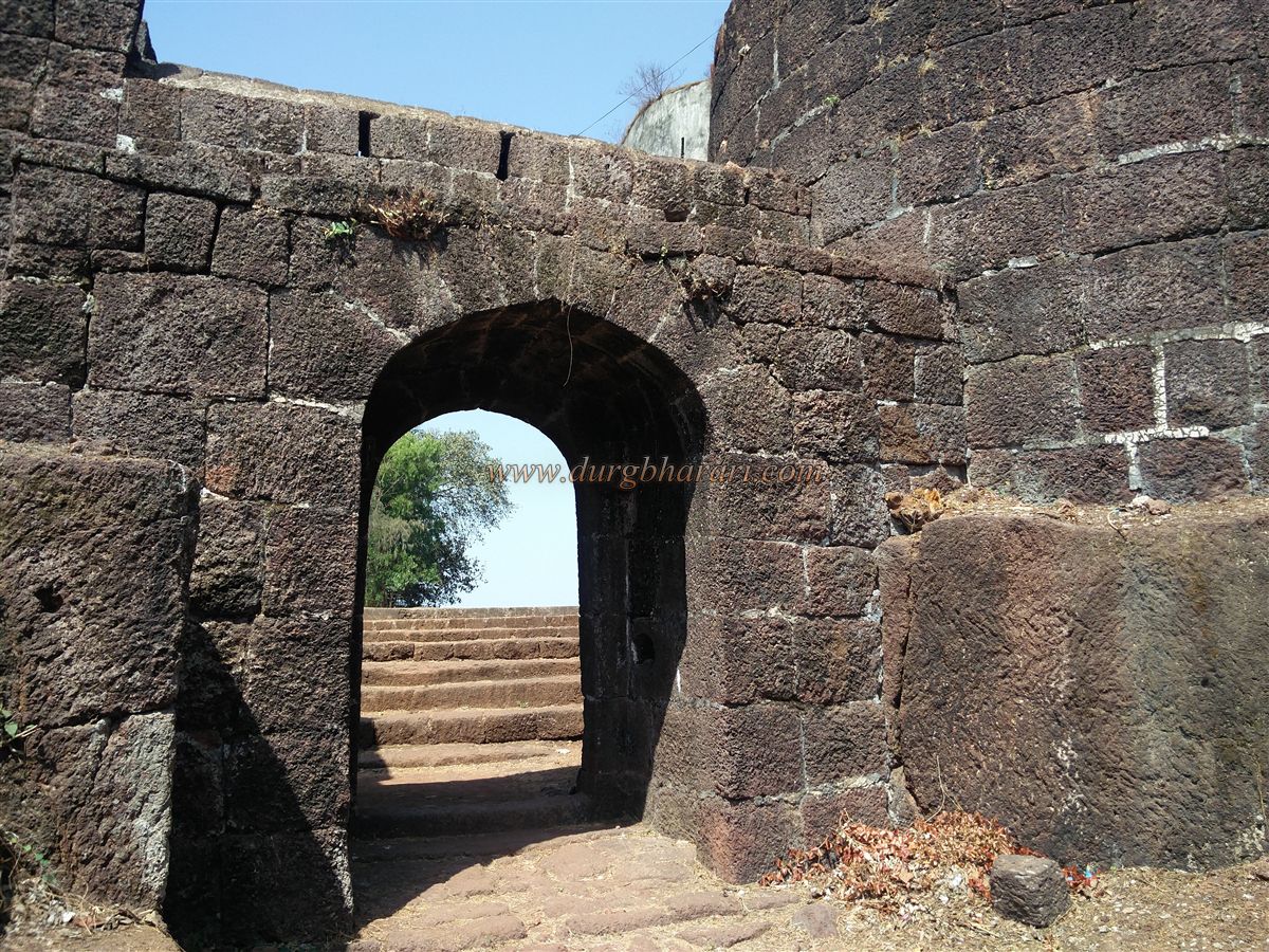
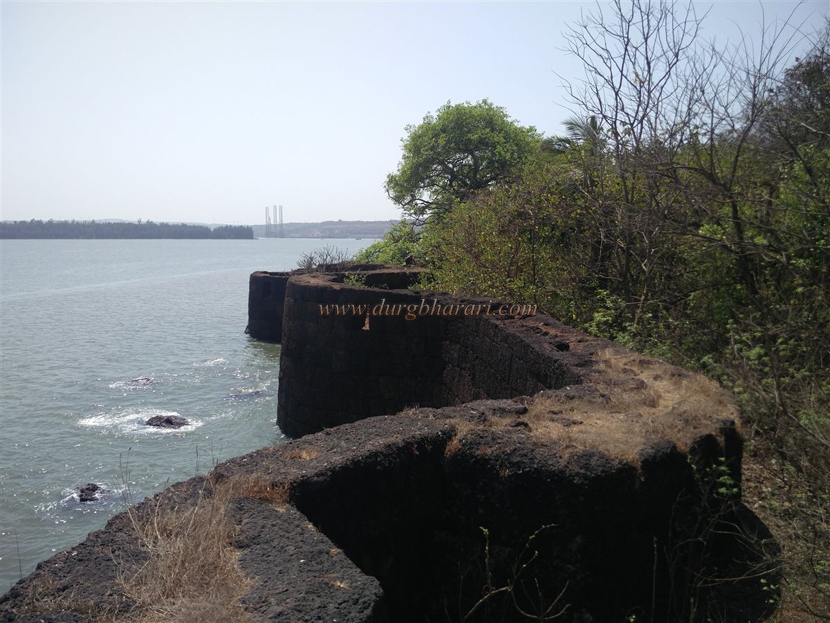
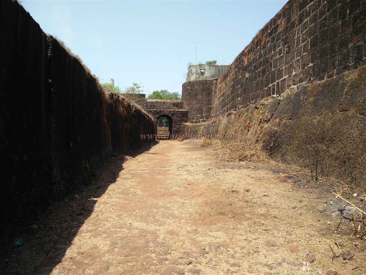
Jaigad is a complete fort with a citadel and a lower fort. Its layout is similar to Yashwantgad and Gopalgad, with the citadel having strong fortifications on the plateau side and the lower fort’s walls descending towards the sea. Since the plateau projects somewhat into the sea, the fort is surrounded by seawater on the north, east, and west sides. Around the citadel is a 15-foot-wide and equally deep rock-cut dry moat, dug to prevent enemies from reaching the walls. This moat curves around the left of the main entrance and extends down on both sides. On the right of the main gate, within the moat, is a gate to the lower fort, leading down to Jaigad port.
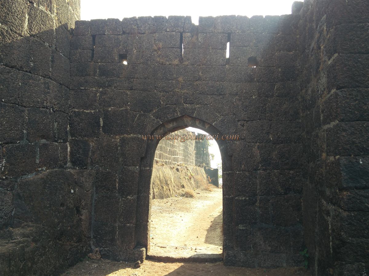
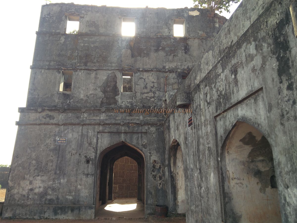
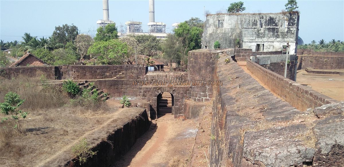
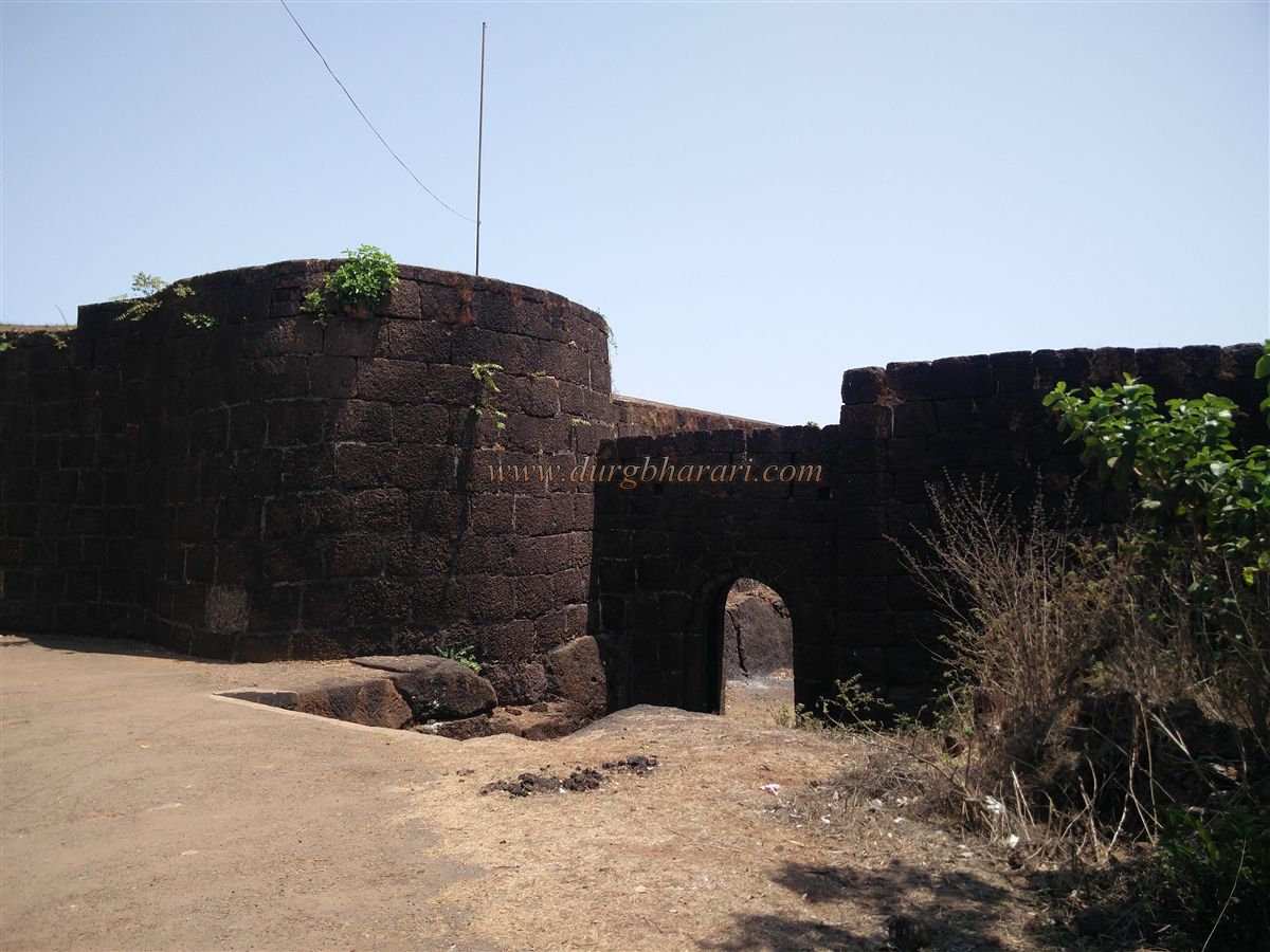
The main gate of the fort is concealed between two strong bastions, with lotus flowers carved on either side of the entrance. Until a few years ago, there was a two-storey customs rest house above this gate, now abandoned and in ruins. Its construction damaged the bastion’s structure considerably. The entire fort stretches north–south over about 18 acres, with the citadel covering 5 acres and the lower fort 13 acres. Much of the lower fort is privately owned. The citadel’s main gate faces east, while the lower fort’s main gate faces west. The citadel also has a small southern sea-facing gate, while the lower fort has two additional gates and a small postern gate.
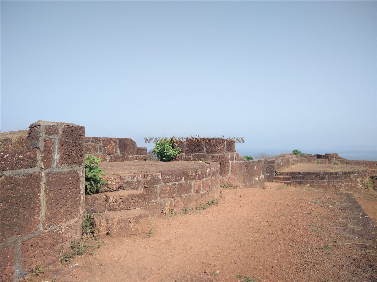
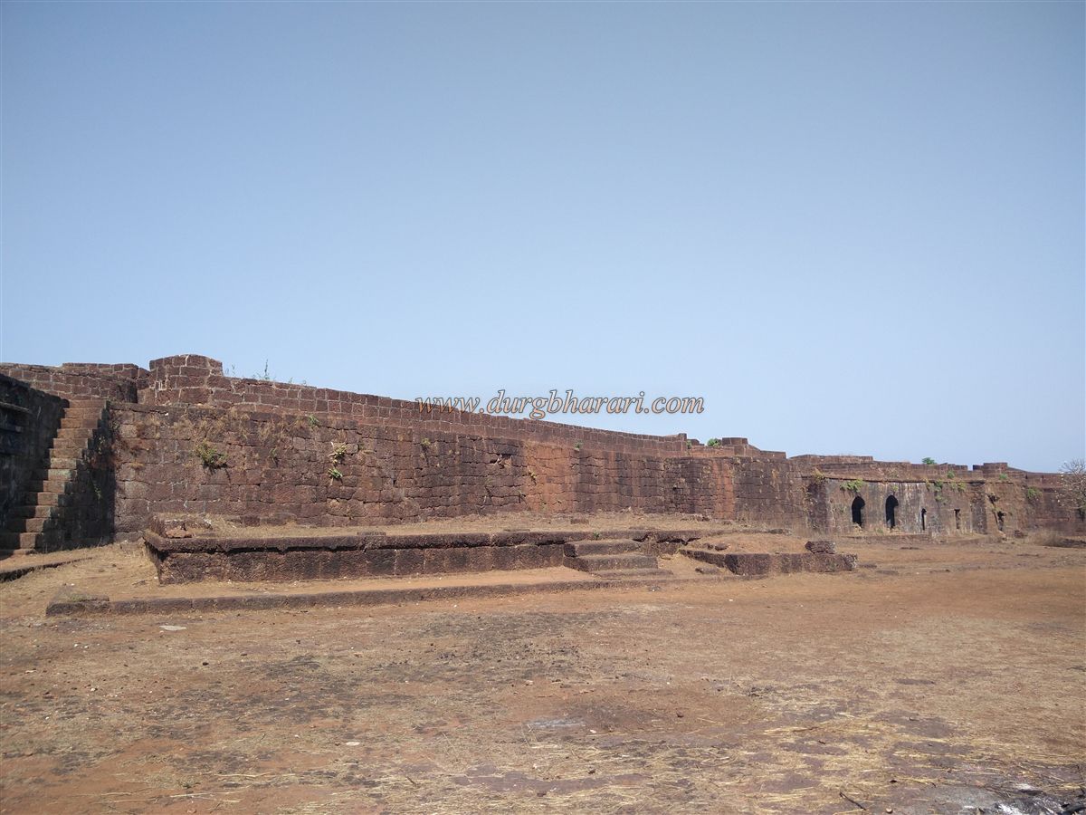
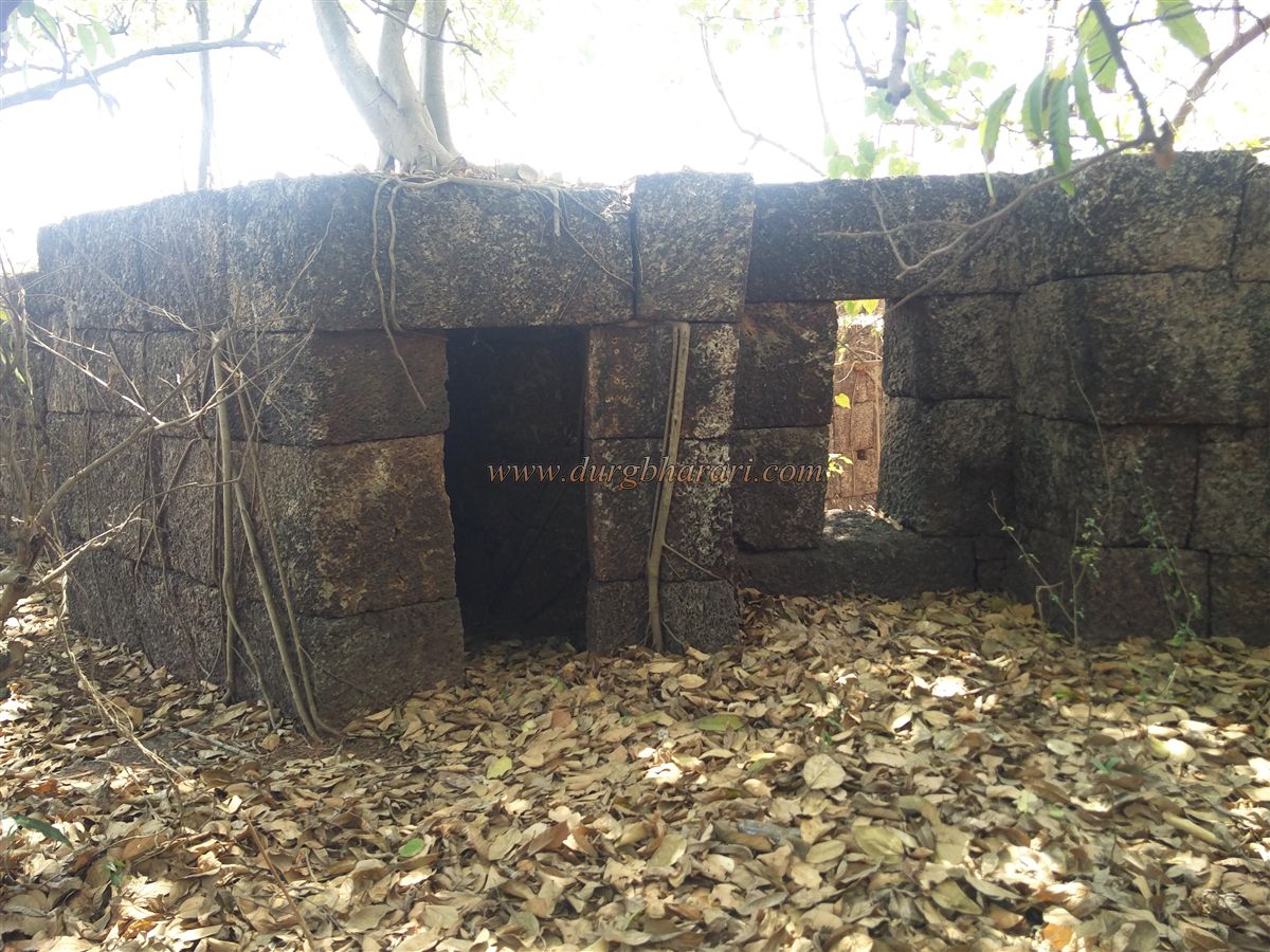
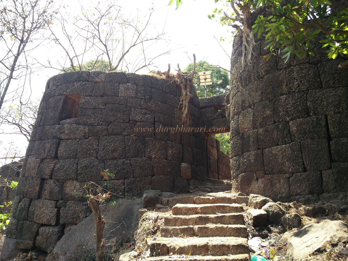
Inside the main entrance, there are guardrooms on either side, and to the left along the fort wall is a spacious granary. Next to it is a plinth of a structure with steps. From here, stone stairways lead to the upper part of the gate and to the ramparts, with more steps at intervals. Apart from one collapsed section, the ramparts are intact, so it is best to first walk around the fort on the walls and then explore inside. The laterite stone ramparts and bastions are still sturdy, with numerous gun slits.
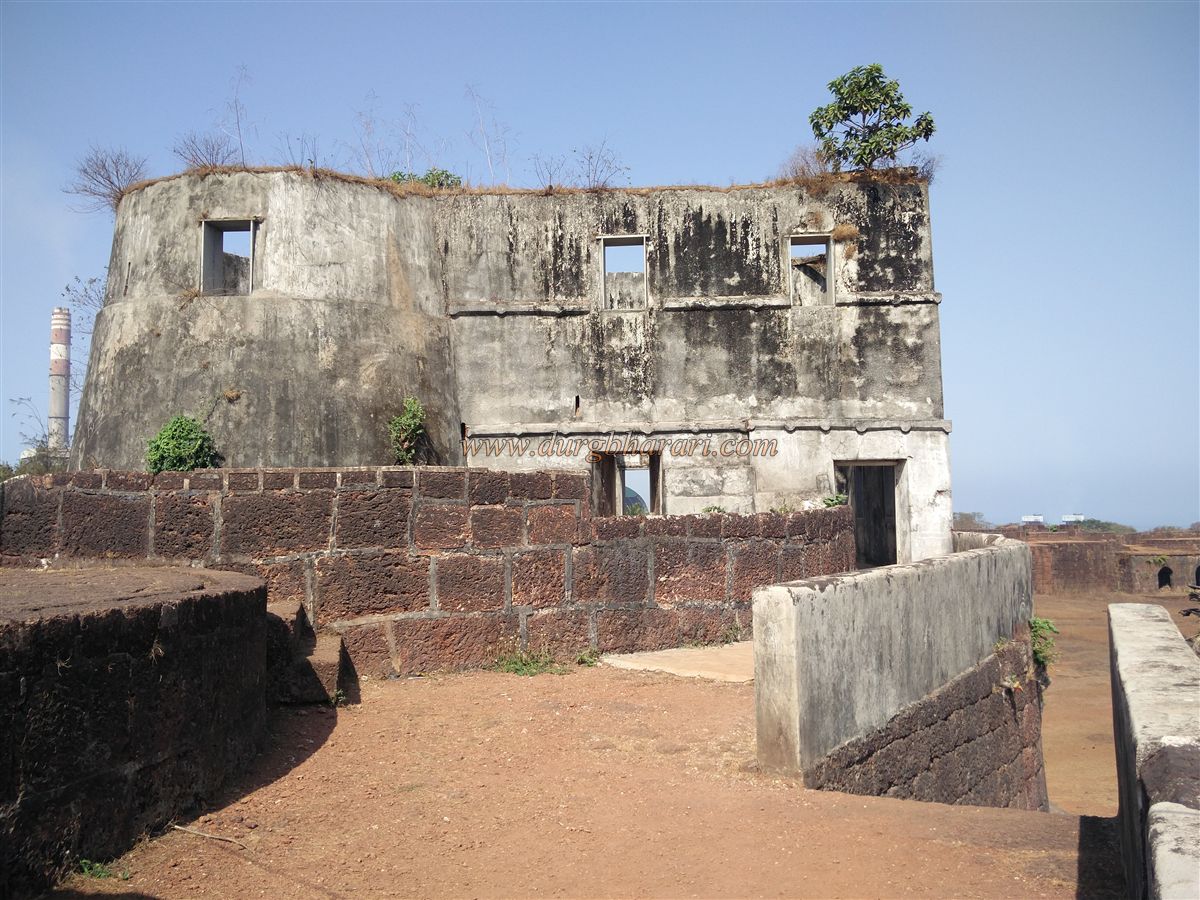
Starting the circuit, the second bastion from the gate has the remains of a tiled customs building. After two more bastions, a partially collapsed stretch of wall requires caution or a descent to rejoins via stairs. Next is the tallest bastion on the fort, three storeys high (including the ground floor) without a roof, known as Madi Bastion. It has doors on both sides from the ramparts, musket slits, and cannon windows, offering a full view of the creek. The following bastion has a triangular British-era lighthouse building, used until 1932. Below this bastion is the citadel’s small southern gate, flanked by guardrooms, with another large granary beside the wall.
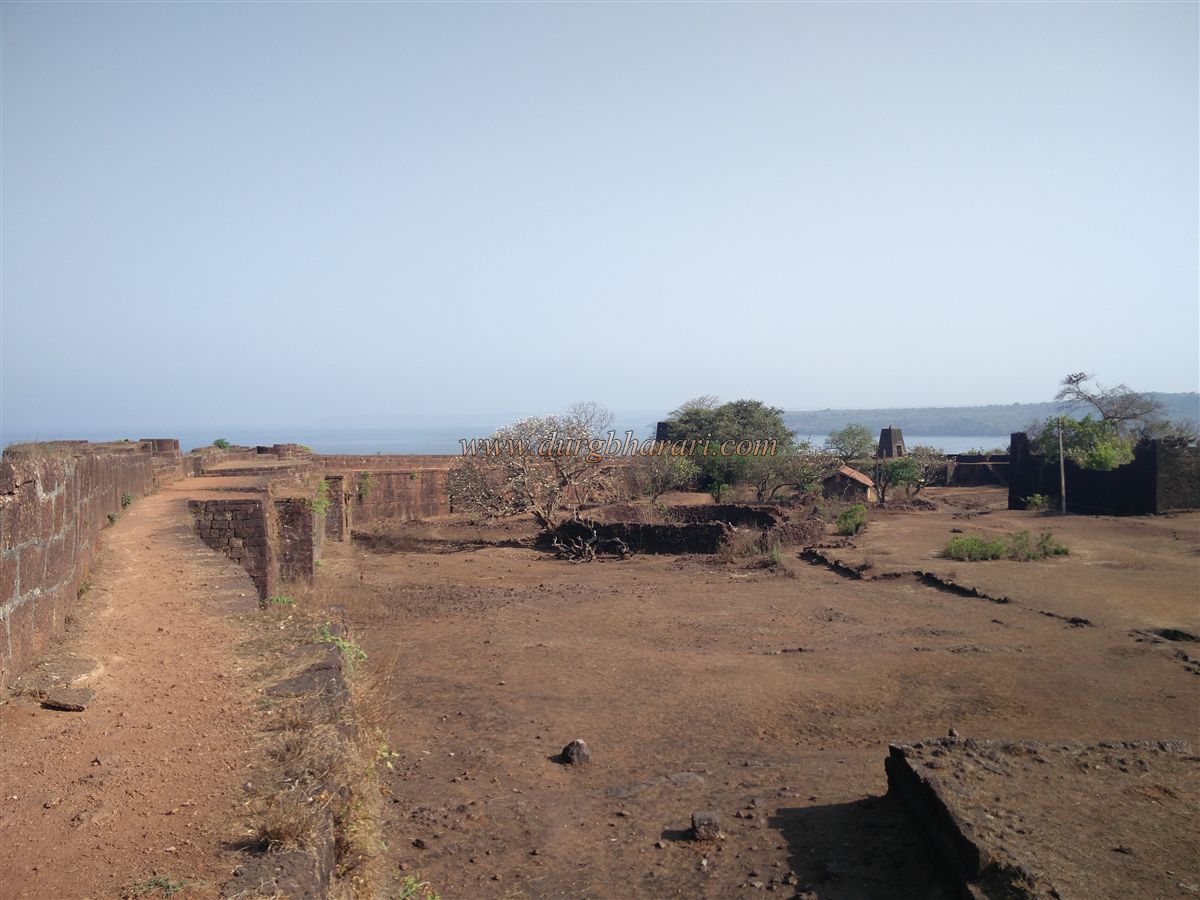
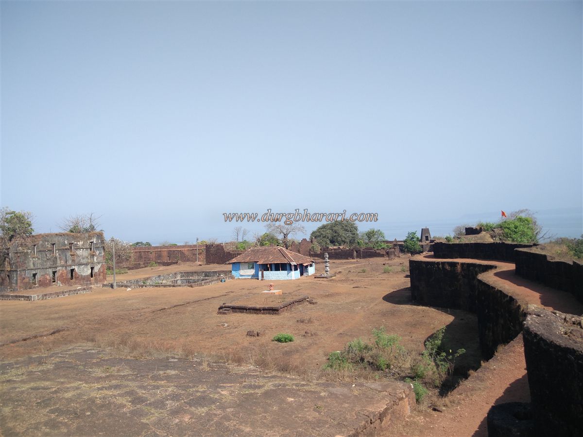
Continuing, one finds a latrine along the wall. An 1862 record mentions 55 cannons on the fort, but none remain today. The entire fort has 28 bastions, 12 in the citadel and 16 in the lower fort along the creek. Descending from the bastions, there is a square well about 50 feet deep, with a small cistern beside it. On the left corner of the wall is another storehouse, likely for gunpowder or a blacksmith’s workshop. In the middle of the citadel stands a roofless three-storey building known locally as Kanhoji Angre’s palace, though its design suggests an administrative office.
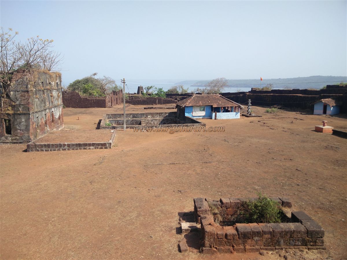
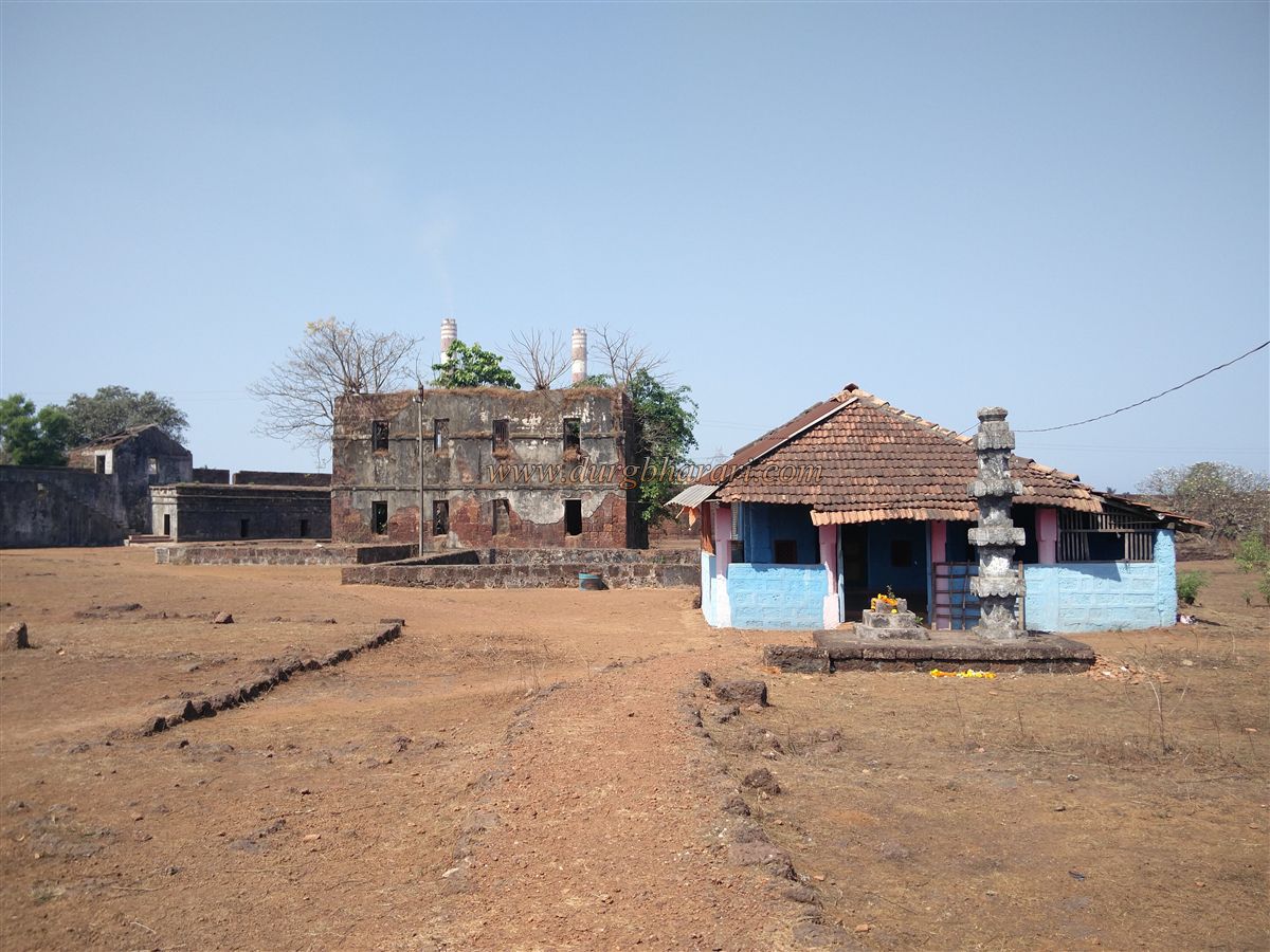
To its left is a lime-mixing pit, a water channel, and a grinding stone. Below the left-side walls are soldier barracks. Further along is a rough stone enclosure with two square masonry wells that have perennial drinking water but no drawing mechanism. Opposite are two stone troughs. To the right of the palace are two plinths of buildings, behind one of which is a large divided rainwater tank. Near the other plinth is a tomb. Adjoining the tank is a traditional Konkani-tiled Ganesh temple, housing idols of Ganesh and Hanuman. Two lamp towers once stood before the temple, of which only one survives. Near it, along the wall, is a memorial to Jaiba, who was sacrificed during the fort’s construction. Behind the temple is a large ruined building, likely the citadel’s main office and the fort commander’s residence.
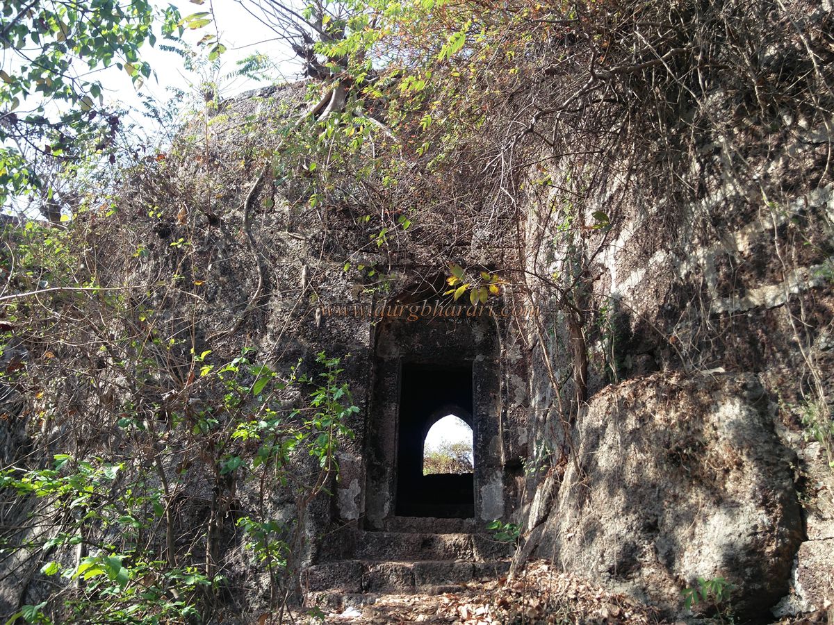
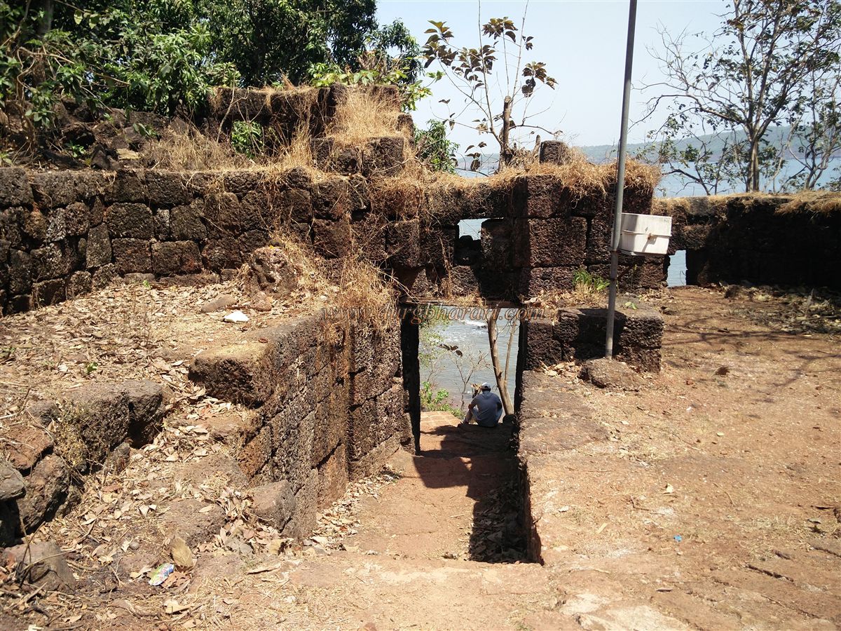
Completing the citadel circuit takes about an hour. From the citadel’s main gate, one can enter the lower fort via the moat gate, where steps lead down. Near the citadel wall is a natural laterite cave with a temple of Mohmaya Devi, the family deity of the local Ghatge clan. Further along are two 20-foot-high stone pillars left as measurement markers.
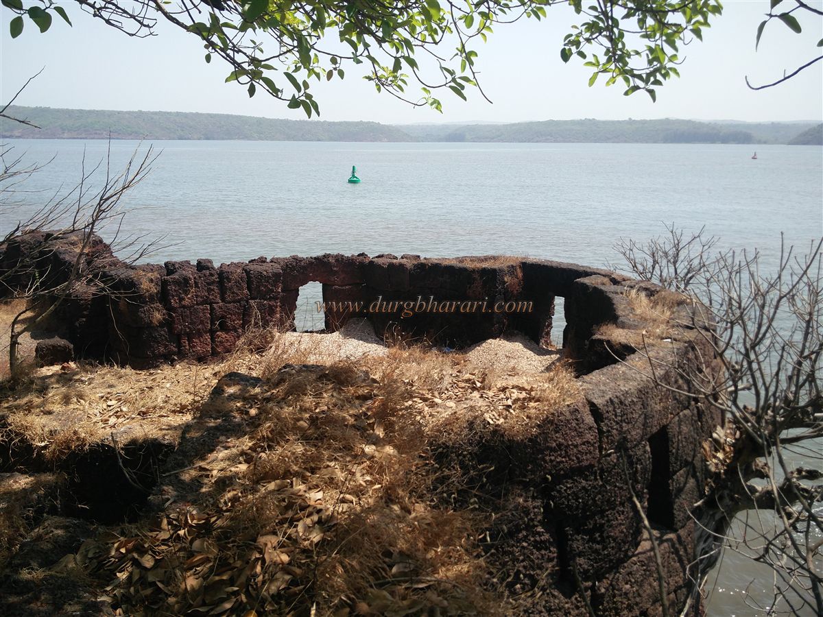
From the lower fort’s wall, a bastion offers views of the citadel gate, creek, and port. Another northern gate is flanked by bastions and has a Hanuman temple inside. Outside this gate is a well with fresh water despite its proximity to the sea. A nearby postern gate leads to a small rectangular dry well. The largest sea-facing bastion in the lower fort has eight cannon windows and a cellar, protecting a landing jetty and sea gate below.
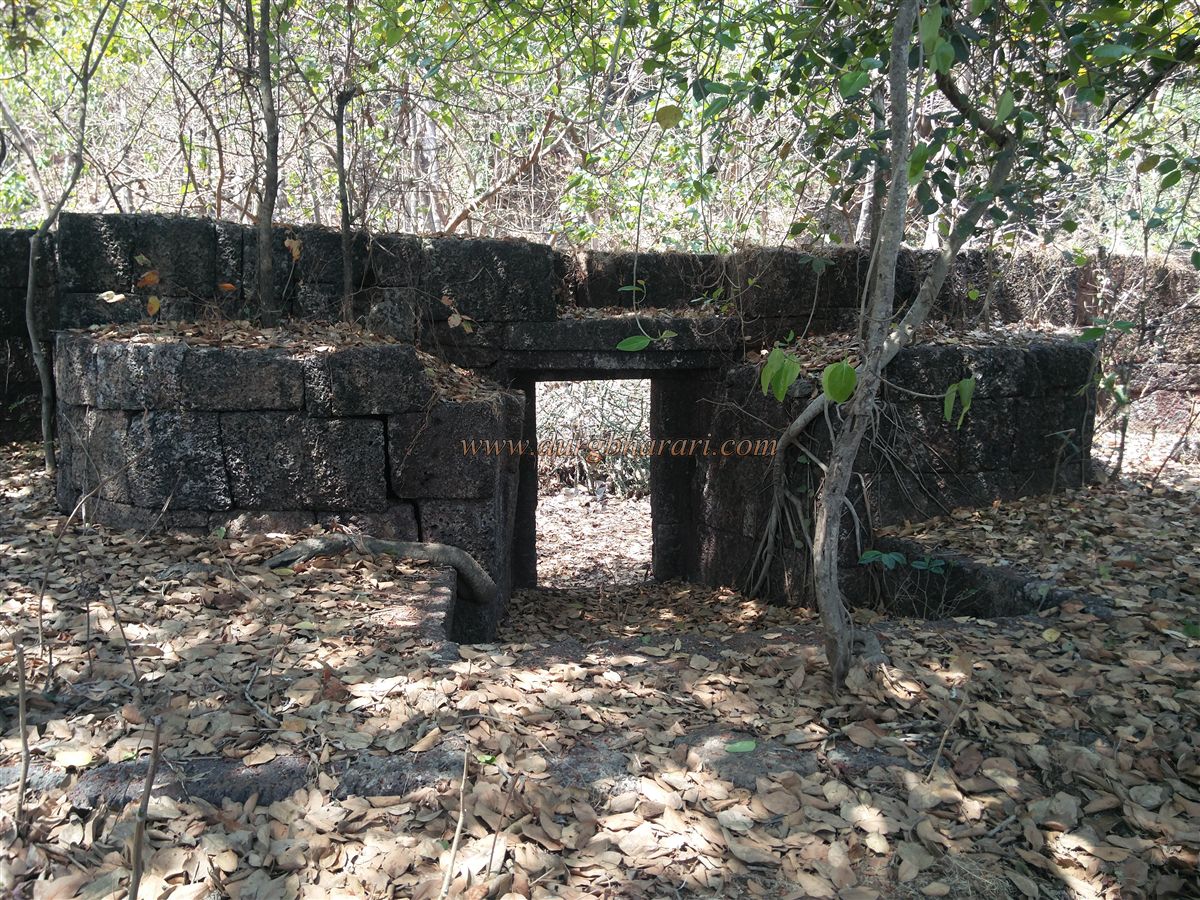
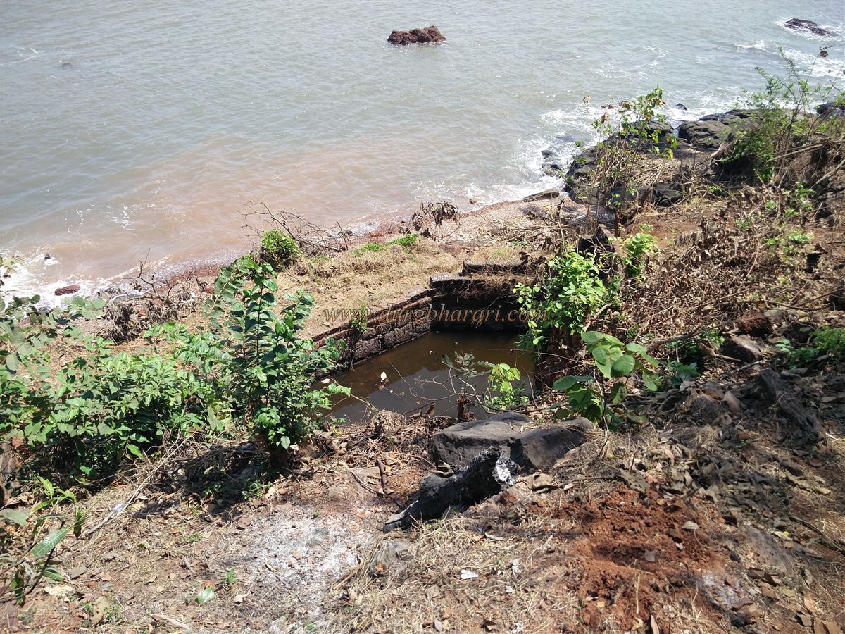
Along the lower fort’s sea-facing wall are more latrines, and a large bastion with a Shiv temple and ruins of a structure. The southern gate of the lower fort has a tank below for supplying water to ships. The inhabited area within the lower fort has a restored Shiv temple and several wells, as well as memorials and tulsi shrines.
The entire fort circuit takes about three hours—one for the citadel and two for the lower fort. There is no firm evidence of when and by whom Jaigad was built, but it predates Shivaji’s era. In 1347, it was under Bahmani Sultan Allauddin. After the Bahmani decline, much construction was done under the Adilshahi of Bijapur. A legend says that during construction, one bastion kept collapsing, so a human sacrifice was decided upon. Jaiba volunteered, and the fort was named Jaigad after him.
AdilShah hold was short-lived—around 1578–80, the Naik of Sangameshwar captured it. In 1585 and 1588, Bijapur tried to recapture it with Portuguese help but failed both times. During Shivaji Maharaj’s reign, the Marathas gained control, though the details are unclear. In 1698, Chhatrapati Rajaram Maharaj granted the fort to Admiral Kanhoji Angre. It later fell briefly to the Siddhis but returned to Maratha hands in May 1733. In 1713, as part of a treaty between Balaji Vishwanath Peshwa, Kanhoji Angre, and Shahu Maharaj, Jaigad was one of ten forts given to Angre. In 1756, Peshwa Nanasaheb, with British help, defeated Tulaji Angre and took Jaigad. The British exploited the Peshwa–Angre conflict to strengthen their hold on the Konkan coast. In 1818, after the Anglo–Maratha War, the fort passed to the British. Vijaydurg and Jaigad can be visited in a single day from Ratnagiri or Guhagar.
© Suresh Nimbalkar
GALLERY