JAFRABAD JALNA
TYPE : CITY FORT
DISTRICT : JALNA
HEIGHT : 0
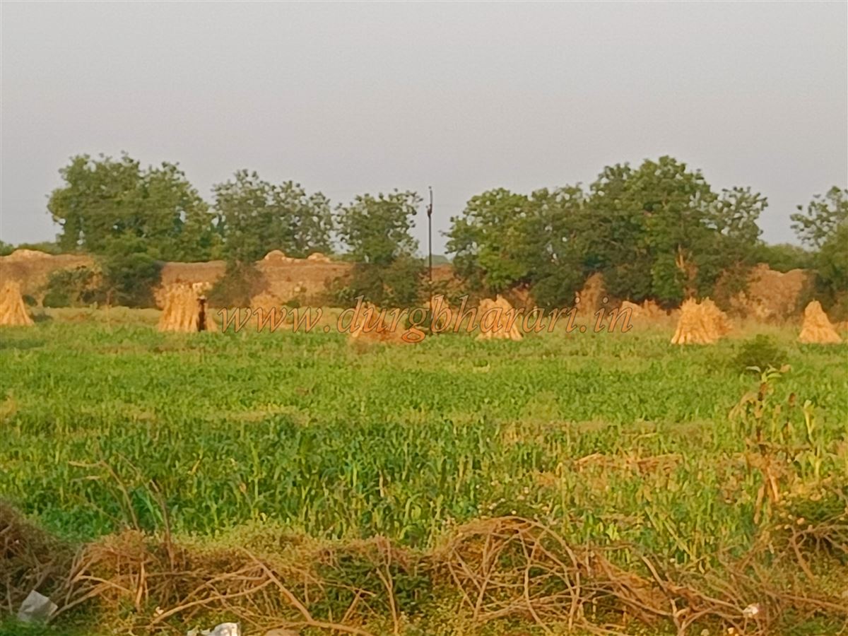
Jafrabad, situated at the confluence of the Kelna and Purna rivers, is an important city in the Jalna district. Since medieval times, Jafrabad has been a significant city, and even today many fort enthusiasts are unaware that there is a beautiful fort here. This ignorance has led to the fort being neglected. In earlier times, the fort was built on the riverbank with the city outside its walls, but now, with the rapid growth of settlement inside the fort, its condition is deteriorating. Apart from the encroaching habitation and minor damage to the fortifications at one or two points, the fort is still in fairly good condition. To preserve this condition, conservation and maintenance are essential.
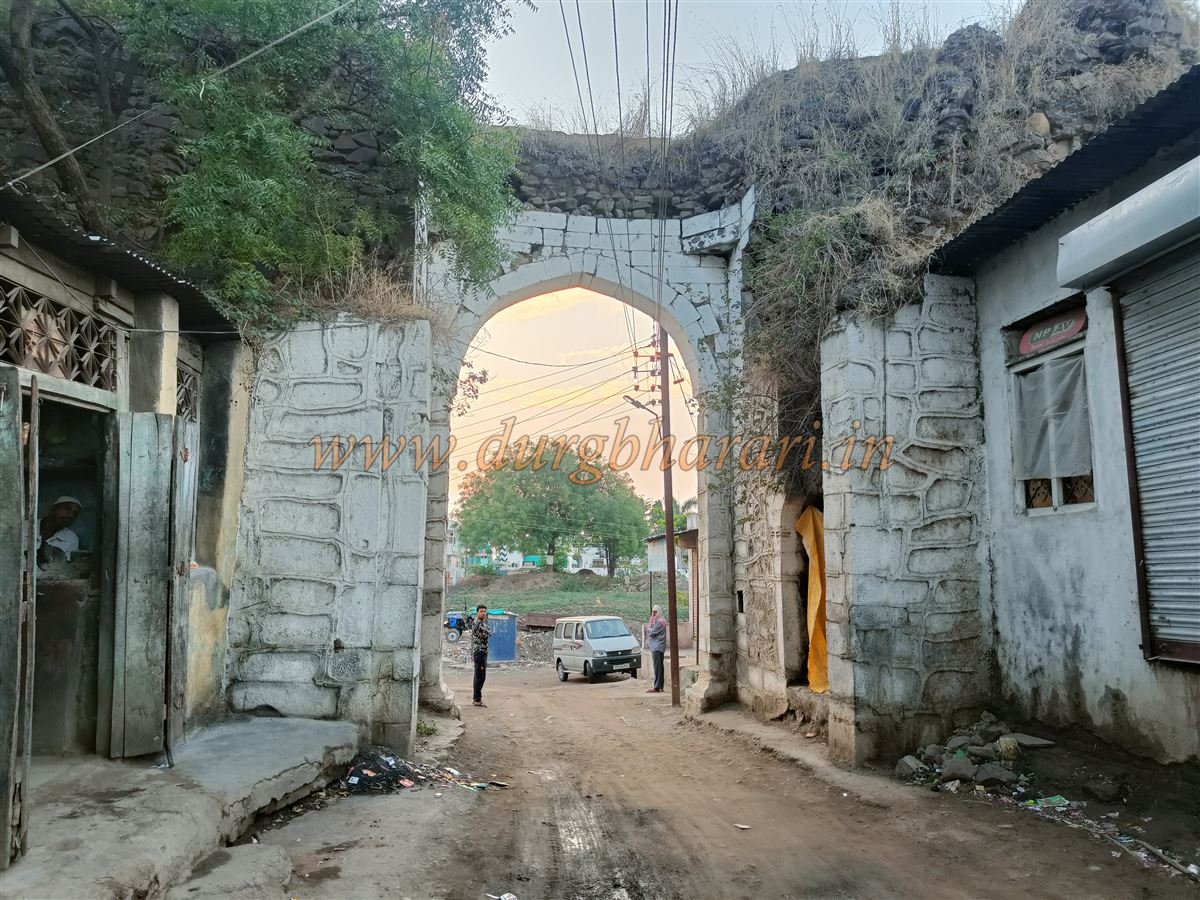
Jafrabad, the taluka headquarters, is located 48 km from Jalna and 60 km from Buldhana. The distance from Chhatrapati Sambhajinagar to Jafrabad is about 110 km. From the Jafrabad bus station, a five-minute walk leads to the main north-facing gate of the fort situated by the river.
...
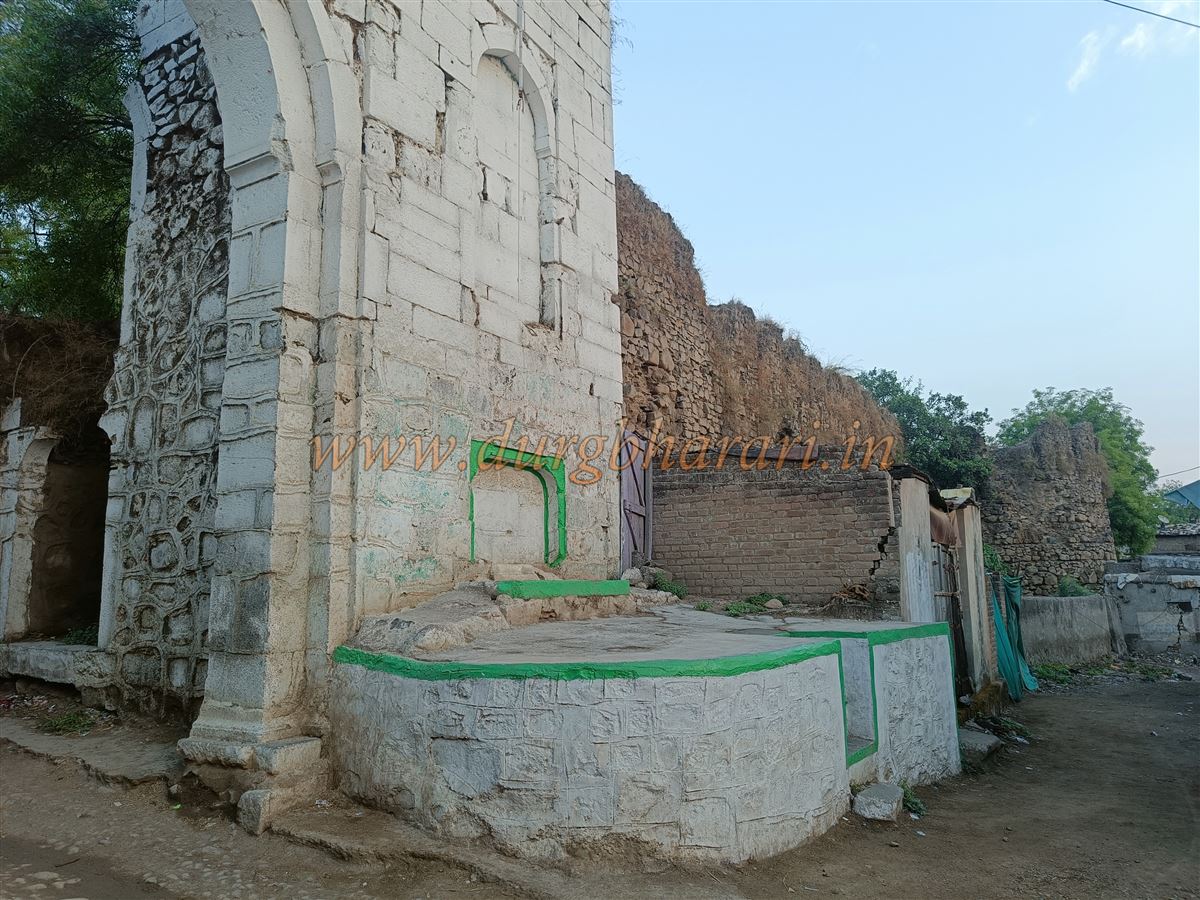
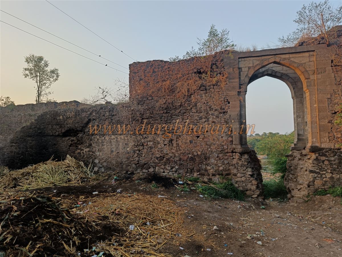
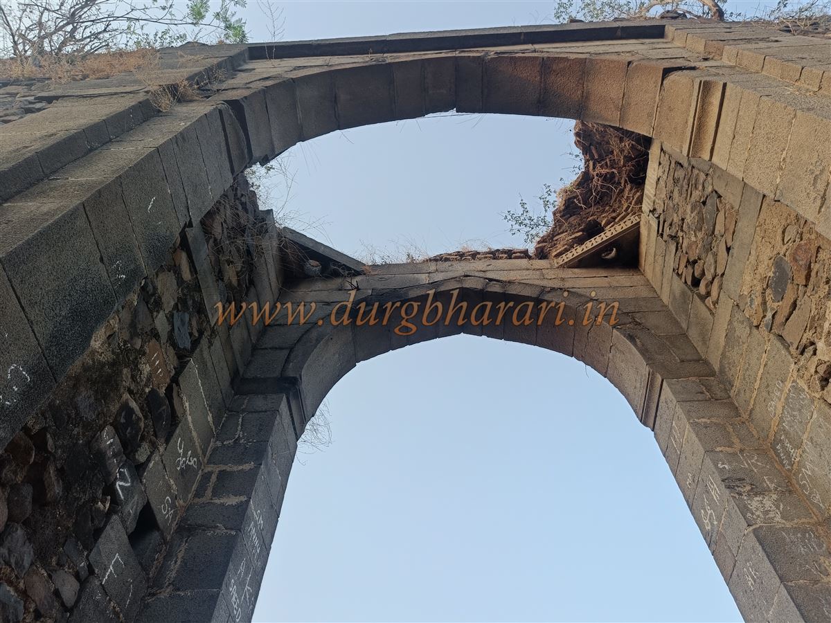
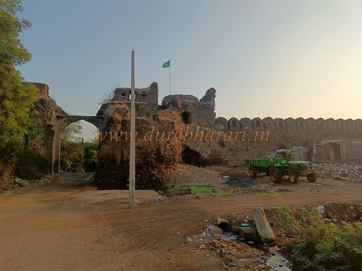
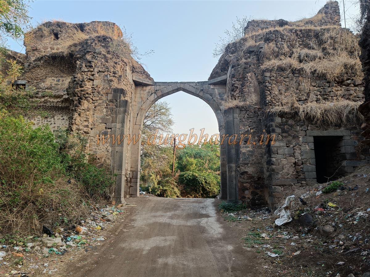
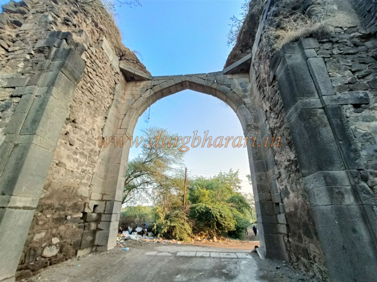
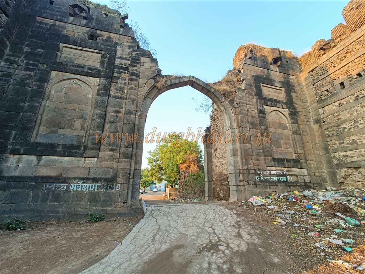
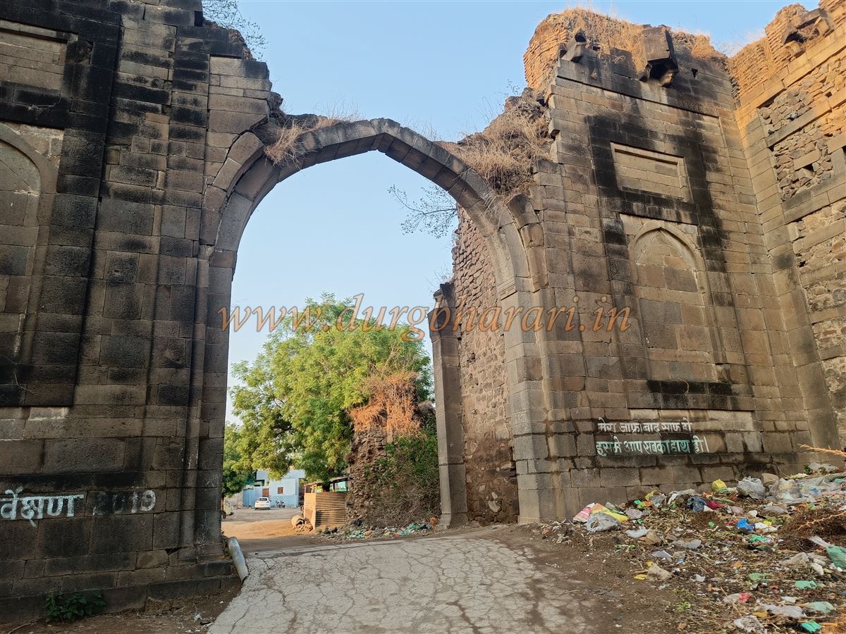
This gate, built of dressed stone, has an arched entrance with decorative niches above it still in good condition, though the structure above the arch has been destroyed. Inside the gate are guard rooms on both sides, and a little further along are steps leading to the ramparts. To the right of the gate, a little distance away, stands a large circular bastion; to the left, houses built against the wall obscure the view.
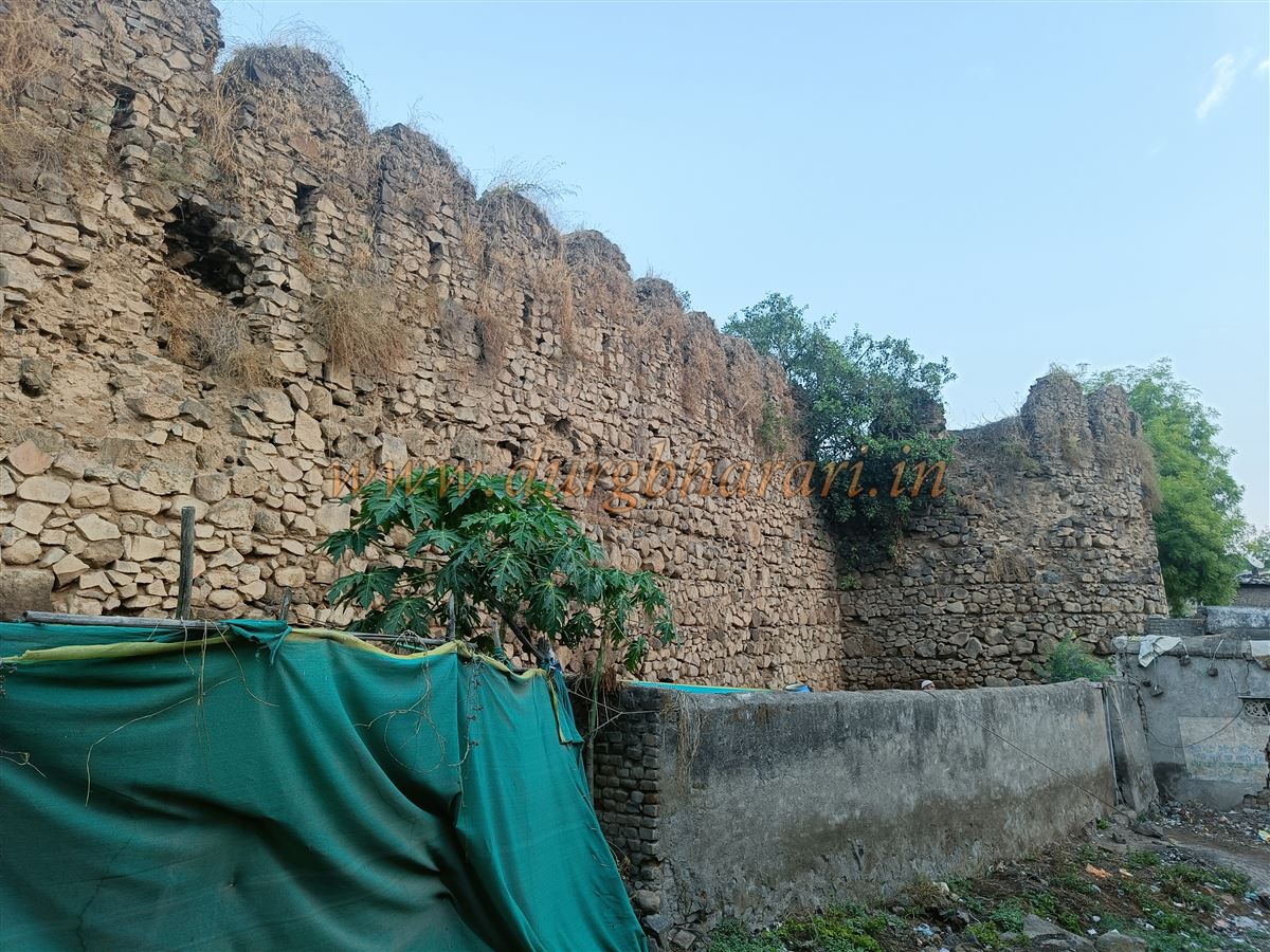
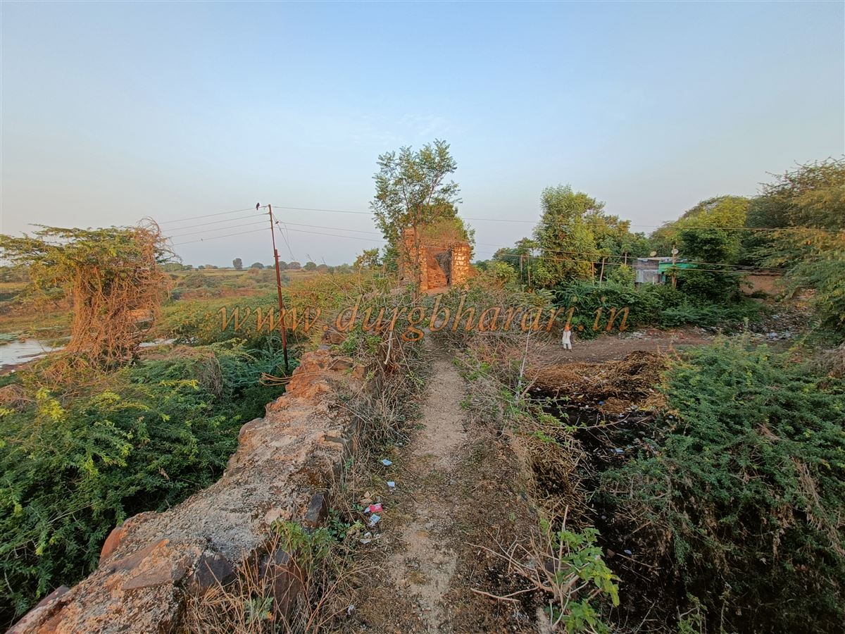
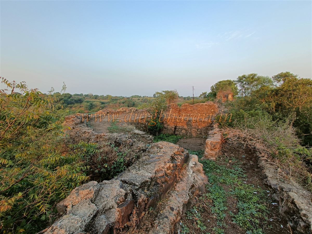
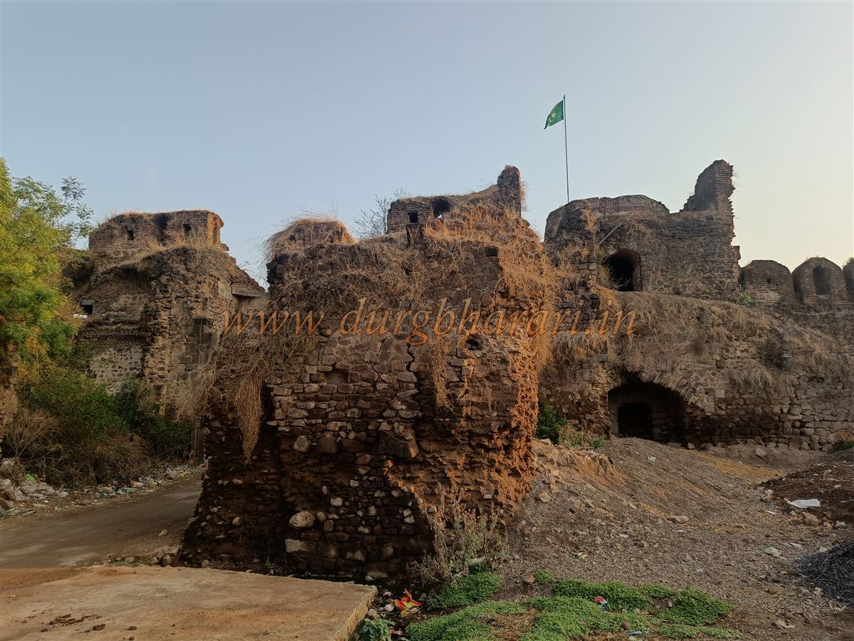
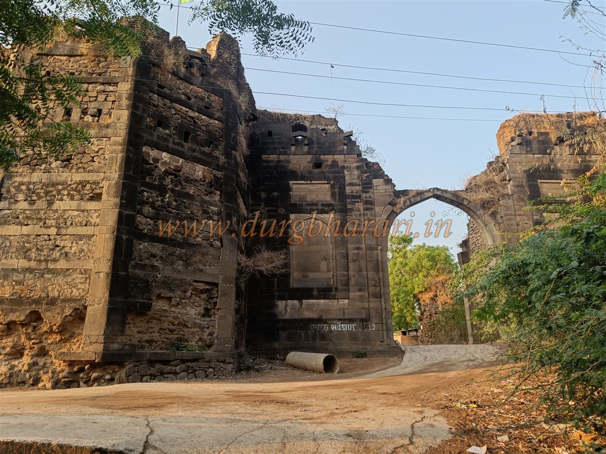
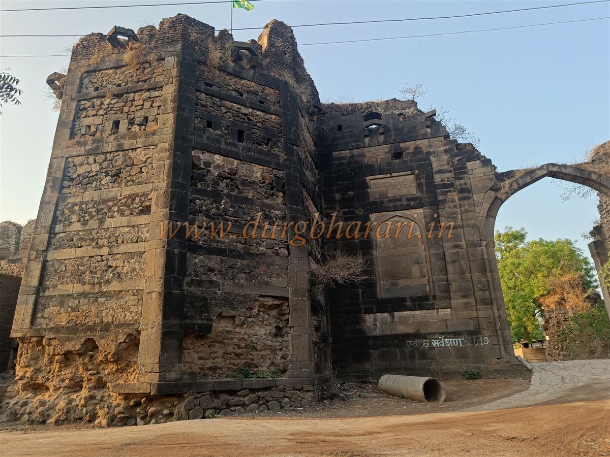
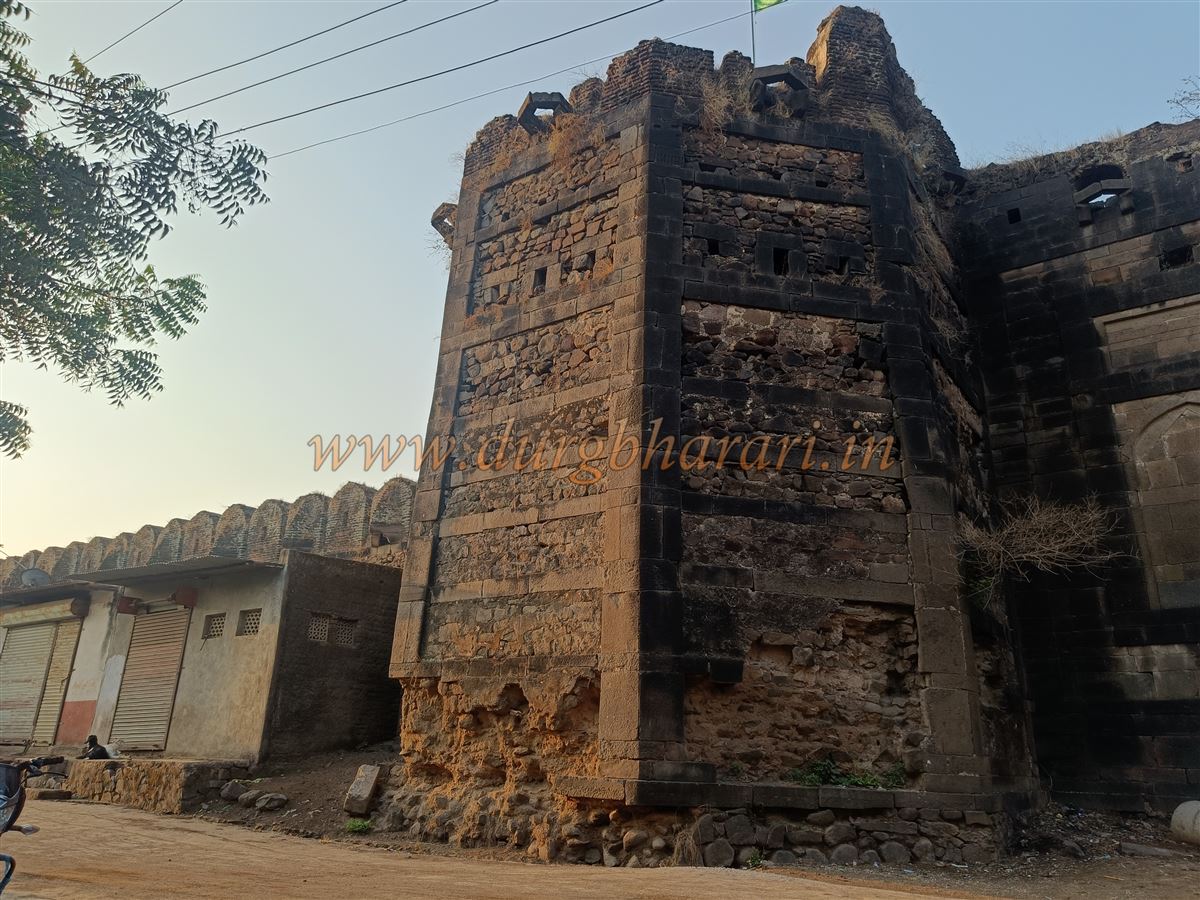
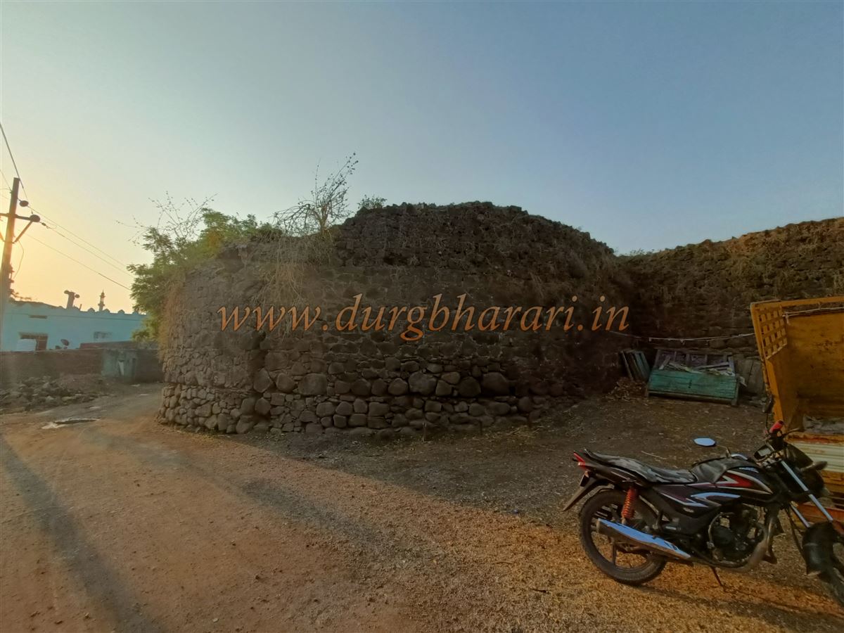
The 25-foot-high fort wall is entirely built of stone, with battlements at the top of the walls and bastions. Gun ports are built into the walls for musket fire, and the bastions have embrasures for cannons. The fort, octagonal in shape, covers an area of 45 acres and has a total of 16 bastions of various sizes in its fortifications—eight at each corner and eight more placed two on either side of the four gates. Twelve of these are circular, while the two bastions beside the main Delhi Gate are hexagonal in shape, built of dressed stone with decorative carvings.
The fort has four gates in the four cardinal directions—two large main gates and two smaller ones known as Khidki gates. The western and northern sides have the main gates, while the other two directions have the smaller gates. The main gates are so wide that even today large four-wheeled vehicles can pass through with ease. Since the gates and ruins are scattered throughout the interior settlement, it is best to take a local guide, even a small boy, to navigate.
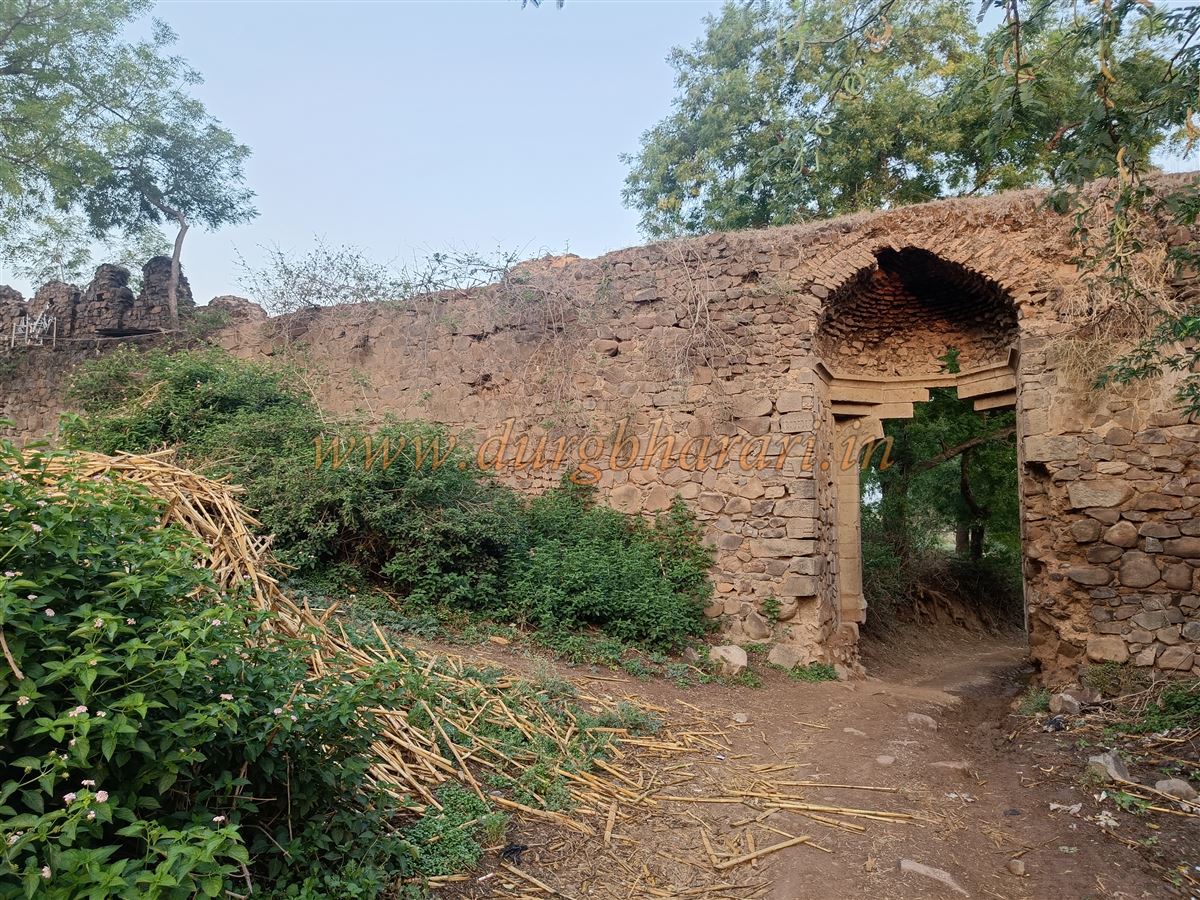
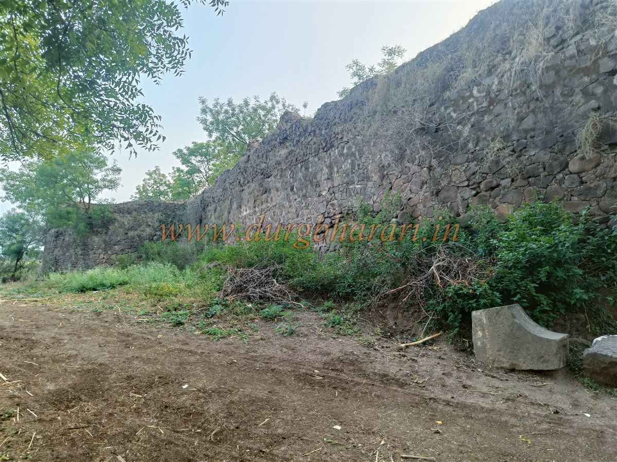
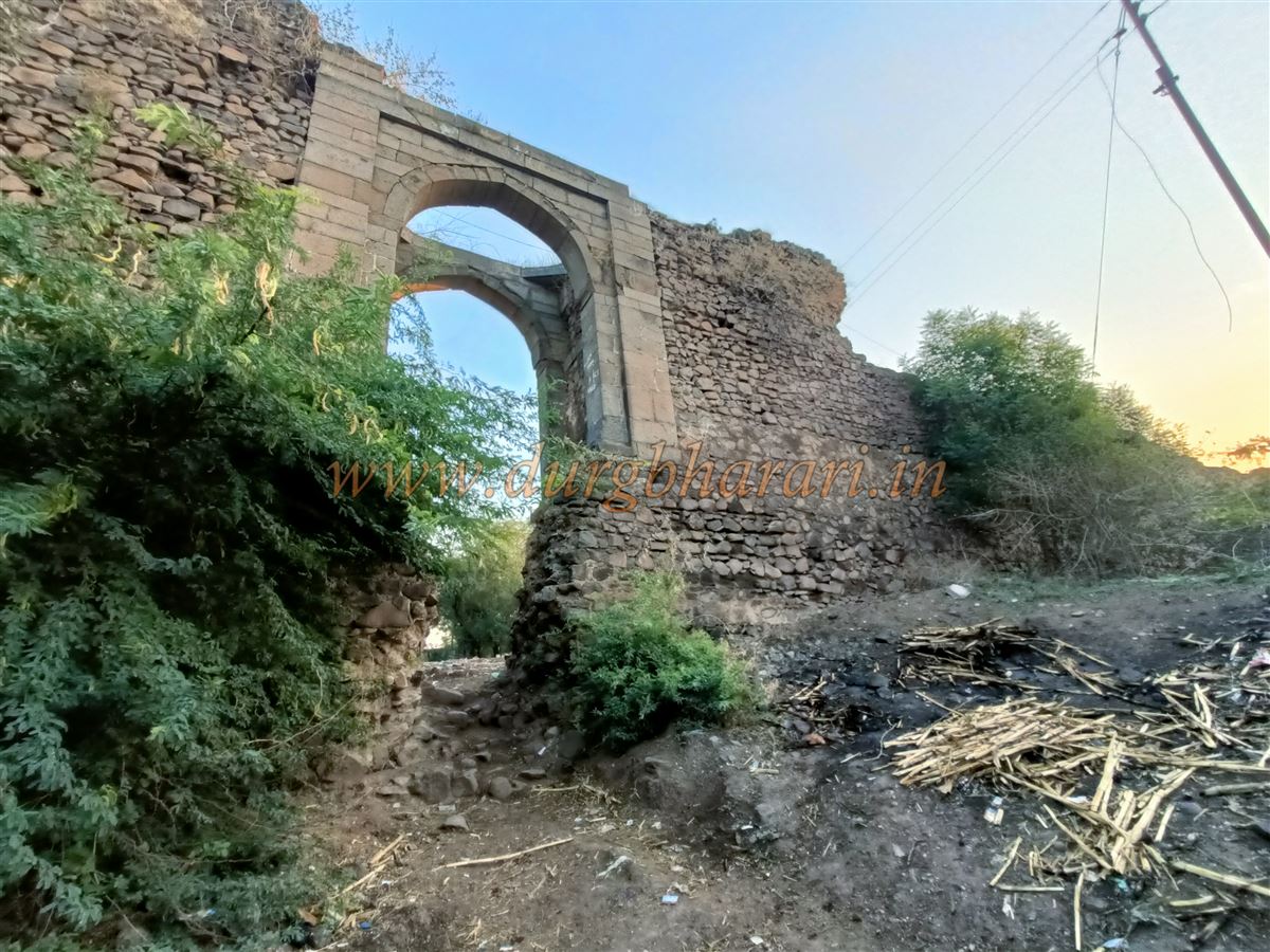
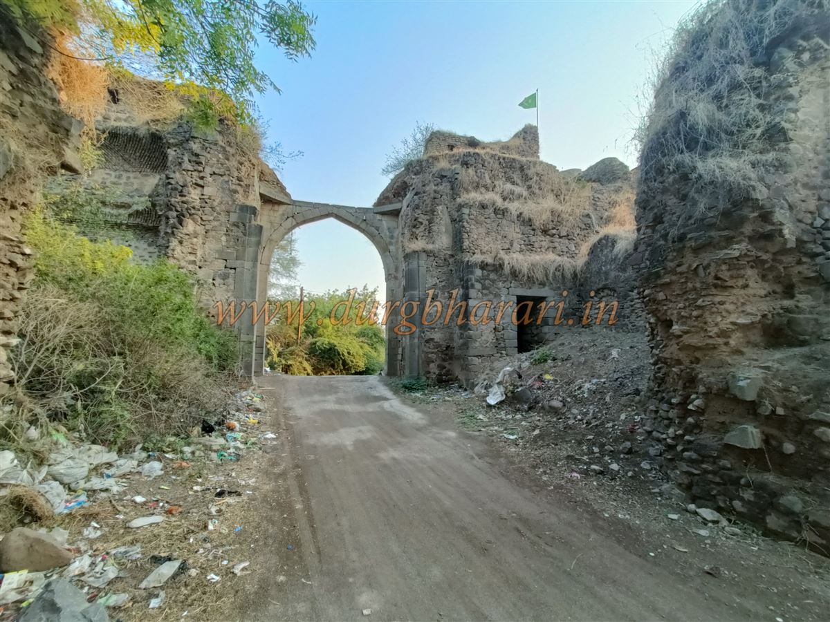
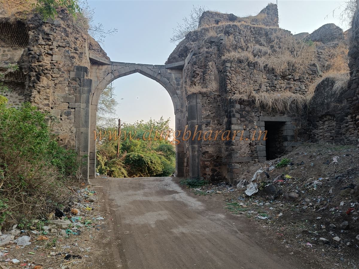
Entering through the main gate and walking about 400 paces straight ahead, a lane appears on the left. Following it leads to the second gate by the riverbank. Though called the Khidki gate, this double-arched gateway is quite large. To the left of the gate, steps lead up to the wall, allowing one to walk along the river-facing rampart. On these bastions, provisions for mounting cannons and quarters for guards can still be seen. Outside the gate, walking into the riverbed offers a view of the river-facing fort wall and its bastions—about 30 feet high and still solid. This section of the wall has four bastions: two large and two medium-sized.
Returning to the main road and walking straight leads to a square. Turning left from here takes you to the Nizam-era rest house. This part of the fort is on higher ground, offering views of the Purna River and distant countryside. Locals call this spot the Balekilla (citadel), suggesting it may have been the fort’s inner stronghold. During the Nizam’s rule, it was built to accommodate visiting government officials. Now unused, it has fallen into disrepair. Within its courtyard is a massive Bangdi cannon placed on a platform, along with three Persian inscriptions. There is also a Nizam-era well, built to supply water to the fort settlement.
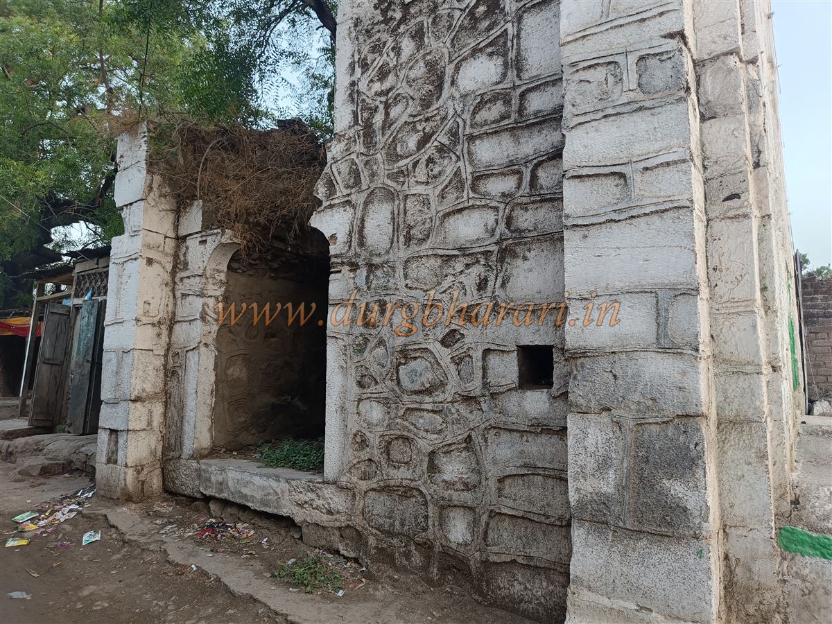
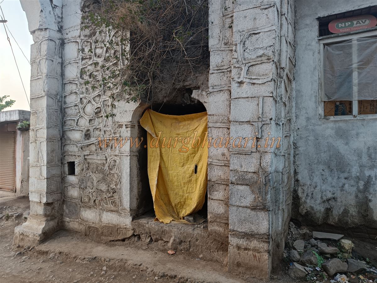
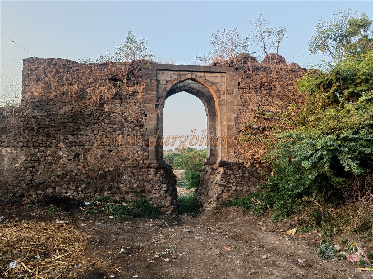
From the square, turning right leads out of the settlement, and turning left again brings you to the third gate in the fort wall. This medium-sized gate, built of dressed stone, has a partially damaged arch. The wall here has well-built battlements, and outside the gate a bastion is visible a short distance away. From here, one should proceed to the western side to see the fort’s fourth and final main gate—the most beautiful of all. Many of the fort’s ruins are located here. Two hexagonal bastions flank the gate, and inside were once large halls, now mostly collapsed. Steps beside the gate lead up to the wall, where barracks for soldiers are visible. From this gate, much of the fort and its distant walls can be seen.
Beyond the main north-facing gate lies the Maqbara Masjid. Within its courtyard are tombs of members of the royal family. This is an old mosque, and behind it is another well with steps leading down on one side. Along the steps are two small chambers, with an arched structure above. On the other side of the well are two storeys of chambers decorated with carvings, likely used as a cool resting place during summer. Unfortunately, the well is now full of filth.
It takes about two hours to explore the entire fort and other structures. The Jafrabad Fort was likely built during the reign of Shah Jahan, as one of the Persian inscriptions in the well records that in Hijri year 1040 (1630 CE), by Shah Jahan’s order, Mustafakhan built the well while constructing the fortifications. Another inscription in the mosque states that in Hijri year 1076 (1664 CE), by Aurangzeb’s order, Rijaazat Khan built the mosque. The city of Jafrabad was named after Aurangzeb’s general Jafar Khan, who was granted this town along with 115 other villages as a jagir. Although he built up the town and named it after himself, inscriptions show that the fort already existed before his time.
© Suresh Nimbalkar
GALLERY