INDRAI
TYPE : HILL FORT
DISTRICT : NASHIK
HEIGHT : 4405 FEET
GRADE : MEDIUM
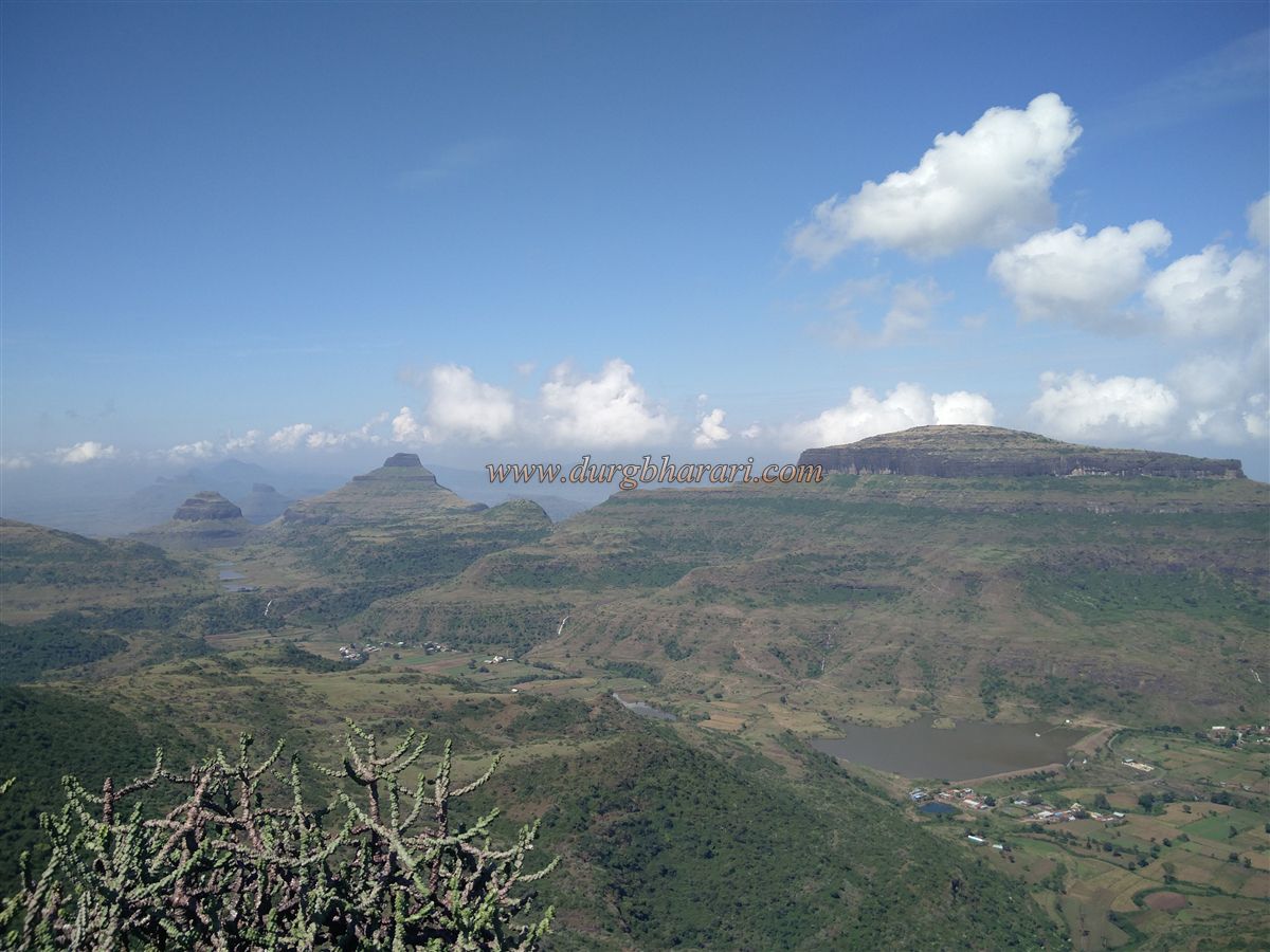
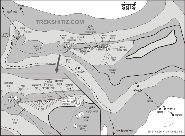
There are more than 65 forts on the Selbari-Dolbari, Trimbak-Anjaneri, and Ajanta-Satmala sub-ranges of Sahyadri in the Nashik district. This district is also known as Devbhumi as it has a large heritage of ancient temples and caves. Indrai is a fort located in this range by the name of Devadhidev Indradev. Indrai is an important fort located on the Ajanta-Satmal mountain range in Chandwad taluka. Chandwad has been an important route from ancient times to travel from north to south. Therefore, Chandwad fort was built on one side and Indrai fort on the other side to keep an eye on this wharf route. Indrai fort plays a major role in the protection of this wharf route. Vadbare and Rajdherwadi are the villages at the foot of Indrai fort. Since most of the fort lovers visit Rajdher and Indrai fort together, they stay in Rajdherwadi village and climb the fort from there.
...
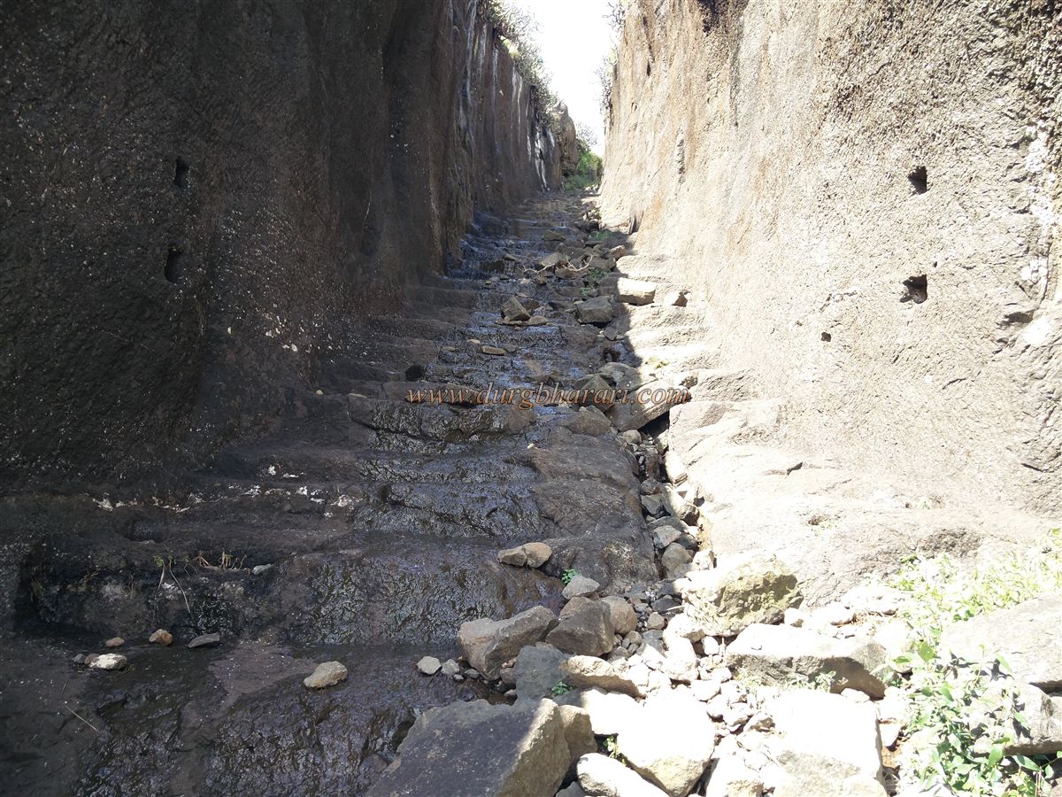
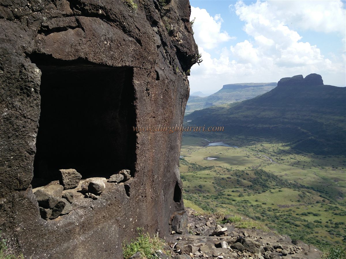
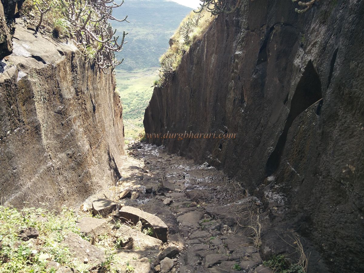
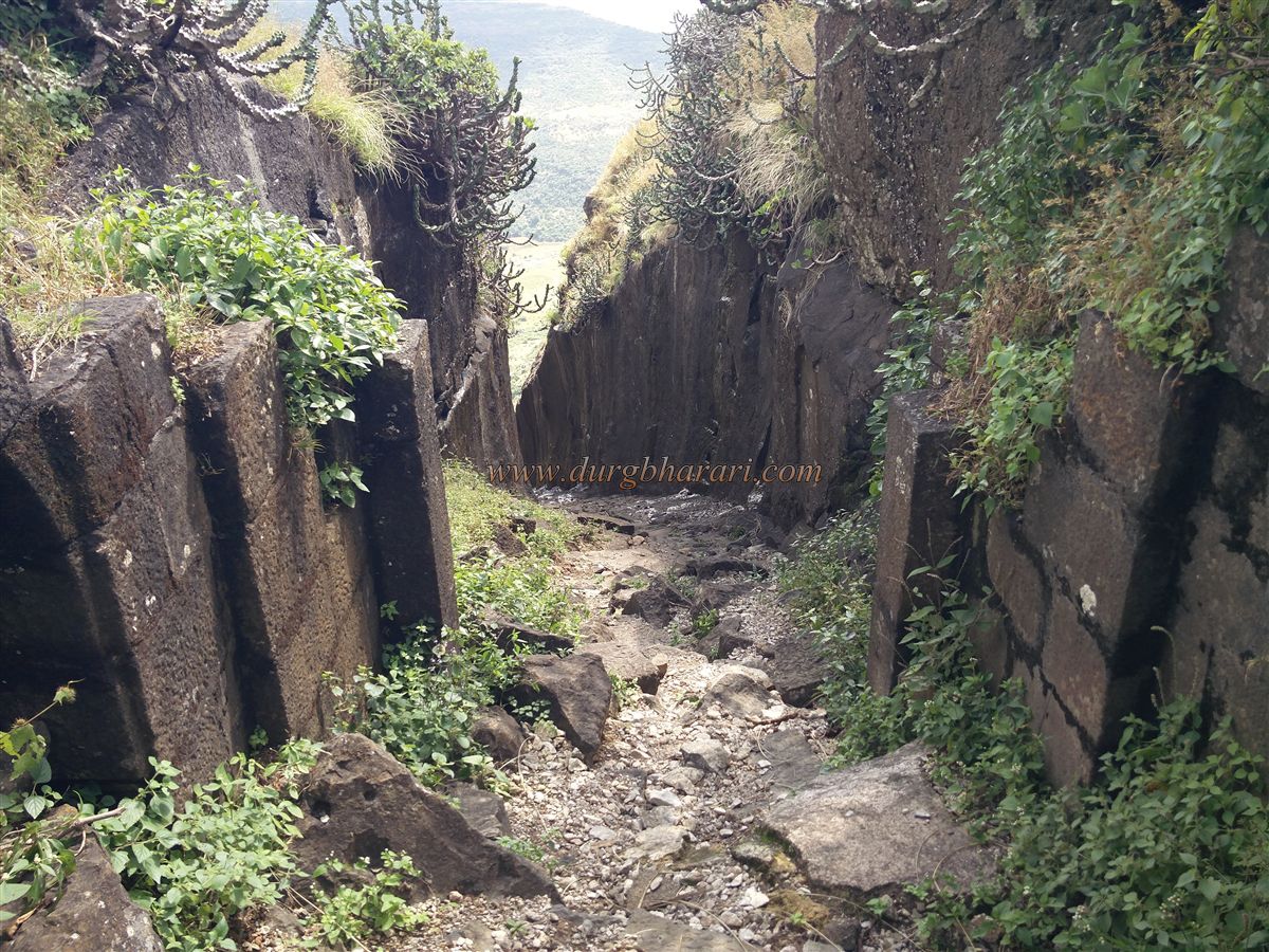
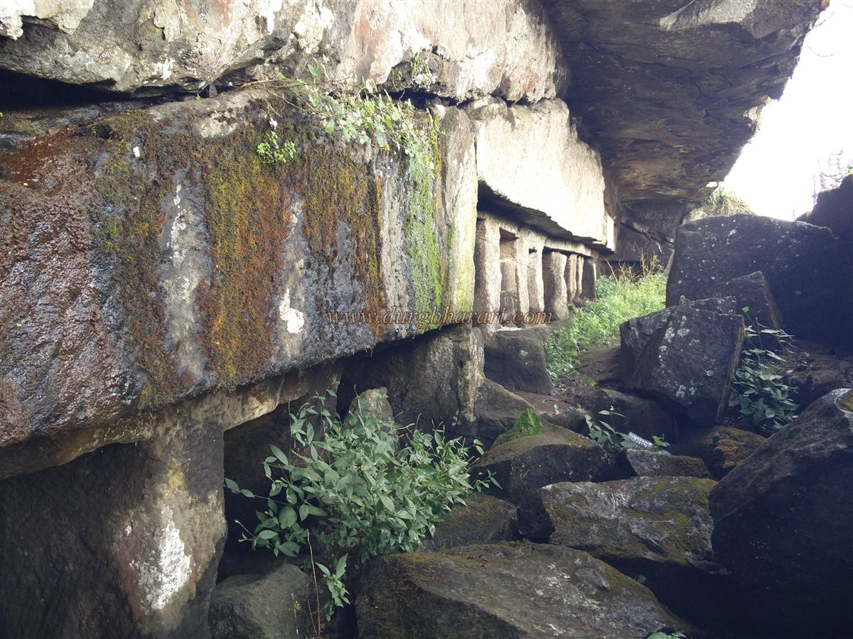
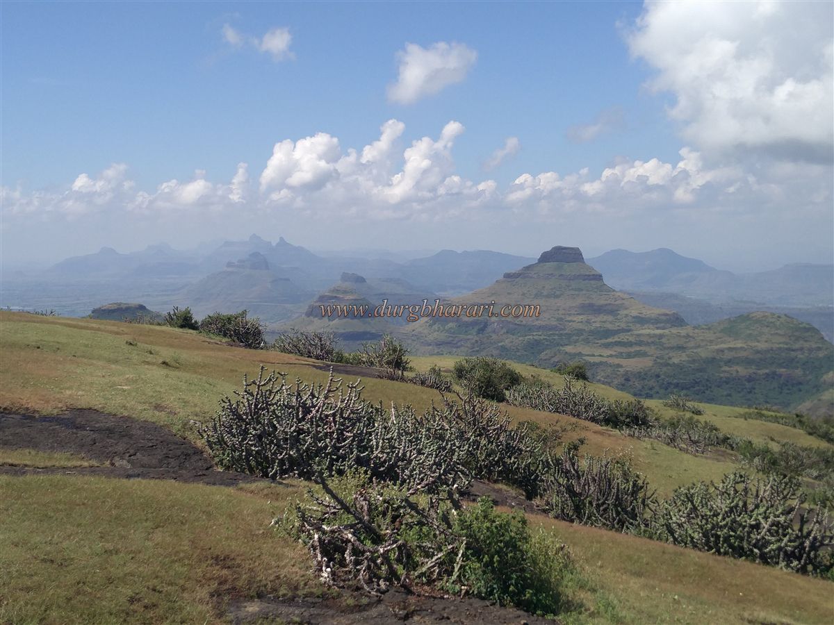
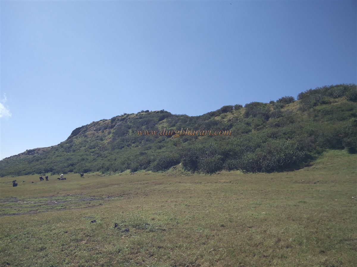
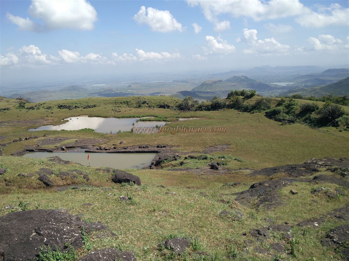
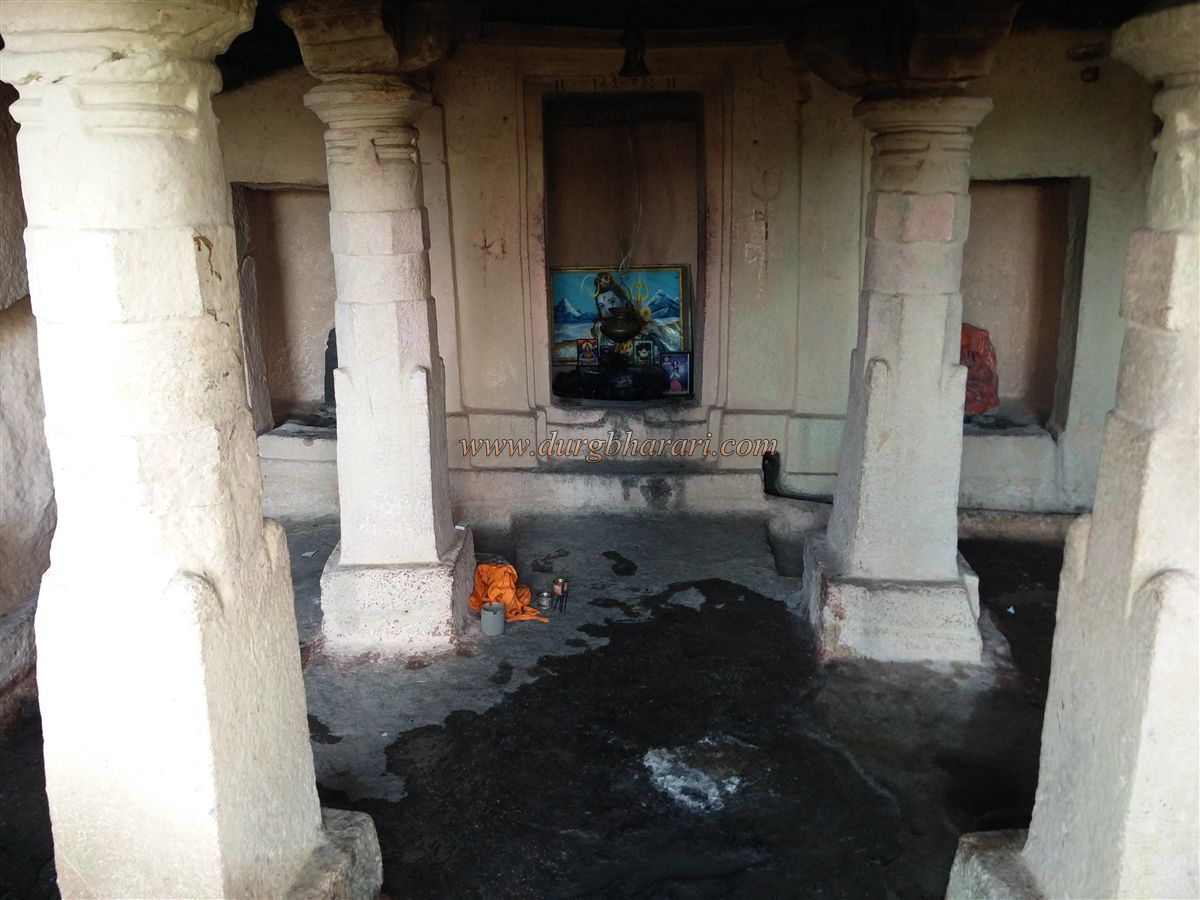
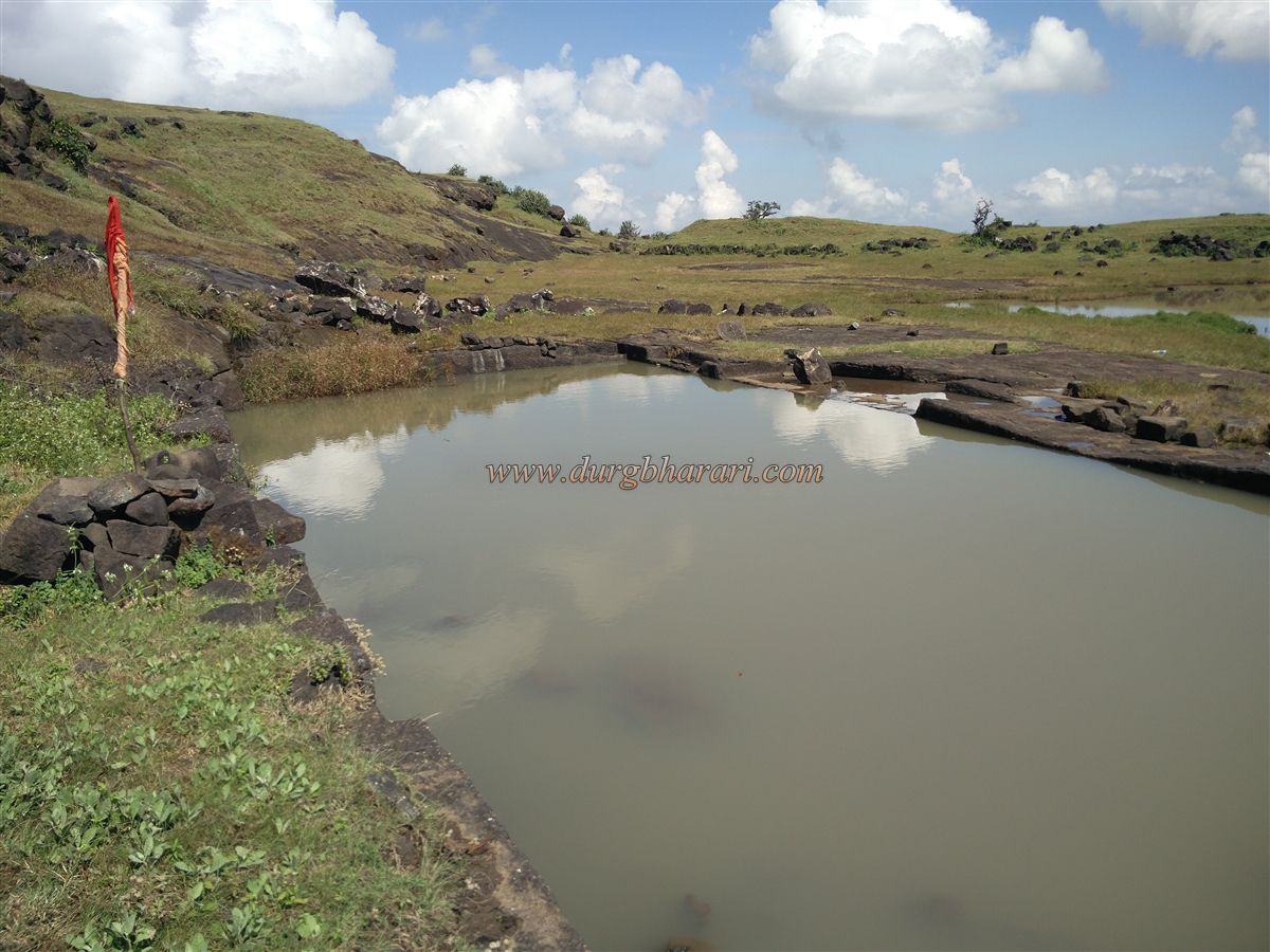
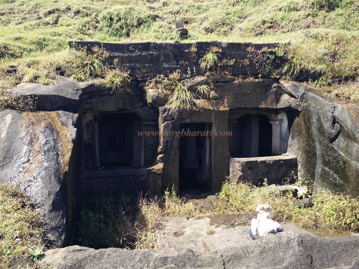
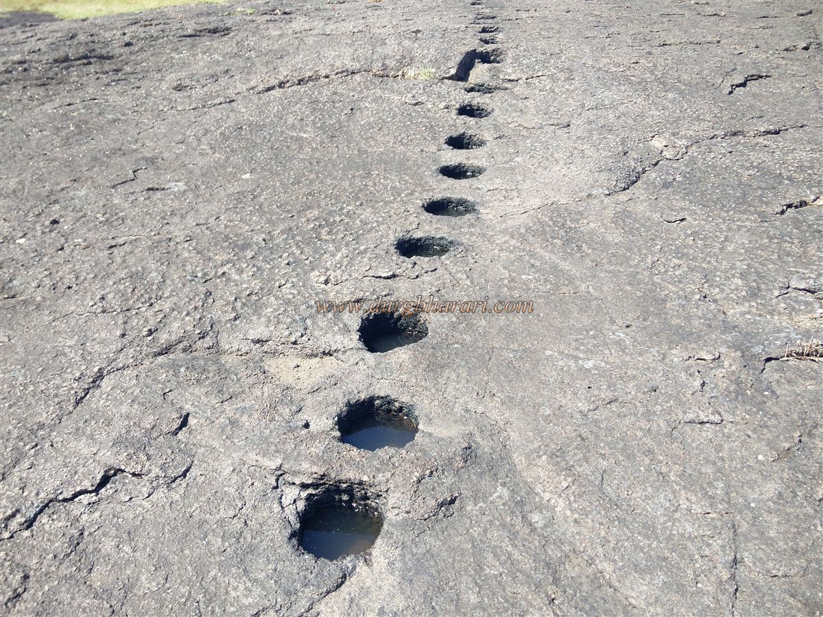
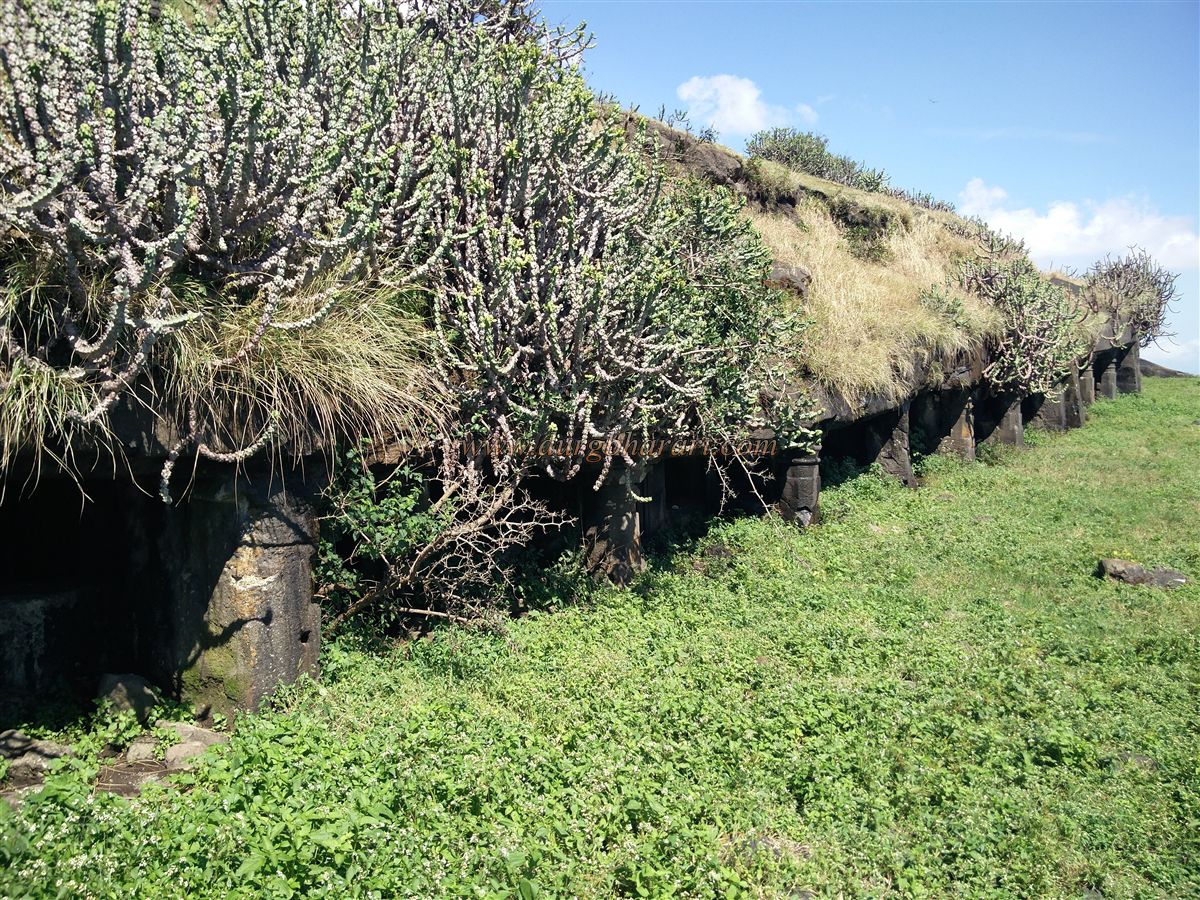
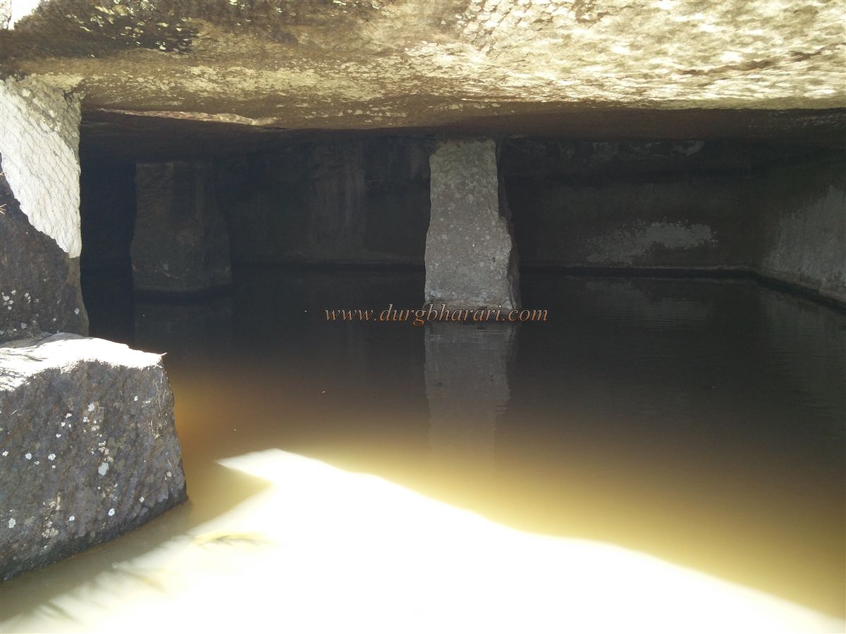
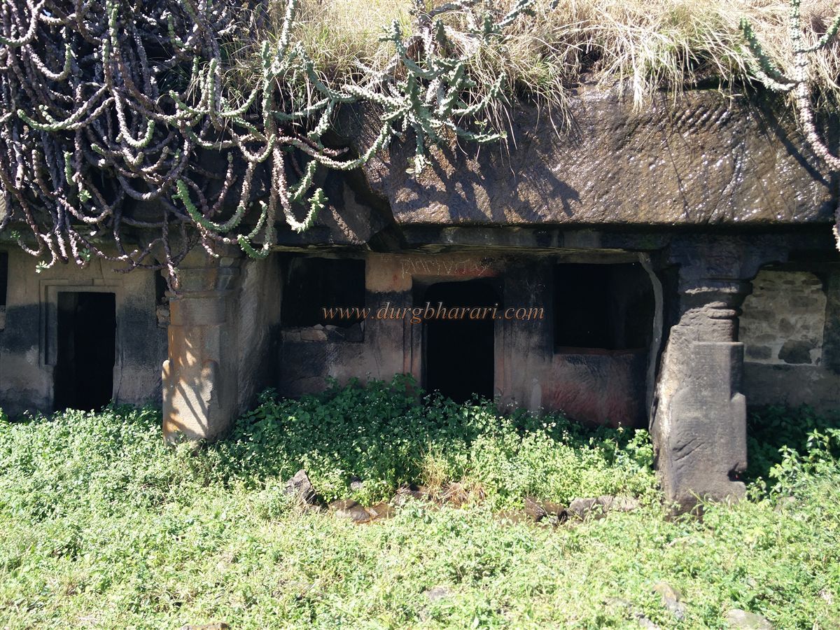
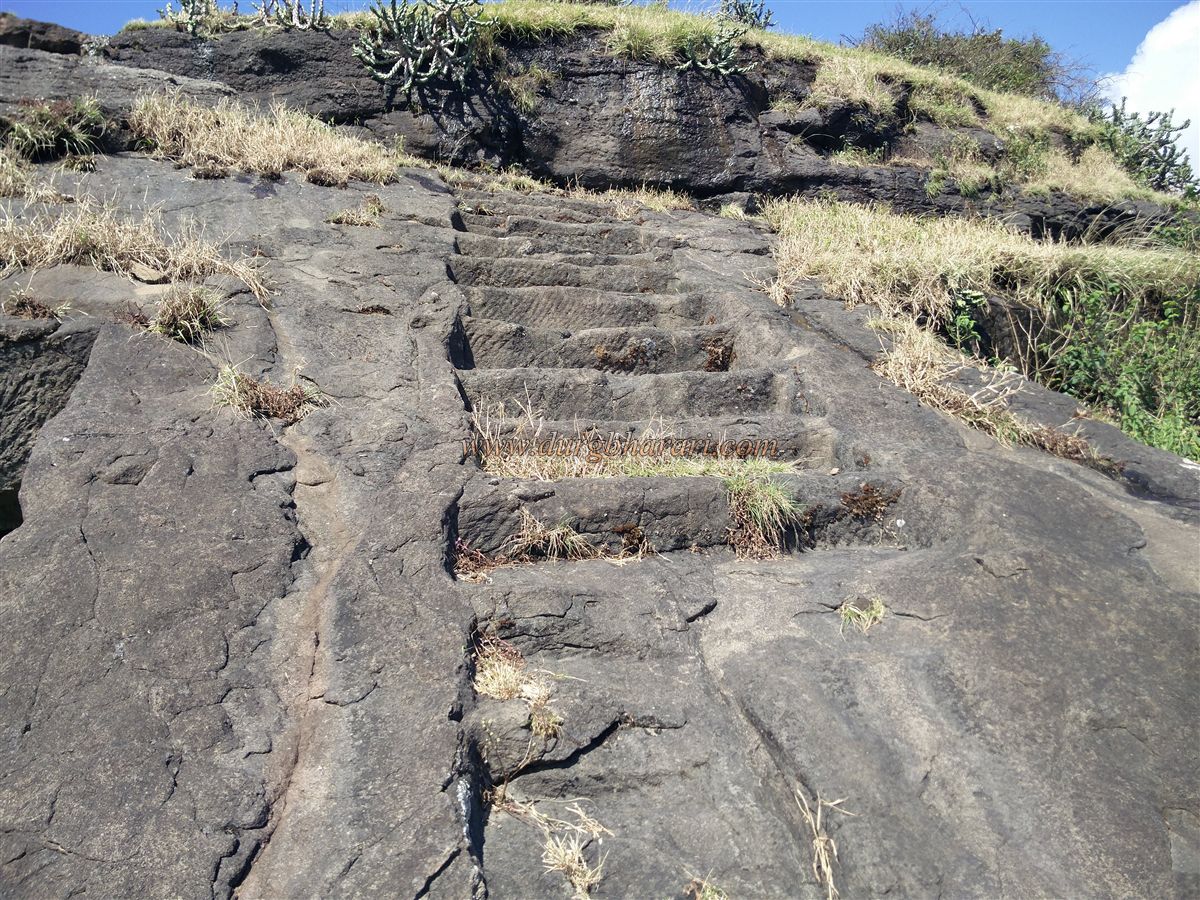
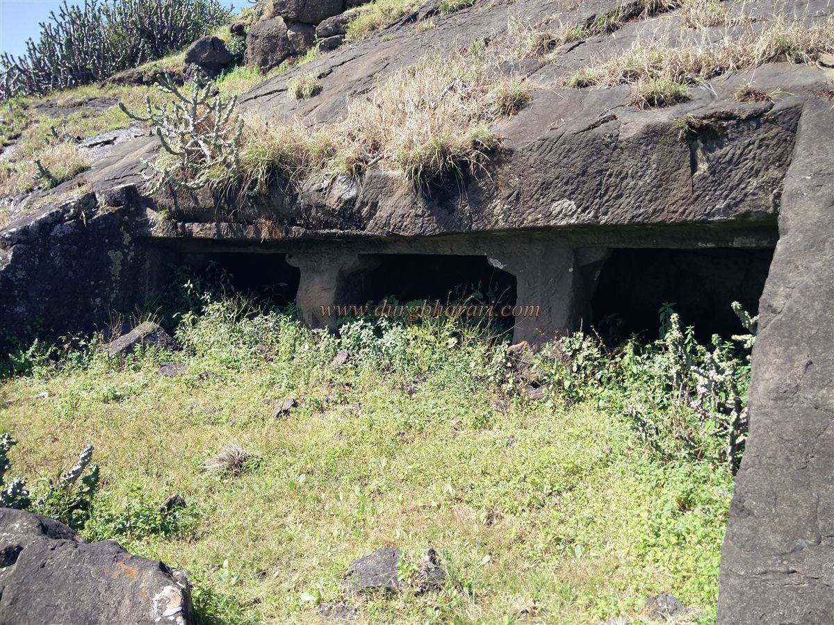
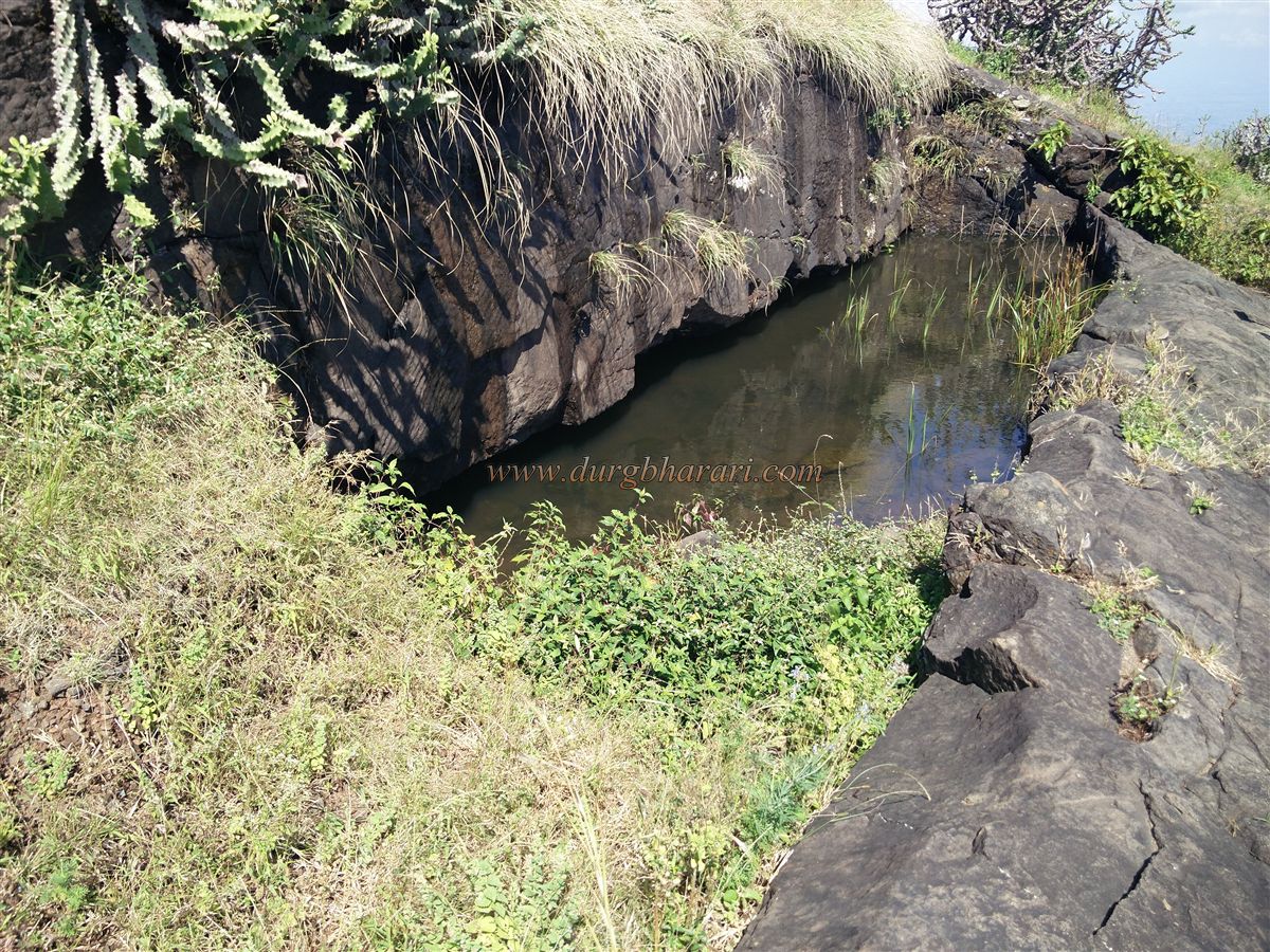
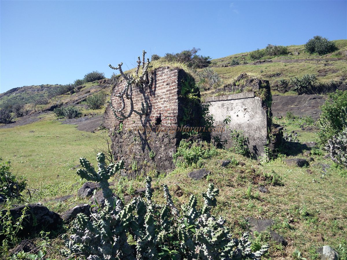
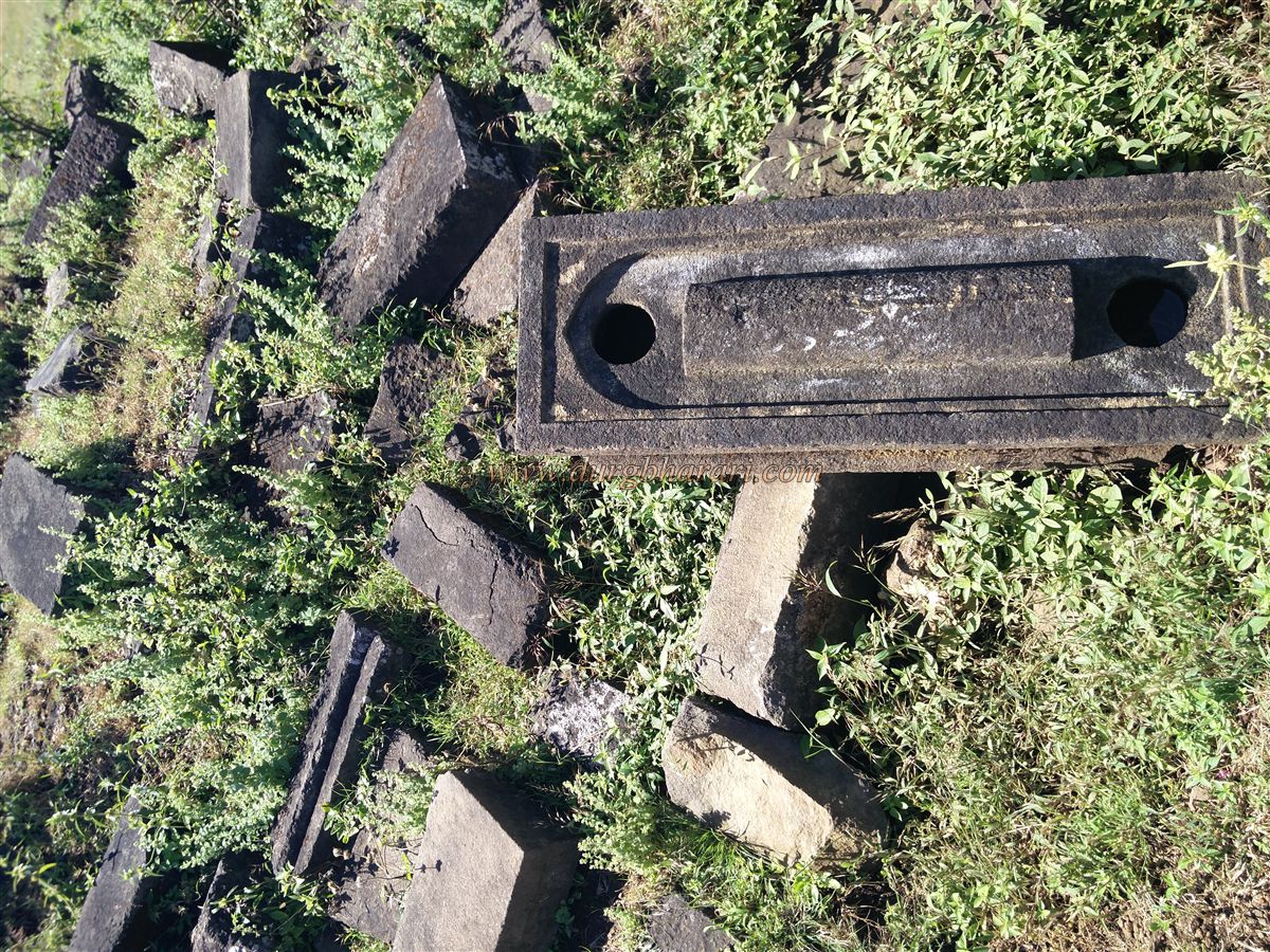
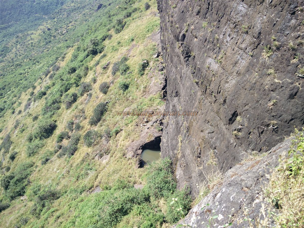
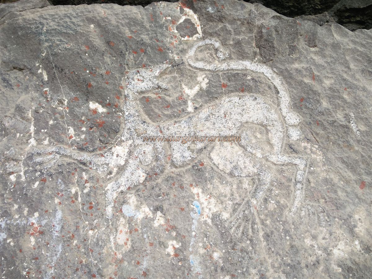
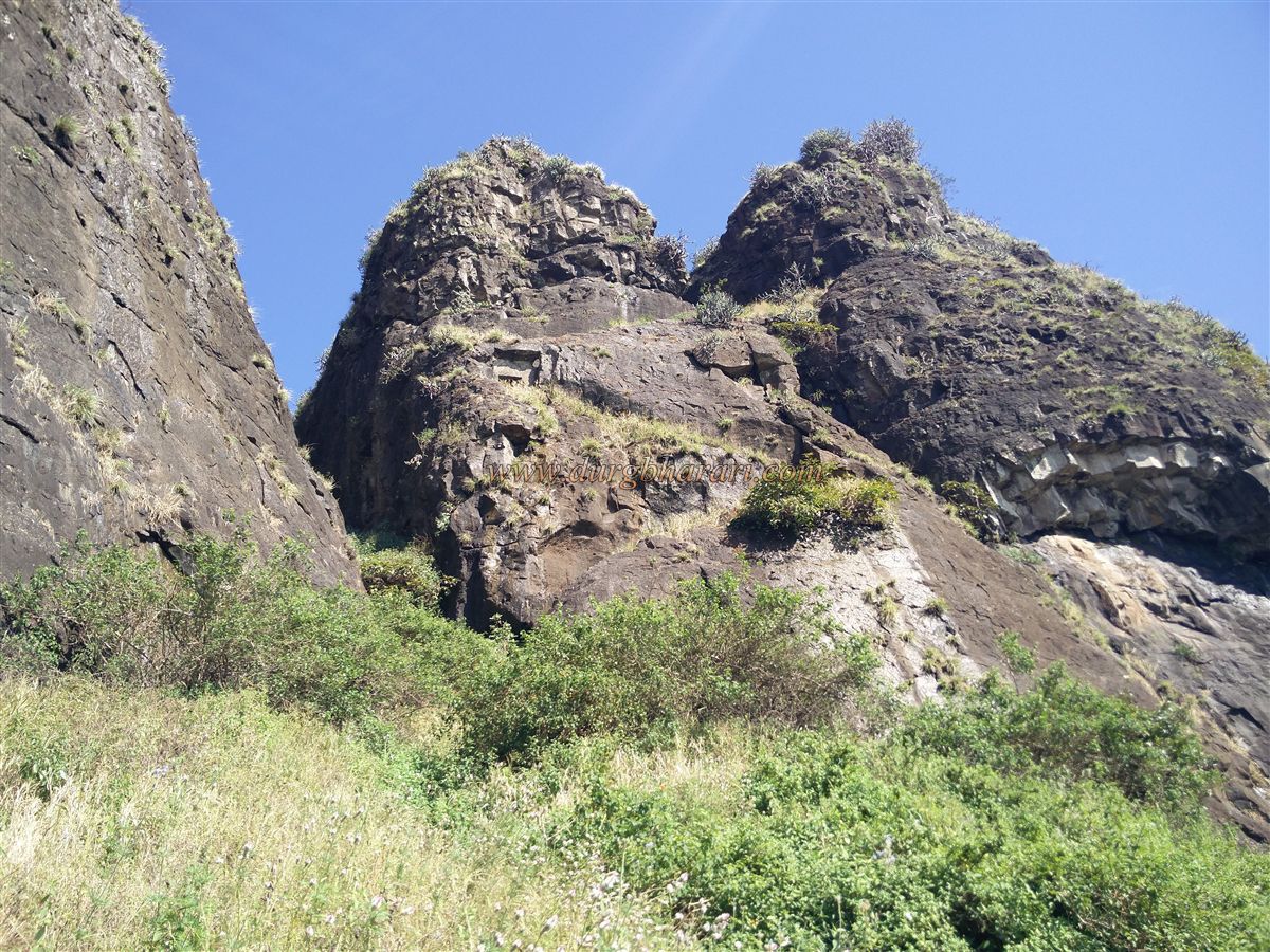
Even so, the nearest and easiest way to reach the steps of the fort is from the Ahilya Devi settlement, which is located between Vadbare village and Rajdherwadi village. It takes about an hour to reach the fort and half an hour to descend, but you need to have a private vehicle to reach Ahilya Devi, otherwise, you have to walk from Vadbare village or Rajdherwadi to Ahilyadevi settlement. Wadbare and Rajdherwadi villages at the foot of Indrai fort are at a distance of 6 and 10 km from Chandwad taluka respectively and at a distance of 70 km from Nashik city. Rajdherwadi is situated between Rajdher and Indrai forts. On entering Rajdherwadi, one can see Rajdher fort on the right and Indrai fort on the left. An unpaved road leads from the village to the hill of Indrai fort. From here it takes about half an hour to climb the path to reach a plateau. From there it takes about 1 hour to reach the left end under the steep wall of Indrai fort. At this end, the path coming from Wadbare village and Ahilya settlement meet here. There is a tamarind tree here and an ancient stone temple with a round dome. This temple is known to the locals as the temple of Sati. There is a new broken idol in the temple and a tombstone can be seen in front of the temple. Adjacent to the temple is a well of stone construction filled with bushes and trees and in front of the temple is a small pond at some distance. Some carved stones can be seen around this pond. The trunk of the hill is divided into two directions in the lower part, the trunk on the left turns slightly to the left and descends to the Ahilya settlement, while the trunk to the right goes directly towards the village of Vadbare. Since cattle from Ahilya Devi settlement are coming to graze on this plateau, this path is visible. All you have to do is walk in the direction of the fort. It takes two and a half to three hours to reach the temple from Rajdherwadi and one and a half to two hours from the Ahilya settlement. Looking up at the fort from the temple, one can see a saffron flag fluttering on the hill. After climbing the hill for half an hour from the temple, you can see some remnants of construction on the surface. There is an idol of Hanuman at the opening of this place and this place should be a checkpost under the fort. If you look closely, you can see the built steps, ramparts, and the circular foundation of the bastion. Looking at the fort from here, one can see the steps carved in front of the fort. The gate at the beginning of the steps and the surrounding constructions may have been demolished by a mine during the British period. But since the cattle from the surrounding villages are going to the fort for grazing, their owners have built a stone path up to the steps. Beneath these steps are two caves carved into the rock and a water cistern. The water in this cistern is potable and this water must have been used by the soldiers on the fort. From the book I read, it mentions that this was the only door (way) to go to the fort but in reality, there were still two more doors to go to the fort. One of the gates has been blocked by stones for some reason, while the other passage (door) is on the verge of collapsing due to no one using it. The path that I have just described is the path that we used to climb the fort. After walking for 10 minutes along the footpath at the bottom of the steps in front, you will see 15-16 caves carved in a row. Some of these caves are dilapidated and there are two spacious caves in which the villagers house their cattle. There is a water cistern next to this cave and there is a sculpture of Vyala in one of the caves. In one of the large caves, there are carved stables for horses, and the front part of these stables is enclosed by stone. On the way to this cave, when you look at the fort above, you can see the gorge, which is surrounded by a stone construction. This was the old closed road to the fort. Next to this is a Z-shaped footpath carved into the rock. When you come up in the closed direction of the gorge, you can see a half-closed north-facing door lying on the right side. When you enter through this door, you can see the guard's porches carved in the rock on the upper right side of the door. There is a large pile of stones on the steps. There is another north-facing door carved in the rock above. There is also a small bench carved out of the rock for the guards. There is also a small round window carved in the rock. From here we climb 10-12 steps to reach the third east-facing door carved in the rock. From here, the next road through the gorge is completely carved. The road was once paved but now due to lack of monitoring, stones have accumulated on this road. At the end of the road, you will see that the entrance to the fort is destroyed. At the mouth of a small cave here, you can see a small temple and from here you can enter the fort. On the other side of this road, there is a road leading to the mouth of the closed gorge at some distance but this road is heavily overgrown with bushes. Crossing the chain of four gates, we reach the vast plateau at the second stage of the fort. The first stage is the plateau which starts at the bottom when you reach the fort by the steps you saw at the beginning. As you descend that path, turn left and start walking towards the citadel. There are a large number of remains on the fort. On this plateau, a large number of quadrangle structures of houses and many other carved remains can be seen. At the end of the plateau are the remains of a large mansion, and the bathroom in this mansion survives to date. On the right side of the mansion, you can see 5-6 water cisterns. Next to these cisterns, there are three caves weighed on the pillars. From these caves, one can see a hill of “sade teen rodga” standing in front. The old village of Indrai was situated at the foot of this hill but later the villagers migrated from here to the surrounding villages. From here you can see the ancient temples and some other structures in this village. Seeing this cave, we climb a few steps carved in the rock and come to the top of the hill. There are 20-22 cave caves carved in a row over here. The cave, which has a door in the middle and two adjoining caves with windows are connected by a door from the inside. The outside part of the cave is carved on a pillar inside the cave. It is possible to stay in some of these caves except in the rainy season. The last of these caves has a drinking water cistern. Next to this group of caves is another huge cave weighed on a pillar and in this cave a large amount of soil has accumulated. At the top of the cave are two dry cisterns of water carved into the rock. There is a huge carved lake in front and enclosed by stone construction along the edge of the valley. On the way to the lake, you can see 30-32 potholes carved in a straight line in the rock. There is a small carved cave on the bank of the lake and Shiv temple is carved in another big cave at some distance. The cave temple is composed of Dwarmandap, courtyard, and the sanctum sanctorum. The pillars in the courtyard are carved. There is a Shivling in the temple and a stone Nandi is placed on the doorway. There is an idol of Ganapati in one corner of the temple and Bhairav in the other. This temple can easily accommodate 5-6 people. After climbing the hill at the top from the left side of the temple, we reach the highest point of Machi. There are another lake and steps carved in the rock to descend into this lake. Here you can see the quadrangle structure of a temple in front and the remains on it. The path from the lake to the top of the hill takes you to the citadel on the fort. The citadel is heavily forested with cactus and due to this no remnants can be seen on it. The top of the fort is 4408 feet above sea level and is spread over 60 acres east-west. From the top of the fort, an area from Deola to Satana can be seen as well as Chandwad, Kanchan-Manchan, Mangitungi, Nhavigad, Koldher, Rajdher, Dhodap, Salher, and Chaulher forts are visible. After descending the citadel, start again from the remains of the temple. Going straight along this path, you will see a tall and large quadrangle structure on the left. This structure should be the office of the fort. On reaching the lower side of this stage, two cisterns carved into the rock can be seen. There is another cistern on the plateau below, but this cistern is extinguished with soil. This plain surface is very huge. The locals say that there was a market on Indrai fort in medieval times and this place might be the location where the market was. From here, instead of going straight ahead, go downhill to the left and continue along the edge of the ridge. After walking for about 10 minutes, you will see steps carved into the rock that descends. There is a group of 5-6 caves carved in the rock at the top of these steps and the way to these caves is also carved in the rock. Since some of these caves are not in use, water has accumulated in them. This cave is built out of stone. After seeing the cave and coming straight down, you come to the plateau where you had started to see the fort. Going straight down from here, you can see the remains of houses and the medium-sized cisterns built in the adjacent rock. Going down from here on the left side, there are steps carved in the rock. Going down these steps we reach the gate of the fort. This east-facing door has completely collapsed today, leaving only the frame. Inside the door are guard porches made out of stone. On the left side of the door is a 9-line Persian inscription carved on the wall. Since it is in the open, it has been severely damaged. It is mentioned in the inscription that Alavardikhan Turkman, the chief of Shah Jahan Badshah, conquered this fort in 1636 AD and also Chandwad, Rajdher, Koldher, Kanchana, Manchana, Ravalya, Jawalya, Markadya, Ahivantgad, Achalagad, and Ramsej forts in two months. The path of about 150 steps leading down through the door is completely carved in the rock. Signs of construction can be seen in some places along this route. After descending 100 steps from here, this road turns left. At this turn, there is a small cave carved into the rock wall. On this path lies a beautiful stone carved with a round lotus flower. Where did it come from? After descending the steps and coming down to the Hanuman idol, your fort round is complete. After starting from the base, it takes 7 hours to walk around the entire fort and come back to the base. Chandwad has been an important trade route from ancient times to trade from the north to the south. Therefore, Chandwad and Indrai forts were built to keep an eye on this wharf route, and Rajdher, Koldher, and Mesna forts were built for their protection. The path carved into the rock of the fort, the caves and the pillars on the fort testify to its antiquity. This fort was probably built during the Satvahana period. Considering the remains of the fort, it must be an important fort in this area and it also must have had a large population. The fort, which was in the possession of Gambhirrao, the chief of Nizamshah, was captured on 17 March 1636 by Alavardikhan, the Sardar of Shahjahan Badshah, in exchange for money. Since there is no mention of this fort during Shivaji Maharaj’s period, it must have been in the possession of the Mughals. After the conquest of Chandwad fort on 15th April 1818, Captain McDowell also captured Indrai fort.
Note- The people of the local villages leave their useless animals on the fort. These animals live for a few days and die due to lack of food and water, but for many days due to lack of human companionship, these animals have become aggressive. Therefore, they should not be distracted while walking around the fort.
© Suresh Nimbalkar
GALLERY