HARISHCHANDRAGAD
TYPE : HILL FORT
DISTRICT : NAGAR
HEIGHT : 4626 FEET
GRADE : MEDIUM
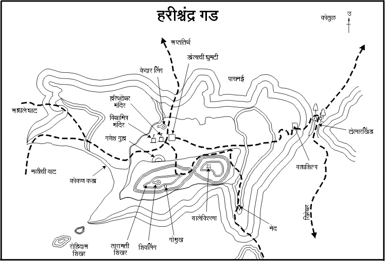
The tallest fort in Maharashtra, and the largest in terms of area, is Harishchandragad. Its vast expanse is such that the boundaries of Thane, Pune, and Ahmednagar districts all meet at this fort. Spread across roughly 1,750 acres, there are a total of 12 routes to reach the fort, with six gates along these paths. Though these gates are now in ruins, their remnants can still be seen. The 12 routes are as follows: 1. Pachnai, 2. Vetal Dhar, 3. Ganesh Dhar, 4. Rajmarg, 5. Khireshwar, 6. Kotul, 7. Lavhale, 8. Rajdhar route, 9. Junnar Darwaja, 10. Makadnal, 11. Nali route (Bhavani Nal), and 12. Bailghat. Some of these routes converge at Tolarkhind. For those who want to explore the fort without much difficulty, the Khireshwar and Pachnai routes are the most convenient and widely used today. Both these villages are accessible by state transport buses. If one ascends via one route and descends by another, it is possible to explore the entire fort in two days, but this requires an overnight stay on the fort.
...
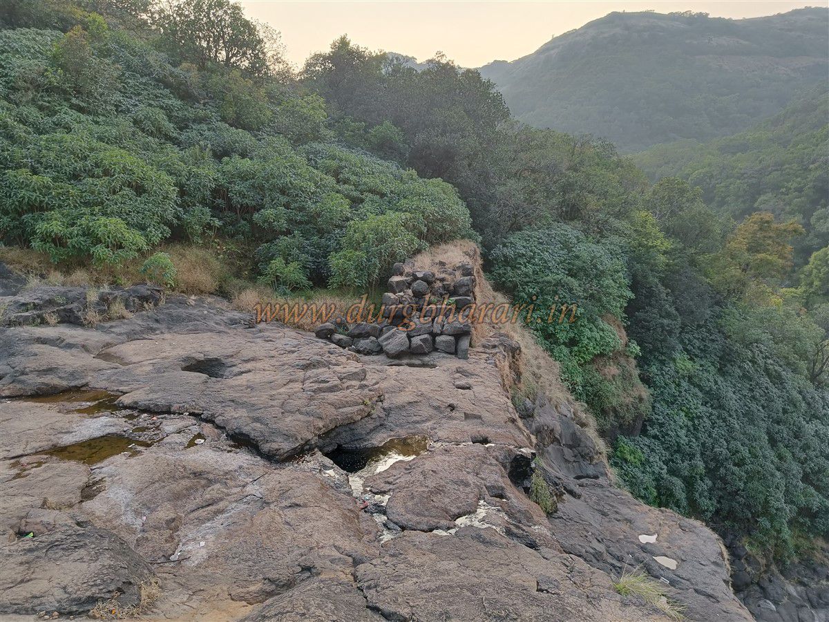
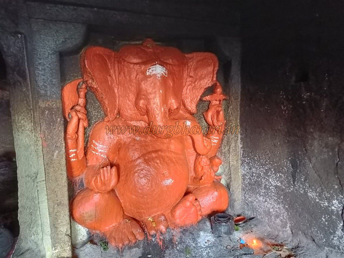
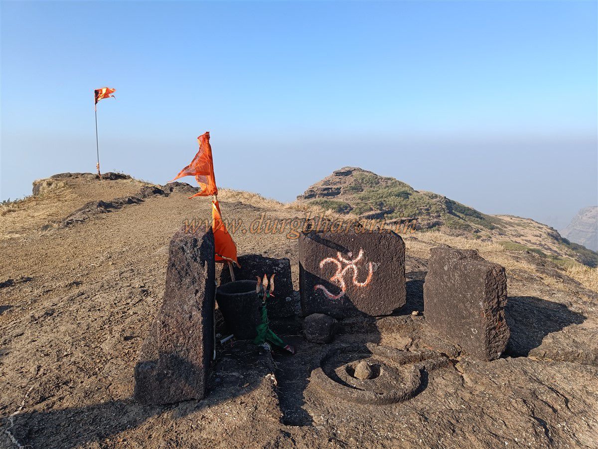
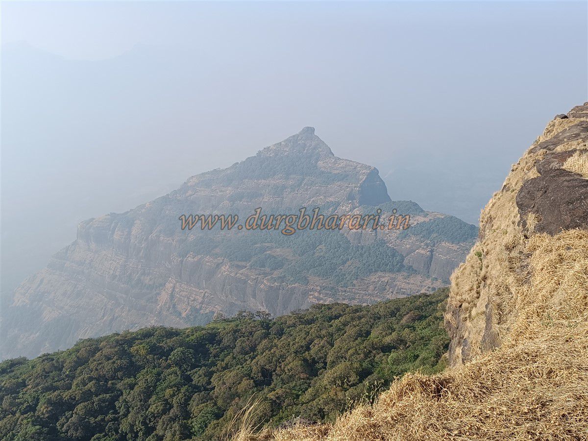
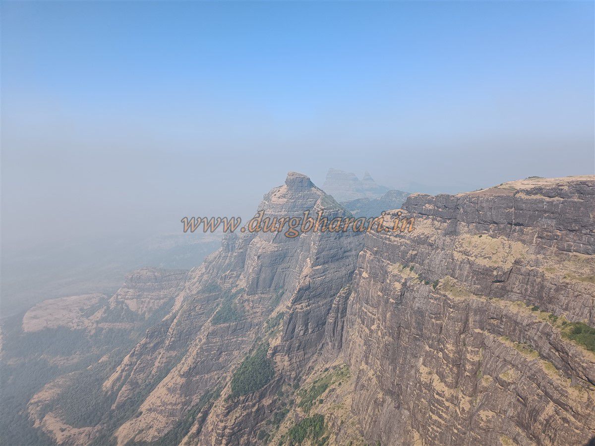
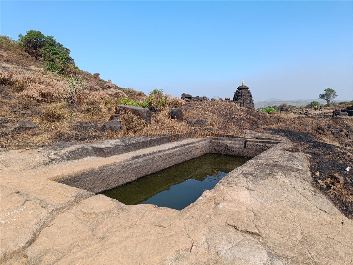
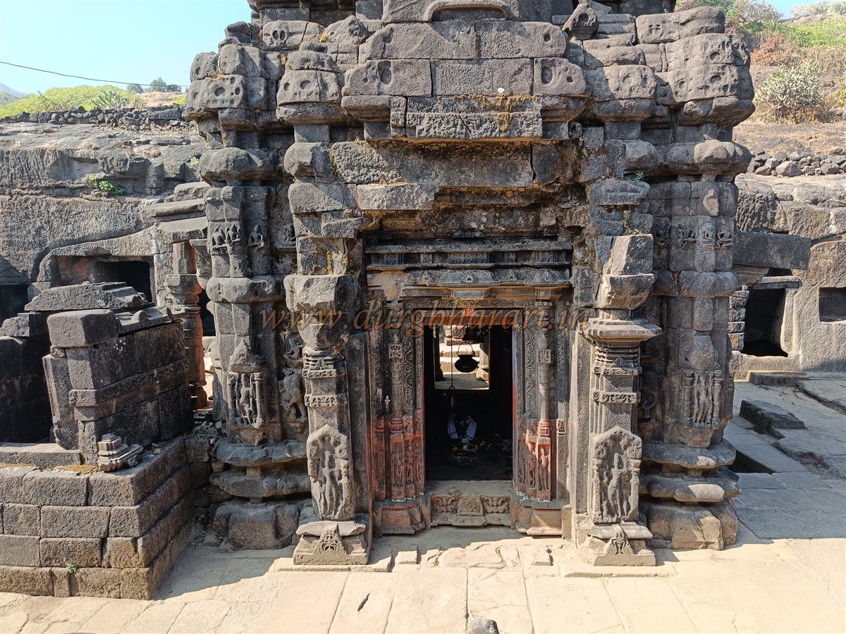
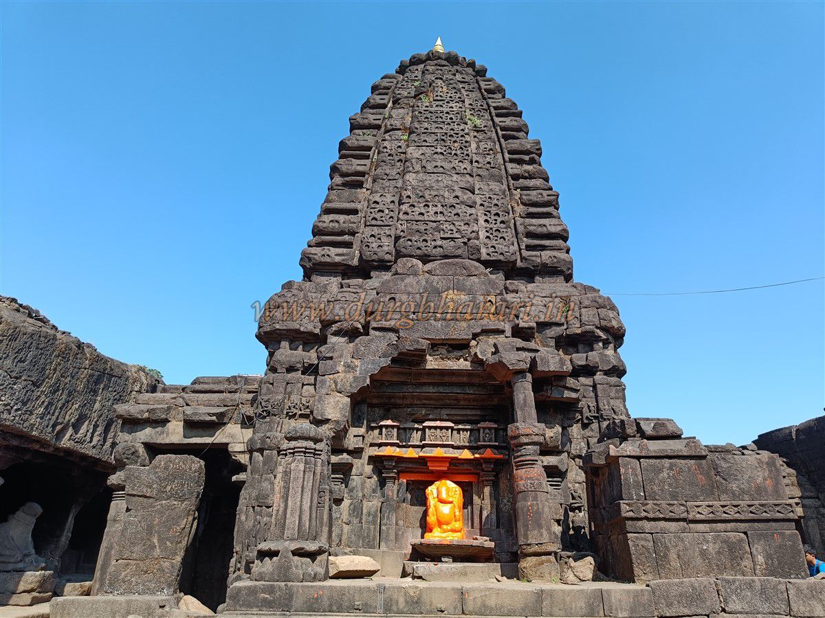
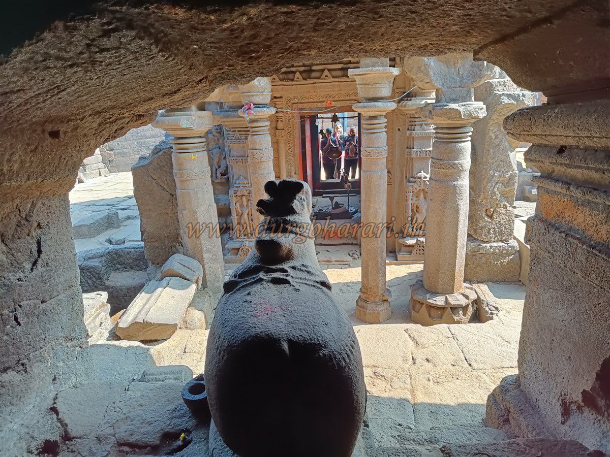
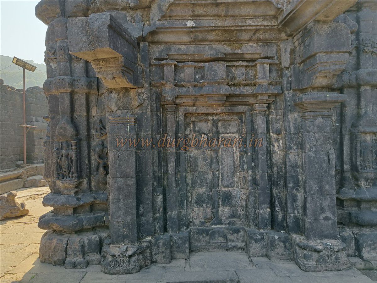
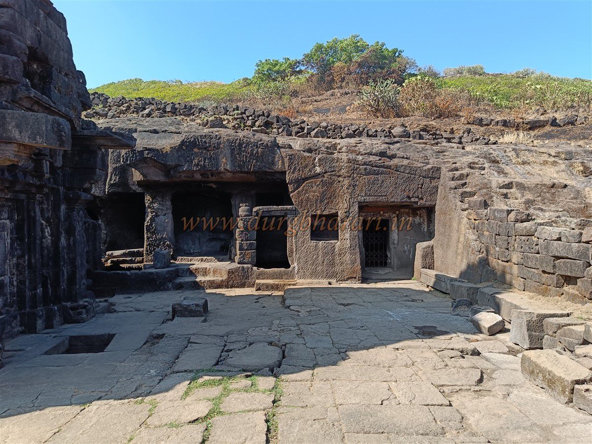
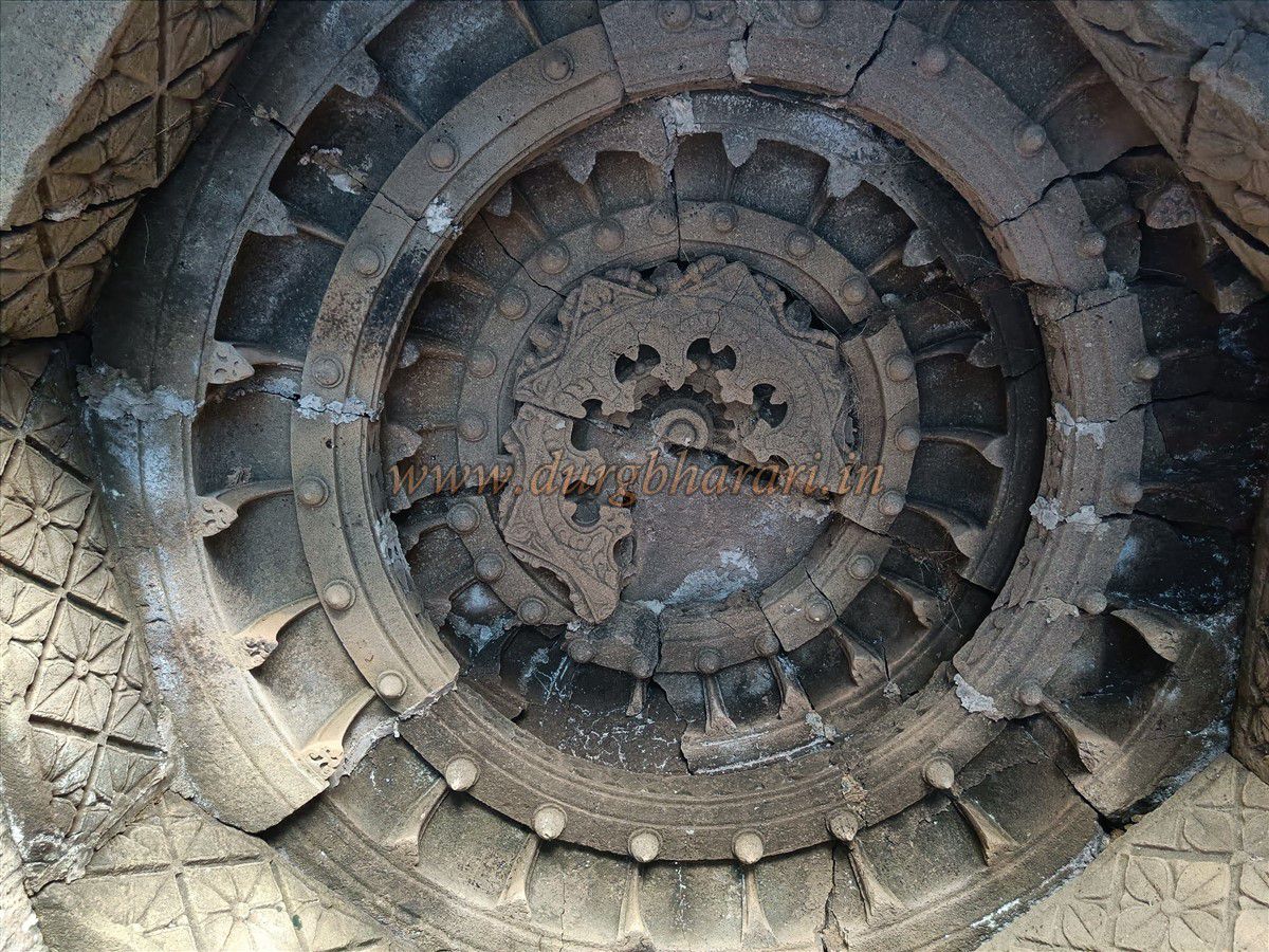
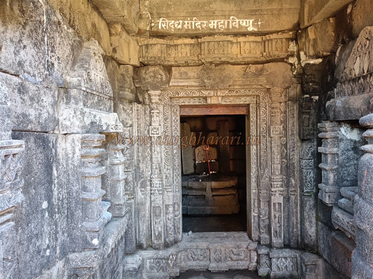
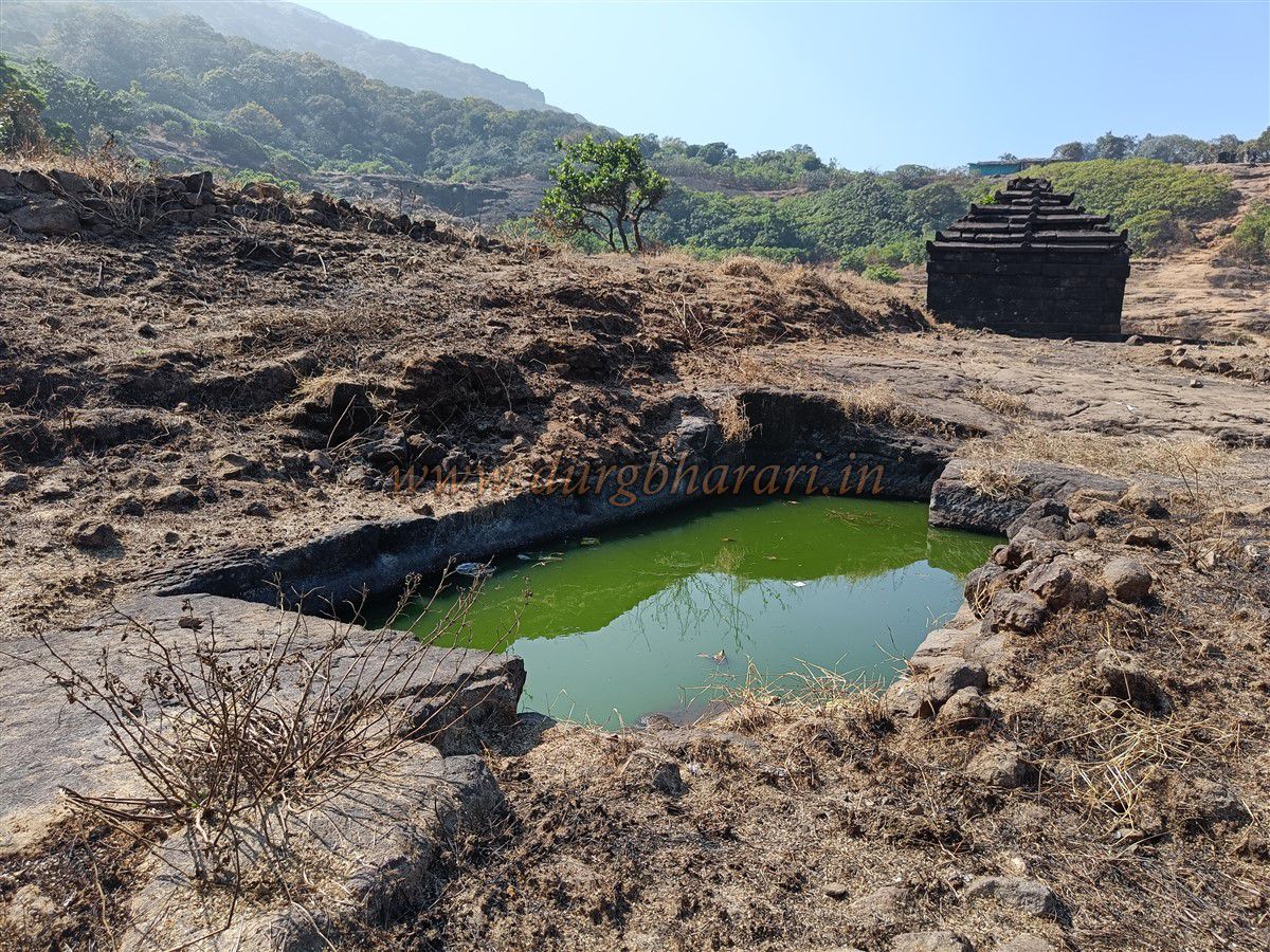
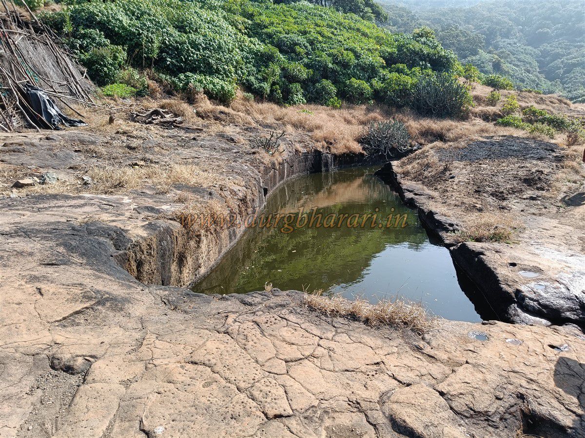
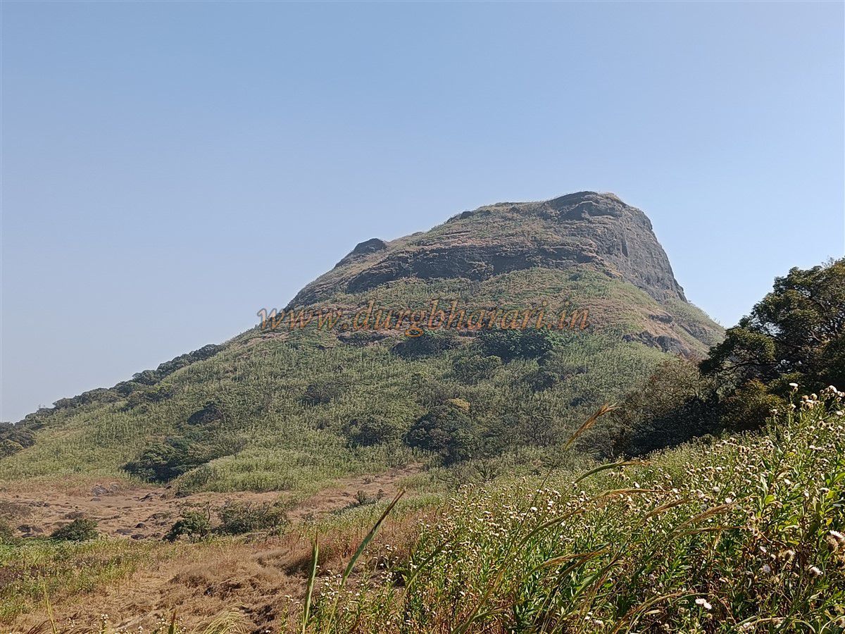
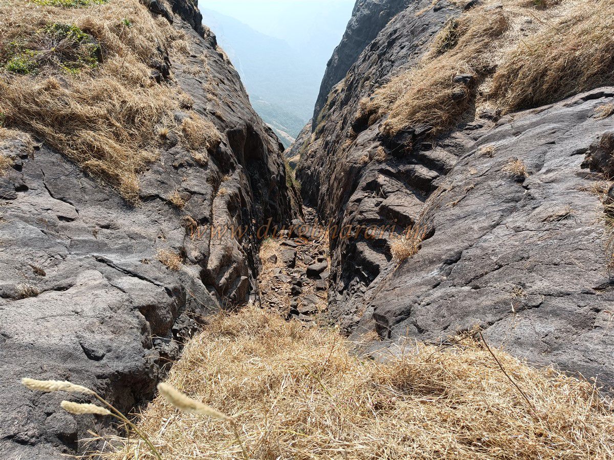
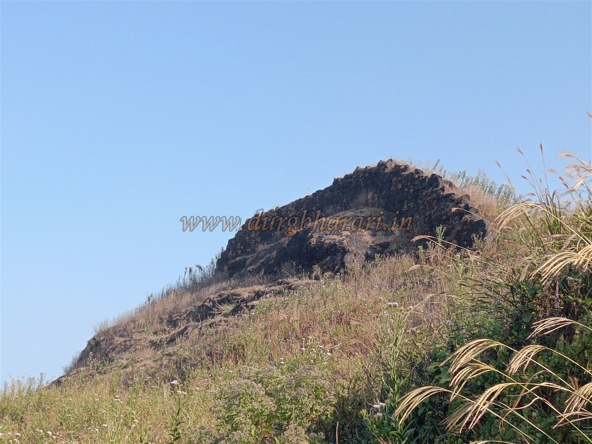
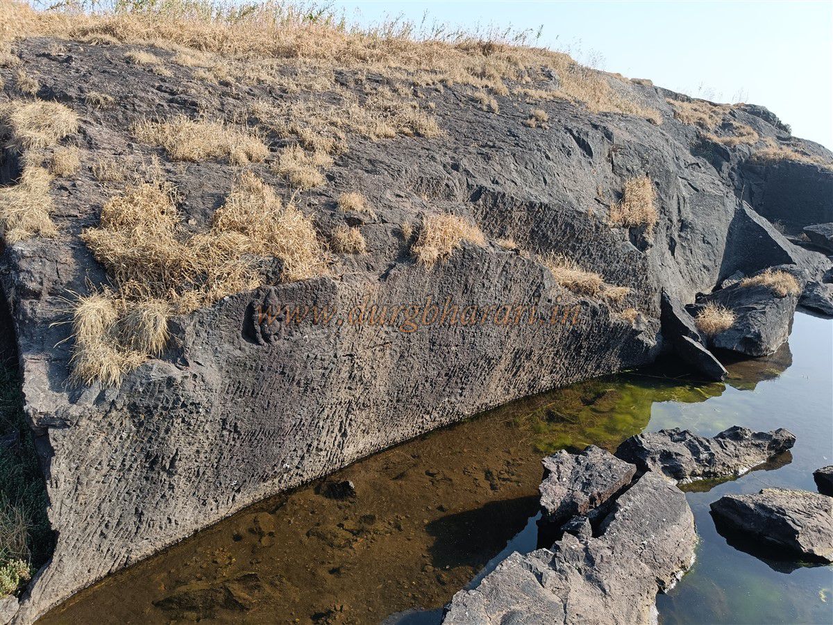
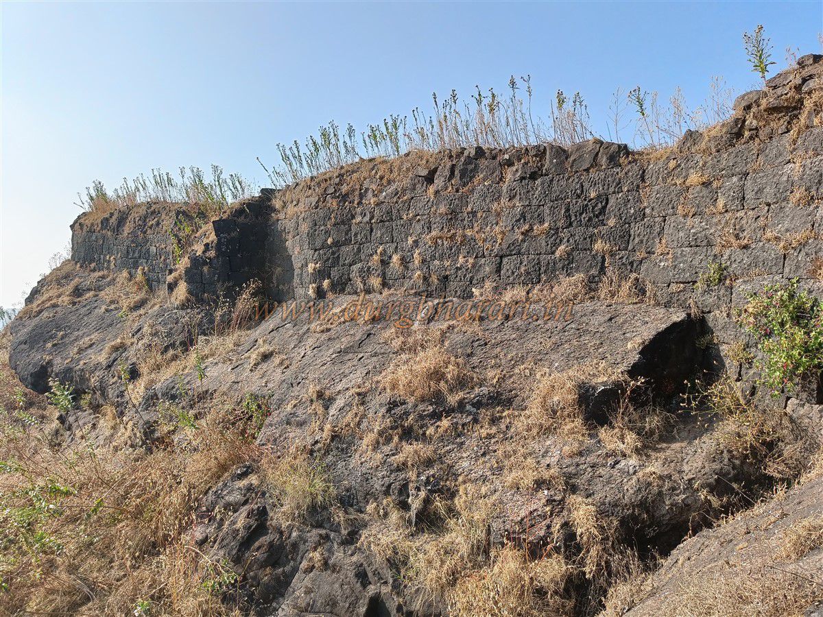
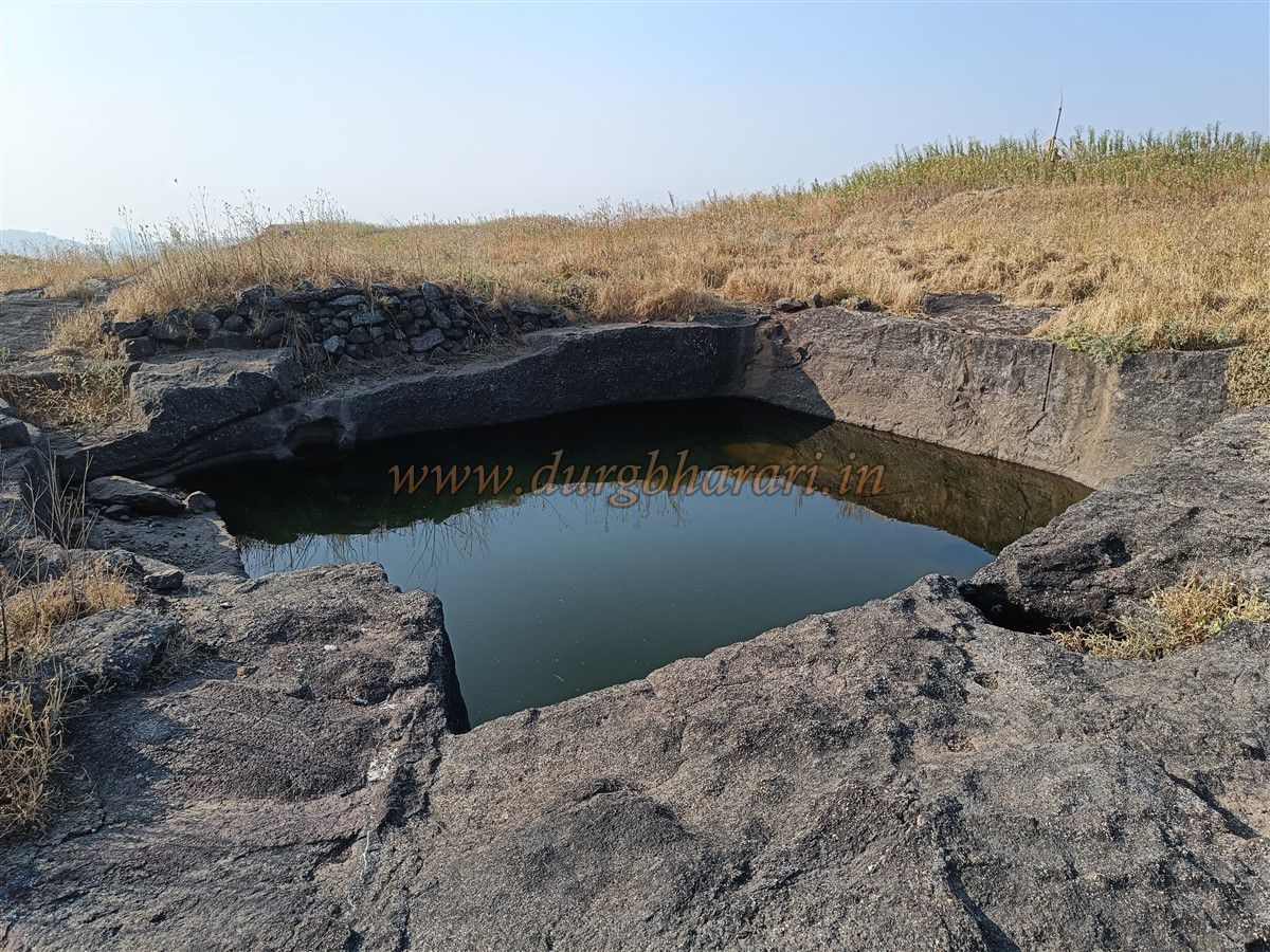
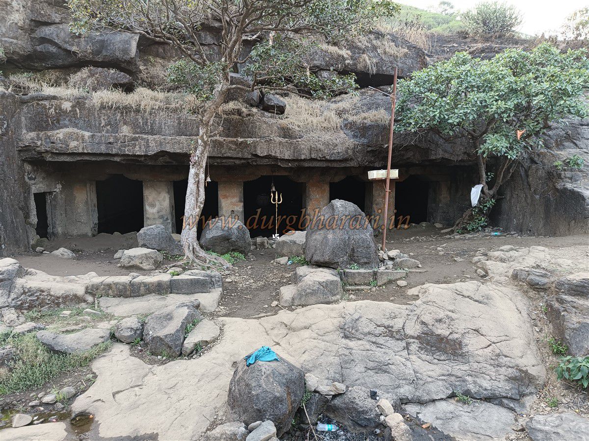
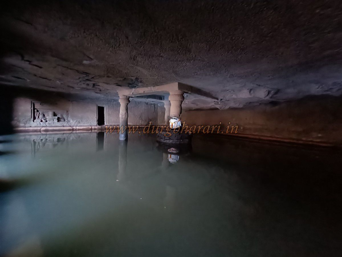
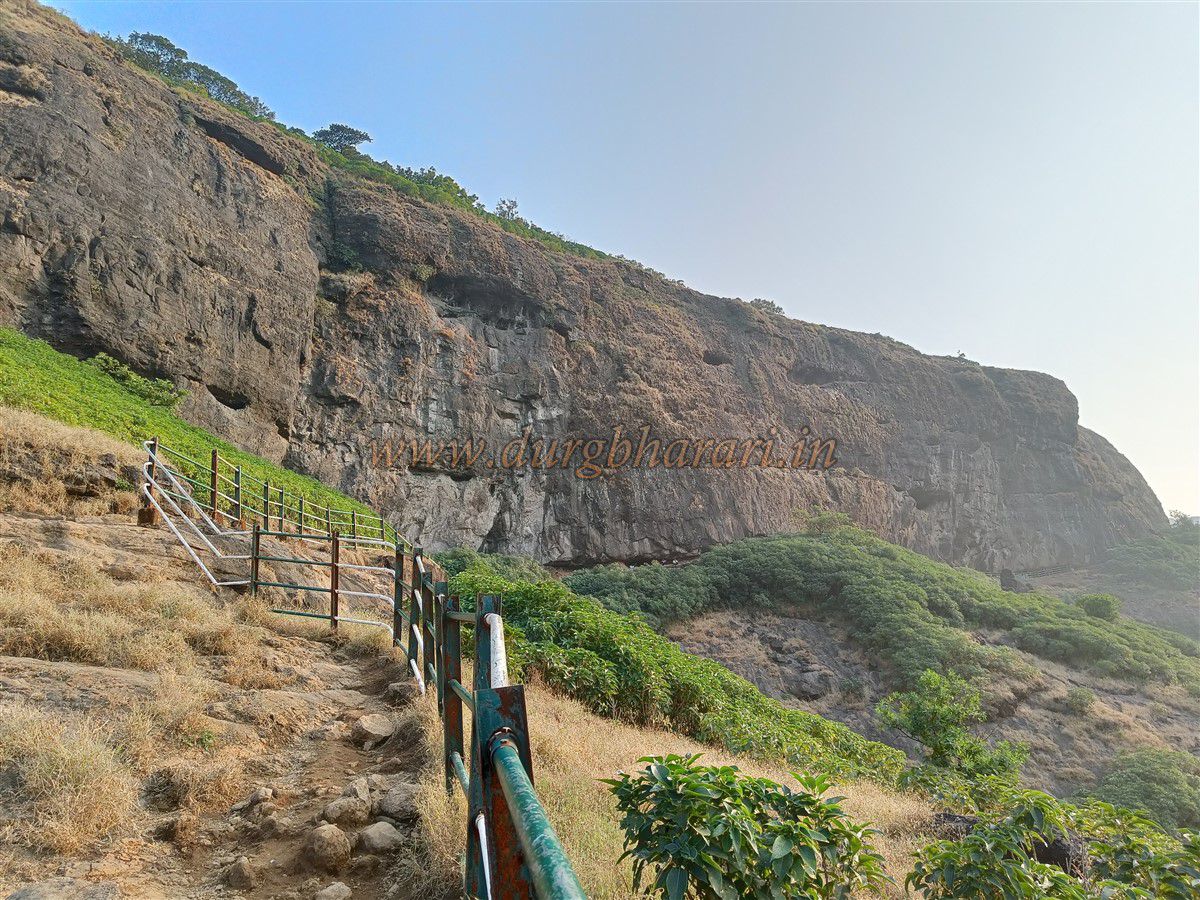
The Pachnai route to Harishchandragad lies in Ahmednagar district. To take this route, one must first reach Ghoti on the Mumbai-Nashik highway, then proceed to Rajur on the Sangamner road. The distance from Rajur to Pachnai is 29 km, with bus service available between the two. The path from Pachnai village to the Harishchandreshwar temple on the fort is quite simple and takes about two hours. Another easy route to the fort is via Khireshwar, which is mostly used by those coming from Pune. From Mumbai, one must travel via Murbad and ascend Malshej Ghat to reach Khubi Phata at the top of the pass, from where Khireshwar village is 5 km away. There are specific state transport buses from Pune to Khireshwar, but if transport is unavailable, this distance must be covered on foot. Near the village, on the bank of a stream, stands an ancient Shiva temple. This temple is worth visiting if one is ascending the fort via Khireshwar. Built in the 11th century, the doorway of its sanctum features exquisite carvings of Vishnu in the reclining position with his consorts. The roof of the outer Sabhamandap is adorned with sixteen carved panels depicting various deities: Ganesha and Riddhi riding a mouse, Shiva and Parvati on a bull, Brahma and Saraswati on a swan, Skanda and Shashti on a peacock, Kubera and his consort on a man, and Kama and Rati on a makara, among others. Locally, this temple is also known as the Nageshwar temple. A short distance away are two rock-cut caves, one of which stands on twelve pillars. Nearby is a perennial water cistern. From this point, a path leads to the fort through the Junnar gate, but it is advisable not to take this route without a guide, as it is beyond the capacity of most trekkers. From the village, a simple well-trodden route via Tolarkhind leads to the temple on the fort, taking about four hours to ascend. Though the path is simple, the climb is strenuous. After December, water becomes scarce along this route, so adequate supplies must be carried. It takes roughly an hour and a half to reach Tolarkhind from Khireshwar village. In this pass, there is a stone carved with a tiger figure. The straight path from here leads to Kothale village, while a path ascending to the left along the ridge leads to the summit of Harishchandragad. This path has rock-cut steps at some points. Higher up, remnants of fortification can be seen, and within half an hour, one reaches inside the fortifications. A little further along this route, the path splits in two: the more frequented one leads directly to the Harishchandreshwar temple, while the less trodden path leads toward the citadel. Near the hillock of the citadel, a well-built bastion of dressed stone can be seen. On this route, one also comes across a footpath from the south, leading from the Junnar gate to the citadel. If one wishes to see the Junnar gate, they should take this path. Skirting the citadel, this path reaches a slope in about 10 minutes. Descending slightly, one can see a series of carved depressions on the rock. Below these depressions are two rock-cut caves, with a water cistern next to one. One cave is habitable, accommodating four to five people, while the other has a finely carved but damaged Shivalinga in its center. Further down this path are the remains of a large structure on a plateau, followed by another rock-cut water cistern. The Junnar gate of the fort lies ahead. This gate resembles the Naneghat pass. Both sides of the pass have fortifications, and steps are carved into the rock to descend into the ravine. The gate itself is in ruins, with only remnants of its construction surviving. Descending about 100 feet into the ravine reveals a rock-cut cave with a water cistern above it. Beyond the ravine lies the spur of the fort leading toward Khireshwar village, where numerous house ruins can be seen. After exploring the Junnar gate and its surroundings, one must return to the citadel path. The ascent to the citadel is loose and slippery, requiring one to use hands and feet in some sections. At the base of the citadel, ruined stone steps appear first, followed by rock-cut footholds in some sections. The fortifications here are built entirely of dressed stone, though much of this side has collapsed. The gateway here too has fallen, leaving only a broken opening for entry. The opposite side’s fortifications are relatively intact, though the gateway there has also collapsed, leaving only its base. The citadel’s summit spans about 3 acres, with remains of small and large structures and four water cisterns. One cistern on the edge of the fortifications is dry, while a Ganesh figure is carved above another. At the highest point of the fort stands the remains of the killedar’s (fort commandant’s) residence, with a statue of Chhatrapati Shivaji Maharaj installed on its platform. Outside the residence is a stone domed shrine with a Shivalinga inside and a small water cistern within. The water in this fifth cistern is potable. The citadel summit rises to 4,482 feet above sea level, offering views of Kalsubai, Ratangad, Ajoba, Ghanchakkar, and Bhairavgad to the north, and Malshej Ghat, Bhairavgad, Nana’s Thumb, and Jivdhan to the southwest. Descending from the citadel and continuing along the main path for an hour brings one to the Harishchandreshwar temple beneath the Taramati peak. Along this route, one encounters two sets of ruins and rock-cut steps, one set made of dressed stone. At the junction where the paths from Pachnai and Khireshwar meet, there is a small dome with a water cistern in front. Inside this dome is a Shivalinga with a carved figure of King Harishchandra carrying water in a kavadi. Around the dome are memorial stones and broken sculptures. A short distance ahead, within an enclosure, lies the Harishchandreshwar temple. This is not the only temple on the fort; outside its enclosure are several other small ruined shrines, including two cave temples, one dedicated to Vinayak and another with a Shivalinga. One temple has a broken idol of sage Vishwamitra, and another houses idols of Ganesha and Shiva-Parvati. Most of the remaining temples enshrine Shivalinga. This cluster of temples is centred on the main Harishchandreshwar temple. The temple complex contains twelve cisterns, excluding the pushkarni (stepped tank), most of which were formed while quarrying stone for the temple. The pushkarni outside the enclosure is known as Saptatirtha. Along one edge of this tank are fourteen small shrines once housing Vishnu idols holding various weapons, but some of these idols were stolen, prompting the archaeological department to relocate the remaining idols to a cave behind the Harishchandreshwar temple. Numerous intricately carved stones can be seen around the complex. The main temple is built between two ridges, with an enclosing wall. The only entrance is on the eastern side, with a stone bridge in front. A spring-fed tank outside the enclosure channels water under this bridge, which also carries rainwater from Taramati peak. This place is regarded as the source of the Mangalganga River, which flows toward Pachnai village. From the path descending toward Pachnai, one can see this water cascading down a high cliff, where a stone dam once diverted it for use on the fort. The remnants of this dam can still be seen, though it no longer retains water. The eastern gateway of the enclosure features three kirtimukhas, and two inscriptions are carved on its walls. Inside the enclosure, six steps lead to the temple courtyard. The Harishchandreshwar temple stands about 40 feet tall from base to spire and has two entrances, east and west, each guarded by carved dwarapal with Nandi statues seated in front. In the center of the sanctum is a square Shivalinga carved from a single block of stone, set within a circular base. Another Shivalinga is placed behind it. Apart from the spire, the walls, pillars, and doorways of the temple exhibit beautiful carvings. The stone on the temple’s kalash has circular indentations decorated with intricate designs. On the southern platform adjacent to the temple sits an idol of Ganesha, with an inscription in Devanagari above it, partially reading “Shridashina Nath Kashish Sakpanath.” On the western side of the temple are two weathered six-foot-tall Bhairav idols, and to the south stands a memorial stone. The temple has been compared to the Mahabodhi temple at Bodh Gaya in the Gazetteer. Attached to the eastern wall of the enclosure are two small temples, and on the northern wall is another intricately carved shrine, labelled as Mahasiddha Vishnu Mandir, though its structure suggests it belongs to the Shaiva tradition. To the west are six caves, two of which serve as water cisterns with cool, sweet water. One cave houses idols collected by the archaeological department, while another has a platform with a spacious underground chamber beneath it. This basement is said to have been used by the yogi Changdev for penance, where he composed his philosophical text Tattvasara. Three inscriptions mentioning Changdev are carved on the pillars of this cave, and one also mentions the pilgrimage of saints Nivruttinath, Dnyaneshwar, and Namdev to Harishchandra Parvat. The northern wall of the enclosure has largely collapsed, and to the west, on a raised mound, stands a medium-sized stone dome known as Dombacha Dom. From here, a path leads directly to the Konkan Kada, bypassing Rohidas peak. About 200 feet downhill from the temple, following the flow of the Mangalganga, lies the Kedareshwar cave. This grand 50x50-foot cave has a carved scene of Shiva worship on its southern wall and a chamber next to it. In the center of the water-filled cave is a massive Shivalinga, three feet tall and six feet long, seated on a platform. Four pillars once supported the roof over this platform, but only one remains intact, with the others broken or destroyed. The water in the cave is 3-4 feet deep, and to circumambulate the Shivalinga, one must wade through the cold water. Two inscriptions are carved on a square pillar at the cave’s entrance, one reading “Shri Vatesar Sivasya Pranamati,” and the other “Siddha Shri Guheshwar Bhairav.” After visiting Kedareshwar, one can return to the Harishchandreshwar temple. To its south rises Taramati peak, the highest point on the fort, at 4,626 feet above sea level. Beneath this peak are 8-9 rock-cut caves and an underground water tank. One cave features a beautifully carved seated Ganesha, eight feet tall. These caves, along with those behind the Harishchandreshwar temple, provide accommodation for visitors. Given the large number of trekkers, tents, tea stalls, and meal services are available on the fort. On the second morning, one can explore any missed spots. From the junction of the Pachnai and Khireshwar routes, a spur leads to the Taramati peak. This well-trodden path initially passes through dense forest, reaching the flagpole on the peak in about 45 minutes. Apart from a carved Shivalinga and a stone mortar on the summit, there are no significant remnants, but the panoramic views are worth the climb. From here, one can see Shivneri, Hadsar, Chavand, Nimgiri, Sindola, Jivdhan, Gorakhgad, Kaladgad, Ratangad, Bhairavgad (Moroshi), Alang, Madan, Kulang, Bhairavgad (Shirpunje), Kunjar, Naneghat, Katrabai, Ajoba, and Kalsubai. A descent from the other side of Taramati leads to Konkan Kada, requiring one to cross two ladders. After the second ladder, a leftward path leads to Makadnal, which features a Gomukh spring that reportedly flows year-round. To the west of the fort lies Konkan Kada, Harishchandragad most spectacular attraction, drawing countless trekkers. This semi-circular cliff is about half a kilometre long, with a nearly 75-foot concave overhang in the middle. Its vertical drop from the plateau is about 3,000 feet, with a sheer 1,500-foot cliff face. Watching the sunset from here is an unforgettable experience. In 1835, Colonel Sykes recorded witnessing a rare circular rainbow (Indravajra) here. Two routes ascend the fort from this side: the Sadle Ghat route and the Nali route, also called the Konkan gate by locals. These are not suitable for ordinary trekkers. A trail from this plateau descends via Bailghat toward Pachnai village, passing a water cistern and remnants of a gate, taking about three hours. The history of Harishchandragad dates back to ancient times. The Skanda, Agni, Matsya, and Padma Puranas all praise Harishchandra Parvat. The peaks—Harishchandra, Taramati, and Rohidas—are directly associated with King Harishchandra. The fort is believed to have been built in the 5th or 6th century during the Traikutaka or Kalchuri dynasties. In the 10th century, Shilahara king Jhanjh constructed twelve Shiva temples at the sources of rivers between the Godavari and Bhima, including the Harishchandreshwar temple at the source of the Mangalganga. The rock-cut caves also date to this era. In the 13th century, Yogi Changdev resided here and composed his philosophical treatise Tattvasara, as mentioned in its verses between 1028 and 1033, which also record its completion at Harishchandragad in Shaka 1234. That century also saw visits from Sant Dnyaneshwar, Nivruttinath, and their siblings during their pilgrimage. After Chhatrapati Shivaji Maharaj’s second Surat campaign, the fort became part of the Swarajya. The Sabhasad Bakhar includes Harishchandragad among forts established by Shivaji Maharaj. Later, during Aurangzeb’s southern campaign, it fell to the Mughals. In 1747–48, the Marathas recaptured it and appointed Krishnaji (Karnaji) Shinde as Killeder. In 1751, some repairs were carried out, and revenues from 20 villages were allocated for its upkeep. The fort is mentioned in the Shahu Roznishi records. In 1775–76, Santaji Sawant was appointed Havaldar of the fort. During the final Anglo-Maratha war, Colonel Sykes captured it in May 1818, where Killeder Vishnu pant Joshi was martyred in battle. In 1835, Sykes recorded witnessing the Indravajra phenomenon at Konkan Kada. Later, on June 14, 1818, under the orders of Ahmednagar collector Henry Pottinger, the fort was handed over to Boit by Ramrao Narsinha, the Kamavisdar of Shivneri taluka. On December 18, 1818, Captain Mackintosh arrived to demolish the fort’s routes, water tanks, and fortifications. Between 1836 and 1843, British officer Harrison, then collector of Ahmednagar, attempted to develop Harishchandragad as a hill station, even building a bungalow near the temple caves, but it was soon destroyed in a fire, ending these efforts. The platform of this bungalow can still be seen today.
© Suresh Nimbalkar
GALLERY