HARIHAR
TYPE : HILL FORT
DISTRICT : NASHIK
HEIGHT : 3586 FEET
GRADE : MEDIUM
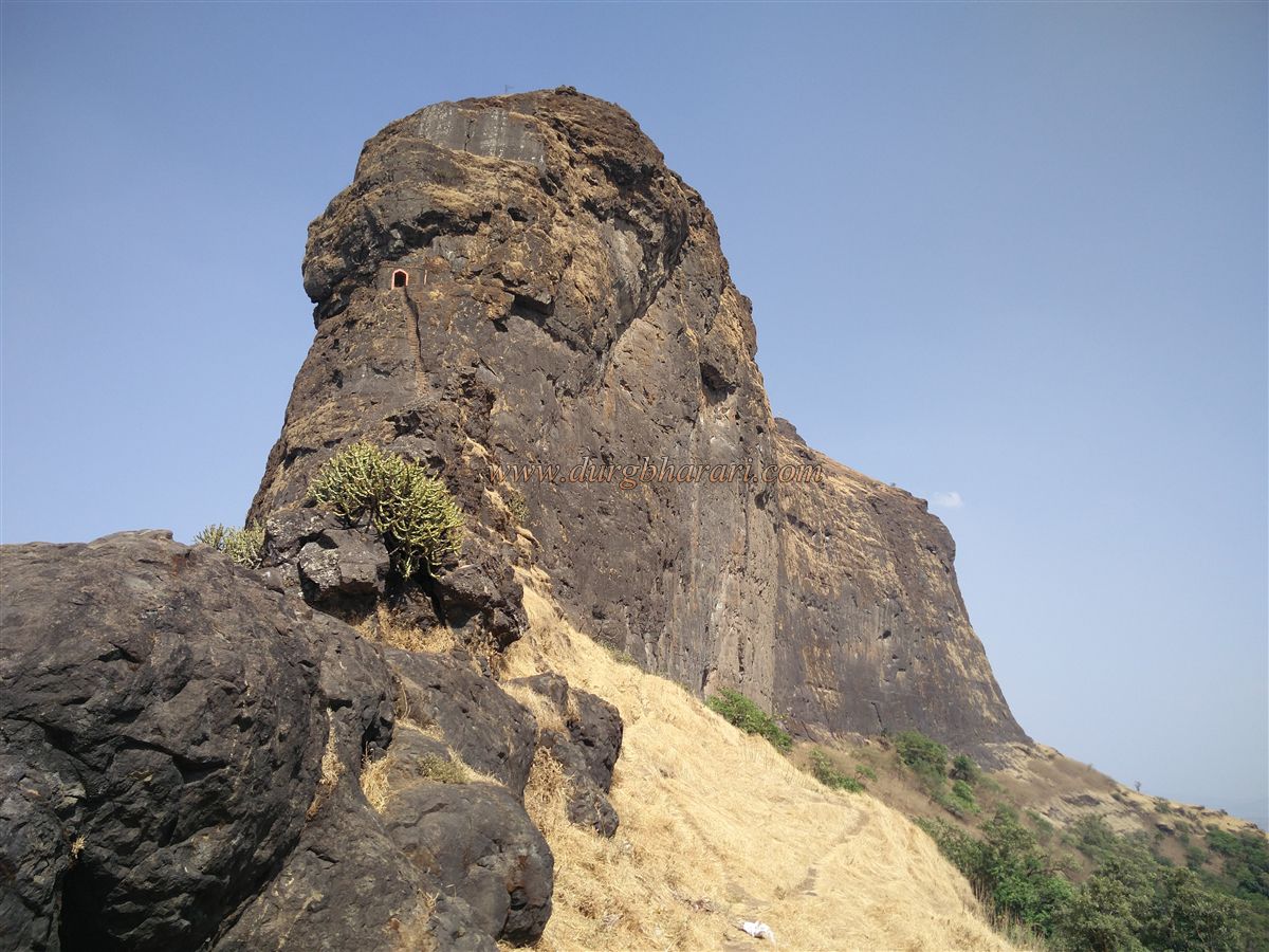
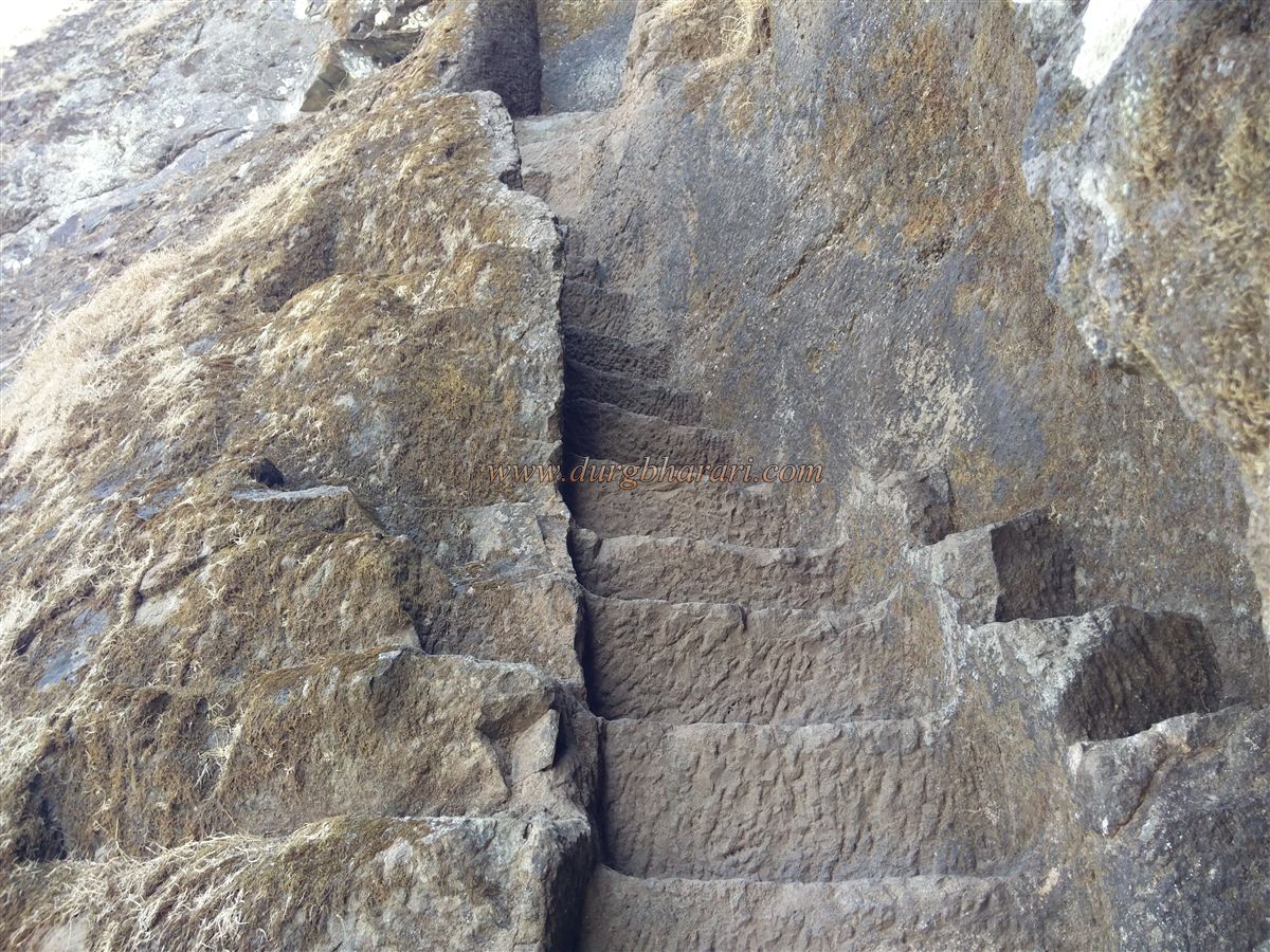
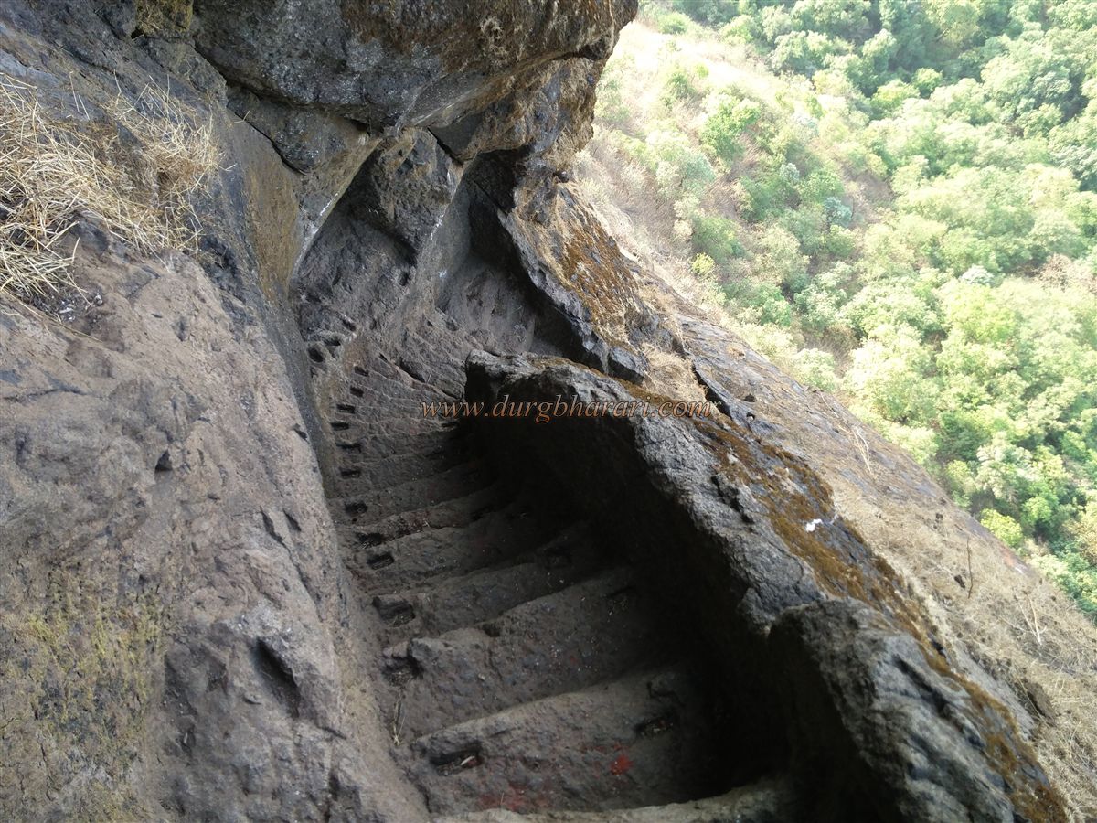
Every fort in Maharashtra has its own distinct identity. Some forts are famous because of the historical events that took place there, while others are renowned for their unique fort architecture. One such fort, celebrated for its fortification feature, is Harihar Fort, known for its rock-cut steps carved at an angle of 70 degrees into a vertical rock face. This access path, extremely rare among forts in Maharashtra, still survives on this fort, but sadly, its beauty is now being overshadowed. Due to its proximity to the cities of Mumbai, Pune, and Nashik, this fort has become a hub for organized trekking groups. The dangerous crowding on weekends creates the potential for serious accidents, making it necessary to implement measures to control such situations in time.
In Nashik district, there are several hill ranges like Selbari-Dolbari, Ajantha-Satmala, and Trimbak.
...
Among them, spread to the east of Nashik and south of Igatpuri, lies the Trimbak range, which houses many forts such as Bhaskargad, Harshegad, Trimbakgad, Anjaneri, Ranjangiri, Gadgada, and Bahula. After Trimbakgad, Harihar is the second most important fort in this range. Since ancient times, Nashik has been a famous marketplace. To protect the trade route coming from Dahanu port toward Nashik—via Dahanu, Javhar, Gondaghat, Amboli Ghat, Trimbak, and Nashik—a chain of forts was built along these ghats. Harihar and Bhaskargad were constructed to keep watch over Gondaghat.
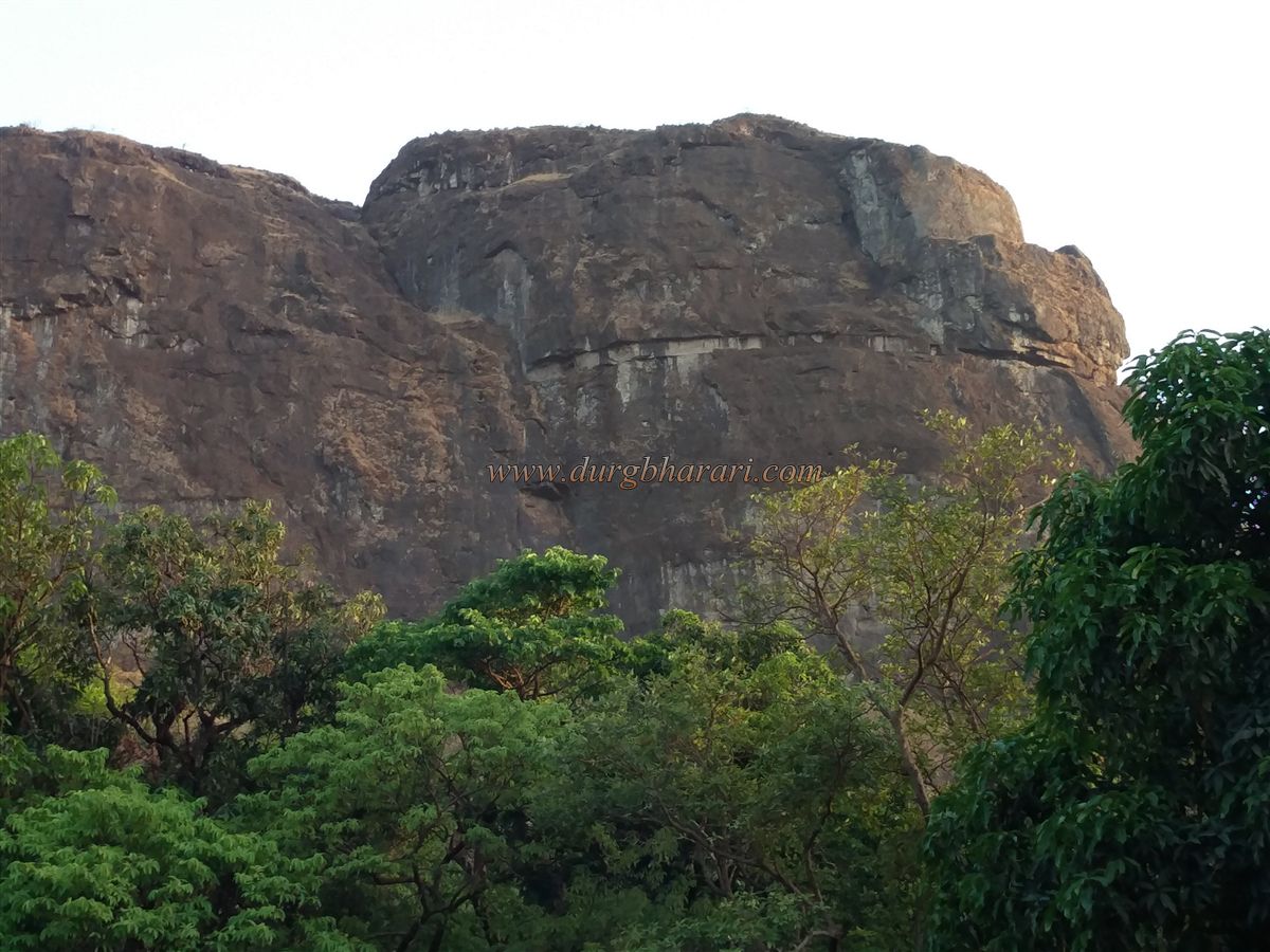
The villages of Nirgunpada and Harshewadi lie at the base of this fort. From Nirgunpada, it takes about one and a half hours to reach the base of the fort, while from Harshewadi, it takes about one hour. Both routes meet at the same point at the fort’s base. If one wants to explore the entire fort with less effort and in less time, Harshewadi is the best option. From the Mumbai–Nashik highway via Ghoti, the distance to Nirgunpada is approximately 170 km. If you have your own vehicle, you can reach Harshewadi, which is 5 km away, by a dirt road; otherwise, begin the trek from Nirgunpada. From Nashik, the distance to Harshewadi via Trimbak is 41 km, making this route convenient for visitors from Nashik and Pune.
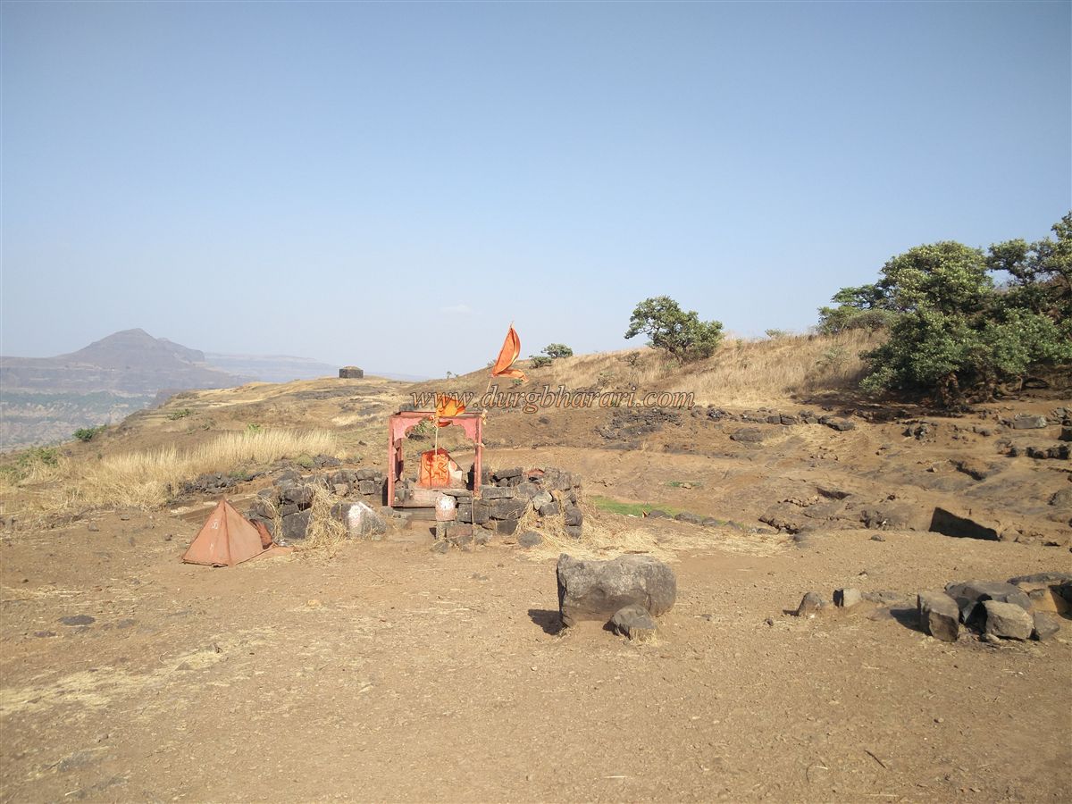
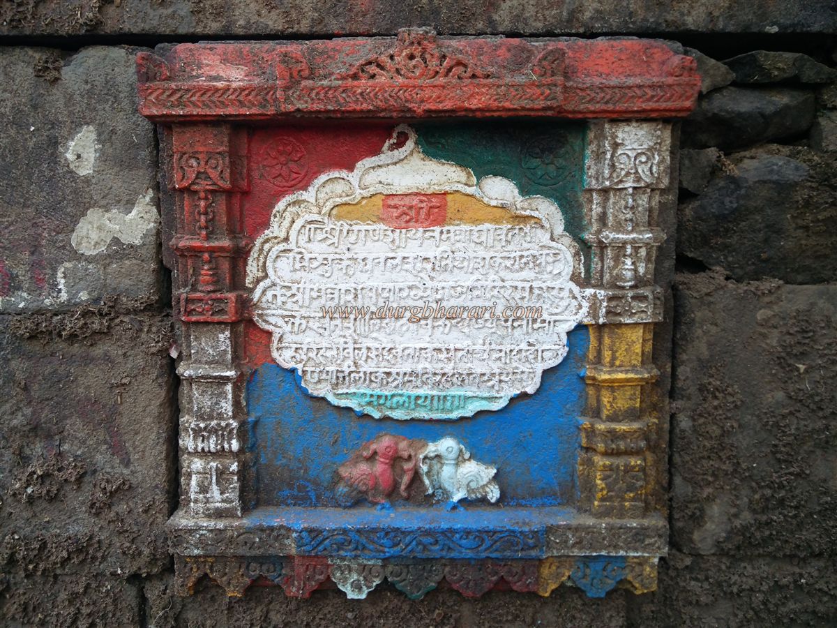
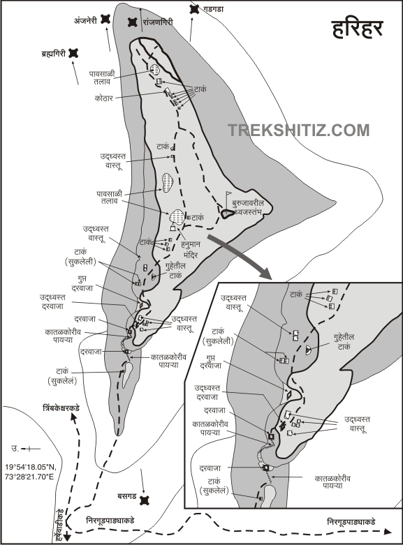
From Harshewadi, one can clearly see the hill of Harihar, also known as Harshgad. From here, after about 45 minutes of steep climbing along a dam’s edge, one reaches an open plateau just below Harihar Fort. On this route, to the left, stands a memorial stone, and a little ahead lies a ruined, dry, stone-built water cistern. Past this cistern, there is an ashram and beside it a stone-built pond (pushkarni). On the edge of this pushkarni are temples of Lord Ganesh and Lord Shiva, and behind the ashram, in a thicket, lies a Hanuman temple. On one corner of the wall of the pushkarni is an eight-line inscription in the Devanagari script carved into the stone. Around this inscription is an arch design, with two ornate pillars on either side, a lotus carving above, and two birds carved below. The inscription reads:
Shri || Shri Ganeshaya Namaha || Tri Va Mi Shruke Dhaval Sha Ne Yo Sha Ka Tra Ta || Shri Mantrash Gira Ra Sa Sukta Sat Shalivahan Shake Harahara Vilasade Loka Shramanirahaste Shreya Mangalam ||
In this inscription, there is mention of Harihar Fort. Additionally, words like “Shalivahan Shake” and “Ganeshaya Namaha” are clearly legible. However, since the inscription is painted over with oil paint, some letters are difficult to read. Currently, a sadhu resides here. For those wishing to stay overnight on the fort, this is the most beautiful place.
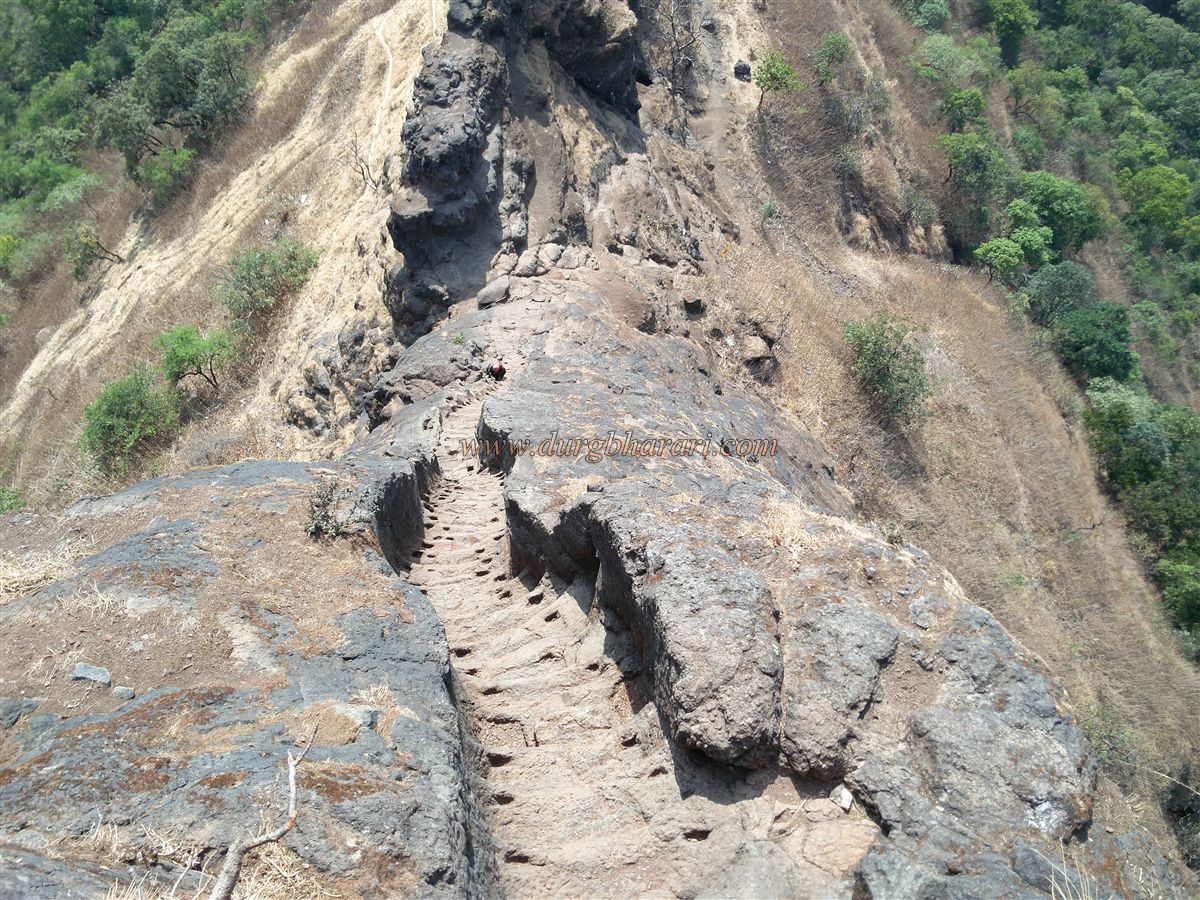
Returning to the main path and moving forward a little, we reach the plateau in front of the fort. The route from Nirgunpada also merges at this plateau. Here, some stones smeared with vermillion are placed. From here, keeping the hillock in front to the left, the climb continues. Due to the large crowds visiting the fort, villagers have set up about ten to twelve small stalls here, selling tea, cold drinks, snacks, and meals. Passing through these stalls and climbing the worn path for ten to fifteen minutes, keeping another hillock to the right, we arrive at a small pass cut into the rock face that contains the famous rock-cut steps of Harihar.
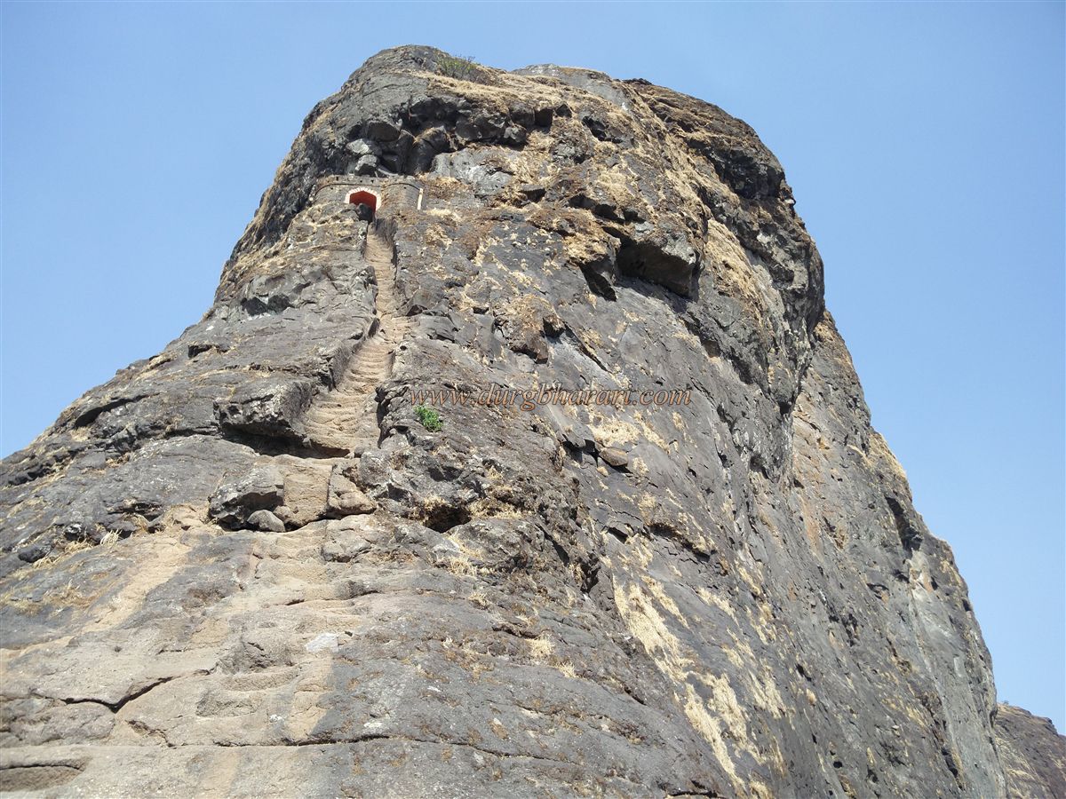
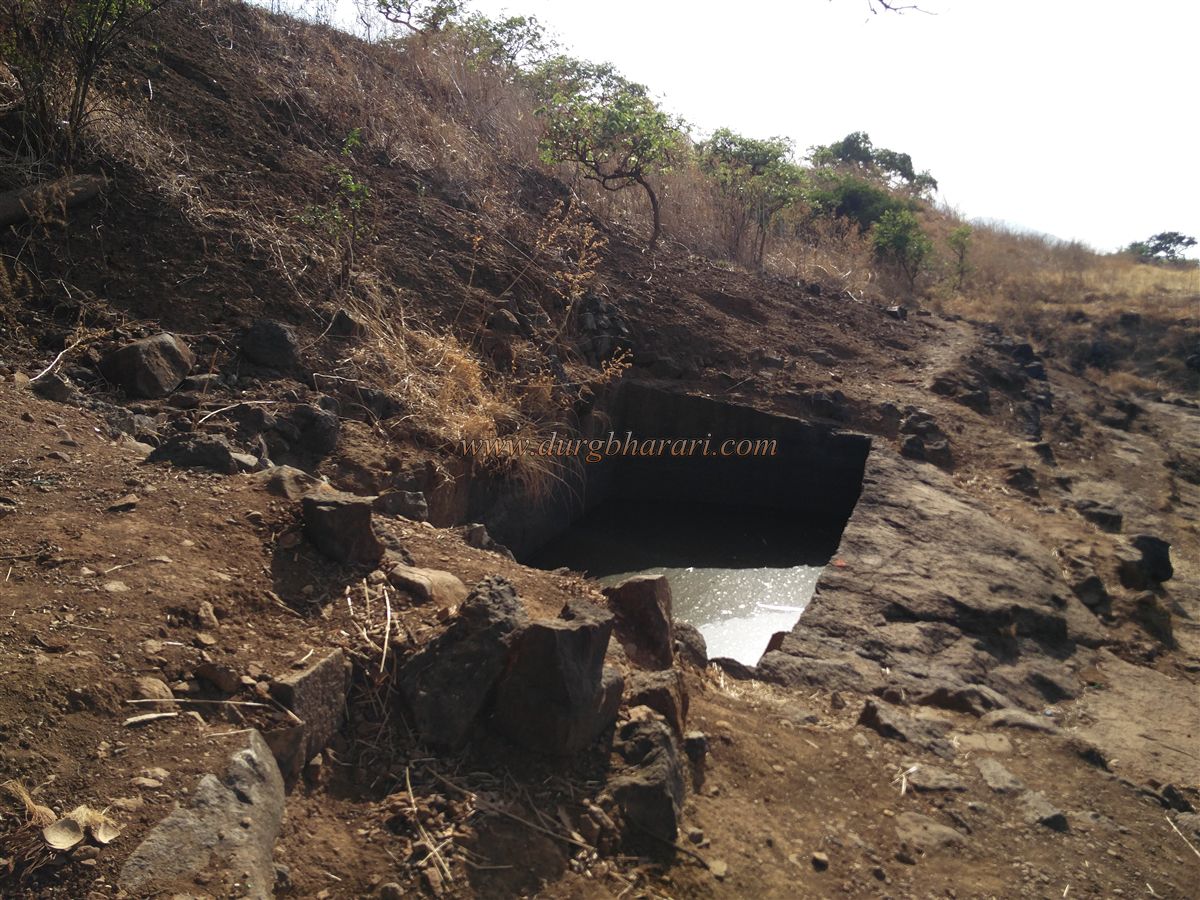
Before starting these steps, on the opposite side below, there is a small rock-cut water cistern. The entrance to the fort—a straight rock-cut staircase carved at a 70-degree angle with a gate above it—is simply breath taking at first sight. During the 1818 Maratha-British war, Captain Briggs of the British army captured Harihar Fort. He was astonished by these steps, carved like a steep staircase on a vertical rock wall at a height of about 200 feet. The British policy was to destroy the pathways and entrances of conquered forts using cannons. But Captain Briggs, deeply impressed by the beauty of these steps, chose not to damage them, even after capturing the fort.
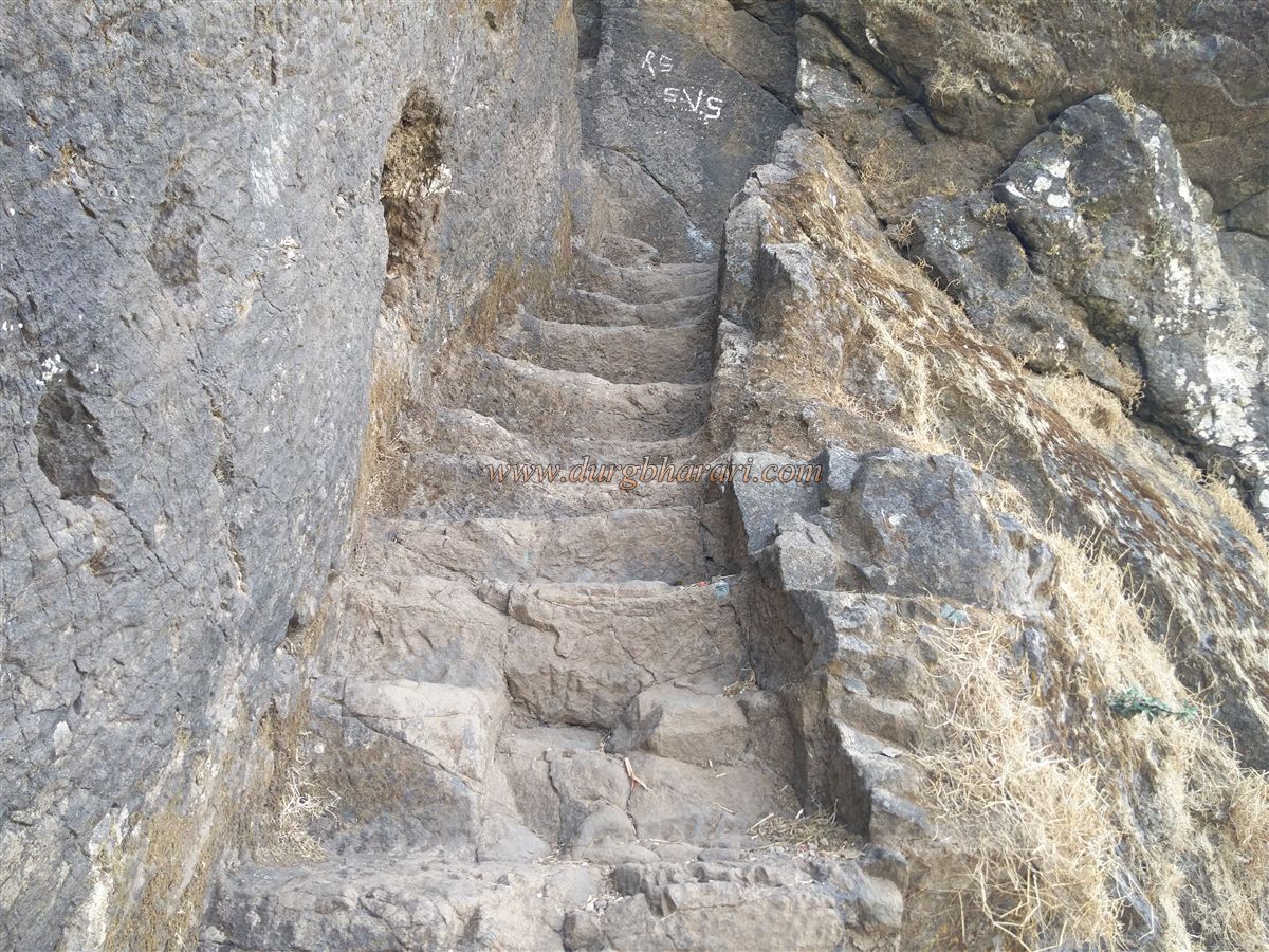
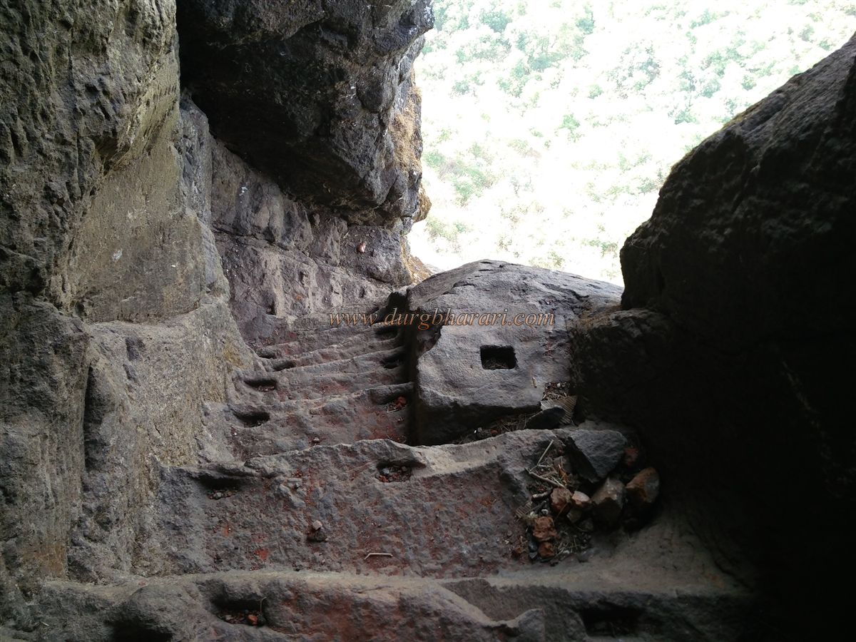
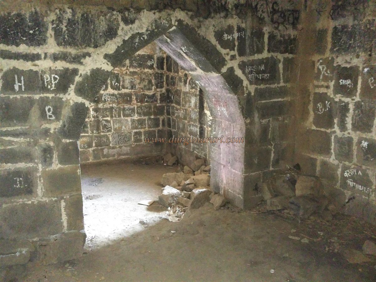
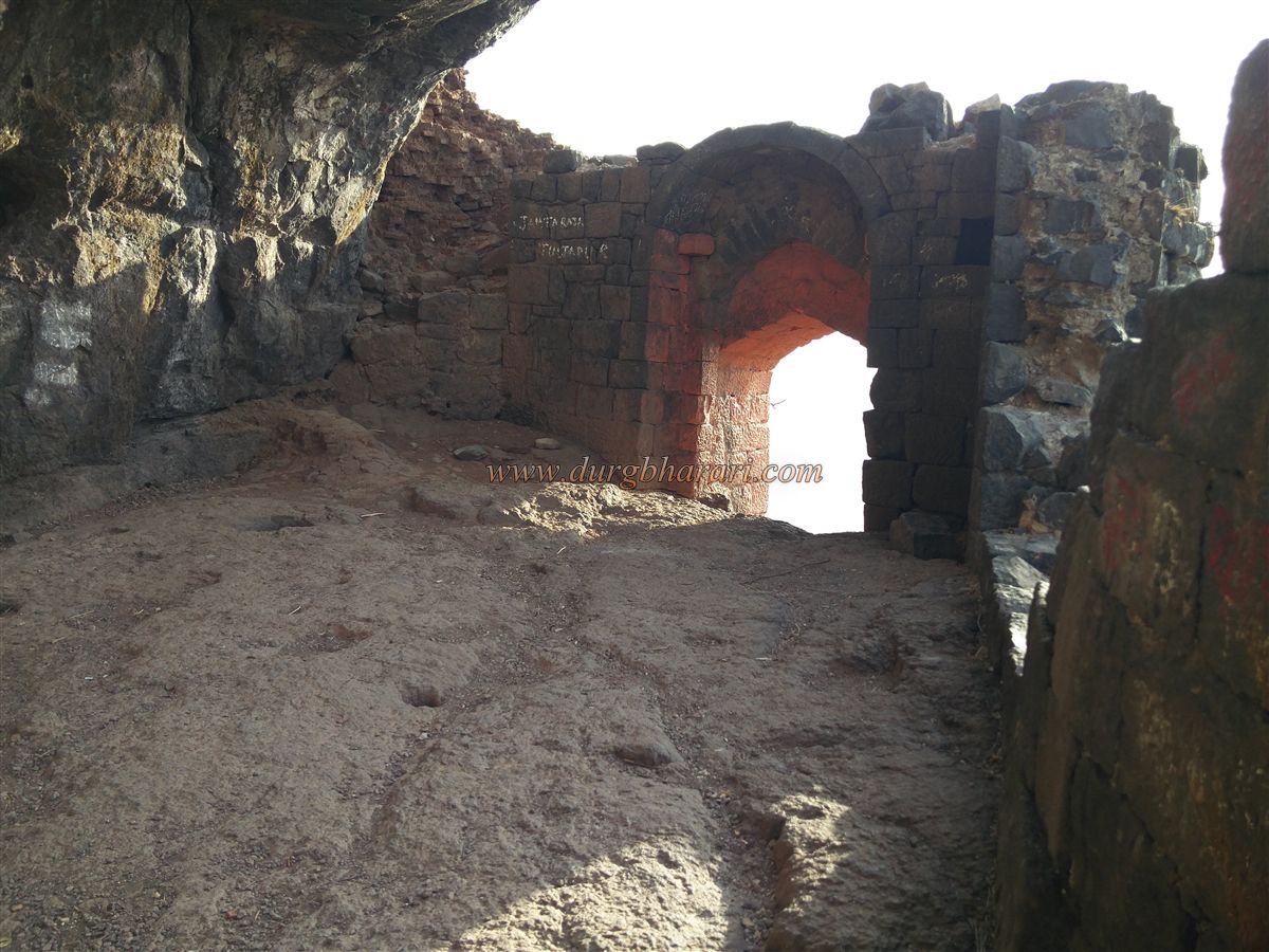
This first entrance gate of Harihar, flanked by two small bastions carved into the rock, enhances the magnificence of this pathway. These steps are so narrow that only one person can go up or down at a time. Niches are cut into the rock on both sides for support, but since some steps are damaged, one must climb carefully. After climbing around ninety steps, we reach the fort’s first small west-facing gate. Inside, to the right, there is a rough-hewn idol of Lord Ganesh, smeared with vermillion. The arch of the gate and the parapet above are built with bricks.
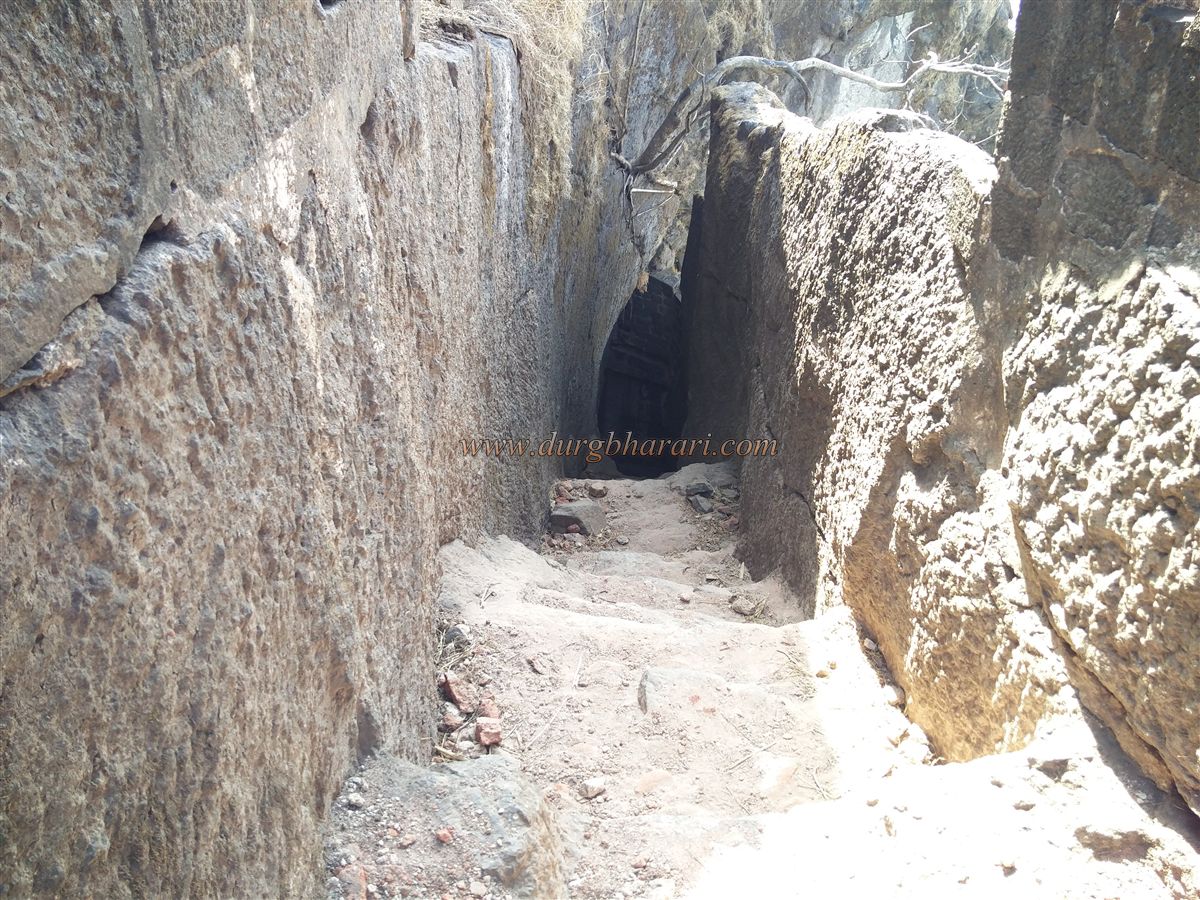
Beyond this gate, an overhanging rock passage carved into the cliff leads forward. This passage is low, requiring one to bend slightly to cross. After crossing it, we reach two more west-facing gates carved into the rock, with about 30–40 steps leading through them. Holding onto the supporting niches, we eventually reach the final gateway of the fort, which is a small underground entrance. After passing through this last gate, we enter the fort. The brick dome over this gateway has largely collapsed, and the fallen bricks are scattered around. Past the gate, there are remains of some ruined structures, and crossing them brings us to the main plateau of the fort.
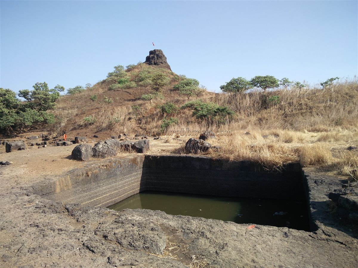
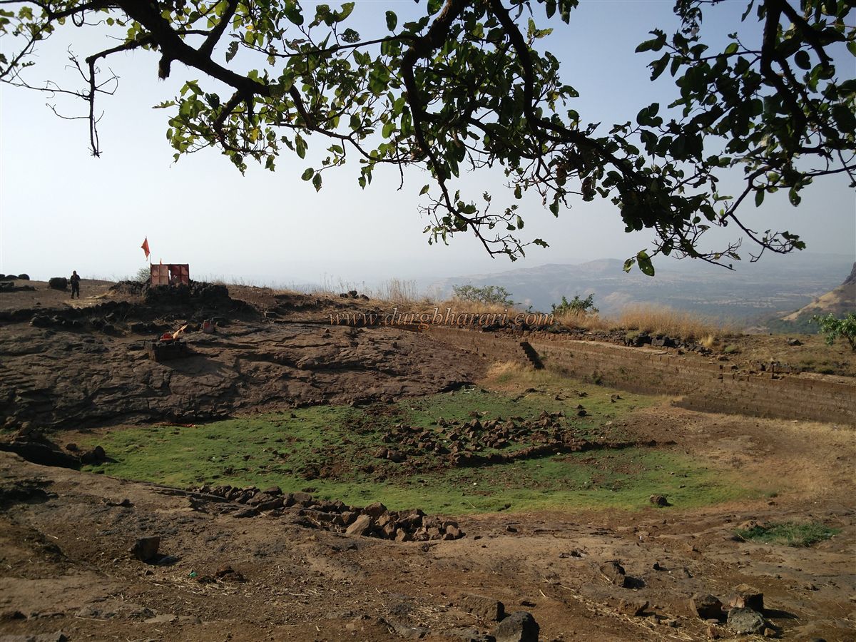
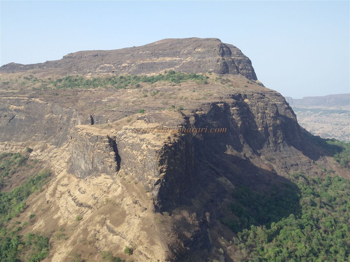
The fort, roughly triangular in shape and oriented east-west, covers an area of about 16 acres. From the sky, it appears like an eagle with its wings spread. Situated at an altitude of 3,445 feet above sea level, Harihar Fort has sheer cliffs on all four sides, eliminating the need for extensive fort walls. The only way up is through the rock-cut stairway we used.
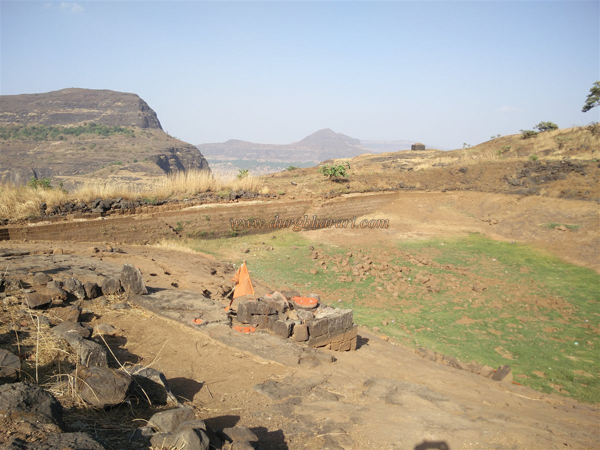
A little ahead on the left, at a lower level along the cliff, there are ruins of an ancient entrance and pathway carved into the rock, but the route to it has collapsed. This was likely part of the original construction of the fort, later destroyed by rock falls. Above this ruined gateway is a 50-foot-deep granary, but descending into it requires ropes; otherwise, it can only be viewed from above. Above the granary is a buried rock-cut cistern. Continuing forward, we come across the remains of a large structure, probably the administrative building or mansion of the fort (sadar or wada). Along this path, to the left, there is a rock-cut cave.
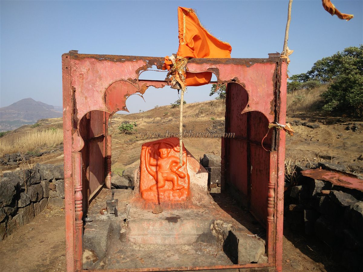
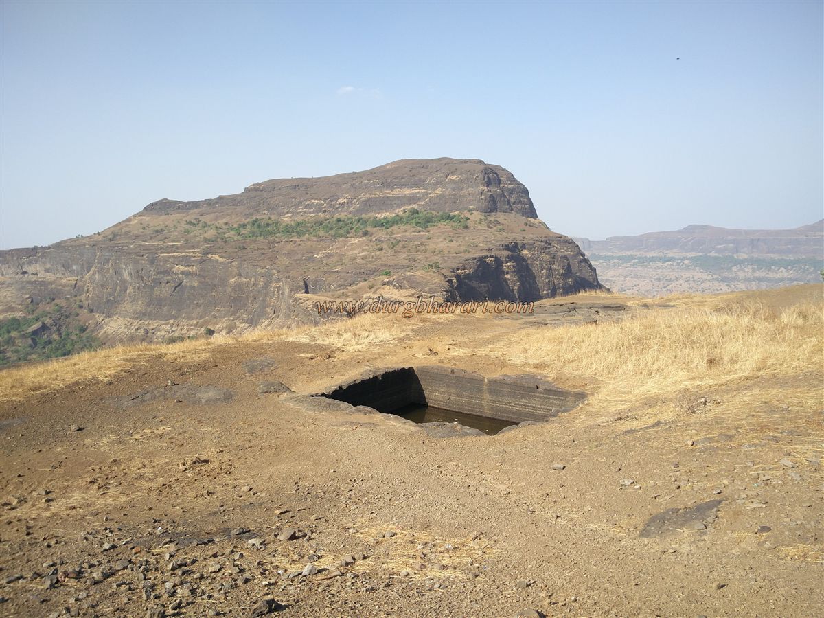
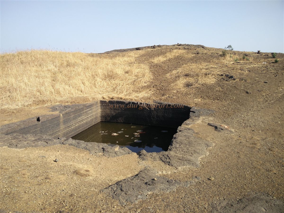
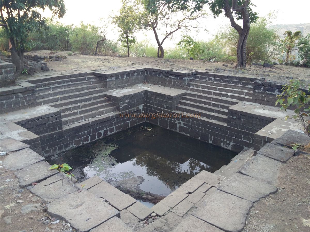
Further along, there are three large rock-cut cisterns and a spacious reservoir. A stone wall has been constructed on the western side of this reservoir to hold water. On the bank of the reservoir stands a Hanuman idol placed in an iron shrine. Two small platforms are located nearby—one with a Shivalinga and Nandi, and the other with a broken idol of Lord Hanuman. To the right of the reservoir, beneath a fig tree, is another rock-cut cistern, and both this cistern and the reservoir contain potable water.
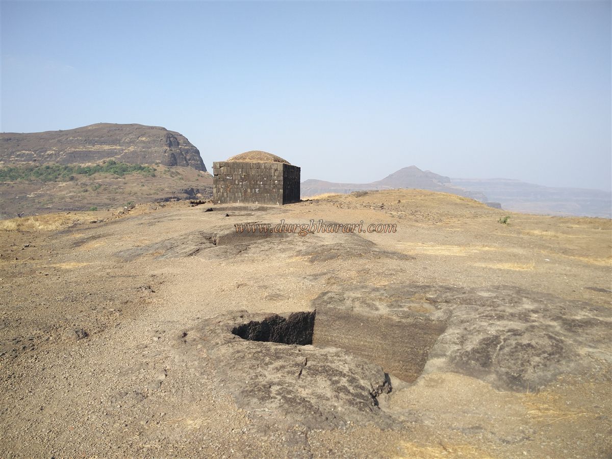
From the reservoir, one can see a stone building with a domed roof, which is the fort’s gunpowder storage (Darukhana). On the way to this structure, to the left, lies another rock-cut reservoir with a square cistern carved at its center. Nearby is another rock-cut tank supported by pillars, now completely filled with soil. After exploring these, we reach the 30x12 ft. gunpowder storage building—the only structure on the fort that still has an intact roof. The building is divided into two sections, with a small window-like door for entry. It is dark even during the day, so a large iron oil lamp is fixed into the wall for lighting. About 10–12 people can comfortably stay inside this storehouse.
In front of this structure are five small rock-cut cisterns, and behind it, one large tank and a small pond. Of these, water in one of the tanks is suitable for drinking. From here, a path leads down to the fort’s edge.
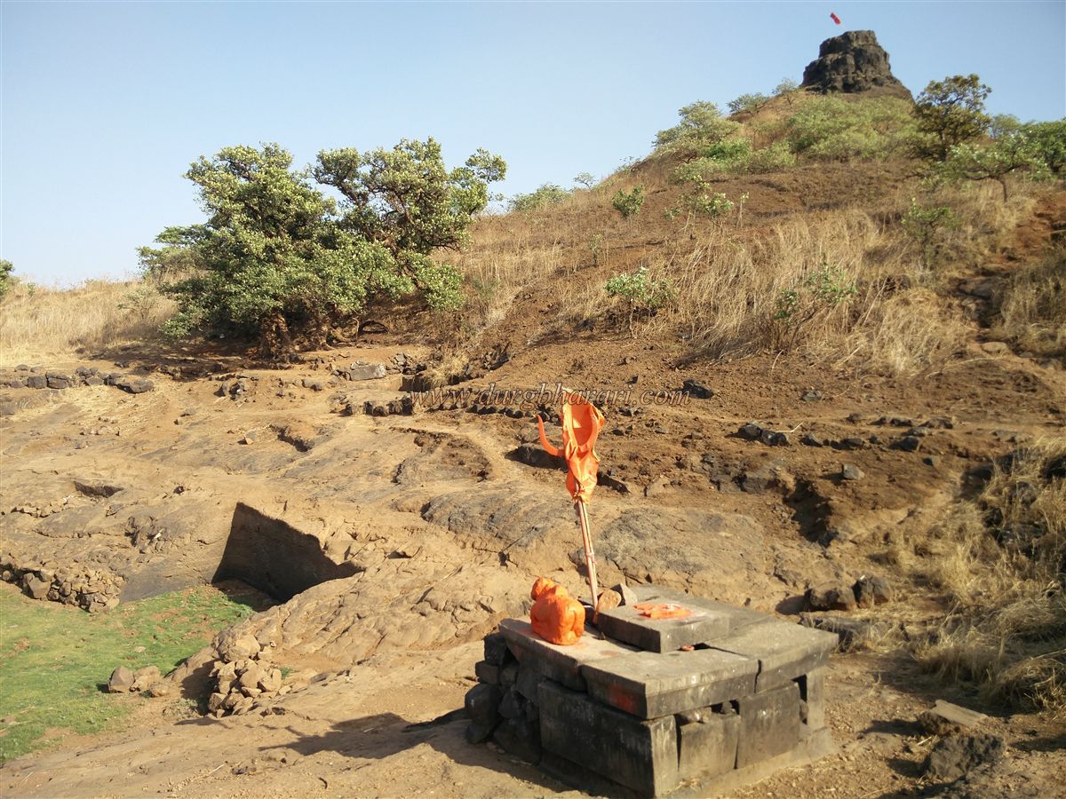
After exploring the gunpowder storehouse and surrounding areas, we head toward the highest point of the fort—a hillock. The path to the top is slightly slippery and requires careful climbing. This 60–70 ft high hillock is the fort’s summit. Before reaching the top, one must climb the final rock-cut section. At the peak stands a flagpole, where a saffron flag flutters proudly. From here, the entire Harihar Fort is visible, along with the surrounding Trimbak range—Wagher Fort to the north, Kavnai and Tringalwadi to the south, Kapdya, Brahma, and behind them Brahmagiri to the east, and Phani Hill, Basgad, Utwad, Anjaneri, and the Vaitrana reservoir to the west.
Thus concludes our exploration of Harihar Fort. Though the fort is small, with narrow boundaries, the ruins spread across the plateau require about two hours to explore fully. However, one must descend carefully.
There is no definite evidence of when Harihar Fort was constructed, but based on its overall rock-cut features, it appears to have been built during the Satavahana period, around the same time as Trimbakgad. In 1636, when Shahaji Maharaj attempted to revive the Nizamshahi kingdom, he captured this fort while taking nearby Trimbakgad. Later, the fort came under Mughal control. Around 1670–71, Moropant Pingle recaptured several forts in the Nashik region, including Harihar. On January 8, 1689, the Mughal general Matbar Khan captured it. In 1818, when the British took Trimbakgad, this fort also fell into their hands.
During the monsoon, moss accumulates on the steps, making climbing and descending risky. Therefore, it is advisable to avoid visiting Harihar Fort in the rainy season.
© Suresh Nimbalkar
GALLERY