HARGAD
TYPE : HILL FORT
DISTRICT : NASHIK
HEIGHT : 4160 FEET
GRADE : MEDIUM
The Alang-Madan-Kulang forts in the Kalsubai range of Nagar district are famous for their thrilling treks. If you have 2 to 3 days, you can easily see 5 forts like Salota, Salher, Mulher, Moragad, and Hargad. Among these 5 forts, the most neglected fort is Hargad. It is the third tallest fort in Maharashtra after Salher-Salota and is taller than Mulher fort. Hargad fort was built to protect Mulher fort. As the fort is located in the perimeter of Mulher is known to be a part of Mulher, although Hargad is a separate fort as it has three different entrances and the gates of both the forts are not common. The forts are located on the border of the Dang region and Baglan, which is densely forested on the west. To reach Hargad in Satana taluka, you have to reach Mulher village via Nashik-Satana-Taharabad. The distance from Nashik to Satana is 90 km and from Satana via Taharabad to Mulher is 35 km.
...
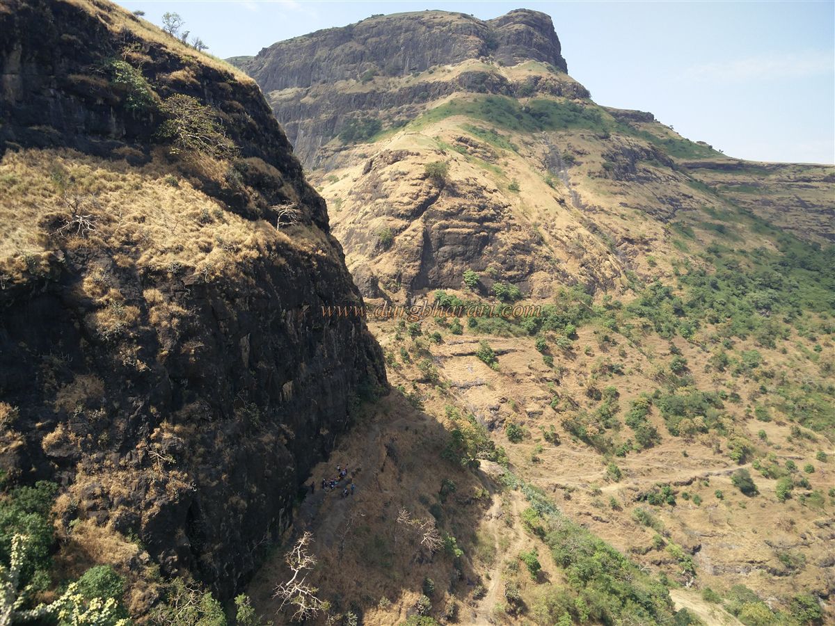
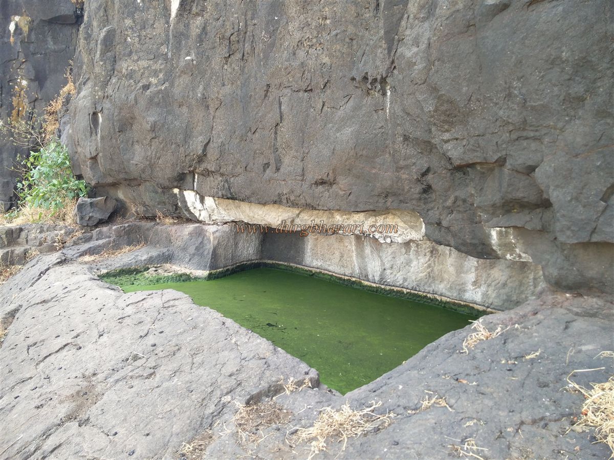
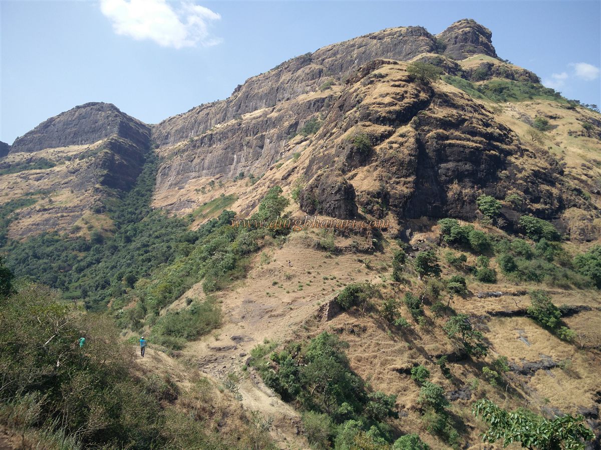
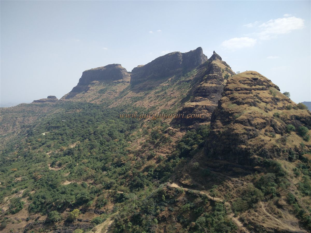
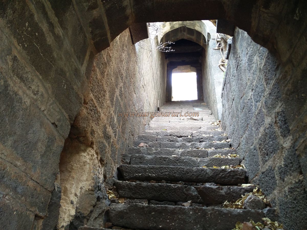
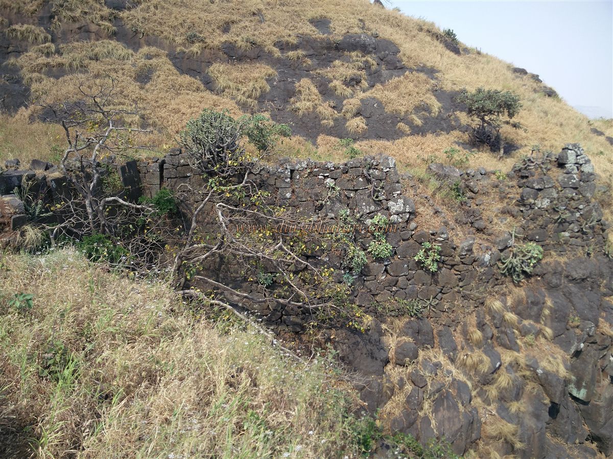
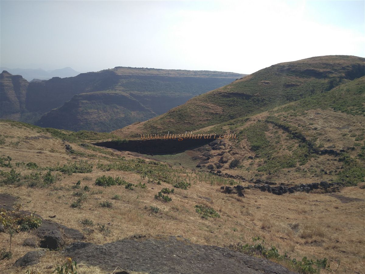
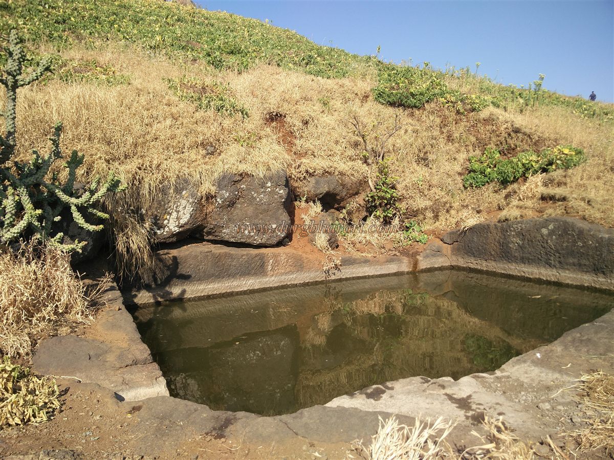
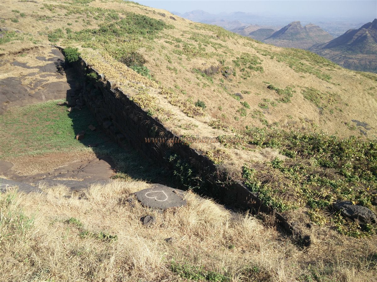
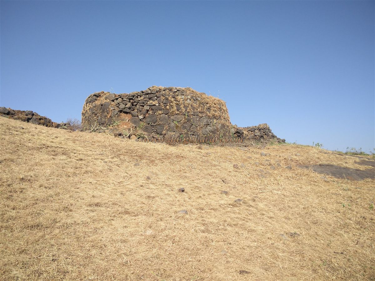
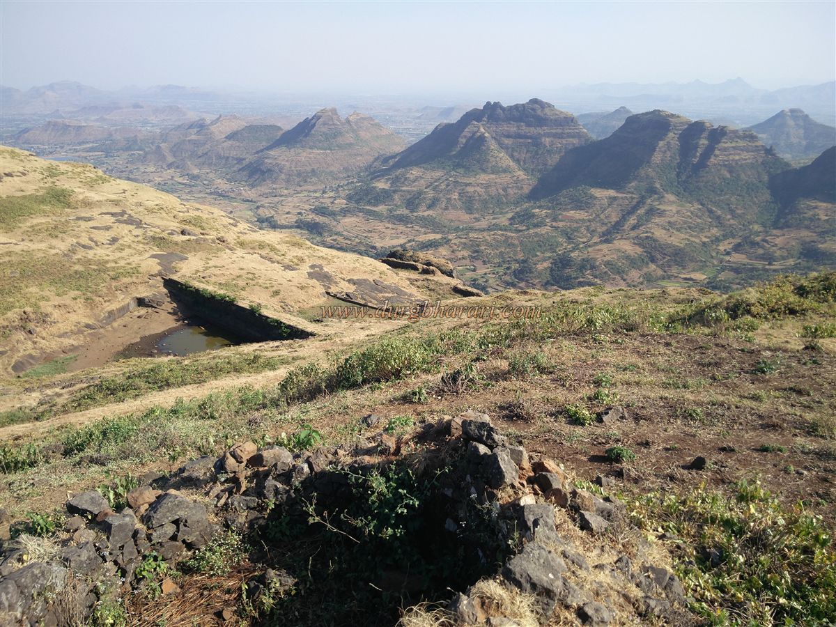
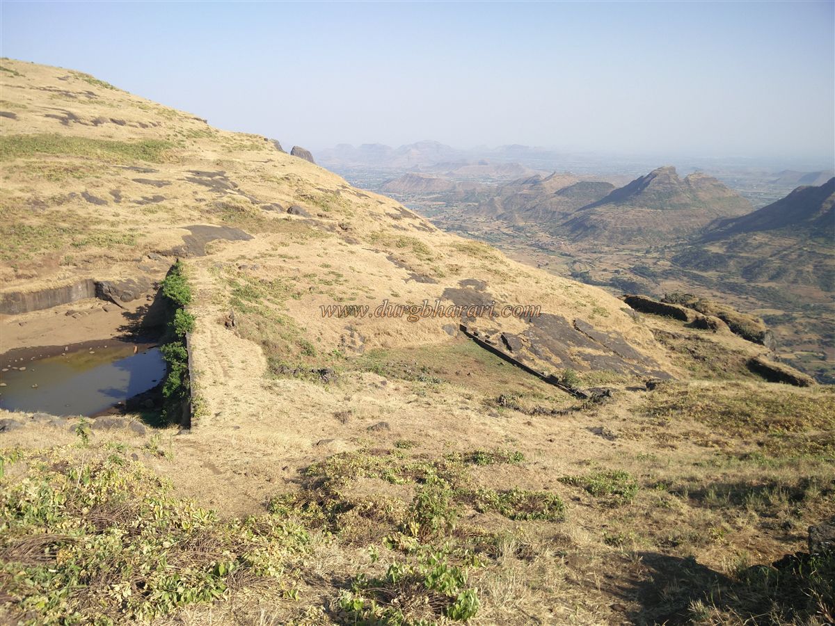
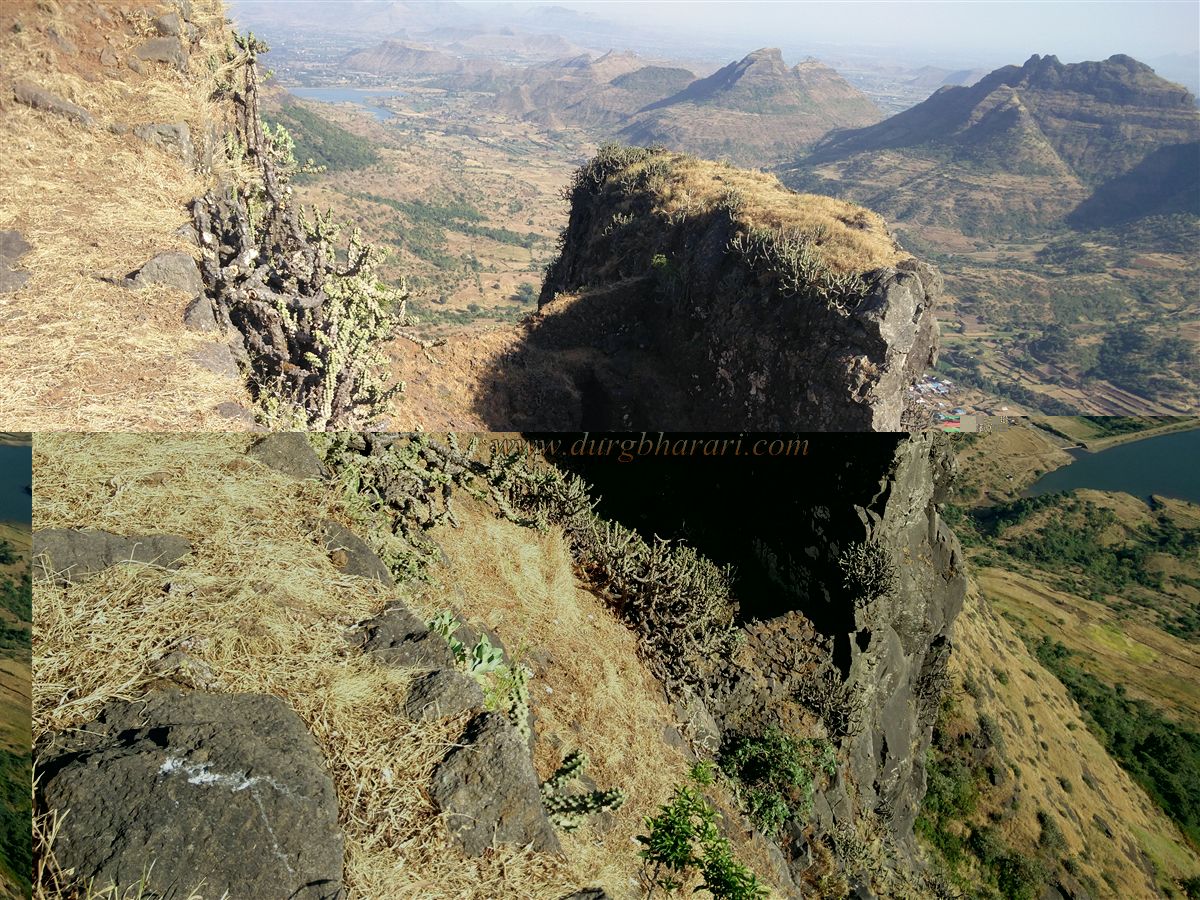
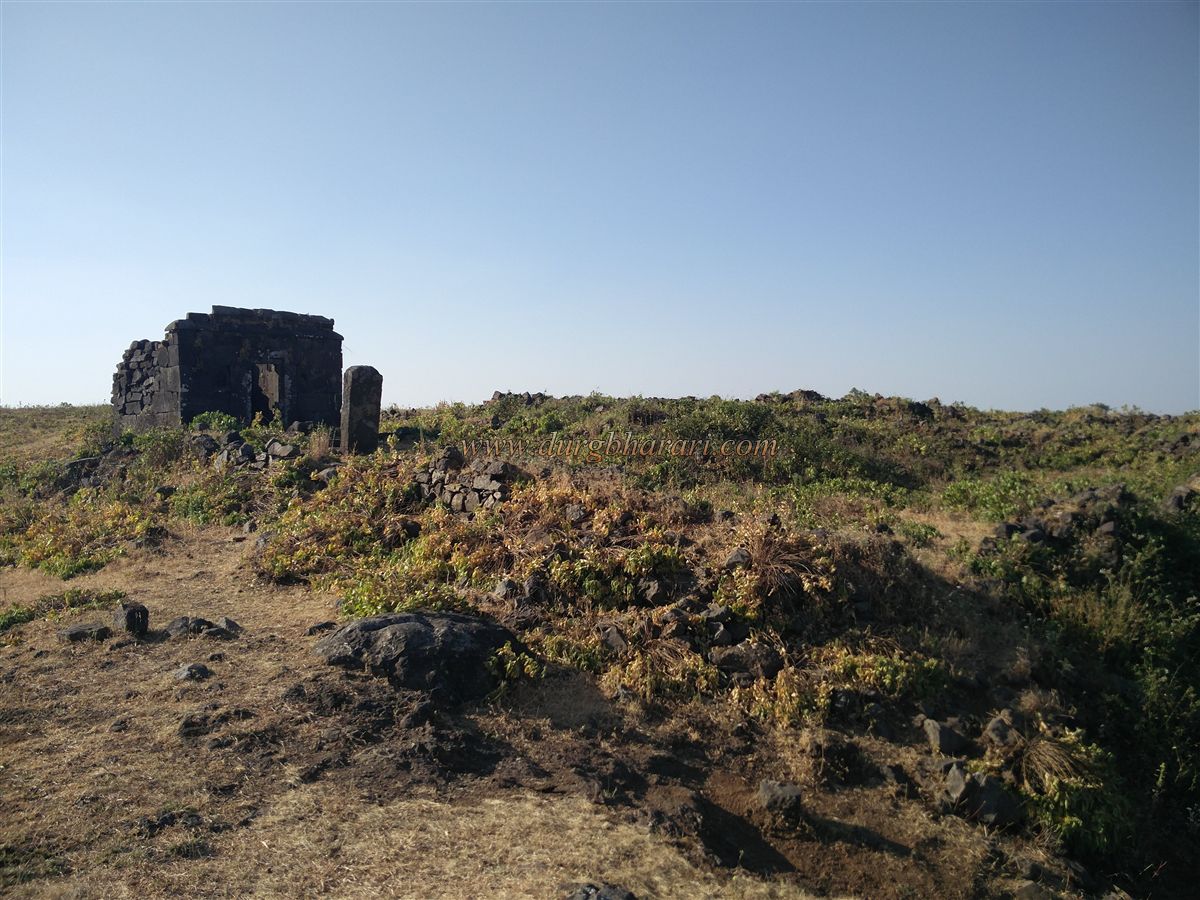
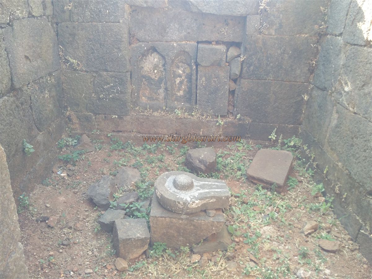
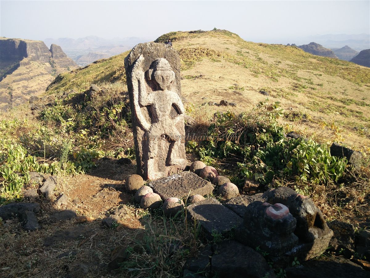
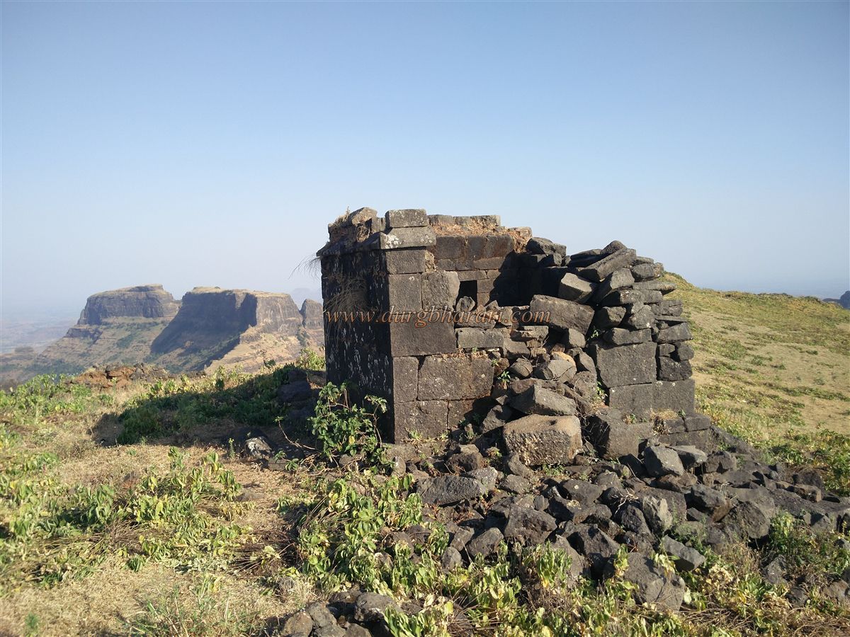
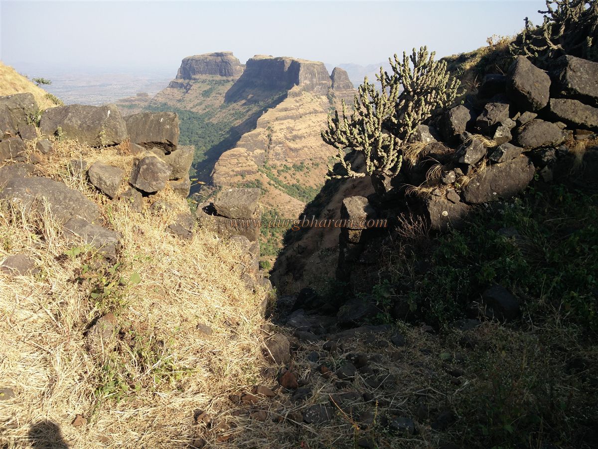
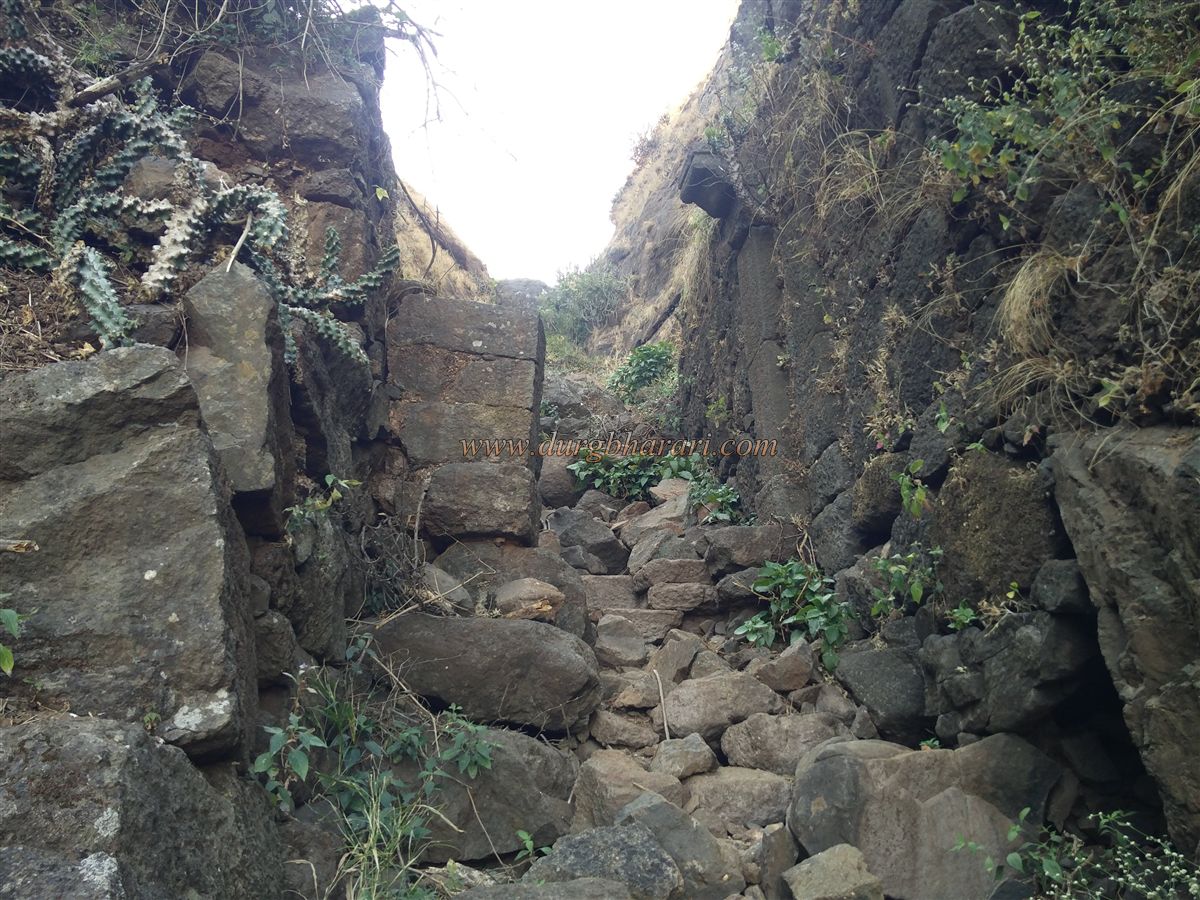
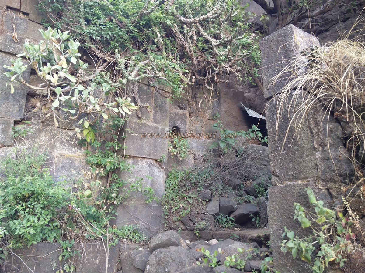
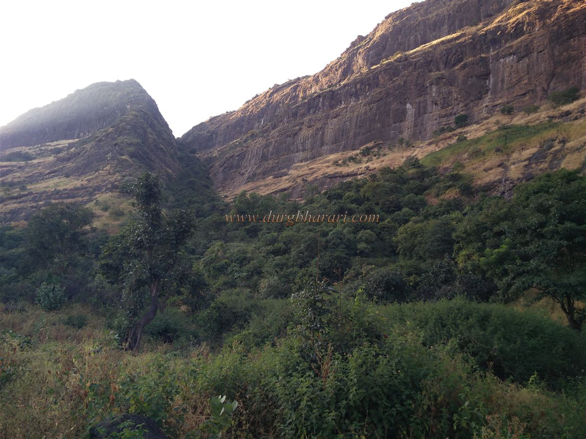
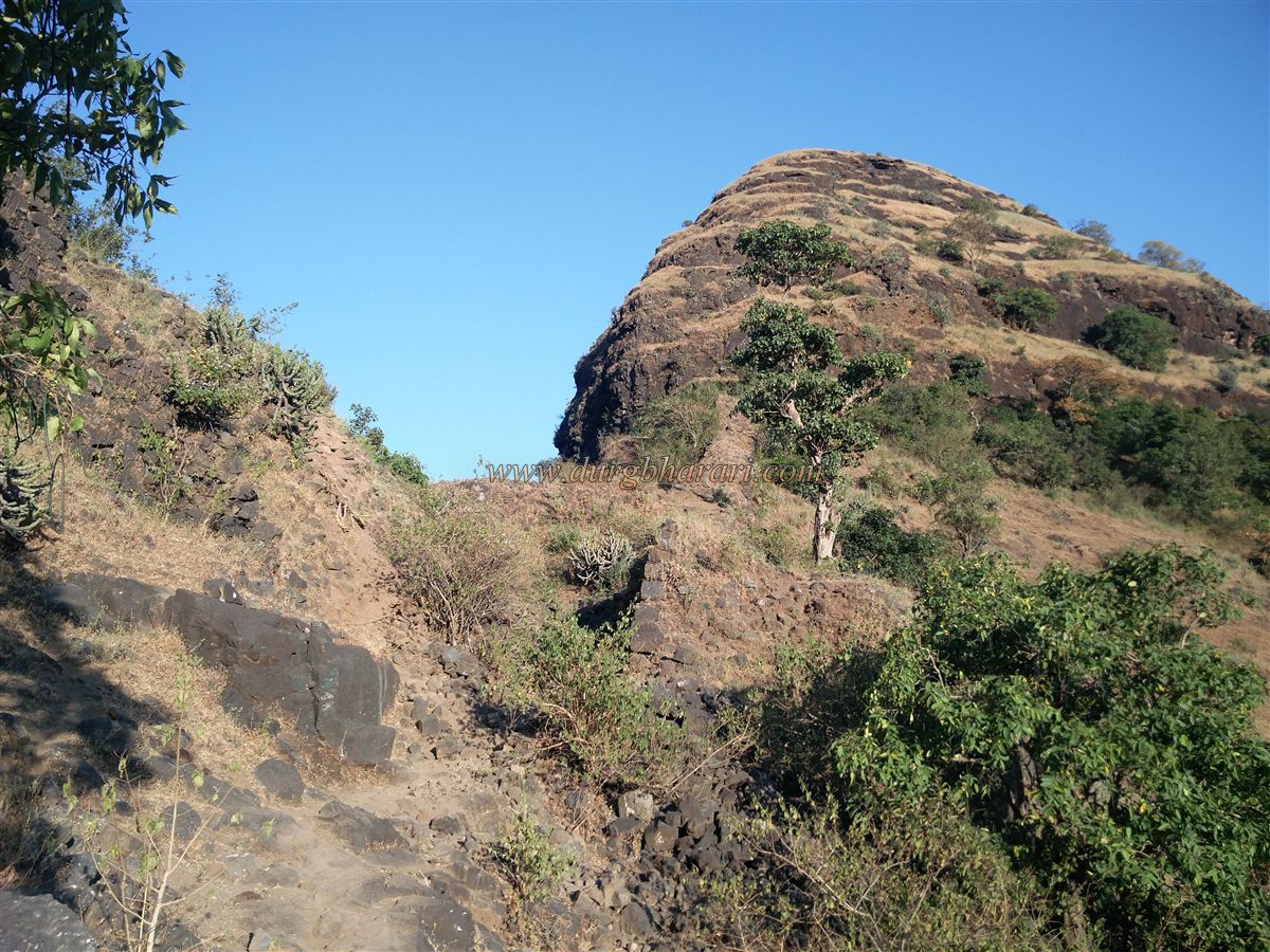
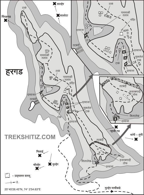
When you go to Mulher village, you see Mulher fort in front, Moragad on the left, and Hargad on the right. On the way to the fort from Mulher village, you can see the old carved mansion in some places in the village. On the way out of the village, you will see a temple on the pinnacle on the left and a large old Mughal-style circular dome on the right. At present, there are four ways to reach the fort, two of which are used by trekkers, while the remaining two paths are used by the locals. From these paths, the locals take their animals to the fort for grazing in the rainy season. The first route leads from Jamod village to Kapar Bhavani to the fort and the second route from Narkol to Gotachi Bari. Both these roads are not used much but only locals use these paths. For the convenience of the trekkers going to the fort, both these paths go to the fort through the Machi of Mulher. One of these paths is difficult but takes less time while the other path is easy, but you have to walk a little longer. This paved path leading to Mulher fort takes us to the Ganesh Temple at Mulher Machi by crossing the three gates of Machi. After passing the Ganesh Temple, one can see a path leading to the gorge between Mulher and Hargad on the right. This way we reach the gorge by crossing the two ruined gates of Mulhergad on Machi. This gorge is called Dakindara. The path from Mulher's citadel also descends to this place. This part of the gorge is fortified up to the hill trunk with two gates in the direction of both the forts so that it is not easy to get to and from both the forts of Mulher and Hargad. Currently, most of the ramparts have collapsed and only the bastions near the gates remain. A trunk of a mountain with Hargad fort descends into this gorge. It takes one hour to reach here from the base of the fort. From here, there are two ways to reach the fort. One way takes you to the fort in one hour from the hill in front of the fort, while the other way leads from the gorge towards Hargad on the left. The first path is a bit slippery and the steps are broken in some places but if you are ready to do a little adventure, there is no problem to go this way. If you go this way and descend the other way, you will see the entire fort in less time and fewer efforts. However, it is advisable to avoid this path while descending. It takes half an hour to reach the valley and an hour and a half to reach the fort from the valley. The ramparts and three gates of this road have collapsed on a large scale. Apart from gotyachi bari coming from Narkol village, another road comes to the valley. After crossing a small ridge on the trunk, we reach the plateau below the fort by steps carved into the rock. At this place, you can see the remains of an outpost under the fort. The road from Jamod via Kaparbhavani also comes on this plateau. Crossing the ascent of the plateau, we head towards the hill in front of us. There are some steps carved in this place and by climbing these steps you come to the fort. There is a beautiful east-facing gate leading to the fort here, although it is not visible until you reach in front of it. The ramparts built near the gates have been severely damaged. There are some stones placed under the quadrangle structure to go to this gate which is on a tall structure and you can enter the fort by this door. The gate of the fort is decorated with carvings. In the guard's porch near the door, we see a worn-out inscription. As you enter through the gate, start your fort round from the left side and you can see the huge bastion of the fort in the direction of Mulher. From this bastion, the entire path leading to the fort can be seen on the way to the trunk. This area on the north side of Hargad is in front of Mulher fort and is surrounded by a large number of ramparts. On the way to the top of the fort, you can see two cisterns carved in the rock. One of the cisterns has mossy water and the water in it is drinkable by setting aside the moss while the other cistern is extinguished with soil. As you approach the cistern, you see the ramparts above the door. The height of the fort is 4180 feet above sea level and the area of the fort is spread over 110 acres in the northwest. On the surface of this northern part of the fort, there is a huge cannon of 14 feet in length which is the main attraction of Hargad. This cannon is a replica of the Kalalbangadi cannon at Janjira fort and is known as Hazarbagdi. The range of this cannon includes Mulher’s citadel and not only Mulher’s Machi but also the part up to Mulherwadi. The top of Hargad is a wide plateau and the northern part of the fort is fortified on both sides to separate it from the plateau. I think this part should be for the royal family people or the soldiers. Adjacent to these ramparts is the remains of a mansion. Going north, you can see the quadrangle structure of many ruined structures and the remains of an outpost at the end of the fort. After going straight along the path, we reach the ruined Shiv temple. There is an idol of Lord Hanuman on the temple premises and at the base of this idol are two broken Nandi and nine cannonballs. Remains of a large settlement are scattered in the vicinity of the temple. On the left side of the road, you can see two big dams built on a hill slope. From this end of the fort, the mulher-mora fort is seen in the distance. On the way back from here, on the right side, there are water cisterns carved in the rock and the water in them is drinkable. From here, walking down the slope, you come to the wall of the second dam seen from above. In the lower part of the embankment wall, one can see a cistern carved in the rock. As you cross the embankment, you will see three large and one small structure on the left side of the hill. According to some, it is a granary, while according to others, it is a mint on the fort. In two of these circular structures, you can see the stone used by the goldsmiths to shape various ornaments. At present, however, the cattle of the villagers are kept in this building. Next to the mint is the remains of an object, and behind it are two water cisterns carved into the rock filled with green water. The first thing we see on the slope as well as on the way down is the dam. The embankment wall is sixty to seventy feet long and is built on the slope in two stages. The storage capacity of the dam has been increased by digging a hole, but at present, it does not hold water. Considering the large water reserves and the remnants of the structures on the fort, it seems that there should be a large number of people living on the fort. There are two gates to reach the fort in the gorge on the lower side of the embankment and ramparts have been built on this south bank of the fort. Below here a door appears to be built. You can go down to the door with a little care through the stones of the collapsed wall. The gate is built on an area connected to a hill on the south side. There is a hero stone lying in front of the door on which a warrior with a sword in his hand is carved. From Narkol village, the path leading to the fort from Gotachi Bari comes up through this gate. The path at the bottom of the second door is paved and is used only by locals. After seeing this gate, we climb the hummock next to the embankment and come to the area in front of the trunk of Mulher fort. Remains of a large number of houses can be seen in this area. After looking at these remains, come back to the Shiv temple we saw earlier. From Hargad, Mulhermachi, Moragad, Mulhergad, Nhavigad, Mangitungi, and Salher-Salota forts and surrounding areas can be seen. It takes two and a half hours to see the entire fort. We should descend the fort from the valley in front of the temple as described in the beginning. At the beginning of the road, there are dry cisterns on the left side. There are three doors on the path of the valley, which descends 300 feet at an angle of about 60 degrees. All these gates have collapsed and there are traces of the gates and in some places there are bastions. After crossing this door and reaching Dakinkhindi by foot, your journey is complete. Since the history of Hargad is related to the Mulher fort, the history of this fort is not very different. In the Mahabharata, Mulher is referred to as Ratnapur. The town was named Mayurpur after the Mayur king who lived here at that time and later the name Mulher came into existence. Mulher is the capital of Baglan and the forts Mora-Hargad were built by the Bagul kings. At that time, Mulher's market was prosperous. The trade route from Surat to the south used to pass through here. While Mulher was in the possession of the Sultan of Gujarat, it is recorded that he minted Mahmudi's rupee in the mint located here. Apart from this, Mulherwadi was famous for its making of the base of the sword. Before Mulher came under the control of the Mughals, during the reign of King Bahiramshah, he doubted that Amatya Kashi Raja got with Aurangzeb. So Amatya Kashi Raja left politics and came to Hargad to worship Ganesha. In the seventeenth century, Tahir, the first Mughal fort keeper of Mulher, named the city of Tahrabad after him. King Bahirji ruled when the Mughal chief Muhammad Tahir invaded Baglan. Seeing that he would be defeated in the war, he made a treaty with Aurangzeb and the wealthy Baglan fell into the hands of the Mughals. After the capture of Baglan by the Mughals, Hargad along with Mulher also came under their control. In 1672, Moropant Pingale along with Mulher annexed Hargad to the Swarajya. At the beginning of the nineteenth century, Hargad fort, like other forts, came under the control of the British.
© Suresh Nimbalkar
GALLERY