GHARAPURI
TYPE : SEA FORT
DISTRICT : RAIGAD
HEIGHT : 400 FEET
GRADE : MEDIUM
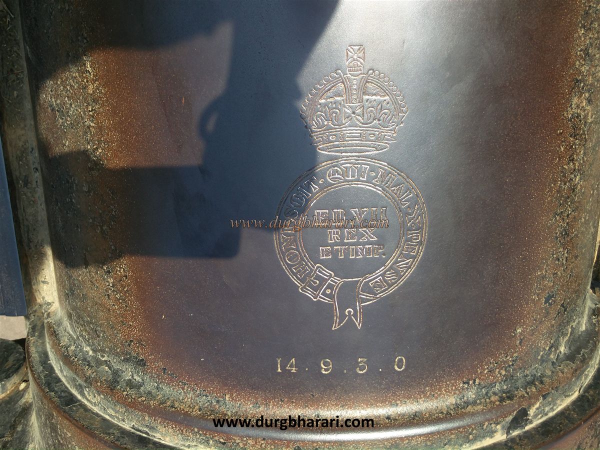
Shaivamurti of Gharapuri, the symbol of Maharashtra Tourism Development Corporation, and Gharapuri Island is world-famous for its caves. Very few people know that there is a fort on this island which is now known as Elephanta and is only 10 km from Mumbai. According to some historians, it was a fort during the Shilahar period. It is mentioned that Sambhaji Raja also made some repairs here in the year 1682. Although the fort and the cannon on it date back to the British period, the history of the island suggests that there may have been a fort here in the past but unfortunately very few remains of the fort can be seen here today. Boats are available from Gateway of India from 9.00 am to 3.00 pm to reach Gharapuri. The boat ride takes about an hour. Gharapuri Island has two hills spread from east to west, the eastern hill is about 270 feet high and the western hill is about 500 feet high.
...
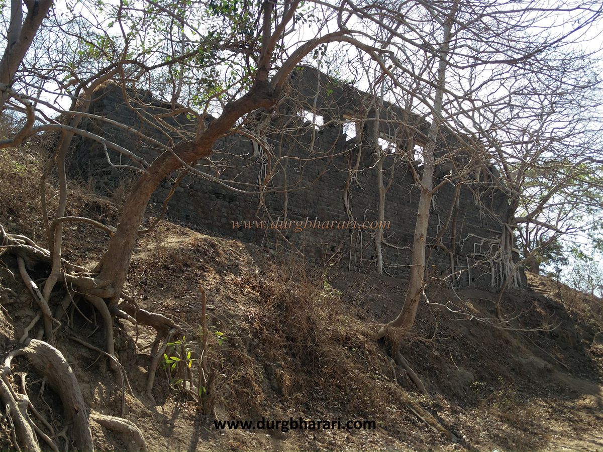
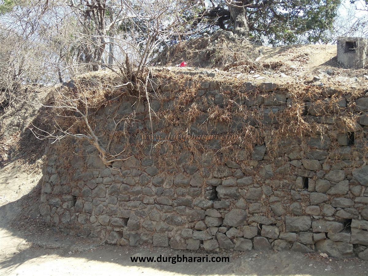
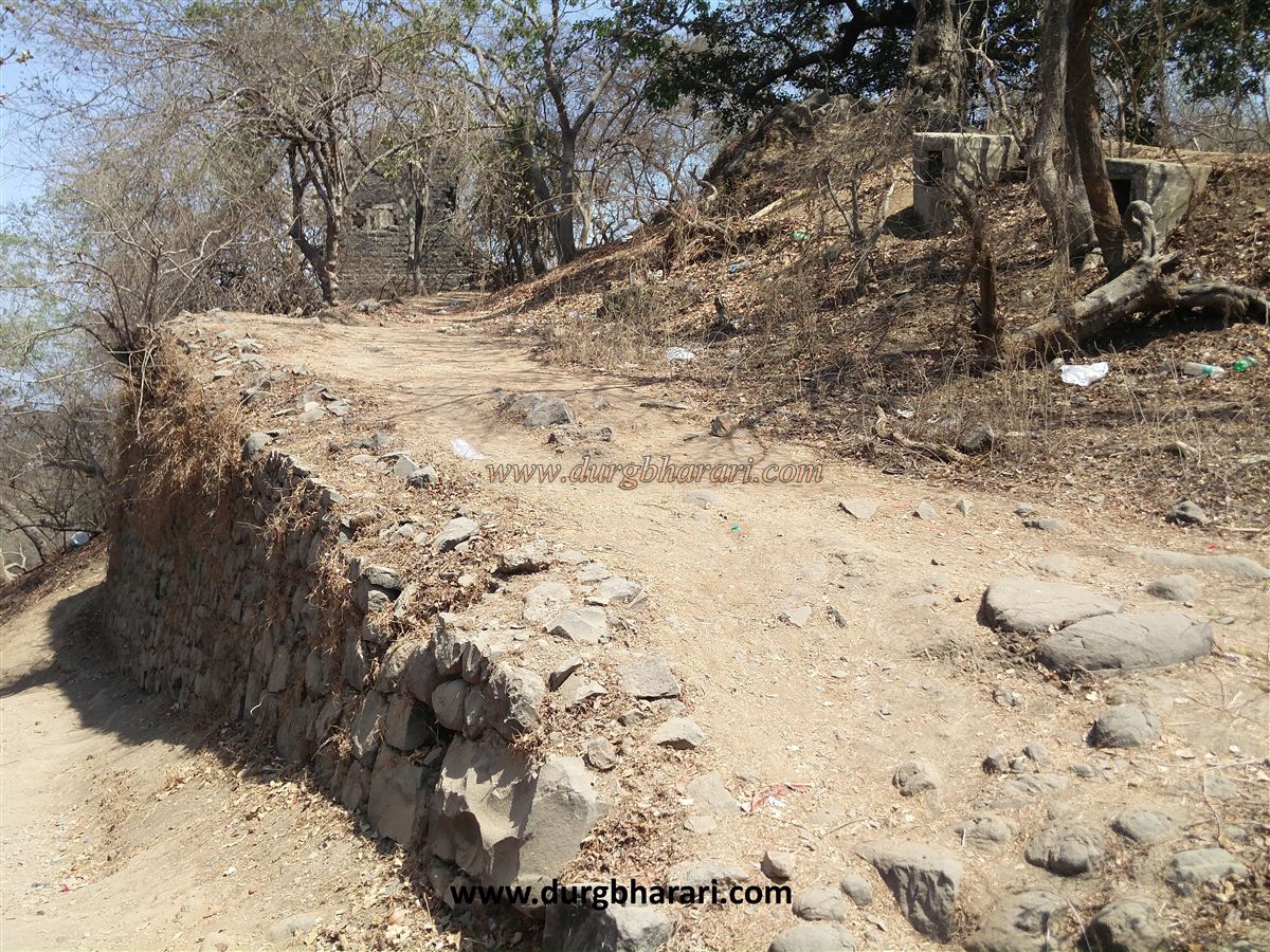
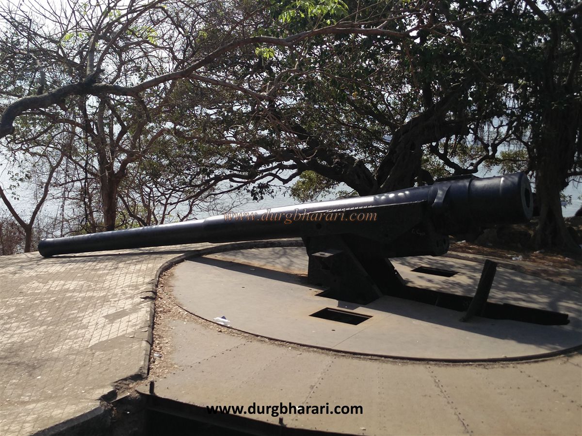
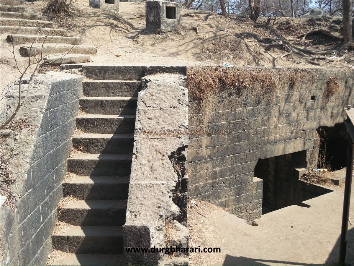
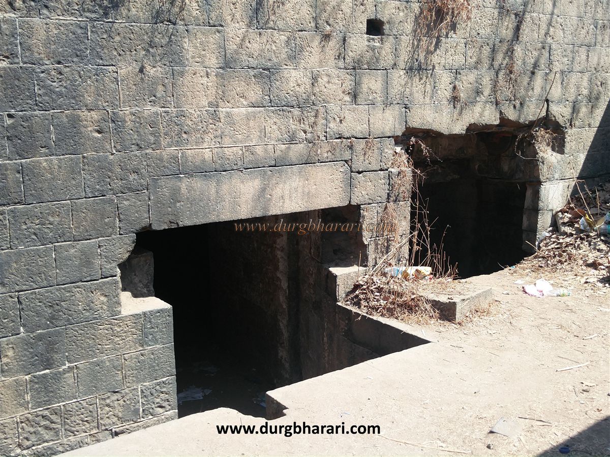
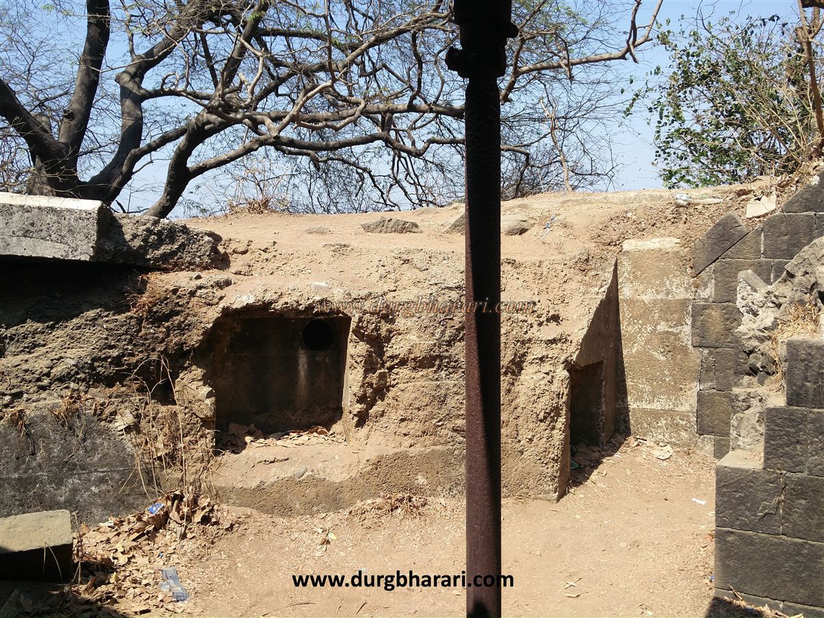
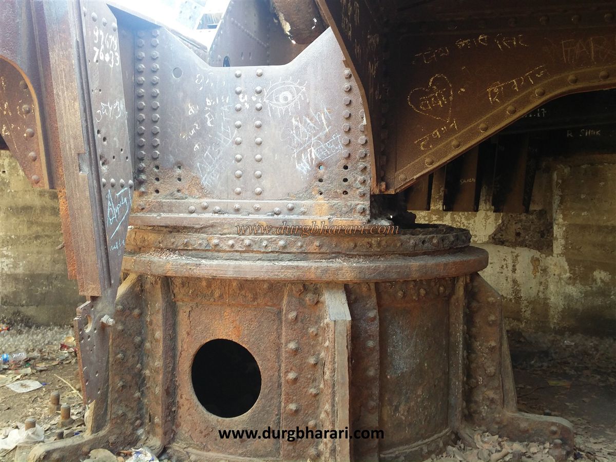
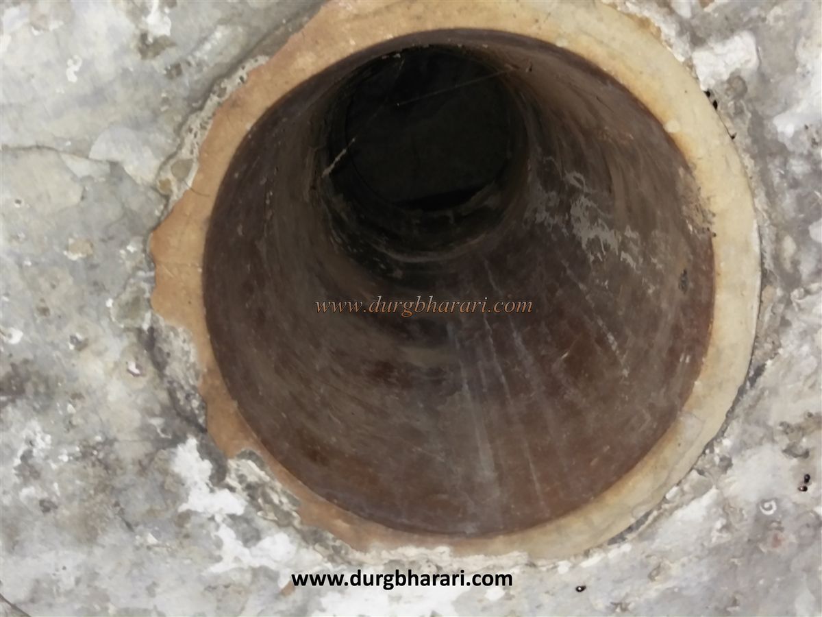
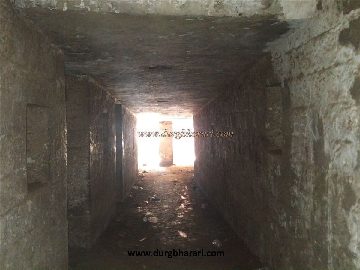
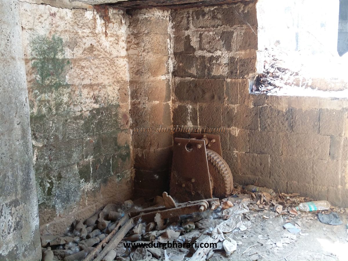
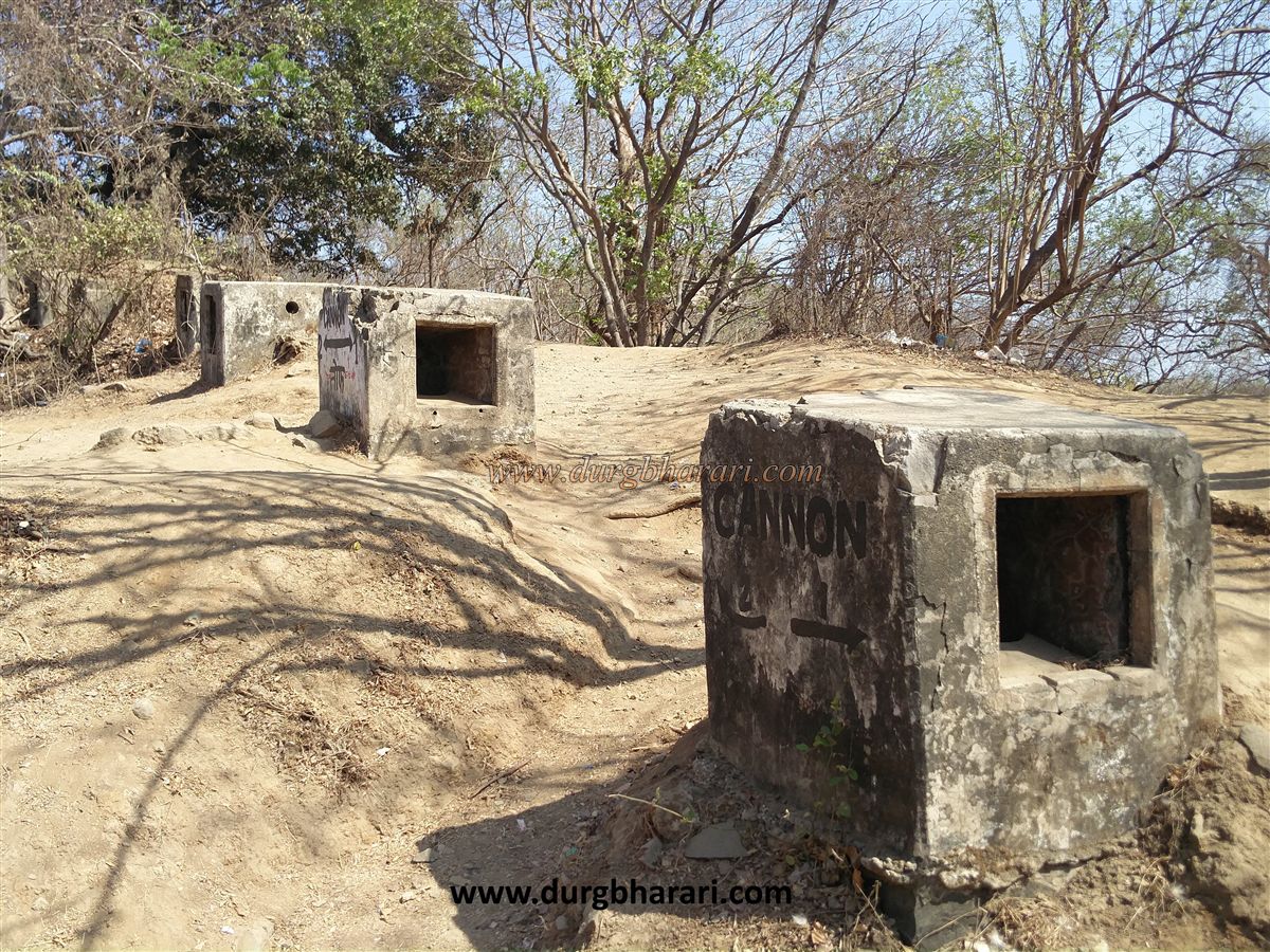
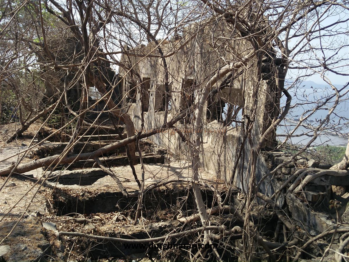
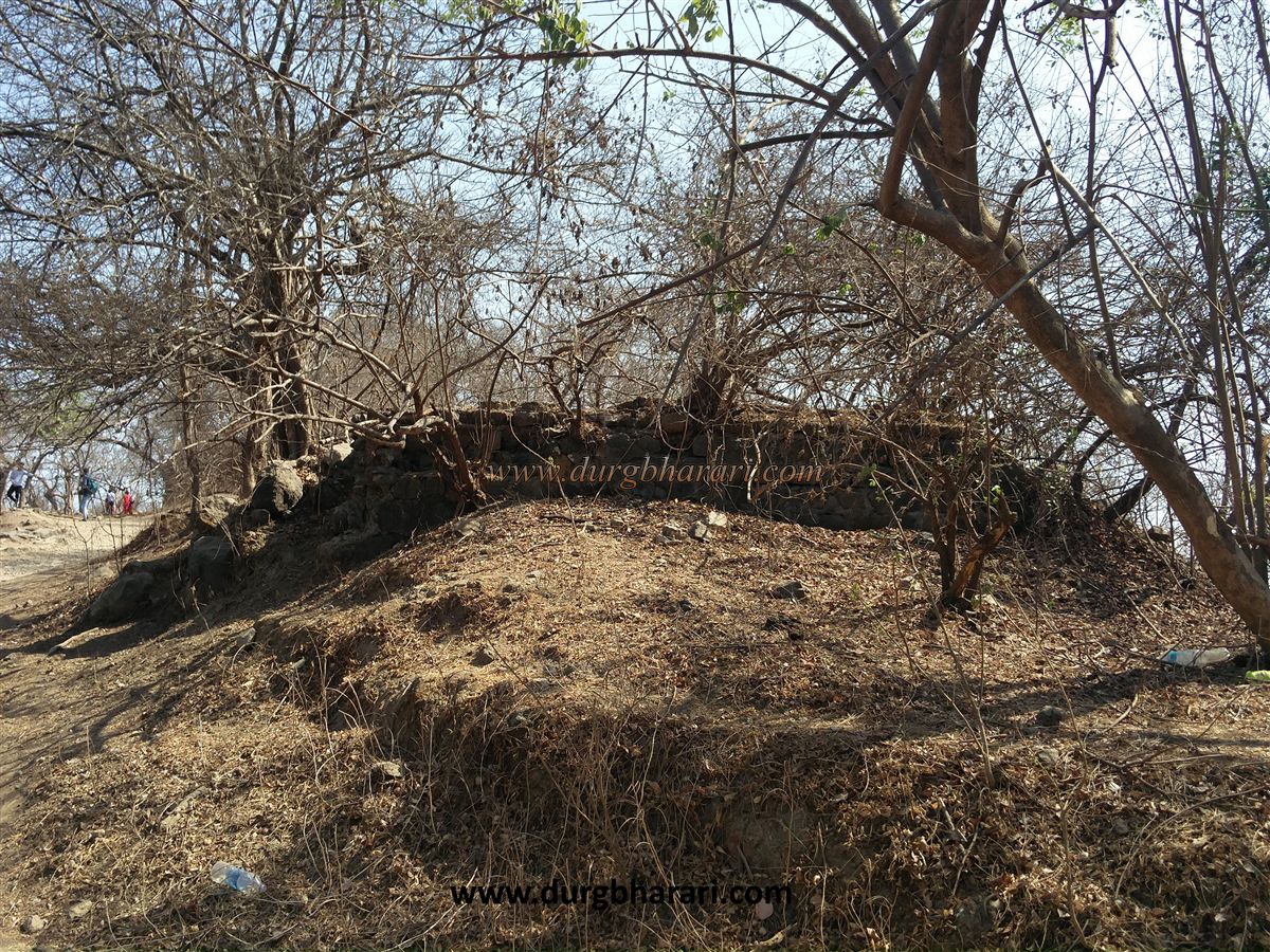
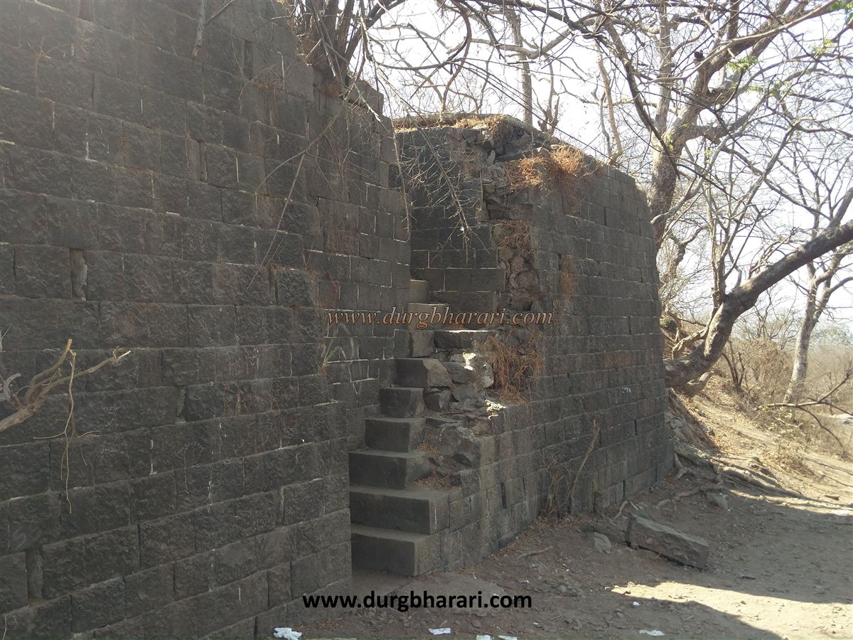
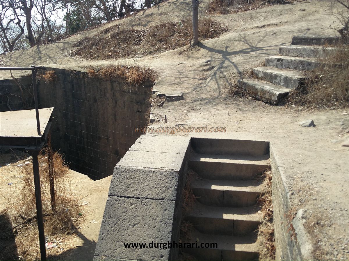
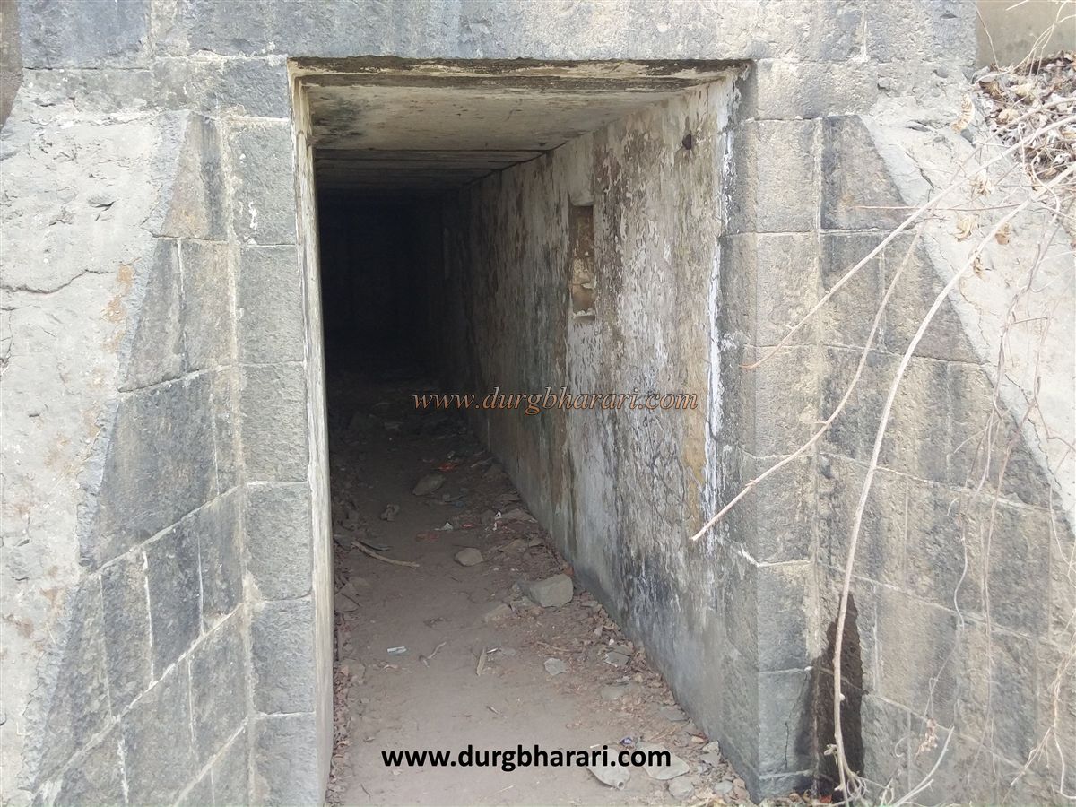
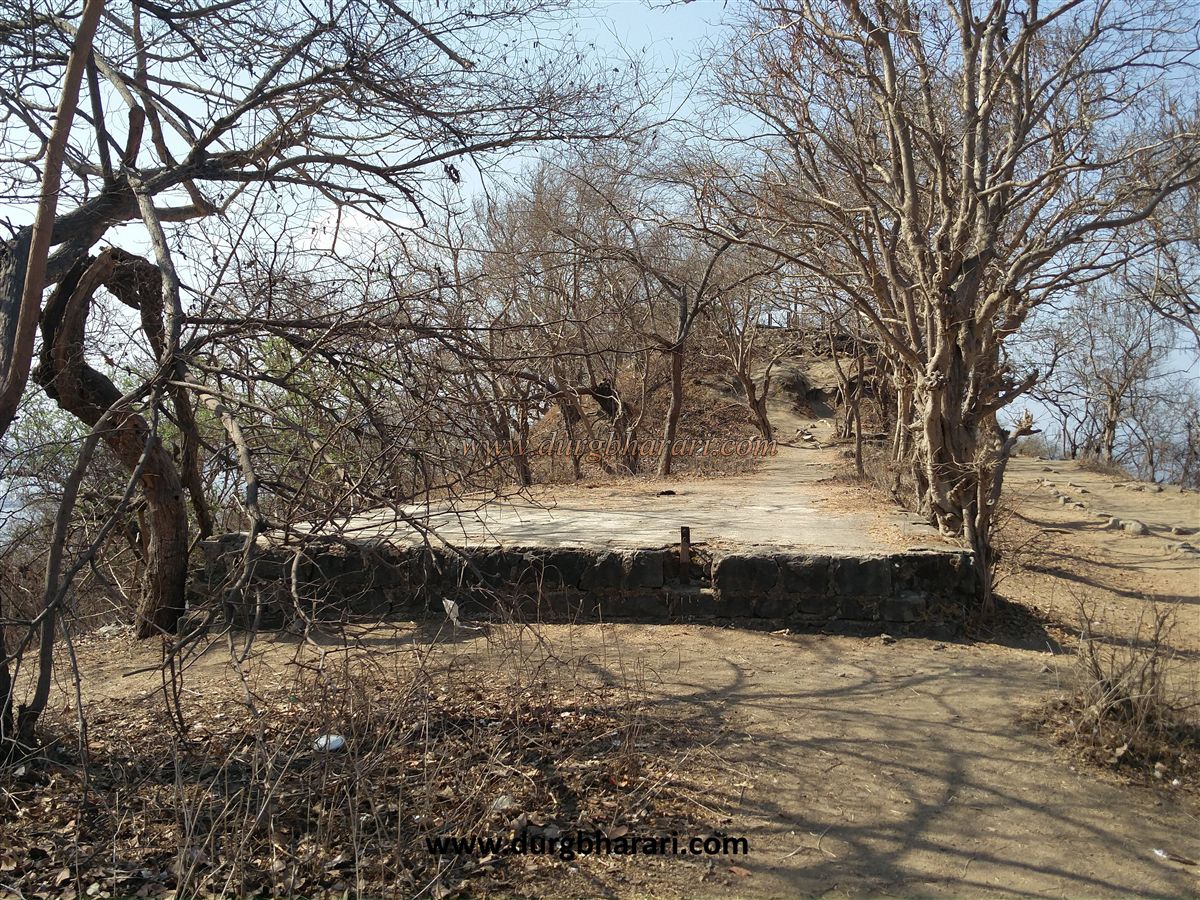
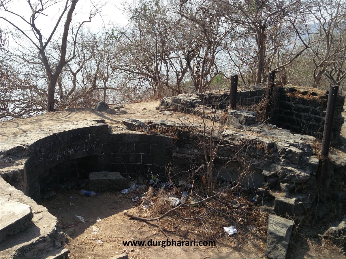
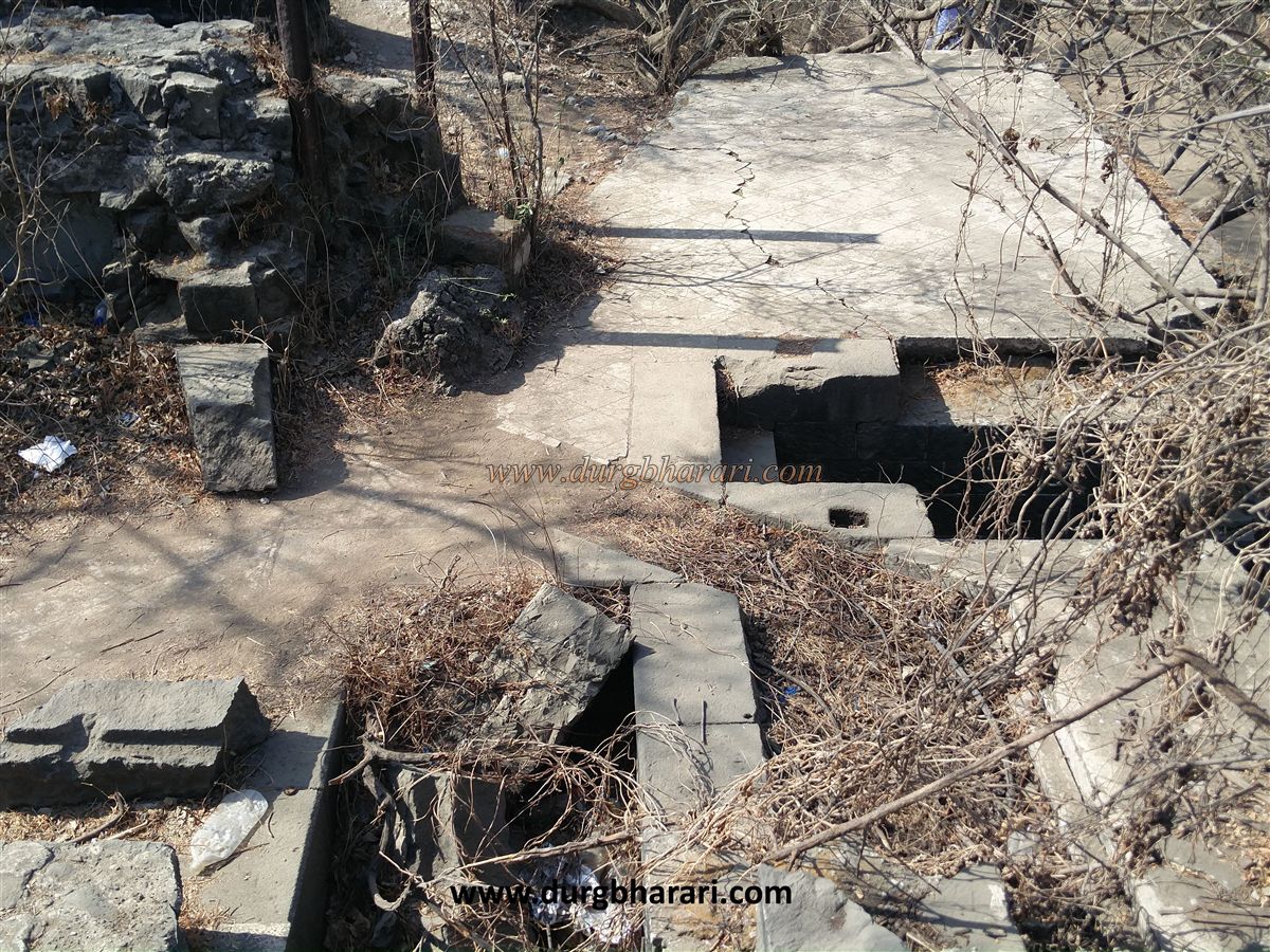
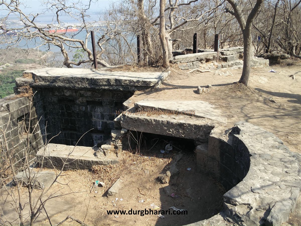
There are caves on the hill on the left and the remains of the fort can be seen on the hill on the right side. It takes fifteen minutes to walk from Gharapuri port to the caves. At the end of these steps, the path splits into two. The path on the left leads to the caves and the path on the right to the fort. After a 10 minute climb on the right-hand side, the remains of the fort begin to appear. The wall of the barn is visible on the hill on the right side of the road. The barracks are built below this path to house the soldiers and to maintain the flow of air in the barracks pipes are constructed from the underground here to the surface above. To prevent rainwater from entering the underground barracks from the pipes, they are constructed in L-shape. There is an underground passage from the cannon to get to this barracks. Going further along this path, you can see a huge 35 feet long cannon. Gears are mounted in the basement to move the gun up and down. The cannon can be rotated in all directions in 360 degrees. Gears have been fitted for that too. These gears can be seen by going down to the basement under the cannon. The barracks have a total of five rooms out of which four are small rooms and one large room. Rooms for ammunition are built on the underside of the cannon. On the way to the second cannon after seeing the first cannon, you can see the remains of three more structures on the way. The wall of the first building can be seen coming down. Next to this, we see only the foundation of one building. The third building is like a bastion and is built of wrought stone. The building has storage space as well as living facilities but it is in a state of disrepair. Seeing all these three structures, we come to the second cannon. The second cannon is also 35 feet long and the design and construction of this cannon are the same as the first one. The barracks of the soldiers here are much deeper than the previous barracks. The barracks have a total of four rooms out of which three rooms are small and one is large. There is only one large window at the top to allow air to enter the barracks. Rooms for ammunition are built on the underside of the cannon. A chain pulley is designed to bring the ammunition up from the depot under the cannon. There are two ways to reach the soldier's barracks. Seeing these two cannons and the basement completes your fort round. Dronagiri fort is to the east of Gharapuri and Khanderi-Underi fort is to the south. It takes about an hour and a half to see the fort. The construction period of Gharapuri caves is estimated to be between 900 and 1300 AD. The caves are carved out of solid rock and may have taken 40 years to complete. Near the entrance of the cave was a huge sculpture of an elephant, hence the name of these caves is Elephanta Caves. This Elephant’s sculpture is currently in Mumbai's Jijamata Garden. In the sixth century, Kirtivarma of the Chalukya dynasty invaded North Konkan and defeated Maurya in 567-59. His second king, Pulakeshi, destroyed the Mauryan kingdom between 611 and 640 and conquered the Konkan region. It is mentioned in the inscription at Aihole (Karnataka) that Pulakeshi Chalukya captured the capital of Maurya Puri of Konkan. Puri was the capital of the Mauryas of Konkan. Puri means Gharapuri. The capital of the Maurya should be the Mor Bandar near Gharapuri. After the Mauryas, Gharapuri was ruled by the Chalukyas of Badami, Shilahar, Rashtrakuta, the Chalukyas of Kalyani, the Yadavs of Devagiri, and the Sultan of Gujarat. After that, the Marathas ruled over Gharapuri. Seeing the proximity of this island to Mumbai, during the British rule, a fort was built on Gharapuri Island for the protection of Mumbai. At the top of the hill at the same time, we see two magnificent Portuguese-made cannons.
© Suresh Nimbalkar
GALLERY