GAMBHIRGAD
TYPE : HILL FORT
DISTRICT : PAALGHAR
HEIGHT : 2182 FEET
GRADE : MEDIUM
Due to Mumbai, the Konkan province is divided into two parts, namely North Konkan and South Konkan. The Vasai to Daman belt is known as North Konkan and the Alibag to Karwar belt is known as South Konkan. Despite being so close to Mumbai and beautiful in terms of natural beauty, South Konkan and its surrounding area have not developed much for tourism. Gambhirgad fort is situated in Dahanu taluka on the border of East Thane (now Palghar) district and Dadra Nagar Haveli in North Konkan. This fort trek can be easily done in one day by own vehicle from Mumbai. It is better to use a private vehicle as S.T bus service is not regular in this tribal area. To visit Gambhirgad, one has to reach Boisar or Dahanu station by Western Railway train.
...
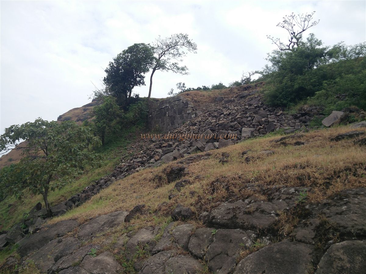
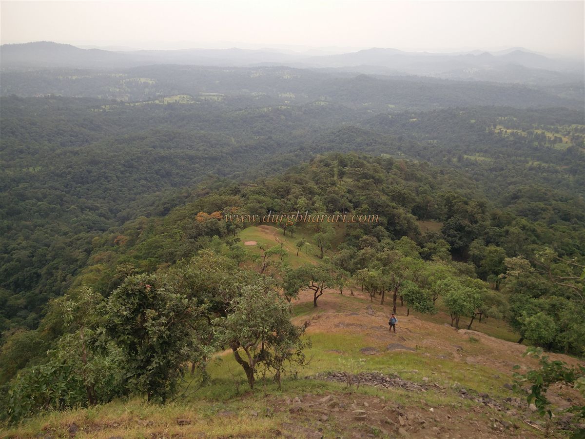
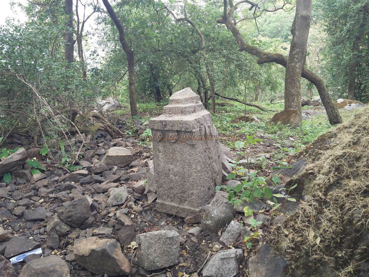
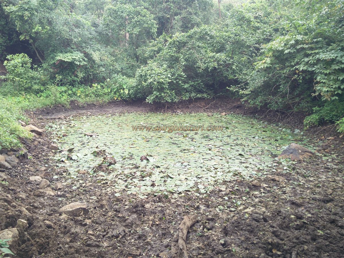
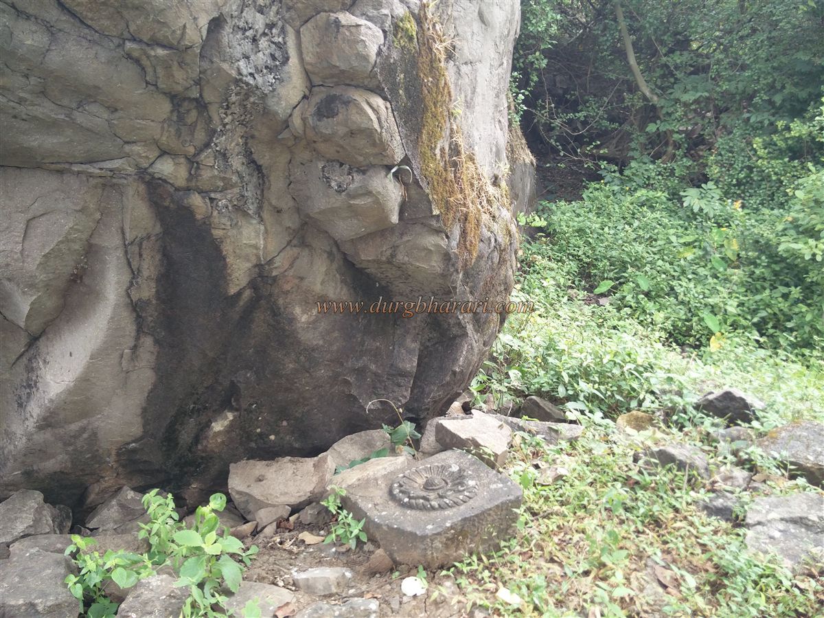
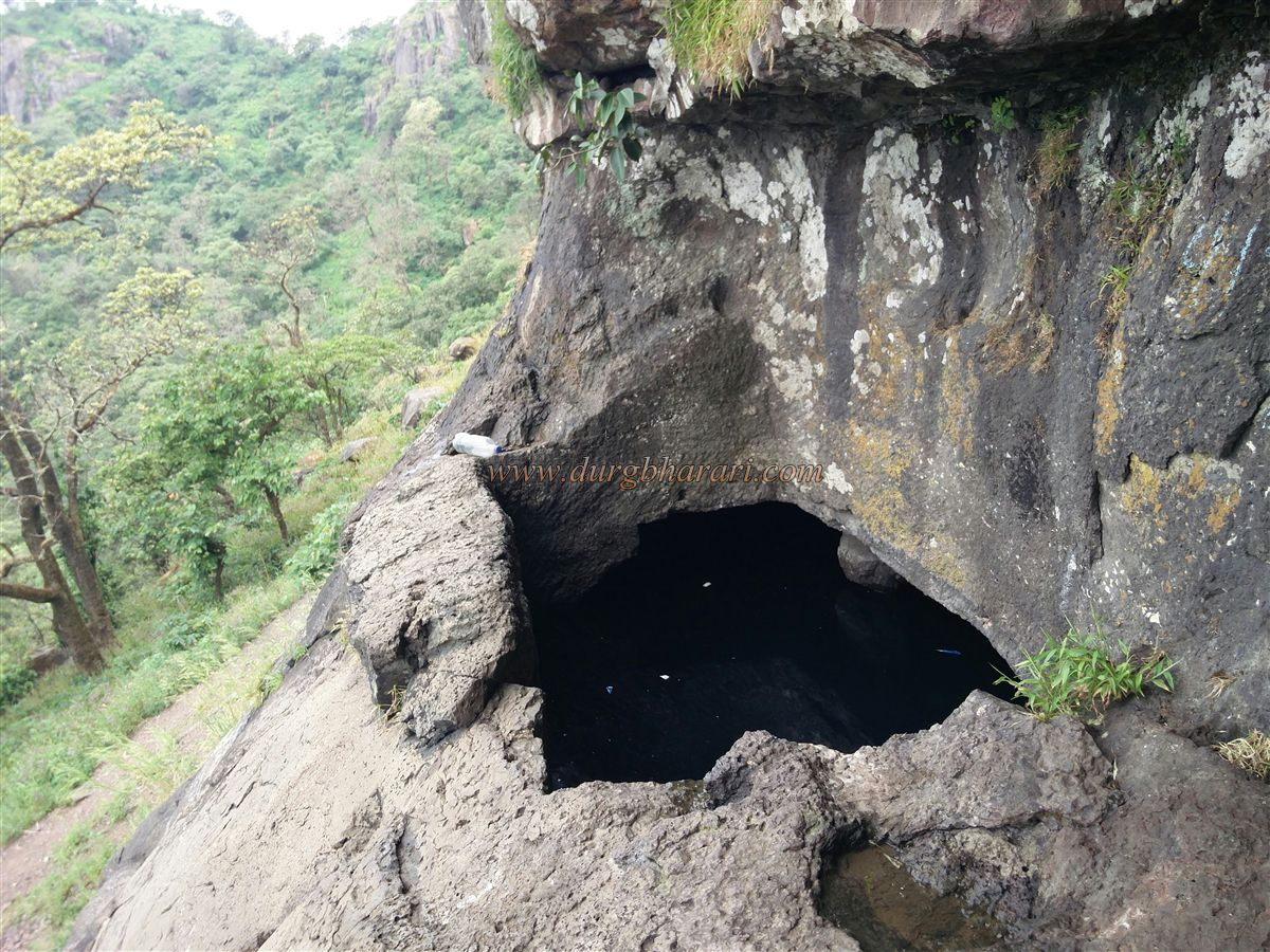
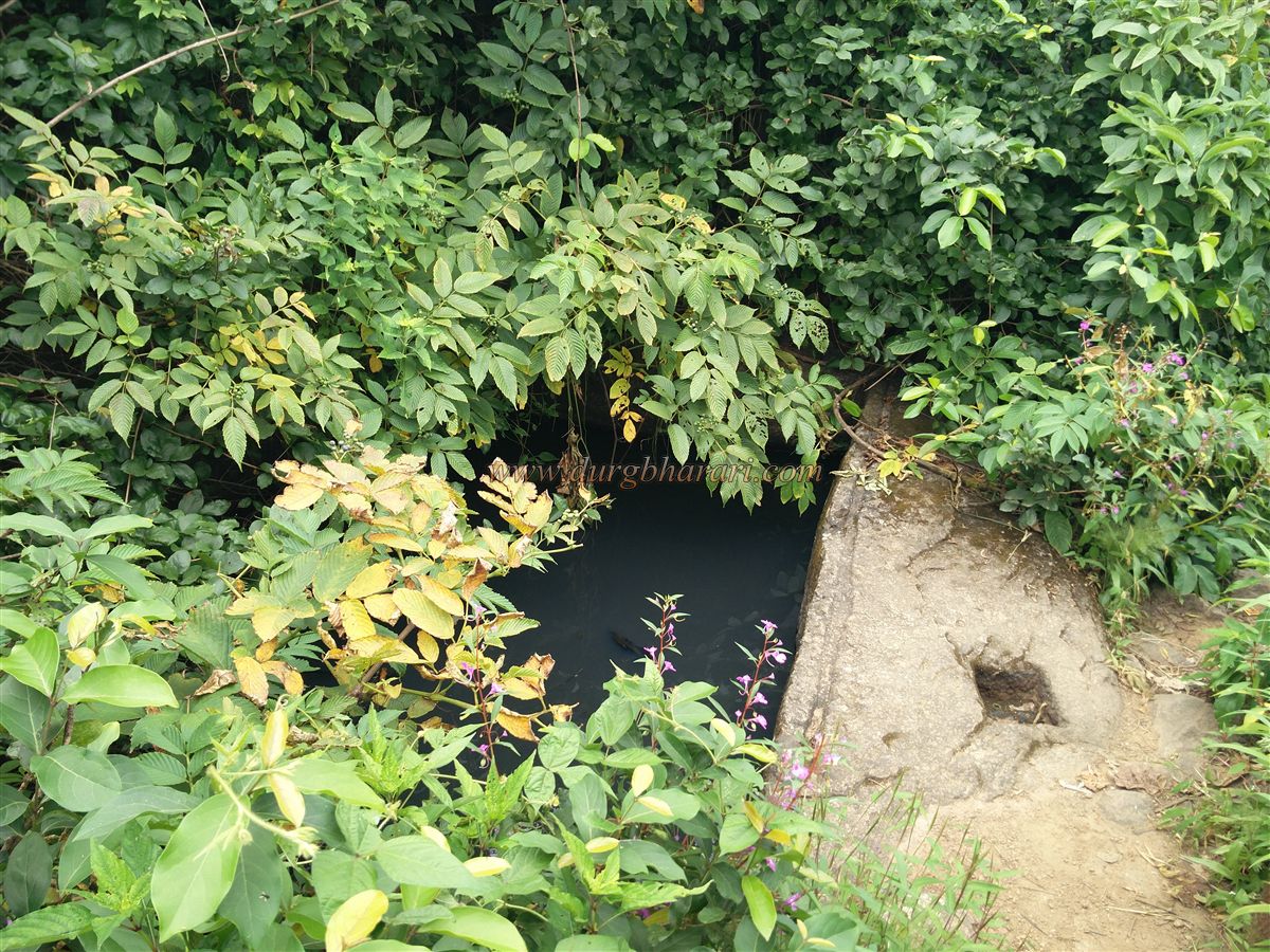
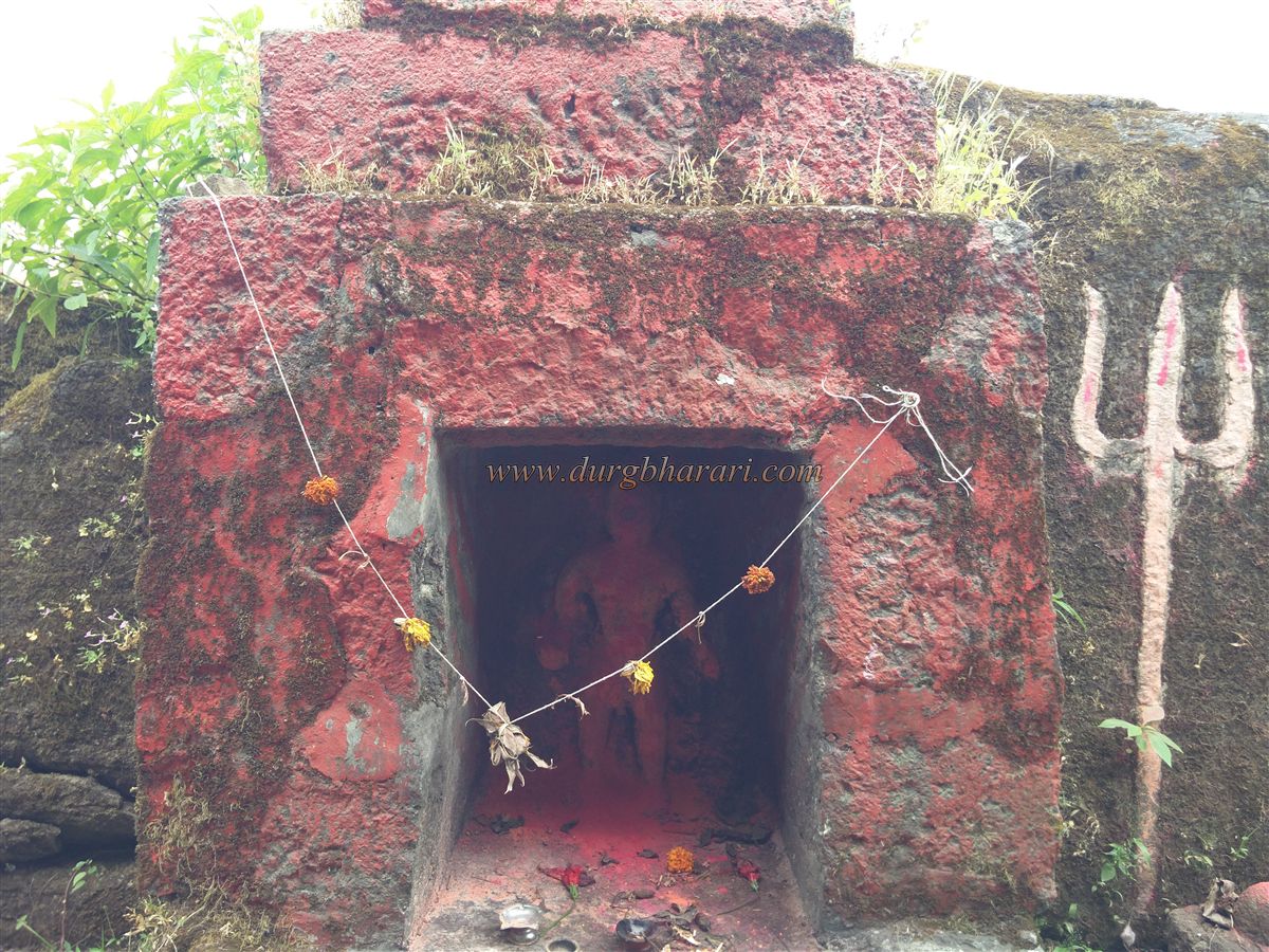
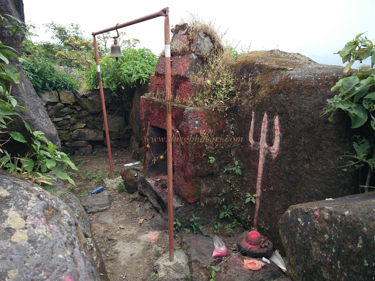
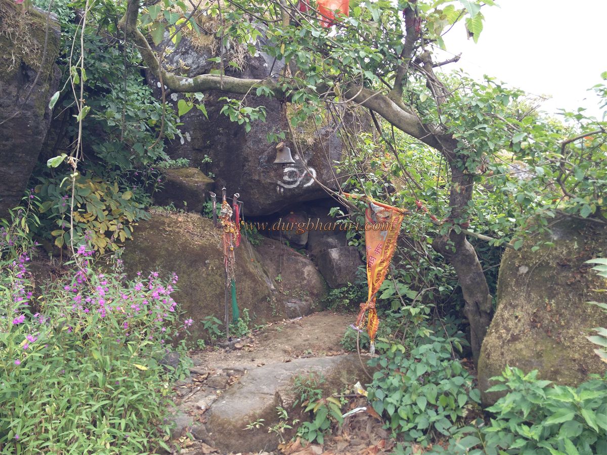
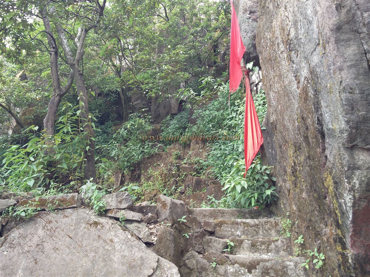
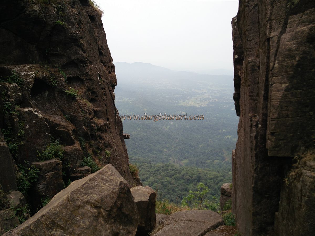
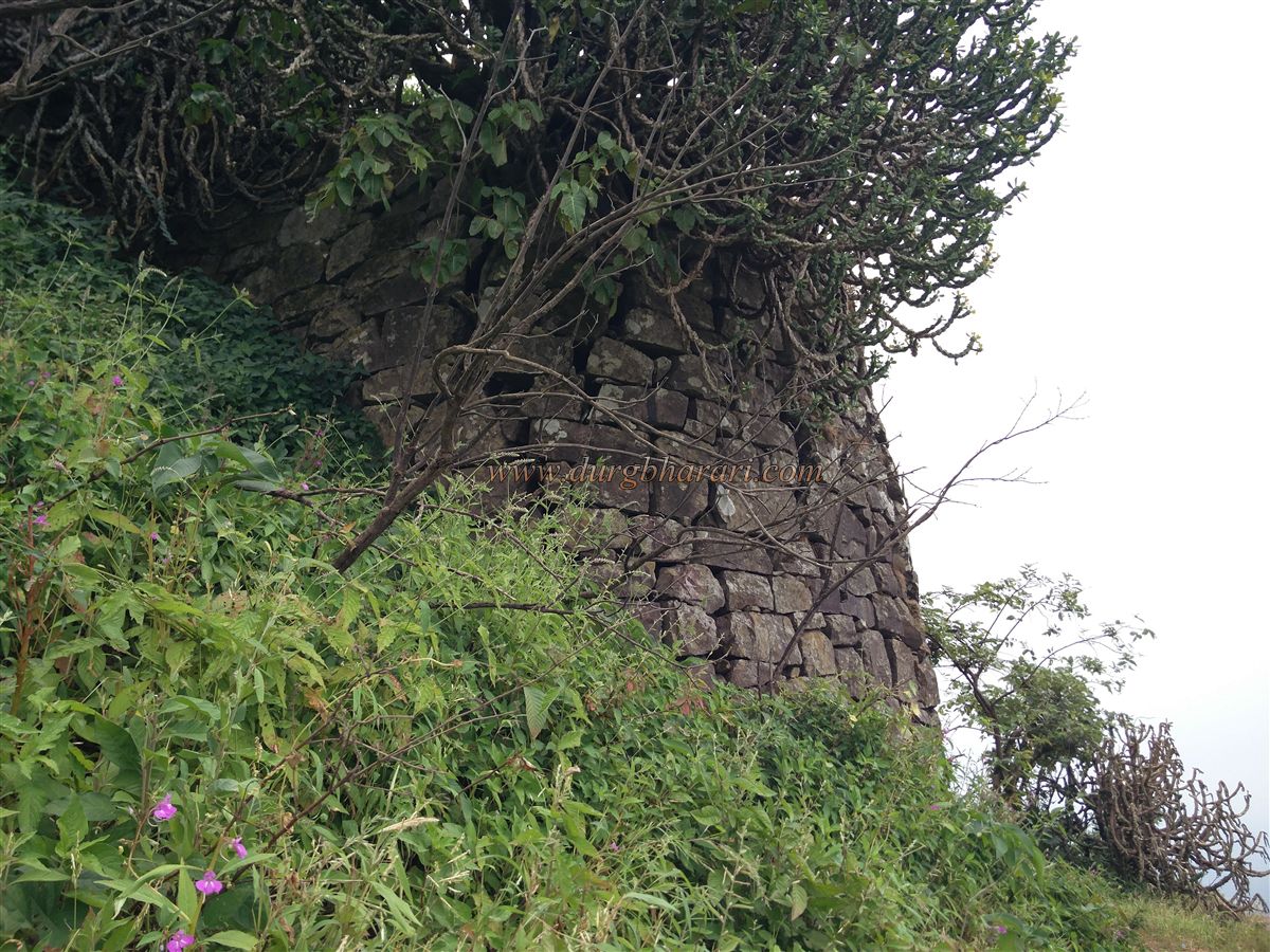
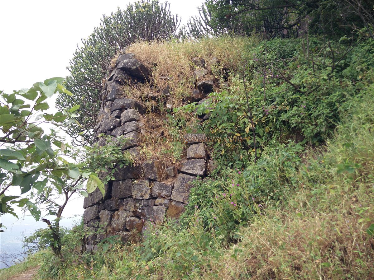
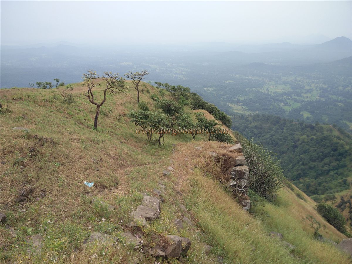
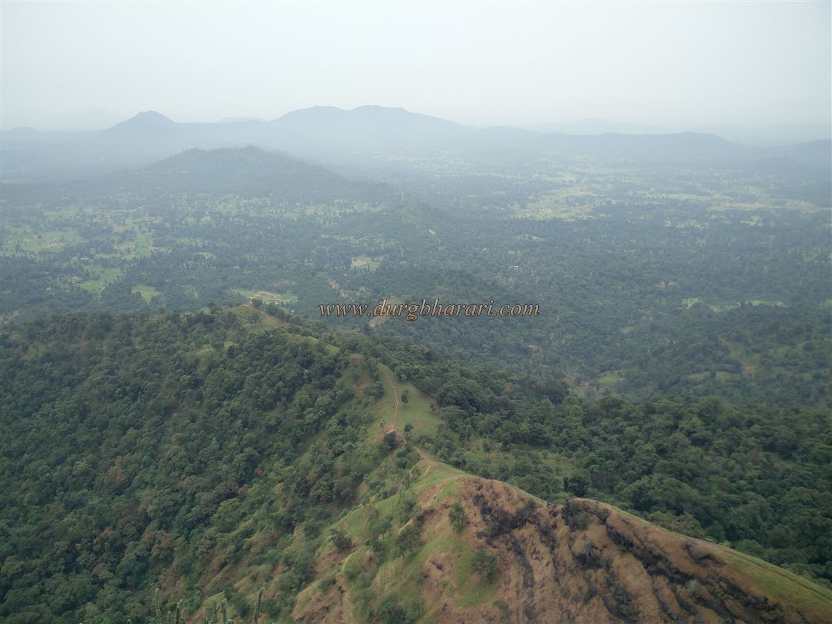
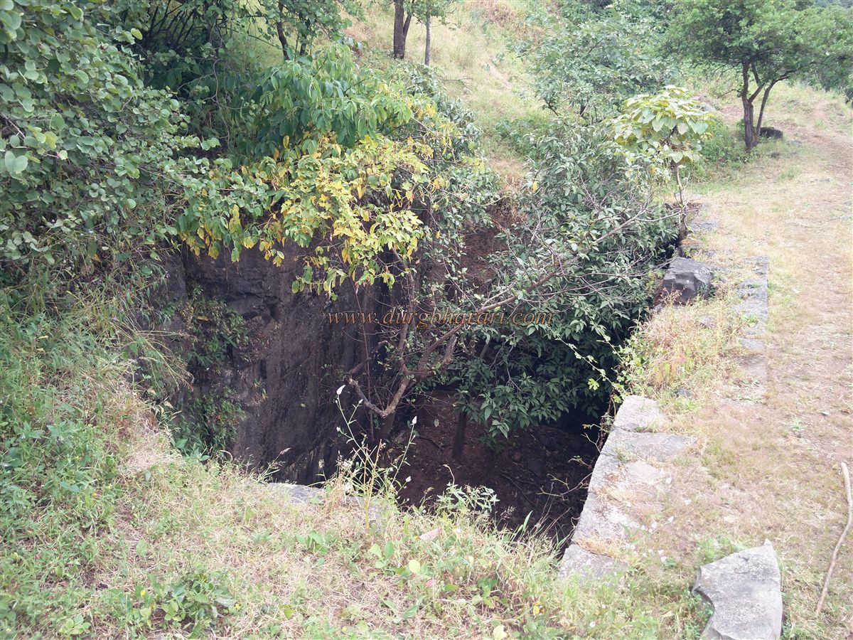
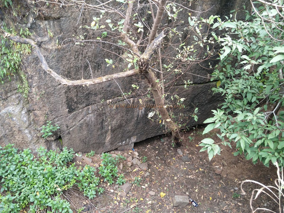
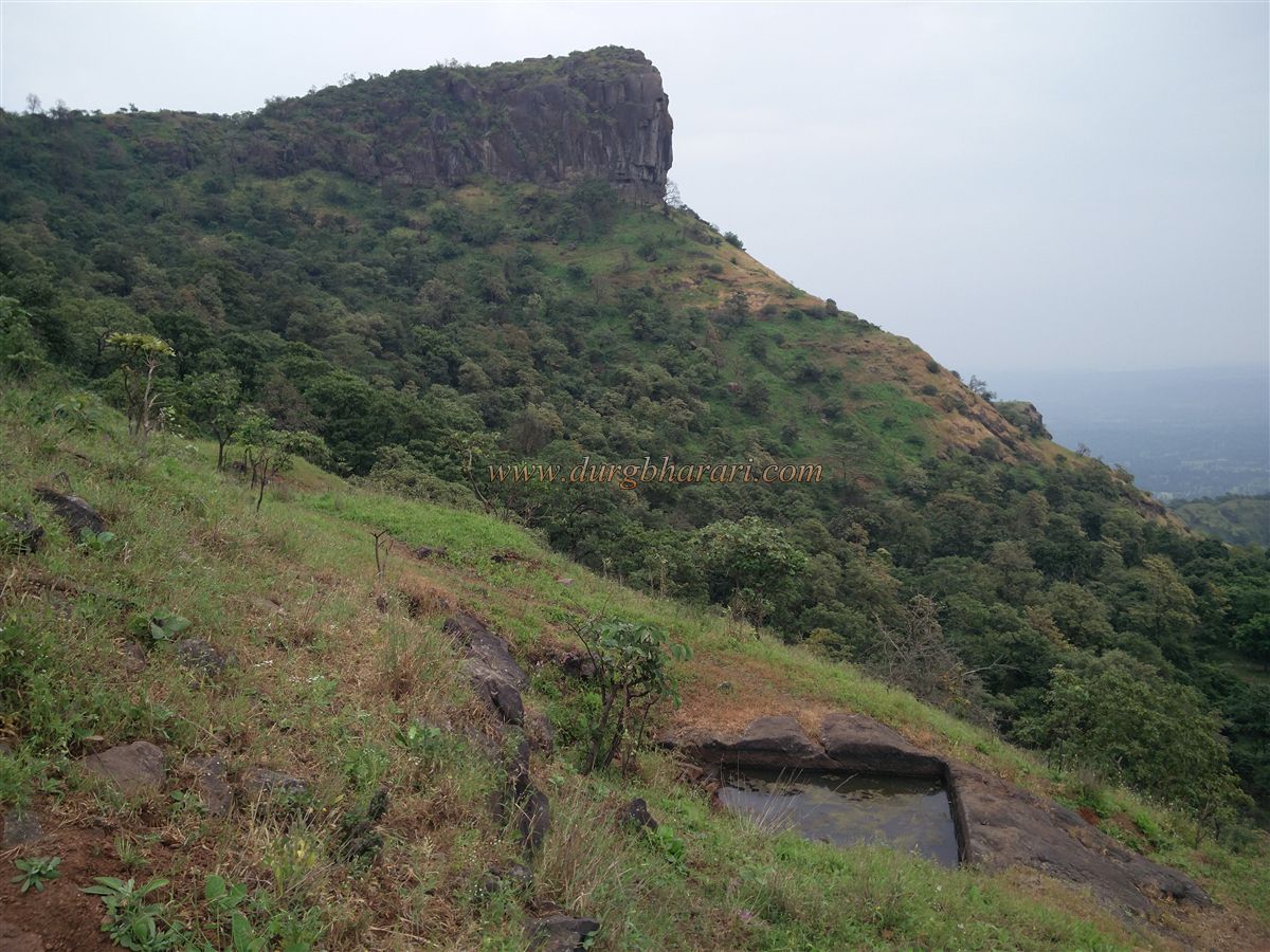
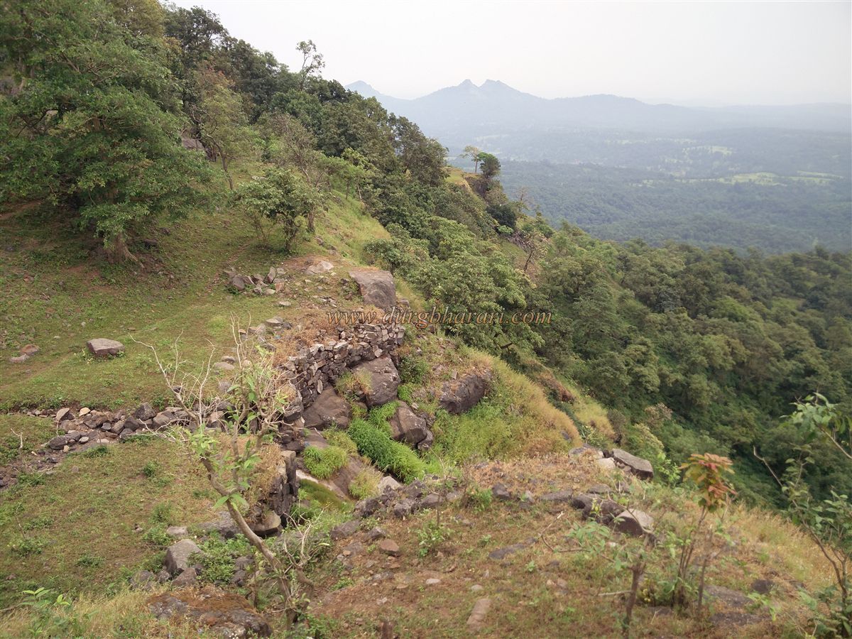
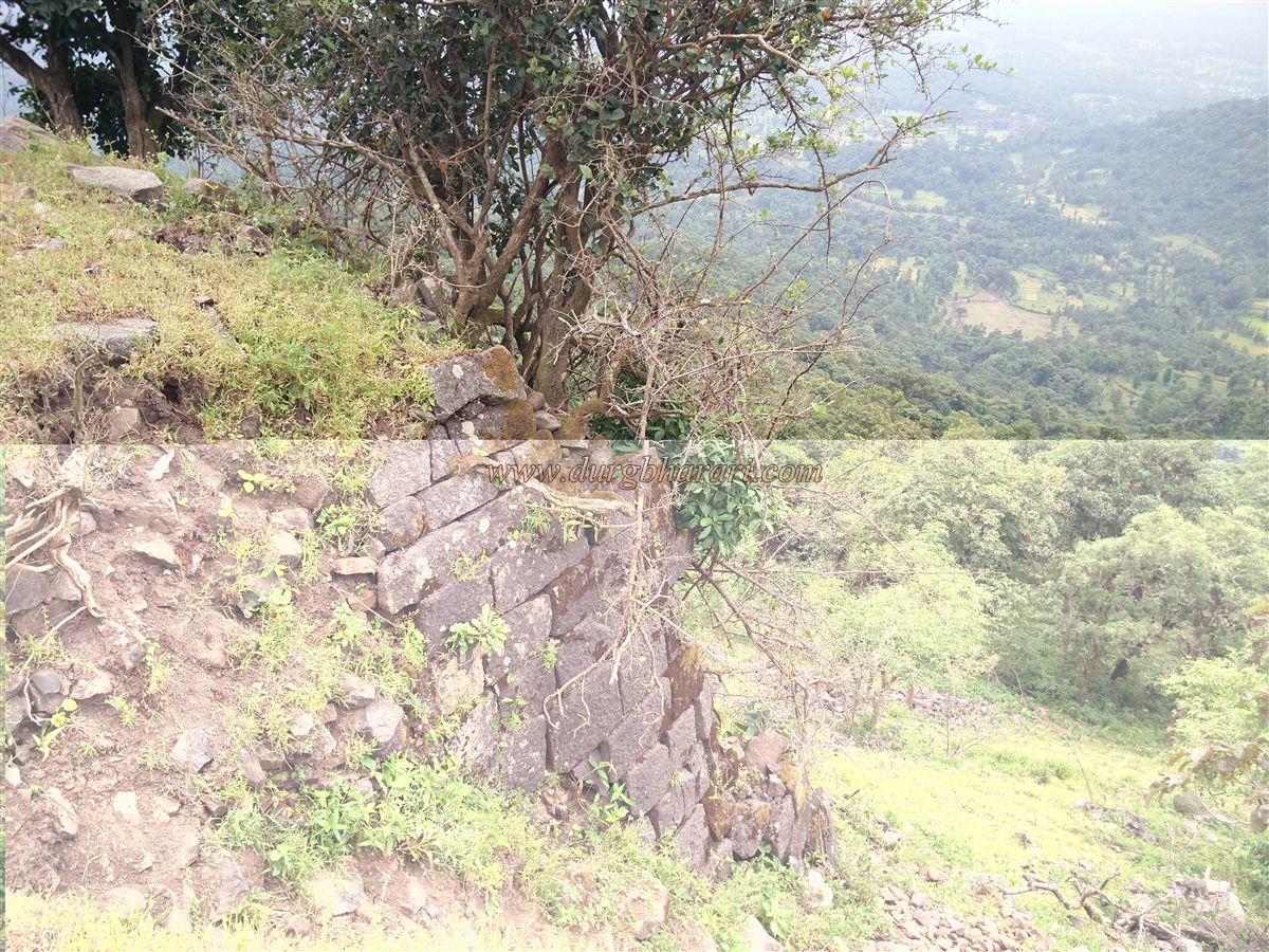
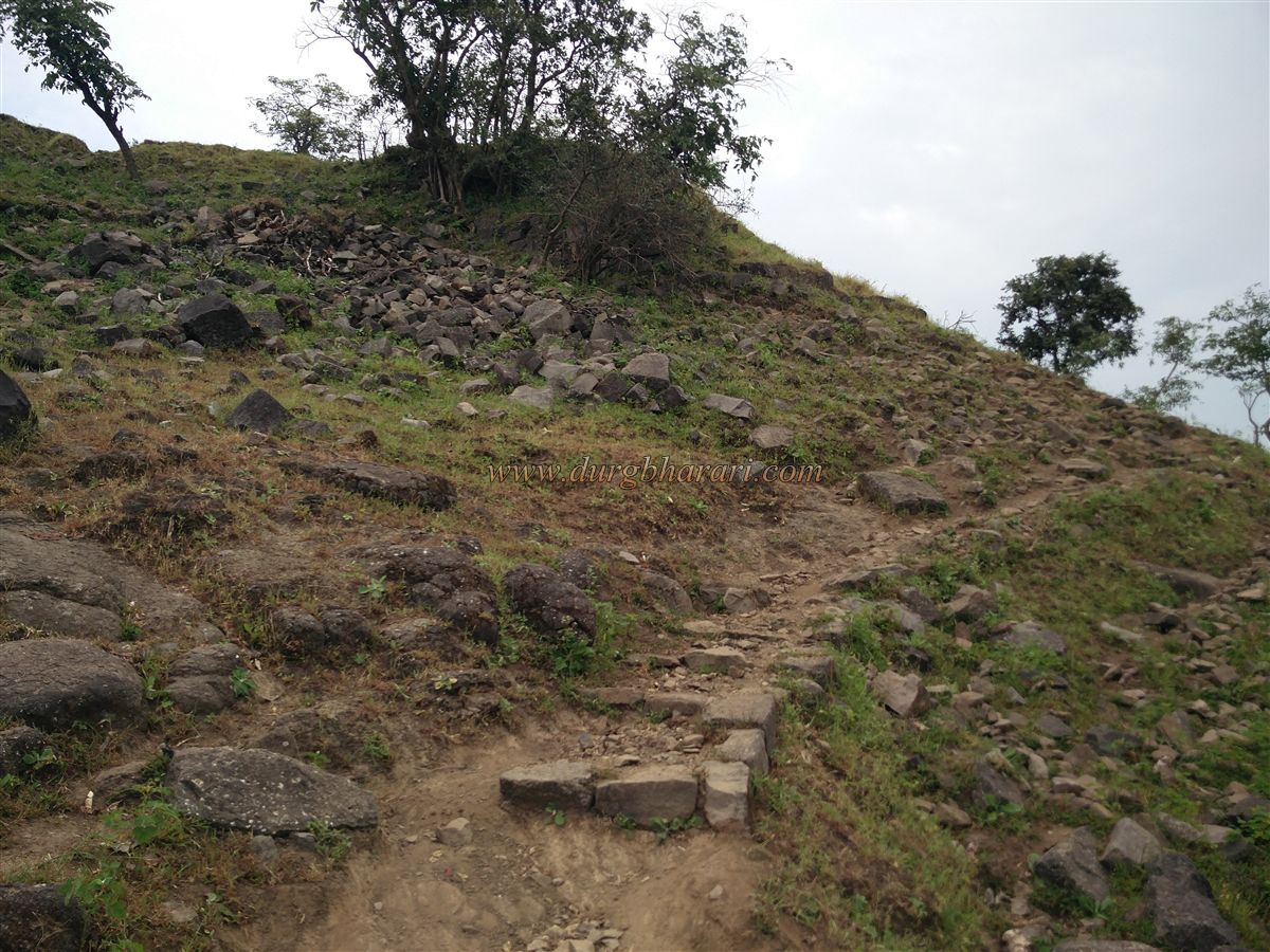
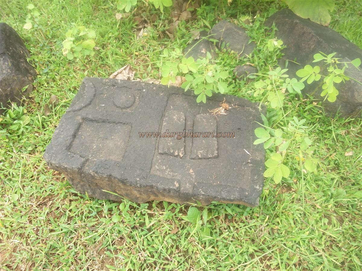
Vyahali is a village below the fort at a distance of 53 km from Boisar railway station and 21 km from Charoti (Casa) Naka on the Mumbai-Ahmedabad highway. As Vyahali is inland from the main road, you have to get off at Saiwan at a distance of 16 km. From Saiwan, rickshaws are available to reach Patilwadi village which is located at the foot of the fort. After descending a small wharf in front of Saiwan, at a distance of 2 km, the fork of Vyahali village starts. 3 km from this fork. Inside, Patilwadi is a small settlement in Vyahali village and this settlement is the village at the base of Gambhirgad. When you come to Patilwadi village, you can see the beautiful Gambhirgad fort behind the village. Apart from this road, there is another path leading to the base of the fort from Raipur village at the backside of the fort, but due to the steepness of that path, it is advisable to go through Patilwadi village. The paved road from the village takes a detour towards the direction of the fort and another visible path on a winding road leads to the fort. This road leads to where the paved road ends. If you walk on this clear path without going through the paved road, you will see a sculpture with the moon and the sun carved on a large rectangular stone. It is a stone Samadhi but the villagers know this stone as Sita's footsteps. From here, there is a stream at the beginning of the road. Near this stream, one can see a well and a Shivling placed under a tin shelter on the bank. After visiting this sculpture of Mahadev and filling water from this well, keep the fort a little to the left, start climbing the hill on the right side. After crossing some distance on this path, the vertical ascent of the fort starts which tries you up to a great extent, but as the path passes through the forest, you don't feel the heat of the sun. This path takes 45 minutes to reach the plateau below the fort. The forest is sparse in this place and the top of the fort attracts our attention. The top of the fort is divided into two parts. The part on the left has conical stone pillars while the right side has a flat head of the fort. After walking towards the area between these two peaks, in half an hour we reach the ruined ramparts of the fort. The gate of the fort should have been in the same area under the ramparts but at present no remnants or marks of the gate are visible. Three ruined bastions can be seen on the ruined ramparts on Machi. You enter the fort from this ruined rampart. It takes an hour and a half to reach here from the village. Gambhirgad Machi and the citadel are the two divided parts. The hill of the fort is spread over an area of 40 acres in C shape. The height of the citadel is 2050 feet above sea level and due to the large amount of forest growing on Machi, the remains on Machi have disappeared in it. Going a short distance parallel to the ramparts on Machi, one can see the large ramparts of the fort at one place. According to the 55-year-old guide who came with us, there were two cannons on at the shore in this place, but the shore collapsed 15 to 20 years ago and the cannons may have been buried under the ground or crashed into the valley. The guide saw these cannons in his childhood. In an article I read recently, many people have written that there is a cannon on the fort but it is not true. On the way to the citadel, you can see some carved stones as well as a stone carved with lotus flowers. The villagers know this place as the place of Goddess Changmata. Remains of some houses can be seen in the surrounding near the trees. From here onwards, we should go up the hill trunk towards the base of the cliff on the right. There are three water cisterns carved in the rock on this side of the citadel and water in one of them is potable. You have to climb a little using the rock climbing techniques to get water. After Diwali, the water goes deep so you have to have a rope nearby to get it out. From here, the next way is the citadel on the right side. This path takes us to the middle of both the hills and turns to the right and goes to the citadel. On the way up the steps, you can see the ruined gate of the fort and the adjoining bastions and ramparts. Upon entering through the gate, on the way to the citadel, a large number of bushes have grown on the road, and on the right side of the road, two cisterns carved in the rock can be seen. The water in this cistern is not potable as it is not in use. In the next part of the road, a stone dome is built in a dilapidated structure and an idol of Goddess Jakhmata is installed in it. Coming up from this temple, we reach the highest part of the fort. It takes two hours to reach here from Patilwadi. Silvassa can be seen from the fort and Jawahar, Bhaskar, Utvad, Harshgad hills can be seen to the east. To the west, the area from Talasari to the sea as well as the area of Mahalakshmi's pinnacle, Asheri, Adsul can be seen. After seeing the citadel on the right, we should visit the head of the fort on the left. There are large stones on the top of the left hill and no remnants are visible due to the overgrown bush. Follow the path to the gorge between the two heads on the left. At one point along the way, you can see the remains of a newly built dome temple and the remains of a house in natural caves. A monk from Silvassa was staying at this place for some time. On the left side of the trunk, there is a road leading from Raipur village as there is a door here, ramparts with two bastions are built here for its protection. Ramparts are descending to the left trunk and in some places, these ramparts have collapsed. In the flat area above the trunk, there is a large dry water cistern with pillars and at the bottom of this cistern, there is a cave. There are many stories about this cistern among the locals as there are no steps to descend into this cistern. When Shivaji Maharaj plundered Surat for the second time in October 1670, the enemy came near Gambhirgad while chasing him. Maharaj could not move fast as the looted ornaments were loaded on horses, mules, and oxen, so he threw some of those ornaments into the well and escaped the danger. Of course, this is just a myth. After seeing the cisterns, you start descending towards the road from which you first entered Machi. You can see another cistern carved in the rock on the slope of the hill. Although there is water in the cistern, it is not drinkable. From here we reach the entrance to the fort by the ramparts of Machi and our fort round is completed. It takes four hours to reach the fort from the foothills. The history of Gambhirgad is available up to a very small extent. Before the beginning of Muslim rule in the south, most of North Konkan was under the control of Koli and Warli landlords. When the Warli king was on the throne at Jawahar, there was a Koli landlord named Papera or Jayaba from the village of Mukne near Thalghat. He gathered the Koli people and took possession of the villages of Pendh and Dharampur and stayed in Kathewada for seven years. On his return from there, he treacherously took his kingdom from the Warli king of Jawahar and gave him the land of Gambhirgad and its environs 6 miles from Jawahar. This Warli king repaired Gambhirgad to some extent. Later, during the Mughal invasion, Mukne Raja allied himself with the Mughals, captured Warli Raja at Gambhirgad, killed him, and annexed the Gambhirgad Sansthan to the Jawahar Sansthan. Gambhirgad is mentioned in the list of forts repaired by Shivaji Maharaj. During 1672-77, Moropant Pingale brought Gambhirgad along with the Segwa fort under his control. It is recorded that Chhatrapati Sambhaji Raje invaded North Konkan in 1683 and conquered Tarapur, Asherigad, and Gambhirgad. In the Vasai campaign of 1737-39, Chimajiappa conquered Gambhirgad along with other forts in Thane. The last attack on Vasai fort was on 16th May 1739 and the Portuguese were permanently wiped out from North Konkan. The fort may have been later taken over by Jawaharkar, as the Peshwa Daftar records that Gambhirgad fort and the area below it were conquered by Raghoba Narayan from Ramdev Rana Ramgirkar Koli on 24 February 1750.
© Suresh Nimbalkar
GALLERY