GADGADA
TYPE : HILL FORT
DISTRICT : NASHIK
HEIGHT : 3030 FEET
GRADE : VERY HARD
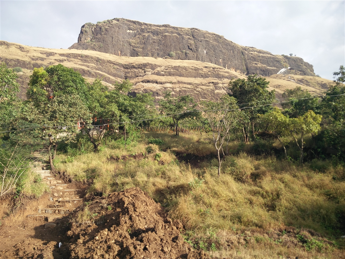
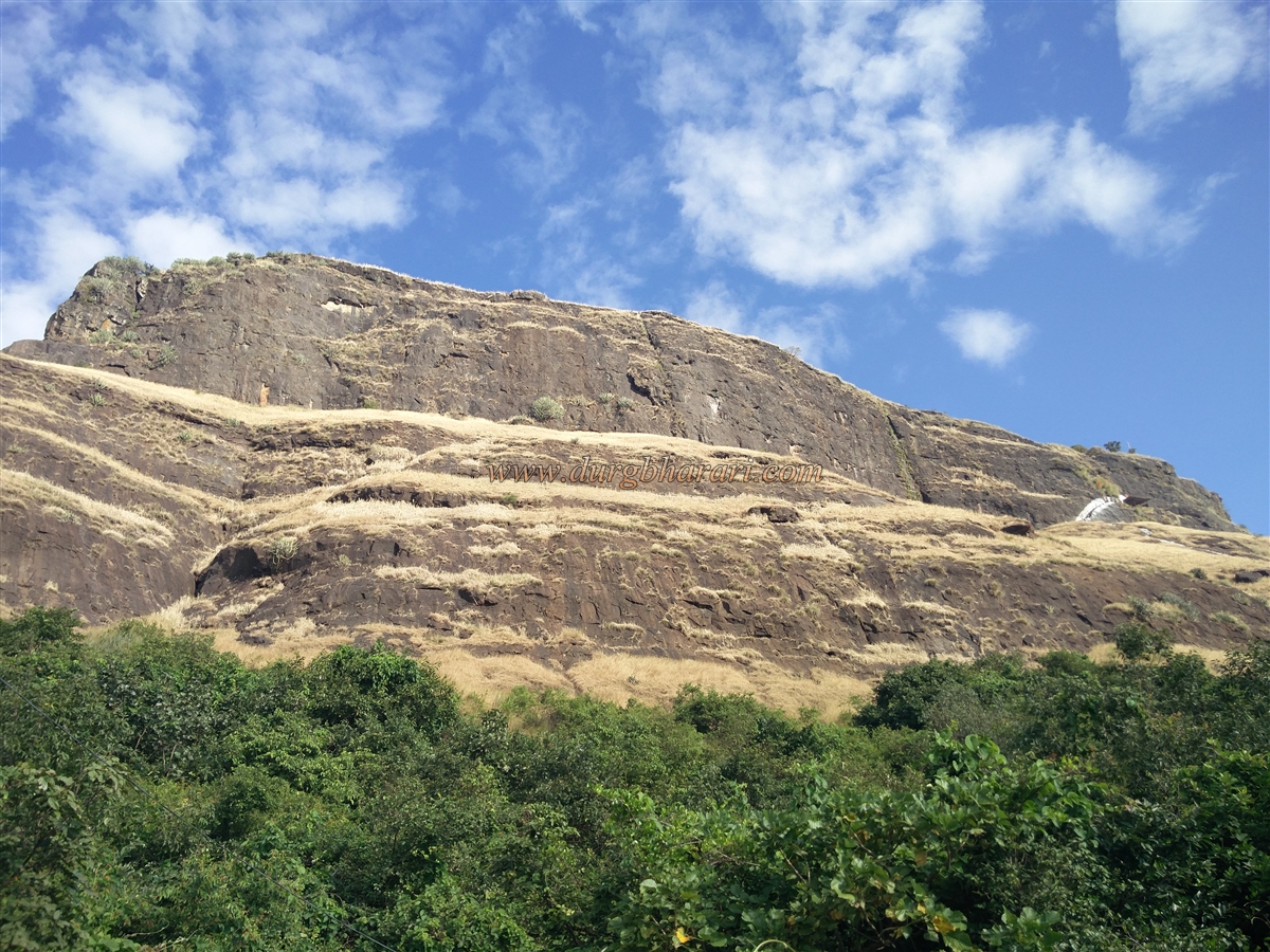
Nashik district in Maharashtra has got a lot of forts. On the Mumbai-Agra highway, you can see many forts around Nashik city. One of these forts is Gadgada aka Ghargad. This fort is only at a distance of 23 km from Nashik. The footpath of this fort was previously destroyed by the British, making it difficult to reach the fort. Therefore, this fort is considered to be in a very difficult category. To reach the fort, one needs to be aware of the mountaineering equipment and climbing techniques. This is the reason why the footsteps of most trekkers do not turn towards this fort easily. We climbed the fort with the help of WILD TROOP's Sudesh Nangre, Dinesh Nangre, and Siddhesh Gotad. To reach the Gadgada fort, one has to reach Gadgada-Sangvi, a village at the foot of the fort.
Nashik district in Maharashtra has got a lot of forts. On the Mumbai-Agra highway, you can see many forts around Nashik city. One of these forts is Gadgada aka Ghargad. This fort is only at a distance of 23 km from Nashik. The footpath of this fort was previously destroyed by the British, making it difficult to reach the fort. Therefore, this fort is considered to be in a very difficult category. To reach the fort, one needs to be aware of the mountaineering equipment and climbing techniques. This is the reason why the footsteps of most trekkers do not turn towards this fort easily. We climbed the fort with the help of WILD TROOP's Sudesh Nangre, Dinesh Nangre, and Siddhesh Gotad. To reach the Gadgada fort, one has to reach Gadgada-Sangvi, a village at the foot of the fort.
...
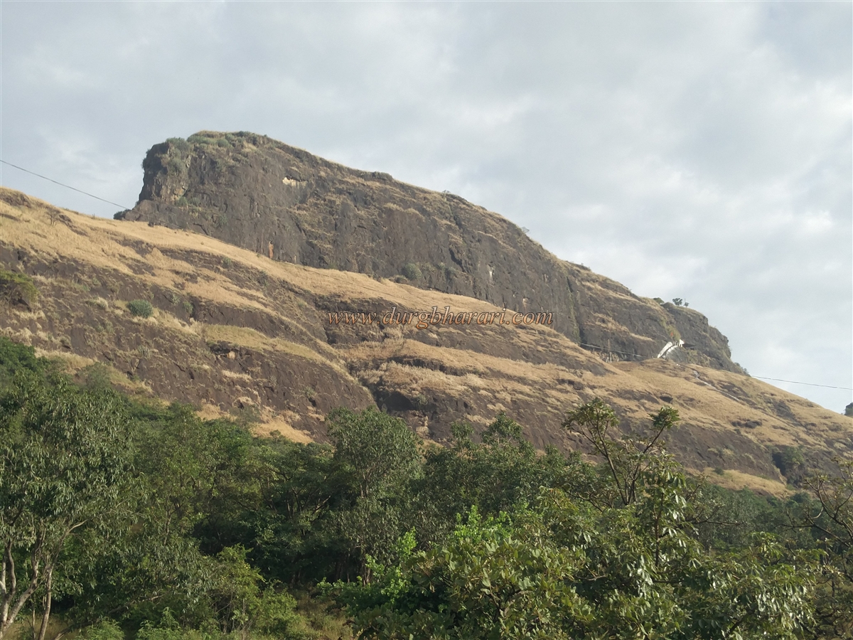
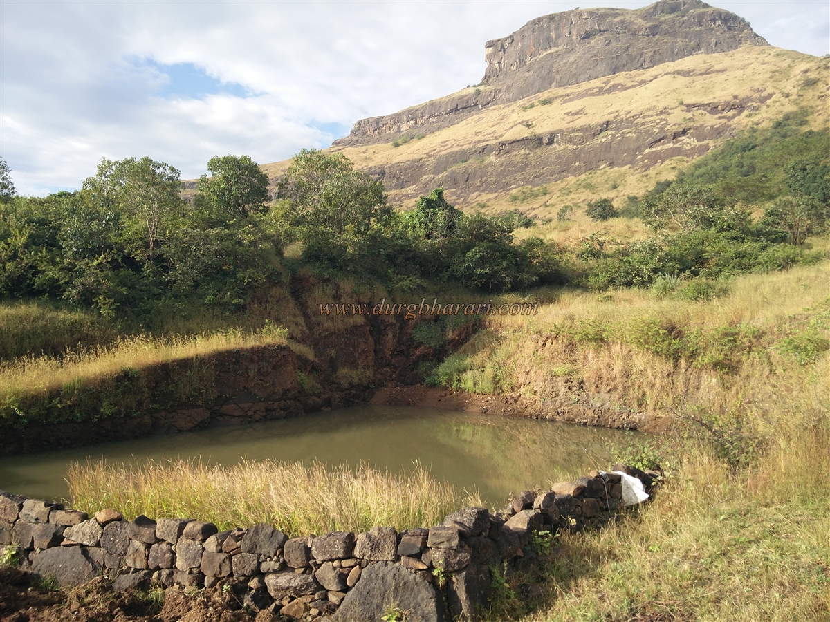
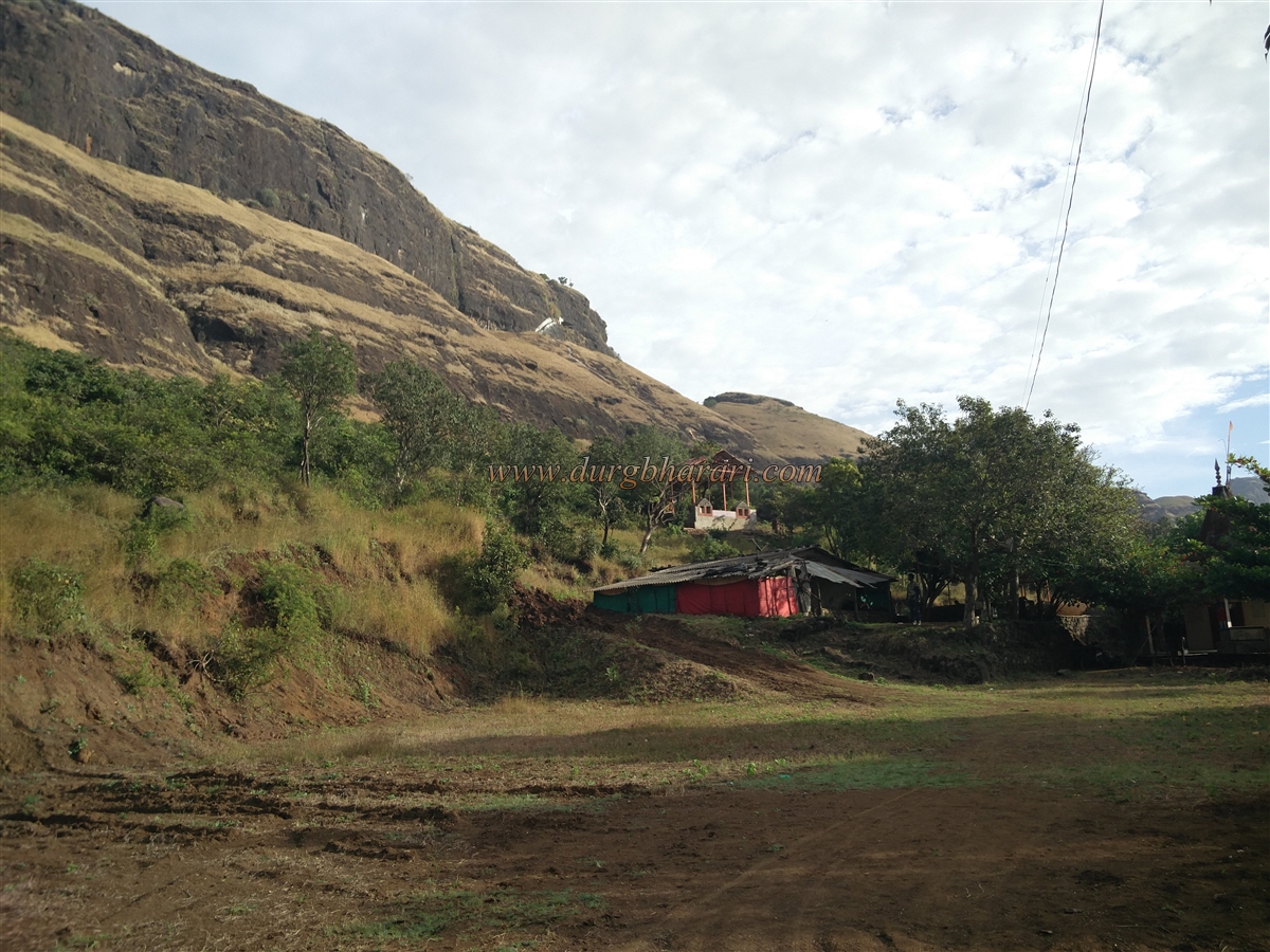
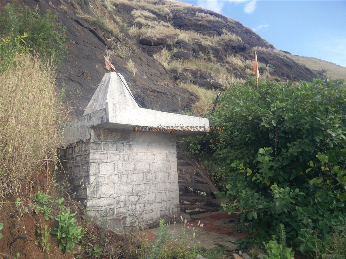
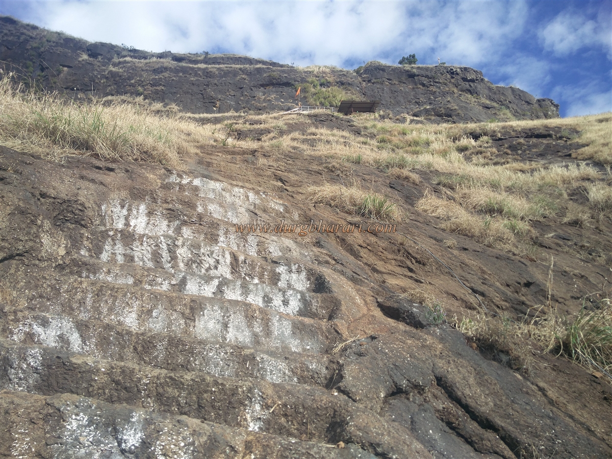
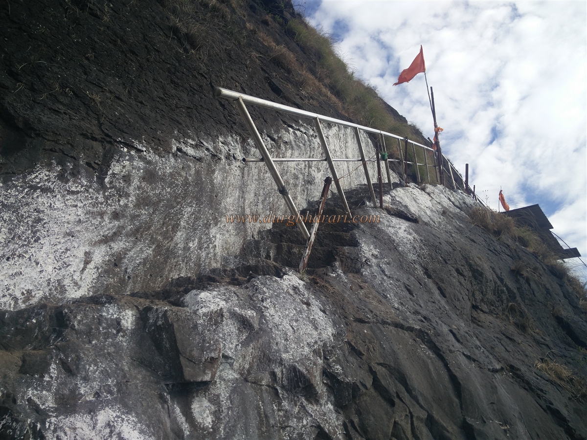
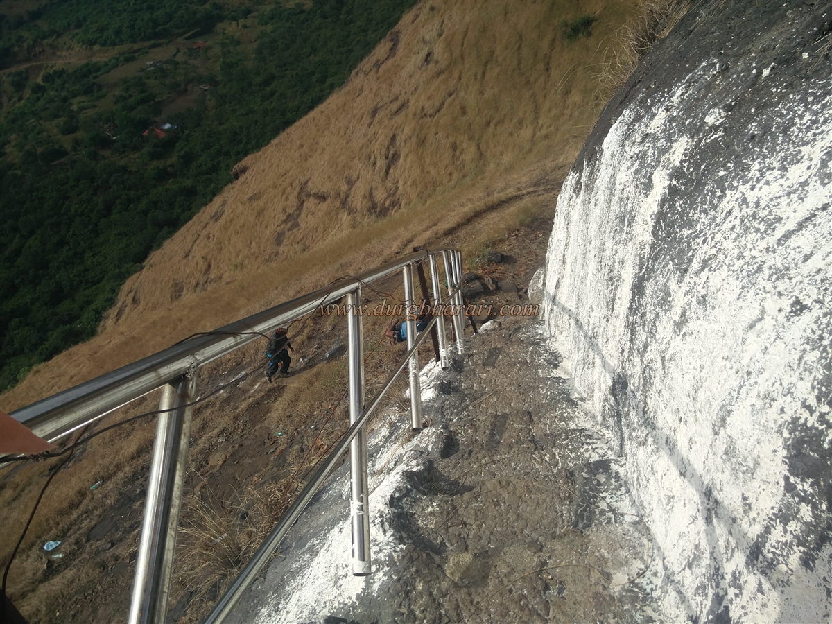
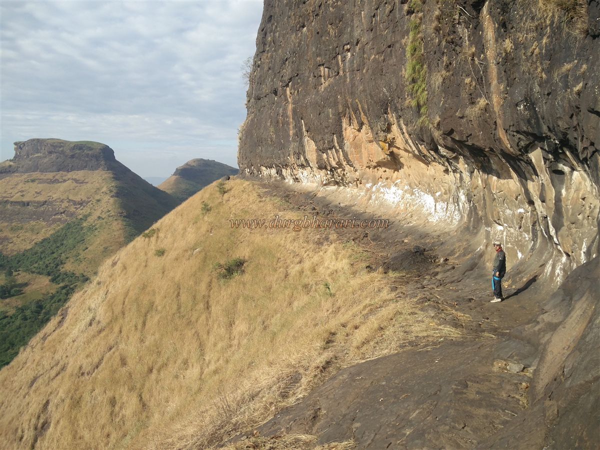
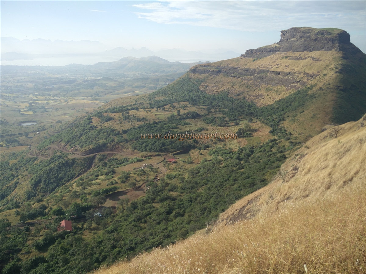
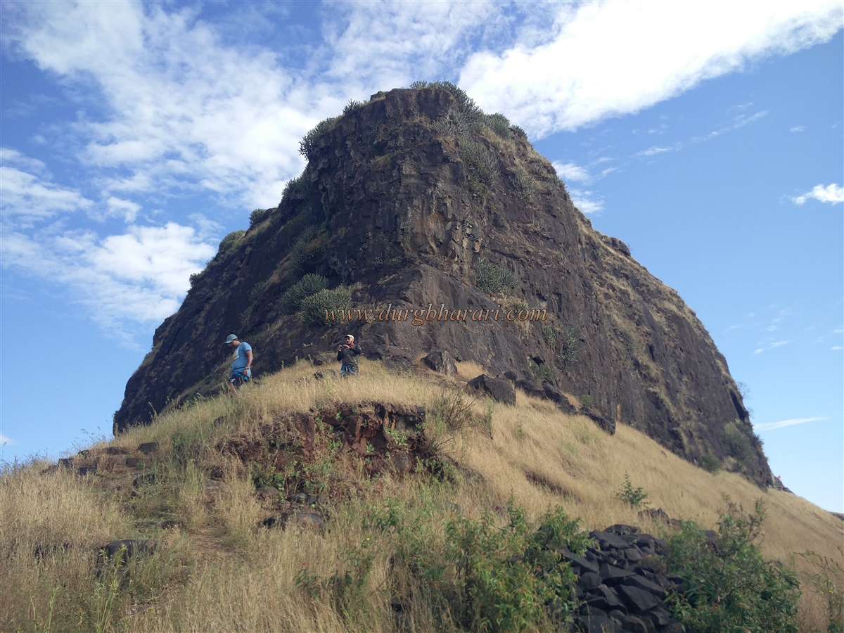
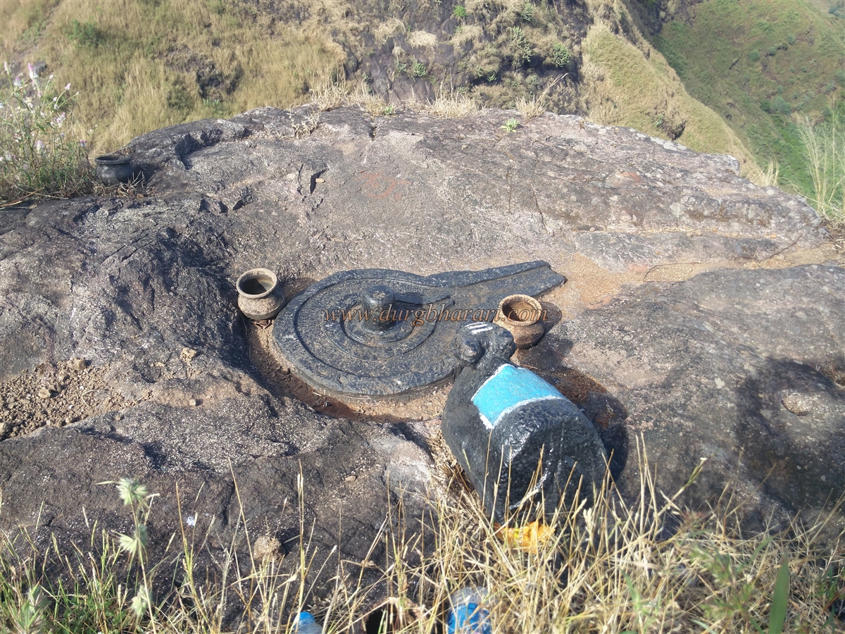
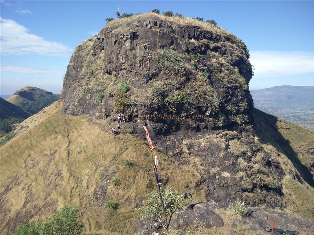
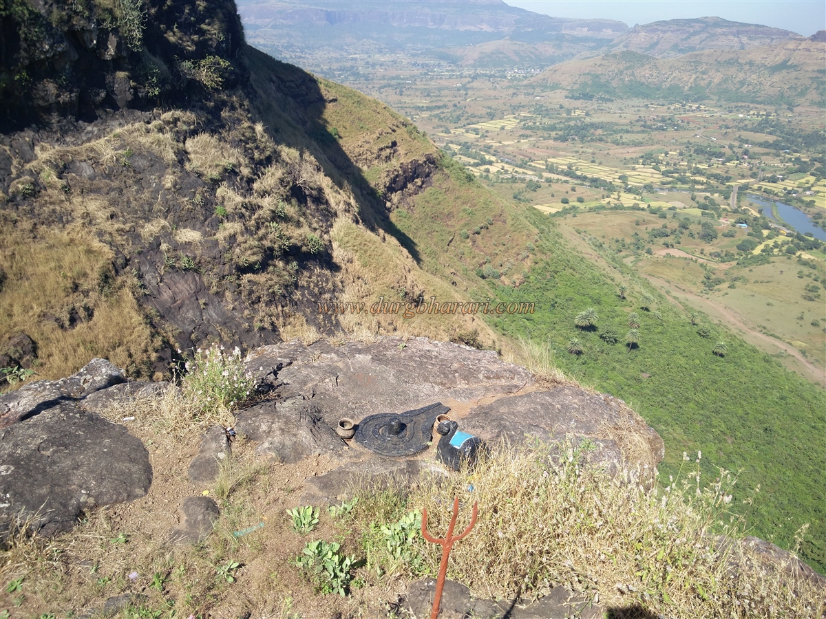
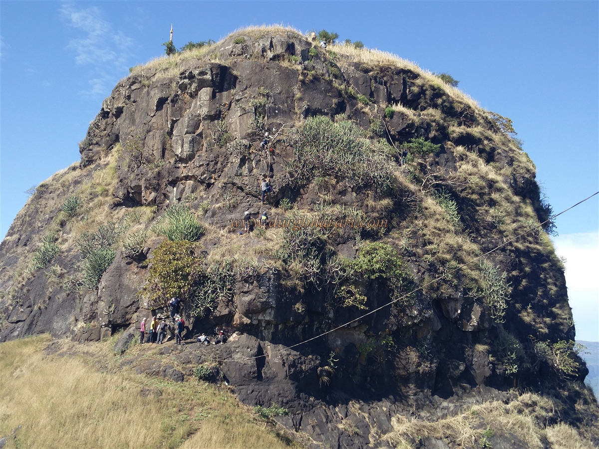
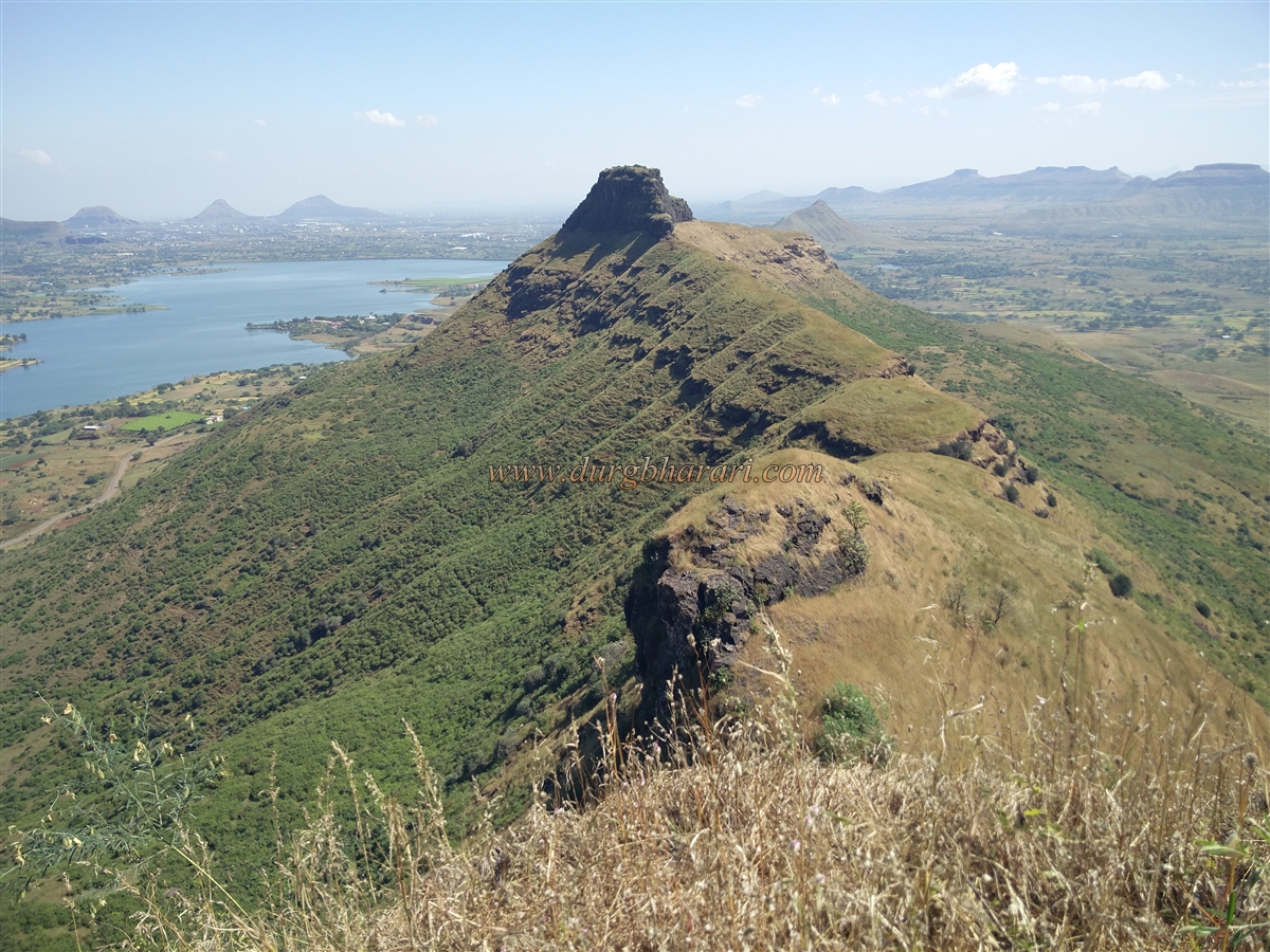
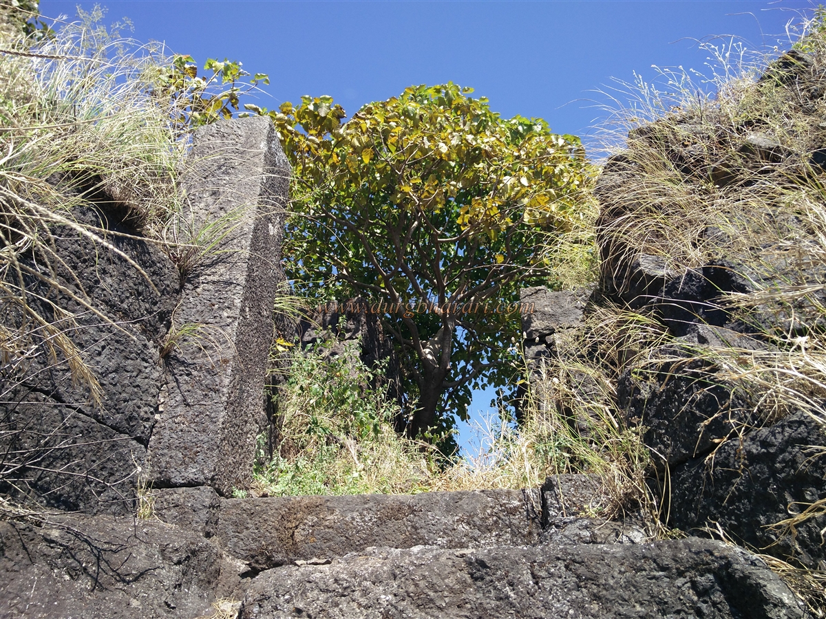
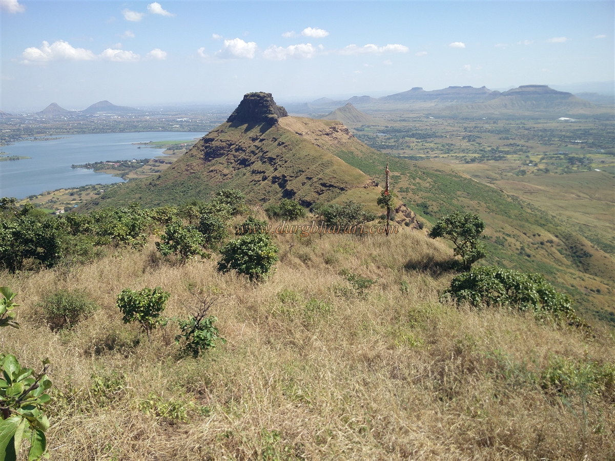
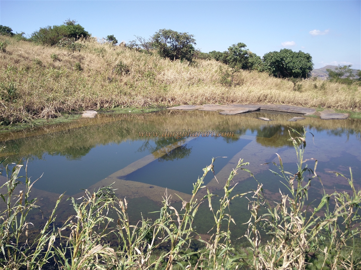
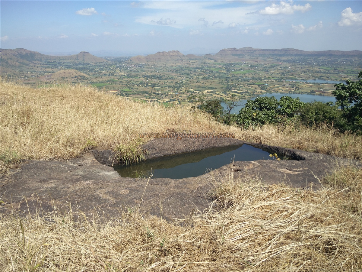
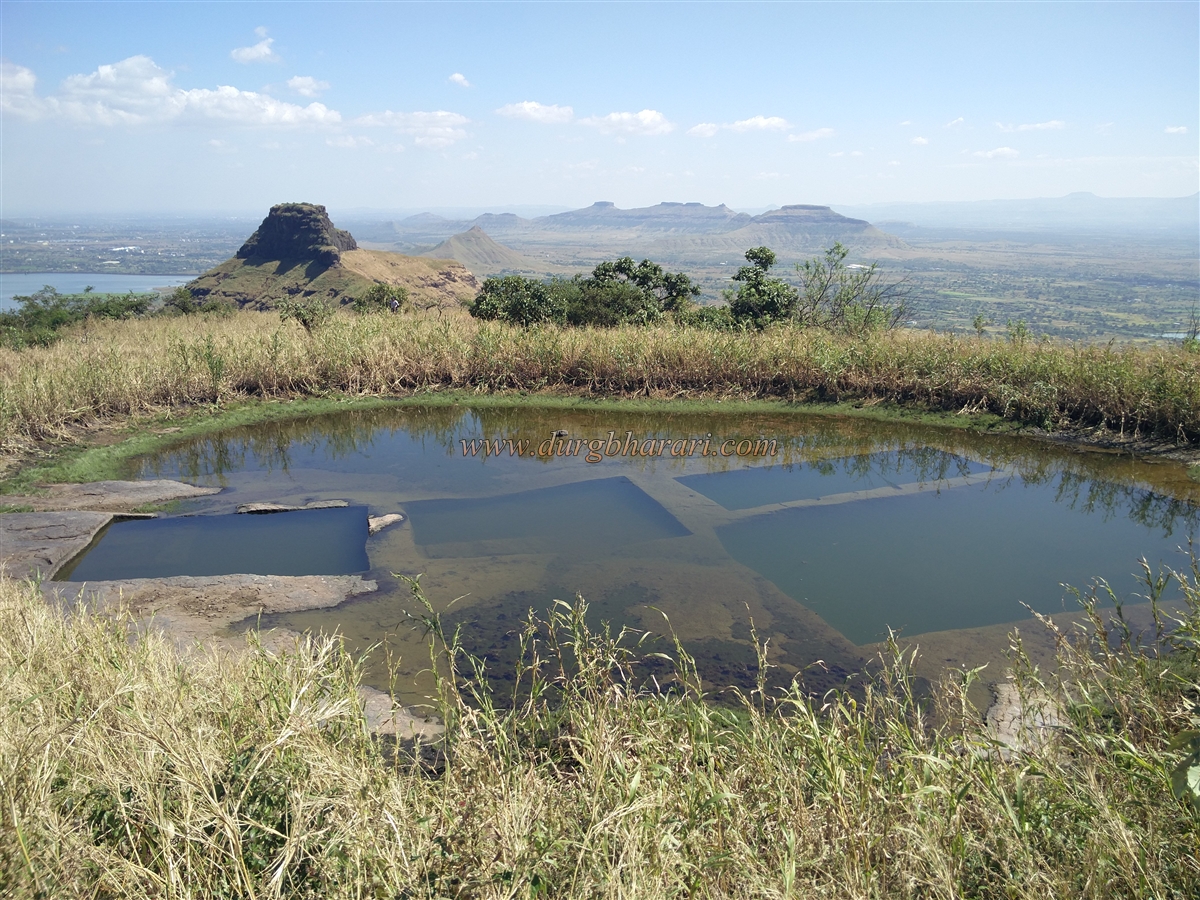
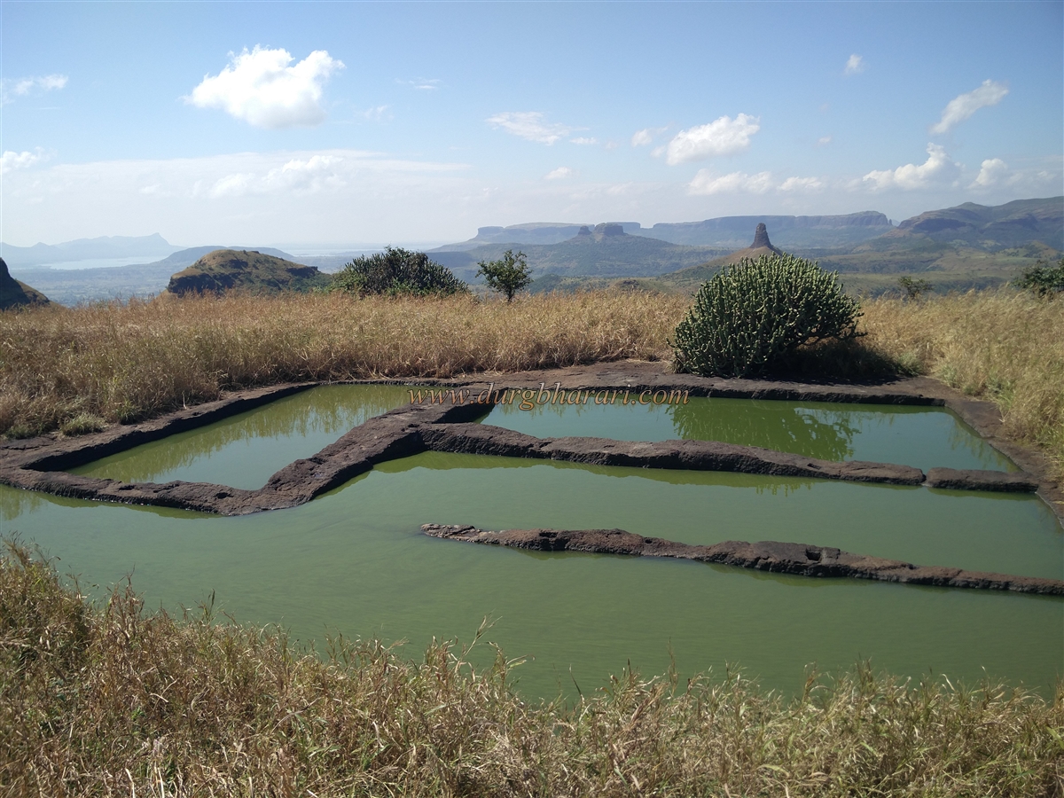
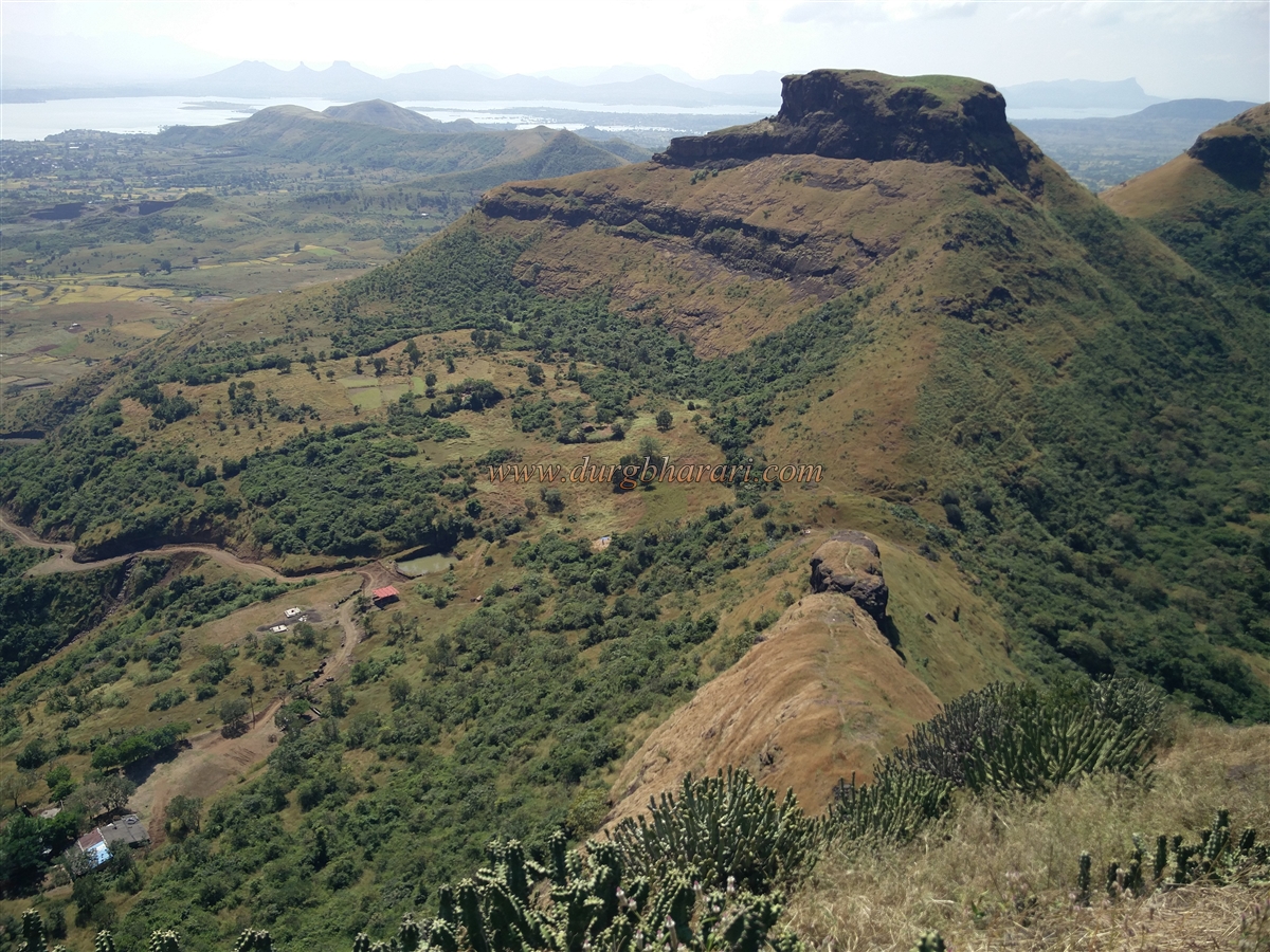
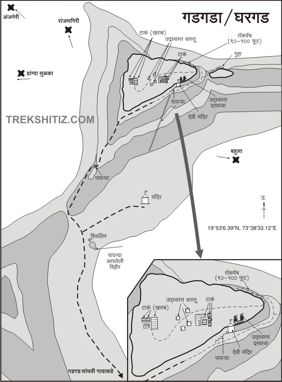
On Mumbai- Kasara highway, after crossing Ghoti fork, there is a fork at a distance of about 17 km to reach Wadivhare village. Wadivhare village is 2 km from this fork. This village is at a distance of 4 km from Gadgada-Sangvi village. As the bus facility is only up to Wadivhare village, the next 4 km distance has to be crossed on foot. If you have a private vehicle with you, you can go directly to the base of the fort. As you enter the village, the three peaks behind the village catch your eye. The peak on the left is known as Aghori and the peak on the right is known as Amboli. The hill between these two peaks is Gadgada Fort. There is a temple of Goddess Bhavani in the cave at the bottom of the fort and this temple can be seen from a distance due to the limestone painted on the walls there. The only way to reach the fort is from this temple. There is an ashram and Hanuman temple on the plateau of the fort and there is a dirt road from the village to reach this temple. On the right side of the road, you can see some newly installed hero stones. In half an hour we reach the Hanuman Temple on the plateau. A little further on, on the left side of the road, a small pond can be seen on the hillside. In many places, we read that there is a well with steps near the temple but now that well only exists in history and the villagers have constructed a pond in place of the well to supply water to the temple and ashram and its surrounding areas. Shivling and Nandi are placed in the open at some distance in front of the lake and there is an idol of Lord Hanuman and Lord Shani on a quadrangle structure in front. There are two ways to go from the lake to the fort, i.e. to the temple on the fort. The first route leads from Hanuman Temple to the fort. This leads us to the steps carved in the rock below the temple. There is a small temple of Lord Ganesha at the beginning of these steps and they directly lead you to the temple of the Goddess on the fort. The second way to reach the fort is by climbing straight from the lake to the hilltop of the Aghori hill and reaching the hill trunk which connects Gadgada fort with the Aghori hill. This trunk takes a detour and leads to the backside of the hill. The villagers have made 5-6 steps by stacking one stone on top of the other in this area. Climb up these steps to reach the trunk of the fort. Stairs are built in some places to reach the ridge on this trunk. This is the original way to reach the fort, but at present, the footpath from Hanuman Temple is used to reach the fort and the temple, so a large amount of soil has accumulated on these steps. This path leads to the temple of the Goddess by going to the end of the ridge and taking a right turn (keeping the ridge to the left). The carved staircase coming from Hanuman Temple is the original way to this place. Half an hour is enough to get here from the lake. From here we reach the temple of the Goddess by climbing 15-20 steps carved in the rock. The temple is in a small cave with idols of two goddesses and a tiger. Here was the original footpath to the fort and this temple must have been set up in the porch of the guard. On the upper side of this temple, you can see the marks of the tunnel dug to break the steps and some broken steps as well as the gate of the fort at the end of the ridge. Even if it is not possible to reach the fort from here, it is possible to get there by tying a rope using the climbing techniques. The new road leading to the fort passes through the gorge between Amboli mountain and Gadgada fort and climbs up to the cliff of Gadgada fort. To reach the top of the fort, go down the steps of the temple and walk a little towards the top of the hill. There is a medium-sized tree growing in this place. Remembering this as a sign to go to the fort, you should start climbing the fort from here. The next stage after climbing this tree is to be crossed using the mountaineering equipment. Until the equipment is being set up, you should see the other remains in this area. From the ridge where you are, a footpath descends into the gorge between Gadgada fort and Amboli mountain. Going down the gorge and climbing the hill in front, you can see a Shivling carved and a Nandi carved in the rock in front of it. After seeing the Shivling, descending back into the gorge, and taking a detour to the Amboli mountain on the left side, in 5 minutes we reach a cave with a 3 x 3 shaped mouth carved in the rock. You have to be very careful while walking on this slippery road and at some point, on this road, you have to climb with the support of rocks. Crawling in a straight line, the cave has two Y-shaped forks at a distance of about 25 feet. On the right side, there is a small room carved in the rock at a distance of 10 feet and on the left side there is another small door at a distance of 10 feet and inside it is a room of 8 x 8 feet in size. A large amount of dust has accumulated here. Seeing all this, the technical preparation for climbing the fort is complete by the time you return to the fort. After climbing with the support of the tree and coming up, we come to a steep place. From here, you have to climb a difficult cliff of about 15-20 feet with the help of a rope. But our WILD TROOP colleagues managed to get through this stage easily. After coming up from this stage and going a little towards the right, you will come across another cliff about 20 to 25 feet in height. This stage is a bit easier than the first stage as there are patches in the wall but you still need mountaineering equipment! After passing this stage, you enter the fort. It takes 2 to 3 hours to reach the top of the fort from Gadgad Sangvi village. The triangular fort is located at an altitude of 3035 feet above sea level and is spread over 6 acres from east to west. Since not many people visit the fort, a large amount of grass has grown and you have to find a way out of this grass to find the remains. Turning to the left, we reach the ruined north-facing gate of the fort. When you look at the top of the Bhavani temple, you can see this door. The arch of the door has been destroyed and the stone frame of the door is proving its existence even today. 5-6 steps are leading to the temple on the outside of the door and inside there are guard porches on both sides. Upon entering through the door, you can see dry water cisterns carved in the rock on the left. After seeing these cisterns and walking a little further on the main road, you can see a group of 5 cisterns carved in the rock. Stairs are carved to descend into these cisterns. This water is drinkable. To the right of these cisterns is another carved cistern filled with water on the hillside below. When you come forward from the group of cisterns, you can see the remains of 7 structures lost in the grass. Two of these structures have a large quadrangle structure and the other one has a small one. After seeing the remains of the building and coming out of the grass, we come to a group of four cisterns filled with green water. Continuing on the left side of the cistern, we reach the bastion at the trunk towards the Aghori peak of the fort. From this bastion, the original path to the fort is completely visible. Returning to the cistern from here, you can see the ramparts on the right side, and in some places, you can see the cisterns carved in the rock but are extinguished with soil. Your fort round is complete when you come to the door. One hour is enough to explore the entire fort. After descending three or four steps through the door, rappelling 90 feet, we descend directly to the temple. Considering the size of the fort and its location, it must have been used for surveillance. Dangya Sulka, Anjaneri, and Valdevi dams can be seen from the head of the fort in the east, and Mukne dam, Patta, Aundha, Beetangad, and Kalsubai mountain ranges can be seen in the west. Gadgada fort is silent about its history. During the reign of Shivaji Maharaj, this fort came under Swarajya between the years 1670-72. On 18 July 1748 Gadgada fort was conquered by Shankaraji Keshav Sabnis but it is not known from whom did he conquer it. When the fort was captured by Captain Briggs in 1818, the fort is said to have two gates.
© Suresh Nimbalkar
GALLERY