GADBORI
TYPE : HILL FORT
DISTRICT : CHANDRAPUR
HEIGHT : 804 FEET
GRADE : EASY
In Chandrapur district, within the Sindewahi Taluka, lies a small village named Gadbori. Locals say the village got its name due to the presence of a fort (gad) and numerous ber (bori) trees in the area. Located about 7 kilometres from the town of Sindewahi, this village is home to a fort built on a high hillock by the banks of the Uma River.
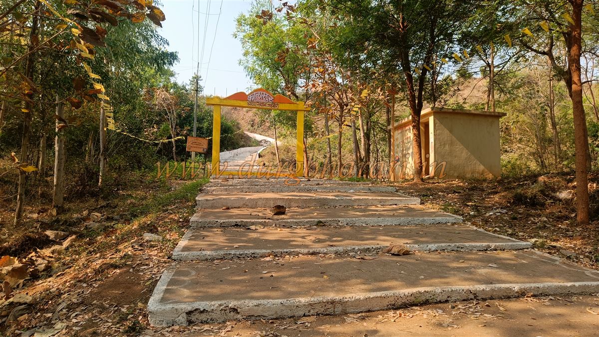
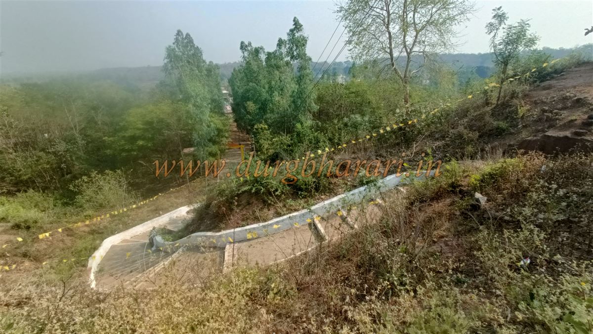
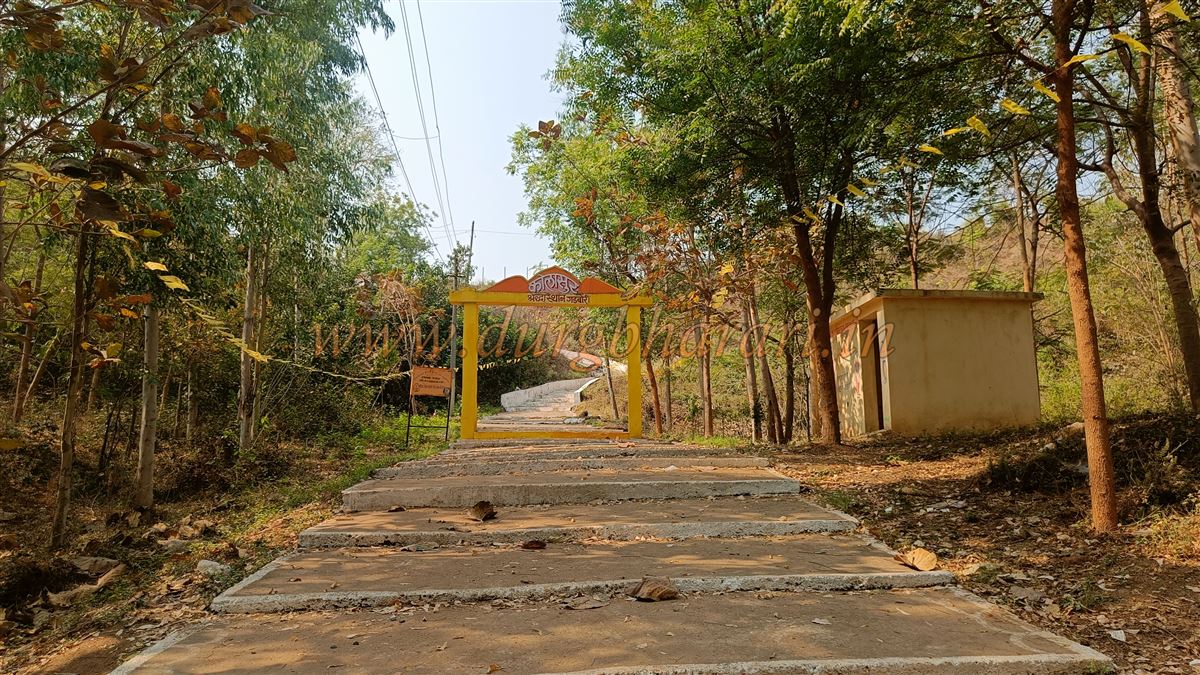
As one enters Gadbori village, the hill with the fort and a temple atop it can be seen distinctly from a distance. Because of the Kolasur Devi temple on the fort, new steps have been constructed to reach the top. Upon asking for directions in the village, one is guided to these steps, which lead easily to the fort’s summit.
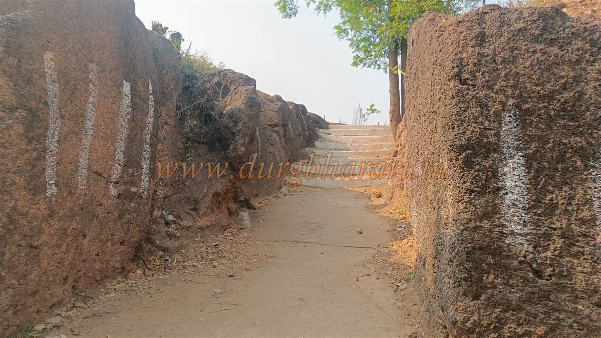
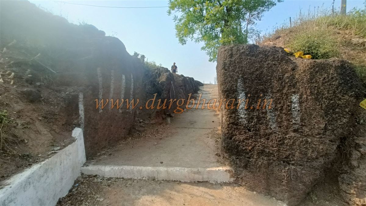
The pathway near the fort’s entrance is carved out of rock, but the original archway has been lost to time. To the north of the entrance stands a newly built Kolasur temple.
...
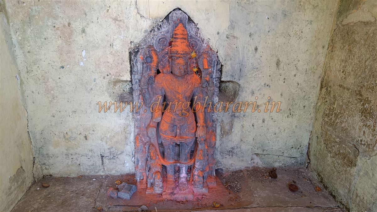
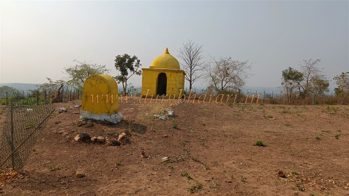
Based on the carved stone foundation of this temple, it is believed there might have once stood a beautifully constructed Vishnu temple at this location. Kolasur is considered an incarnation of Lord Vishnu, and inside one of the small domed structures (Ghumti) on the fort is a beautiful idol of Vishnu, reinforcing the belief that the original temple might have been dedicated to him.
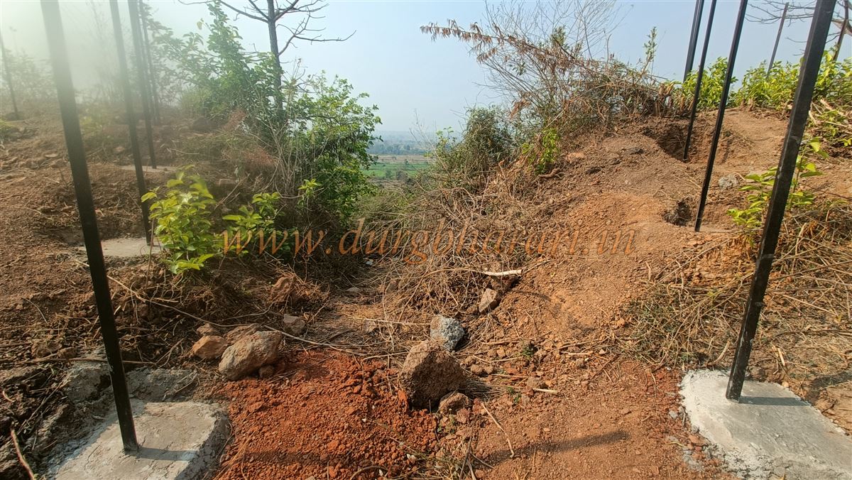
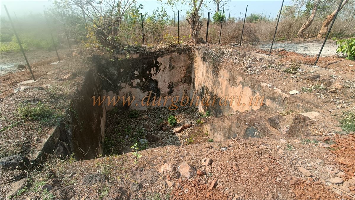
There are two main access routes to the fort—one from the north (more frequently used) and the other from the south. The southern gate has been completely destroyed, with only traces remaining. Descending slightly from this side, one can see a bastion built into the fortification wall. Above the southern gate, there is a square rock-cut water tank with steps leading down into it, though it has dried up due to lack of maintenance.
The fort covers an area of about three acres and sits at an altitude of 804 feet above sea level. Apart from the water tanks and the Kolasur temple, two other small domed structures exist on the fort. One of these houses the idol of Vishnu, while the other is believed to be the Samadhi (memorial) of Kolba Wagh, a former fort commander.
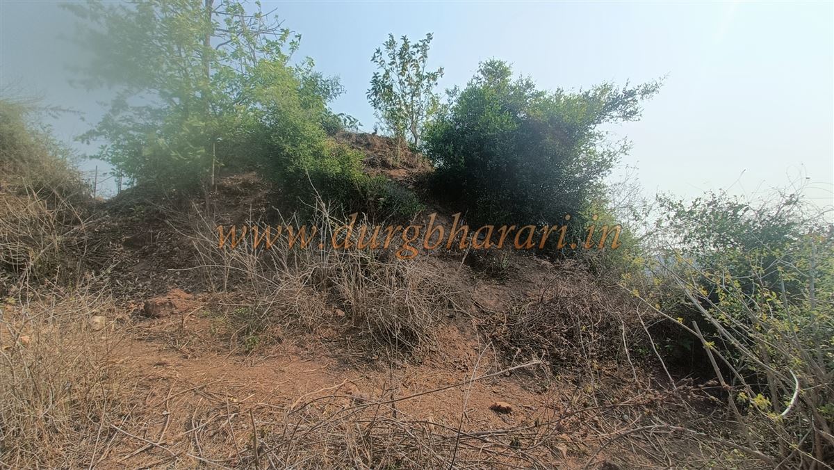
The western section of the fort still has well-preserved fortification walls and bastions, all constructed using finely cut stone, indicating that the entire fort may have originally been built in this same durable style. A newly built cement platform has been added to a large bastion on the western side, plastered with lime. A private access path has also been created to reach this memorial site. Dense vegetation surrounds the lower parts of the fort, so one must make their way through the growth to inspect the remaining walls and bastions. It takes approximately half an hour to explore the entire fort.
Historical records suggest that King Kurumprahod of the Mana tribe, who belonged to the Nagavanshi lineage, constructed Gadbori Fort. In the 9th century, he first built the Vairagad Fort, and later went on to construct forts at Rajoli, Gadbori, and Chimur. He also established a village on the banks of the Vailachana River to the north of Vairagad and named it Kurukheda, which later evolved into the name Kurkheda.
During the Chalukya Emperor Rajendra II’s conquest in 1070 AD, he achieved significant victories at Vairagad and Chakrakot (now in Baster), which was then ruled by the Nagavanshi Mana tribe. Some years later, a powerful king from this dynasty, Pratapbhushan, revolted and overthrew Chalukya authority, establishing his own independent kingdom. He captured regions such as Sangadi, Bhandara, and Pauni.
During the reign of the Mana dynasty, four noble titles were conferred for administrative purposes:
1. Badwaik
2. Mokasi
3. Bhoyar
4. Diwan
Typically, Badwaik and Bhoyar titles were awarded to brave and intelligent men from the Naranware clan, Mokasi was conferred upon people from the Wagh clan, and the title of Diwan was given to members of the Gajbe clan.
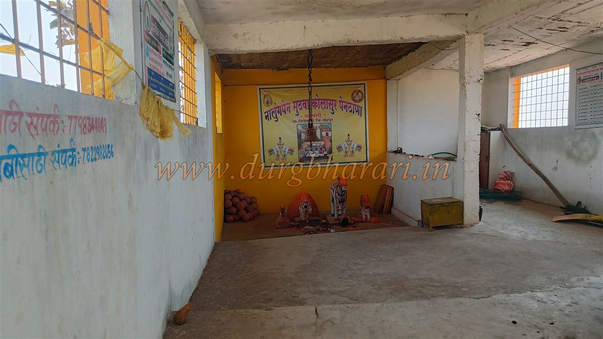
The last Badwaik was Manoji Badwaik from Bhamdeli, while the last Mokasi was Kolba Wagh, the fort commander of Gadbori. Until 1734 AD, the Gadbori Fort was under the control of Kolba Wagh of the Mana dynasty. He was a contemporary of Gond King Ramshah of Chandrapur (Chandagad), who ruled from 1672 to 1735.
Kolba Wagh’s domain included Gadbori, Nagbhid, Chimur, Neri, Madanagad, Navargaon, Bhatala, Bhisi, Chandanakheda, Varora, and 209 villages across these territories. In 1731 AD, the famous Battle of Irwa took place between the armies of Gond King Ramshah and King Kolba Wagh. The fort on Irwa hill, under Kolba Wagh’s control, had strong fortifications and stood 350 feet above ground, made entirely of stone. Ramshah’s nephew Agba led a large army to capture it but was defeated.
In 1734, to exact revenge, Ramshah sent his general Semaji (alias Shankar Dhume), who cunningly captured Kolba Wagh alive and took him and his treasury to Chandagad, where Kolba Wagh was executed the next day. This marked the tragic end of a valiant king of the Mana tribe and the end of the Mana kingdom itself.
According to M. S. Jambhule, in his book "Social and Cultural History of the Mana Tribe", Kolba Wagh ruled from Gadbori Fort carrying the banner of rebellion but was ultimately betrayed and executed. A memorial (Samadhi) was built on the fort where he is believed to be buried.
© Suresh Nimbalkar
GALLERY