FATTEPUR
TYPE : NAGARKOT
DISTRICT : NANDURBAR
HEIGHT : 0
GRADE : EASY
Once a part of Khandesh, Nandurbar became a separate district after the division of Khandesh. The Tapi River flows through this region, effectively dividing it into northern and southern parts. The district shares its borders with the states of Madhya Pradesh and Gujarat. Predominantly tribal, Nandurbar district was once home to not just one or two, but as many as 15 forts, including Giridurg (hill forts), Bhuikot (land forts), and gadhis (fortified mansions).
Except for the seven forts mentioned by DurgMaharshi Pramod Mande in his book Maharashtratil Gadkille, there are virtually no other references to these forts elsewhere—not even on the internet in this modern digital age. During a comprehensive exploration by our group Durgbharari, we collected information on all these forts, and I have attempted to document that on our website.
...
Among these, 13 are fort-like structures: 1 hill fort, 3 land forts, 2 city forts (Nagarkot), and 7 gadhis. Most of these Gadhikots are now inhabited villages, and due to increasing population pressure, many of the fort remains have been destroyed. Local indifference has also played a major role in the deterioration of these structures. One such example is the Nagarkot of Fatepur.
Fatepur was once part of Khandesh but became part of Shahada Taluka in Nandurbar district after the division of Khandesh. Located in southern Nandurbar, Fatepur is about 15 km from Shahada, situated on State Highway No. 1. To visit Fatepur, one must first reach either Nandurbar or Shahada. The distance from Nandurbar to Fatepur is 55 km and can be reached via Prakasha–Mhasavad road.
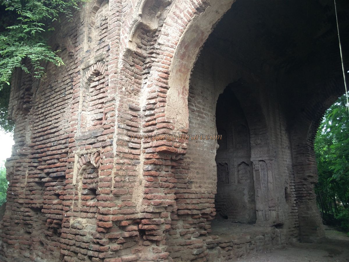
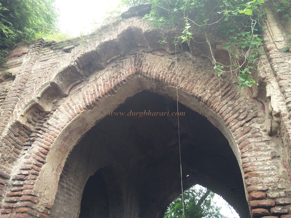
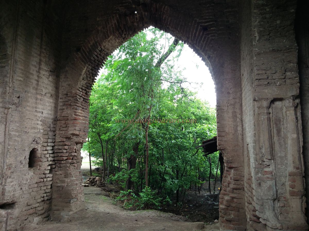
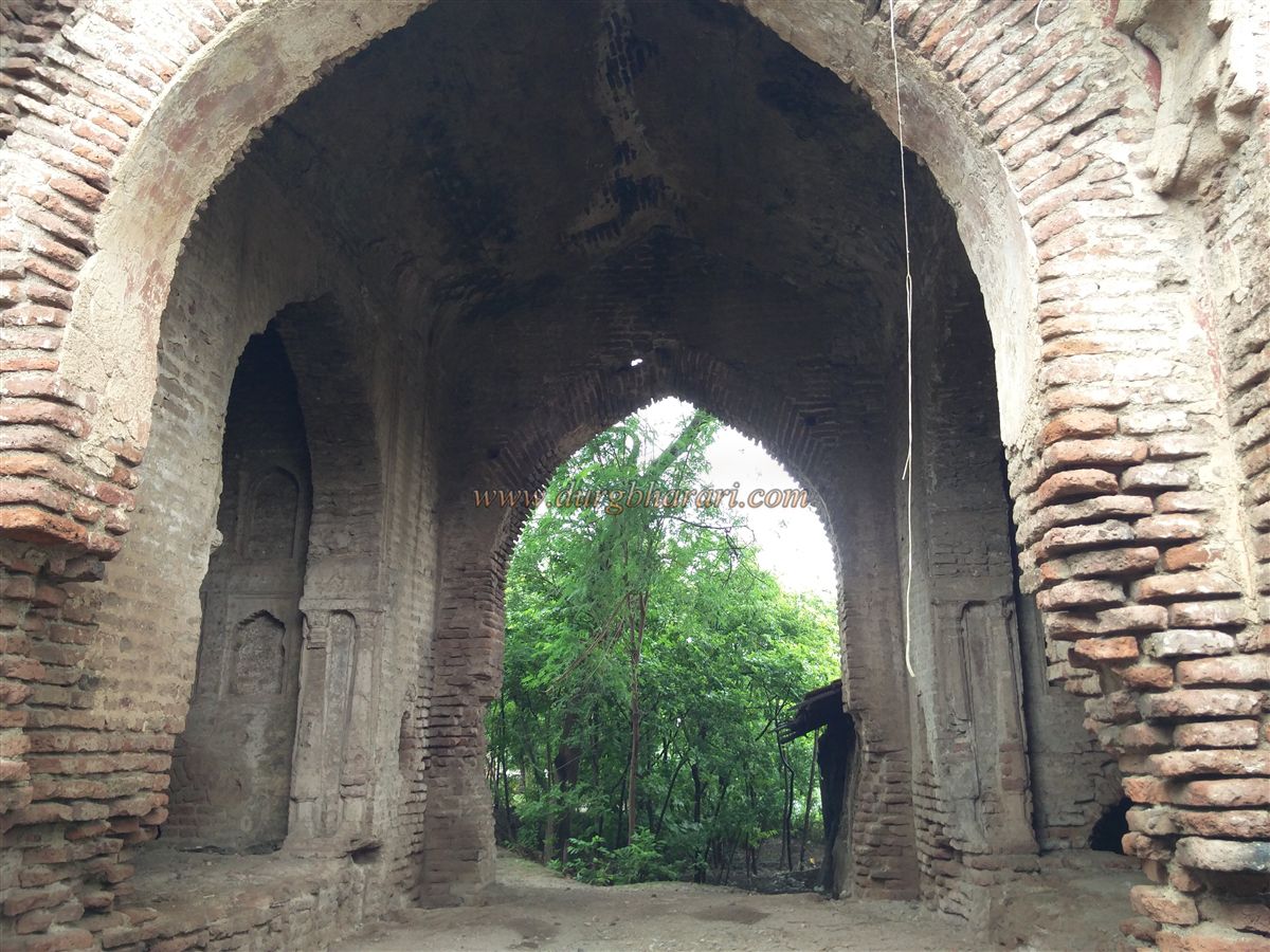
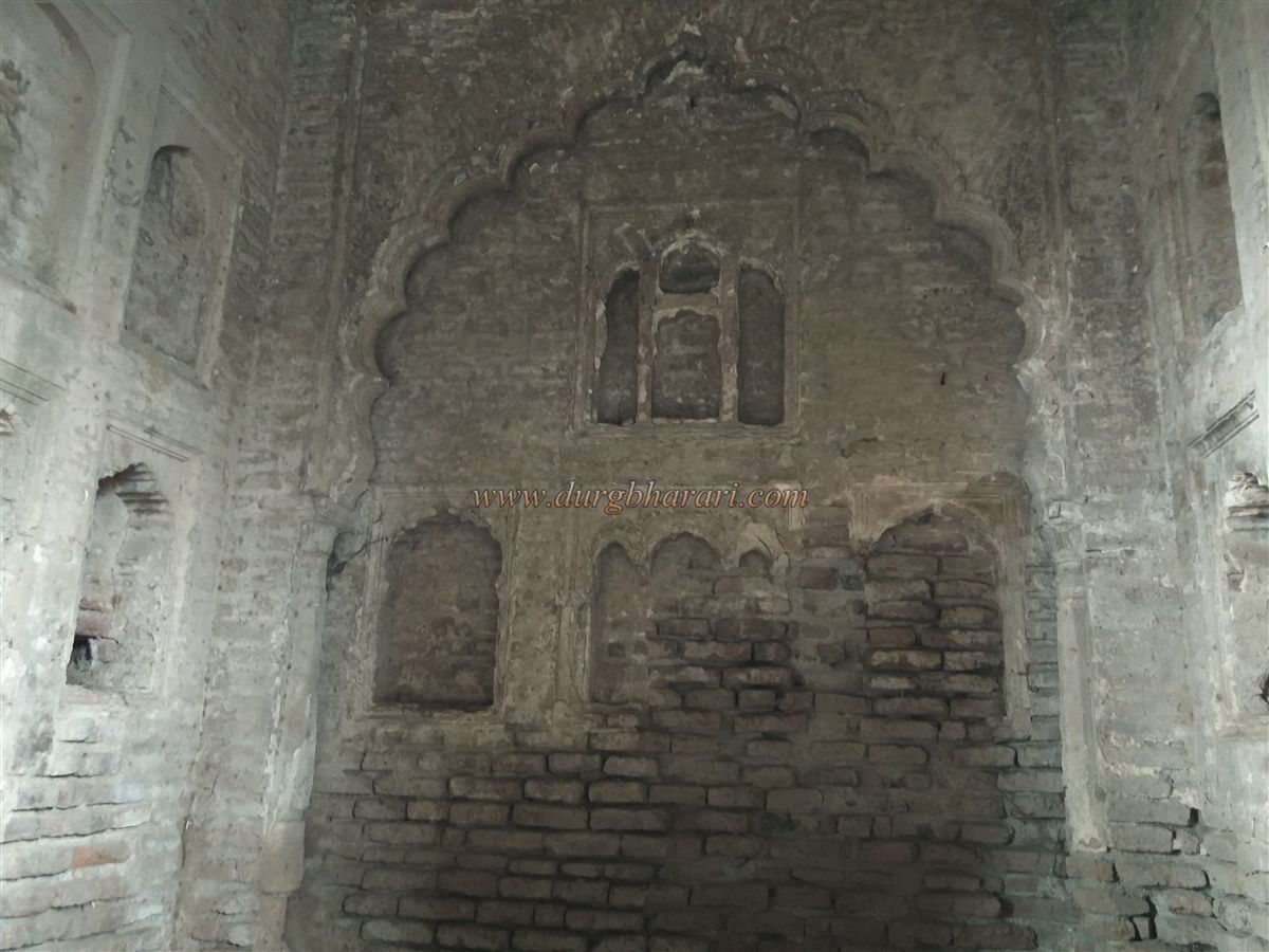
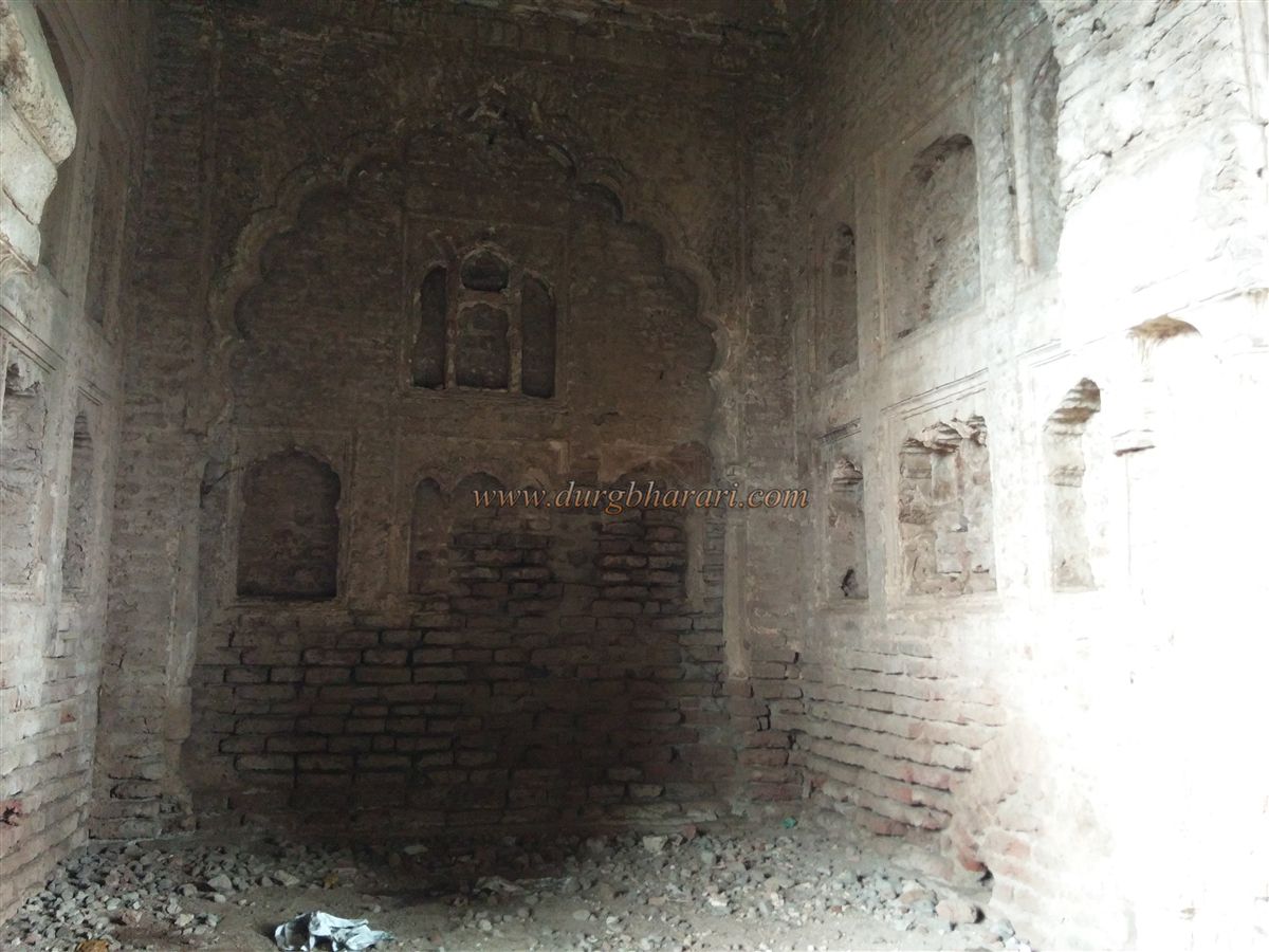
Fatepur is located on the banks of a river. The only remaining structure of the fort is the main entrance gate, which is conveniently located along the main road, making it easy to find. Due to the development of a settlement within the fort, the remaining structures have been completely lost, making it impossible to determine the original layout and other features. However, the grand entrance arch, standing 25 feet tall, suggests that this fort had a significant population in the past.
The arch is built entirely of brick and coated with lime plaster, which once featured sculptural carvings. Though most of the plaster has worn off, some niches still display carvings. On the inner sides of the arch are devdis (watch rooms) whose walls are decorated with ornate niches. Beneath the arch lies a large underground chamber, accessible through a small door on the exterior. A similarly semi-buried door is found inside one of the devdis. Unfortunately, the underground area is now filled with wastewater discharged by nearby homes.
The growing settlement has completely erased the fort’s outer walls, although some remnants survive on the opposite side of the road. On a platform there, locals have constructed a tin-roofed temple that houses a few ancient idols, including one of Bhairav. Since the fort was destroyed long ago, even local residents are unaware of its history. With few remains, the site can be explored in about 15 minutes.
Sultanpur is just 9 km from Fatepur, and the events of Sultanpur may also be related to Fatepur. Malik Raja Farooqui, the first Sultan of Khandesh, had captured Sultanpur and Nandurbar in 1530. However, after an attack by Gujarat Sultan Muzaffar, he had to retreat to Thalner. In 1536, Gujarat Sultan Mahmud Shah Begada granted control of Sultanpur and Nandurbar to Mubarak Khan Farooqui. During the reign of the Farooqui dynasty in Khandesh, Fatepur was included under their rule.
According to the Dhule District Gazetteer, in 1634, Mughal Emperor Shahjehan annexed Sultanpur and Nandurbar to the Malwa province, designating Burhanpur as its capital.
© Suresh Nimbalkar
GALLERY