DONGARTAL
TYPE : HILL FORT
DISTRICT : NAGPUR
HEIGHT : 1520 FEET
GRADE : EASY
Vidarbha is a significant geographical region in Maharashtra, comprising eleven districts: Bhandara, Gadchiroli, Chandrapur, Wardha, Yavatmal, Buldhana, Akola, Amravati, Nagpur, Washim, and Gondia. Most forts in Vidarbha were constructed during the Gond dynasty, roughly between the 12th and 13th centuries AD.
One such largely unknown hill fort built by the Gonds is located in the Parshivni taluka of Nagpur district. While visiting forts in Nagpur, tourists commonly visit Ramtek and Nagardhan forts, but are often unaware of other hill forts nearby. This fort, known in British documents as the "Pendar Gadhi" or "Thane" near Devlapar, is today called Dongartal (meaning foothills).
The fort, earlier known as Sindurgiri or Tapogiri, lies in the Ramtek hills range. Dongartal is itself a hill fort, and at its base lies a Gond-era royal residence or sarai.
...
This structure is familiar in the area and is called Dongartal after the village. The village of Dongartal gram panchayat still remains under Devlapar. The pride of the name “Devlapar Fort” is a recent development. Locals call the structure at the base of the hill “Gadhi” and associate it with a Gond king, but the real fort is situated on the hill facing this residence.
Located 68 km from Nagpur city, the fort is 29 km from Ramtek fort and only 4 km from Devlapar village. Devlapar lies on the Nagpur-Jabalpur highway, making it convenient to reach, but from there, private transport or walking is needed to reach Dongartal. With private transport, one can reach right in front of the Gadhi.
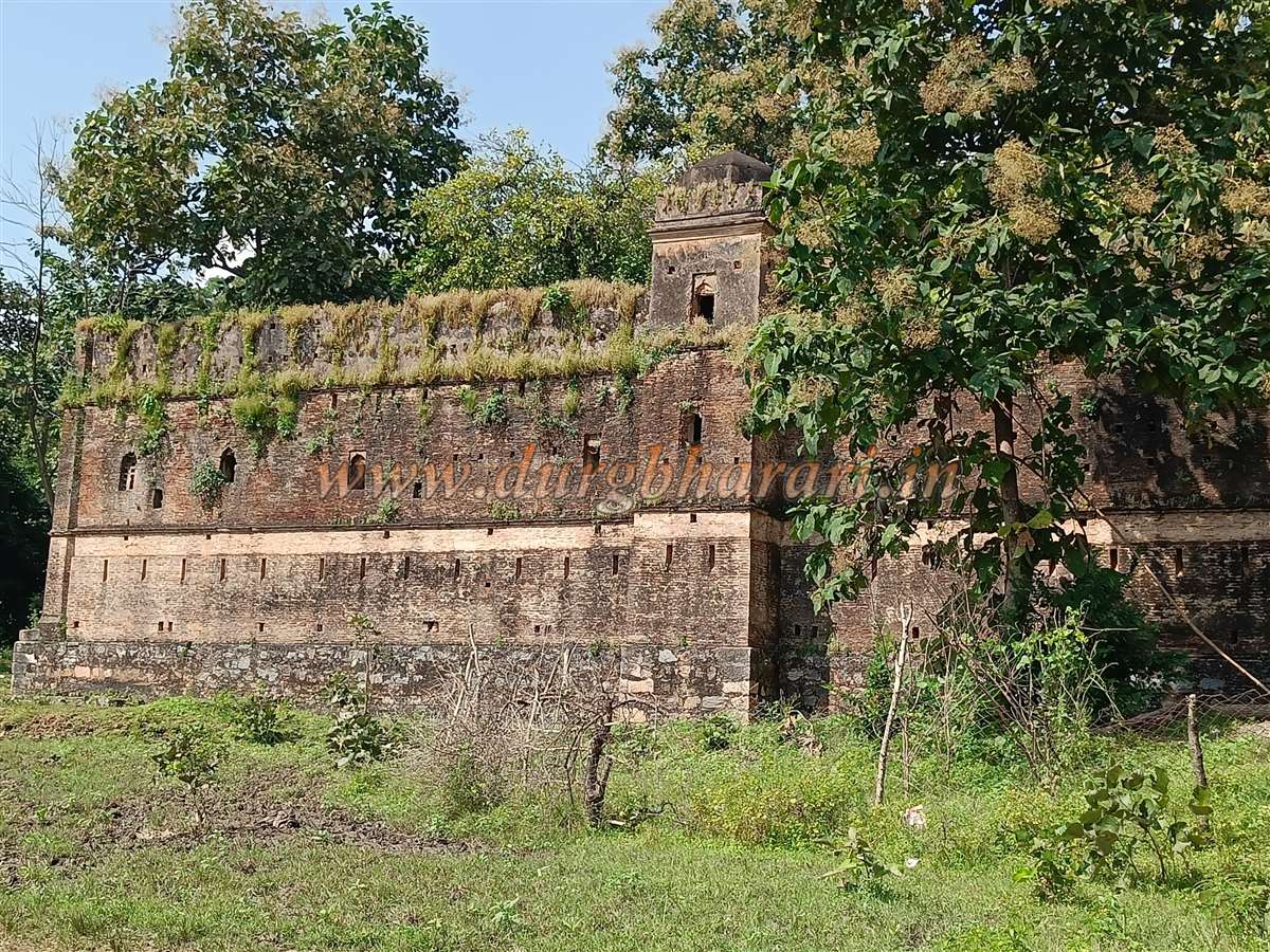
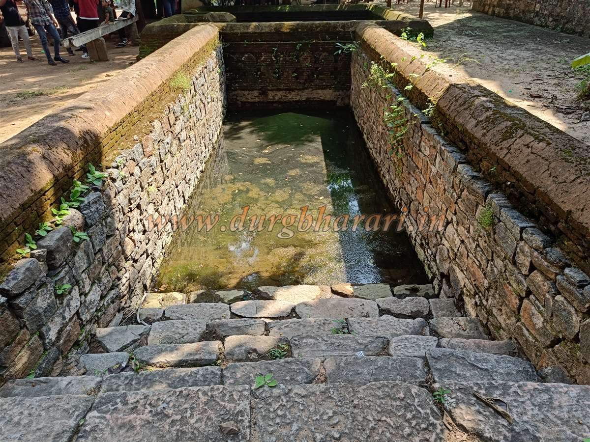
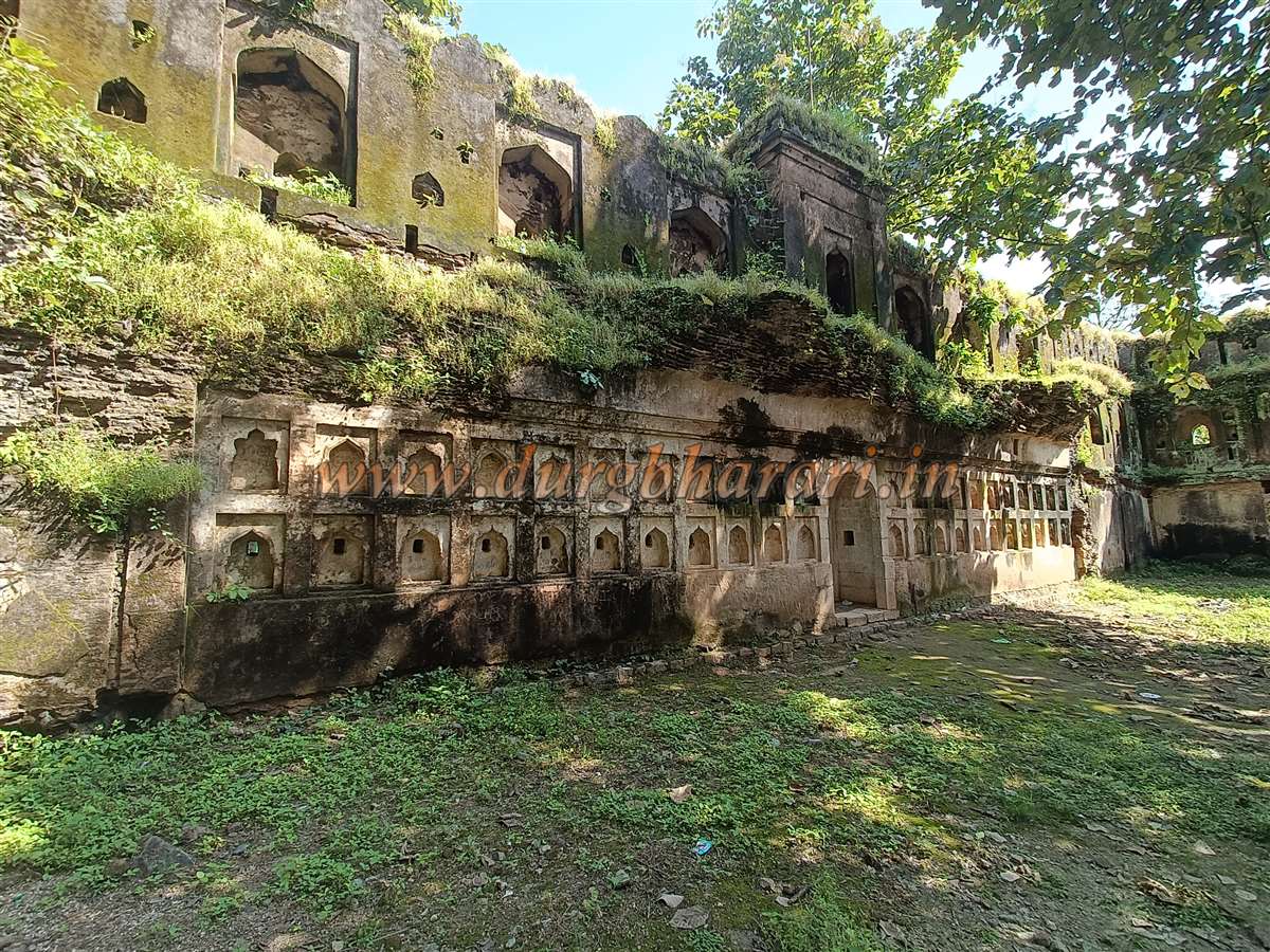
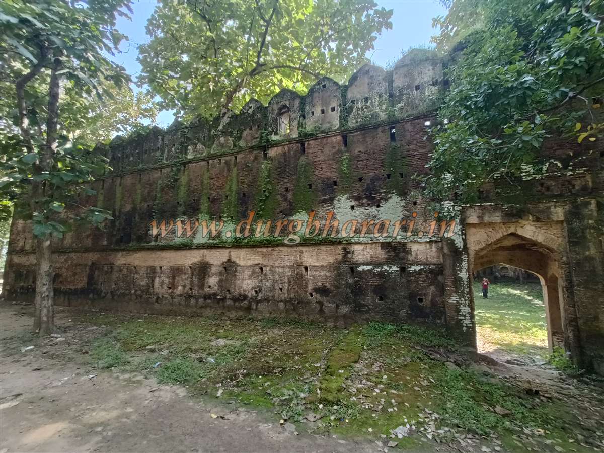
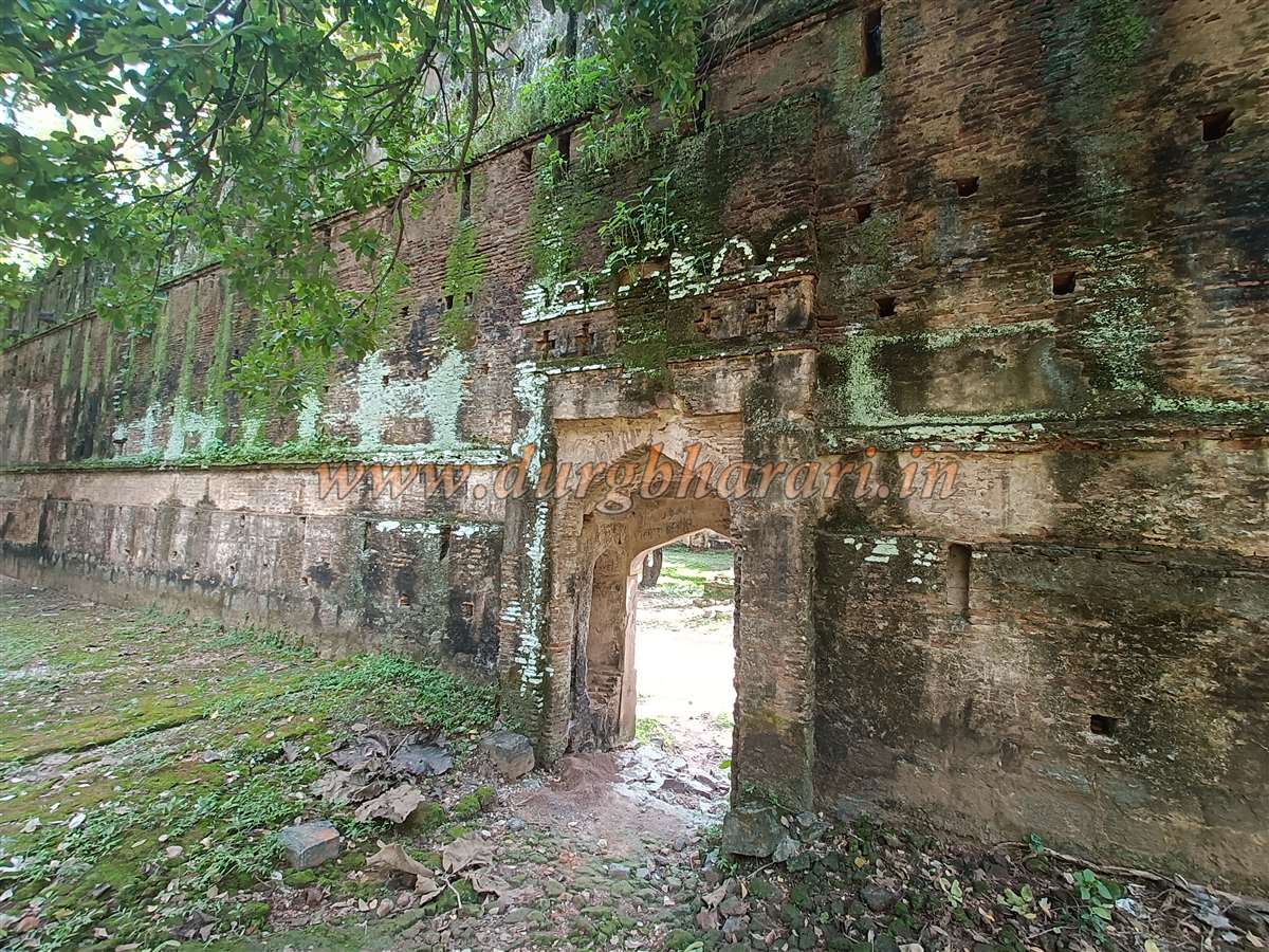
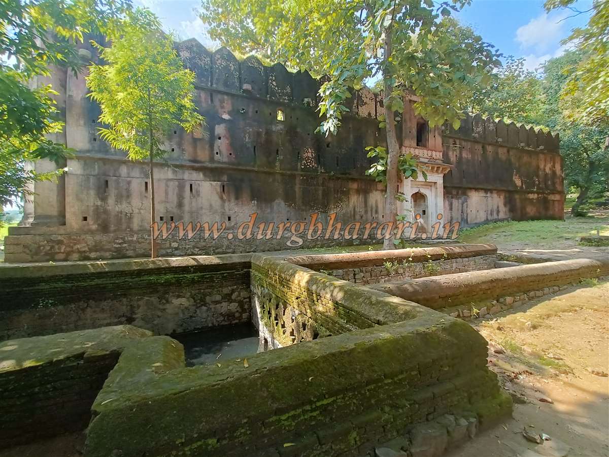
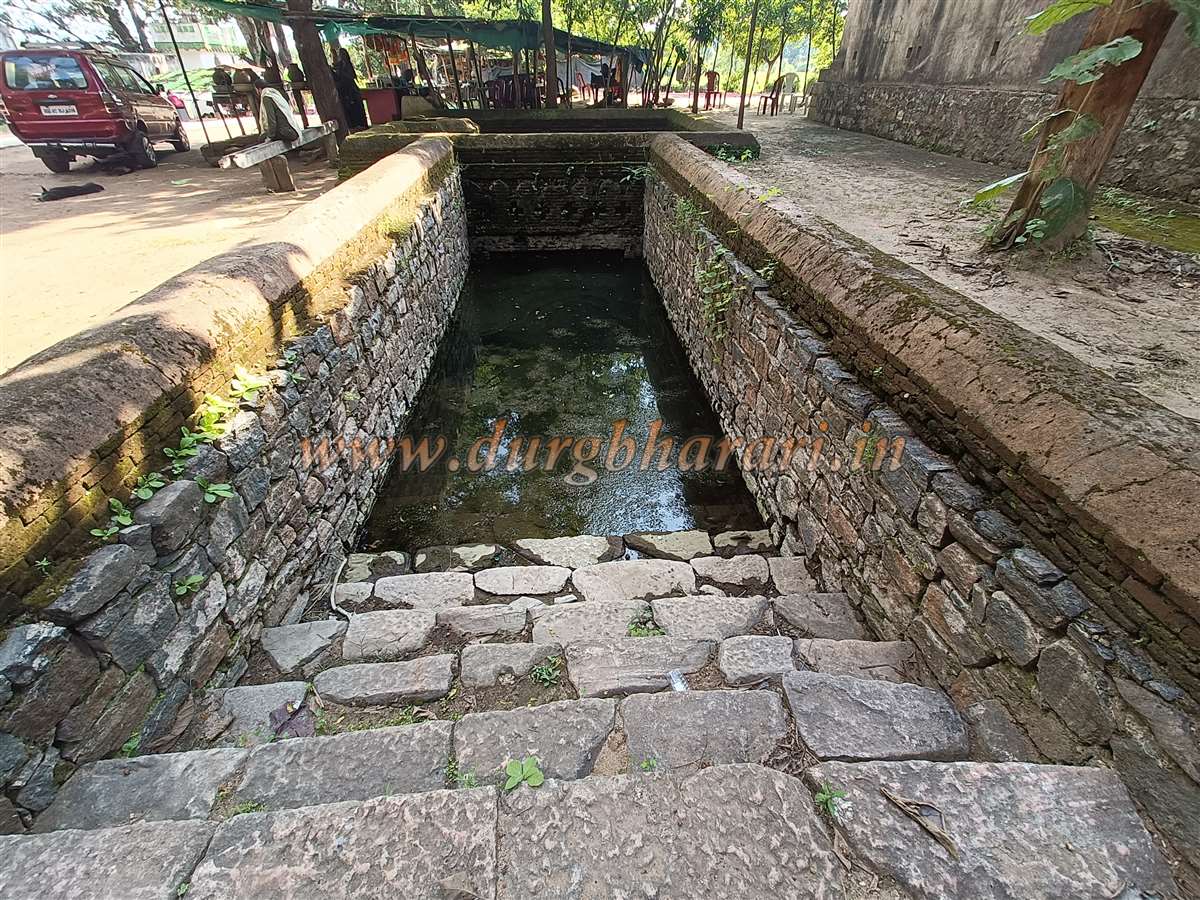
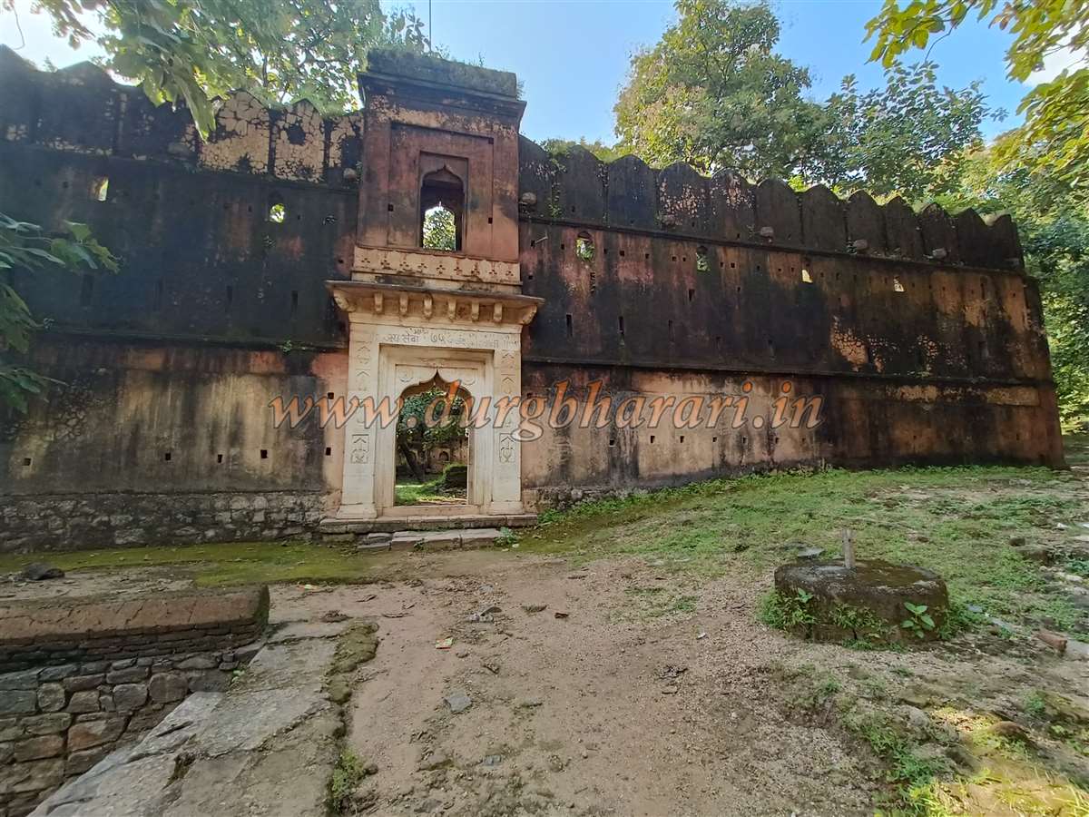
In front of the main gate of the Gadhi is a square stepwell built with bricks, featuring an arched entrance. Stone grinding wheels (raths) used for drawing water remain inside. A little away from the stepwell is a small dry pond. The fort's walls on all four sides are still in good condition, with the main entrance facing north.
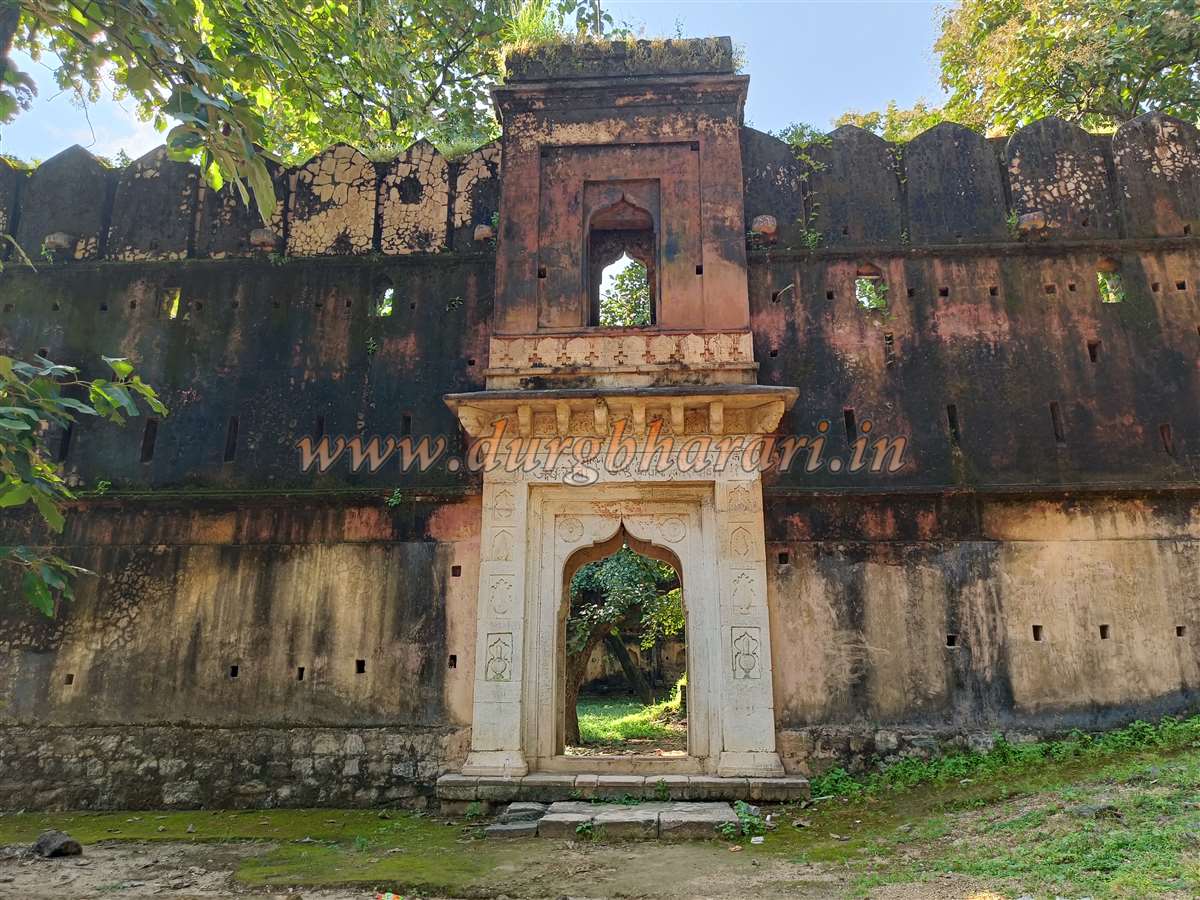
The entire fort is built from bricks, coated with lime plaster. The main gate is decorated with various carvings on lime plaster. However, the emblem of a lion riding an elephant, the royal insignia of the Gond dynasty, is missing, suggesting the structure might be a sarai rather than a royal residence.
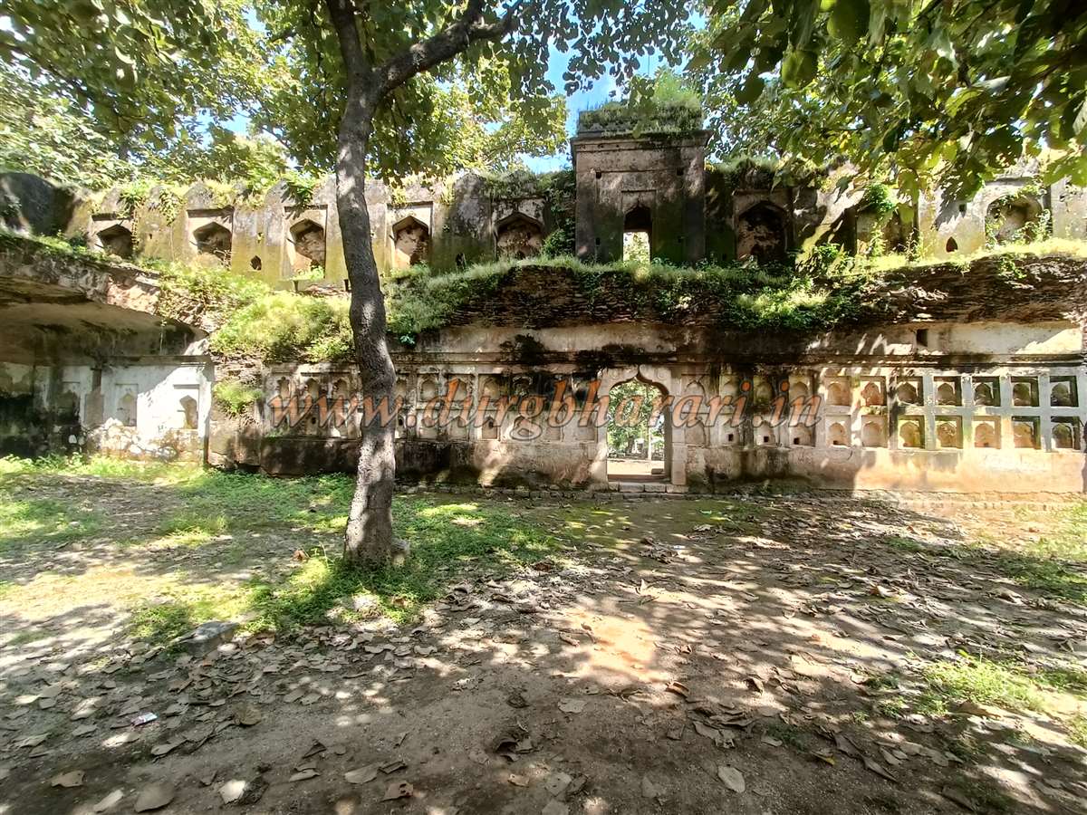
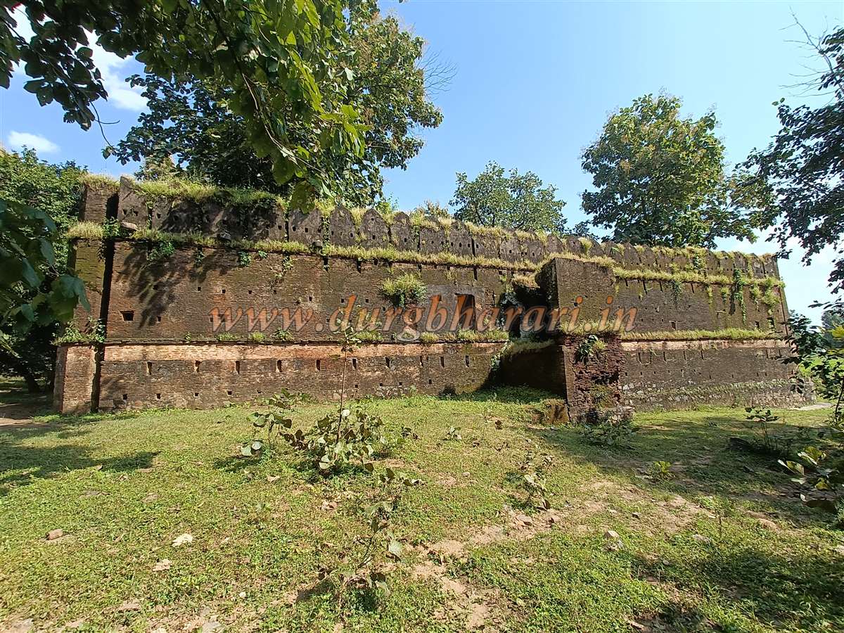
On the southern side, adjacent to the wall, is a square bastion, likely used both for guarding the fort and water supply. Upon entering the fort, decorated corners of different shapes appear along the walls on all sides. The square fort covers about half an acre, with a small square reservoir pond in the center.
Once a two-storied structure, the fort has now largely collapsed from the inside, and the pathway to the upper part is missing. A smaller gate on the west wall allows entry and exit. Exploring the entire fort takes about 15 minutes.
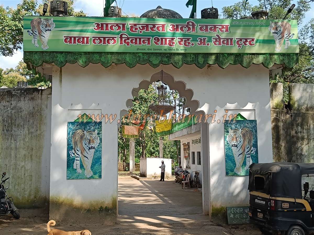
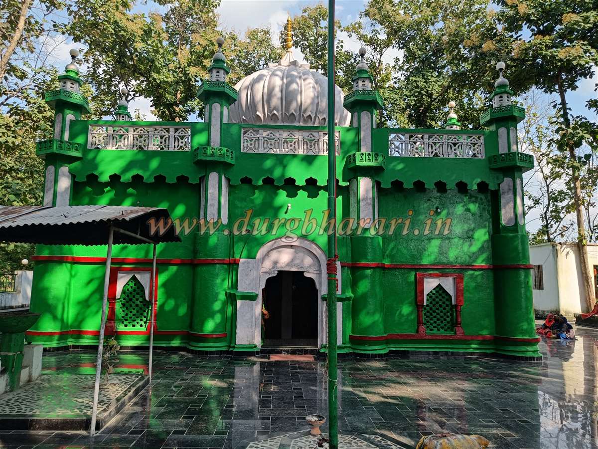
Though the Archaeological Department oversees the fort, it appears to receive little attention. Outside the main gate stands the dargah of Baba Lal Diwan Shah, near which is a small well with potable water.
Leaving the fort and turning left leads to a path uphill toward the main hill fort. Locals call this Baba’s resting place, but travellers should remember the fort lies above and continue exploring.
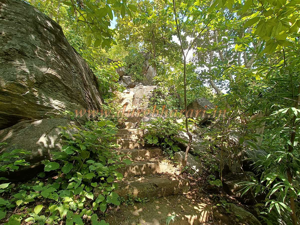
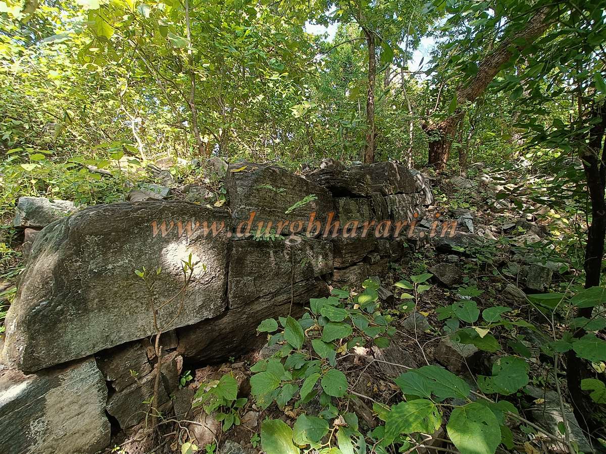
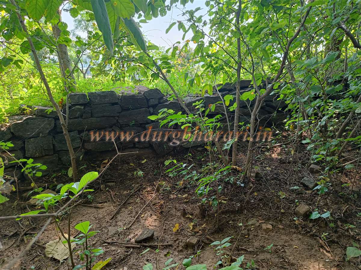
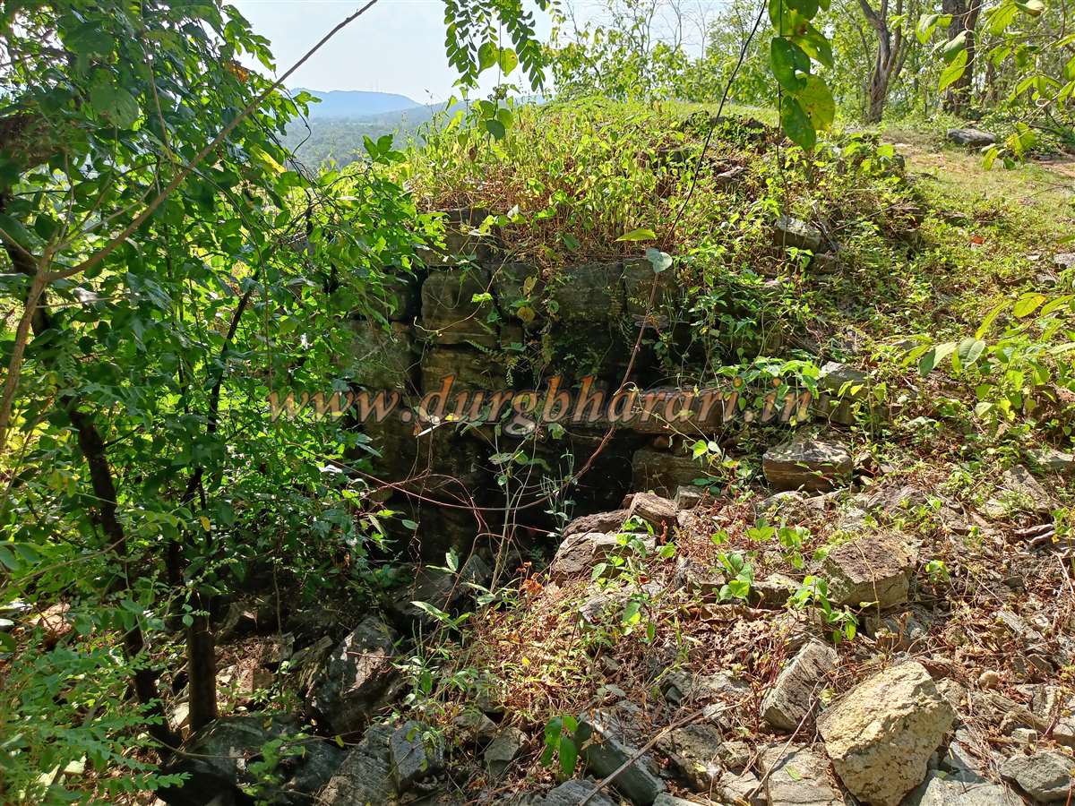
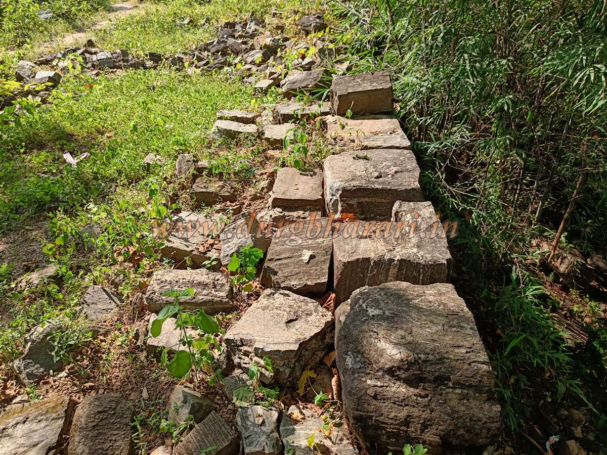
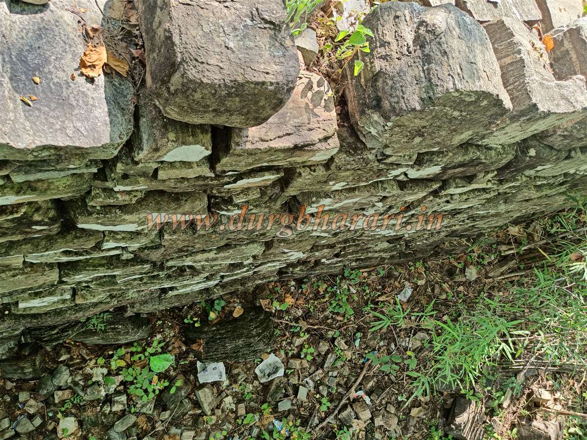
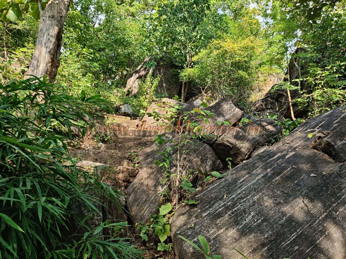
A steep climb of about 15 minutes leads to the ruined east-facing gate of the fort. Though destroyed, remnants still mark the gate's location. The path to the right along the fortification walls offers a view of the ramparts, approximately 7-8 feet wide and 5-6 feet high. Dense vegetation requires clearing to walk along these walls.
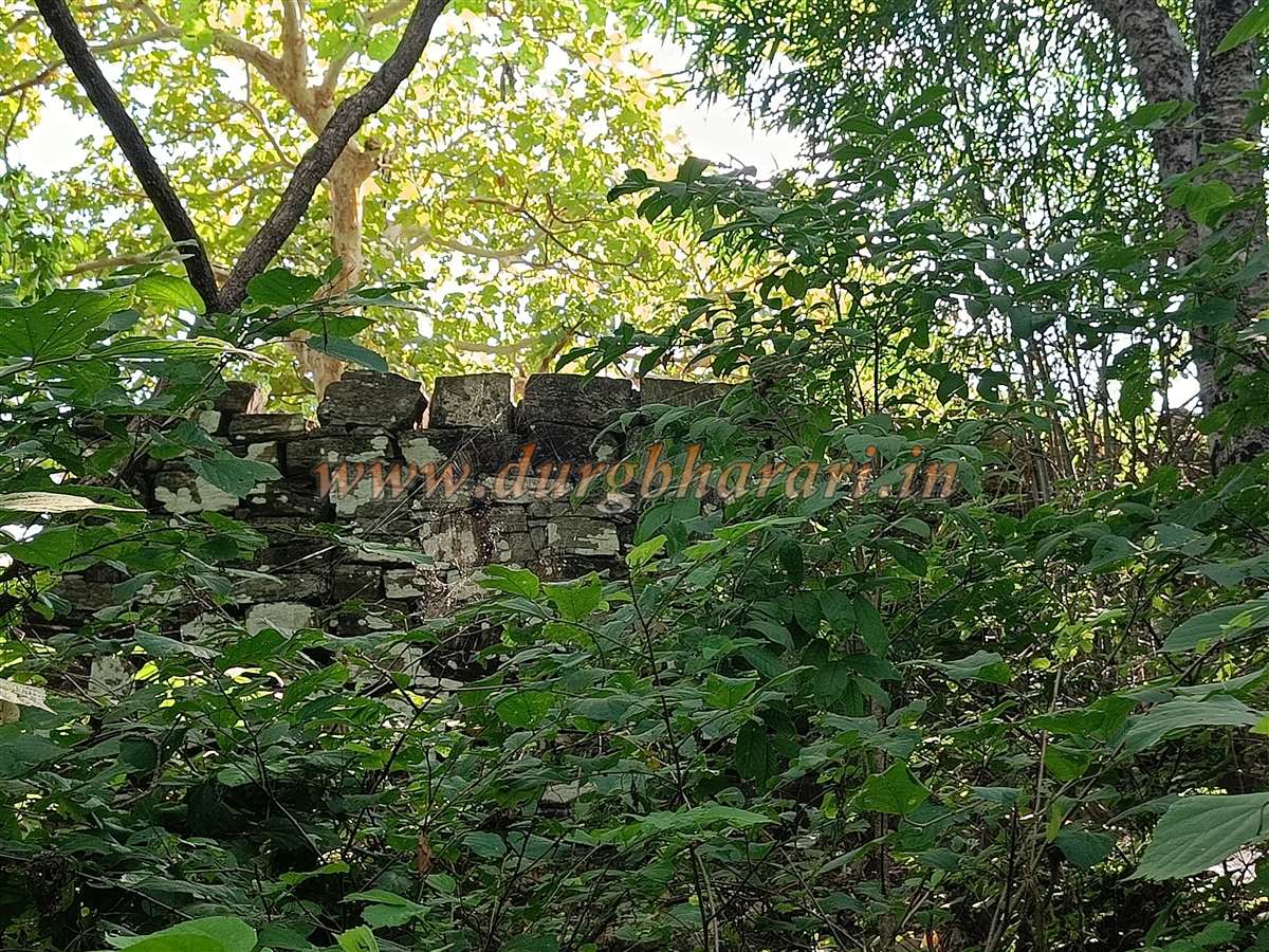
The walls are made of carefully fitted stones and remain largely intact. Due to thick vegetation, other structures remain unseen here. After viewing the walls, return to the main path and head toward the citadel (Balekilla).
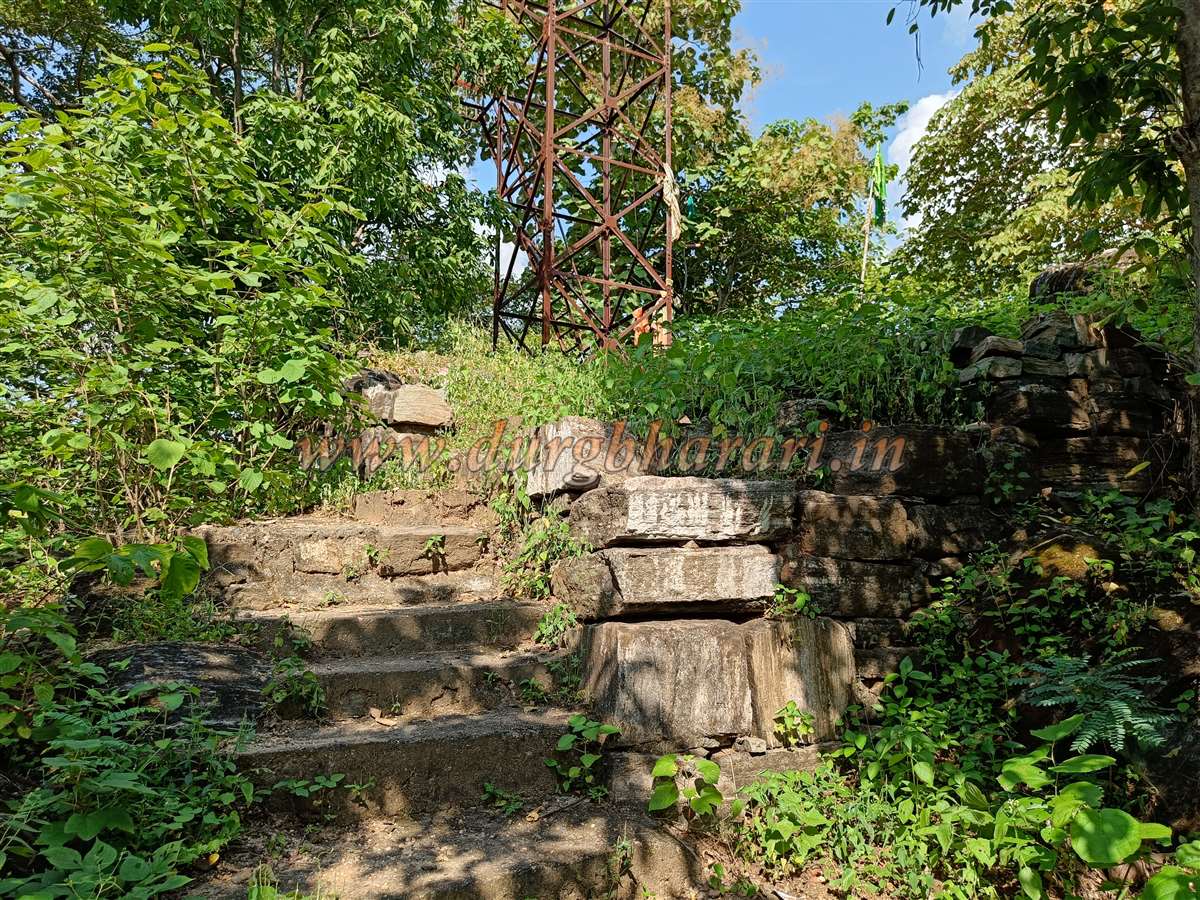
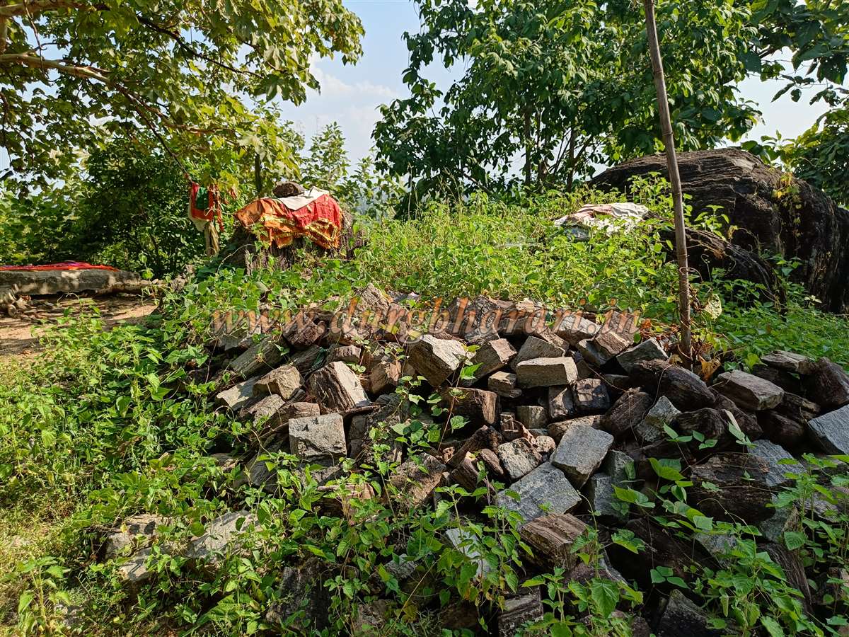
Along the way, two bastions become visible. From here, the open area toward Devlapar is clearly visible. After climbing some constructed steps, one reaches the citadel.
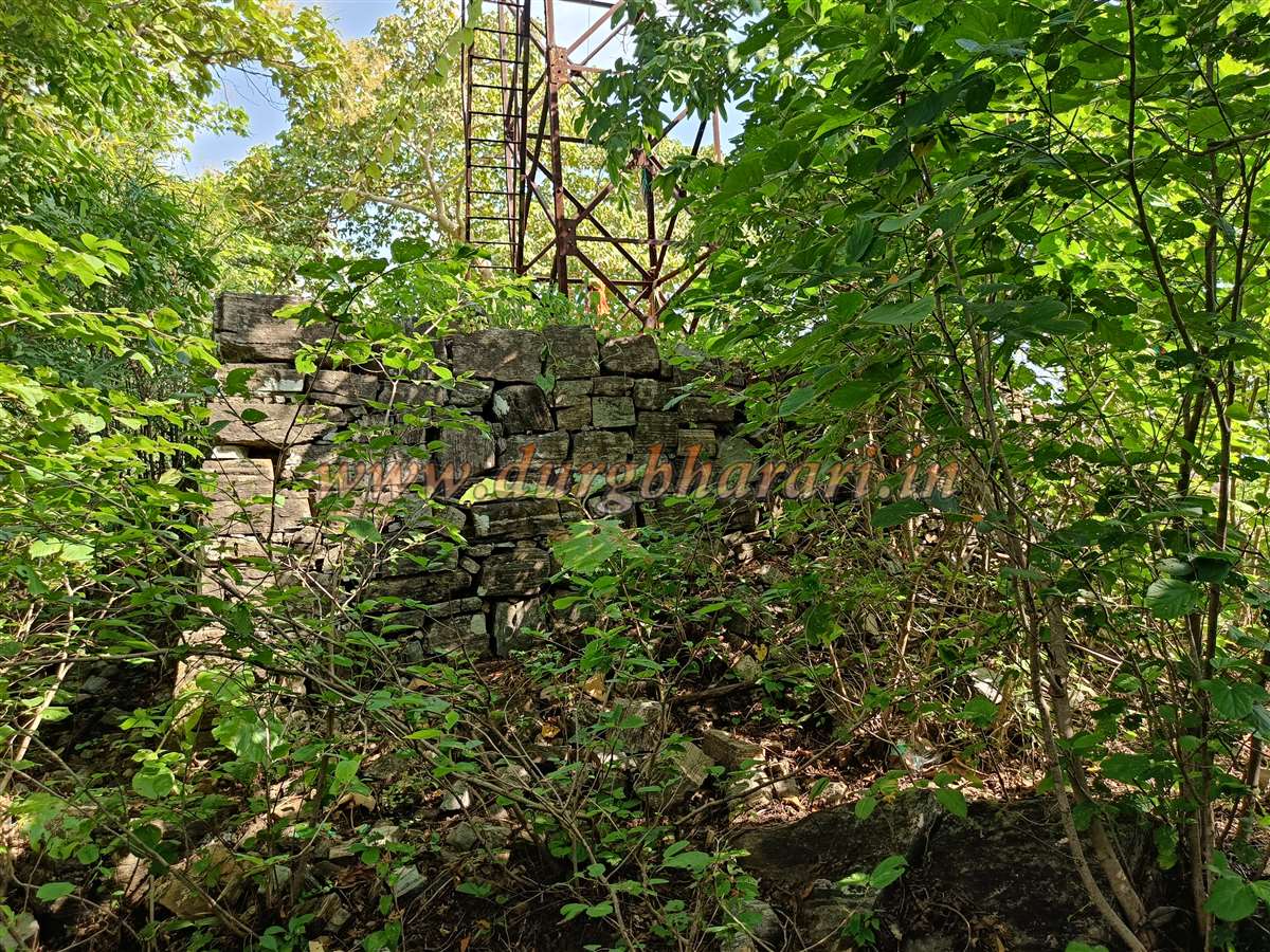
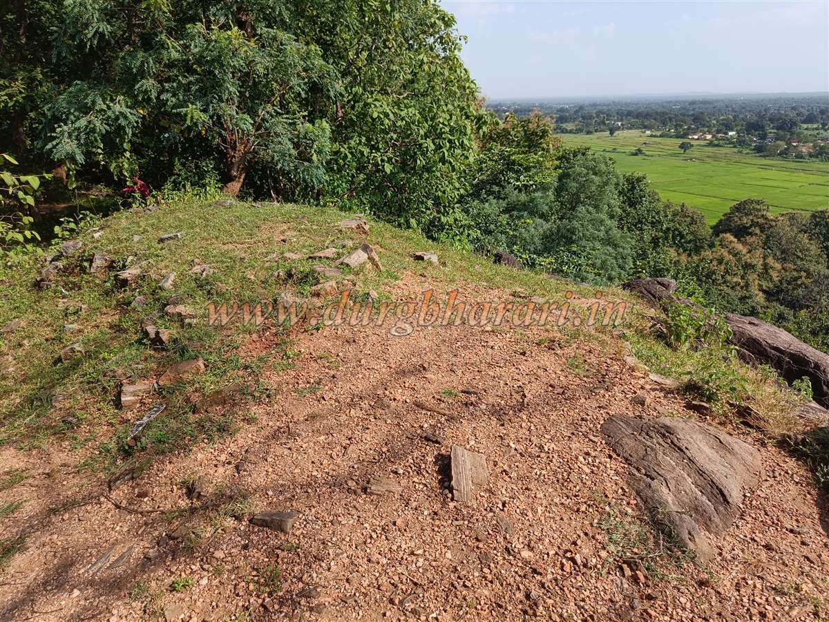
The entire fort covers approximately 8 acres and stands 1,520 feet above sea level. The citadel is very small—only about 40 by 40 feet—and built entirely of stone. The forest department has built a watchtower here for observation, along with a newly constructed small cement platform covered by a sheet.
It takes about half an hour to climb from the base to the citadel. As the fort is on a hill projecting out of the Ramtek hills, a vast plain is visible, but not the hills themselves.
No visible water source appears on the fort, or if present, it is concealed by vegetation. Returning to the base takes about an hour.
The Gond dynasty rose to power in the mid-13th century in eastern Vidarbha and ruled the region for nearly 400 years. Many forts constructed by the Gonds are found in this area. Their capitals were Ballarpur, Chandrapur, and Nagpur.
The Gonds initially accepted Muslim suzerainty, which reduced their military conflicts. During the early 18th century, the Bhosale’s of Nagpur established dominance over Vidarbha and renovated several forts, but there is no reference to renovation of Devlapar fort (also called Pendari fort).
Revolutionaries attempted to fight the British using this fort as a base, but failed. Hence, in British records, Devlapar fort is referred to as the "Pendar Thane."
© Suresh Nimbalkar
GALLERY