DHODAP
TYPE : HILL FORT
DISTRICT : NASHIK
HEIGHT : 4650 FEET
GRADE : MEDIUM
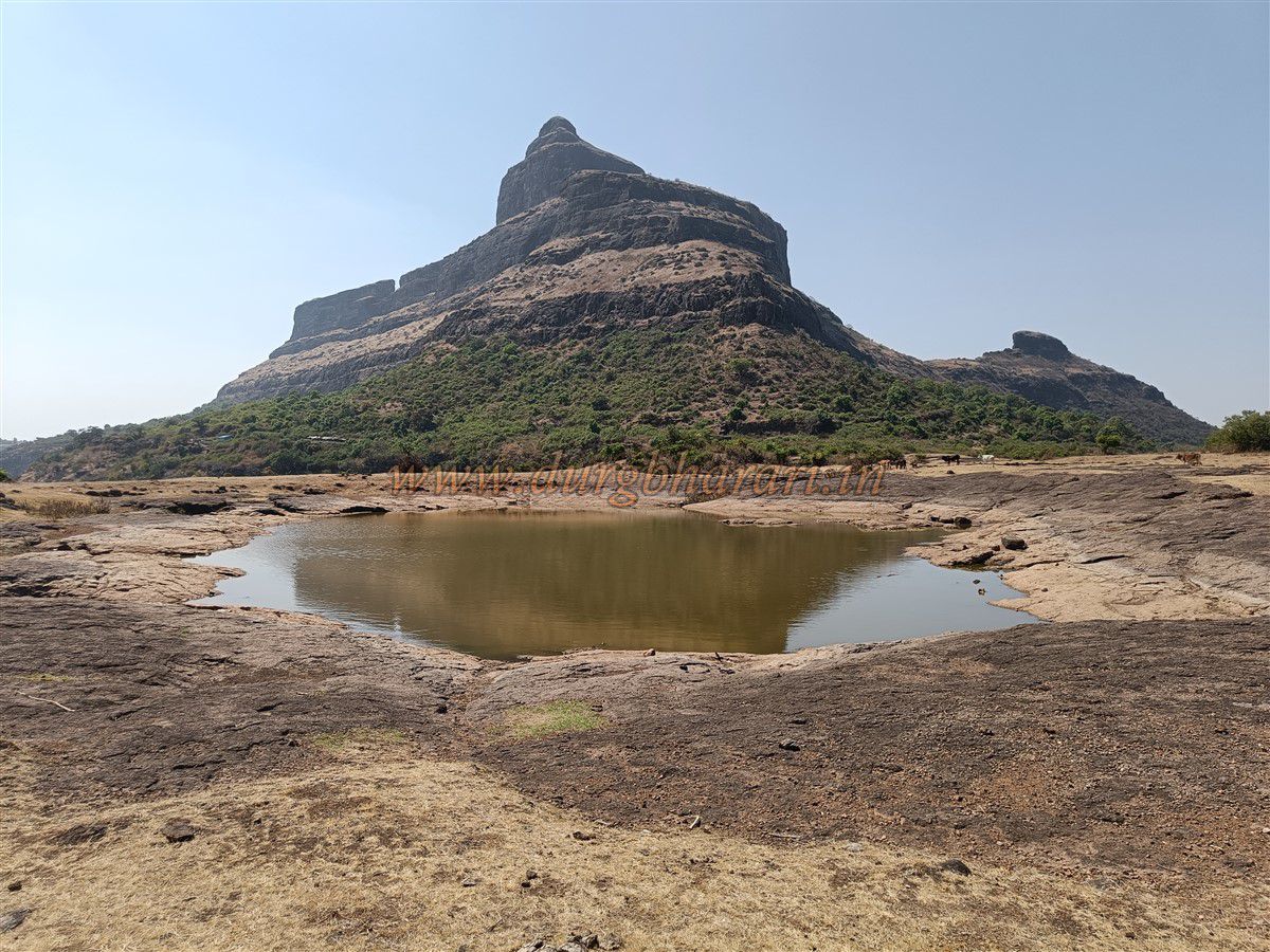
Alongside Salher-Mulher, Galna, and Harihar, another magnificent fort in Nashik district is Dhodap Fort. Known since ancient times by names such as Dhudap, Dharab, and Dhodap, this fort features remnants of a Balekilla (main fort), machi (plateau), gates, secret entrances, fortifications, bastions, temples, water tanks and wells, and steps carved in stone. Visiting Dhodap leaves one fully satisfied with the completeness of this fort.
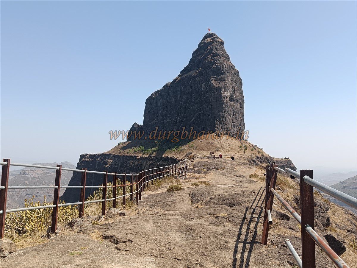
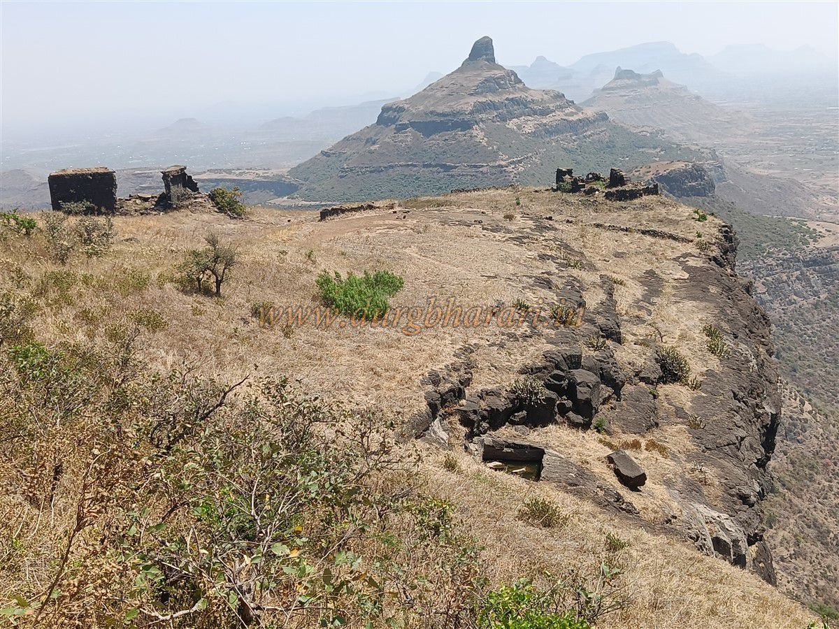
While traveling in the Kalvan region, Dhodap Fort in the Chandvad mountain range is easily recognizable from afar due to its Shiva Lingam-shaped summit and the natural gorge in the mountain. The village Hatti lies at the base of Dhodap Fort. This village is located about 150 km from Nashik via Wadal Bhoi route and about 50 km from the Kalvan taluka headquarters.
...
There is no direct bus service to Hatti, but one can reach the nearby village Dhodambe, about 5 km from Hatti, by state transport bus. Dhodambe village also has an ancient Shiva temple worth visiting. From Dhodambe onward, one must travel on foot or use a private vehicle.
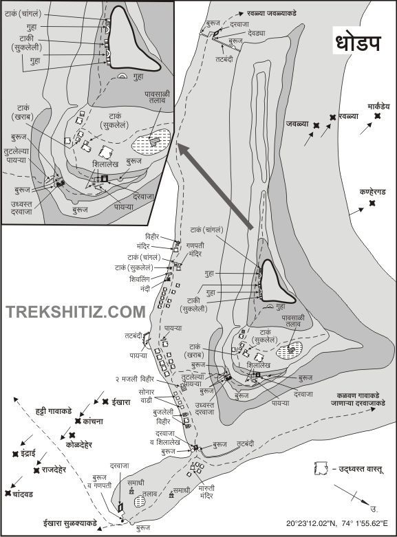
From Hatti village, a narrow worn footpath along the dam leads up to the fort. This path takes about 20 minutes to reach the base of the fort near a small shelter with a Hanuman idol. If you have a private vehicle, you can drive up to this Hanuman idol. After paying respects to Hanuman, it takes about 45 minutes to reach the fortifications below the machi. From here, one enters the machi through a broken fortification wall. Due to extensive ruin, no clear gate remains here, so it is uncertain if a gate ever existed.
The machi is vast and spread over three sections, each accessible via separate gates. Upon entering the machi, the first thing visible is a carved dome housing an idol of Maruti (Hanuman). Since reaching the machi requires little effort, it is recommended to first visit the higher Balekilla and then explore the machi.
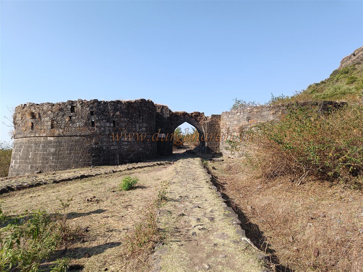
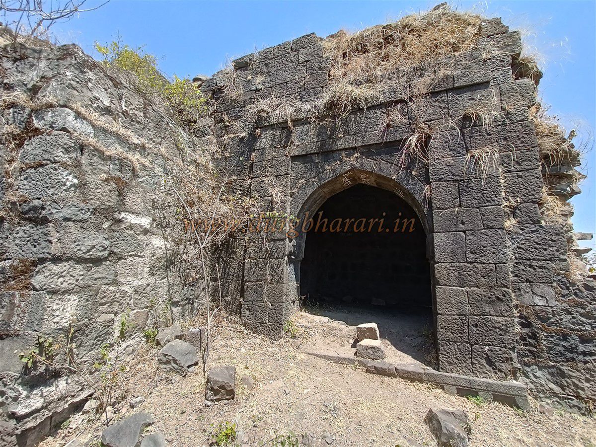
Saluting Maruti and turning left leads to the fort’s north-facing main gate, enclosed between two large bastions. Beneath the gate’s arch on the right side is an inscription in Devanagari script. The machi is separated from the outer machi by a fortification wall built with carefully fitted stones, ascending towards the Balekilla.
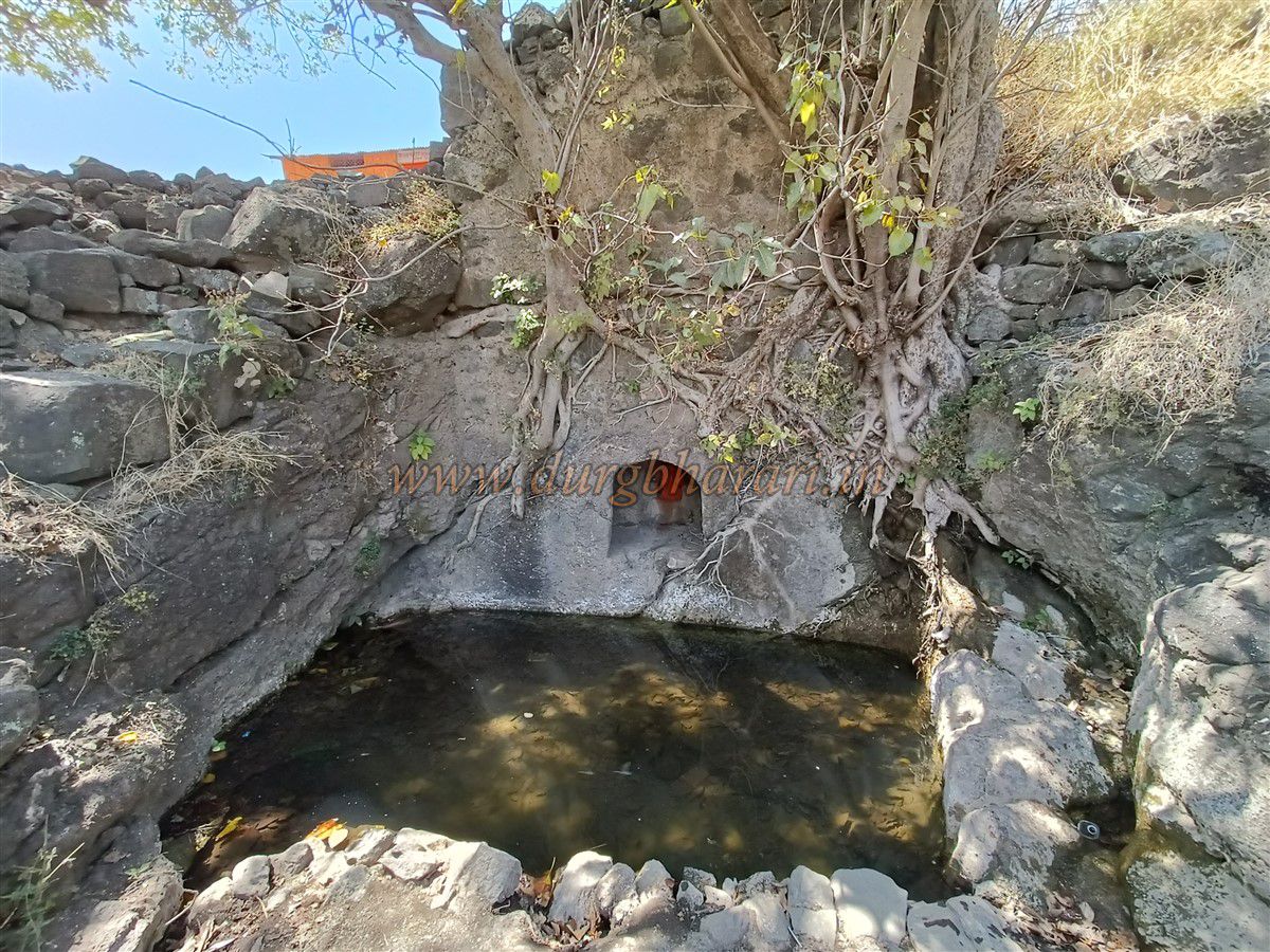
Beyond the gate, on both sides of the path, there are numerous architectural remains. On the right near the path’s start are rectangular house foundations; one features a small dome housing a worn idol. To the left of the path is a stepped well within the fortification, and just outside is a small secret path (chorvat) for exiting the fort. Further along are steps leading to a small water tank and a circular domed Maruti temple nearby.
The temple houses an idol of Maruti and Nandi, with three broken Shiva Lingams and a stone trough outside. A small Ganesha idol sits in a corner at the temple’s front. Nearby, on a platform, is a stone mortar used for husking rice. Towards the left lies Sonarwadi, a small hamlet with 8–10 houses, now abandoned. At the fort’s base, the Gurkha community camps during the monsoon months with their cattle.
From here, the path forks: the left path leads to a two-story well, while the right goes toward the Balekilla. If camping on the fort, it is advisable to explore the machi first and then the Balekilla; otherwise, visit the Balekilla first.
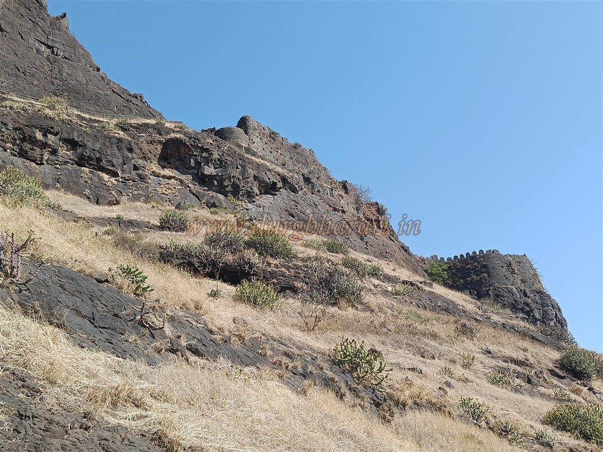
The Balekilla path is a steep ascent with some stone-carved steps and a route cut into the rock. After about half an hour of climbing, you reach the edge of the cliff, where the forest department has installed an iron ladder and cages for safety.
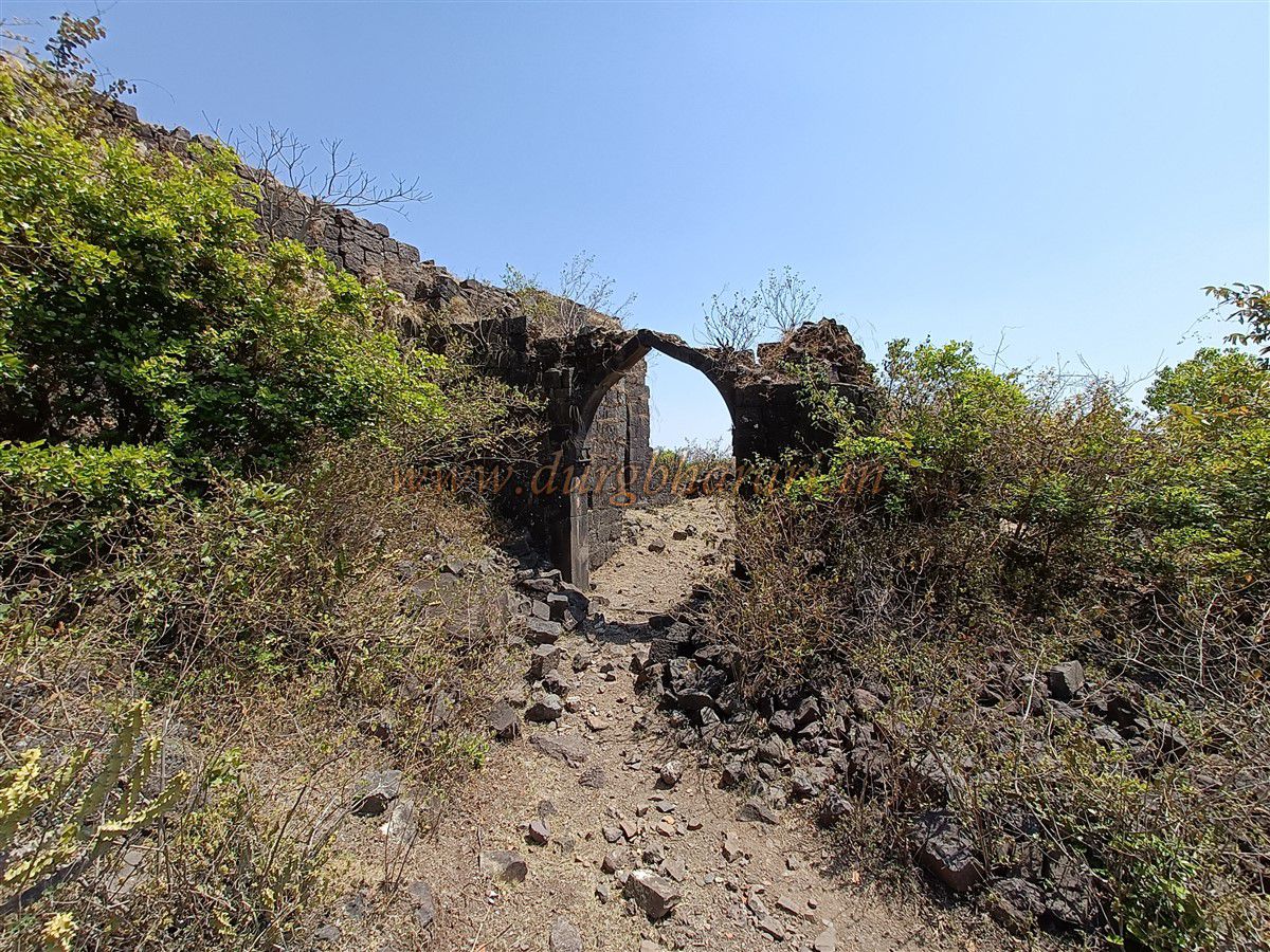
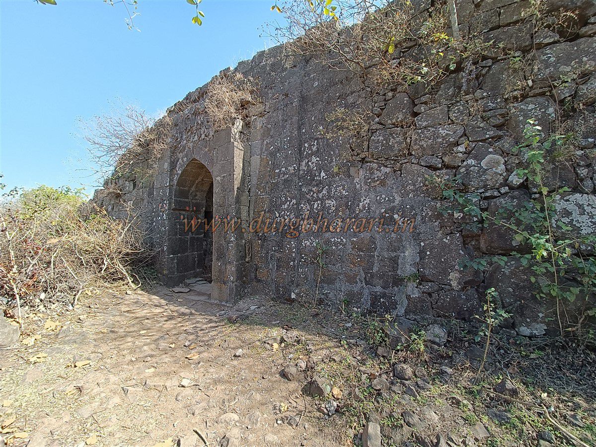
Continuing along this path leads to a small gorge where traces of the original entrance gate exist. Climbing further along the cliff edge and keeping the gorge on the right, you reach the fort’s second gate, also equipped with iron cages installed by the forest department.
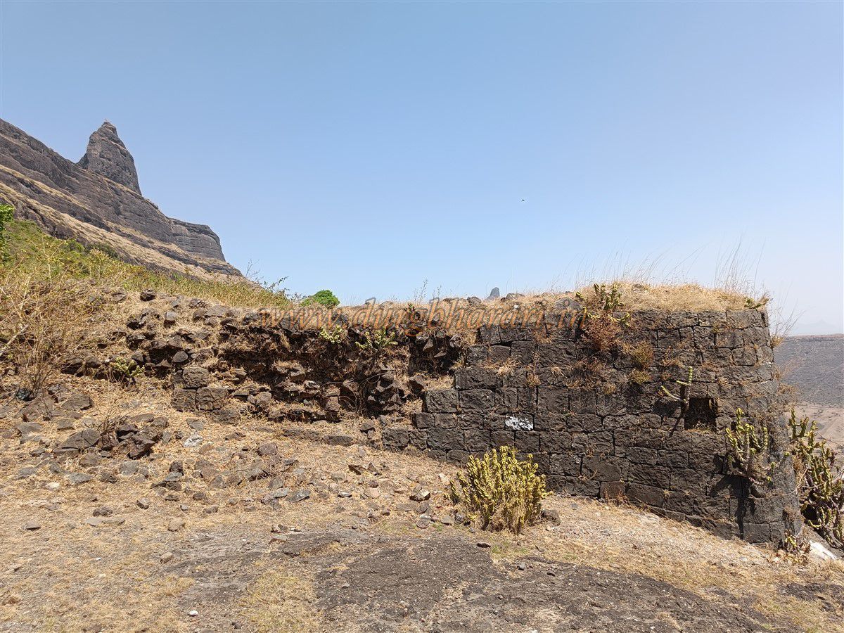
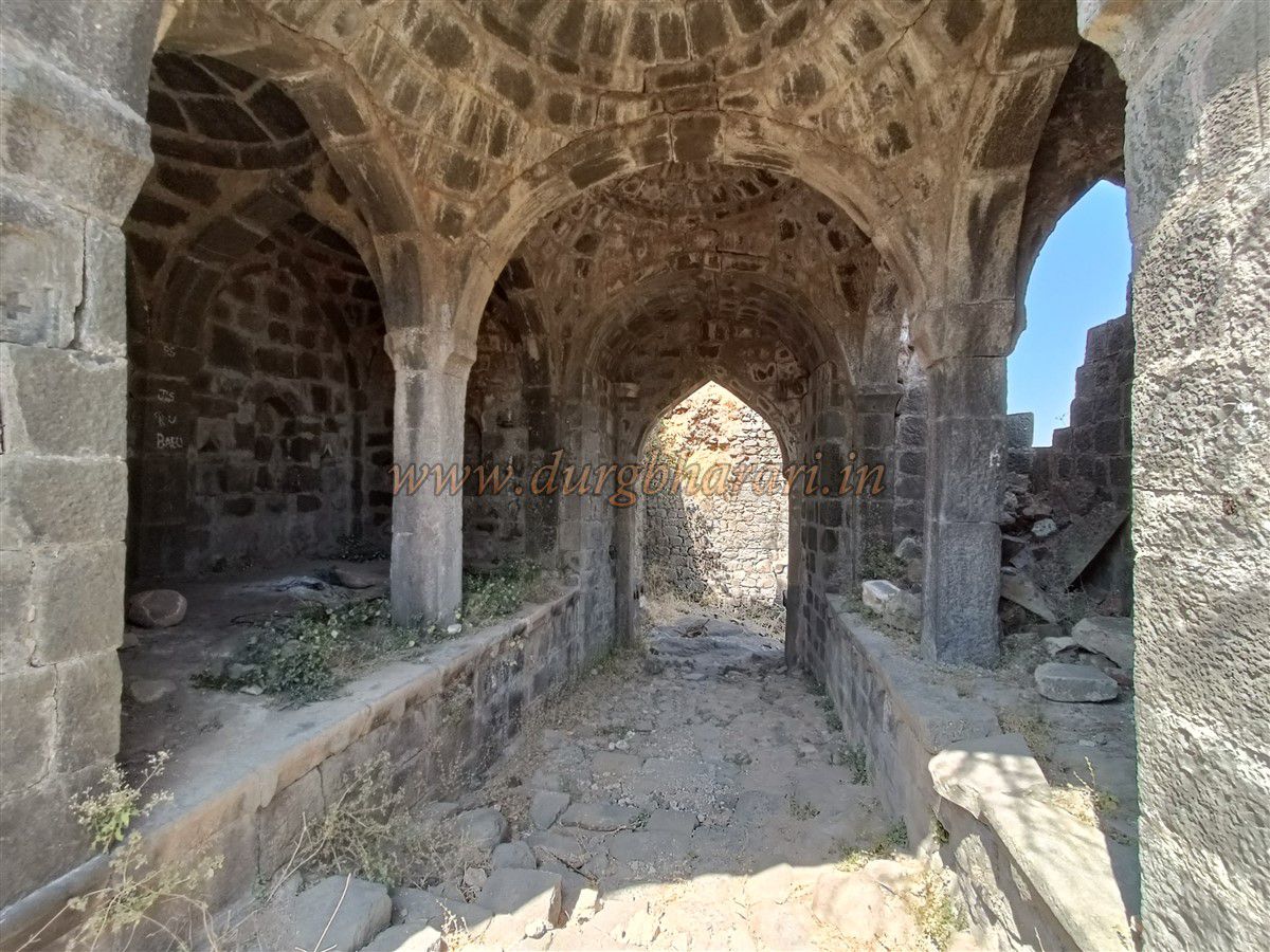
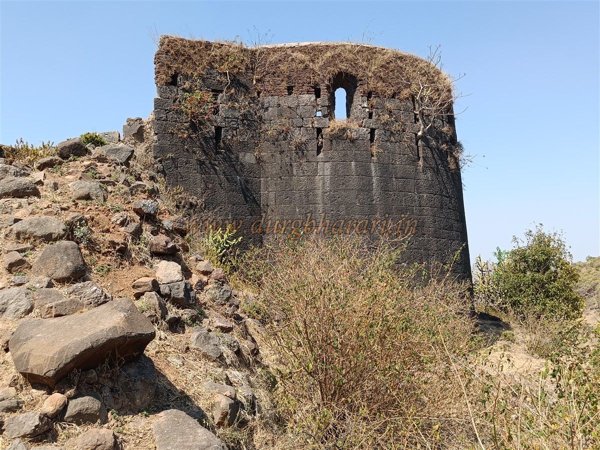
This gate is positioned behind two bastions and connects directly to the Balekilla cliff, where a third bastion is built. Inside the gate are guard rooms on both sides, but the arch has been completely destroyed. The fortification wall along the gorge here remains in good condition, with sturdy walls.
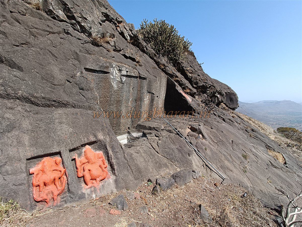
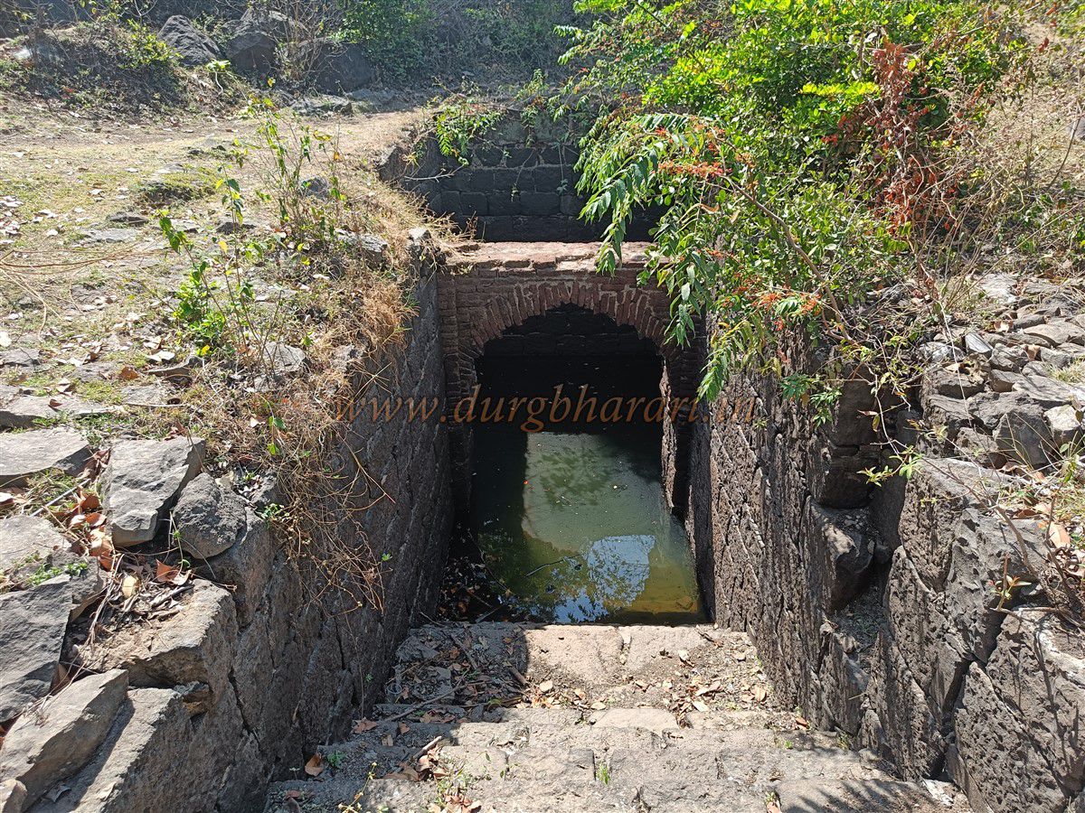
Near the bastion by the gate are water tanks known as Hanuman tanks, filled with potable water. To the right and left of the tank are carved idols of Ganpati and Bhairav respectively. Inside this enclosed area are scattered house foundations. Looking toward the fort summit, the cliff face and the stone-built Balekilla walls with bastions are visible.
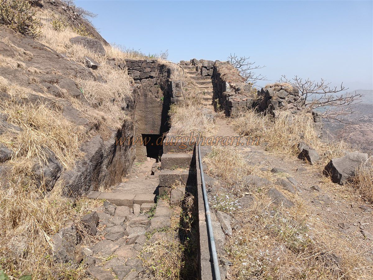
From the gate, climbing a 10-minute path leads to a serpentine stone-cut trail that is the entrance to the Balekilla. Before entering, two large water tanks carved into the rock are visible on the left. At the second bend in the path, two Persian inscriptions are carved into the rock.
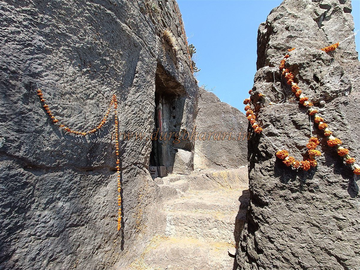
The Balekilla gate is fully cut into the cliff, leading to a 15-foot-long underground passage. The entrance faces north, and the exit faces east. The path inside is cut into the rock on one side and fortified by a wall on the other, with a bastion enclosing the upper area.
From here, continuing along the gorge edge, you see more water tanks carved into the cliff on the left and a bastion on the right topped by a red-painted male figure sculpture. After viewing this gate area, return to the main path to continue your fort exploration.
Continuing ahead, on the right side, are ruined cliff-side structures and fortification walls on the left. After climbing stone-cut steps, in about 15 minutes you reach the Balekilla.
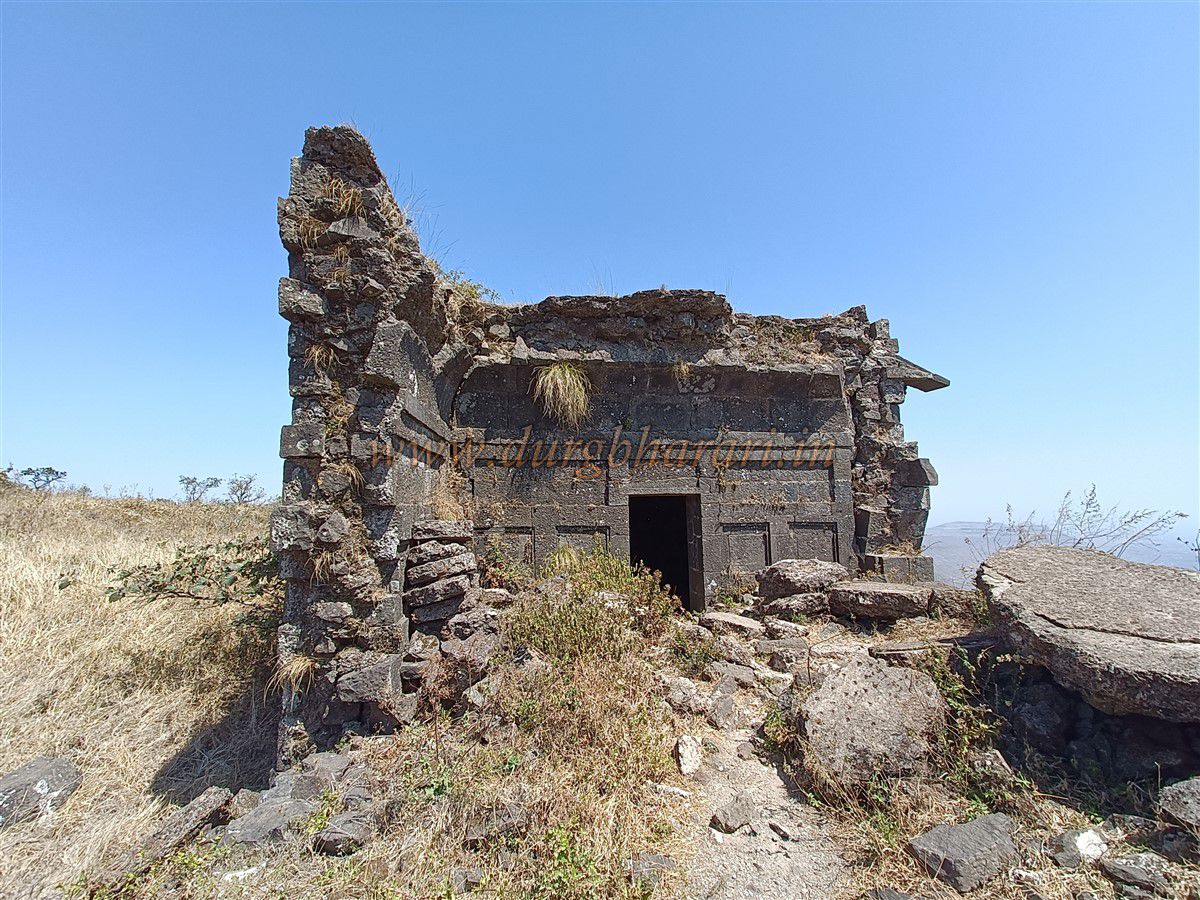
At the start of the Balekilla path is a ruined but beautiful building with a still-intact hall and nearby water tanks. To the right of the wada (fort residence) is a rainwater pond, and along the gorge edge, you see fortifications hidden in the trees.
To the left is a large samadhi platform next to a cliff-edge water tank filled with green water. Below this tank is a ruined mansion with walls and arches still standing. Nearby, another cliff-cut water tank is visible.
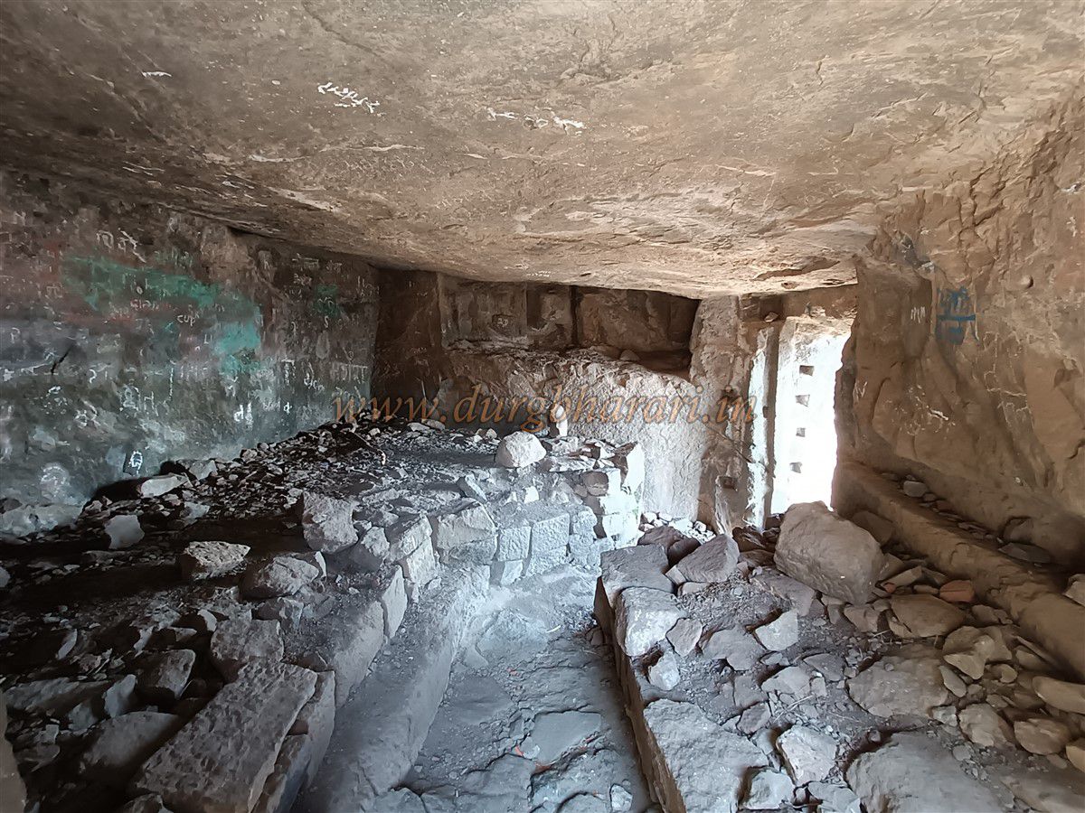
Heading toward the gorge, you will see a rectangular cave that is somewhat slippery and should be visited only if experienced in rock climbing. At the base of this gorge are 8–10 caves carved at different levels, some half-finished and some with water tanks inside.
The last two caves are spacious enough for 40–50 people, featuring multiple halls. One hall houses a small temple dedicated to a goddess. Outside the cave is a water-filled column tank with cool, drinkable water. Near this tank are broken idols of Nandi and Shiva Lingam.
Nearby lies a natural cave with a second opening behind the gorge. It is possible to fully circle the Balekilla via this gorge, but climbing it requires proper rock climbing gear and experience.
On the way from the cave to the gorge, two half-finished caves and a dry tank are visible. The path leads to the natural gorge at Dangsoundane, which separates this fort from the next hill fort. At the end of the gorge are traces of a circular bastion.
This completes the Balekilla circuit. From the Balekilla, you can see 16 small and large forts in the Satmala mountain range such as Ravlya-Jawlya, Markandya, Saptashrungi, Kanchana-Manchana, Premgiri, Salher-Salota, Chaulher, Kanhergad, Chandvad, Indrai, Rajdeher, Koldher, Ahivantgad, Achala, and Ramshej. The nearby forts of Hundya and Ikhara are also visible.
It takes about five hours to climb from the base to the Balekilla and complete a full tour. From the Balekilla, it takes about half an hour to descend to the machi.
On the balekilla, to the left is a two-story well filled with non-potable water, but its structure is impressive. Built in a trapezoidal shape with arches over two levels, stone steps lead down to the bottom.
Near this well, a path leads left toward the gorge. Descending this path leads to an ashram and then to Ganesh Tank, carved into a depression on a hillside with a spring at the top. A small temple of Ganesh is carved into the tank’s wall, giving the tank its name.
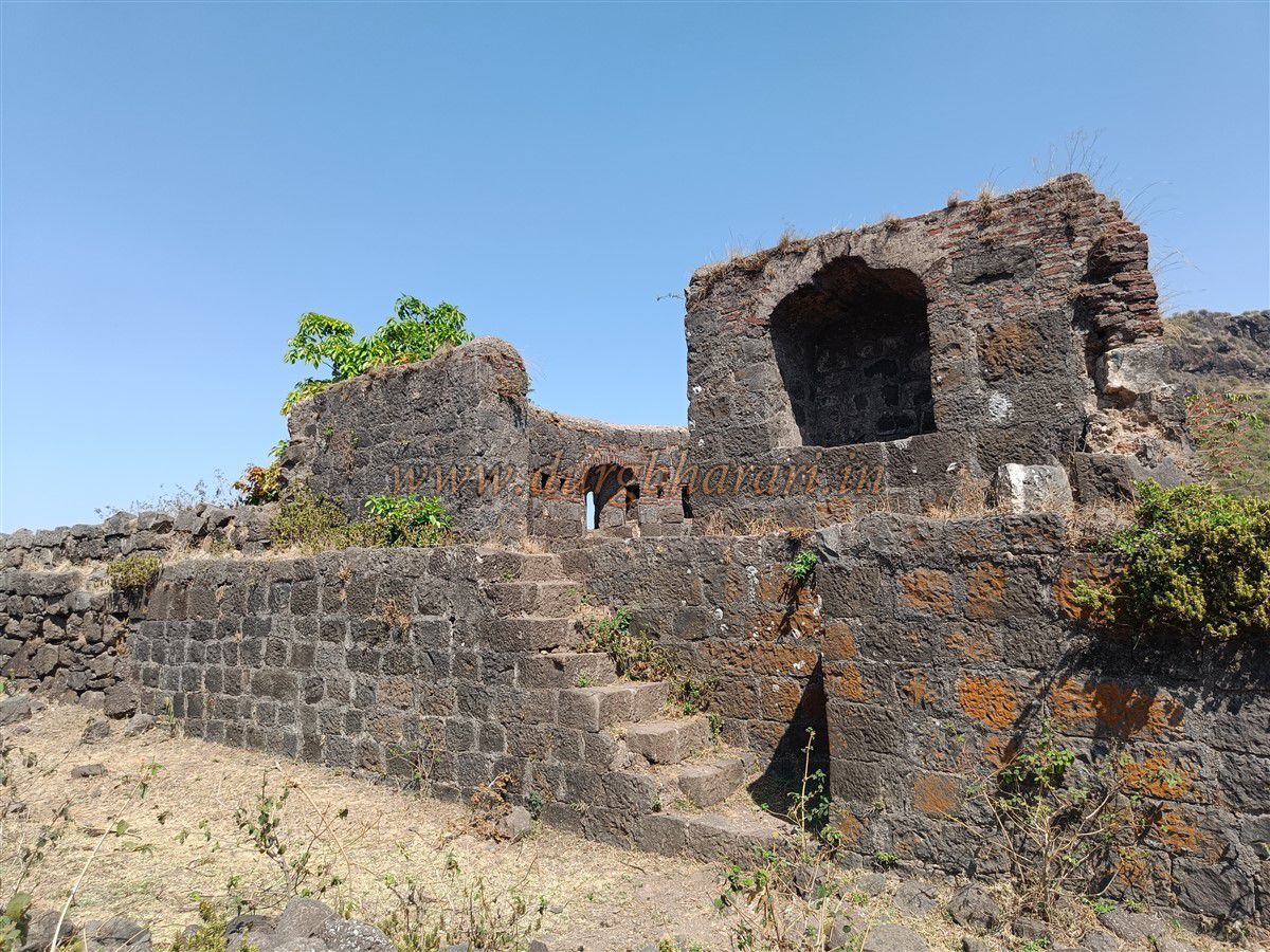
The forest department has constructed shelters nearby. Continuing along the Machi’s trail, fortifications on the left slope near the gorge remain well preserved. Descending slightly, the fortification can be seen close up.
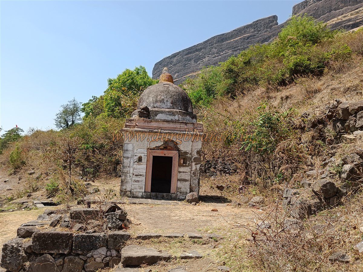
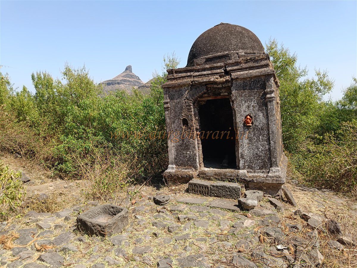
Along the path are remains of houses and walls. A Ganpati temple lies on the right, adjacent to two water tanks — one a reservoir for drinking water, the other for animals. On the left side near the gorge is a ruined Shiva temple with a Nandi Mandap (pavilion) holding a Nandi statue.
Near the temple is a cliff-carved water tank with potable water. Continuing along the path leads to a second Shiva temple of similar design, recently restored, housing a Shiva Lingam inside and Nandi outside.
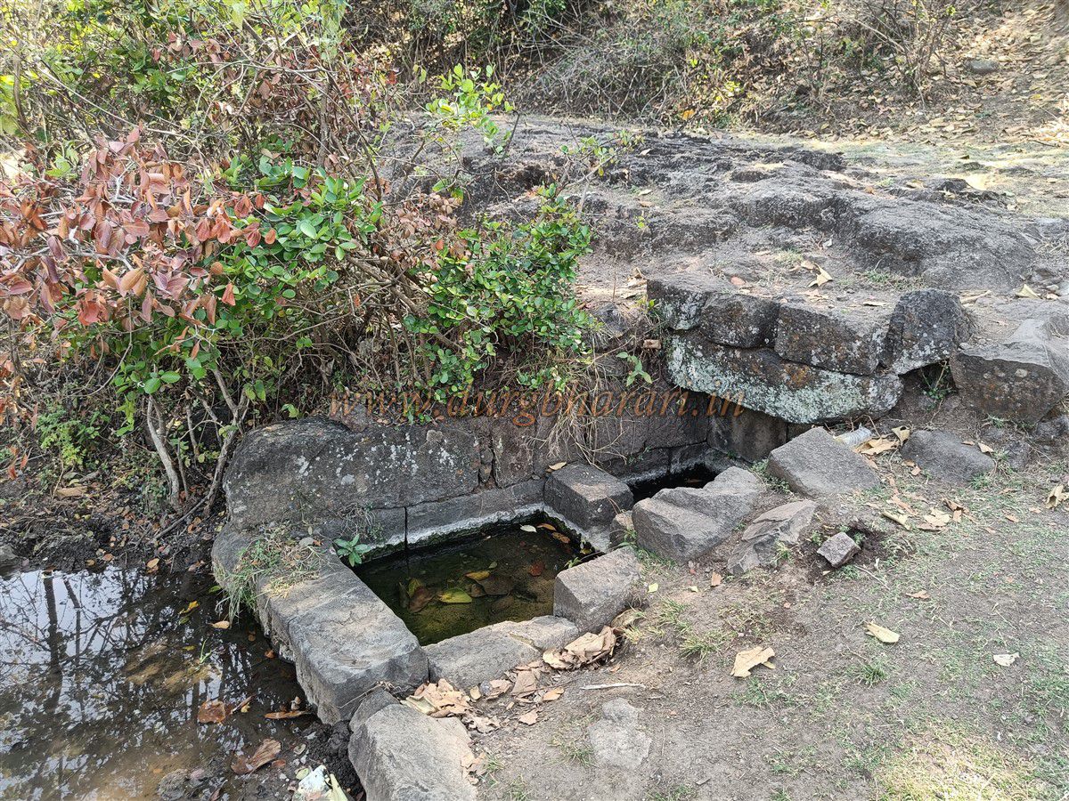
Behind this temple is a small stepwell with potable water. In front of the temple under a tree are two footsteps-shaped stone footprints and some stone remains.
Continuing along, on the left is a plateau with a seasonal pond, suggesting earlier agricultural activity. Another potable water tank carved in the cliff is also visible.
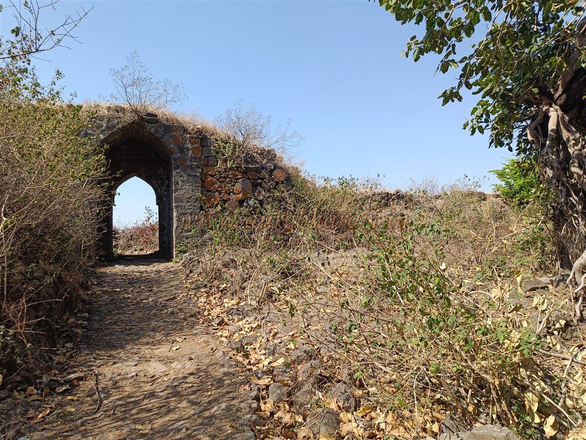
About 20 minutes along a worn path from the second Shiva temple leads to a south-facing gate near the machi. This gate is part of a fortification wall that runs from the balekilla’s mountain down to the gorge, with bastions protecting it.
The bastions near the gate are badly damaged, but the guard room in one bastion remains intact. The gate leads down to the plateau under Ravlya-Jawlya fort. This completes the circuit of Sonar Machi.
It takes about 1 to 1.5 hours to tour the entire machi after descending from the balekilla.
After visiting this gate, return to the first machi gate near Sonarwadi. This gate features two fortified paths: one straight ahead and another turning right towards the fort entrance.
Taking the straight path leads to another two-story well similar to the one previously seen, with an arch and stone steps.
Nearby, a secret exit path leads out of the fort during emergencies.
Along the paved path is a pair of small water tanks with potable water fed by a spring. After about 15 minutes of walking, you reach the Kalvan gate.
From the inner machi gate to Kalvan gate takes about 40 minutes. This north-facing gate is part of the fortification wall connecting the mountain to the gorge.
The gate remains well preserved, with many architectural remains nearby indicating a sizeable settlement.
From Kalvan gate, a path descends to Kalvan village via Otur.
Turning right from this gate leads back to the Machi’s first gate near Sonarwadi.
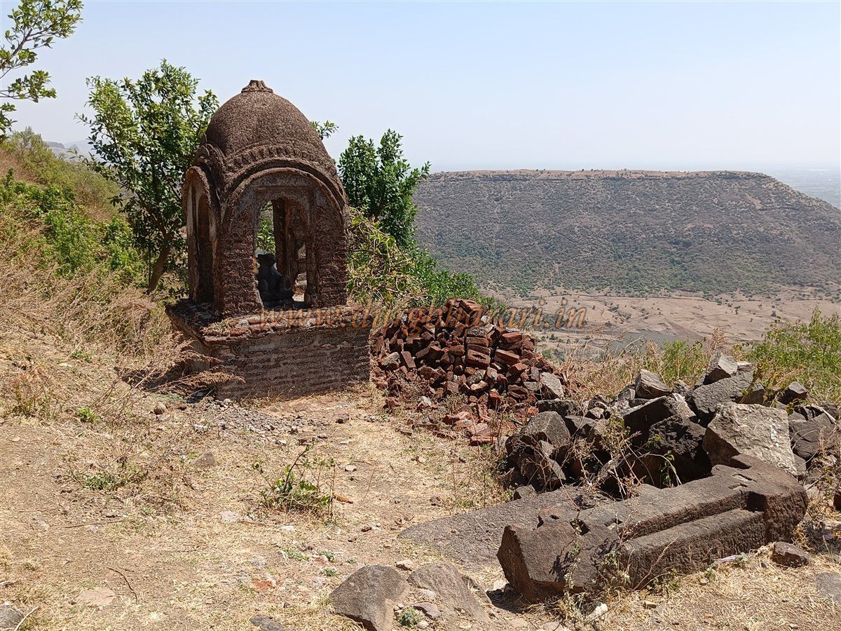
Passing the Maruti idol near the first gate again, you see scattered ruins and tombs.
A large pond nearby was likely formed from stones quarried to build the Machi’s structures.
Along the gorge edge, some fortifications still stand, including a grand main gate reminiscent of the gate at Bhuikot Fort in Marathwada.
This gate has a high chamber with arches on both sides and a roof with six domes. The entrance is indirect with a zigzag path to deter attackers.
The gate’s exterior features engravings of a fish and two lotus flowers.
Traces of a second outer gate exist nearby.
The path from this gate leads to Vishakara Gorge near Sulka and then toward Kanchanbari.
Near the gate is a well-preserved bastion with stairs, embrasures for cannon and guns, and fortifications toward Kalvan gate.
This concludes the fort circuit.
The fort covers approximately 425 acres and takes about eight hours to fully explore.
With year-round water tanks, a large cave for shelter, and numerous ruins, Dhodap Fort is ideal for an overnight stay.
Dhodap is the fourth highest fort in Maharashtra with its summit about 4650 feet above sea level.
Ancient caves and water tanks suggest it has existed since ancient times, but it is first mentioned in the 16th century during the Nizam Shahi period as Dharab.
Mughal commander Alavardi Khan, by enticing the fort’s commander Bhojbal with a large reward, captured the fort on June 19, 1626.
A Persian inscription near the balekilla gate mentions the date Hijri 1046 (1626 CE) and the conquest of 14 forts in four months by Alavardi Khan, servant of Emperor Shah Jahan.
Among these forts were Dhodap, Chandor, Indrai, Rajdeher, Koldher, Kanchana, Manchana, Kanhera, Jawlya, Ravlya, Markandya, Ahivant, Achalgad, and Ramsej.
In 1670–71, Shivaji Maharaj’s army besieged Dhodap, but the commander Muhammad Zaman refused to surrender, so the fort did not fall. At the same time, approaching Mughal forces forced the Marathas to lift the siege. Due to disputes between the Marathas and the Hyderabad Nizam, Dhodap eventually came under Maratha control. In 1768, during a rebellion against Madhavrao Peshwa supported by the Bhosale, Gaikwad, and the British, Raghunathrao Peshwa took refuge at Dhodap. Madhavrao Peshwa’s forces defeated Raghunathrao, seizing his treasury and supplies. Raghobadada came under Madhavrao control and was kept under house arrest at Shaniwar Wada. During the second Peshwa’s reign, two Subhedar, Appaji Hari and Bajirao Appaji, with 1600 soldiers were appointed at the fort. At that time, Holkar chiefs Ajabsing and Sujakum attacked and looted the fort and surrounding village. In 1818, after the second Bajirao Peshwa surrendered to the British, Captain Briggs took control of the fort without a fight. At that time, the fort had 37 soldiers, some cannons, and 1590 cannonballs. Captain Briggs described Dhodap as the tallest and strongest fort in the Chandor range.
© Suresh Nimbalkar
GALLERY