DHARUR
TYPE : GROUND FORT
DISTRICT : BEED
HEIGHT : 0
GRADE : EASY
Traveling the forts of Marathwada, one encounters mighty and robust land forts like Solapur, Ausa, Paranda, Udgir, and Kandhar. These forts are still well-preserved today, and their design is quite different from other land forts found elsewhere in Maharashtra. The Marathwada region lies away from the main Western Ghats (Sahyadri range) and mostly comprises flat plains and some small to moderate hills. Being entirely different from the Sahyadri region, the forts here were constructed accordingly.
Since these forts lack the natural protective shield of mountain ridges as seen in the Sahyadri, they were built as strong military fortresses with thick, double or triple layered fortifications, and surrounded entirely by deep moats. Moreover, a sequence of gates arranged one behind the other was designed to make access difficult for enemies. To witness all these features, one must visit the fort of Dharur in Beed district.
...
Dharur Fort is located in Dharur village in the taluka. By train, it is 80 km from Latur city; by bus, 57 km from Beed city. From Mumbai or Pune, one can reach Latur by express train. From Latur, take a private vehicle or bus towards Latur-Kej-Dharur or Latur-Ambejogai-Dharur. Given the public transport situation in this area, it is advisable to use a private vehicle for travel.
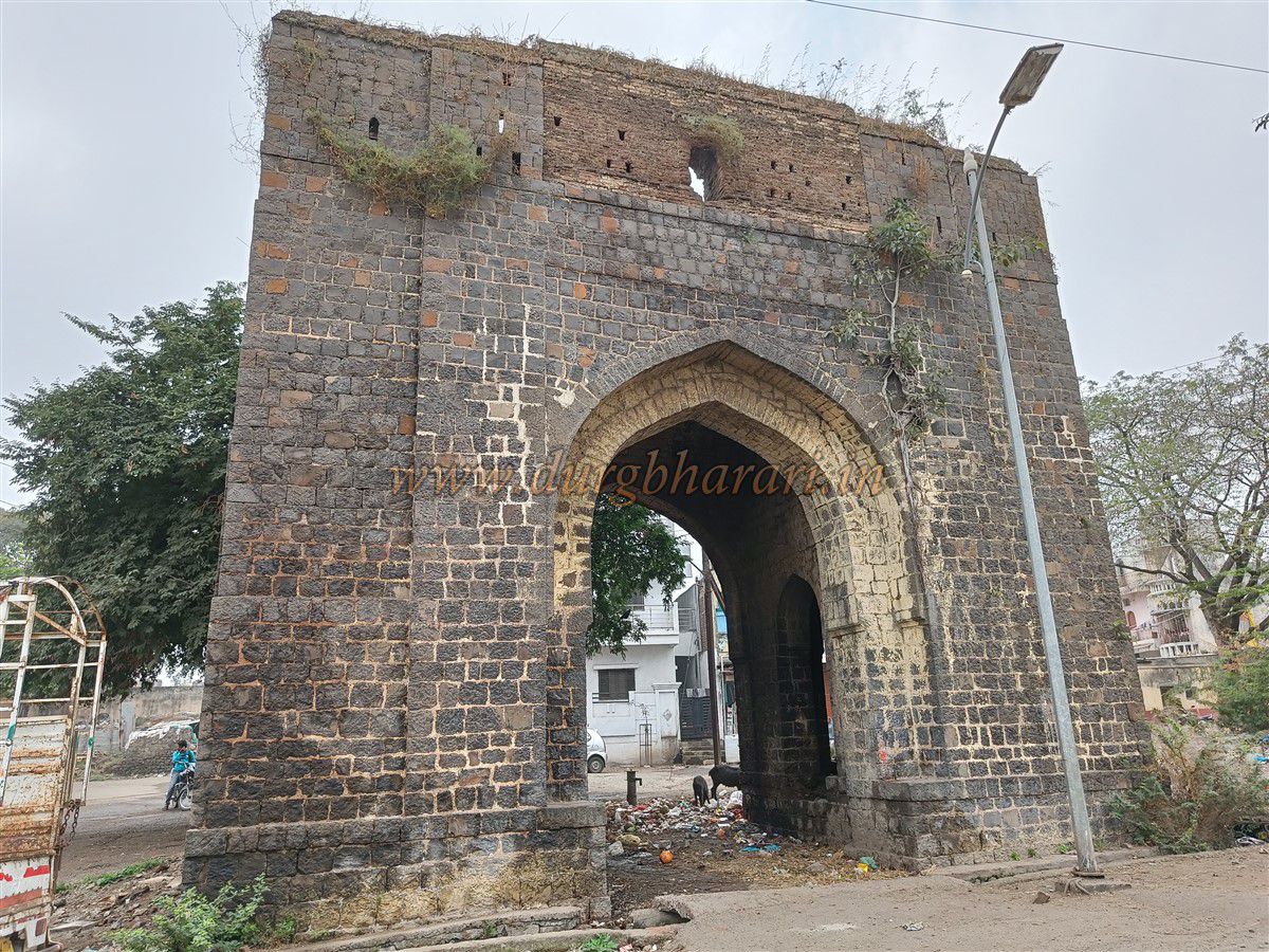
Dharur Fort lies just outside the village behind the Dharur Rural Hospital and can be reached either on foot or by private vehicle directly to the fort gate. The town of Dharur itself shows traces of once being enclosed within fortifications, evident when passing through the village.
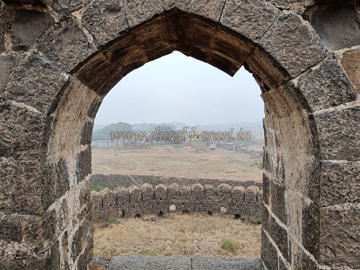
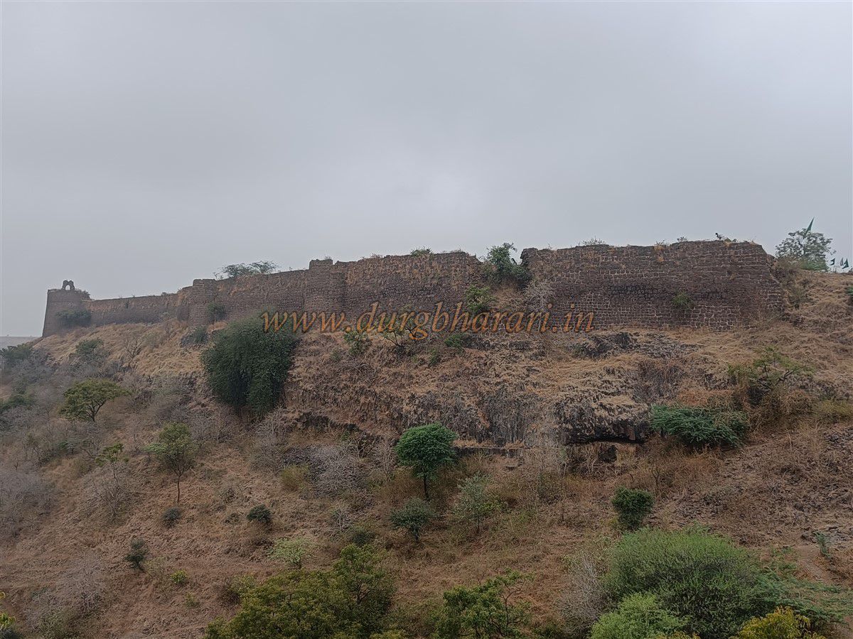
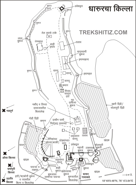
Approaching the fort, you first see one gate of the town fort and an old mosque before reaching the fort situated just outside the village. Though considered a land fort, Dharur Fort is built on a narrow ridge that plunges straight down into a valley, providing natural protection on all sides except the side facing the village.
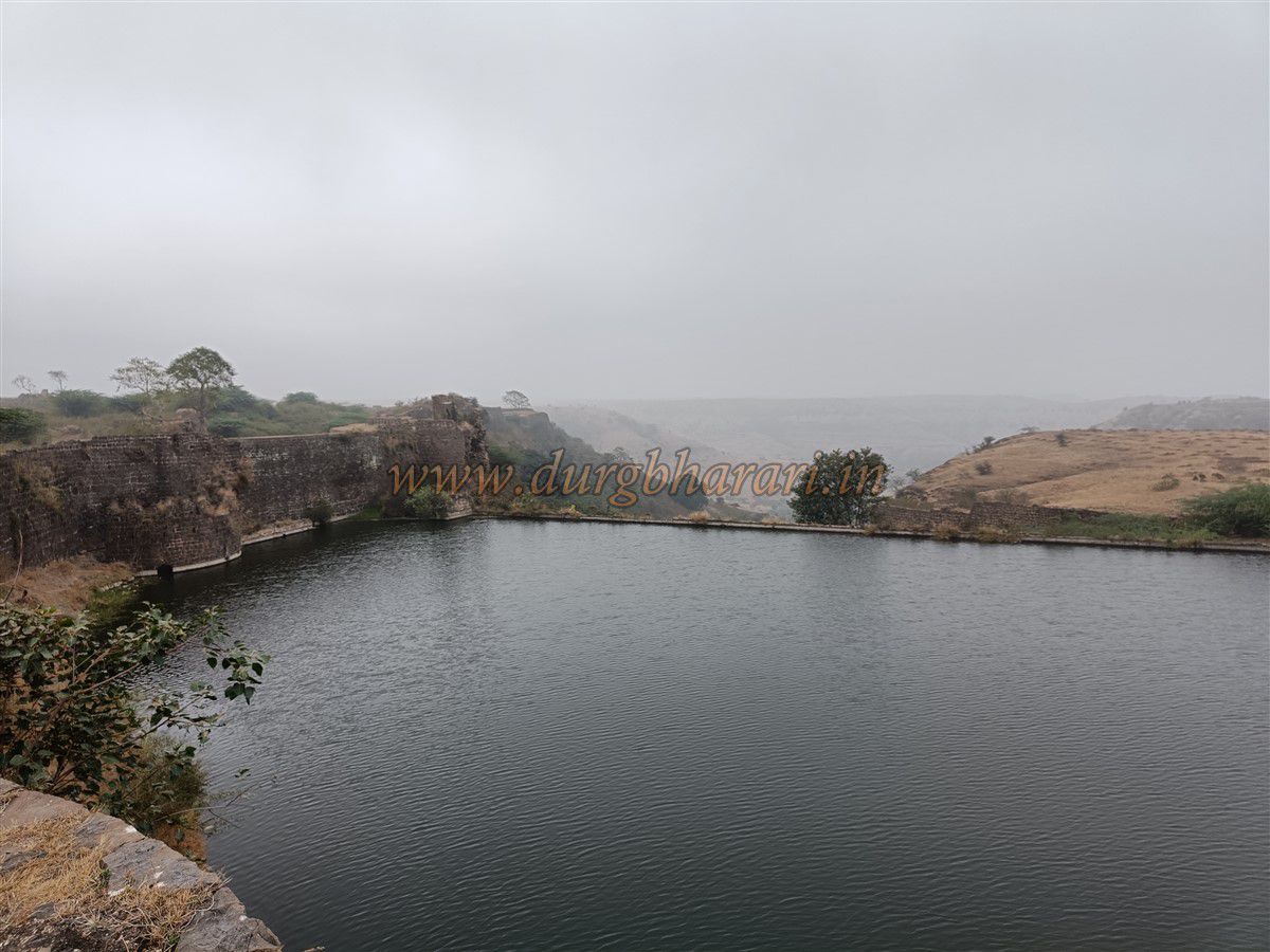
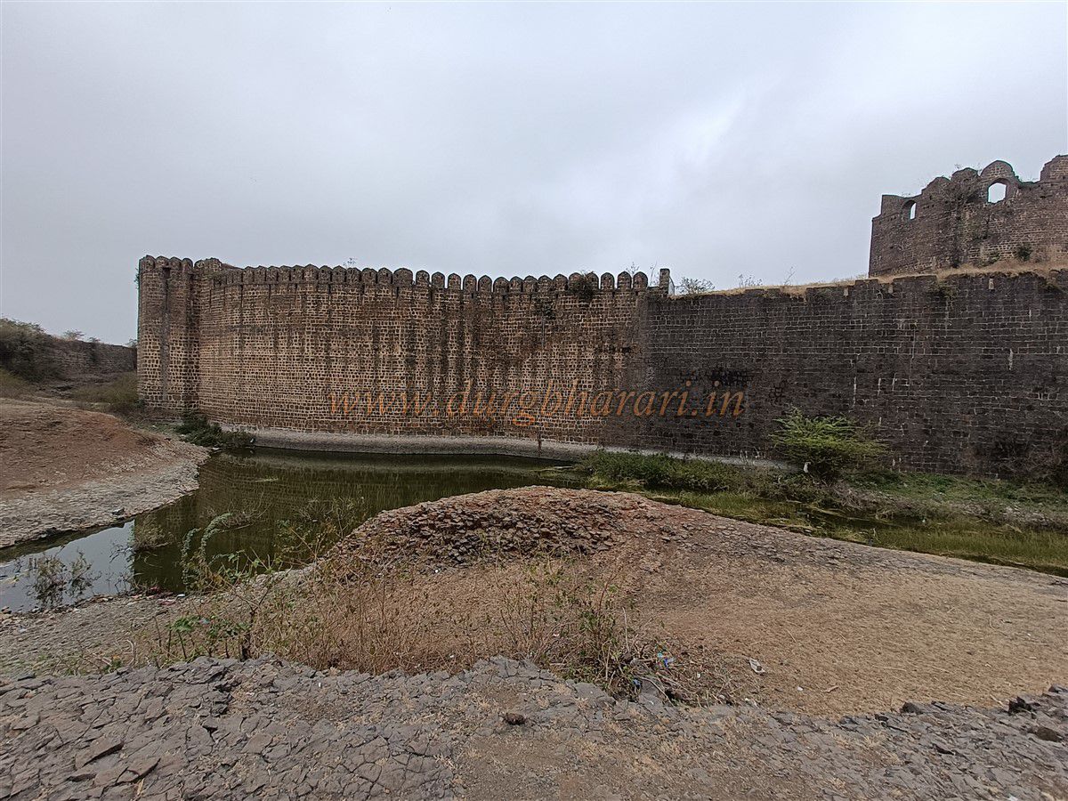
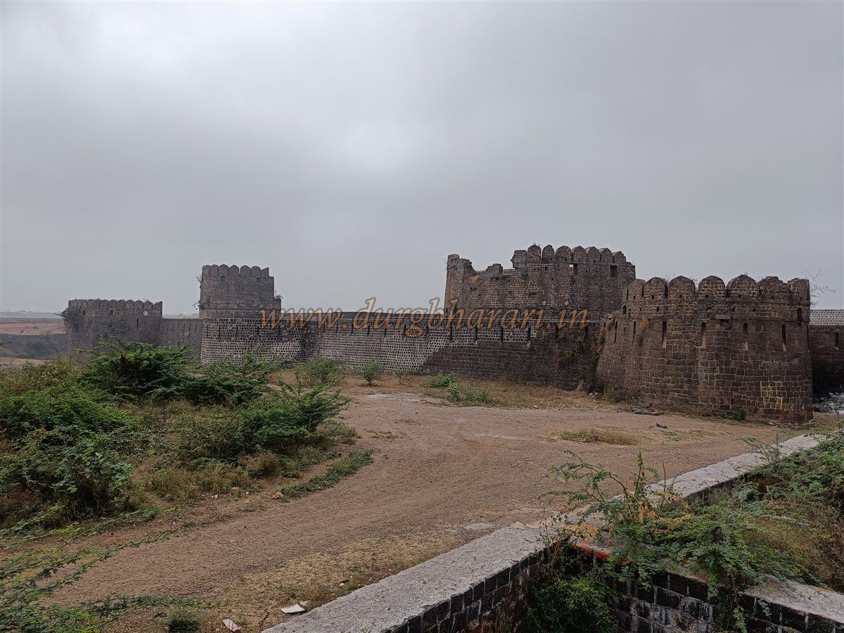
To defend the village side, the fort has a trench with double fortifications in front. To separate the fort from the ground on the gate side, a 20-foot-wide and 25-foot-deep moat has been dug directly down to the valley. This moat is lined with stone walls on both sides, and at the edge towards the valley, a horizontal wall blocks water, forming a reservoir that still holds water today. The moat on the right side of the fort is wide enough to be considered a lake, known as Solapur Dindi or Khari Dindi. Earlier, a wooden drawbridge existed here; now, the moat is permanently filled with stone and earth up to the gate.
Upon entering the moat, on the right side, one can see a water tank. The sight of the fort’s shape, its massive bastions, battlements, and the positions for archers and musketeers fills one with awe.
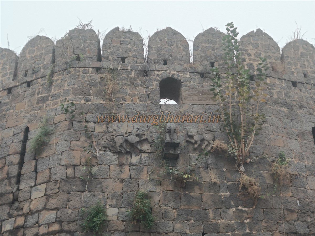
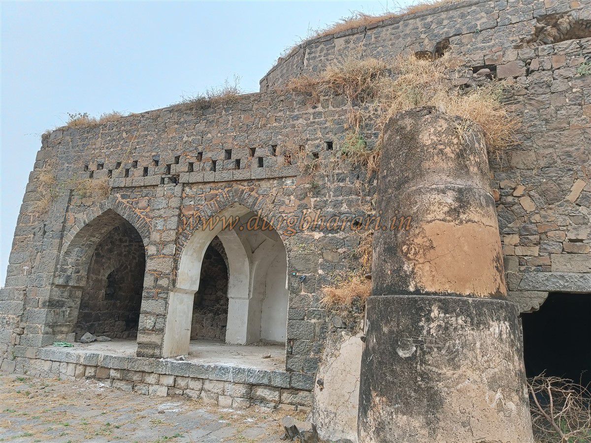
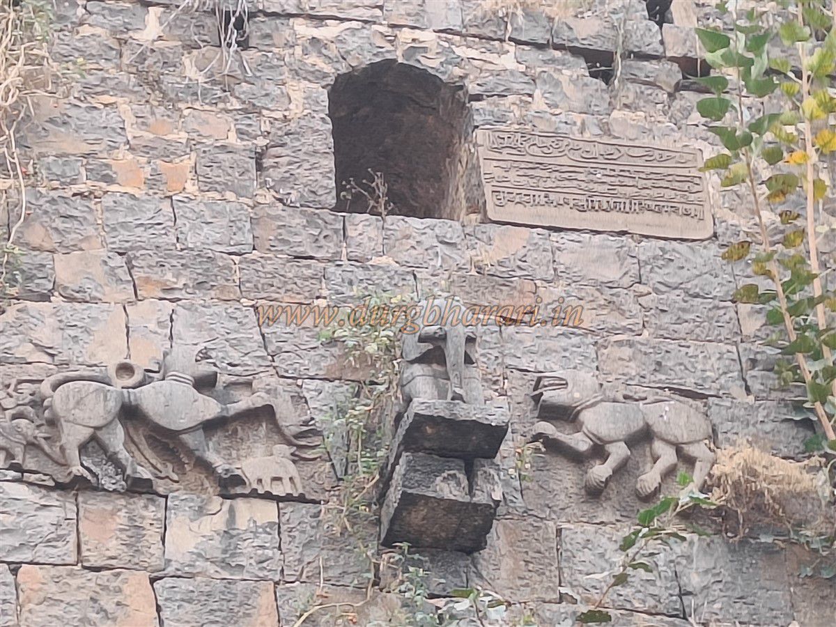
Before entering the fort, descend into the moat on the left and proceed to the third bastion, which is octagonal in shape. This bastion is adorned with an elephant sculpture and two Sharabh (mythical creatures) sculptures nearby. The left Sharabha’s front paw has two elephants carved on it, while the rear side depicts one elephant and two warriors fighting. Above these sculptures is an inscription in three scripts: Arabic, Persian, and Devanagari. Because of the elephant sculpture, this bastion is called the Hathi (Elephant) Bastion.
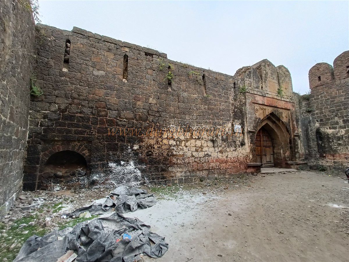
Moving further along the moat, one can see a dam wall and stairs used for climbing up and down the moat. After observing the moat, turning back leads to the fort entrance, guarded by two bastions. In front of the main gate, a horizontal wall stands, with another parallel fortification wall behind it. These two walls provide extra protection to the main gate, and the bastions are built at the ends of these walls. The left bastion, known as Fateh Bastion, carries a Persian inscription.
The path to the main gate is curved so that a charging elephant cannot directly break through, and the narrow distance between the two fort walls was deliberately kept small to hinder enemy movement. Close to the main gate in the fort wall is a small narrow gate sealed with stones.
The main gate faces east, with sentry rooms on both sides, one of which houses a small cannon pivot. The Archaeological Department has recently fitted a new wooden door here.
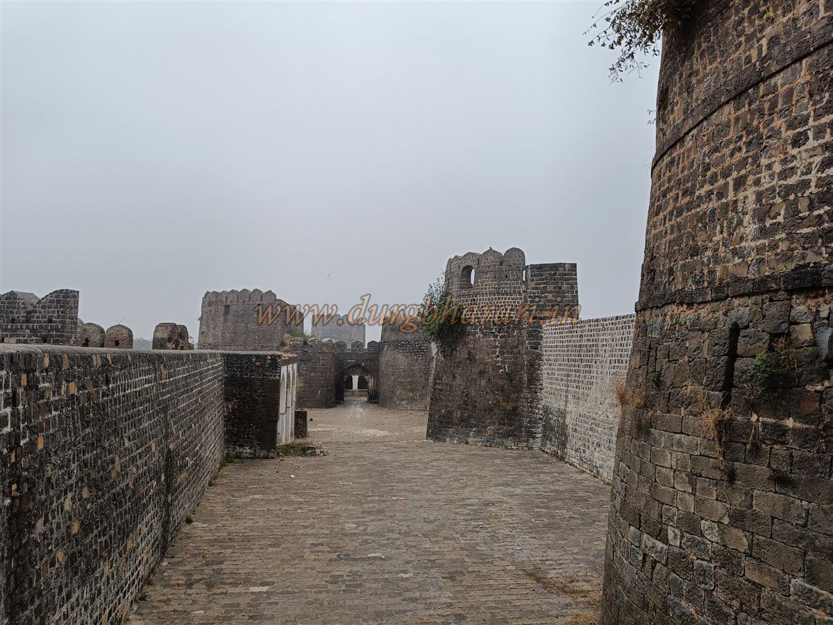
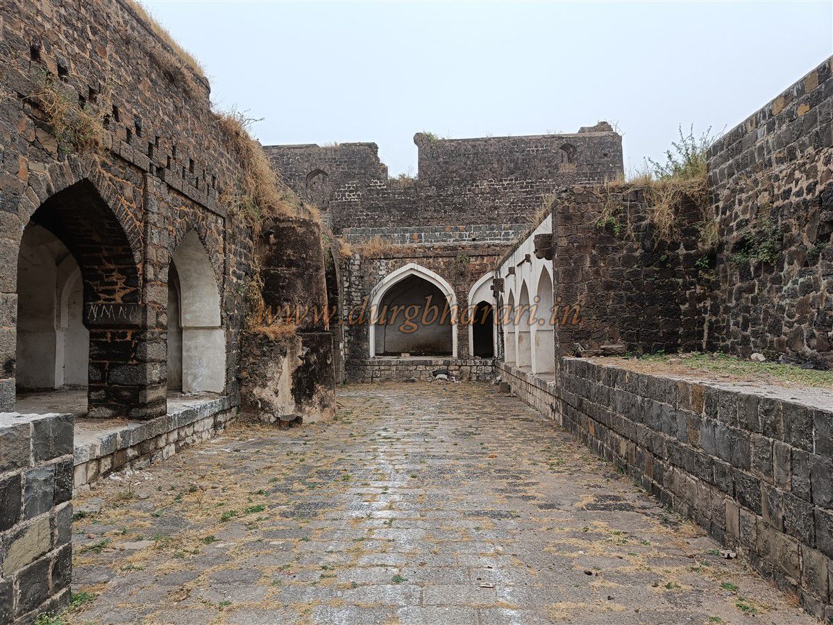
Passing through this gate, you enter the inner fort area, and directly ahead stands the Mahaji Bastion in the inner fort walls. From here, two paths diverge: the right leads between Tanksal Bastion and Solapuri Bastion, while the left leads to the inner gate and the double fortifications with a parapet.
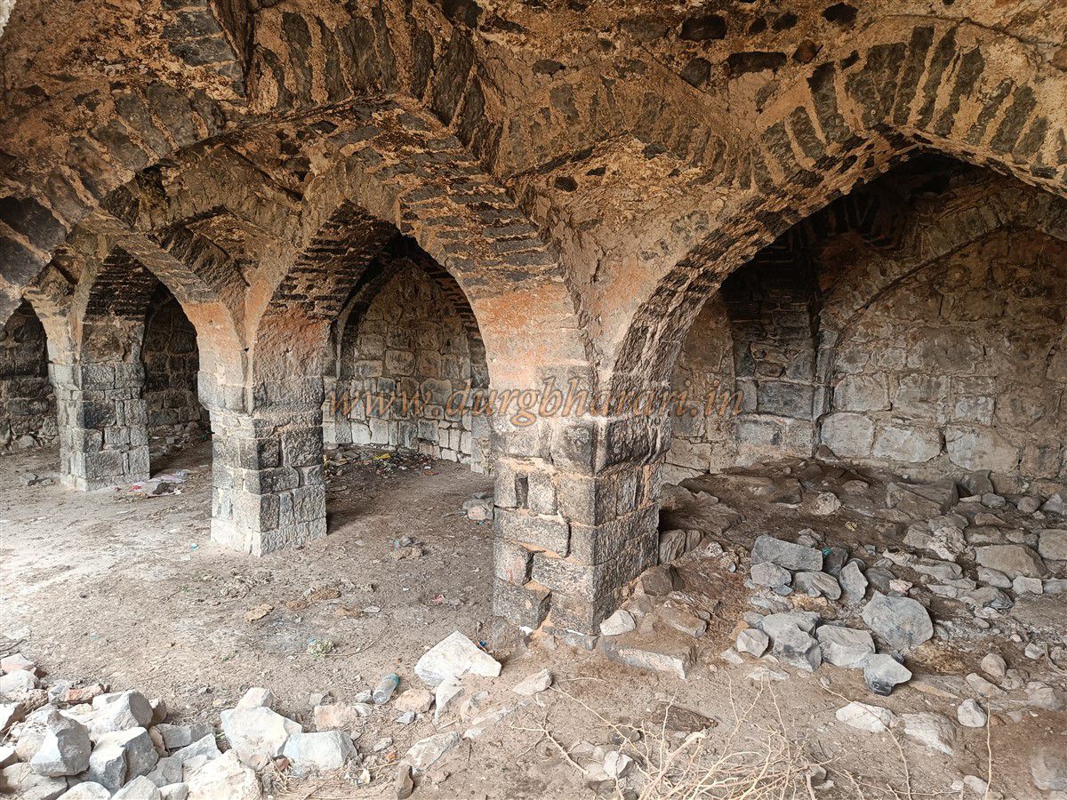
First, explore the right path. Between Tanksal and Solapuri bastions, some arches remain, where once the fort’s mint (Tanksal) existed. A subterranean passage here leads to the inner fort area. The Khapri water channel supplying water to Tanksal is also visible on the bastion above.
To access the outer fort wall, steps are present, which can be climbed to complete the outer fort perimeter walk. After finishing this on the right side of the inner fort, turn left.
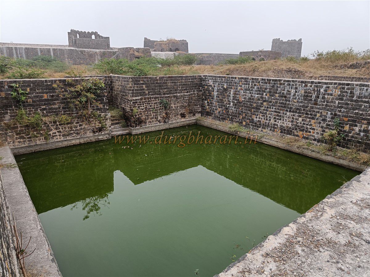
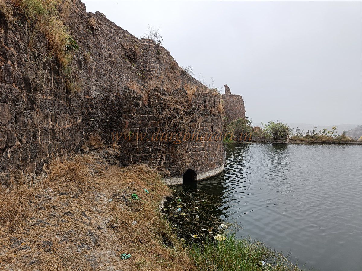
On the left near the first gate’s corner is another gate; the path near it leads to the left part of the inner fort. At the edge of this inner fort double fortification lies a huge semi-circular reservoir called Godi Dindi. This reservoir is carved out of the rock, with the outer fort wall built on its edge. The reservoir’s third side is the valley side fortification, about 20 feet wide and 70-80 feet tall. Near the outer fort wall is the fort’s moat.
The stone-carved reservoir was used as both a defense measure during emergencies and a perennial water supply throughout the year.
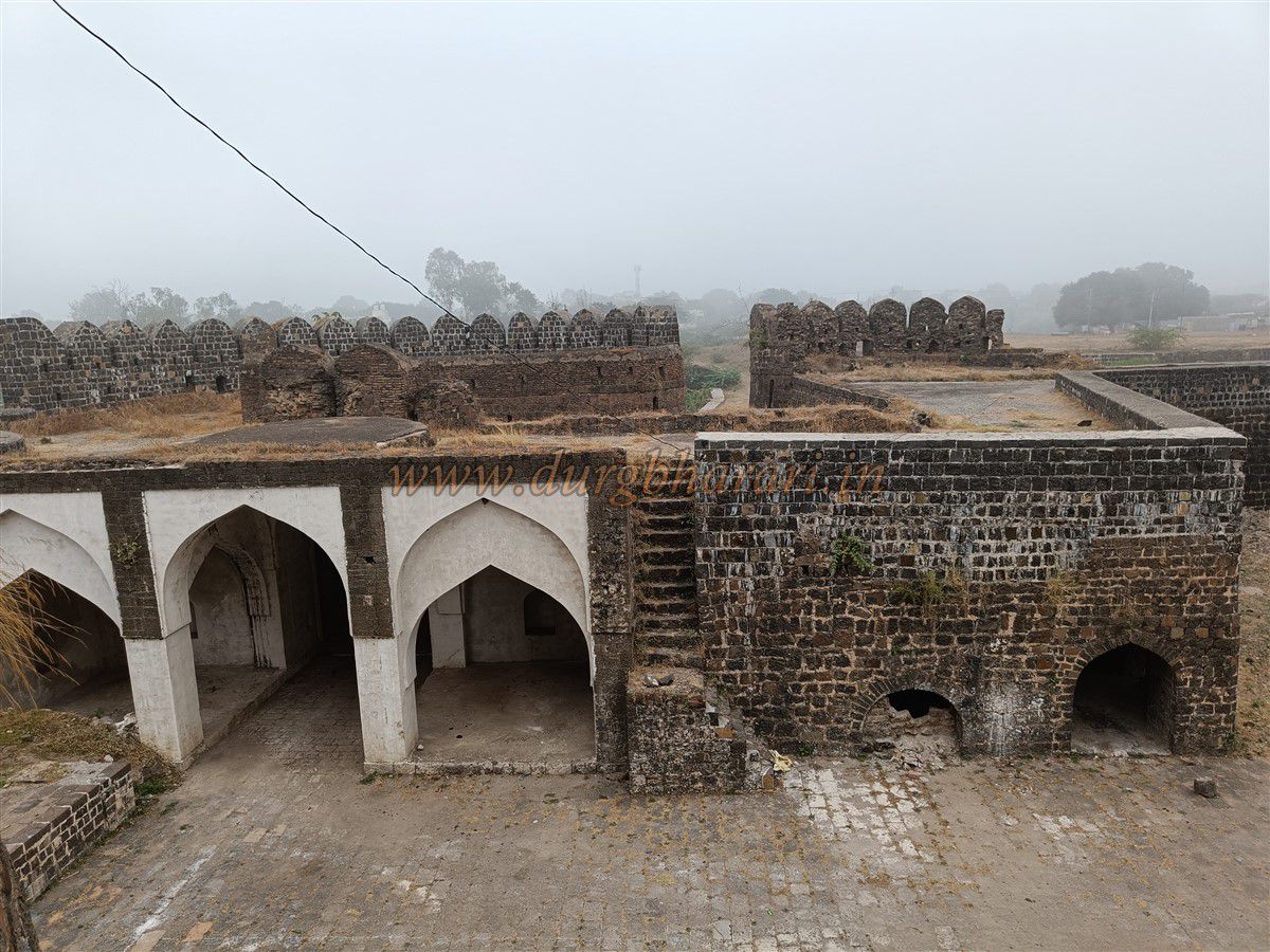
Returning to the main fort entrance, the bastion on the left is called Khanderaya Bastion, while the right has a small gate allowing entry when the main gate is closed. Inside this gate are sentry rooms and arched halls on both sides.
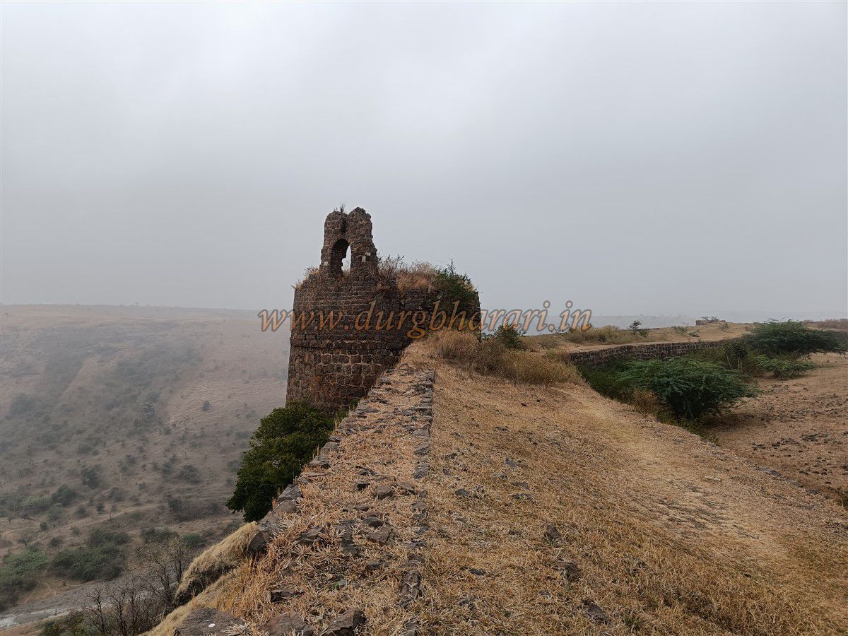
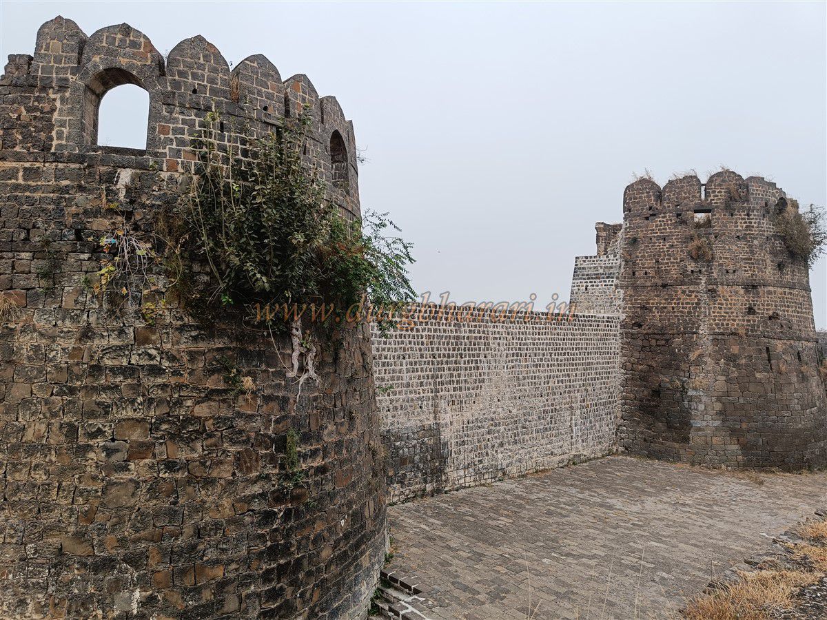
The fort has a water supply system maintaining water levels by a structure called Uchhwas. From here, climb the steps to walk the inner fort walls. Climbing up leads to Khanderaya Bastion, which cannot be accessed from the top due to partial collapse inside. Ahead lies Shahi Bastion, equipped with cannon placements and a room with windows overseeing the entire fort and the Godi Dindi reservoir.
From Shahi Bastion, the entire fort can be surveilled. The narrow fort spreads over about 20 acres inside the moat.
Descending from Shahi Bastion leads to the fort wall near the inner side of Godi Dindi. At the edge of this reservoir wall is a bastion connecting the inner wall with the outer fortification. This bastion, known as Kot Dindi Bastion, overlooks the valley below.
Between Shahi Bastion and Kot Dindi Bastion are arched halls used as soldier quarters. The outer wall beyond this bastion is partially ruined, with reconstruction work underway by the Archaeological Department.
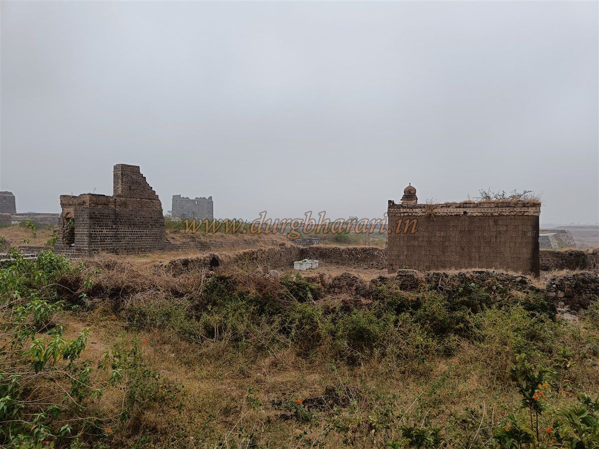
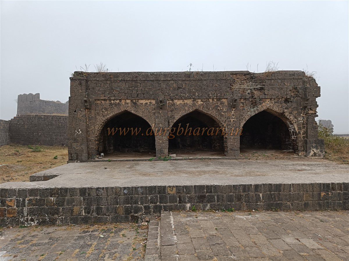
Beyond this, the fort narrows. Passing another bastion known as Kaman Bastion leads to Lal Bastion, which has a storehouse and arched halls below. Near Lal Bastion are ruins of a Rangmahal (pleasure palace) and Shahi Hammam (royal bathhouse). Nearby are remains of tanks and reservoirs.
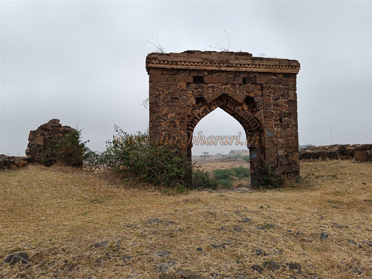
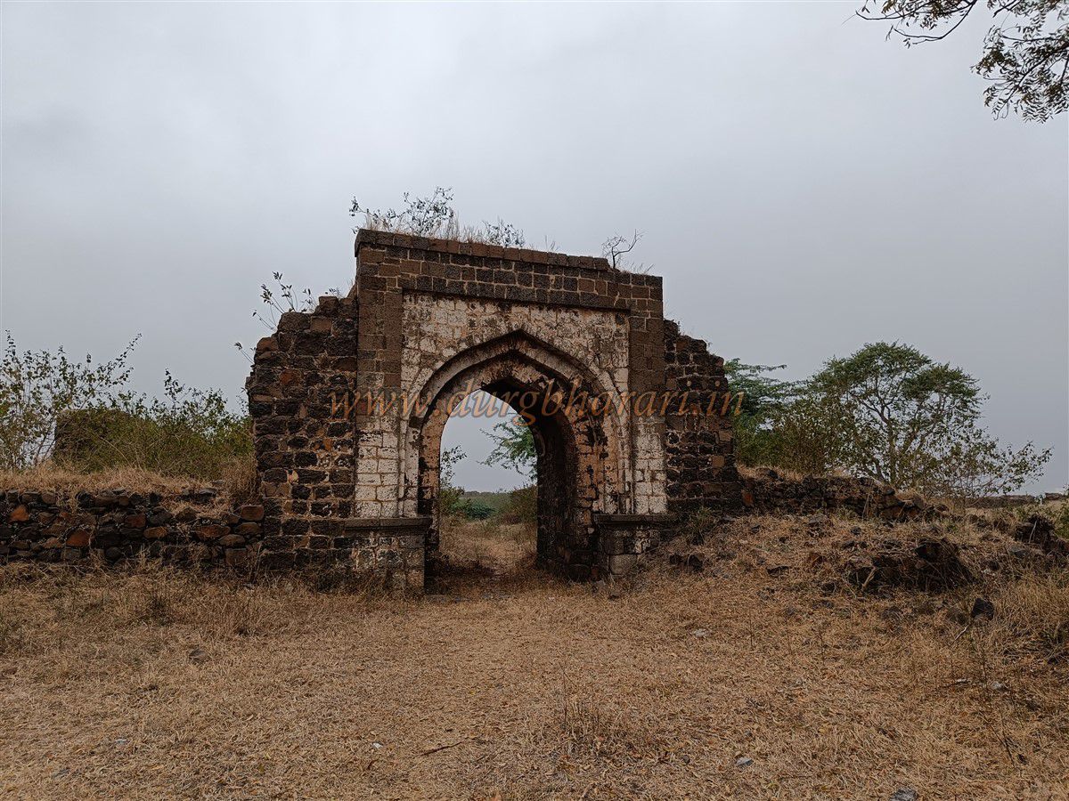
From Lal Bastion, moving further reaches the southern fort bastion, which has the fort’s second north-facing gate and sentry rooms. From here, the walk returns toward the main gate.
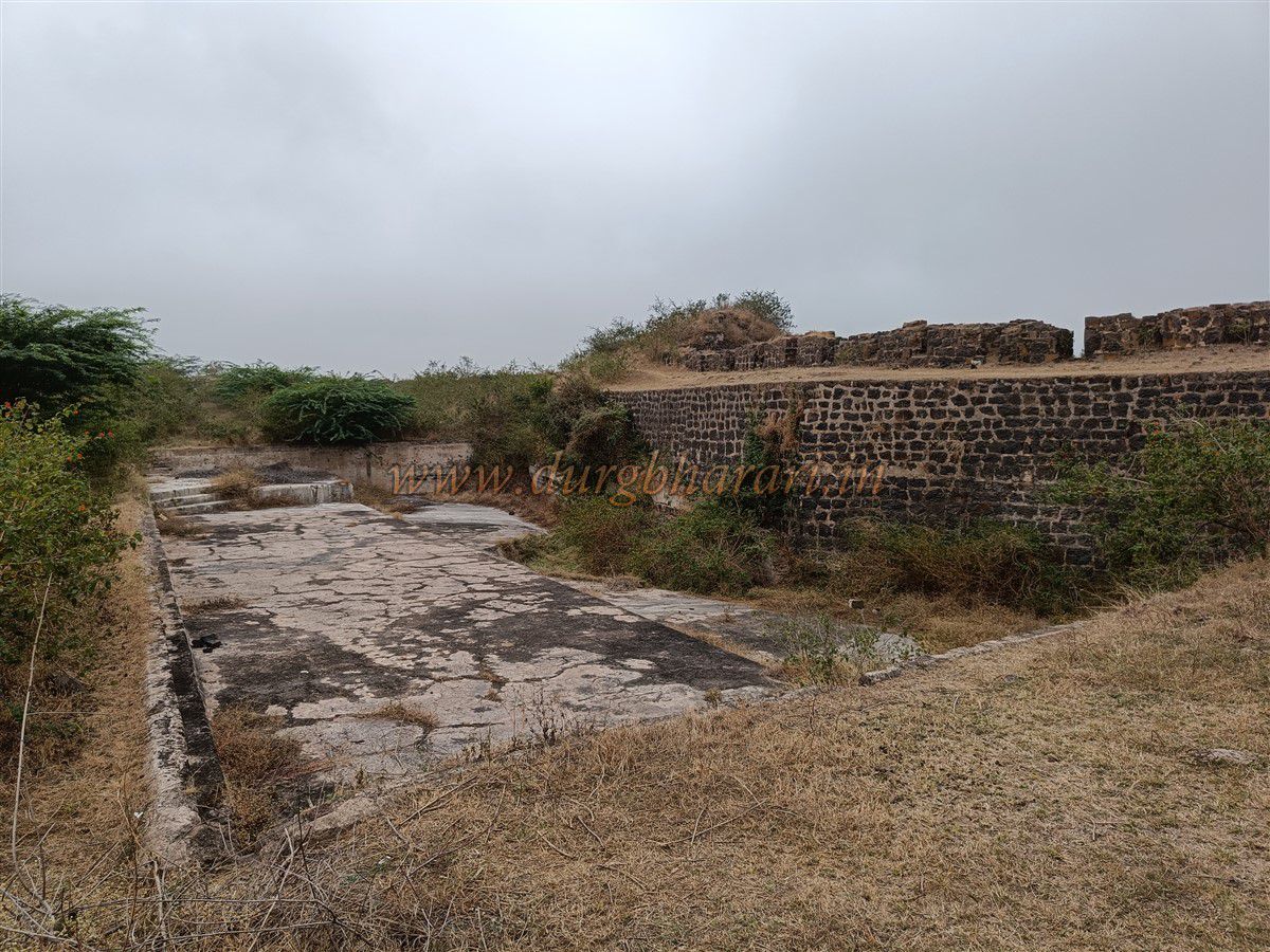
Nearby is a medium-sized dry pond enclosed by two arches, purpose unknown, surrounded by dense thorny bushes. The next bastion, known as Chadarvani Bastion, is adjacent to a stepped pond believed to be a water reservoir. This pond has stone steps and an ornately carved Panhala-style drain to release water.
Water from Khari Dindi reservoir outside the fort used to be channelled into this stepped pond through the Khapri water channel. This system is still visible.
Next to this bastion are remains of the Hawa Mahal, originally a cool resting place for the royal family women, now standing only as a single gateway. Below this bastion is the wall of Khari Dindi reservoir. A dam is visible on the valley slope to retain the water.
Outside the outer fortification, a low bastion stands beside a small gate, giving access beneath the fort walls through arched halls, leading to the reservoir.
The bastion in the reservoir has a small door at water level, possibly used by the royal family for boat rides or as a secret exit during emergencies.
Climbing back to the walls leads to a large tank with three-sided steps. Straight ahead is Tanksal Bastion.
Turning right on the fort walls leads to Mahaji Bastion, accessible by steps and likely once housed a large cannon, although no cannons remain now.
From here, Khanderaya Bastion marks the end of the perimeter walk.
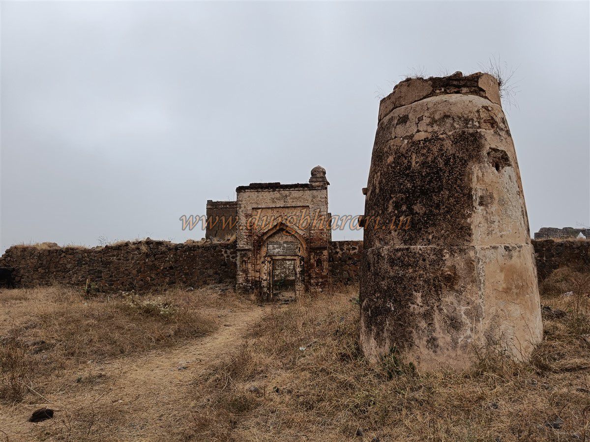
Descending leads to the start of the inner fort area. Going straight from the main gate towards the southern tip, a building with three arches is visible on the left, serving internal fort operations.
A little ahead on the right are ruins of a two-storied mansion. Further ahead is a water supply structure (Manora Uchhwas) with a mosque inside the compound. The mosque’s gateway has a three-line Persian inscription. Inside are the mosque, some graves, and a small reservoir.
Beyond the mosque is the tomb of Sayyed Sadat on a tall platform, with remains of the Khapri water channel nearby. Behind the tomb is an arched gateway in the fort’s walls.
Since this area housed the fort’s officers and important people, it was walled and gated. Large architectural remains are visible inside, including a well-preserved granary (Ambar Khana), and ruins of mansions and houses.
At the settlement’s edge are two underground granaries locally known as oil or ghee tanks.
Returning to the main gate completes the fort tour, which takes approximately three hours.
Dharur town’s location on a hillock by a perennial water stream is its defining feature. The town has been ruled by many dynasties including Satavahana, Rashtrakut, Yadavas, Chalukya, Bahmani, and Nizamshahi.
Local tradition says the town was named after King Dharasingh, but there is no documentary evidence. The town flourished during the Satavahana period, with the Rashtrakut building a fort called Mahadurga to protect the market. An inscription by Rashtrakut King Govind (793-814 AD) mentions Dharur.
Later, Chalukya (Kalyani) and Yadavas of Devgiri ruled. An inscription at Ambajogai mentions Dharur during the Yadav period. A donation record for the Sakaleshwar temple refers to Dharur, granted by Yadav general Kholeshwar (1132-1169 Shaka era).
After the Yadavas, Bahmani Sultanate saw Dharur flourish as a trade center. Following Bahmani’s fall in 1526, five sultanates emerged, including the Bidar-based Barid Shahi dynasty established by Kasim Barid, the Subhedar of Ausa. During Barid Shahi rule, Dharur, Udgir, Ausa, and Kandhar were major forts.
After Barid Shahi decline, many battles took place between Adil Shahi and Nizam Shahi over this region. Recognizing the importance of Dharur, Adil Shahi Sardar Kishwarkhan Lari rebuilt the old Rashtrakut Mahadurga in 1567-68 (Hijri 975) with strong new fortifications.
The fort’s lower side has a water-filled double fortification and a moat, making it difficult for enemies to capture.
The fort is mentioned in works like Busa Teej-Us-Salateen by Fakir Ahmed Zuberi and Badshahnama by Abdul Hamid Lahori.
After Kishwarkhan construction, the town was also walled. The main entrance gate and mosque still stand as evidence.
The fort increased Dharur’s prestige and checked Nizam Shahi movements. In 1569 (Hijri 977), Murtaza Nizam Shah attacked the fort. Though the fort was strong, Kishwarkhan was killed by a conspiracy involving Ankush Khan, who left a section of the fort intentionally weak, allowing Nizam Shahi forces entry.
Murtaza Nizam Shah gained immense wealth and residence in the fort. To mark his victory, he renamed Dharur as Fatehabad. After independence, the people struggled to restore the old name, and on 5 May 1972, Fatehabad reverted to Dharur.
In 1630-31, during Shah Jahan’s reign, Mughal Sardar Azam Khan captured Dharur Fort. The Adil Shahi sent Ranadullakhan to try to regain it, but the fort remained contested.
Azam Khan minted coins at the fort’s mint; coinage continued till Jahandar Shah’s rule (Hijri 1028-1131).
After the Battle of Panhala, Shivaji Maharaj and Netaji Palkar had differences, and Netaji joined the Adil Shahi, but later was persuaded by the Mughals with mansab and jagir grants.
Following Shivaji’s escape from Agra, on Aurangzeb’s orders, Jaysing arrested Netaji Palkar and his uncle Kondhaji at Dharur Fort on 24 October 1666.
In 1683, during Sambhaji Maharaj’s reign, a fort commander killed a commander named Naroji and about 100 horsemen here, recorded in Aurangzeb’s official records.
On 3 February 1760, in the Maratha-Nizam battle near Udgir, Nizam’s troops led by Sultaanji Nimbalkar took refuge in Dharur Fort after being attacked by Ranoji Gaikwad’s forces.
After the battle of Kharda in 1795, Dharur was briefly under Maratha control but was later recaptured by the Nizam.
Post-independence, Dharur Fort remained in Nizam’s hands until the Hyderabad State merged with India.
© Suresh Nimbalkar
GALLERY