DEVGIRI
TYPE : HILL FORT
DISTRICT : AURANGABAD
HEIGHT : 2390 FEET
GRADE : MEDIUM
Devgiri fort was the most important fort in the medieval period. The fort is said to have been built in the 8th century by King Vallabh of the Rashtrakut dynasty. The Yadavs of Devagiri emerged in the Khandesh area in the late twelfth century. The then Seundesh of the first Seunchandra (now Khandesh) included the region from Nashik to Devagiri. Bhillam-2, a prince of the Yadav dynasty, who established his dominance north of the river Krishna, established the village of Devgiri and his capital there. Later Sighanna and his grandson Krishna extended the kingdom. Krishna's brother, Mahadev annexed the region of North Konkan to his kingdom and handed over the throne to his son Aman. But Krishna's son Ramchandra revolted and came to the throne. While Ramchandra Yadav was on the throne, Allauddin Khilji attacked Devgiri in the year 1294.
...
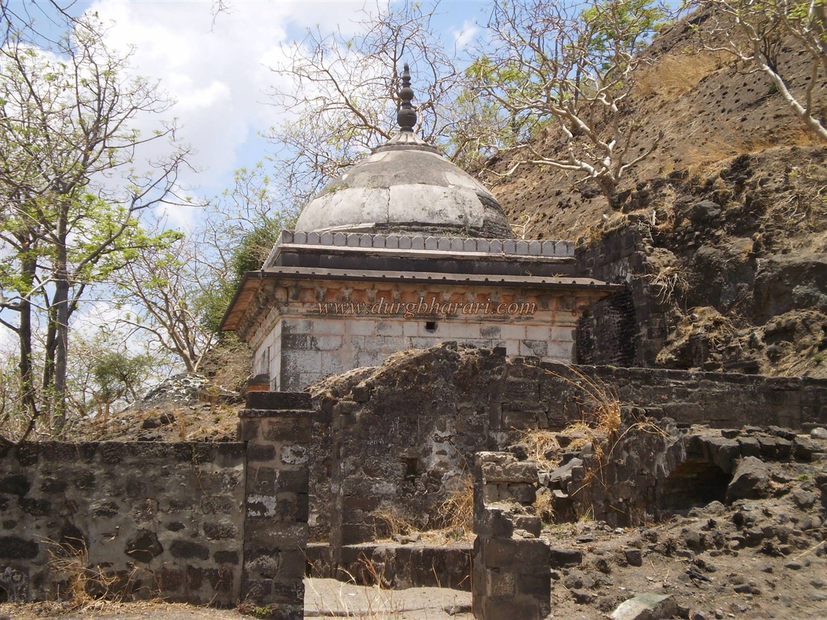
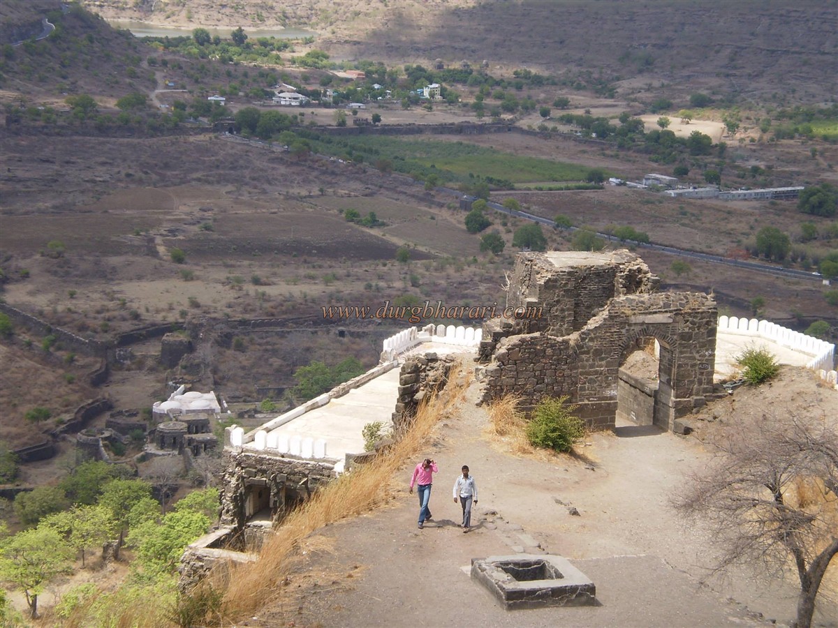
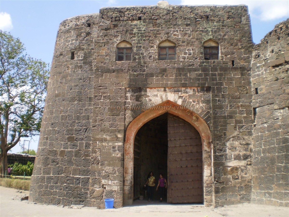
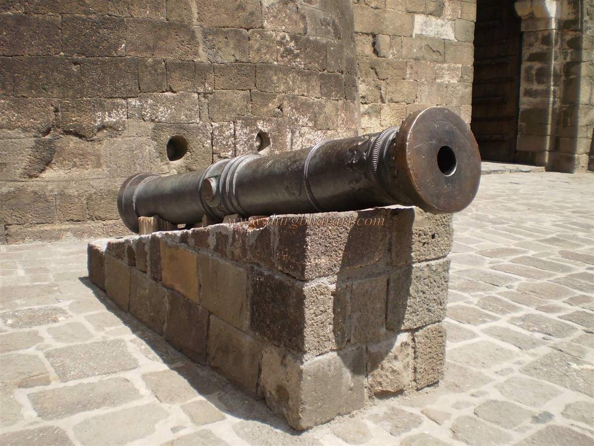
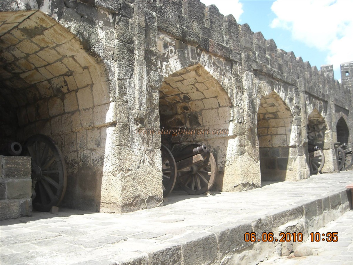
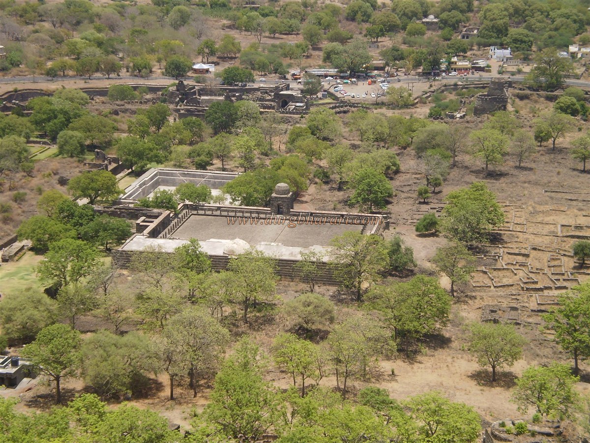
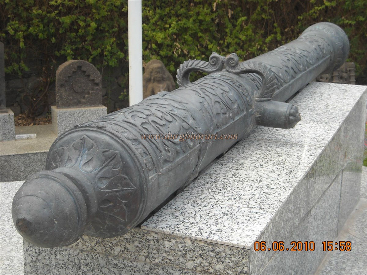
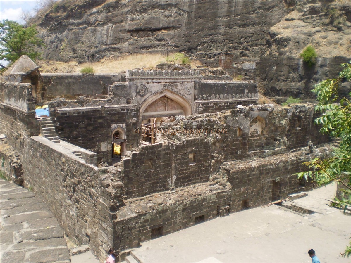
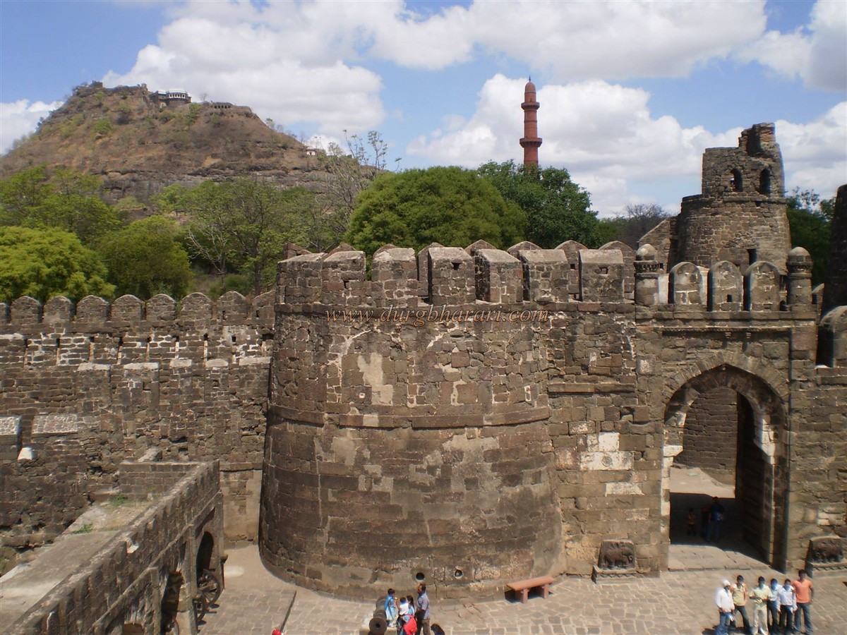
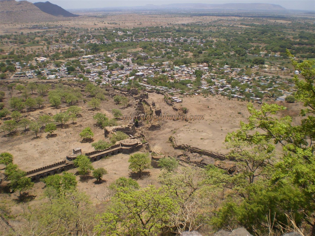
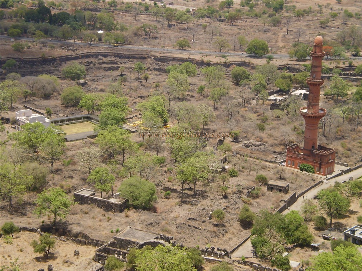
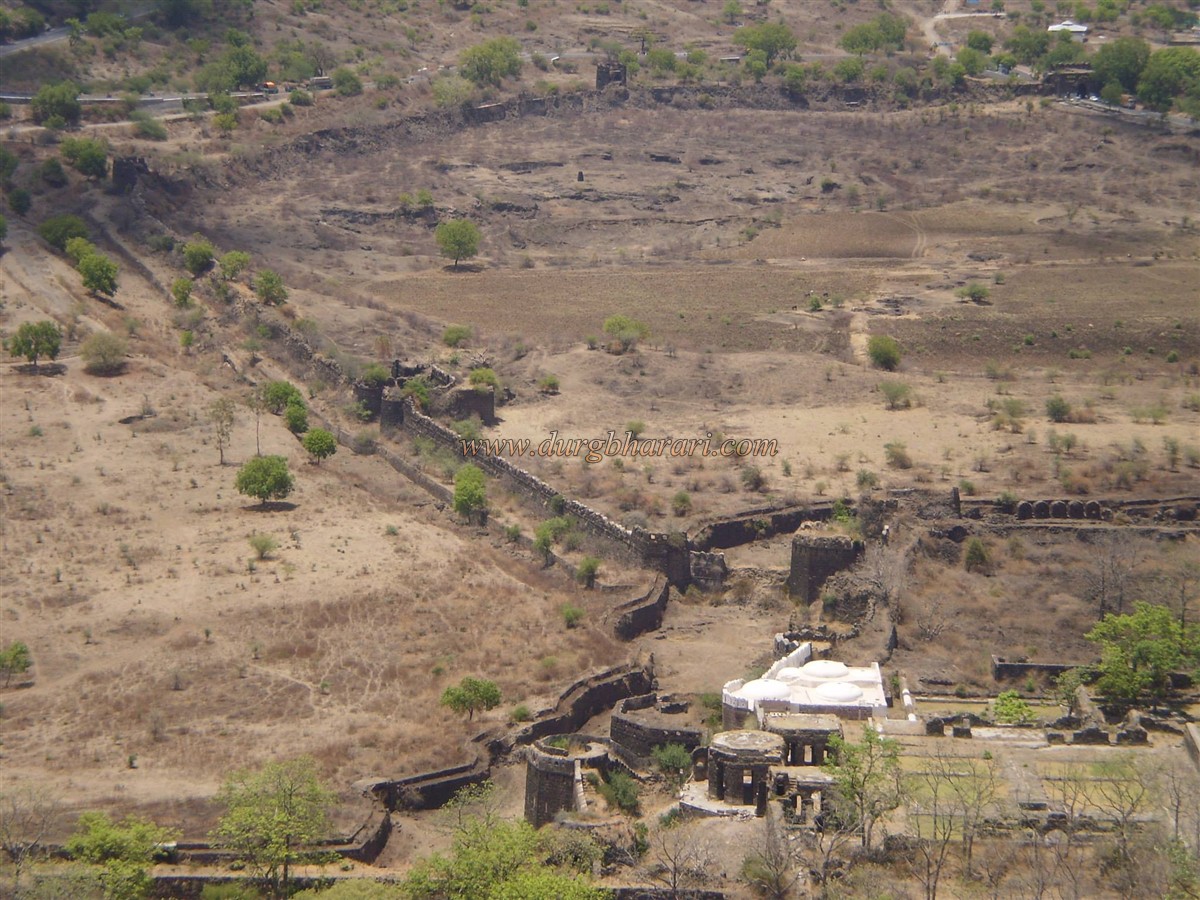
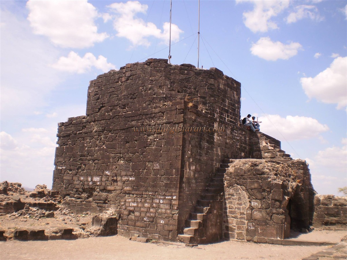
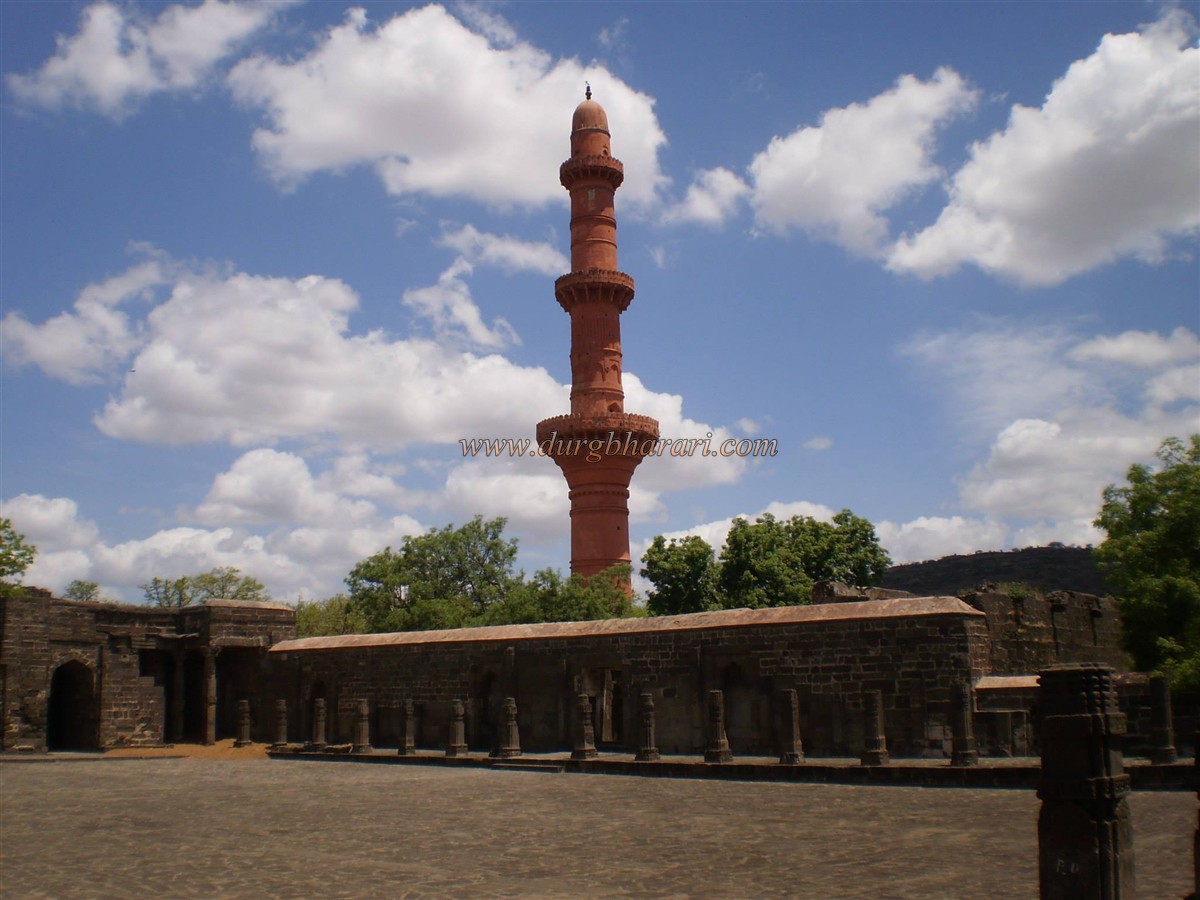
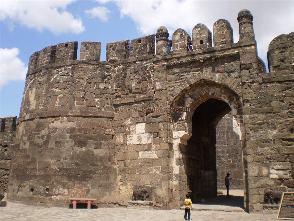
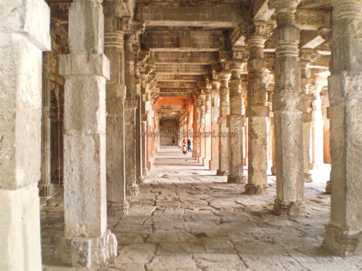
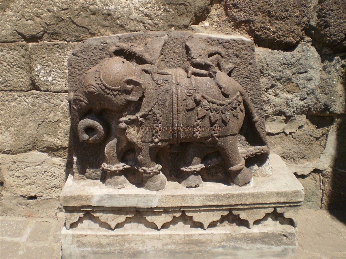
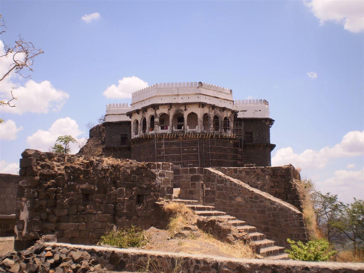
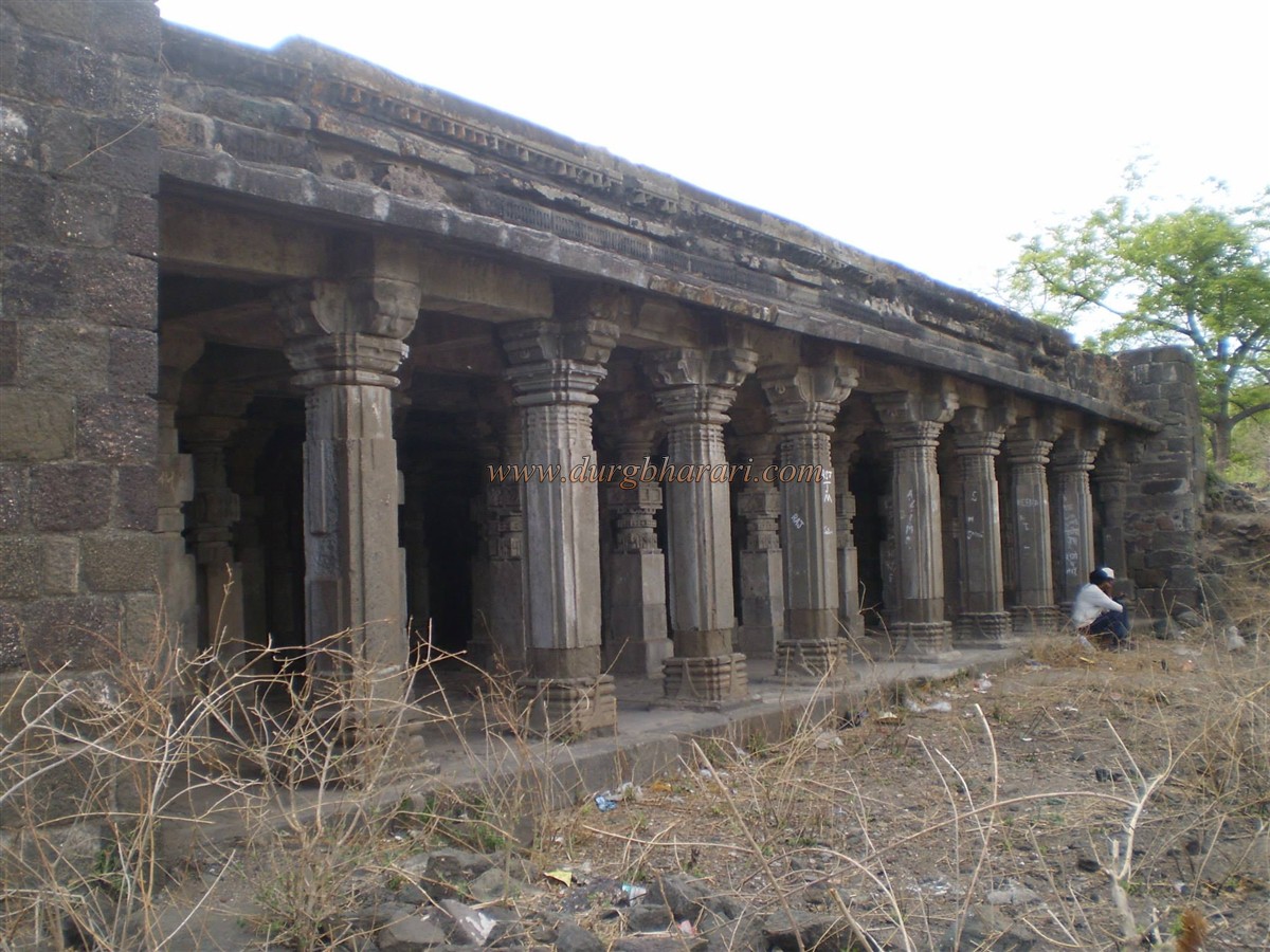
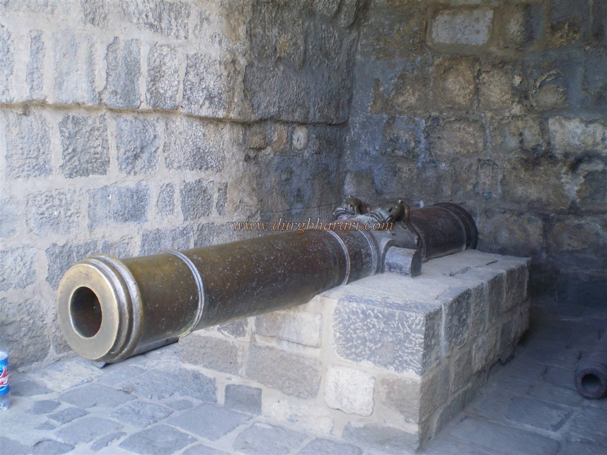
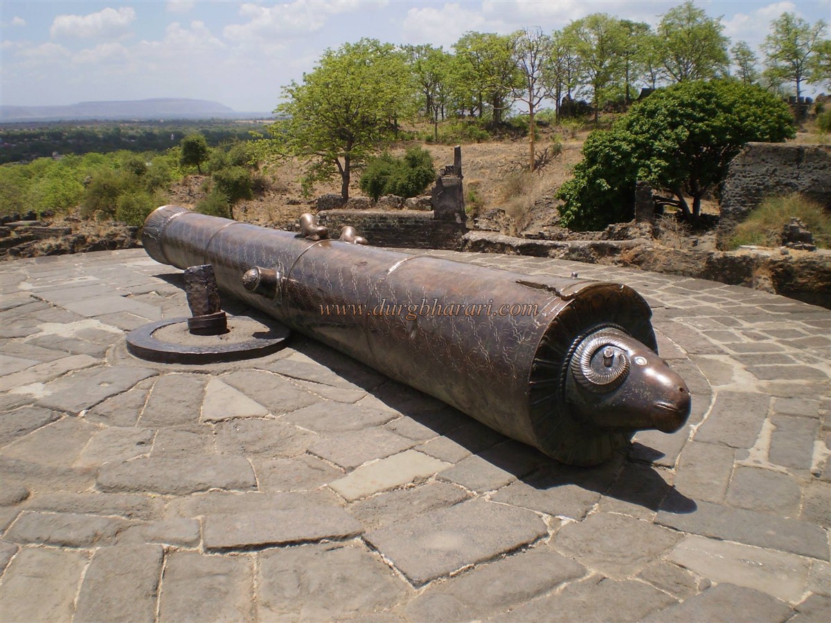
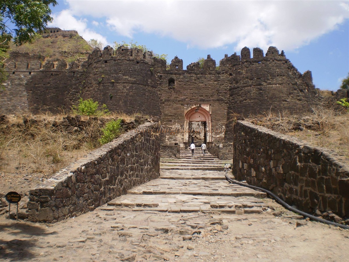
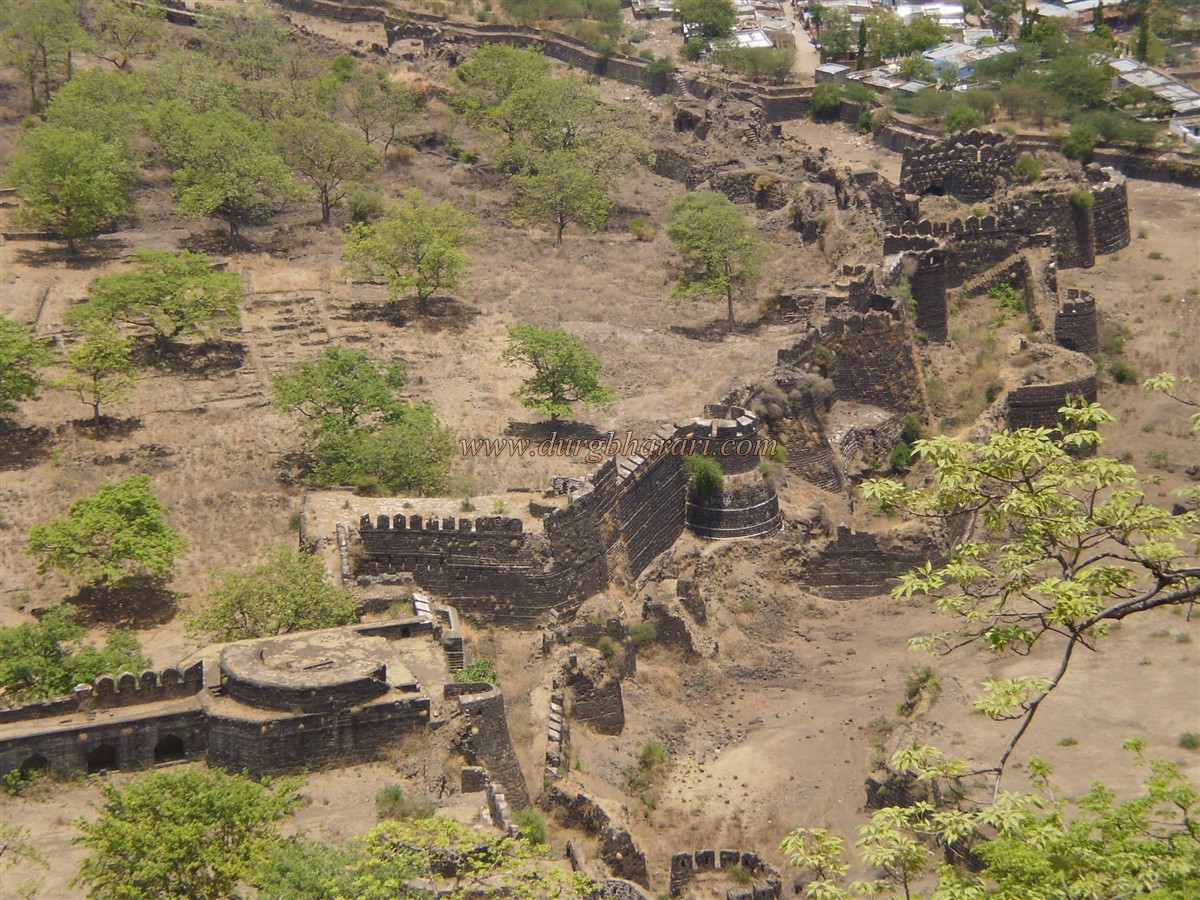
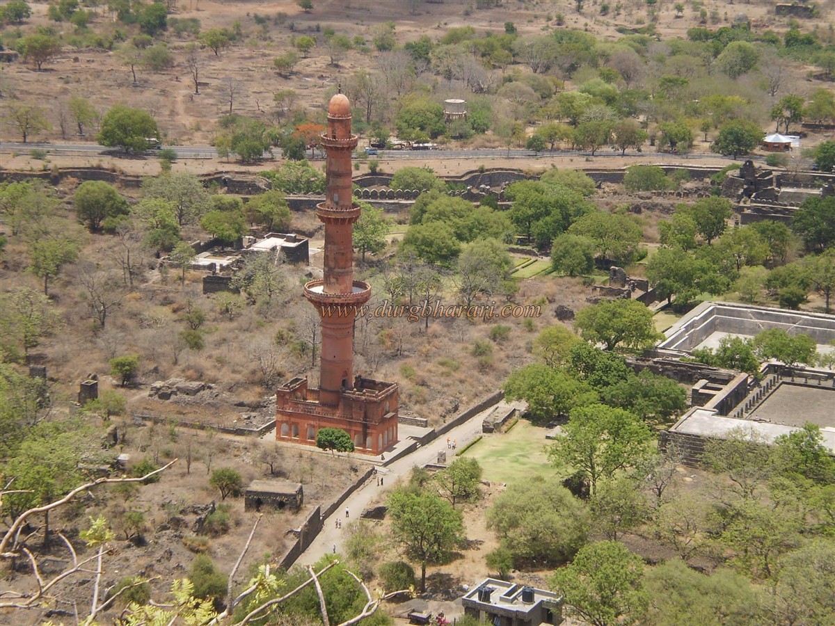
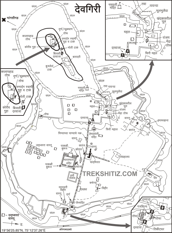
His son, Shankardeva, tried hard to stop Khilji. But since it did not work, Ramchandradev had to make a very insulting pact with Khilji. Then in the year 1307 and the year 1312, Malik Kafur attacked Devagiri again. In 1316, Qutbuddin Mubarak attacked Devagiri. At this time Harpaldev the son-in-law of Ramchandra Dev tried to stop this attack but was unsuccessful at it. His skin was peeled off and his body was hung on the gate of Devgiri. Following in the footsteps of Mohammad bin Tughlaq (1324-1350 AD), the Sultan of Delhi extended his rule to Madurai in the south. In 1326, Muhammad Bin Tughlaq moved his capital to Devgiri and renamed it Daulatabad. His attempt to bring his capital from Delhi to Daulatabad failed and the capital had to be shifted back to Delhi. After Tughlaq, Allauddin Hasan Bahamani established the Bahamani kingdom in the south in 1347 AD. Devagiri aka Daulatabad was the capital of the Bahamani for some time. In the sixteenth century, the Bahamani kingdom was divided into five independent kingdoms, namely Qutubshahi of Govalkonda, Nizamshahi of Ahmednagar, Imadshahi of Varhad, Adilshahi of Bijapur, and Baridshahi of Bidar. By the end of the seventeenth century, all five Shahs had merged into the Mughal Empire. About 15 km from Aurangabad, this fort is also known as Devgad or Dharagiri. It has a strong place in the history of India and especially in the Deccan. In the plains at the foot of the fort are the remains of many ruined buildings. This part was known as Cuttack. Today's Daulatabad village is located in this area. Daulatabad has a total of four ramparts and the outermost rampart is known as Amberkot. The ramparts were built by Nizamshahi Wazir Malik Amber. Remains of these ramparts can be seen around Daulatabad village. The second bastion known as Mahakot is the main fort of Devagiri. There are a large number of remains of the fort in this part. The third rampart after this is the main rampart of the fort and it is known as Kalakot. The fourth rampart after Kalakot is the Devgiri fort and its ramparts are on a hill 600 feet high from the base. A moat has been dug around the entire fort and a bridge has been placed over it to cross the moat. Then you have to cross two underground paths to reach the top of the fort. This underground path must be visited at least once to see the antiquity of the fort. The ramparts around the gate through which we enter the fort are still in good condition and a moat has been dug on the outside of the entire ramparts. Upon entering through this gate, we come to the area between the two ramparts of Mahakot and Kalakot. The wooden doors of the first gate of the fort are still standing and there are nails on this door. Inside the door are guard porches. The area between this door and the next door are in the line of fire from the bank. There are some rooms in this area and there are cannons on the carts here. At the bottom of the second door is an eagle sculpture, and inside it is guard porches. Behind these porches, a road leads to the bastion of the second gate and the adjoining ramparts. In recent times, some of the temple sculptures scattered in the fort have been collected here and in the construction of these ramparts, temple sculptures have been used as stones in some places. While walking around the fort, stones with such sculptures can be seen in many places in the bastions. Adjacent to this second door is a 10-12 feet high quadrangle structure with Jain temples and a Deepmal in front of it. To the right is a temple. Once inside through the door, you can see a cannon going a little further along the path on the right. In front of the cannon is well with brick steps, and behind it are some ruined buildings. After seeing these remains, come back to the gate and enter the fort through the third gate of the fort. Upon entering through the third door, you will see a pink minaret about 100 feet high on the right. Steps are leading up to the top of the tower, which has a radius of about 60 feet, but access to the tower is currently restricted. The construction period of this minaret is currently unknown. At the back of this tower are the remains of a large settlement. In one of these buildings, all the idols and objects found on the fort are kept. Next to it is a gate to exit this part of the fort. When you see this, come back to the tower and start your next journey. After a short walk along this path, you will see a few rooms lined up on the right. There are a few steps on the left side of the road in front of these rooms. After climbing these steps, there is a 40 x 40 feet wide cistern called Hatti Talao in front. Due to the size of this cistern, it seems that water supply in Mahakot and Kalakot areas is done from this cistern. There is a Yadav temple near this cistern and many sculptures are lying on the way to this temple. The courtyard of this magnificent temple has a large number of carved pillars but the roof has been destroyed. Inside the temple is a newly erected idol of Bharat Mata. After seeing this, come to the main road and head towards the fort. On the right side of the road are the remains of a temple that was converted into a mosque during the Muslim rule. The carved pillars are still intact. From here, you can see the main gate of the fort of Kalakot and the adjoining bastions. On this road, there is a hall for soldiers to stay and next to it, there is a wooden door that is still standing. Next, come the guard's porch and steps. After climbing all these steps, you will come across a two-storied palace called Chinimahal. Going back from here and going to the left, there is another mansion called Nizammahal. Considering its size and many rooms and amazing carvings in it, it seems that there might be royal people living here. Currently, the Archaeological Department has started repair work on both the palaces. A path leads to the caves at the back of the mansion. A circular bastion has been built at the front of the fort and a cannon with five different metals which is about 20 feet long has been placed on this bastion. The cannon is called Mendha Tof because of the sheep-like structure on its back. This bastion is built for this cannon and from it, you can see the distant part of the fort as well as the moat around the fort. The moat is about 60 feet wide and a new iron bridge has been built to cross the moat. The moat has an old stone bridge and two walls to maintain the water level of the moat. The bridge used to go underwater when water was released from the dam in times of crisis. After crossing the bridge, the path turns. The third gate of the fort is built in a very narrow place. From here, the famous maze-like path of Devagiri fort is carved in the rock which is like a tunnel starts. The face of this path, which looks like a cave, has a carved Kirtimukh on it. This road is divided into two parts, the first part is about 60 feet long and the second part is 55 feet long. There are new steps to cross the first part, while electric lights have been installed in the second part. It is impossible to go without light in this part of the darkness. The inner side of the road has been diverted and in some places obstacles have been created by constructing steps while in some places fraudulent roads have been dug. There is a temple of Lord Ganesha on the left side after crossing the dark road and reaching the top. After climbing about 150 steps from here, you can see a spacious two-storied building called Baradari in the shape of an octagon. The stairs to the left lead to the first floor of the building. The door on the right of the barracks takes you to the Bijli Darwaza. In the belly of the next bastion, there is a cave with Janardanswami Paduka and water cisterns. The cannon on this bastion is known as Kalapahad. After climbing about 100 steps from here, we reach the bastion at the top of the fort. A 20 feet long cannon named Durga is placed on this bastion and the entire area of the fort comes under its range. This is the highest point on the fort and from here one can see the entire fort and its surroundings. The ramparts of Amberkot of the fort seem to be spread far and wide. It takes a full day to see the fort properly.
© Suresh Nimbalkar
GALLERY