DEVGAD
TYPE : COASTAL FORT
DISTRICT : SINDHUDURG
HEIGHT : 110 FEET
GRADE : EASY
The fame of Devgad's Hapus Mango has spread not only in India but also across the seas due to its rich taste. But the fort which gave the name of Devgad to this taluka and the Hapus Mango is not popular at all. We will now visit this Devgad fort. Devgad has been known as a safe port since ancient times and the first mention of Devgad port comes in the description of Peripals as Togram. The fort of Devgad, situated at the apex of a high ridge in the sea, is connected to the mainland by a small part of the land of only 700 feet in length, with natural sea protection on all sides. On the north side of the hill, which stretches from south to north, beautiful ramparts have been built up to the edge of the creek at the bottom. Except for one or two forts in the Konkan, most of the forts along the creek have the same structure, the main fort on the hill, and the ramparts leading directly to the creek from there.
...
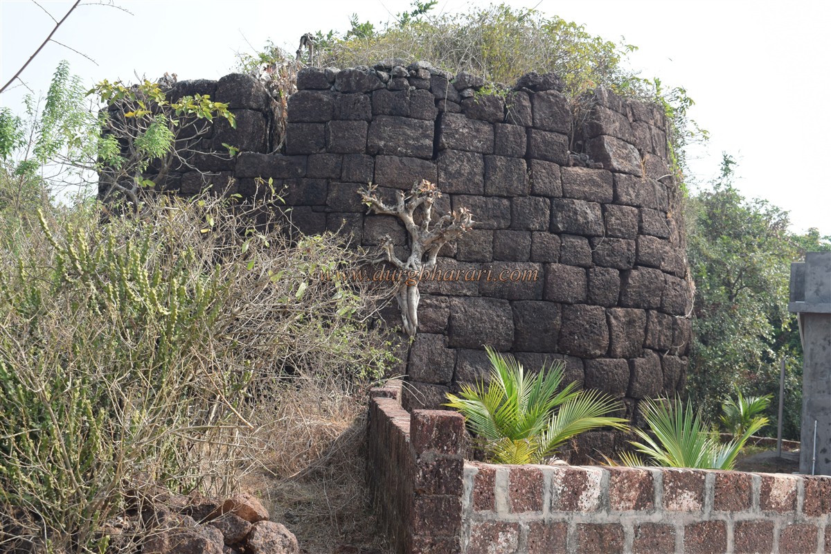
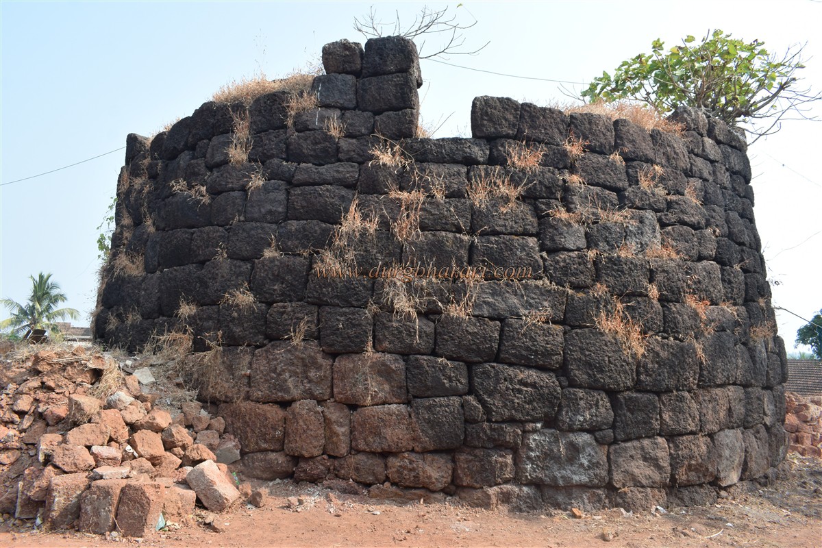
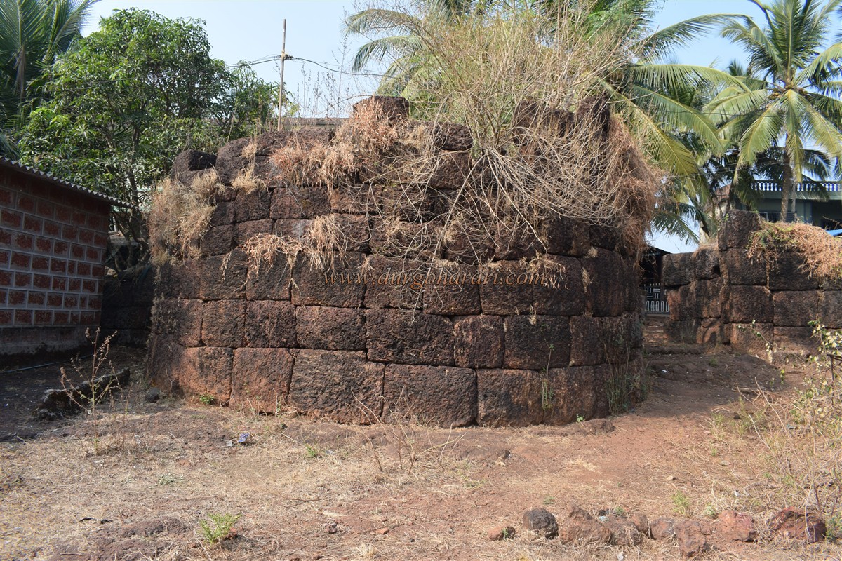
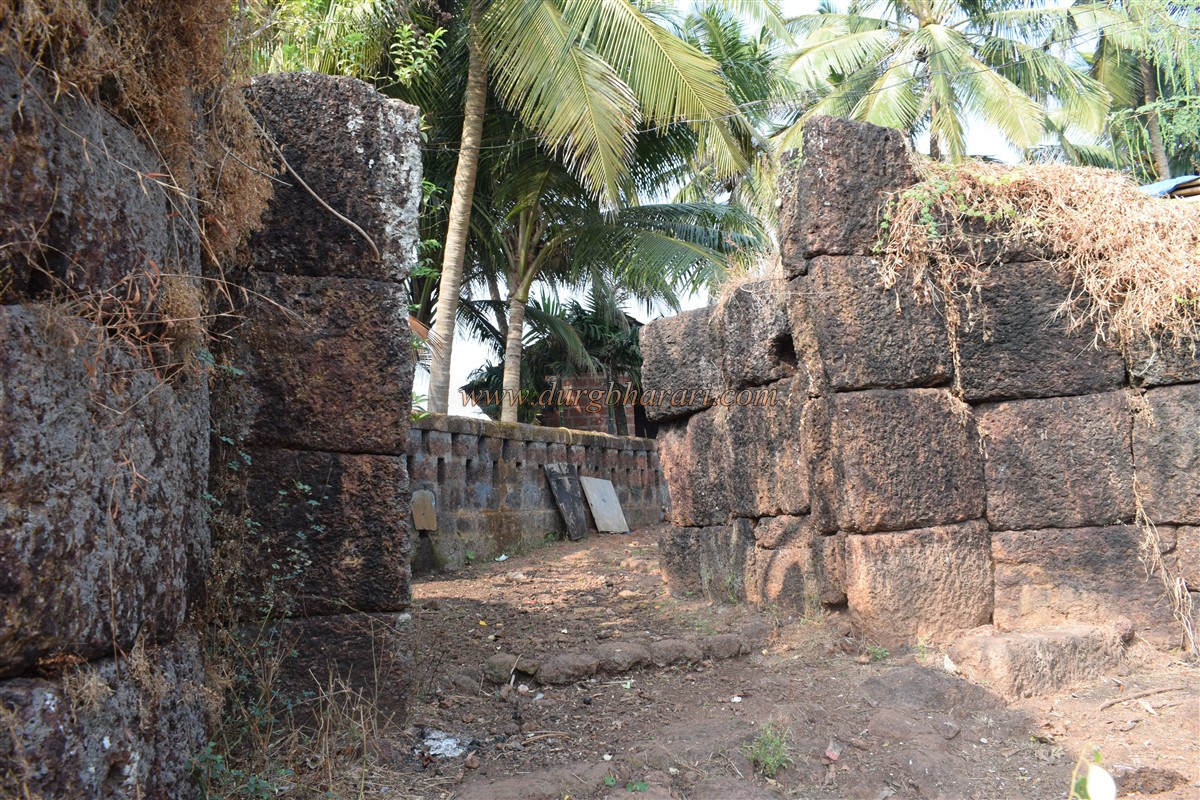
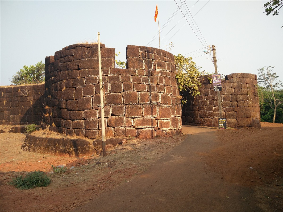
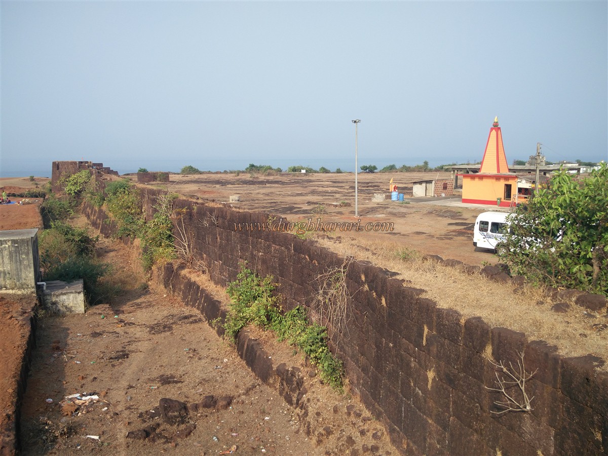
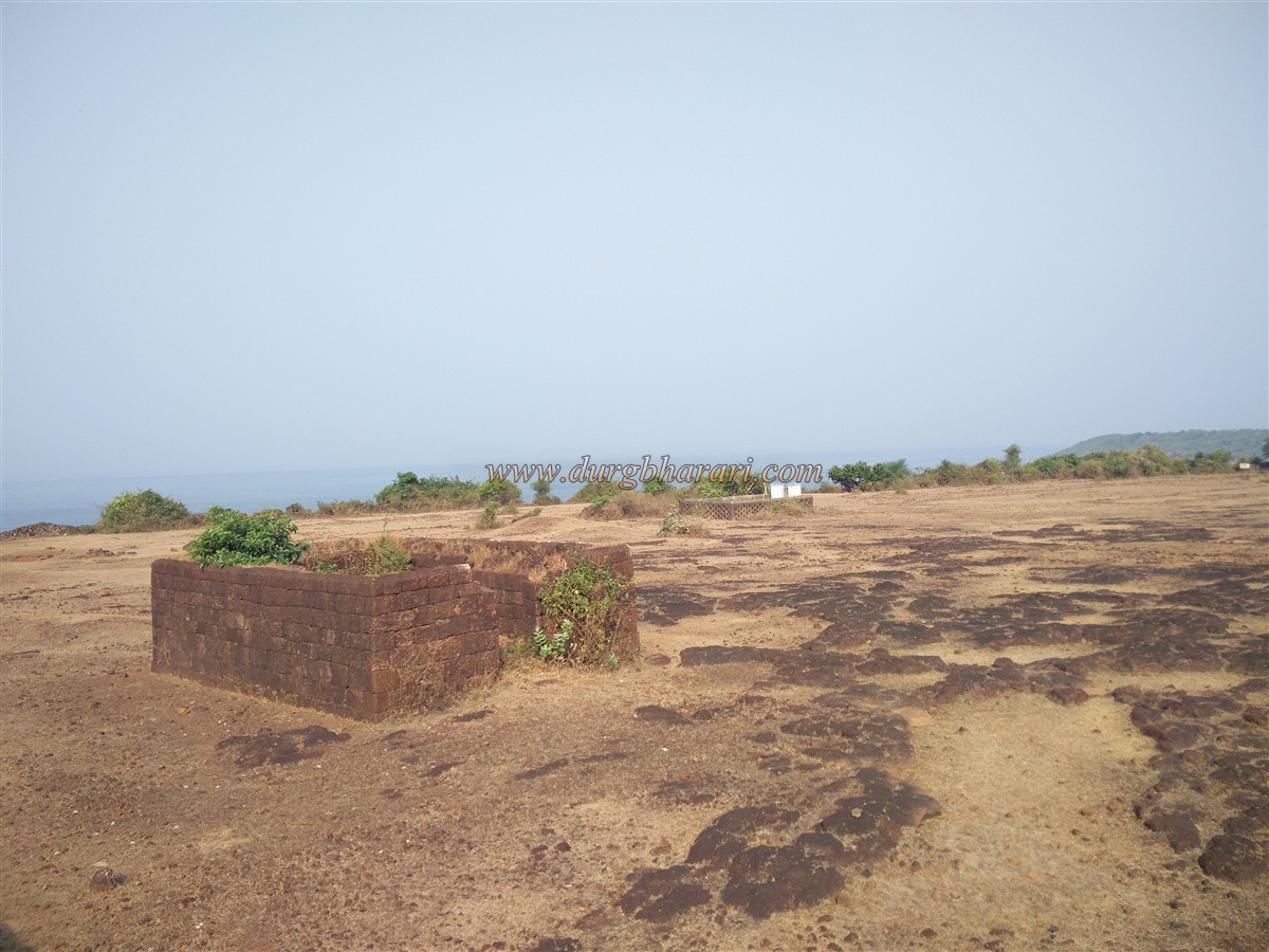
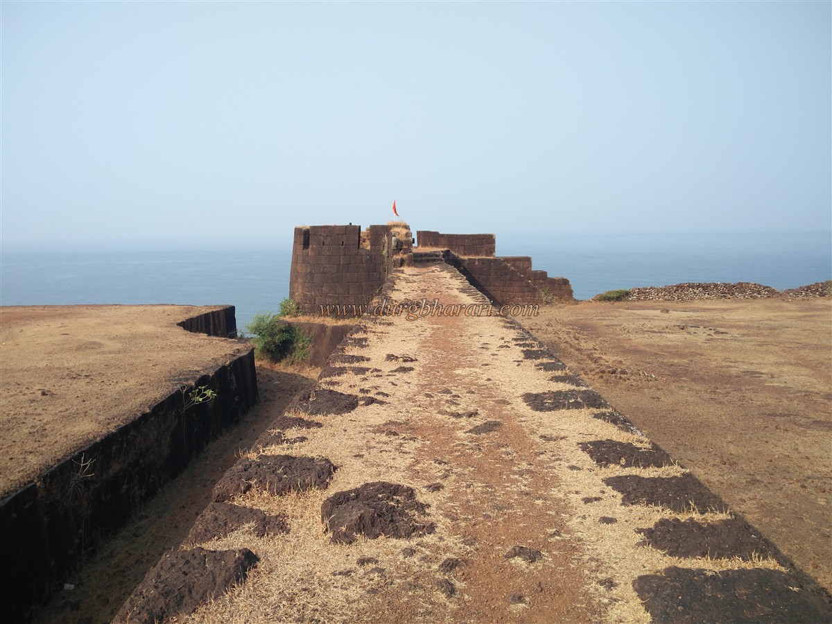
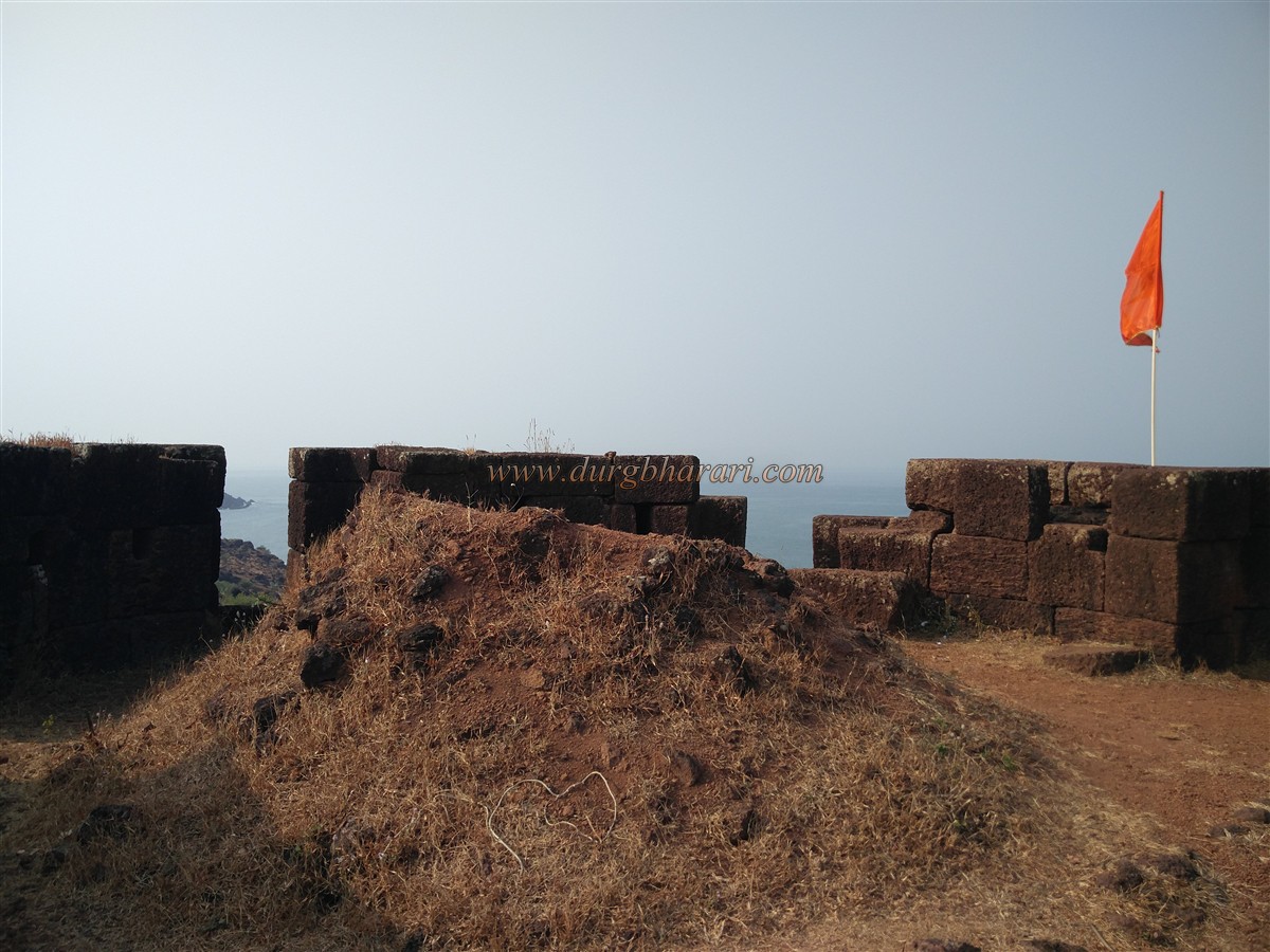
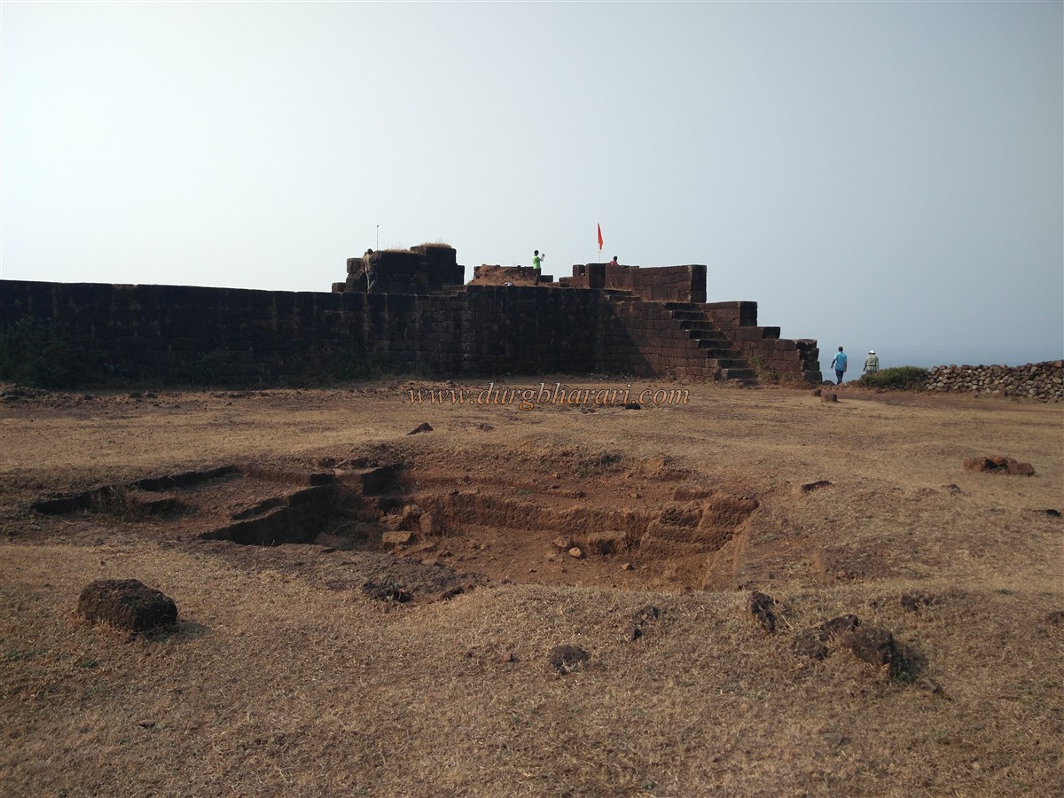
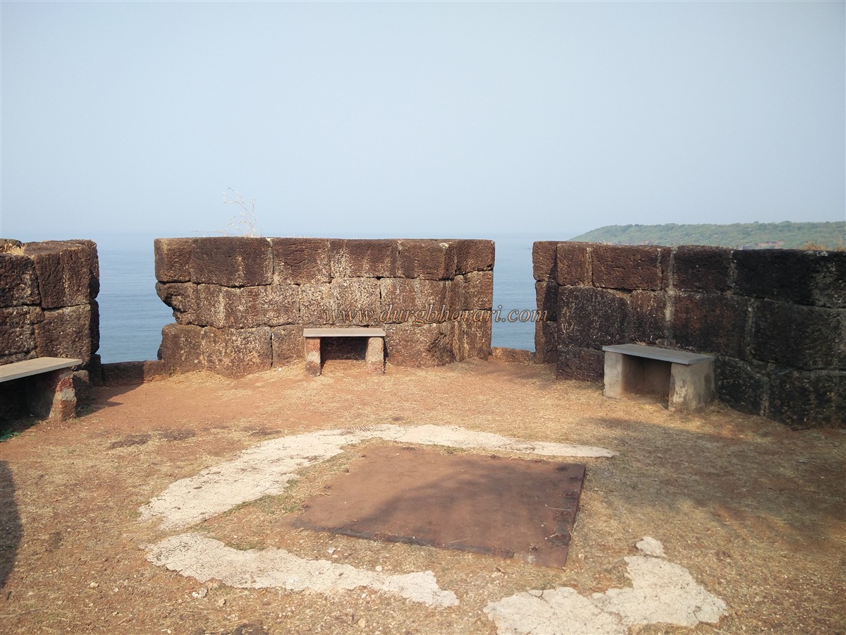
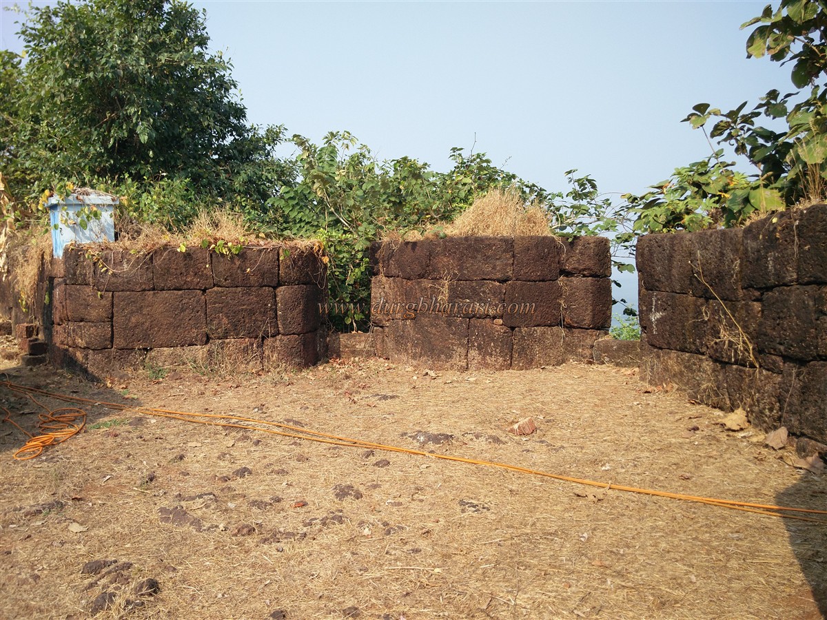
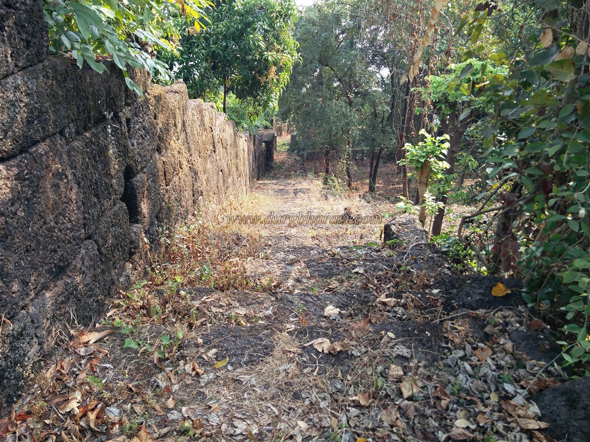
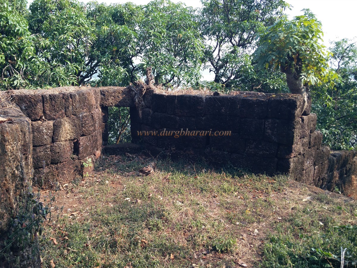
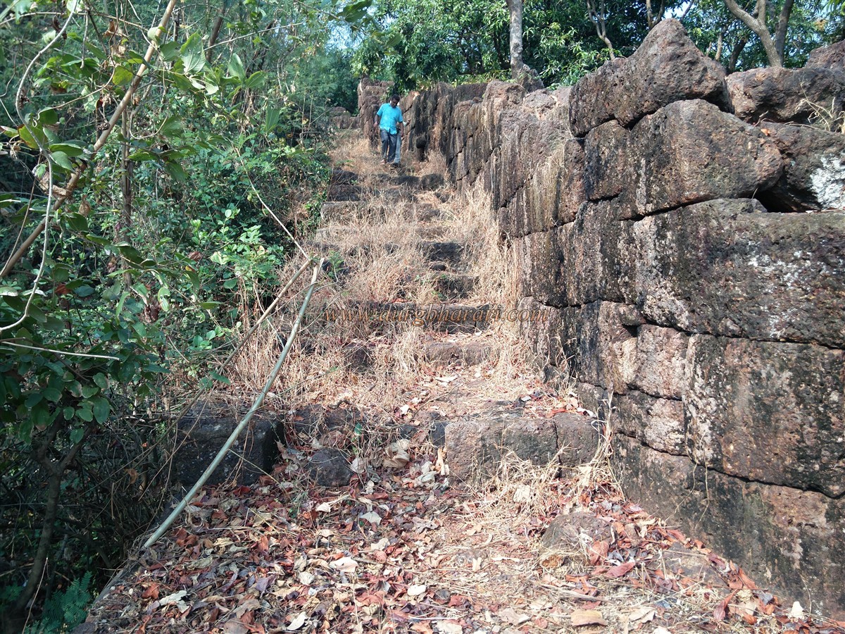
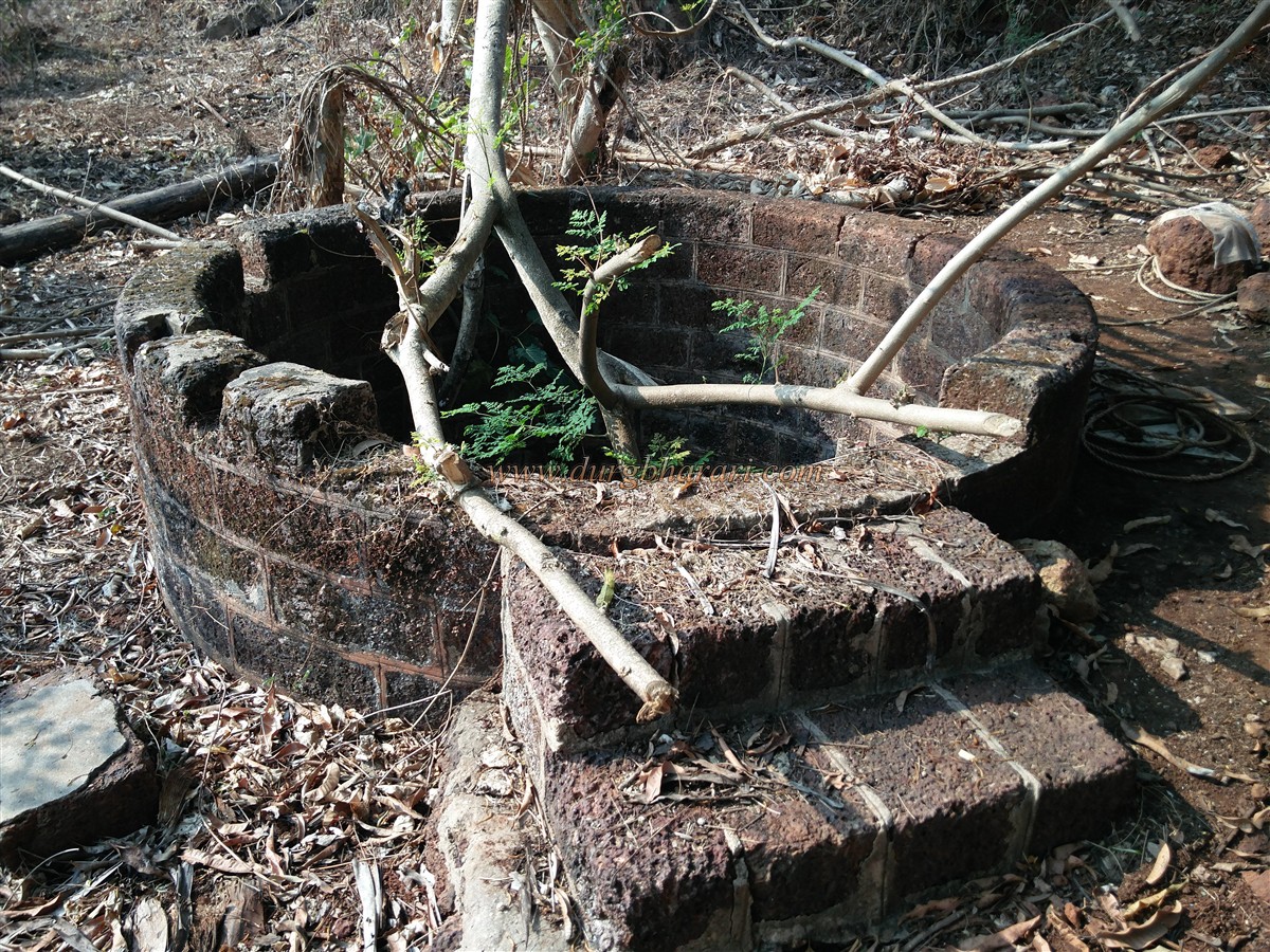
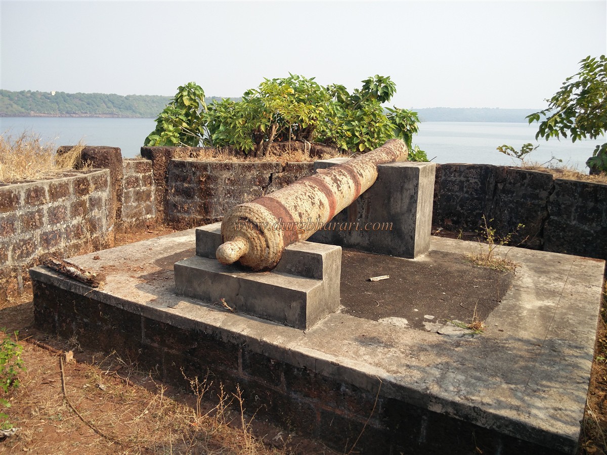
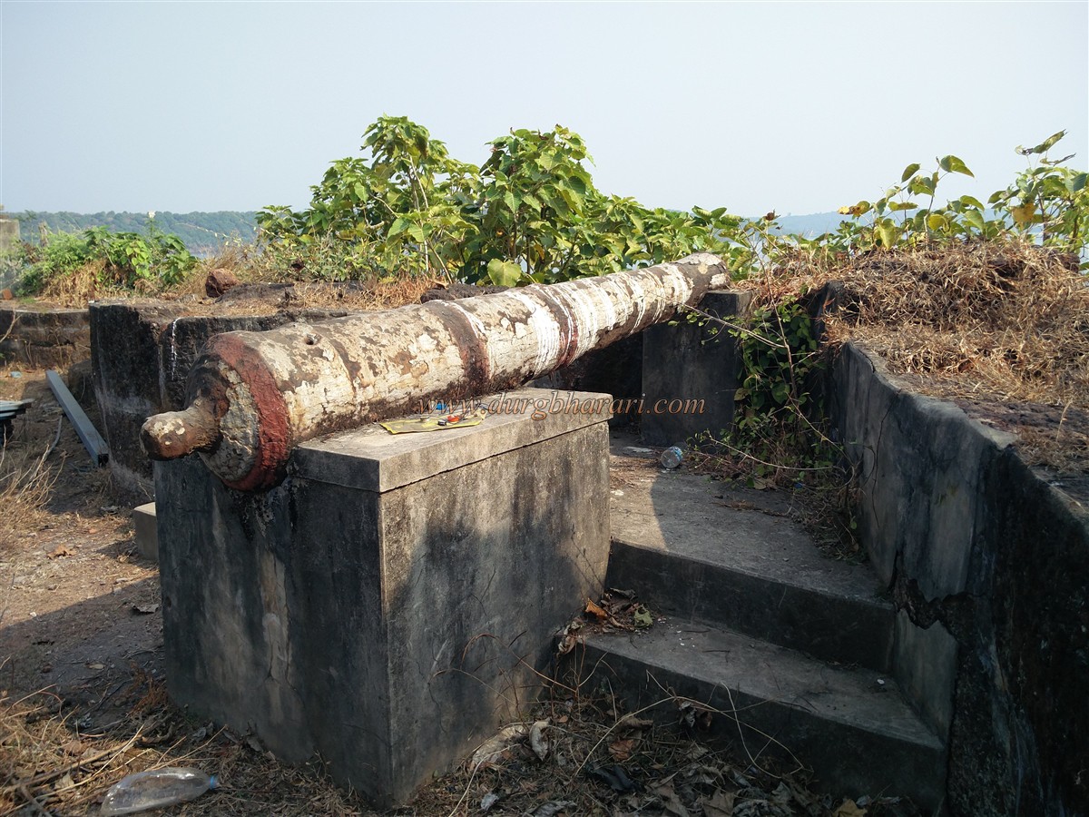
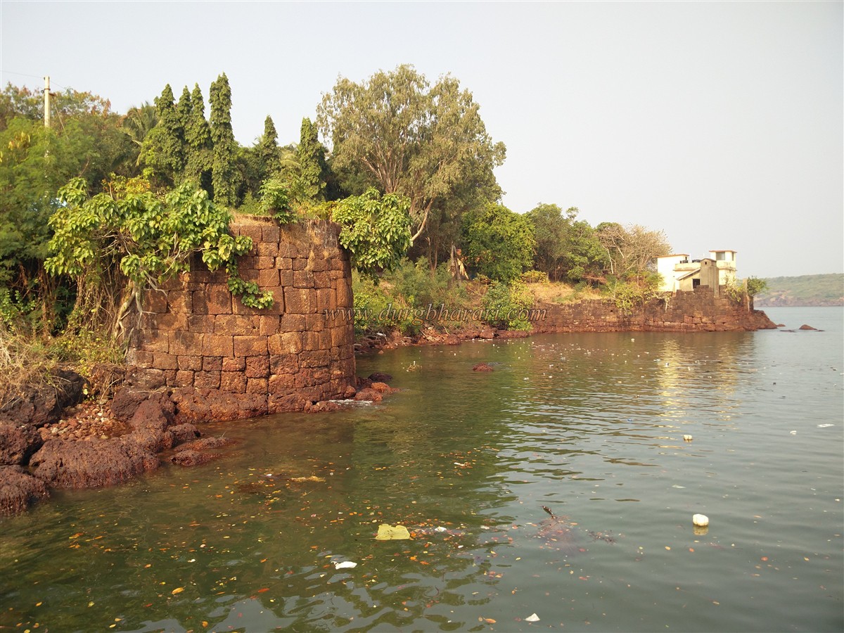
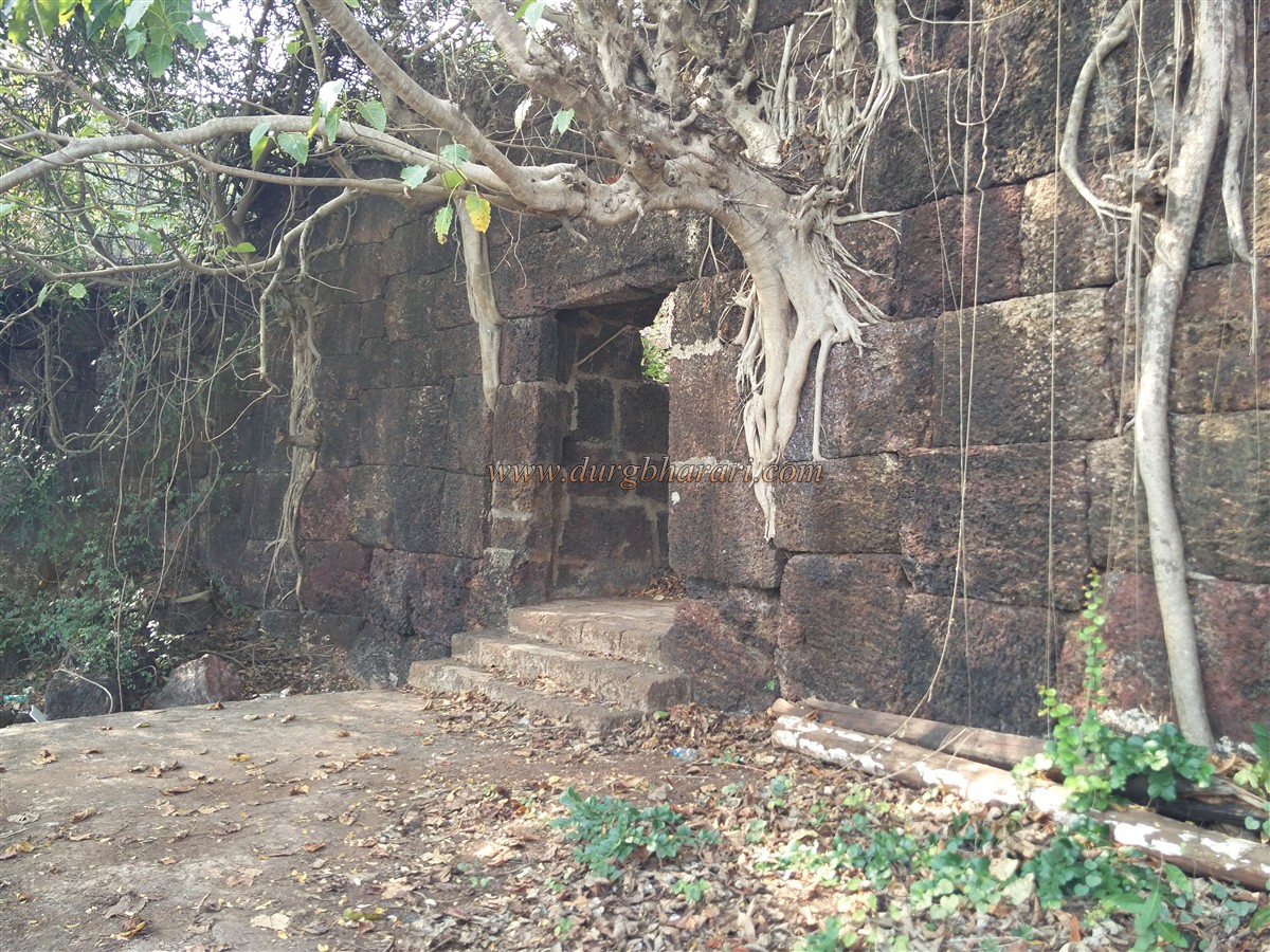
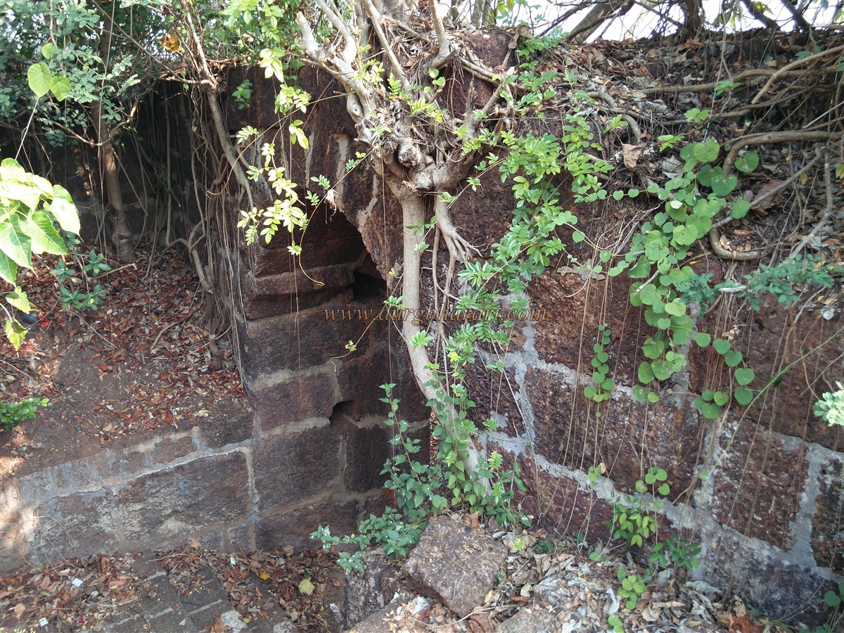
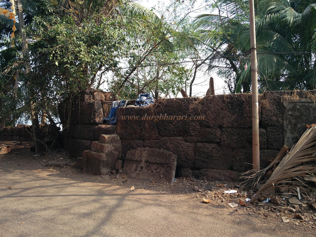
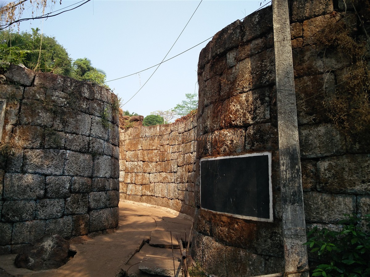
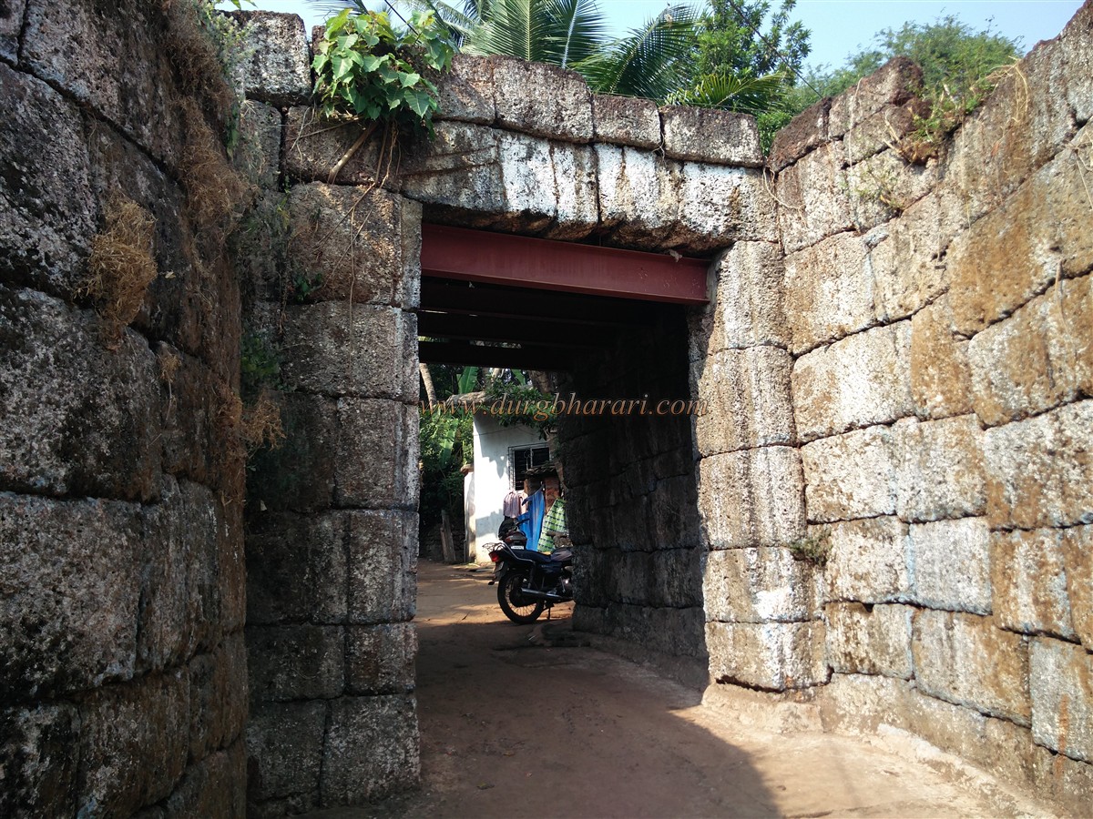
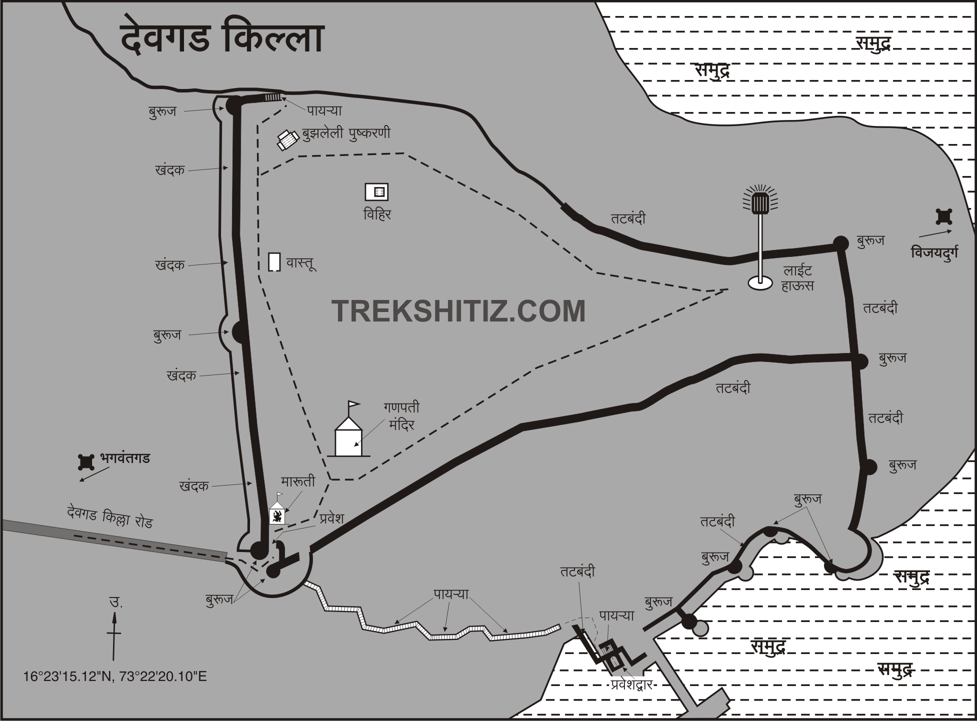
Devgad Fort is also divided into two similar parts and it has a citadel on the hill and a fort on the creek. The distance between Mumbai and Devgad is 464 km and it is a fork leading from Nandgaon to Devgad on the Mumbai-Goa highway. At a distance of 40 km from this fork, is the fort of Devgad. As Devgad is a taluka in Sindhudurg district, there is a direct bus service to Devgad from Mumbai, Pune, Thane, and Kolhapur. The first gate of Devgad fort is only 1.5 km from the Devgad bus stand and this distance can be reached by rickshaw or on foot. After walking straight towards the sea on the road in front of the Devgad bus stand, we reach Dattamandir Chowk in 20 minutes. Three-way routes from this fork take you to different parts of the fort. The straight path in front takes you to the settlements in the fort. On this road, the first Gomukhi gate of the fort is located between the two bastions. This door has an arch on the inside. The east-facing door and arch have been weakened and given an iron base for support. There is no carving on this door. This part of the fort has many settlements and one has to wade through these settlements to reach the plateau. After seeing the door, turn back and come to the fork and start your fort round on the road going up from the left. On the right side of the road, you can see the ruined ramparts of the fort and the houses built on it, while on the left side you can see the beach of Devgad. From here, the road turns right and enters the village. This path leads to another east-facing gate of the fort built in two bastions on the left side of a mosque. The door and one of the adjoining bastions have collapsed. The ramparts starting from the first door extend to till here. These are two different doors to enter the fort. As you proceed along this road, you will see a total of five bastions one on the left side of the road, two on the right side, and two at the end of the settlement. These watchtowers are not built-in ramparts but are completely separate. After walking for 10 minutes from here, you can see the long ramparts of the fort spread from east to west and the three bastions in it. The ramparts are still in good condition and a deep moat has been dug outside the ramparts. The trench is about 15 feet wide and deep. The moat has served the purpose of protecting the fort & stone for constructing fort walls. At the right end of the fort, between the two bastions, is the third east-facing gate of the fort. The arch of the door has been destroyed and only a quarter of the inner porch remains. Upon entering through the door, there is an idol of Hanuman in a small dome adjacent to the wall, and a short distance away is a Ganesha temple. You should first visit the Ganesha temple and then start fort round. Built-in 1915, this temple has now been renovated and the original idol is still standing. After visiting the temple, you should start your fort round by climbing the steps near the door. The entire area of the fort is spread over 60 acres and the citadel of the fort is spread over 19 acres. Not many remains can be seen in the citadel. In front of the second bastion of the ramparts has a ruined structure with a thatched roof. When you reach the bastion at the western end of the ramparts, you can see the endless sea in front of you. The quadrangle structure for canon or flag on this bastion has been destroyed. The western part of the fort is eroded and it is not possible to say for sure whether there was a fortification in this area or not. There is a small cistern carved into the rock near the steps of the bastion. Next to the cistern are the base of houses partially buried in the ground. Adjacent to the remains is a square-shaped deep well, which has been fenced recently. The water from this well is still in use today. Next to the well is a Deepstambh, the port department office, and the staff. Entry to this area is from 4 pm to 5 pm by paying a nominal fee, but if requested, admission could also be given at other times, but it requires a government ID card. Photography is strictly prohibited in this area. There are no remnants of the Deepstambh in the courtyard except for a bastion in the northwest and a rampart in the north. After seeing this part of the fort, one should go to the northern ramparts along the fence wall of this government yard. This area has a large number of mango trees and this area is privately owned. During the mango season, the people in the garden forbid to enter here and give the reason as a restricted area. The northern part of the ramparts is sloping and has steps built on it in different stages. There are a total of 4 bastions in this rampart of the fort, including the bastion in the courtyard of the Deepstambh. The entire ramparts are lined with barrage for cannons. After descending about 100-125 steps, we come to the fourth bastion on the bank of the creek. On this bastion is the office of the port department. From this bastion, one can see three more bastions on the banks of the creek. Looking at this, one goes to the next bastion on the bank of the creek and sees a small round well on the right. The water from this well is still used for boats in the port. On the third bastion, you can see 10 feet long two cannons kept on a cement block and aimed at the sea. According to a survey conducted by the British in 1862, there are 41 cannons on this fort. Later, in recent times, when the Devgad port was in use, it was mentioned that there were three cannons on the fort, but today only two cannons remain on the fort. From this bastion, one can see the port built for the ships of Devgad in front. Come to this port after seeing the bastion. This port which was constantly busy due to frequent visits of boats is now deserted. Near this place, there is a small gate of the fort hidden in the trees. A horizontal wall has been laid in front of the gate so that the inside of the fort is not visible. The outer gate of the fort is square and the inner side has a circular arch. There is a guard's porch on the inside of the door and when you come up here, there is a dome with an idol on a quadrangle structure in front. Remains of a large structure built in a wrought stone can be seen behind the ports employee's residence. The road on the right from Dattamandir Chowk where your fort round started leads to this place of residence. On the way to Dattamandir Chowk, on the right side, you can see the collapsed ramparts on the bank of the creek and the three bastions in it. The ramparts attached to the first gate of the fort have been destroyed due to the construction of the road as well as the houses here. When you reach Datta Mandir Chowk, your journey is complete. It takes 3 hours to complete the entire fort round by the above route and you can see the entire fort. Historians are not unanimous about the date of construction of Devgad fort as there is not enough information about who built this fort and when. Kanhoji Angre is credited with the construction of Devgad fort. The first mention of Devgad fort in the year 1713 is between Kanhoji Angre and Chhatrapati Shahu Maharaj. According to this treaty, Devgad fort was in the possession of Kanhoji Angre. Considering the inadequate water supply and incomplete construction of the fort, it seems that the fort was built during the chaos period. There are only 3 wells in the fort area and even today there is not enough water on the fort. However, according to many historians, the construction of the fort, considering the political situation at that time, such a safe port could not be neglected during Shivaji Maharaj’s period. On this basis, the fort is believed to have existed during the Shivaji Maharaj’s period. On 18th October 1720, Walter Brown, a British officer, with the help of Wadikar Sawant, attacked Devgad fort but they were defeated and they had to retreat. In the joint campaign of Peshwa and the British in 1856, the fort came under the control of the Peshwas without much resistance and Bapuji Hari was appointed as the fort keeper. Gangadhar Bachaji was appointed as the fort keeper between 1798-99. The fort was captured by Colonel Imlak on April 8, 1818. In the year 1875 Kharepatan taluka place shifted to Devgad become taluka place.
© Suresh Nimbalkar
GALLERY