DERMAL
TYPE : HILL FORT
DISTRICT : NASHIK
HEIGHT : 3520 FEET
GRADE : MEDIUM
Nashik district has the highest number of forts in Maharashtra, with over 65 hill forts, most of which remain relatively unknown. One such relatively unfamiliar fort that has not enjoyed the touch of Shivaji Maharaj’s era is Deramal Fort. Despite its vast expanse comparable to forts like Harishchandragad and the semi-circular Bhairav Kada, as well as the well-known Salher, Mulher, and Ahivant forts, this remote fort is not very familiar to fort enthusiasts.
Located in the Galna mountain range, within the vicinity of Galna Fort, Deramal Fort is about 128 km from Nashik city and 38 km from Satana. At the base of Deramal Fort, there are three villages in different directions — Tinghari, Bilpuri, and Pratappur. If you have a private vehicle, approaching via Tinghari village is more convenient.
...
From Tinghari village, the Deramal Fort is not visible. There is a well-paved road from Tinghari toward Pratappur passing through the Hindalbari (Khind) pass. The plateau where Deramal Fort sits is adjacent to this Khind pass. If you trek from Pisolgad Fort, you reach the Hindalbari pass in approximately three hours.
By private vehicle, you can reach the Hidamba Devi temple located at Hindalbari Khind from Tinghari village. Right in front of this temple is a worn footpath leading up to the plateau. This path takes about half an hour to reach the plateau, and from there, about 45 minutes to reach the fort. Otherwise, trekking from Tinghari village to the fort takes around 2 to 2.5 hours, and from Bilpuri village about 2.5 to 3 hours. Having a vehicle reduces the mountain climb by 20%, saving about an hour of trekking.
If coming via Dhule, you first reach Pratappur village and then arrive at Tinghari village through the Hindalbari Khind pass. Near the Hidamba Devi temple at Hindalbari, ancient temple ruins can be seen. It is unclear whether these ruins belonged to a temple originally here or if they were brought down from the fort.
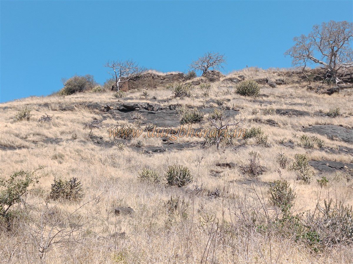
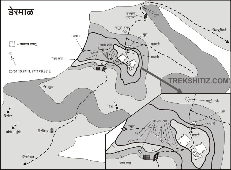
From the worn footpath leading to the plateau, the fort, spread across two hills, comes into view. The plateau directly below stretches up to the base of Deramal Fort. This expansive plateau with its camp-like spread justifies the fort’s name — Deramal (“dera” meaning camp). In the past, this plateau was cultivated during the monsoon, but now it lies barren.
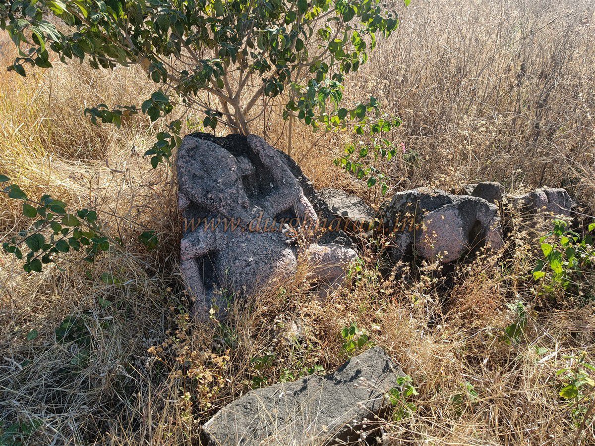
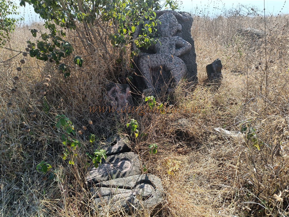
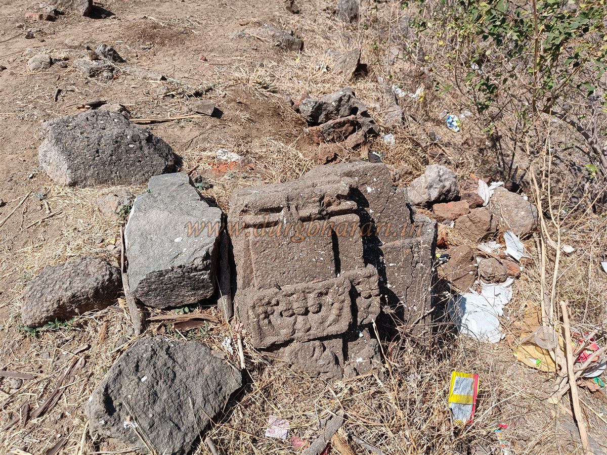
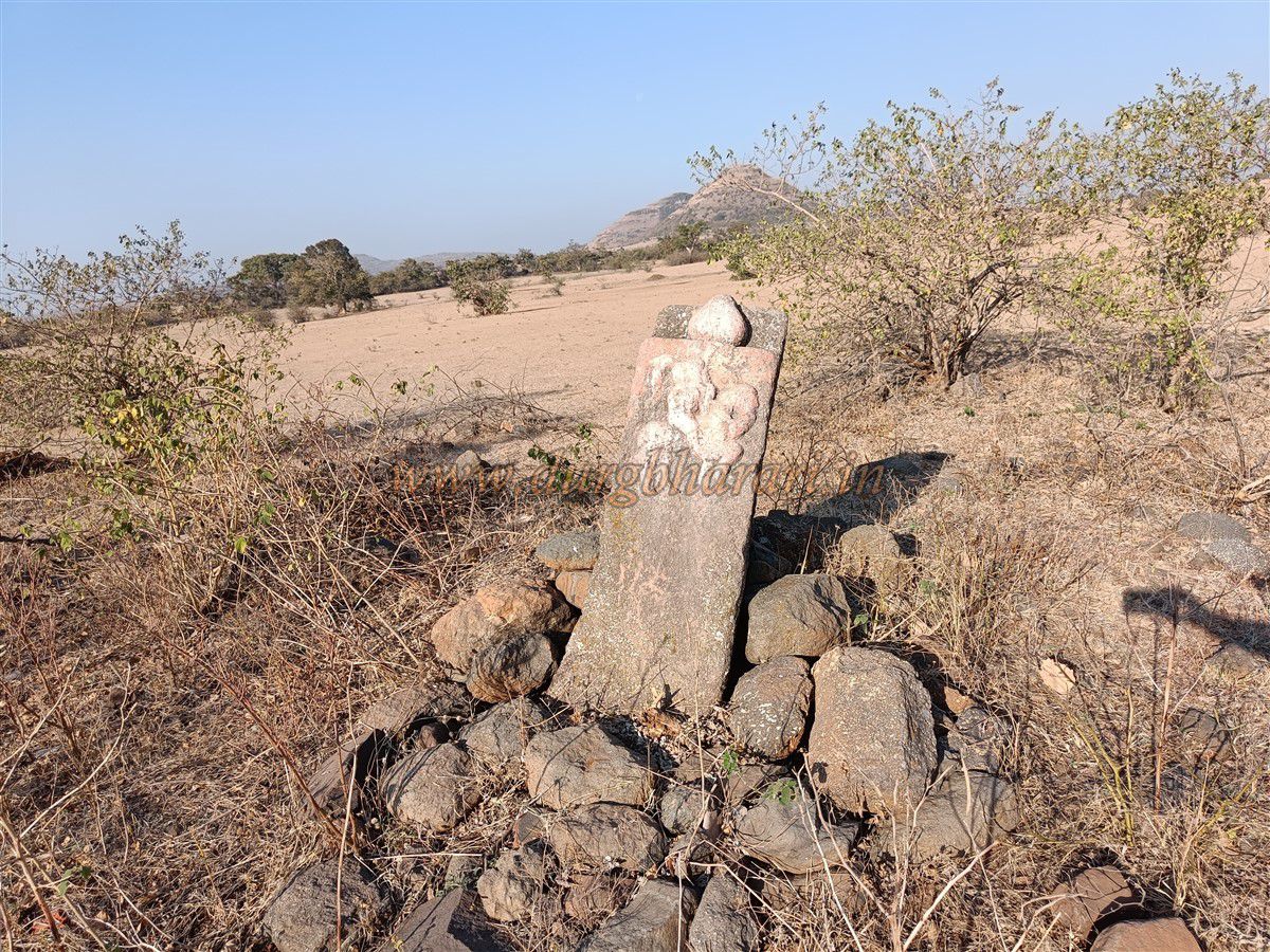
At the start of the plateau is an earthen seasonal dam. From here, a path leads rightward toward the fort. Along this path, you can see a carving of a warrior riding a horse on a three-foot-high rock. Some ornamental carved stones are scattered on the plateau, and nearby lies a dried-up pond.
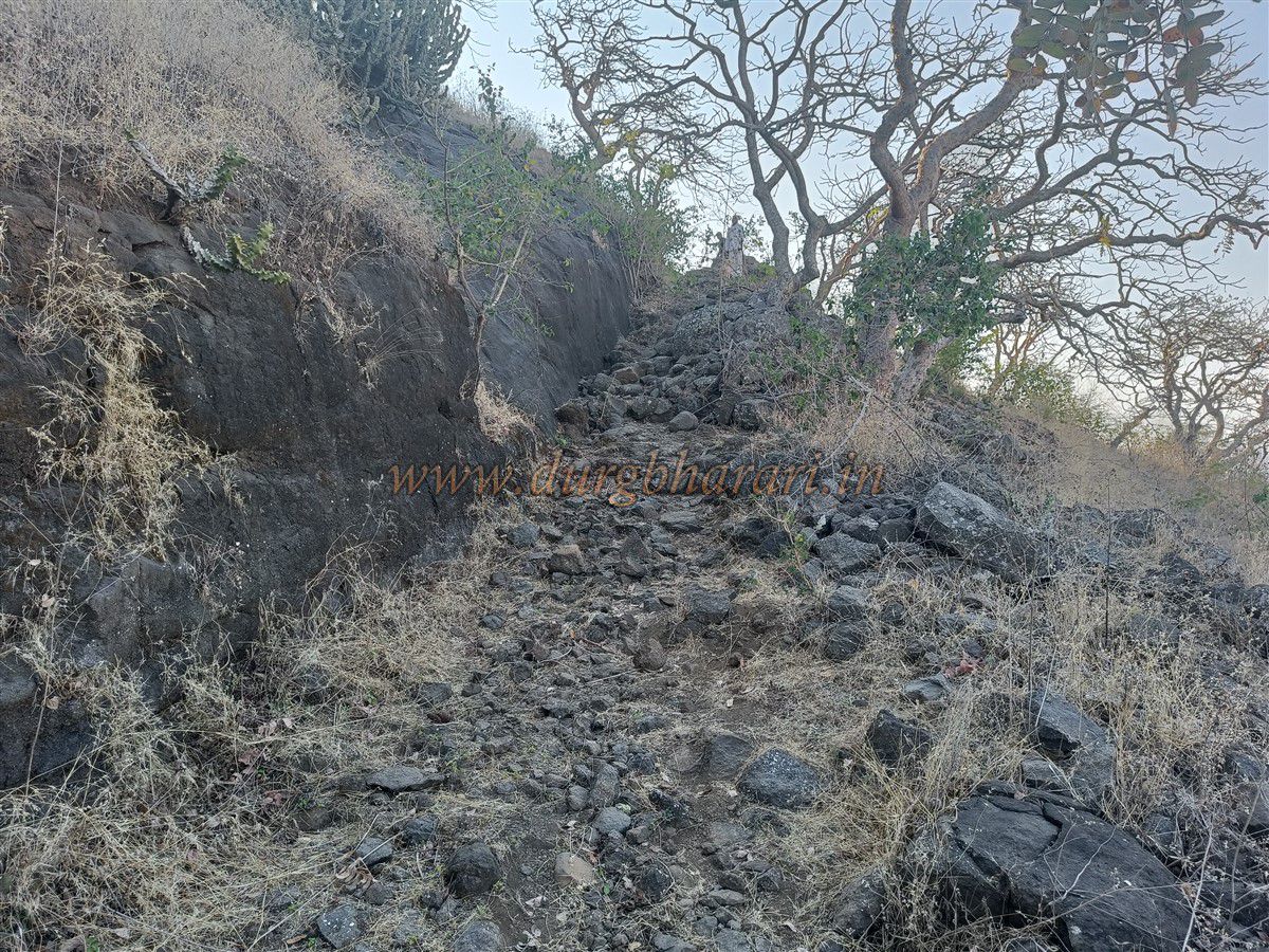
There are three main gates to the fort in total. One gate lies on the Bilpuri village side, while the other two are on the path coming from Tinghari village. From the warrior carving on the plateau, two routes lead to the fort. The more worn and straightforward path goes through a small valley between two hills and ascends to the fort, while the right path leads to the southern gate of the fort. The latter path is less worn, slippery near the end, and involves going around the hill, so the first path is preferable.
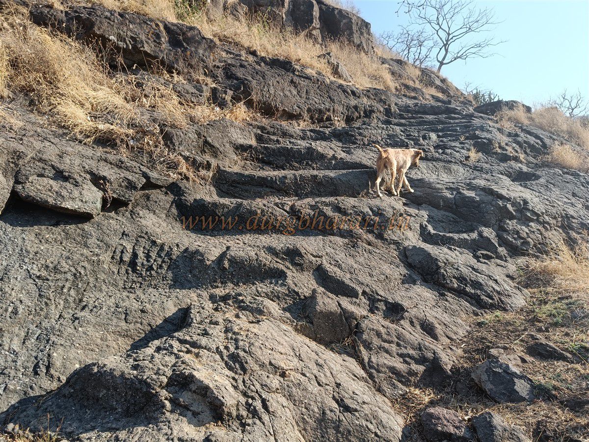
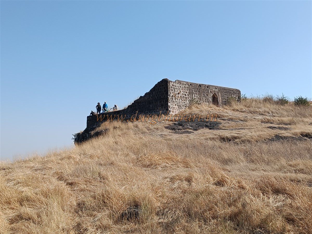
From the warrior carving, it takes about 15 minutes to reach the base of the hill. From there, a slight ascent on a rocky, uneven stone step path leads to the fort entrance. This main gate has been completely destroyed, and the adjacent two bastions are also in ruins.
Inside the fort, there is little space for walking and the paths are broken, so you need to explore carefully to find remains. Upon entry, a path on the left leads to Bhairav Kada (Bhairav cliff), straight ahead is the Bhairav Kada itself, and to the right is the hillock of the Balekilla (main fort).
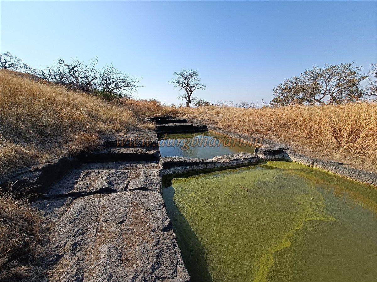
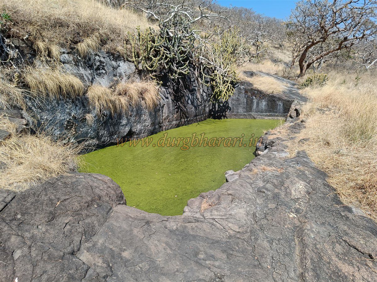
Start by exploring the left fortification walls. Few ruins remain here, but on this edge is a large water tank carved into a rocky depression filled with water containing reeds. From here, the entire plateau you came from is visible.
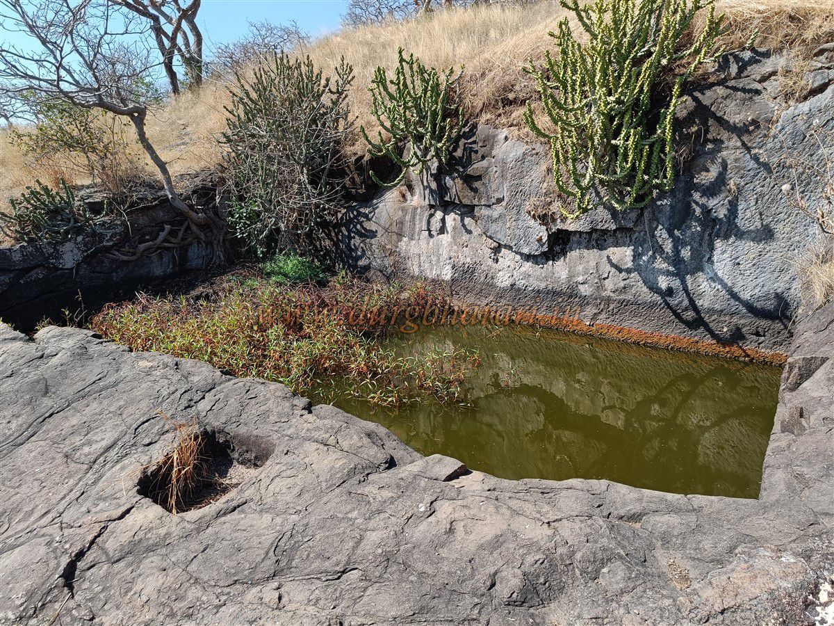
After viewing this area, return to the entrance and begin ascending the right hillock of the Balekilla. Near the start of this path are two rectangular water tanks carved into the rock, one atop the other — the upper one square-shaped. A little higher up is a tank half-filled with silt.
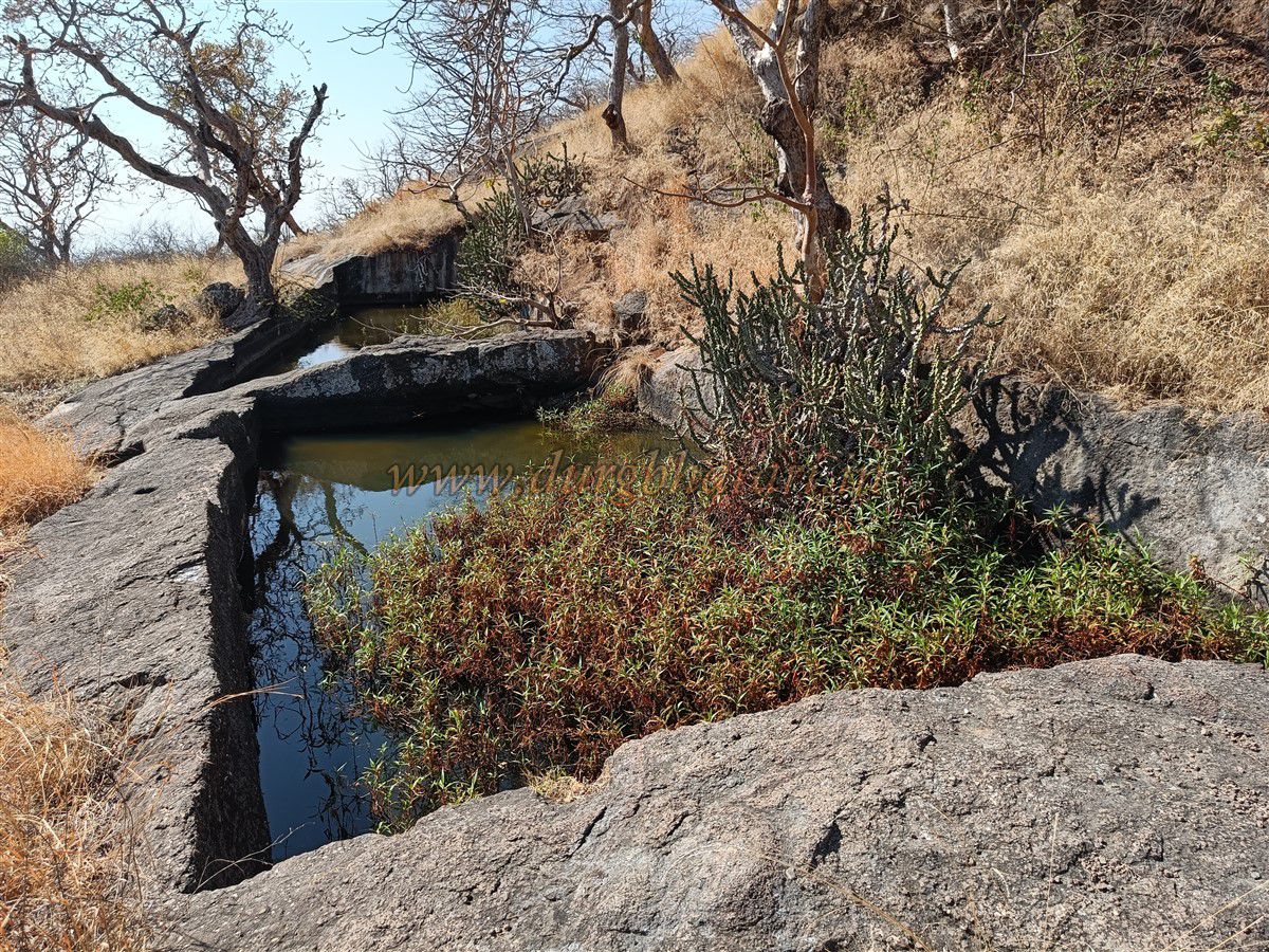
Continuing up, you reach a flat area below the Balekilla, where seven small to medium-sized tanks are carved in a row in the rock. All tanks have water, but only one contains potable water.
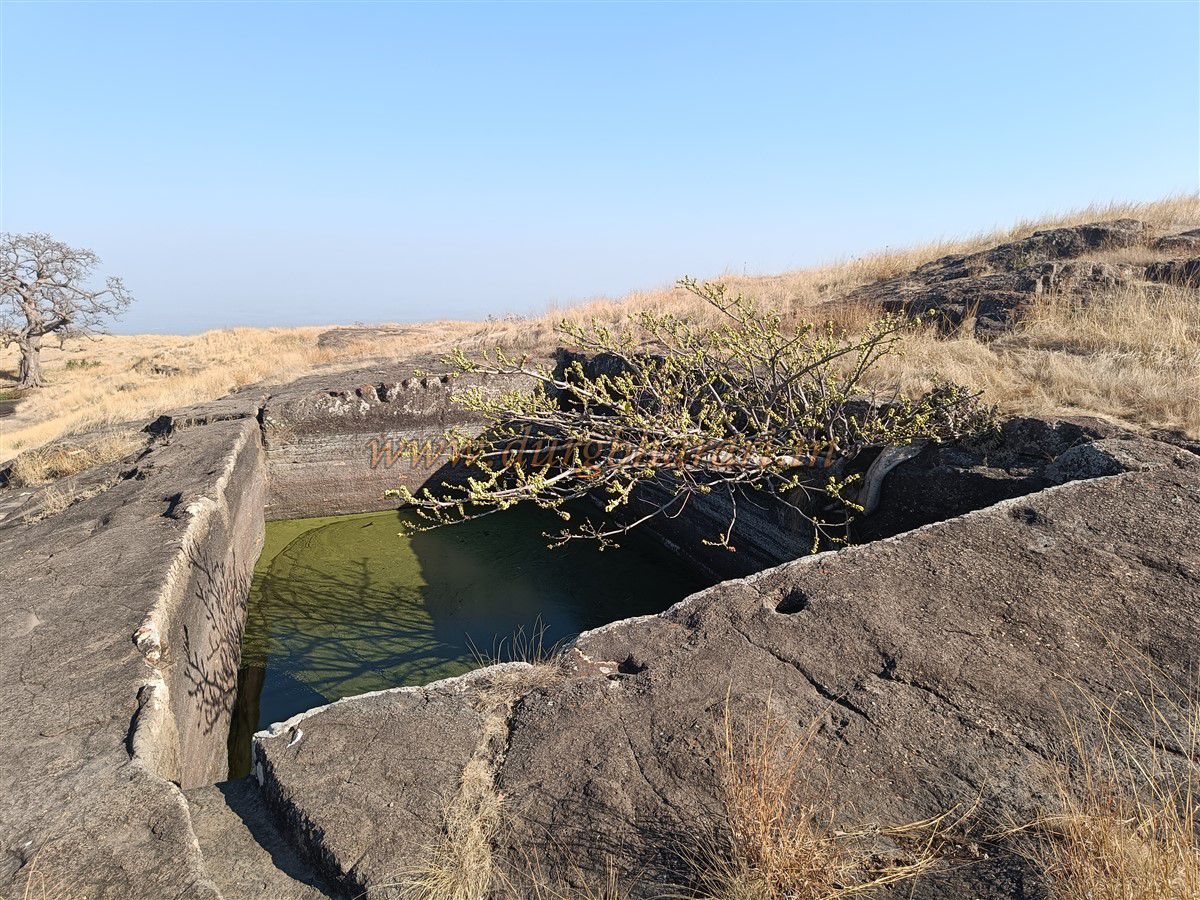
Moving toward the Balekilla, near its fortifications are two large and one small tank. One large tank is dry; the other two have greenish water. Beyond these tanks lies dense vegetation, and hidden within it are fortification walls and two large rock-cut water tanks.
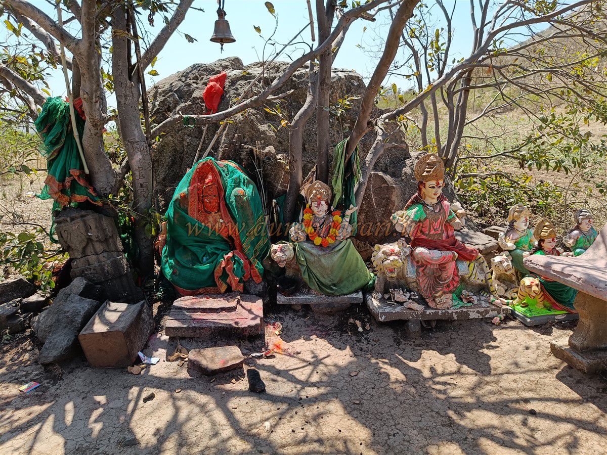
Return from here and begin climbing the balekilla’s fortification wall. On the left side of the path, under a small tree, is a weathered idol of Ganesh. A short distance away are idols of Hanuman, three Shiva Lingams, and a small goddess idol.
The path to the left descends downward, while the right path leads to the balekilla’s summit. The Balekilla summit is enclosed by four bastions and fortifications, but dense vegetation hampers a proper walk around.
The Balekilla gate lies between two bastions, but the thick vegetation prevents access. The internal ruins indicate that a large wada (fort residence) once existed here. Square-shaped, now collapsed, water tanks are visible. The balekilla is the highest point of the fort, at about 3,520 feet above sea level.
From the summit, one can see the forts of Pisol, Salher-Salota, Mulher-Mora-Hargad, Mangi-Tungi, and Bhamer.
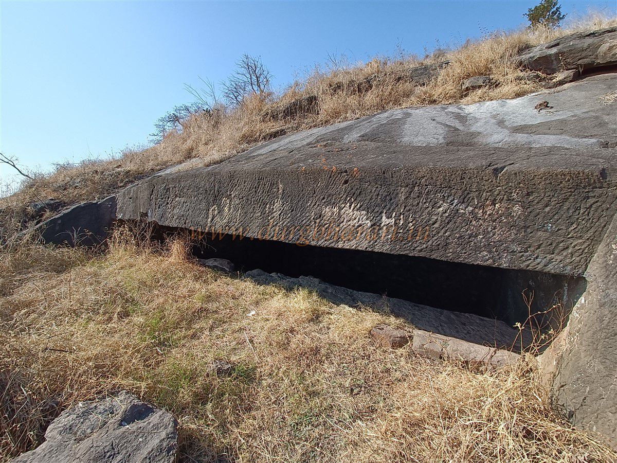
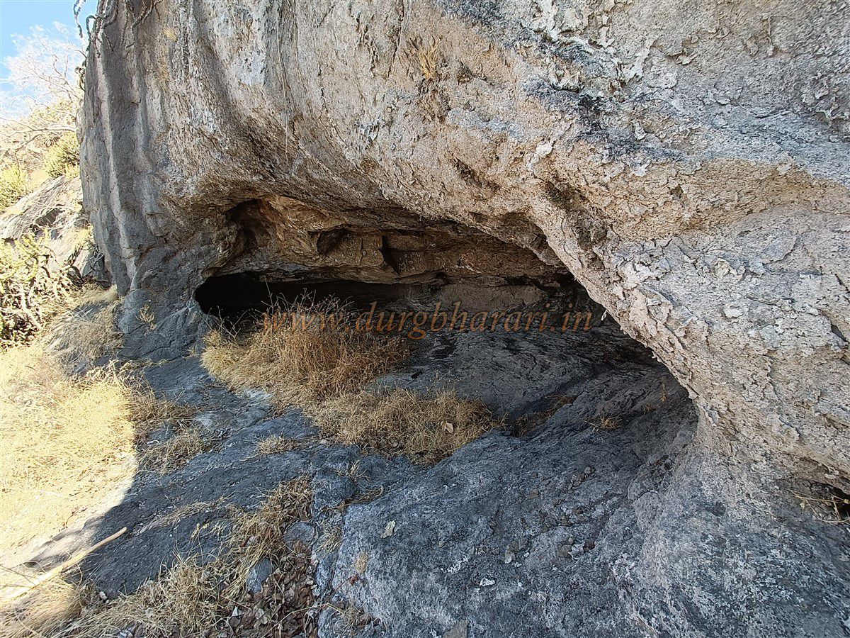
Descending from the Balekilla via the path near the Ganesh idol, you reach a small cave called "Kordi Vakhar" by locals. The entrance is very narrow, requiring you to bend and enter. This cave can easily shelter 7 to 8 people and serves as a good overnight camping spot.
After completing the Balekilla tour, proceed toward Bhairav Kada. At the edge of Bhairav Kada is the ruin of a large building, of which only one wall and an arch remain. This was probably the fort keeper’s residence.
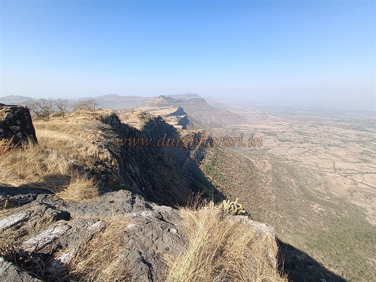
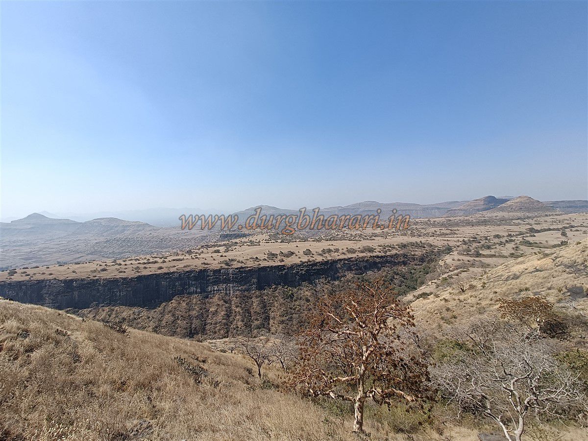
Inside, along the edge, are two carved steps called the footprints of Bhairavdev by locals. From here, a beautiful semi-circular view of Bhairav Kada unfolds. The cliff is nearly 1,200 feet high with Pratappur village situated below.
Near the arch of the ruined building are two rock-cut water tanks, one a “joined tank.” To the right toward the plateau of Sonde are ruins of fort walls and houses. A secret exit path exists here but is little used.
Returning near the arch, continue the fort tour on the left side. First, a dry monsoon pond is seen, then a partially carved water tank.
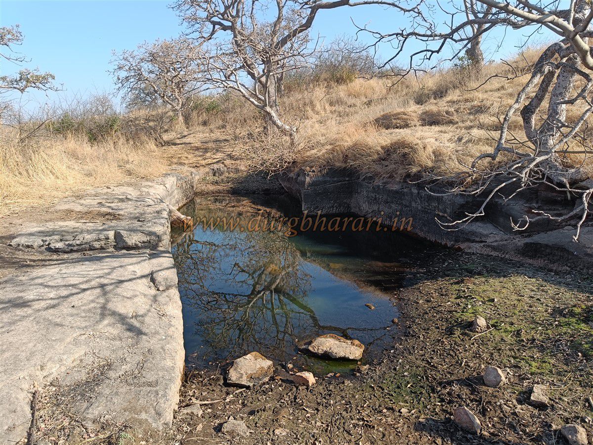
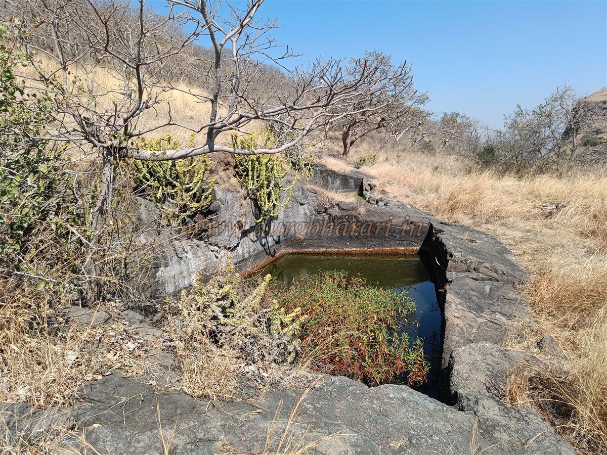
The path descends to the machi (lower fort area). Here is a large joined water tank known locally as “Samudra Taki” with potable water.
The northern fort remains show that you have descended a lot and instead of climbing back up, it is best to circle the fort southward.
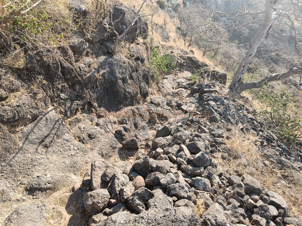
Along this path, fortification walls built with carefully fitted stones on rocky slopes are visible. Further ahead are two more rock-cut tanks.
The path descending ahead leads to Bilpuri village and the fort’s gate. Though your fort circuit continues straight ahead, descend to see this gate and other ruins.
Descending this path, the first water tank appears. Further ahead is a winding path descending into a gorge in the direction of the opposite hill, where traces of three gates once stood.
After viewing this, it takes about 40 minutes to return to the machi.
From the machi, continuing the circuit around the fort, you come to the southern side. The final section of this path is quite dangerous and slippery. Those inexperienced should avoid it and instead turn back after viewing the Bilpuri gate.
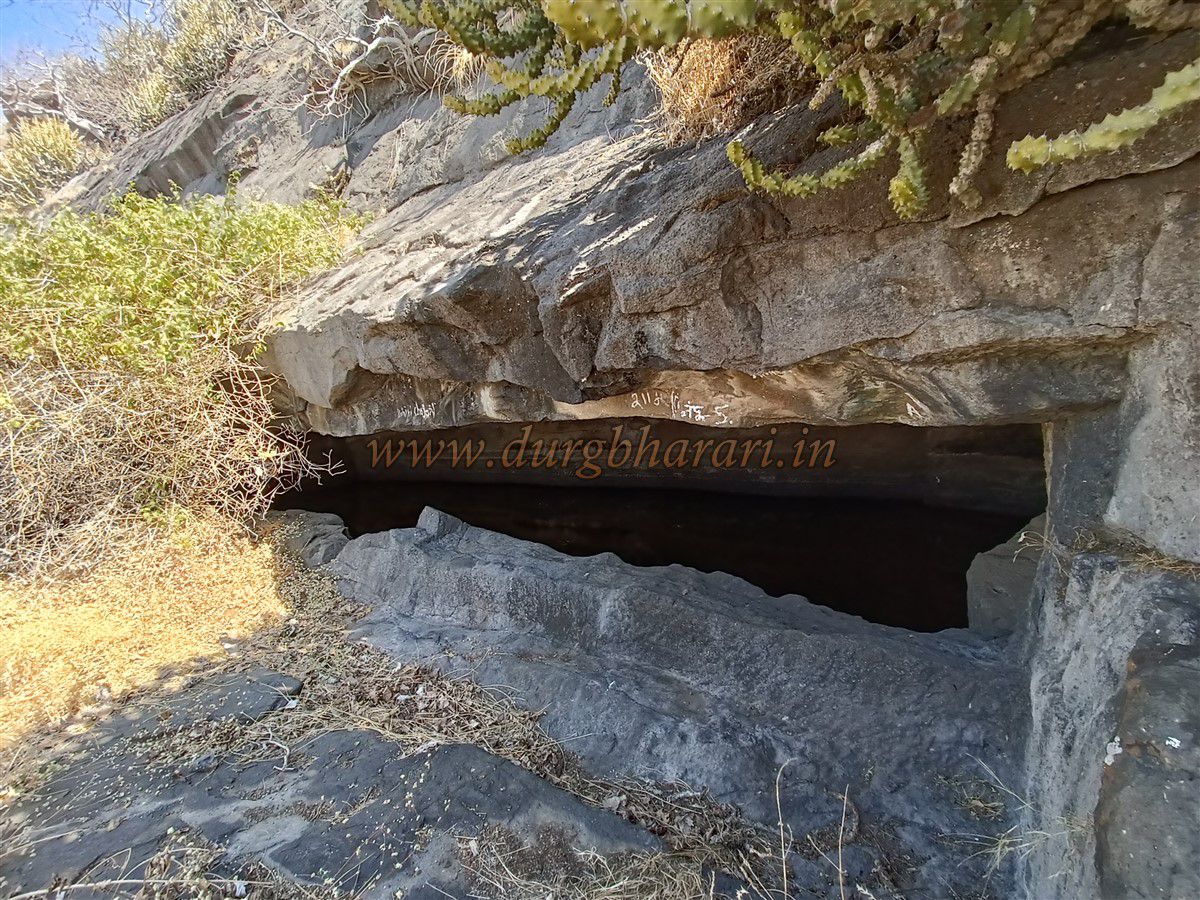
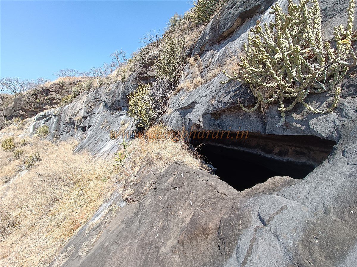
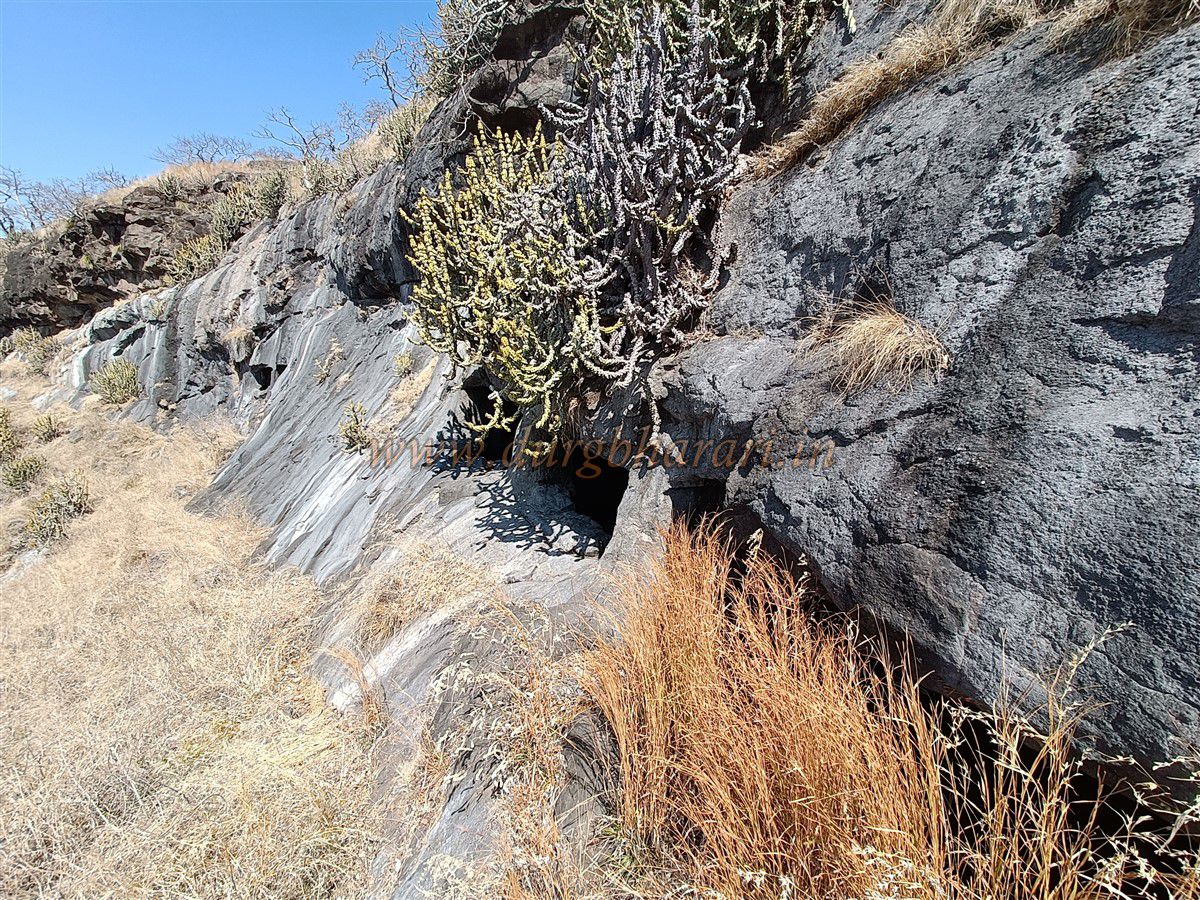
From here toward the plateau, six caves are visible on a nearby hill. One is natural; the remaining five are man-made. Two of these are water tanks, one of which has water comparable in taste to that in the Devtaki at Sinhagad Fort.
The other three caves are suitable for overnight stay but are located on a steep cliff, leaving no space outside. The paths to the caves are also challenging.
The fort’s southern slope is steep and slippery, with fortification walls running down to the gorge. Most of these walls have collapsed, and two gates are blocked by stone walls.
Carefully navigating this steep path, you reach a dried pond on the plateau below and begin your return journey toward Hindalbari.
Due to dense vegetation in parts of the fort, locating ruins is challenging. The fort is quite large, and it takes about four hours to complete a full circuit.
Although the history of Deramal Fort is not well documented, its location on the ancient trade route connecting Khandesh and Surat port suggests its medieval importance.
It is believed that the Gawli king Mahesh built this fort in the 13th century. In the 14th century, Rathod ruler Bagul Raja Nandev defeated Mahesh and conquered Salher, Mulher, Deramal, and Pisol forts.
The Rathod Bagul rulers then governed this region, which came to be known as Baglan after their dynasty.
In 1637, the Mughal Empire took control of Baglan. Although the region came under Maratha control during Shivaji Maharaj’s reign, no mention of Pisol or Deramal forts appears in records.
In 1818, Baglan became part of British territory, marking the beginning of British rule here.
Note: Near Hindalbari pass are about four to five houses where a 60-year-old local guide named Pandit lives, who has good knowledge about the fort. Since the fort paths are mostly broken and it is difficult to navigate, it is advisable to hire a guide to visit the fort.
With proper planning, both Deramal and Pisol forts can be visited in a single day by private vehicle.
© Suresh Nimbalkar
GALLERY