DATEGAD / SUNDARGAD
TYPE : HILL FORT
DISTRICT : SATARA
HEIGHT : 3260 FEET
GRADE : EASY
The English poet Shakespeare once said, “What’s in a name?” To truly understand what’s in a name, he should have once visited Sundargad. Sundargad, also known as Dategad, is a fort whose beauty can be experienced in reality. As its name suggests, the fort is indeed beautiful and worth visiting at least once. So, let us set out to explore this Sundargad.
On the Mumbai–Kolhapur road, about 28 km from Umbraj, lies Patan, the taluka headquarters. Tolewadi and Kawadewadi are two villages at the base of Dategad. The distance from Patan to Tolewadi is 7 km, and from Patan to Kawadewadi is 15 km. If you go via Tolewadi, you enter the fort through the ruined fortification, while from Kawadewadi there is the main royal route to the fort. Both routes take only about 15 minutes to reach the top. Since there is no ST bus service on this route, private vehicles are more convenient.
...
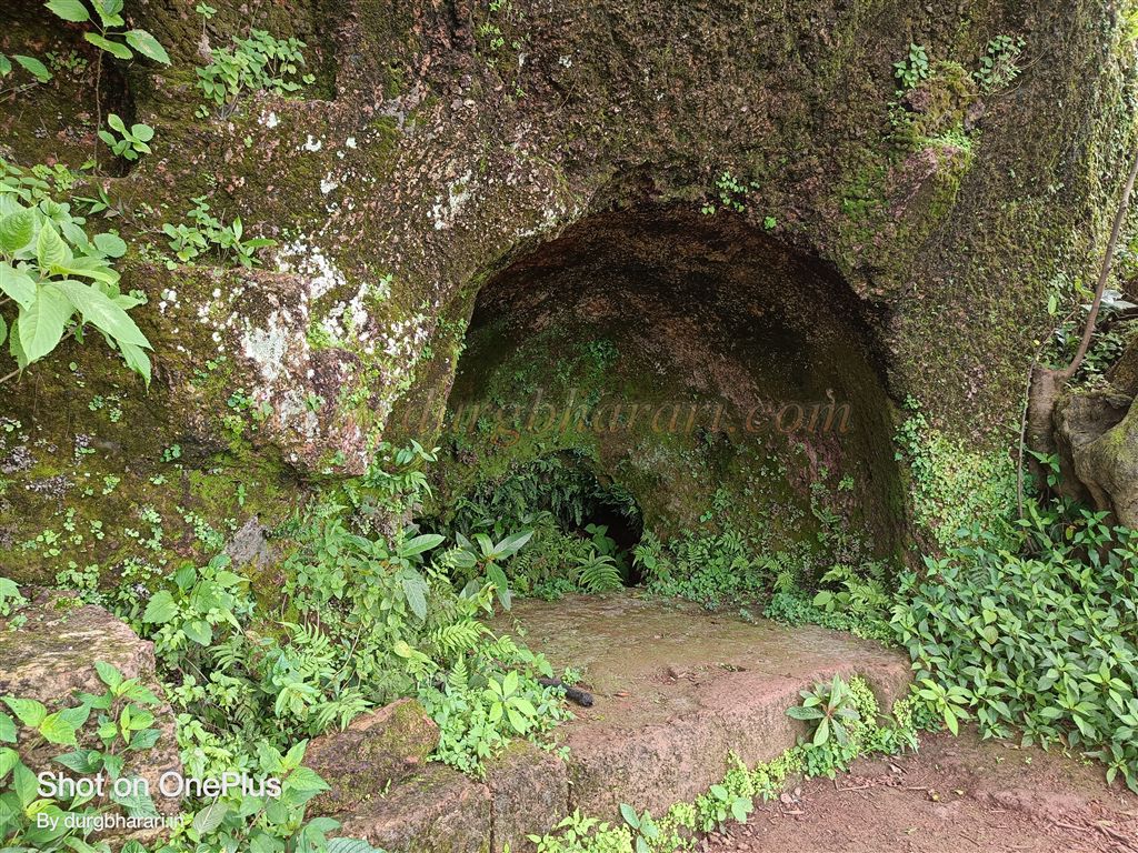
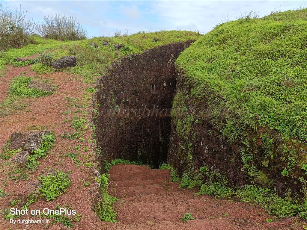
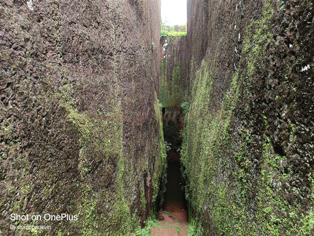
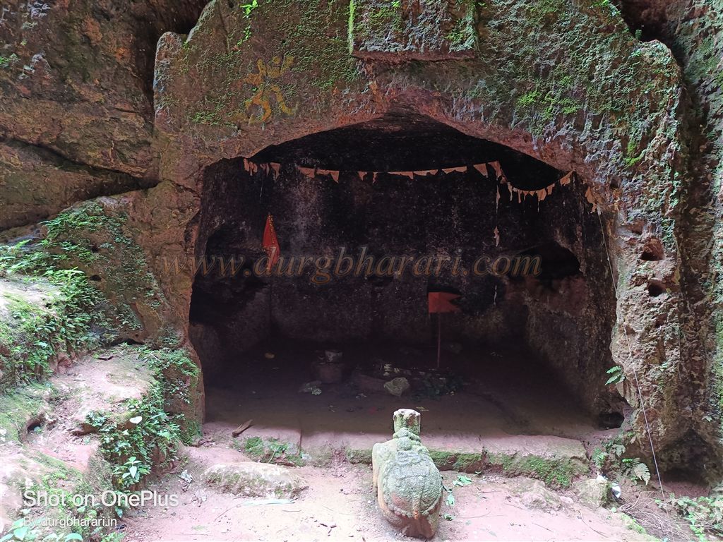
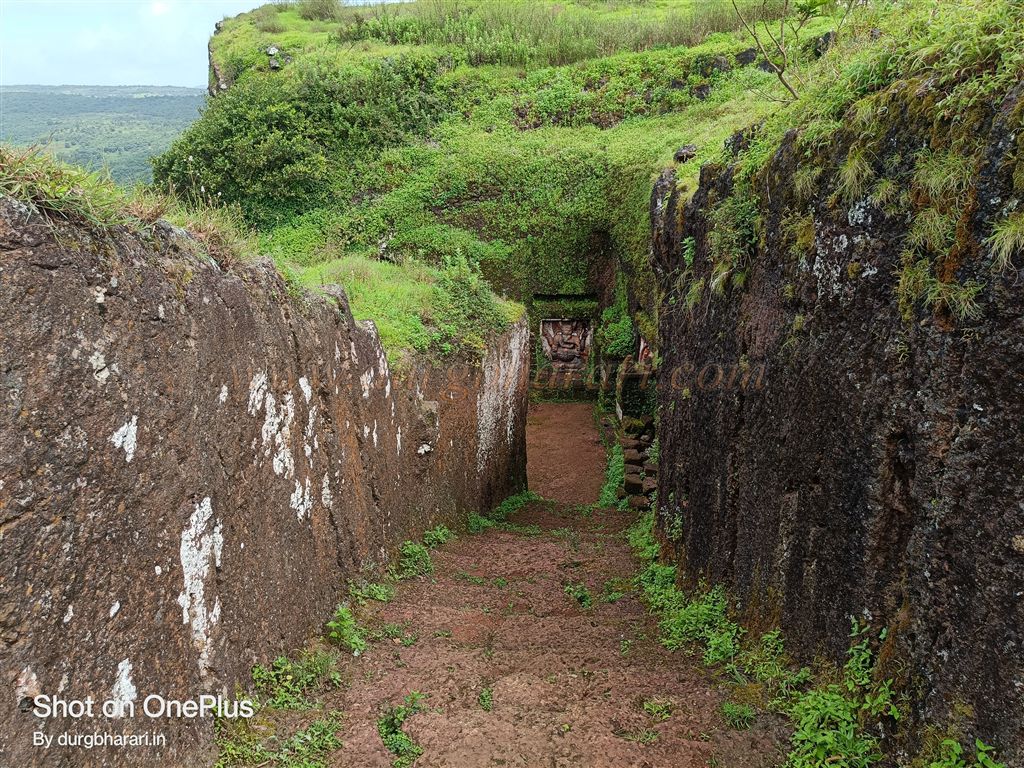
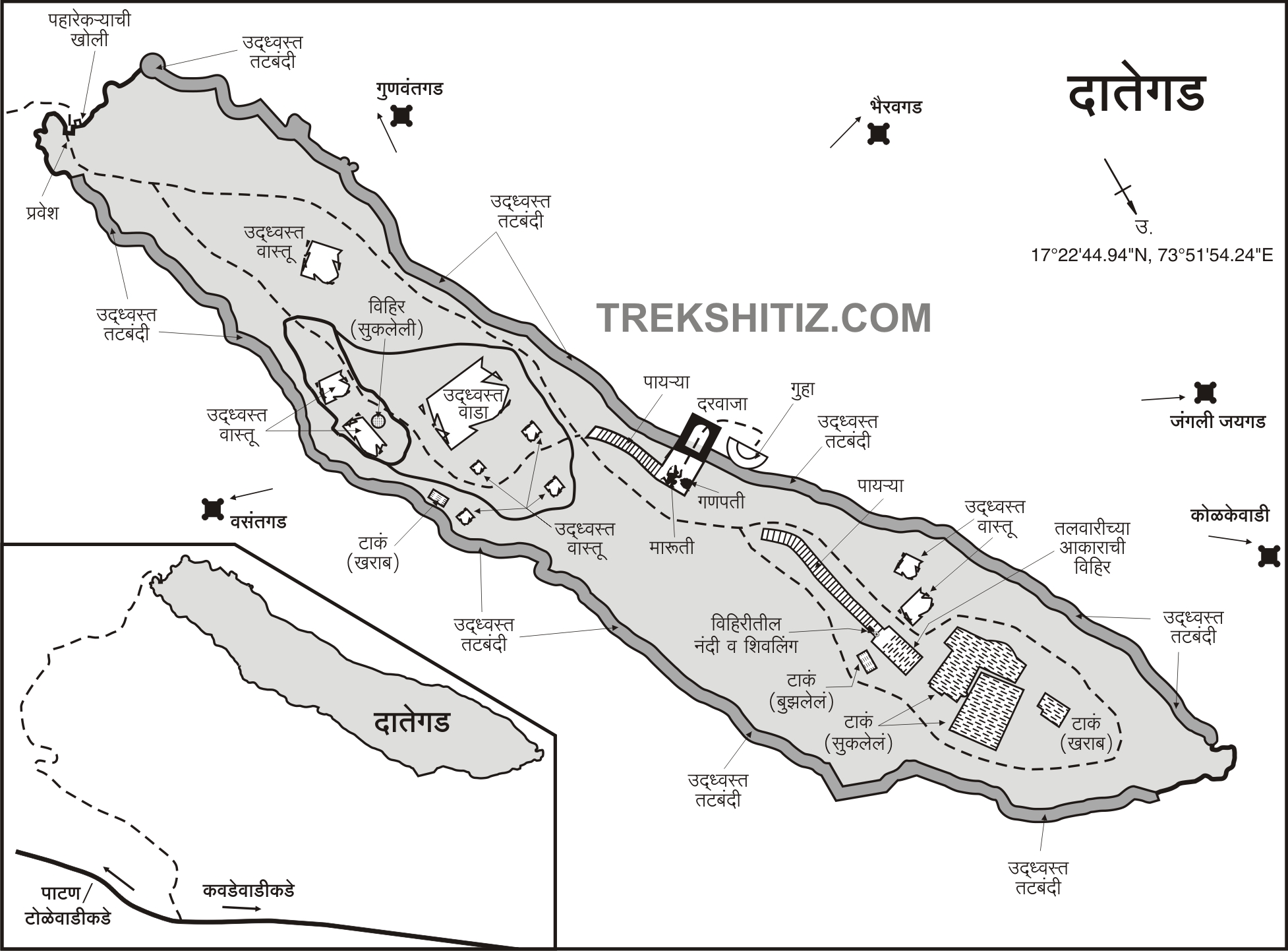
From Patan, while heading towards Kawadewadi via Chapholi, the hill of Dategad appears on the left side along with a parking area beside the road. Team Dategad, an organisation dedicated to the fort’s conservation, has worked tirelessly to restore the fort. They have created a small parking space and reopened the main royal pathway to the fort. Along this route, traces of the original path are visible. After a short climb and walking along the fort wall from below, the path—keeping us within arrow range—leads to the east-facing entrance. On the way, you come across two caves—one natural and one rock-cut.
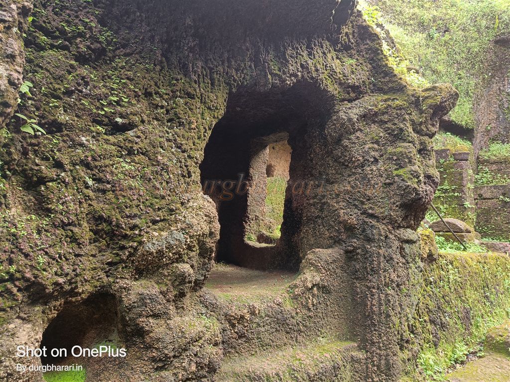
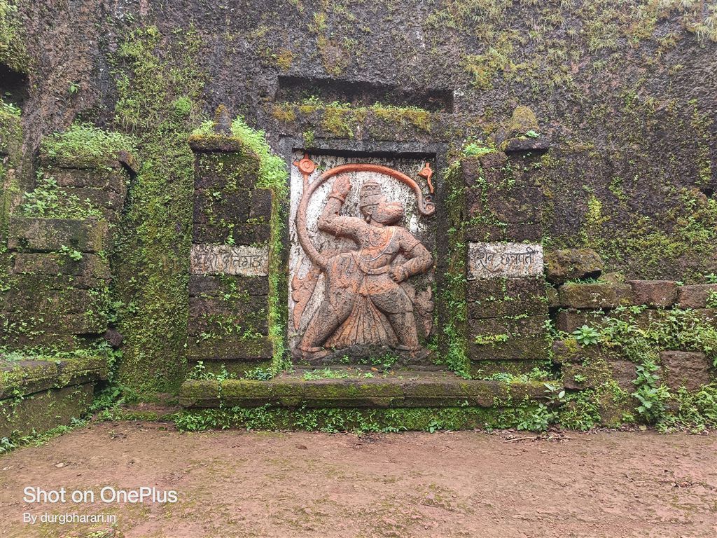
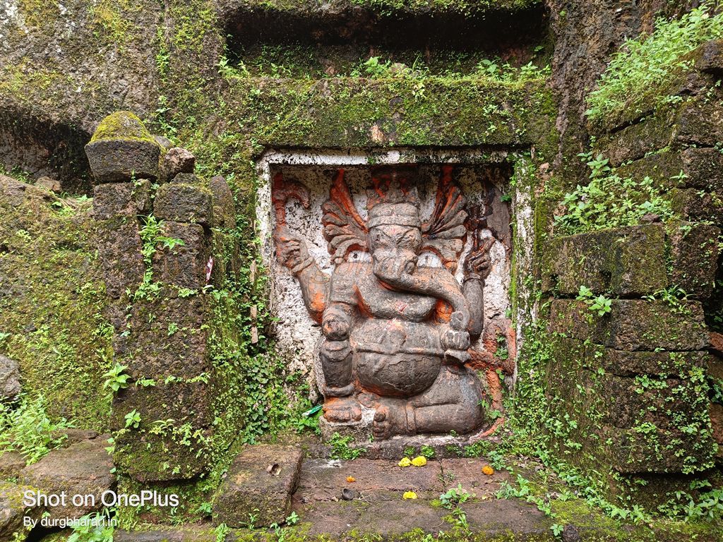
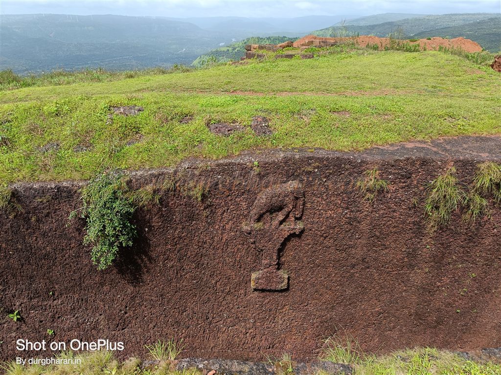
In front of the main gate, there are 10–12 steps, and inside the gate, on both sides, are guard chambers carved into the rock. The gate’s arch, though weathered, still stands. Directly opposite is a six-foot-high rock-carved statue of Lord Hanuman in an intense pose. On the left wall of this statue is another of the same size, depicting Lord Ganesha. Both sculptures are exquisitely carved.
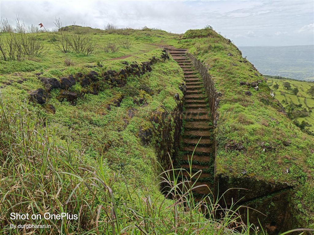
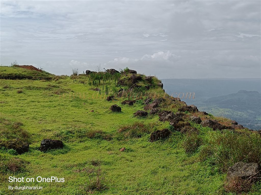
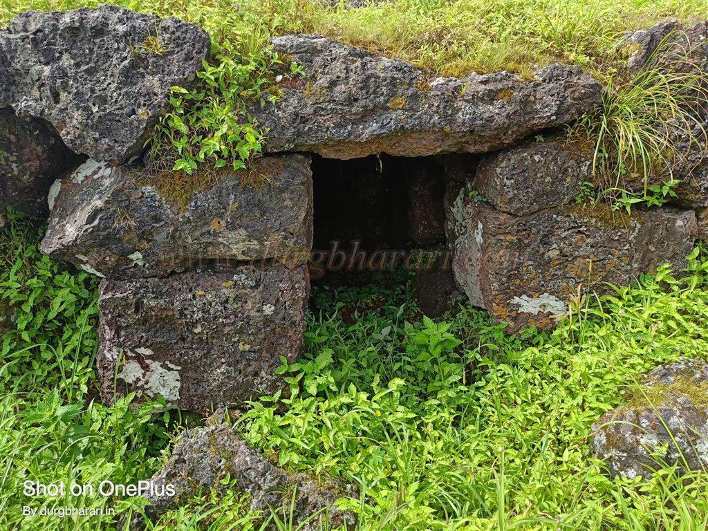
From here, a rock-cut path leads to the fort summit. Along this path is a small square cave with a narrow entrance carved into the left wall. This entire section of the fort has been carved from solid rock. Climbing the steps, you enter the fort. The top stands at 3,260 feet above sea level and covers about four acres from north to south. Upon reaching the top, it’s best to begin exploring from the left side.
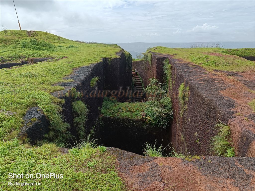
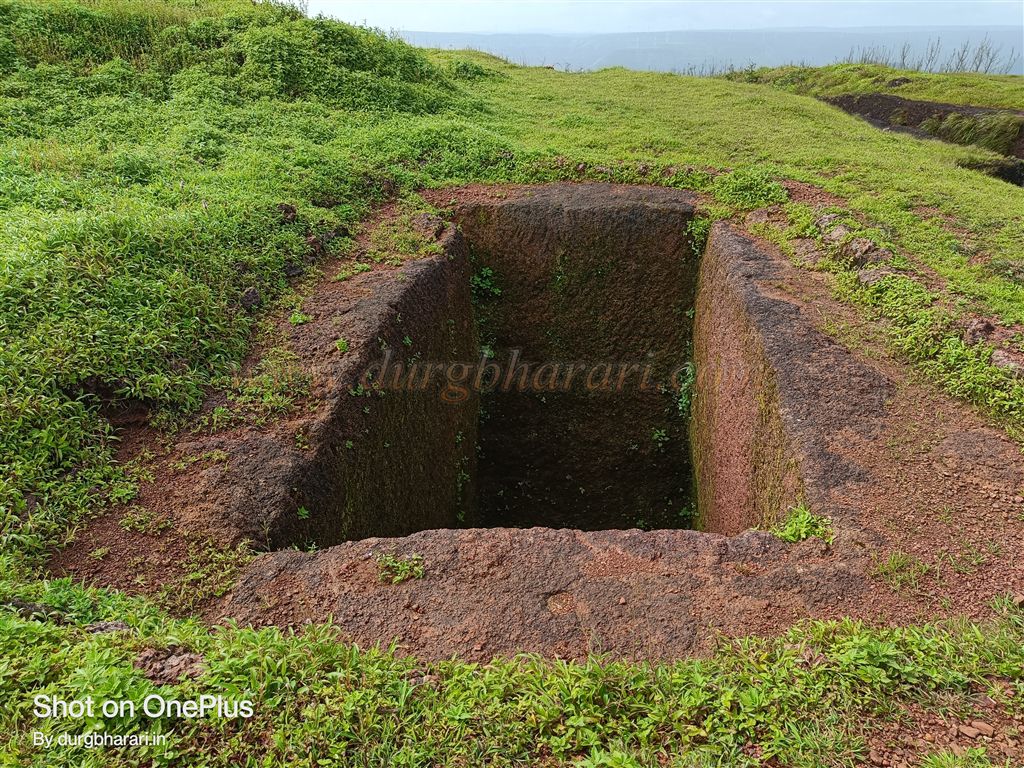
The first sight here is a massive rock-cut well, 150 feet long, 10 feet wide, and about 70–80 feet deep. At its edge is a stone trough, and steps of two sizes—small and large—are carved to descend into the well. At the base, in the left wall, there is an 8 x 8 ft cave with a Shiva Linga and a Nandi installed. Above this, midway on the wall, is a carved elephant figure visible while walking along the well’s rim. The well’s water is not potable. At the other end of the well is a rectangular rock-cut cistern.
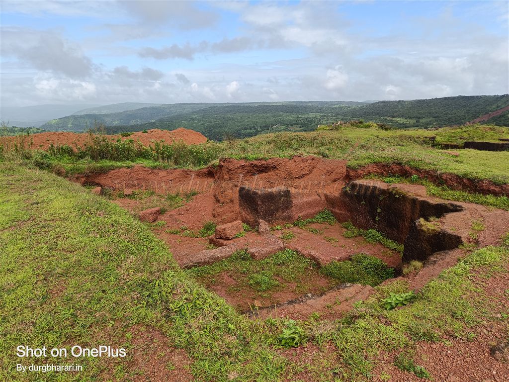
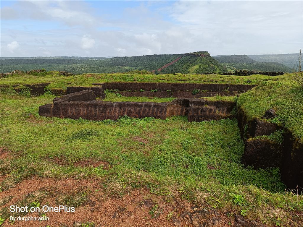
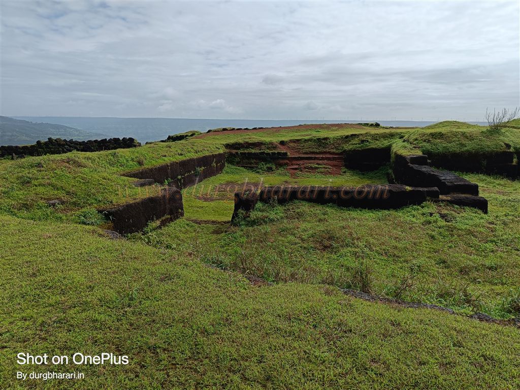
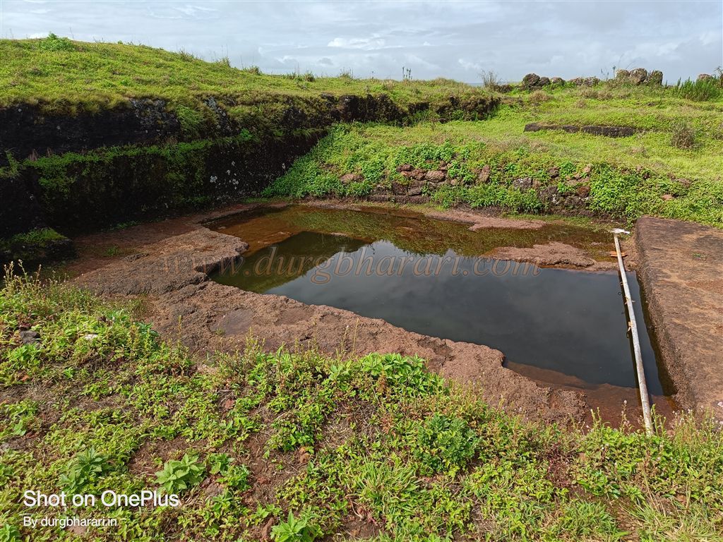
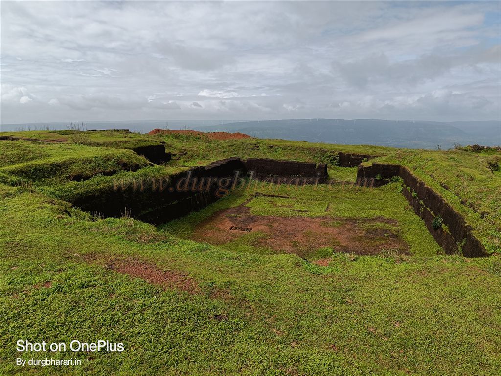
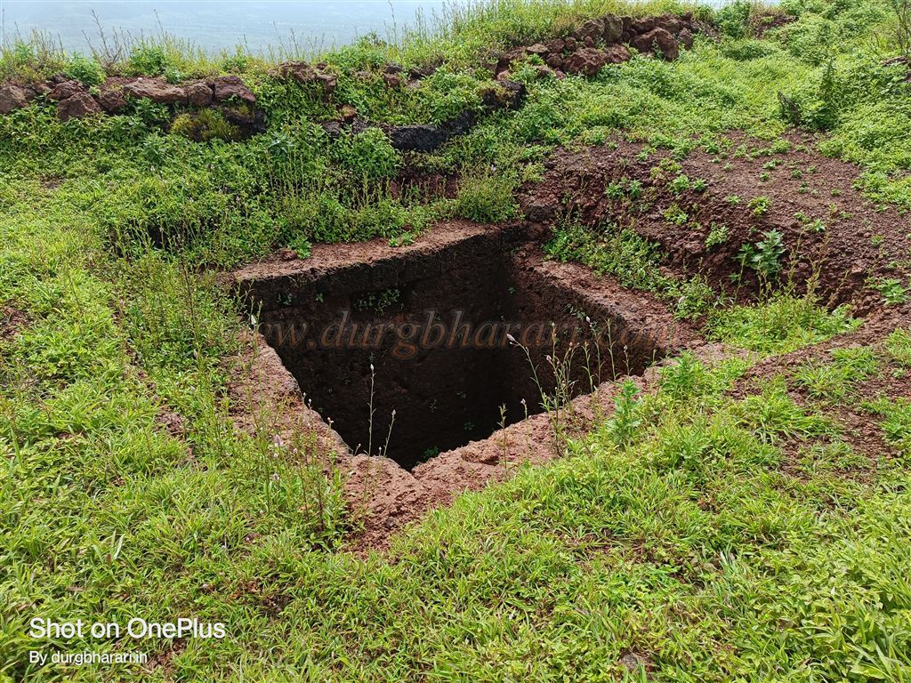
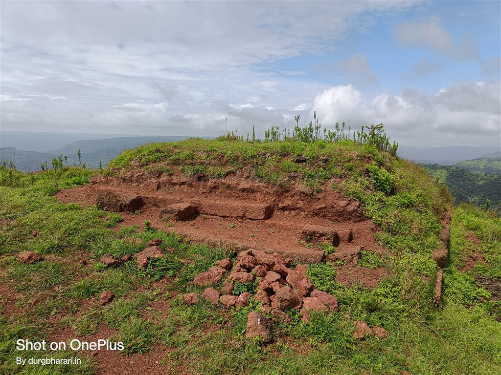
Proceeding past the well and fort wall, you find another cistern formed from stone excavation and two rock-cut platforms for structures. Moving along the northern edge, there is another medium-sized rectangular tank. Except for the stepped well and this cistern, no other tanks hold water even in the rainy season. Further ahead is a large rock-cut reservoir, probably the foundation of a building. Though the fort wall here is still in good condition, a large natural crack below threatens its stability.
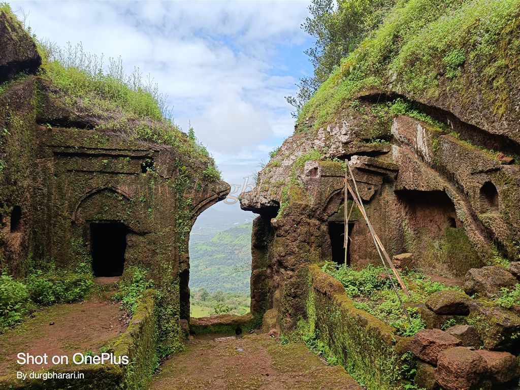
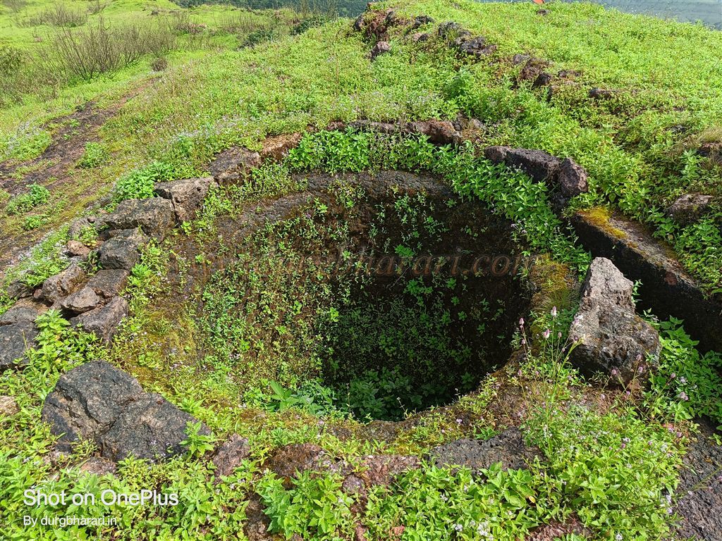
On the right is a small knoll offering a full view of the fort’s summit. Descending and moving ahead from the point where you first entered the top, you pass along the fort wall on the left, finding two square cisterns, a small circular well, and a few small rock-cut building platforms. This path leads to the fort’s southern tip, where significant collapse has occurred, revealing the rock-cut base of a bastion. Given the remains, dressed stones, and a descending path, this might have been the location of a second gate.
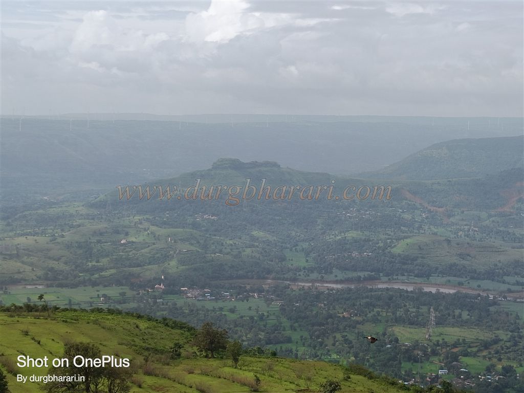
Returning and moving along the other side of the wall, you see a latrine built into it. Moving further, you come across a constructed building platform, returning to your entry point and completing the circuit. The entire exploration takes about an hour. From Dategad, one can see Gunvantgad and the surrounding region stretching far into the distance.
In medieval times, the Chiplun–Patan–Karad–Bijapur route was an important trade route. Several forts such as Janglijaigad, Gunvantgad, Vasantgad, and Sadashivgad were built to monitor it, and Dategad was one of them. Judging from the rock-cut well, it is evident the fort predates the era of Shivaji Maharaj. It is believed to have been built in the 12th century by King Bhoj II of the Shilahara dynasty.
In the 15th century, the fort was under the Shirke family until Malik Uttujar defeated them and annexed it to the Bahmani Sultanate. After the Bahmani decline, it came under the Adilshahi. Around 1526, the Salunkhe, descendants of the Chalukya lineage who had acquired the Deshmukhi of Gunvantgad and Dantagiri, were appointed by the Bijapur court to guard the Satara and Konkan regions. From Kalyan Subha, Tukoji Raje Salunkhe, along with his brother Ramrao and 5,000 troops, marched first to Satara, taking control of Patan, then moved towards Ratnagiri, subduing Dhamdhoom in Sangameshwar taluka. Impressed, the Adilshah entrusted all conquered regions to them.
After Afzal Khan’s death, in 1673, during the Satara campaign, Shivaji Maharaj captured this fort along with Kalyangad, Sajjangad, Ajinkyatara, and Chandan–Vandan, assigning Dategad to a Salunkhe Sardar. Residing in Patan, the family became known as Patankar. Around this time, Dategad earned the name Sundargad.
After Chhatrapati Sambhaji Maharaj’s death, the Mughals captured it, but in 1689, the Marathas regained control. In recognition of the valor of Santaji Ghorpade and Chandji Patankar in the south, Chhatrapati Rajaram Maharaj granted the Patankar 12 villages—11 in Patan Mahal and 1 in Karad Mahal. In 1707, Chhatrapati Shahu Maharaj took the region during the monsoon.
In 1745, during a dispute between the Peshwas and Tulaji Angre, the Angres laid siege to Dategad but failed to capture it. Ramchandrapant Amatya Bawdekar, who served under all three Maratha Chhatrapati, stayed on the fort for three months. In the 18th century, the Pant Pratinidhi men lived on the fort and often obstructed the execution of Peshwa orders, prompting the Peshwas to take control.
In 1752, Balaji Vishwanath, along with troops, stayed here with Dadopant to keep watch on Tarabai. In May 1818, during the Anglo-Maratha War, without any battle, the fort was handed over to Captain Grant, a British officer.
With proper time management and a private vehicle, one can visit Machhindragad, Gunvantgad, Dategad, and Vasantgad all in a single day.
© Suresh Nimbalkar
GALLERY