DABHOL
TYPE : COASTAL FORT
DISTRICT : RATNAGIRI
HEIGHT : 450 FEET
GRADE : EASY
Dabhol is a scenic village located in Dapoli taluka of Ratnagiri district. While reading the description of Ratnagiri district, it is mentioned that there are 26 forts and 4 fortresses in this district. it is mentioned that Dabhol fort, Chiplun fort, and Sangameshwar fort are destroyed. In most places, it is said that Dabhol fort was destroyed, while in Parag Pimple's book Saad Sagarchi, it is said that there are remnants of Dabhol fort in the vicinity of Chandika temple. Although there are no forts in Dabhol today, it is mentioned that the fort was located on the sea-facing hill of Dabhol. P.K. Ghanekar is a man of worship for today's generation of fort wanderers. After reading a brief mention of Dabhol fort in his book Tourism in Konkan, I also decided to see the ruins of this fort, but when I went to the actual place,
...
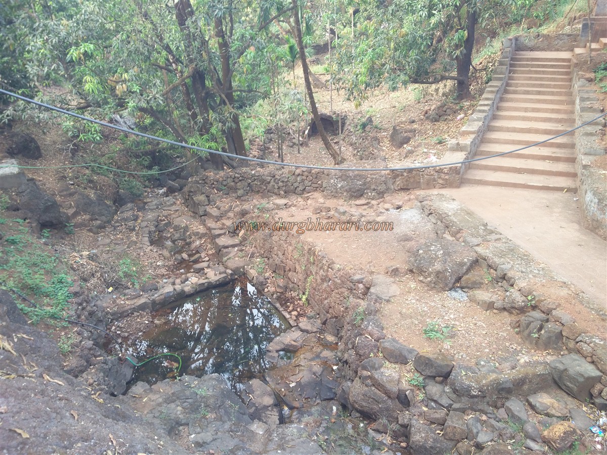
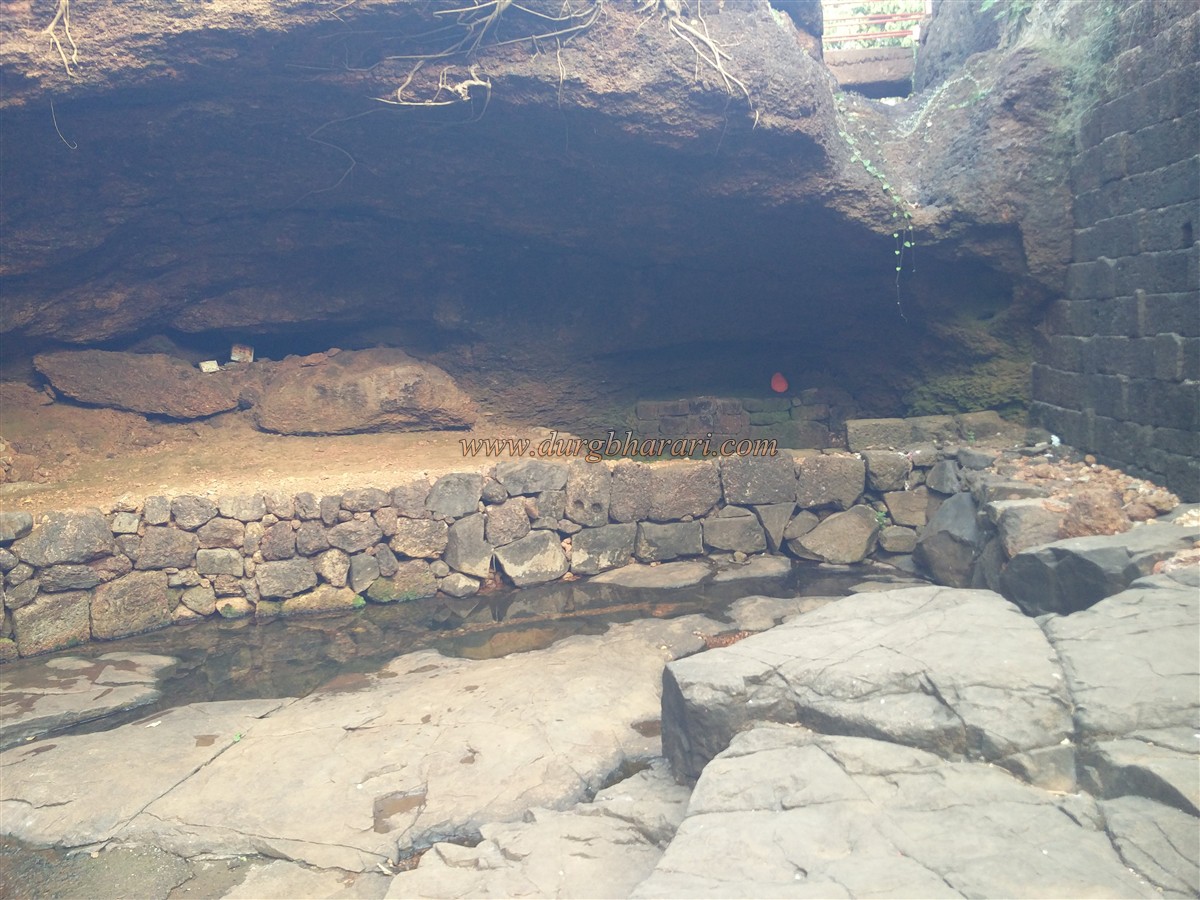
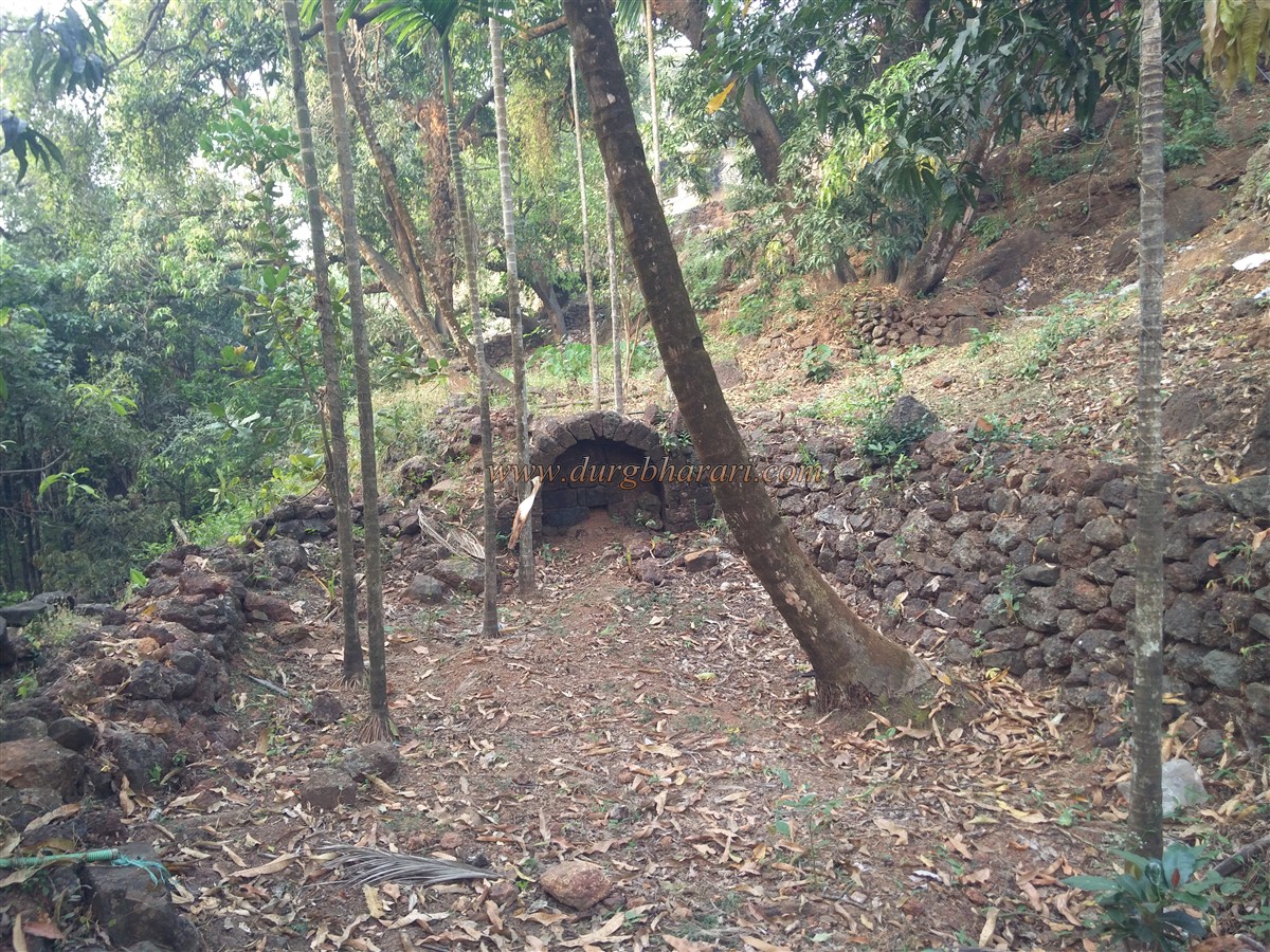
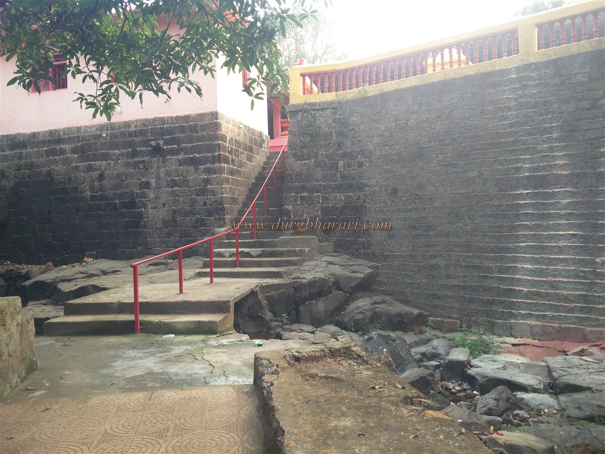
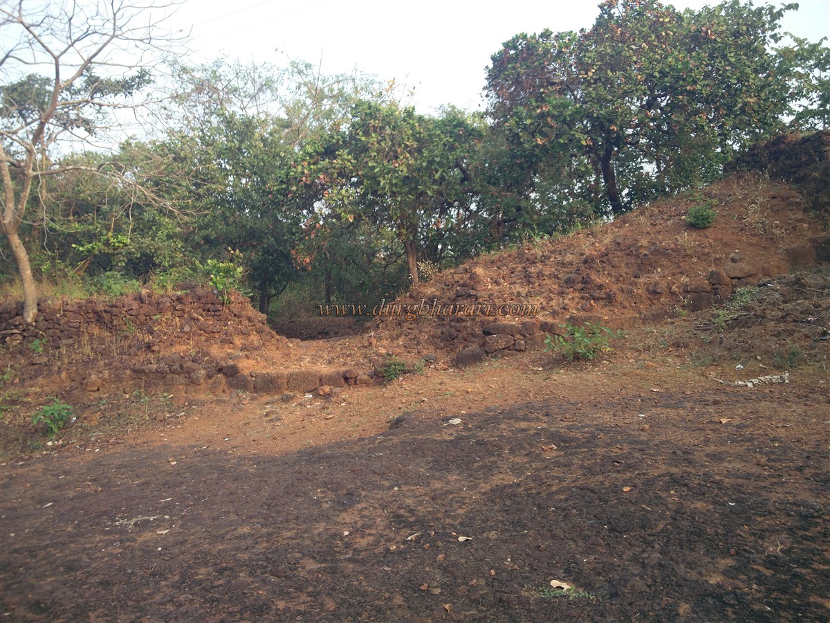
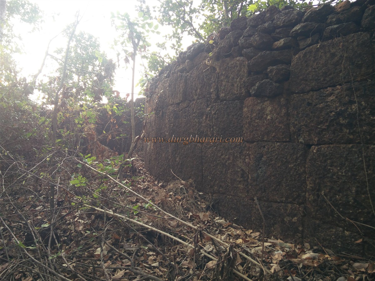
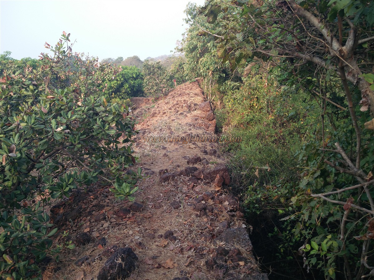
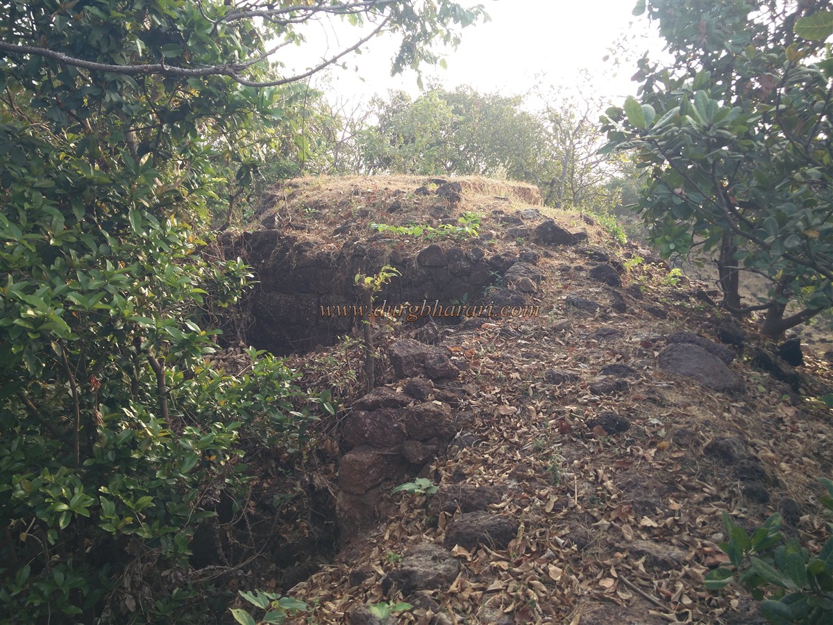
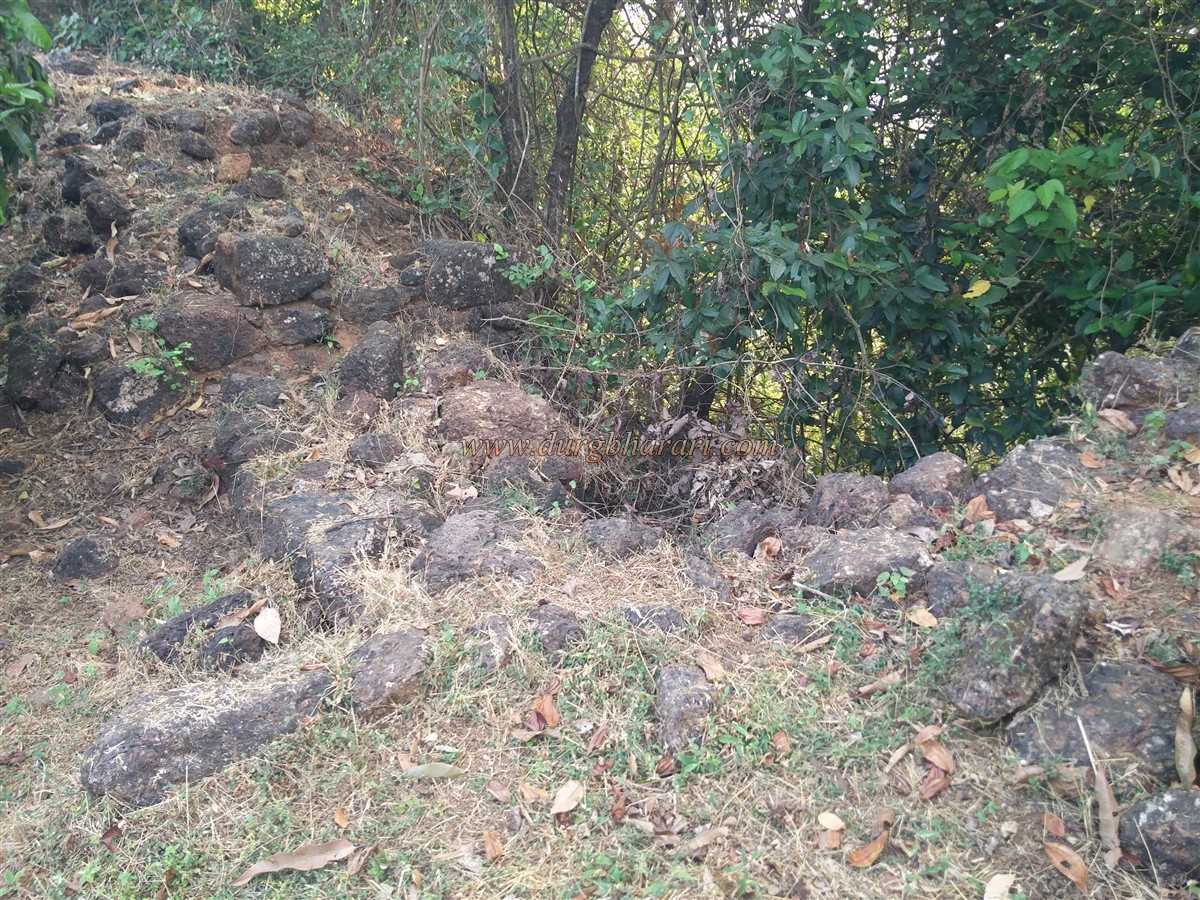
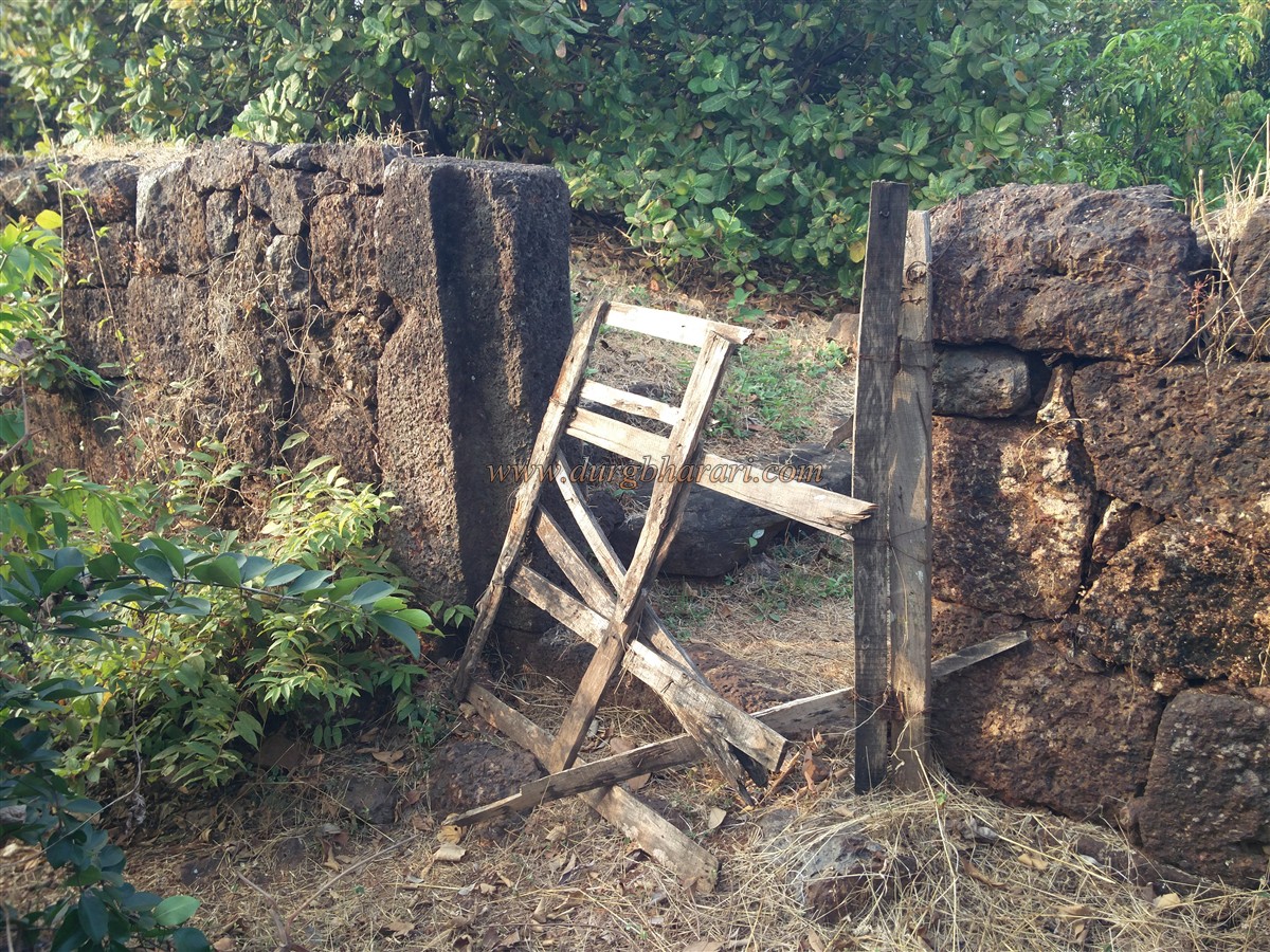
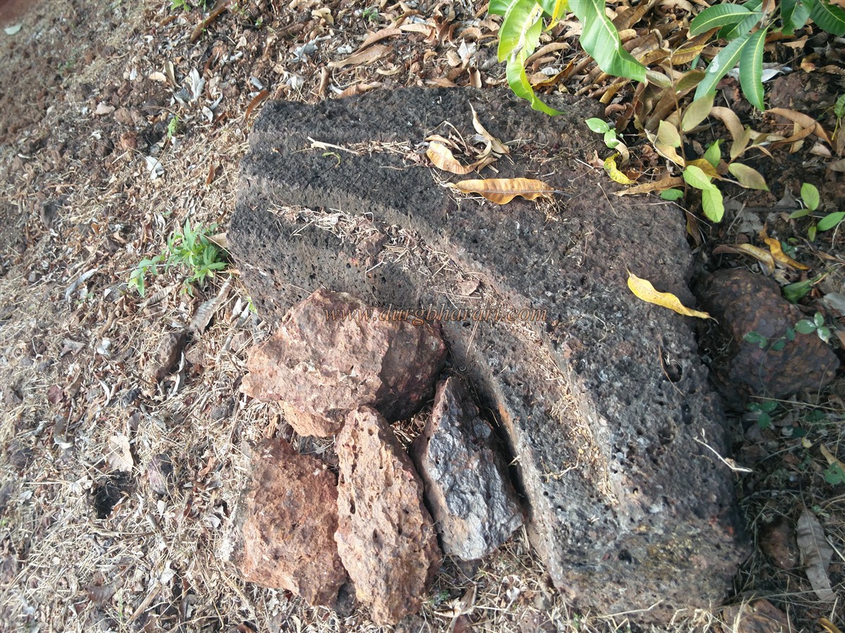
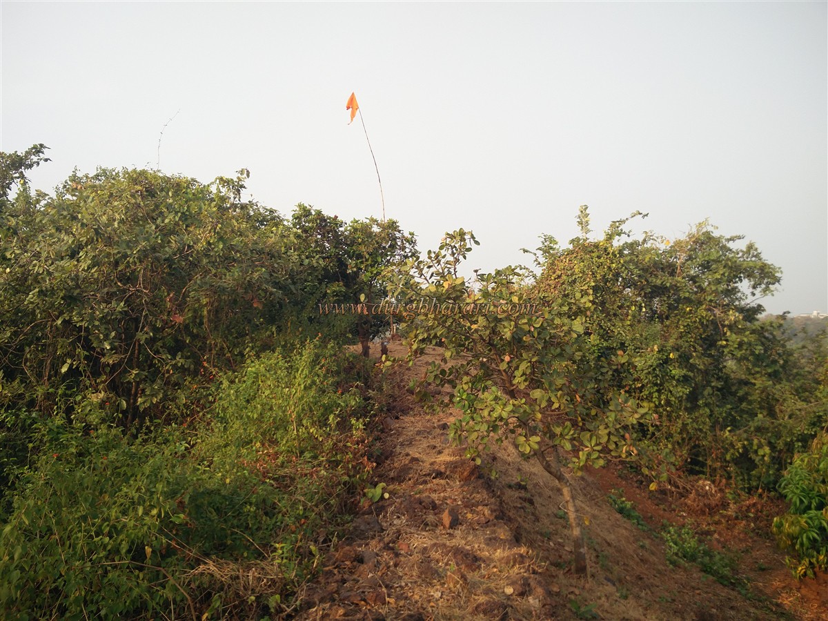
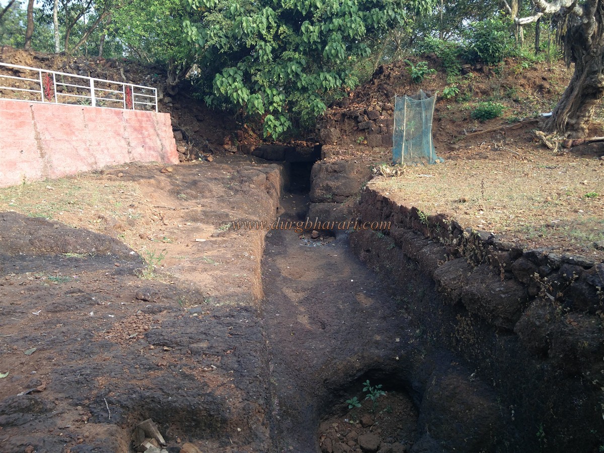
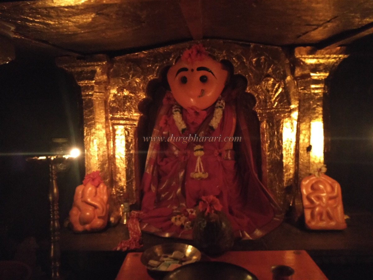
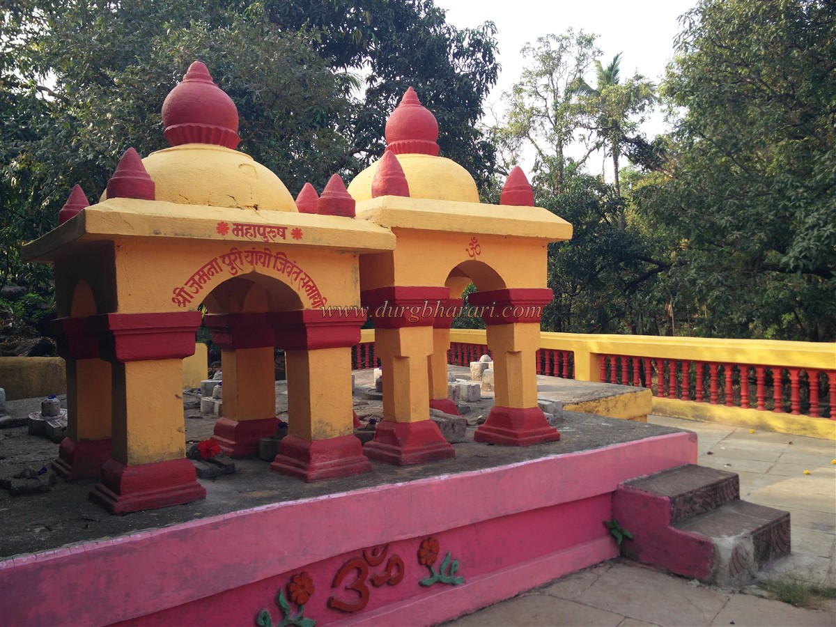
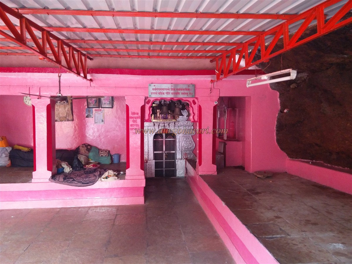
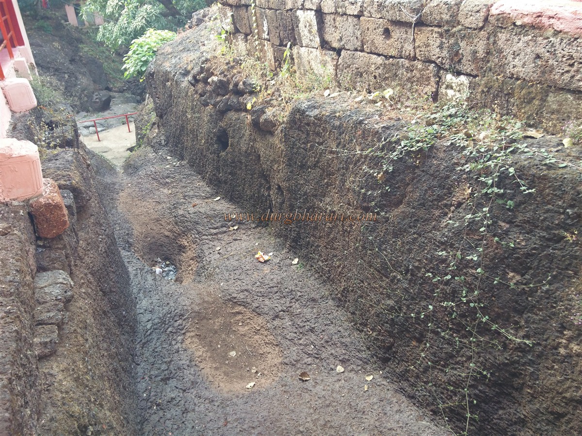
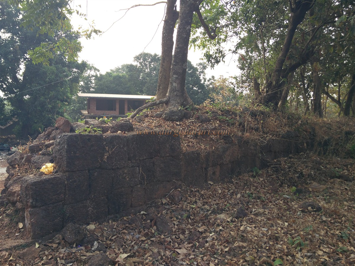
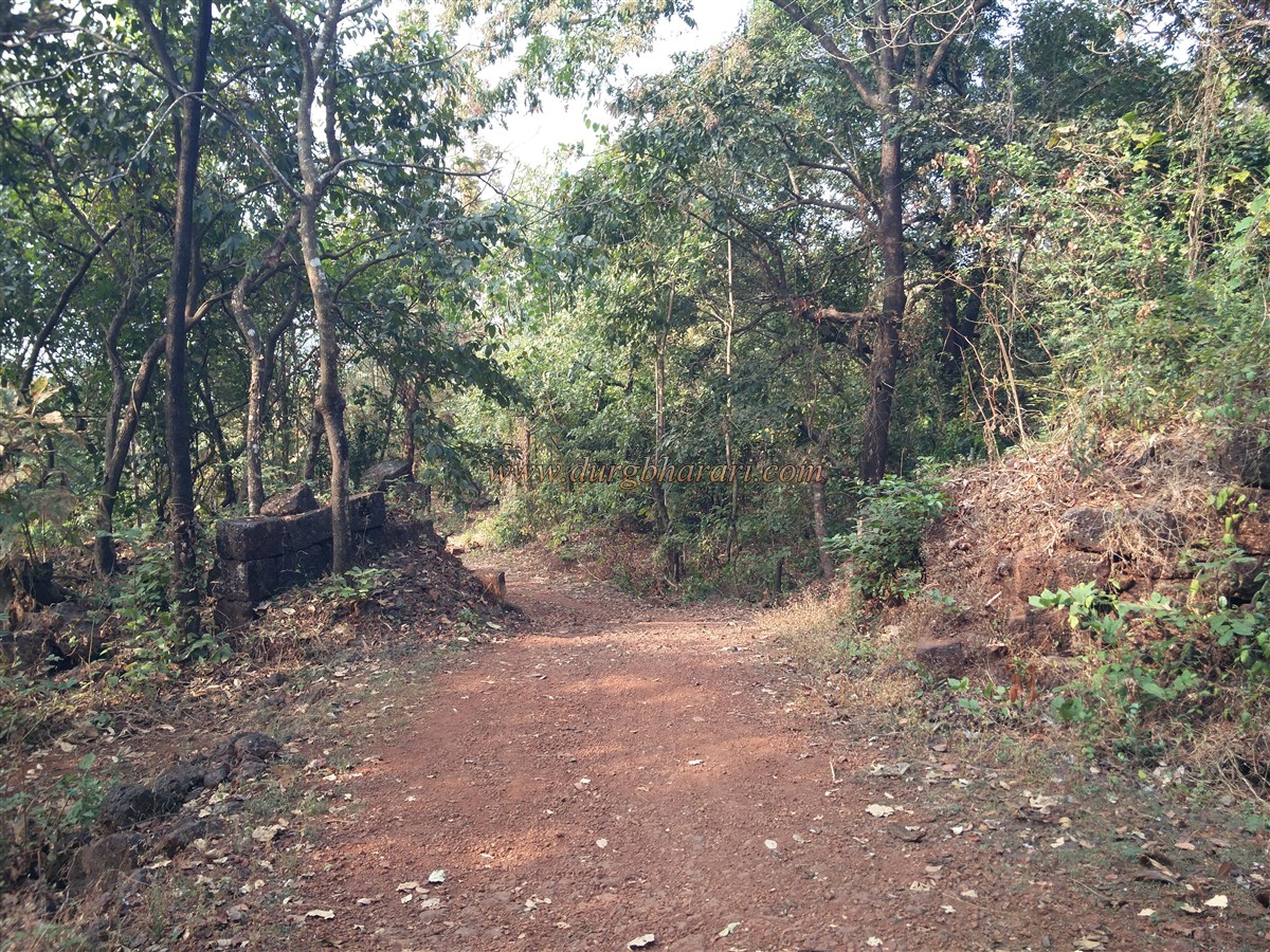
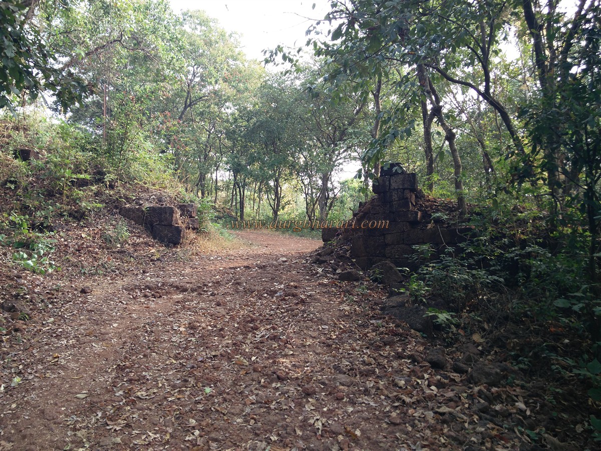
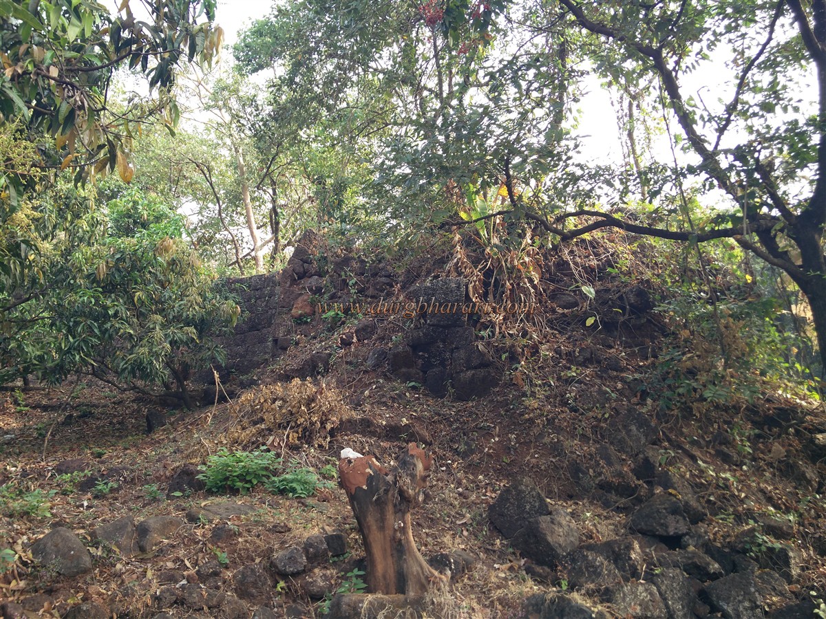
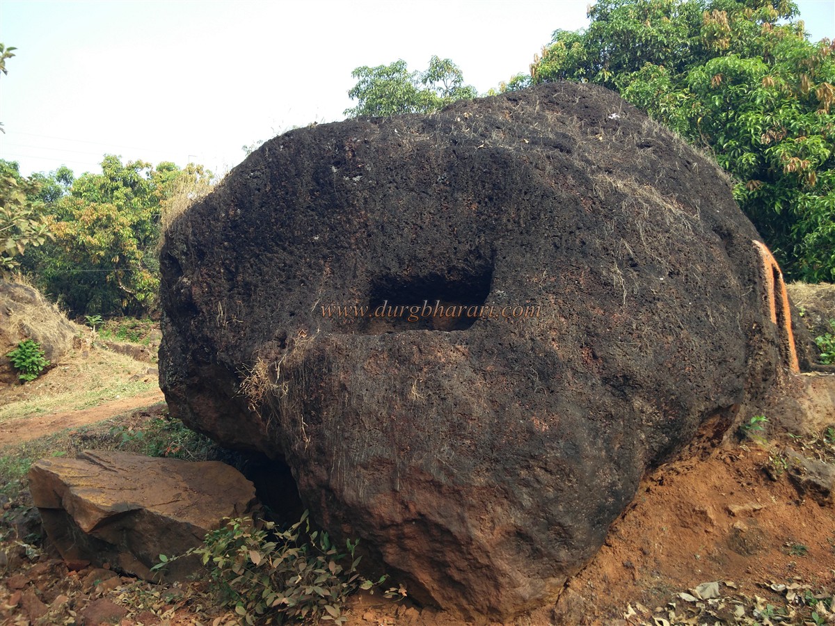
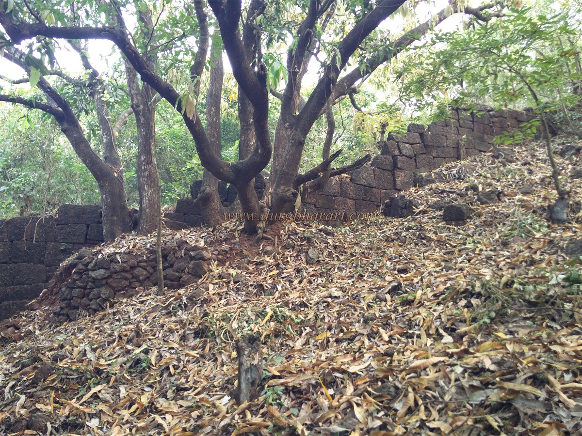
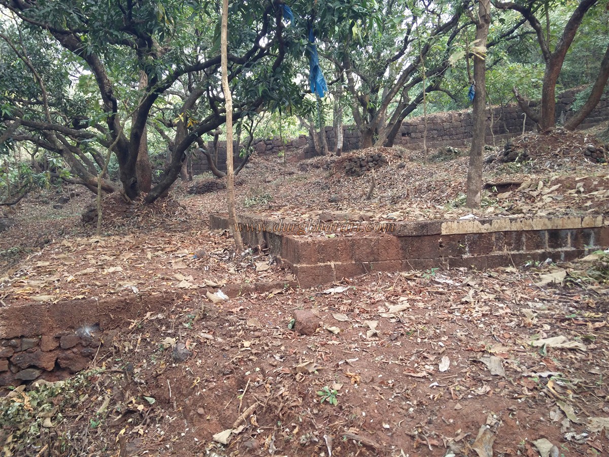
I not only got to see the ruins but the entire fort. I thought exploring the whole fort would take a few minutes but it took half a day. This place has not only the remains of the fort but the entire fort and the Chandika temple are situated in this fort. To visit Dabhol fort, first of all, you have to reach this Chandika temple which is 3 km from Dabhol port. Half a km on the left side of Dapoli-Dabhol road is the Chandika Devi temple. The distance from Dapoli is 25 km. There is an S.T bus facility available on this road but you have to get off at the fork and walk for about half a km. The paved road leading to the temple has been brought inside by breaking the ramparts of the fort. Chandika Devi's temple is a cave temple and in this natural cave temple, there are a three-and-a-half feet high stone verdant idol of the goddess. Steps are carved in the rock to descend to this cave. You have to walk about 10-12 feet inside them. Artificial light like torch or flashlight is forbidden in this cave. After visiting the idol of the Goddess in the cave, you should go out again. During the Dabhol invasion in 1661, Chhatrapati Shivaji Maharaj had visited Chandika Devi and Dalbheshwar. Due to its resemblance to the Badami Cave Temple, it is believed to have been built during the Chalukya period in 550-78 AD. After this, you should start your visit to the fort. There are two recent Samadhi of the Pandits in the temple premises. The lower part of the temple has a perennial waterfall and the water from here is supplied to the houses adjacent to the temple by a pump throughout the year. We cross a small bridge before entering the temple. This bridge is built on a stream of water. At the back of the temple, you can see the ruined ramparts of the fort. The ramparts built of crushed stone are about 8 feet high. If you look at the ramparts from the outside, you can wrought stone in the ramparts and their bastions inside. Once you see the ramparts from the outside, climb the ramparts and start walking towards the east. This octagonal fort is spread over 24 acres and you can easily see 22 bastions in the entire ramparts of the fort. You can walk about 1910 feet without descending from this rampart. In these ramparts, you can see a square bastion as well as a circular bastion. A quadrangle structure is built on the bastion at the east end. The ramparts to the east have a buried latrine or a small door. Going straight from the ramparts, you can see the east-facing gate of the fort. The stone frame of the door is still fortified and the arch is lying on the adjacent ground. On the outer side of the gate is a double wall with two bastions. After seeing the door and coming straight ahead, we come to the south-east bastion of the fort. The saffron flag is hoisted on this bastion. From this bastion, Dabhol port and the creek spread in the distance can be seen. It is not possible to go further as there is a lot of bush growing in the area ahead. Going down from here, on the way to the temple from the mango orchard, you can see a quadrangle structure built in wrought stone. There is a mango tree on this structure. Next on to the temple precincts, you can see two bastions and a crumbling rampart near the base. Going straight from where the road enters the ramparts, you can see two bastions nearby, but the gate in this bastion is destroyed. After seeing this part, go down the road towards the creek. On this road, you can see the fortifications of the fort in good condition as well as the remains of the gate facing the creek. From here, we come to a monolithic cave. The cave is carved in two parts inside and there are a quadrangle structure and a window for light to get in. As you walk along the ramparts, in some places you can see collapsed bastions. The ascending ramparts from here are built entirely of wrought stone and you can see a small door in good condition in this rampart. In front of the door are a quadrangle structure built of wrought stone and local people known this place as the Vetal Chala. After descending from here we reach the port. This is where your fort round ends. Two hours is enough for the whole fort round. Built on a hill near the port of Dabhol, this fort is a sea fort with bay water on one side and land on the other. The feature of this fort is that it has access to water by diverting the stream of the bay to the fort. Today's Dabhol town was known as Dalbhyavati in ancient times. The name, derived from the abode of the Dalabhya sage, was later changed to Dabhol. Dabhol is mentioned on a map of the Ptolemy kings of the Macedonian dynasty of Egypt. This shows that Dabhol is trading with the Western and Middle Eastern world. The history of Dabhol till the thirteenth century is the history of Hindu dynasties like Chalukya and Shilahar. This western port was under constant sea attack by the Portuguese, Dutch, Negroes, Turks, and Iranians. Many travelers like Roman, Arabian, English have visited Dabhol and written down the characters observed at that time. After the fall of the Yadav Empire, Malik Kafur established a military station at Dabhol. When he returned to Delhi in 1314, an independent Marathi state came into existence. These kings were under the Vijayanagar emperors. During the reign of Bahamani (1347 to 1500 AD), Allauddin Hasan Bahaman Shah conquered Dabhol and renamed it Mustafabad, but he could not keep Dabhol under his control for long. This part was then in the possession of the independent king of Sangameshwar. According to the manuscript of Anjanvel, a Maratha chief named Pawar was building a fort at village gudhe tarf Valambe before the 15th century. Around 1502 (Shak 1424), Mustafa Khan demolished the fort of Pawar. According to Burgess's visit, a chief named Azam Khan came to Konkan in 1494 AD. At this time Nagojirao ruled in Konkan. Azam Khan died in the battle of Dabhol but Nagoji was defeated. Azam Khan's son changed the name of Mustafabad to Hamzabad. When this part of Konkan came under the control of Adilshahi, Dabhol was the main place of this province. The importance of Dabhol port increased during the Adilshahi period. Arabian horses were imported from Arabia to the port of Dabhol. The Bijapur-Guhagar highway was built. The Bijapurkars must have built Anjanvel on one side of the mouth of the creek and Dabhol fort on the other side to keep an eye on the merchant ships in the port of Dabhol. Although the port of Dabhol was under Adilshahi's control, the Portuguese ruled the sea. In 1508, Dabhol fort had 6,000 troops and 500 Turks. Between 1510 and 1522, the Portuguese looted the port of Dabhol three times. In 1520, Ismail Adilshah offered to befriend the Portuguese if they protected the import of horses from Dabhol, but the Portuguese refused. It is mentioned that there were two forts and 4000 inhabitants at Dabhol in 1547 AD. In 1582, a conflict broke out between the Portuguese and the Adilshahi. According to an earlier agreement, Adilshah had agreed to demolish the fort of Dabhol and hand over the guns to the Portuguese, as well as return the confiscated boats belonging to the Portuguese. But since Adilshah did not abide by this agreement, the Portuguese brought their army to the port of Dabhol. Frightened by this, Ali Adilshah signed a new treaty with the Portuguese on 29 January 1582. From the middle of the thirteenth century to the end of the sixteenth century, Muslim rule lasted for more than 300 years. Around 1651 (Shak 1574), Shivaji Maharaj captured the province of Dabhol. There must have been a fort at Dabhol during this period, as some Portuguese paintings of the port of Dabhol between 1673 and 1724 clearly show the ramparts of the fort on the hill behind the village. There is no separate mention of this fort as Dabhol fort during or after Shivaji Maharaj’s period. Later, due to the decline in the use of Dabhol port, the importance of this fort was also lost and the fort was forgotten.
© Suresh Nimbalkar
GALLERY