CHAULHER
TYPE : HILL FORT
DISTRICT : NASHIK
HEIGHT : 3500 FEET
GRADE : MEDIUM
The western part of the Nashik district has many peak forts touching the sky. Going from west to east in Nashik district, first Satmala range and then Selbari-Dolbari range can be seen. Some forts are located in the middle of these two ranges. Chaulher is one of them. The fort stands in the valley of Girna and Aram rivers. Chaulher is also known as Chaurgad, Tilvan Fort, or Chalheri Fort. To reach Chaulher, you have to reach Satana at a distance of 95 km from Nashik. You need to get on the S.T bus that goes from Satana to Tilvan. In half an hour from Tilvan, we reach Chaulher village. The shape of the Chaulher fort is similar to that of the Salher fort. The height of Chaulher is 3700 feet and it is easy to climb the fort, but in some places, there is a steep climb. Chaulher is a village at the foothills of the fort and there is a trunk of the hill descending from the fort.
...
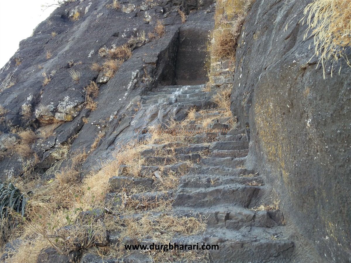
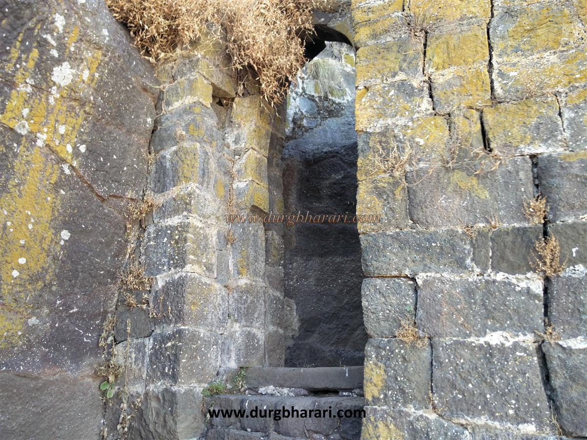
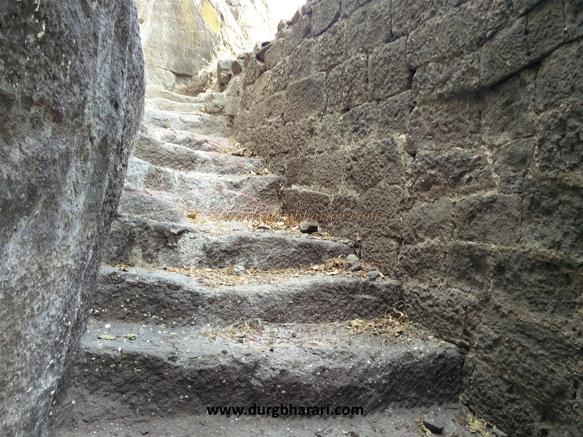
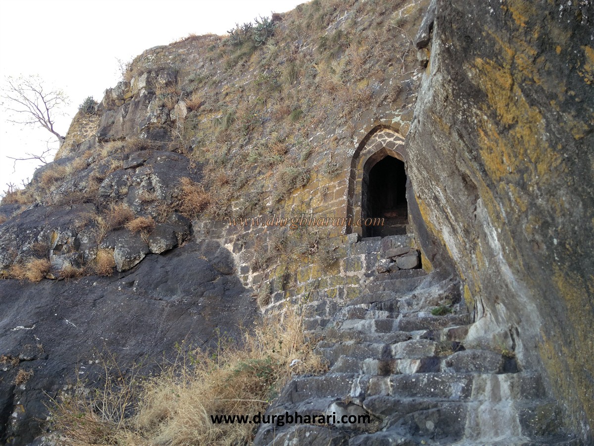
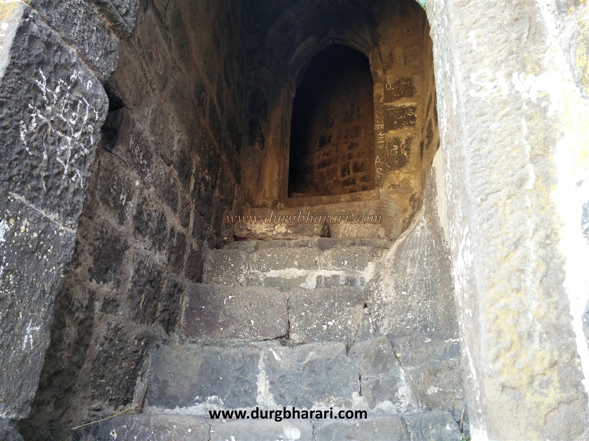
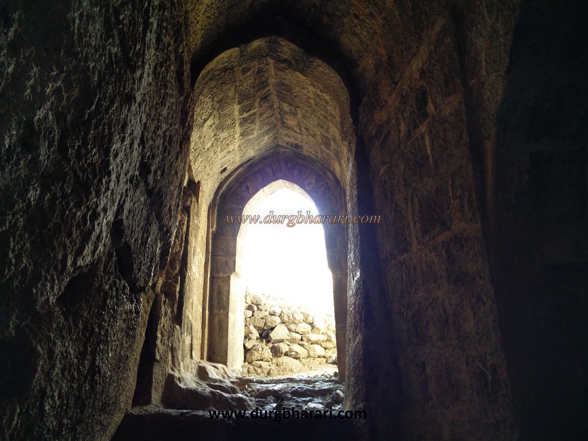
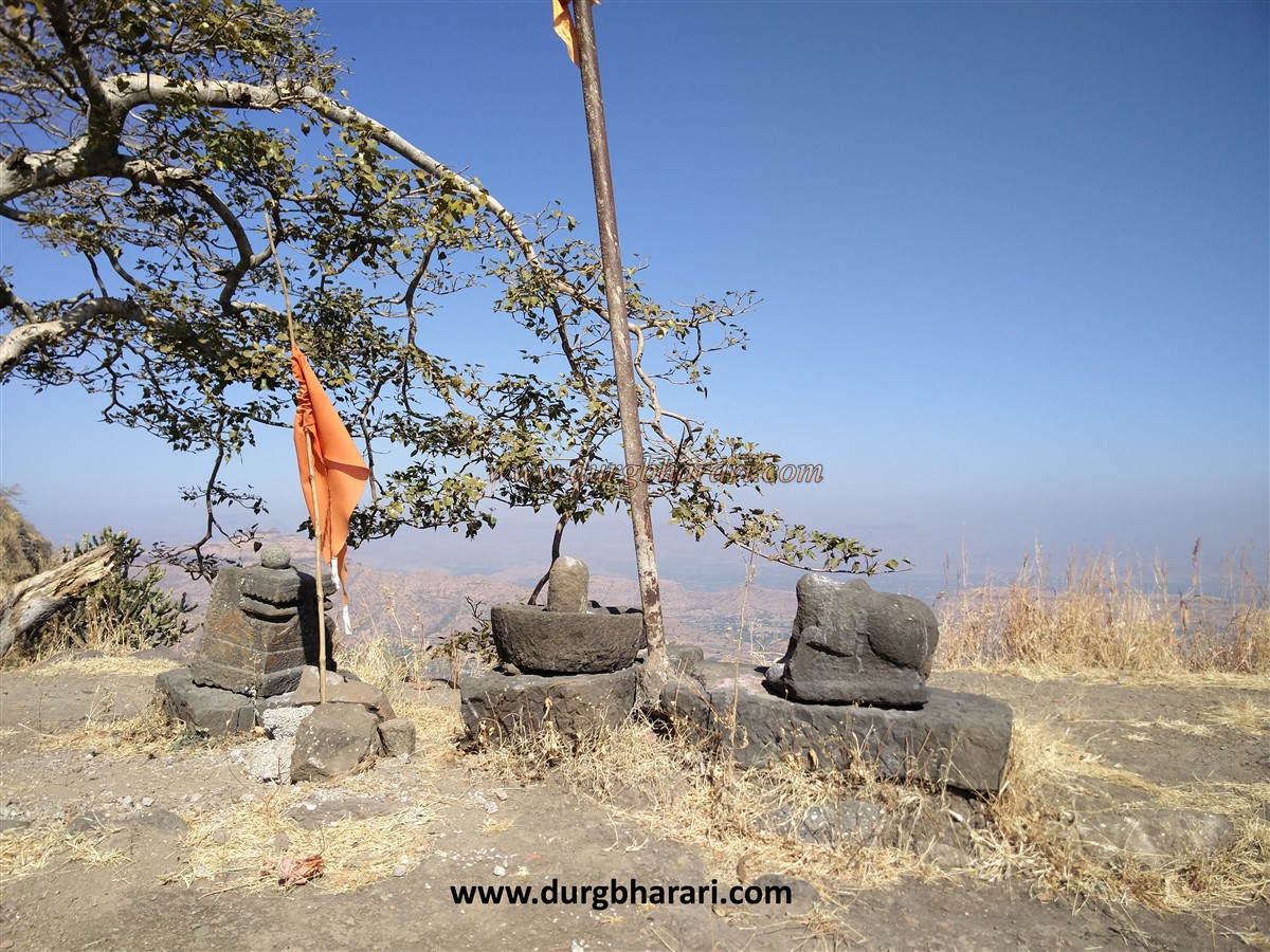
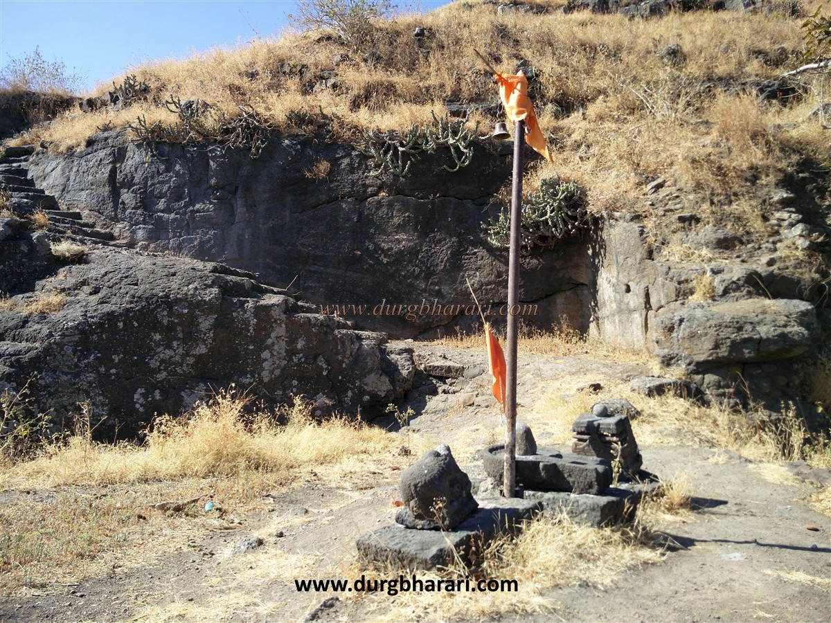
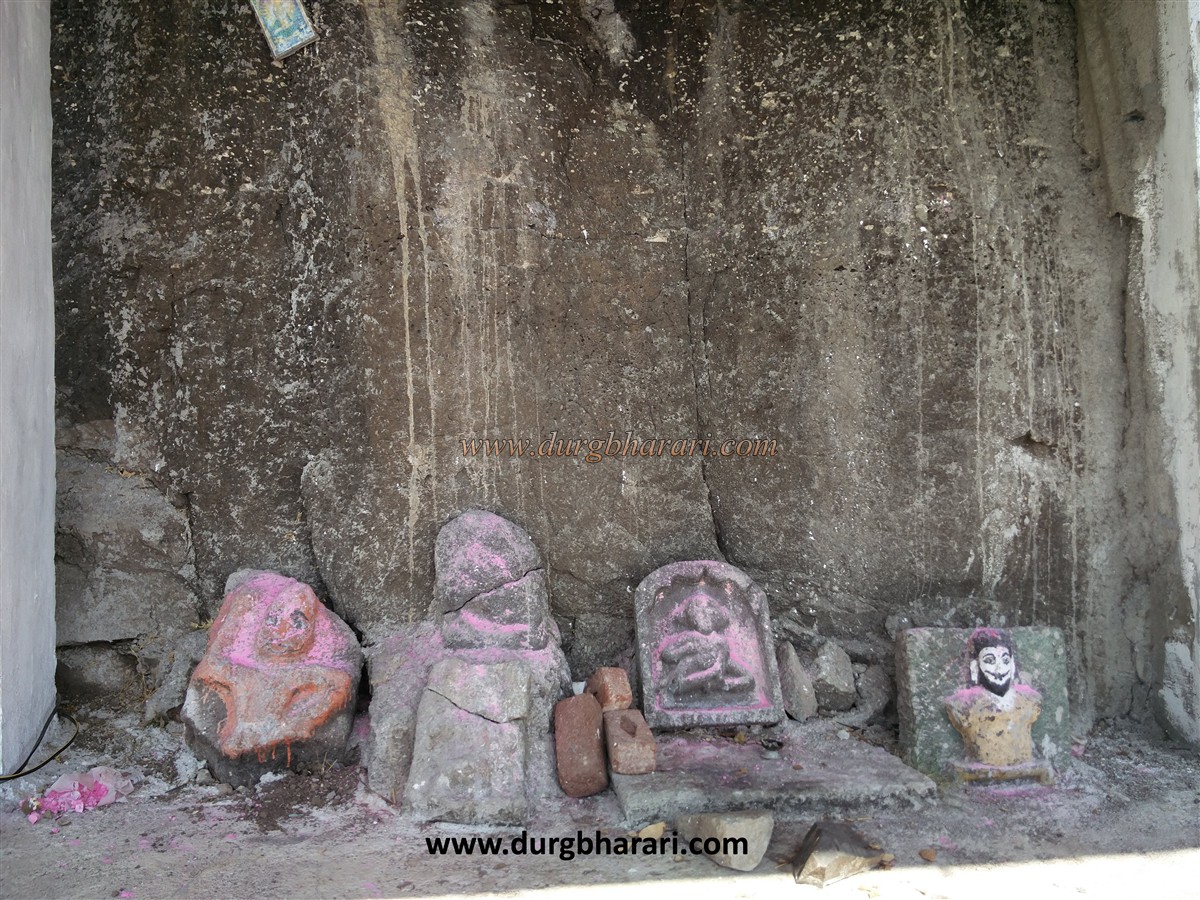
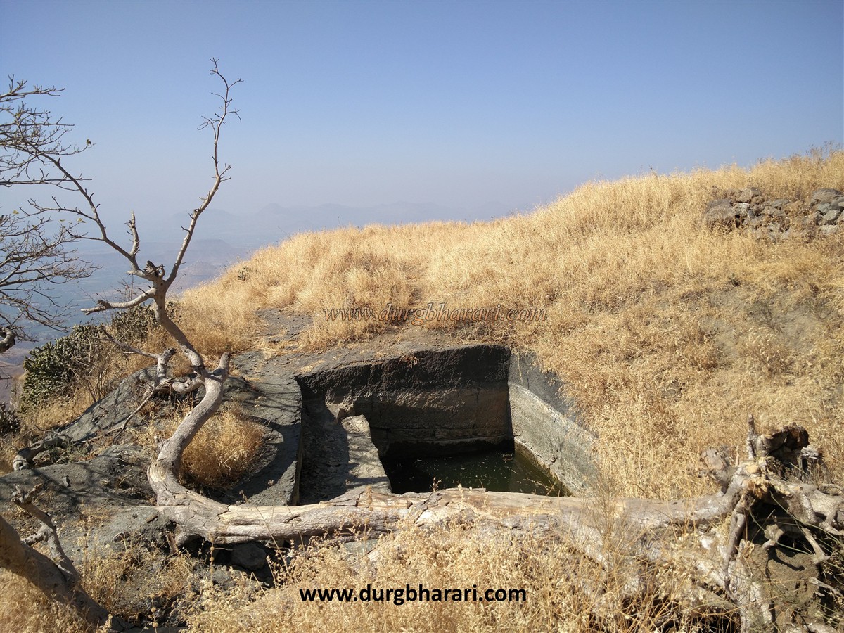
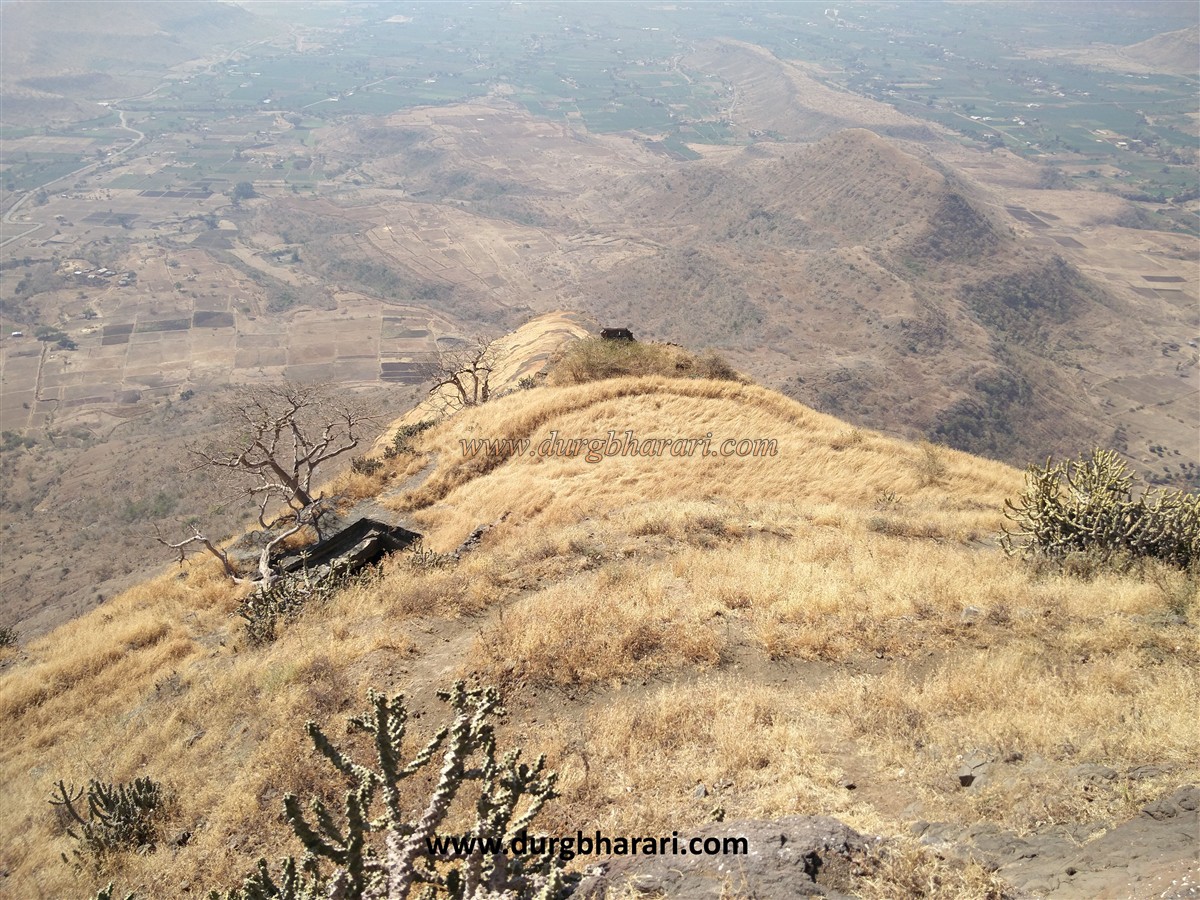
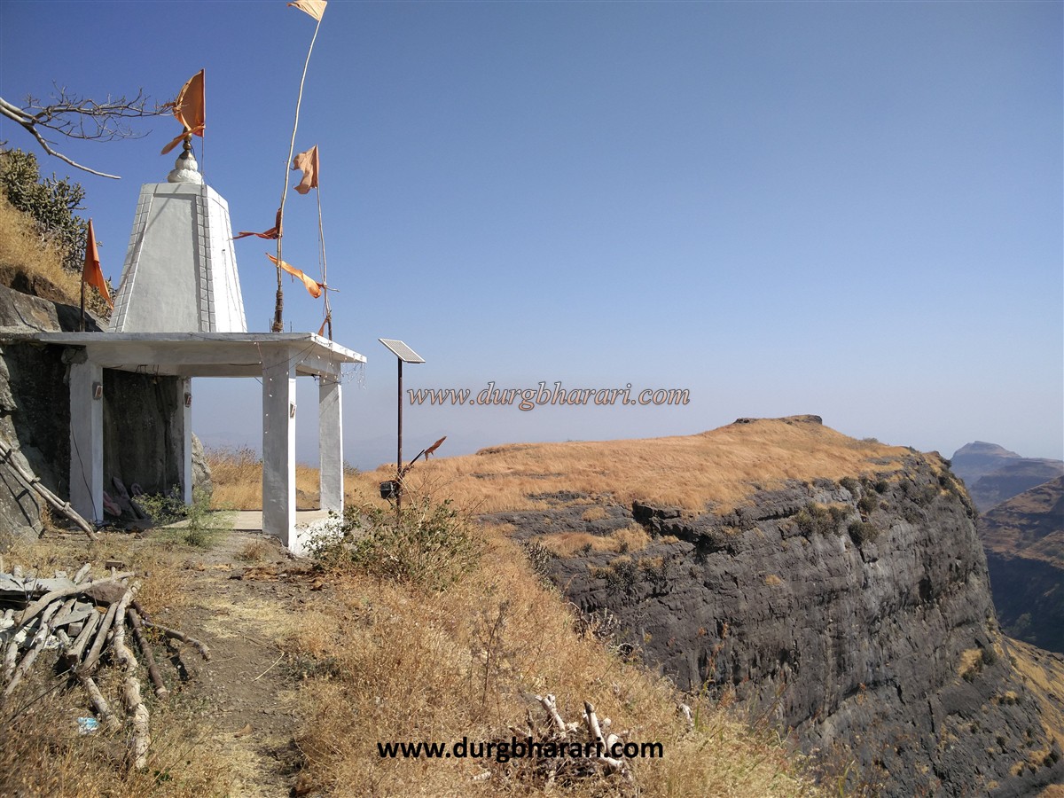
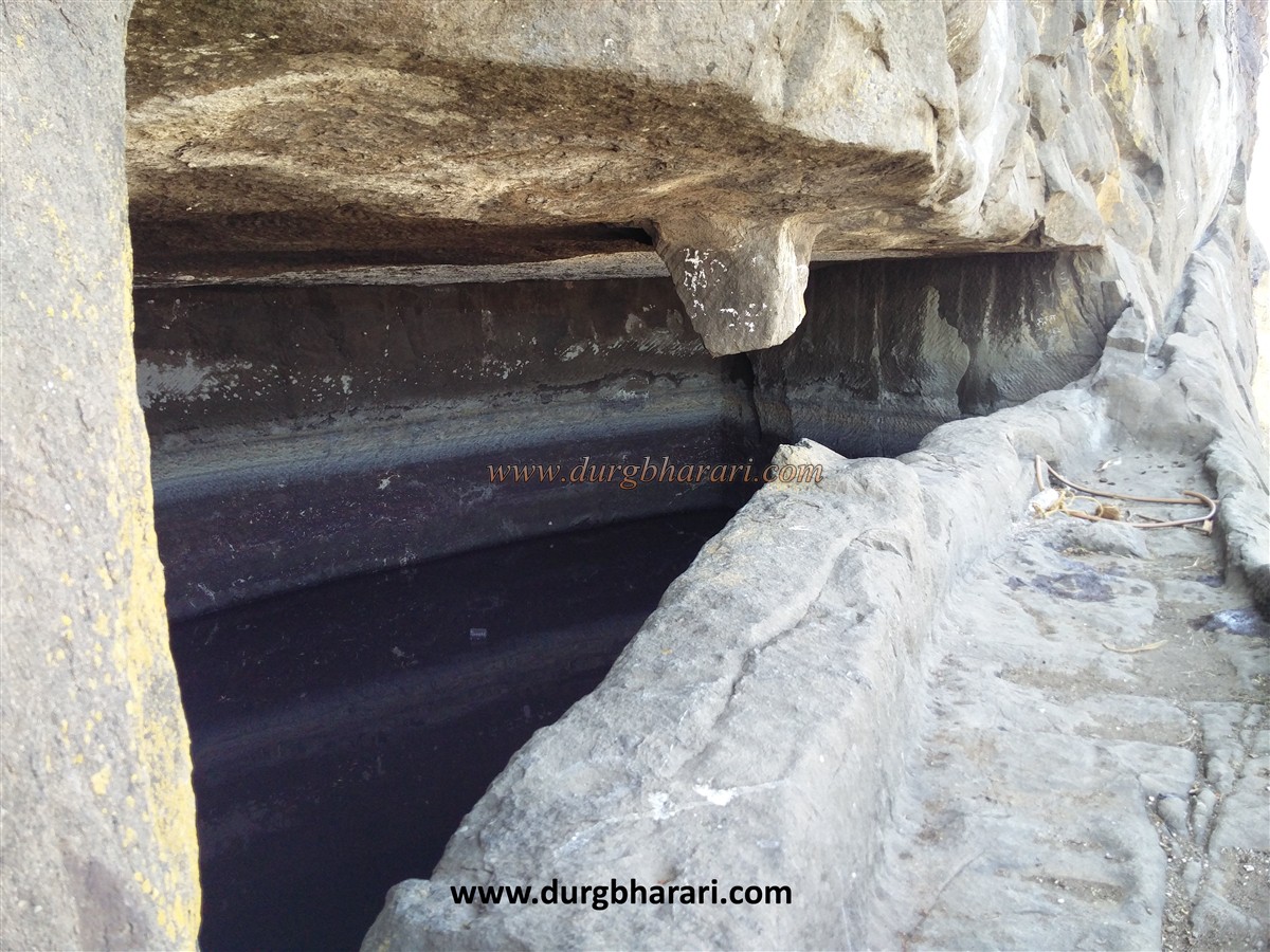
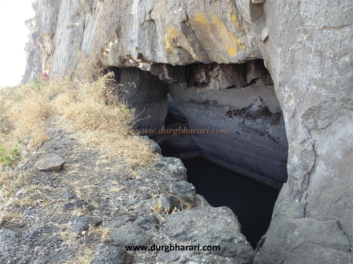
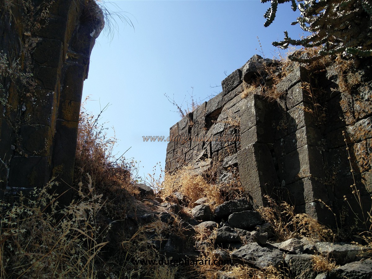
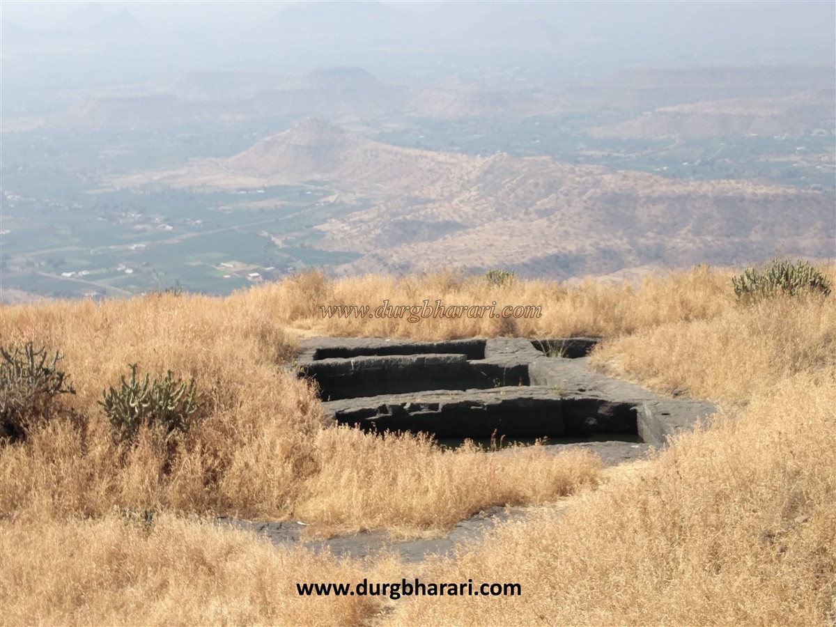
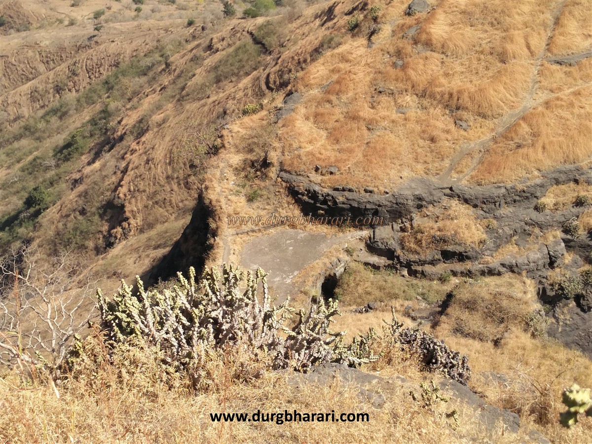
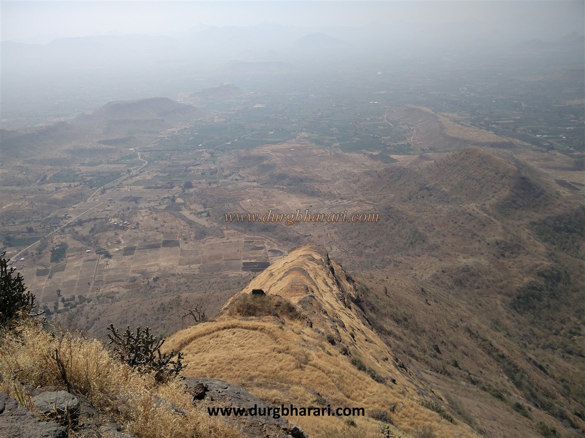
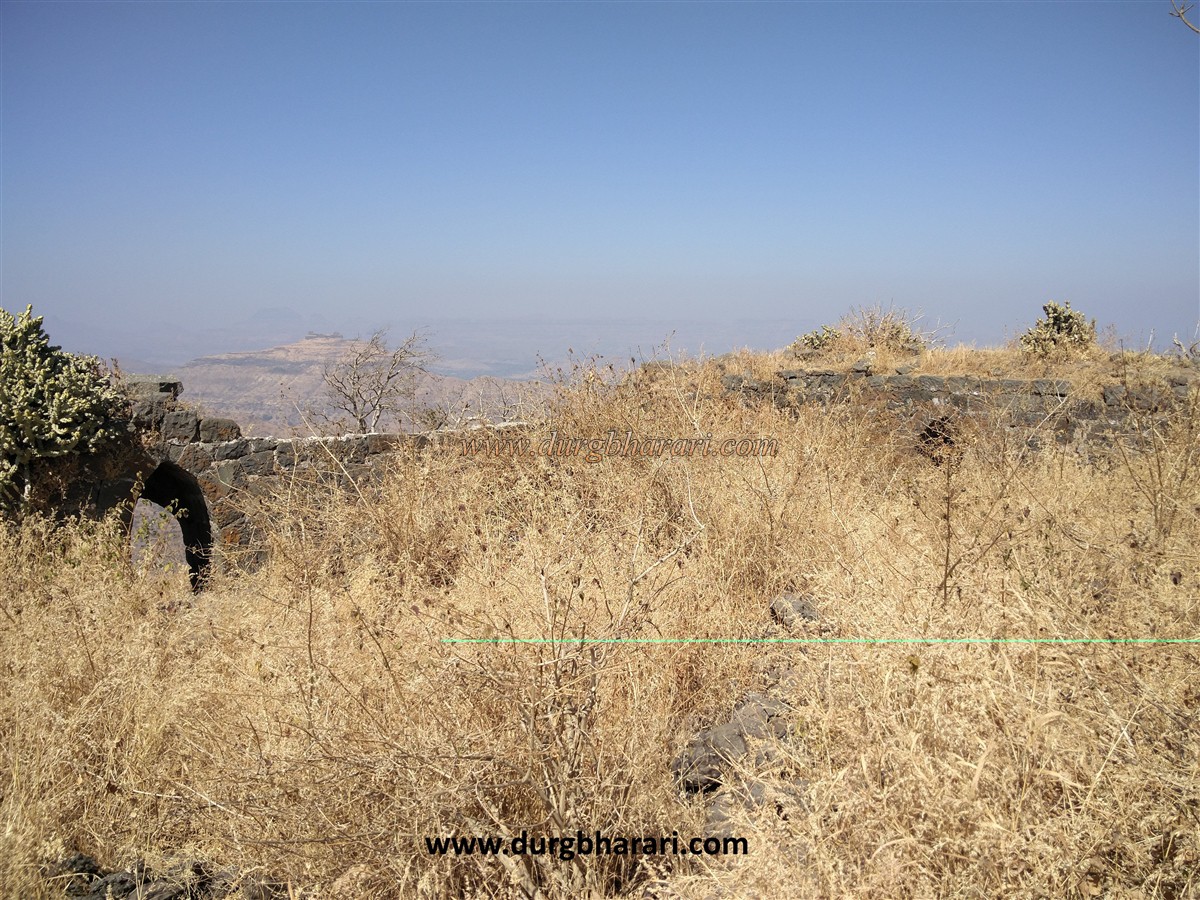
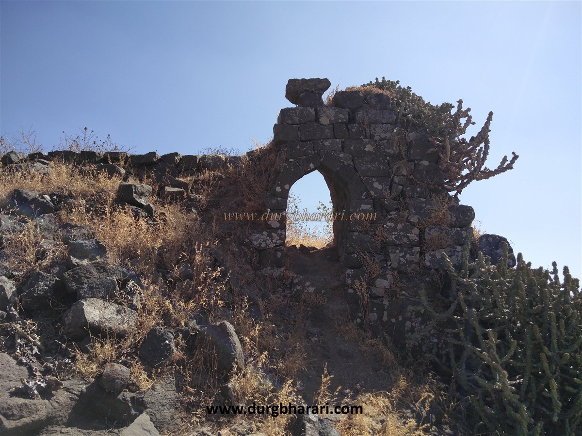
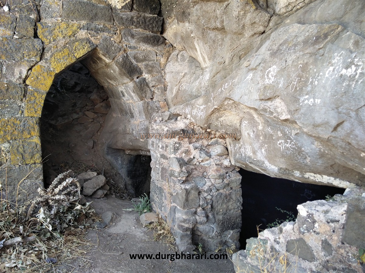
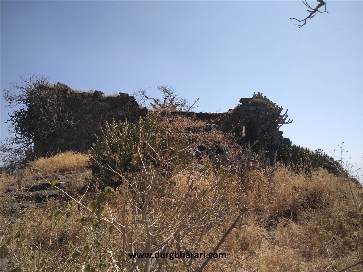
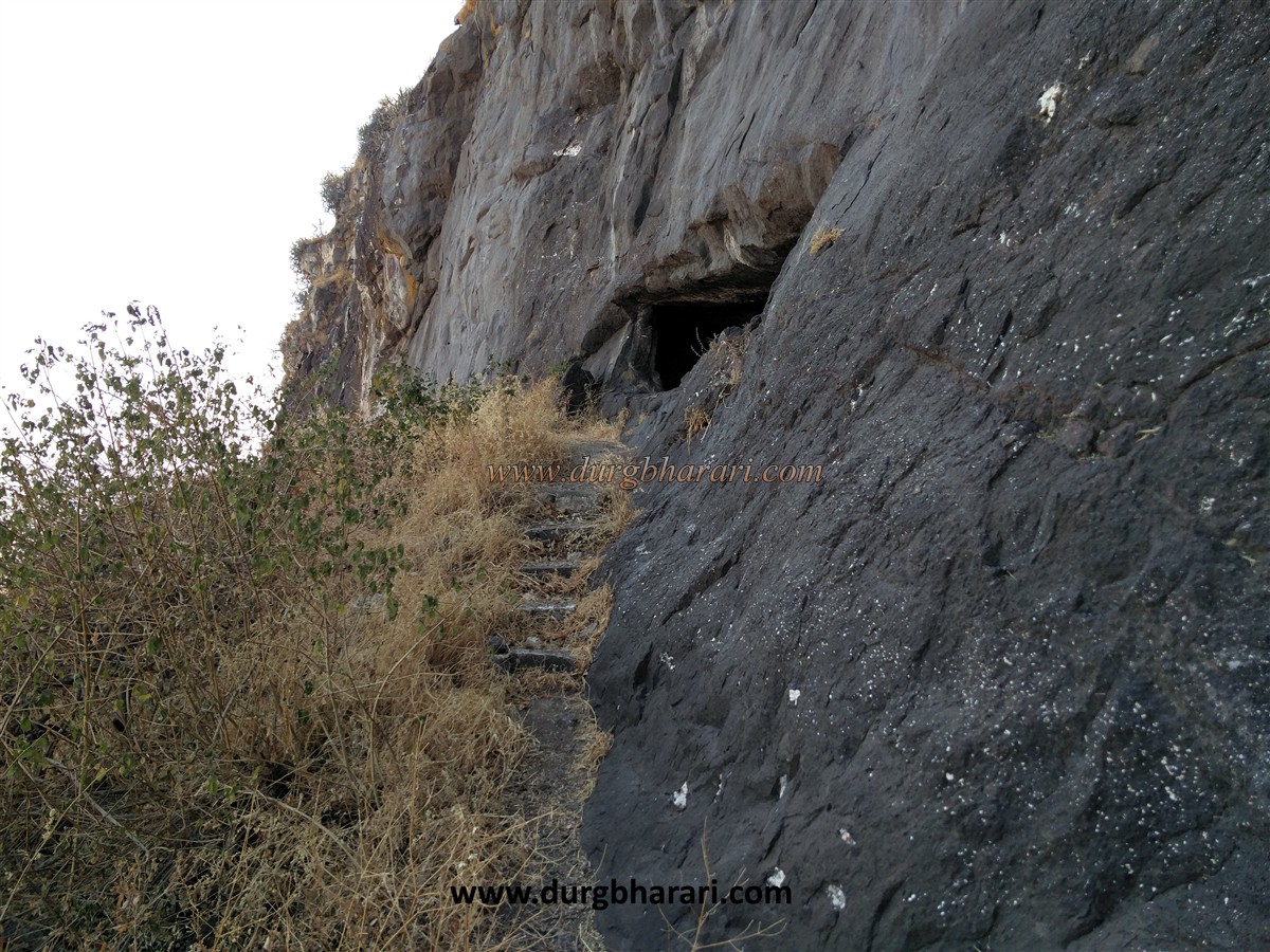
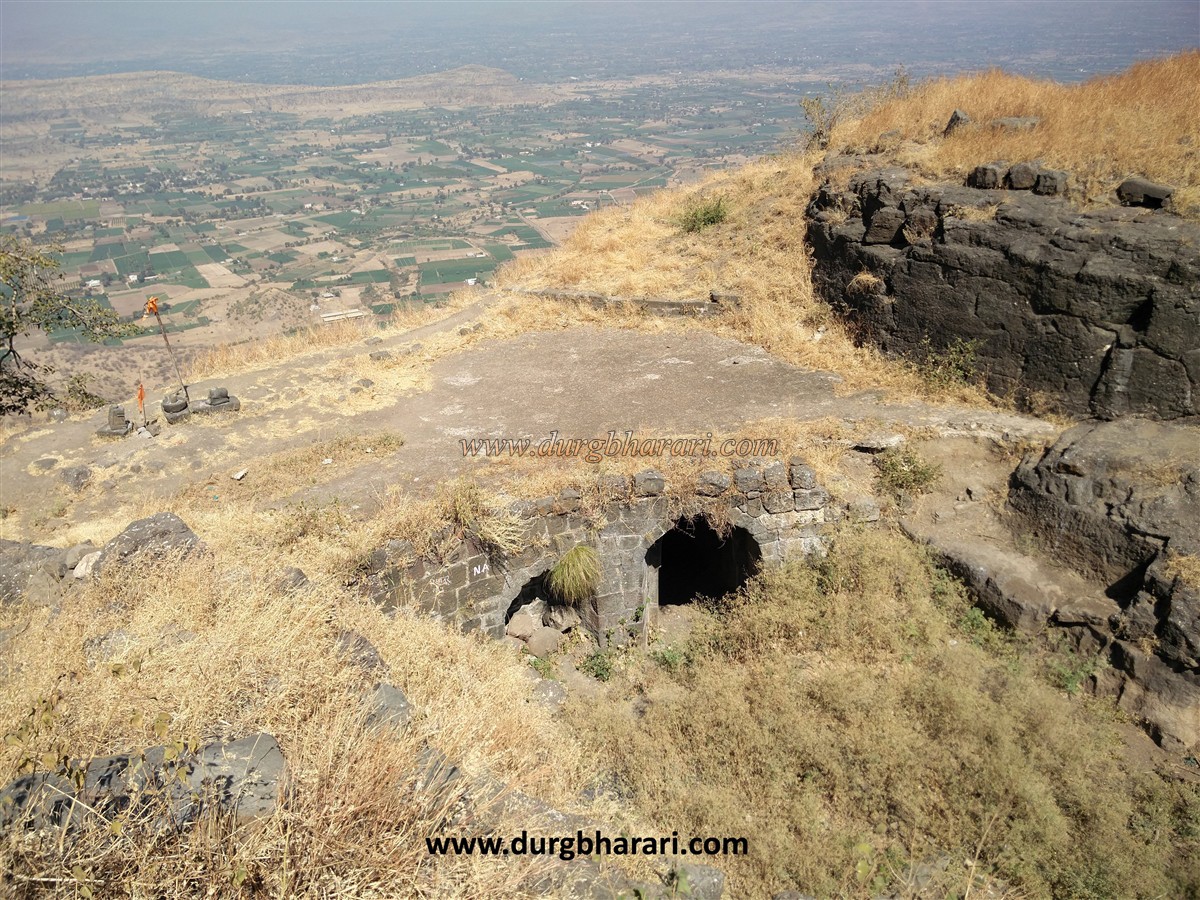
To reach the fort, one has to cross two hills on foot. After crossing the first hill, the rocky climb of the fort begins. It takes about 1.30 to 2 hours to reach this fort from the Chaulher village. The gate of the fort is not visible from the road unless you go directly in front. While entering the fort, you can see doors carved in a line in an underground tunnel. You have to cross these 4 doors to enter the fort. The charm of Chaulher's fortifications is in the design of this door. Near the first gate of the fort are several steps carved into the rock. The size of this gate is small and when you go beyond it, you can see the features of the fort gate construction. The main entrance to the fort is through a tunnel with a total of three doors. After going up a few steps through the first door, there is a second door and at the end, the third door is built in a circular pattern. There is a dim light in this tunnel and you can see the plan to trap the enemies in this door. Walking through this door reminds me of Devagiri's tunnel path. There are a total of seven doors from the base of the fort to the head. The design of these doors is very beautiful. There is a bastion at the top of the last door and a Shivling in the open besides this bastion. On the front wall is an ancient worn-out sculpture carved in stone. Looking at the front from here, one can see a small temple of Chowranganath, Ganesha and Hanuman covered with leaves. Going up through the main gate, the fort is divided into two parts, left and right. Upon entering the fort, there is a citadel in front, and on the left is a small Machi of the fort. On the top of the Machi of the fort, there are two cisterns accumulated with moss, as well as a small dry lake, while at the end there are some remnants of the ramparts. After exploring the Machi, take the path to the citadel. In the lower part of Machi, you can see a big cistern carved in the rock, but now the path leading to that cistern does not exist. There are many such cisterns on the fort and they have different names like Moti Taake, Shewale Taake, Hatyare Taake, Khekda Taake, Lal Taake. Next to the footpath on the left side of the fort is a small newly built temple. Going further, one can see another cistern carved in the rock, and in this area, another bastion like Machi's bastion can be seen. There are paths on both sides to reach the citadel, but the way from here is a bit difficult, so you can turn back and take another path and reach the citadel in 10 minutes. On the way, there is Moti Taake and many other water cisterns carved in the rock. The water in the Moti Taake is suitable for drinking. Another cistern can be seen next to it. The water in this cistern is mossy and not drinkable. A short distance from here is the collapsed gate of the fort. Upon entering through this door, there are some remnants of a ruined mansion in front. Going a little distance on the left side of this mansion, you can see the secret door coming down from the fort. As the interior of this door has collapsed, a lot of soil has accumulated and it is dangerous to go upstairs from here. Next to this door is a huge 40 x 90 feet barn carved in stone. The water cistern on the fort and this barn prove the antiquity of the fort. There are 4 water cisterns on the citadel too but the water in them is not drinkable. From here, the flagpole in front of us comes into view. The entire fort can be seen from the citadel, as well as the Satmal Range and the Selbari-Dolbari Range. Ajmera, Salher, Salota, Mulher, Mora, Hargad, Bhilai, Premagiri, Indramal, Markandey, Ravalya-Jawalya, Dhodap, Kanchana, Koldher, Rajdher, and Indrai are seen from the flagpole. Near Chaulher, to the east, there is a pinnacle called 'Deer-Bhavjay'. The straight edge at the end of the plateau on the other side of the fort is very steep. It takes two hours to walk around the entire fort. Chaulher Fort is a must-visit for its architectural features. The word wadi means small settlement. Looking at the size of the fort, the main settlement of the fort is likely to be at its foothills. Hence its name is Wadi Chaulher. While reading the pages of history, there are references that the village of Wadi Chaulher used to have huge ramparts and the Gawli king was ruling here. A horse stable and a lake from the same period can still be seen on the hills near Wadi Chaulher village. There were a few militants under this king, out of which one was in charge of the area during the Mughal period. According to the locals, the fort was under Swarajya during the invasion of Surat and Shivaji Raje came to this fort at the same time, but no reference is found to it. The fort is under the control of the forest department and they have built iron fences in dangerous places along the way.
© Suresh Nimbalkar
GALLERY