CHANDRAPUR
TYPE : GROUND FORT
DISTRICT : CHANDRAPUR
HEIGHT : 0
GRADE : EASY
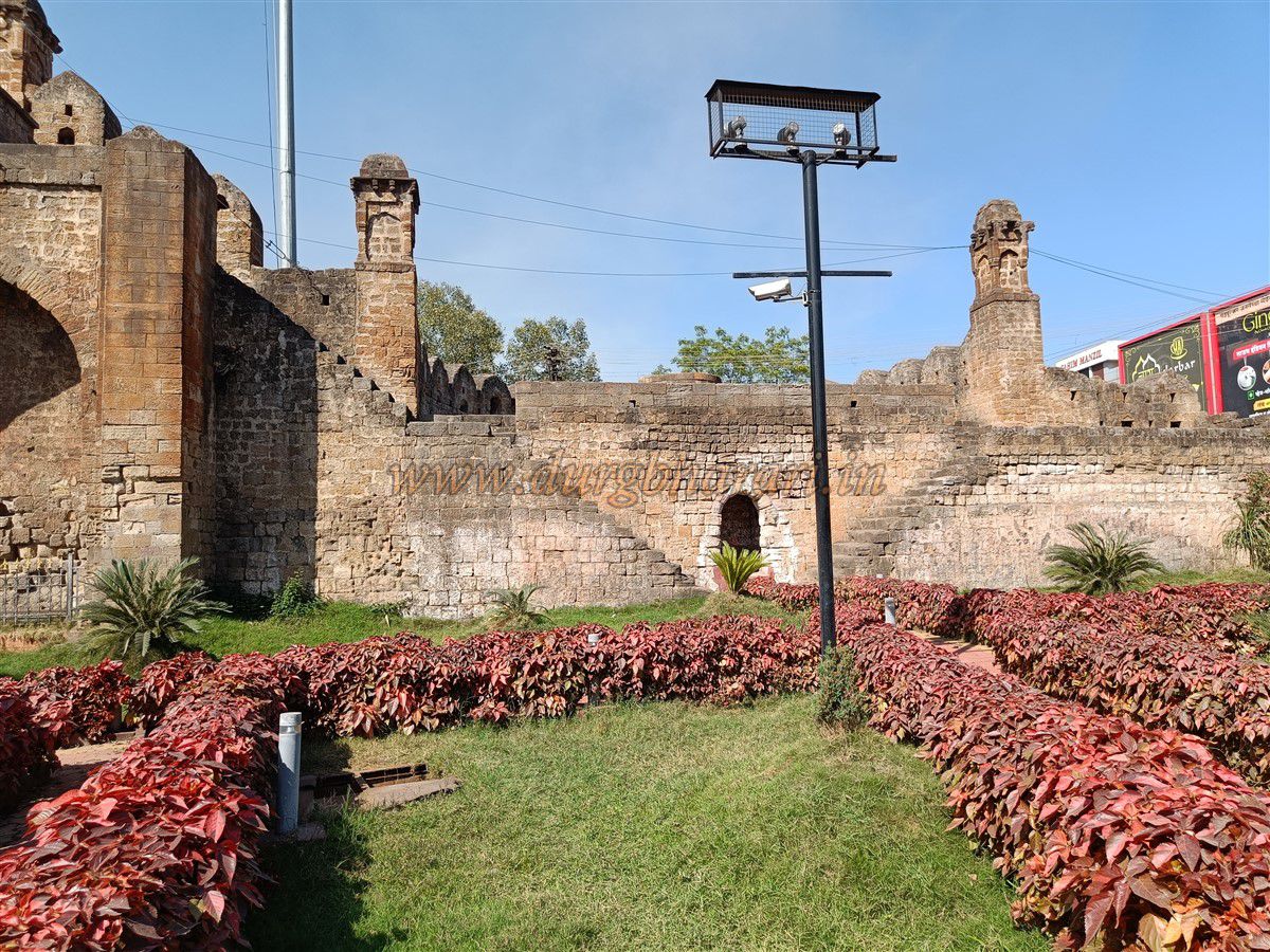
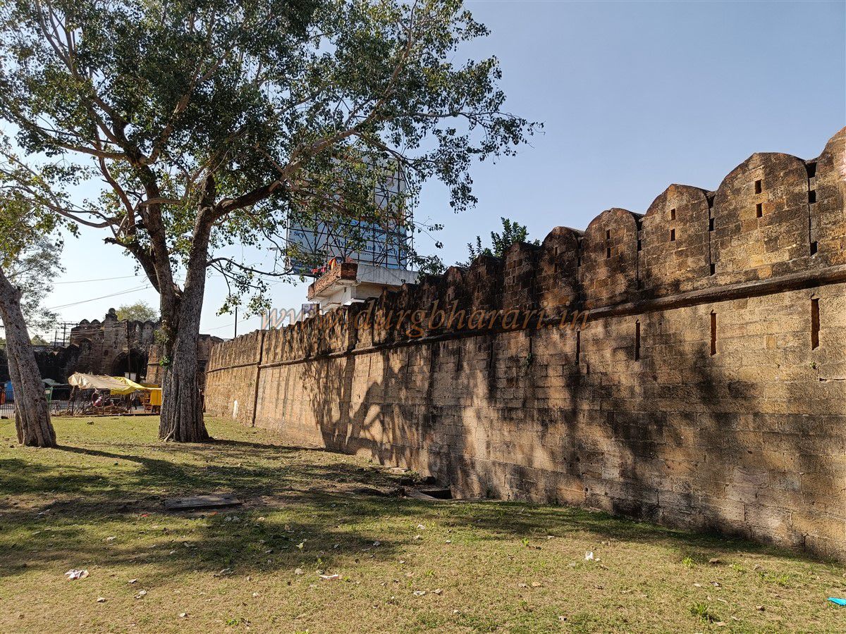
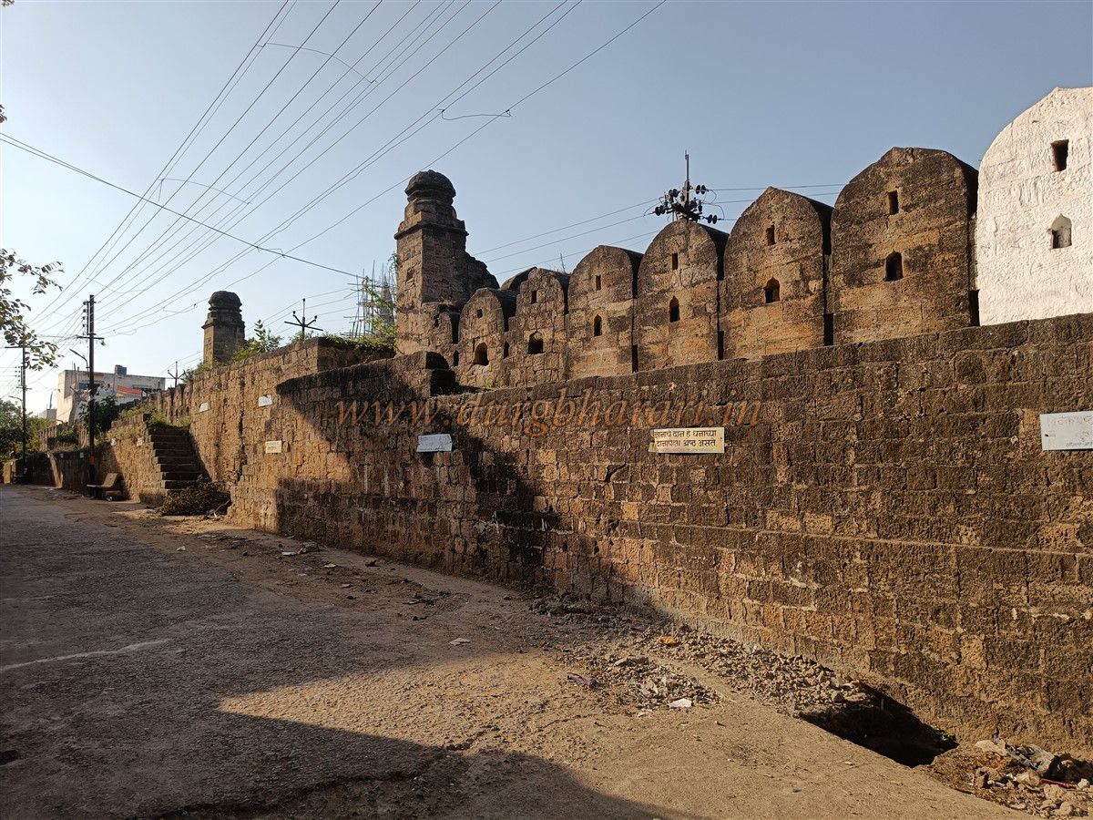
When describing the borders of Maharashtra, a phrase often used is “Chanda to Banda.” Here, “Banda” refers to the last village towards Goa, while “Chanda” refers to today’s Chandrapur district and the city of Chandrapur. During British rule and even after independence, this district was known as Chanda for many years. In 1964, the city’s name was changed to Chandrapur. The city, once the capital of the Gond rulers, was originally enclosed within a fortification of about 3.5 sq. km. Due to increasing population, the fort is now located in the middle of the city. The stone fortification around the city spans nine kilometers and includes 61 bastions of various sizes and shapes. The height of the walls ranges between 15 to 20 feet. The entire fort is constructed using well-dressed stone. The rivers Zarpat on the east and south and the Erai on the west served as natural moats, influencing the varying height of the fort walls.
...
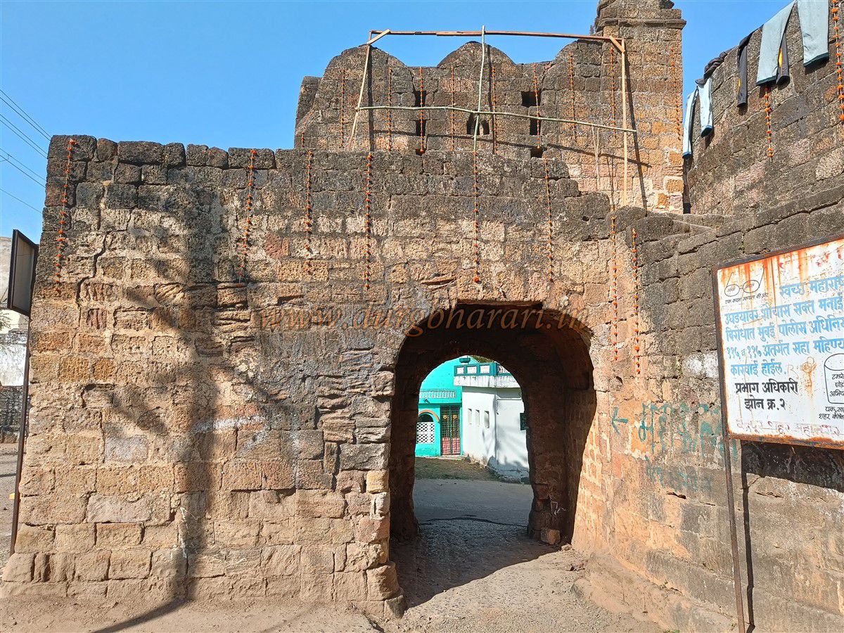
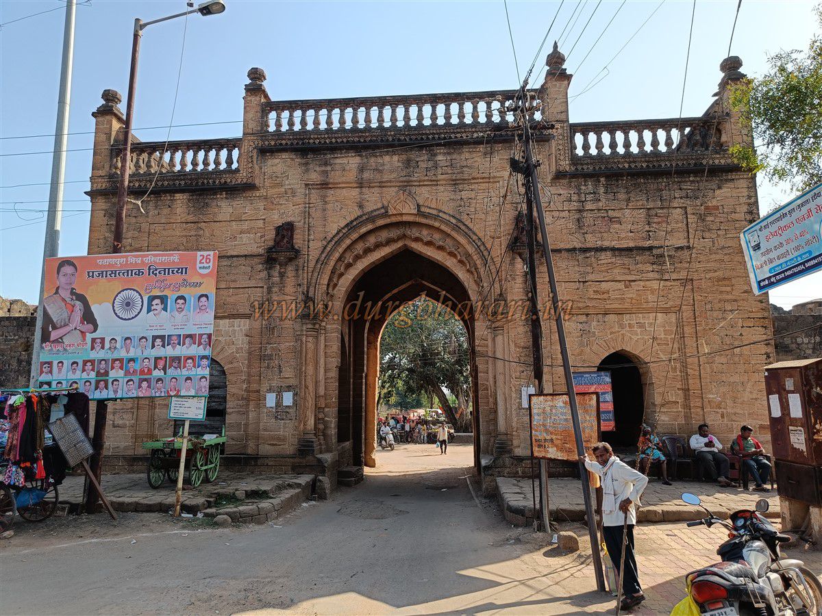
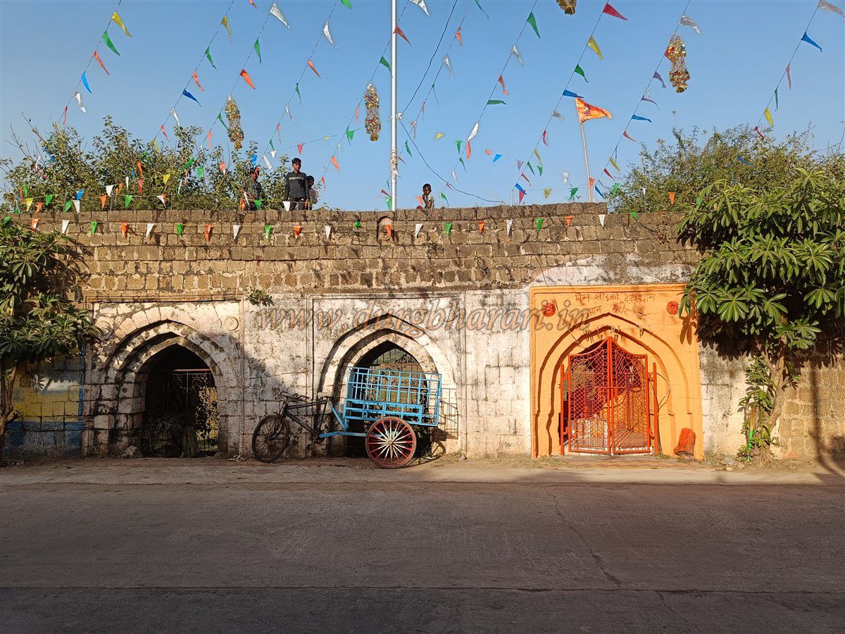
Even today, during monsoons when floods occur, the old fort walls help block the water from entering the city, reducing the impact. Without the fortification, the riverside areas would be submerged. This shows the ongoing importance of the fort’s walls. During the British era and recent times, water level markings from significant floods can still be seen on the Pathanpura Gate and the Vitoba Khidki. There are four main gates and five smaller entrances in this entire fortification. The smaller ones are known as “khidkis” or windows. The names of the main gates are Jatpura Gate, Binba Gate, Pathanpura Gate, and Anchaleshwar Gate. The smaller ones are Chor Khidki, Vitoba Khidki, Hanuman Khidki, Masan Khidki, and Bagad Khidki. These smaller doors are located in the middle areas between the main gates. Like the main gates, soldiers were also stationed at these smaller entrances, which were locked at night and reopened in the morning. Unknown individuals were not allowed in without inquiry. When the main gates were closed, these smaller doors were used for entry. In the center of the fort is the citadel (Balekilla), which is currently used as a prison. While walking through the city, one can see its fortified walls and bastions. Except for the roads leading inside, the fort’s walls are largely intact, and some gates are maintained by the municipal authorities. However, internal structures of the fort have been completely destroyed.
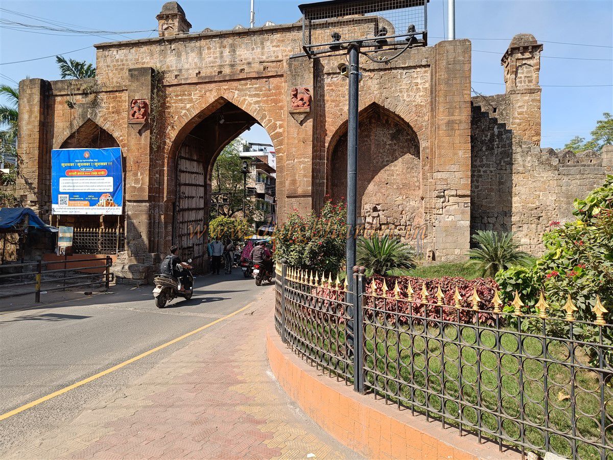
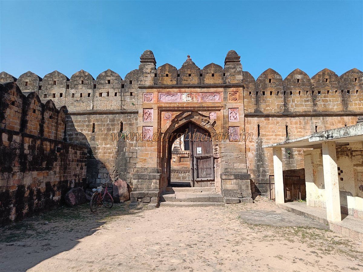
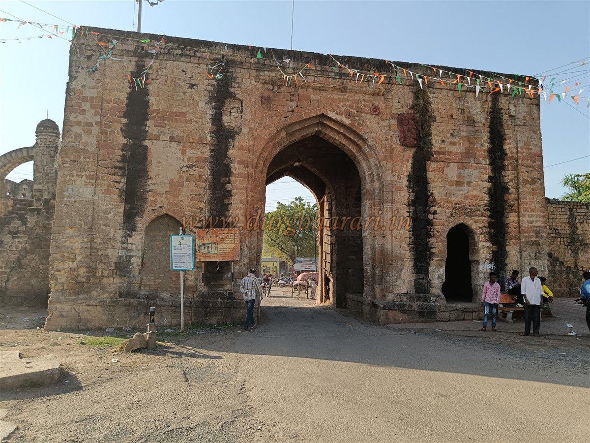
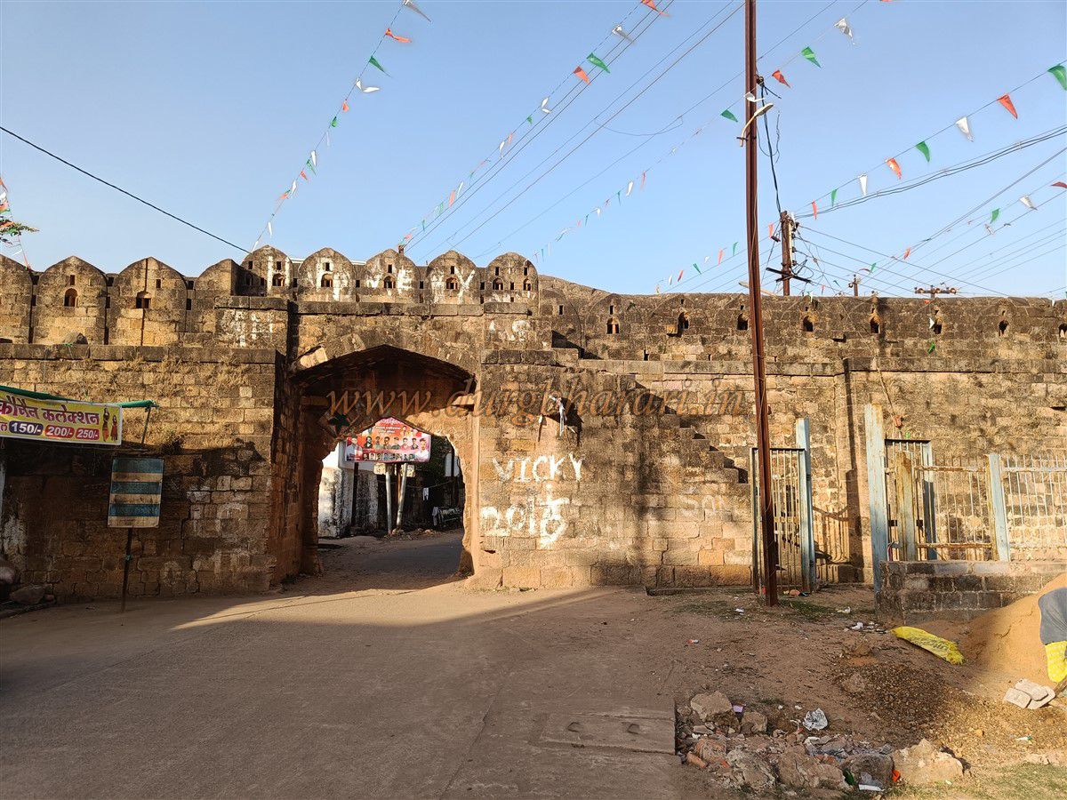
To reach Chandrapur, one can use either Nagpur or Wardha railway stations. From Nagpur, buses and trains are available, and from Wardha, buses can be taken to Chandrapur. The city’s bus and railway stations are located about half a kilometer from Jatpura Gate, making it a good starting point for a fort tour. By hiring a private auto with a local driver, one can tour the entire fort quickly and thoroughly. Let’s begin our fort tour from Jatpura Gate. This west-facing gate is built between two semi-circular bastions and has guard chambers on both sides inside. The Gond royal emblem is carved on both sides of the entrance, and small minarets are built above and near the bastions for aesthetic purposes. There are also windows and loopholes for firing cannons and guns. Carvings can be seen on both bastions. The inner side of the gate also has royal emblems, and there are steps leading to the upper sections and the ramparts. The wooden door of the gate still exists, adorned with large iron spikes. Vehicles currently pass through this gate. A portion of the wall near the left bastion was broken to create a road for heavy vehicles. According to local information, during the battle against the British in 1818, the fort commander Gangasingh, a Jat by caste, attained martyrdom. Since he and his soldiers lived in this area, it came to be known as Jatpura, and hence the gate is called Jatpura Gate. From here, one should take the road to the right to continue the fort tour.
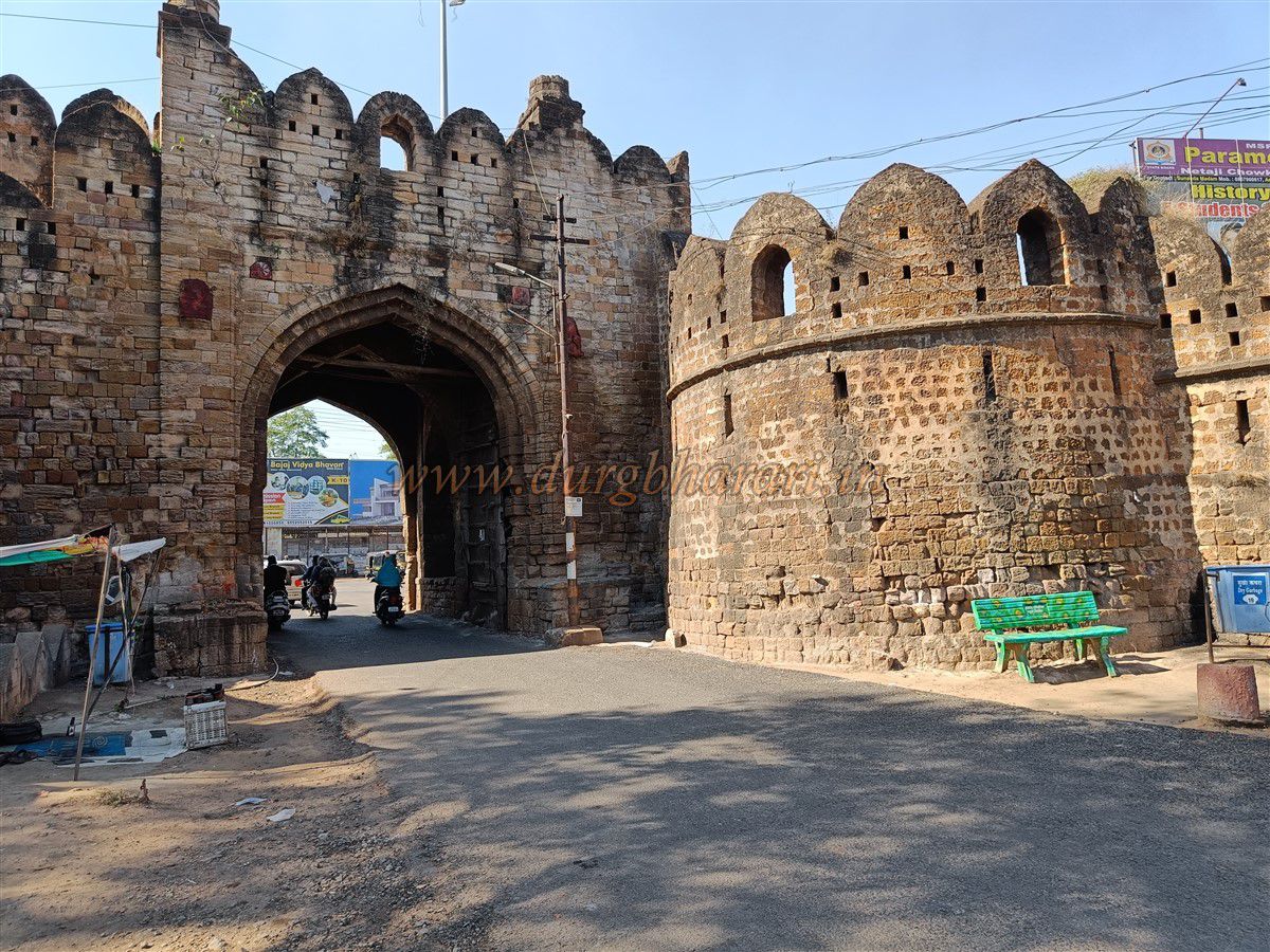
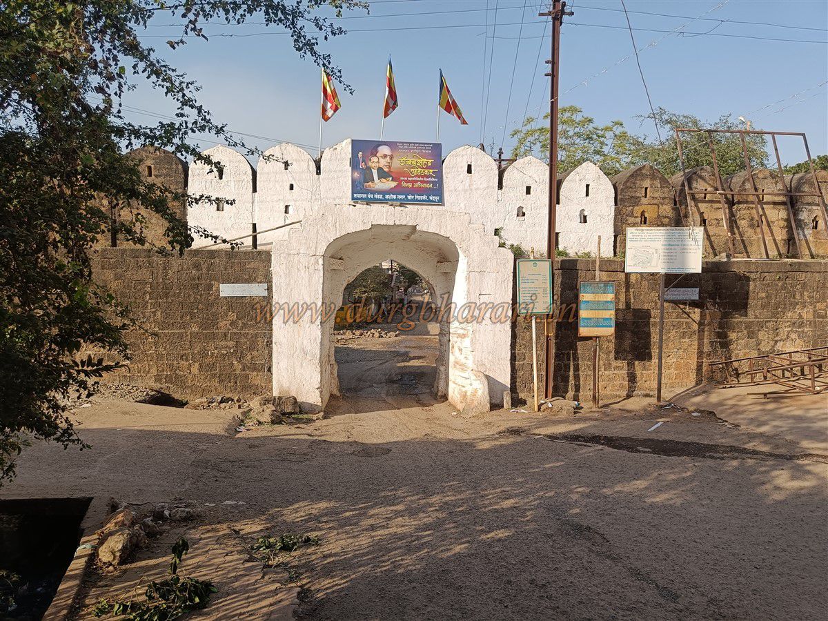
Next comes Chor Khidki, a small door built between Binba Gate and Jatpura Gate. The façade has Gond royal emblems on both sides, alongside a carving of a mythical animal. A little ahead is a circular bastion with staircases on both sides leading to the top from the inner side. There are two small towers on this bastion. From here, walking parallel to the fort walls brings one to Binba Gate, located on the southern side of the city, near the Erai River. As the area outside the gate is not densely populated, it remains quiet. This north-facing gate is also built between two bastions and has Gond emblems and lotus motifs carved on both the façade and the inner side. Minarets adorn the upper parts of the gate and bastions, and one bastion has a semi-circular arch. Inside, guard chambers and soldier quarters are present, and doorways have carvings. Stairs from the inner side lead to the ramparts and bastions. The wooden gate with iron spikes is still intact. There is also a smaller wicket door used for entry when the main gate was closed. According to a plaque near the gate, Binba Mali, who was the fortress commander of the western side during the 1818 battle against the British, died in the war. This gate was named after him.
Next is Vitoba Khidki, a small entrance built between Binba and Pathanpura Gates. To see it, one must go to the Babupeth area. This north-facing gate is built into the wall, next to a circular bastion. Two small minarets are built on the bastion, and a room for soldiers is located below. As the Erai River flows outside this wall, the city has not expanded in this direction. Gond emblems and other carvings are seen on the gate, and deity sculptures found elsewhere have been installed outside. The sparsely populated area offers a panoramic view of the fort walls. Let’s capture these views on camera and continue.
Next is Pathanpura Gate, the most beautiful of the four main gates. This east-facing gate, built between two octagonal bastions, is richly adorned with carvings. Its façade, doorframe, and top are decorated with ornate stone pillars and domes. Gond emblems are carved both inside and outside. The original wooden door has been destroyed due to floods. Guard chambers and living quarters for soldiers are present, and the gate has loopholes and windows for firing. Situated between the Erai and Zarpat rivers, this gate’s surroundings remain undeveloped. From here, we move towards Hanuman Khidki.
Hanuman Khidki lies between Pathanpura and Anchaleshwar Gates, beside the Zarpat River. This small gate is next to a bastion with an inner room for soldiers. A platform for a cannon is built on the top, with a flag post. Moving parallel to the fort wall, we reach Anchaleshwar Gate. Along the way, to the right, a sunken ground appears near the wall—once a large pond inside the fort, now converted into a playground with spectator seating.
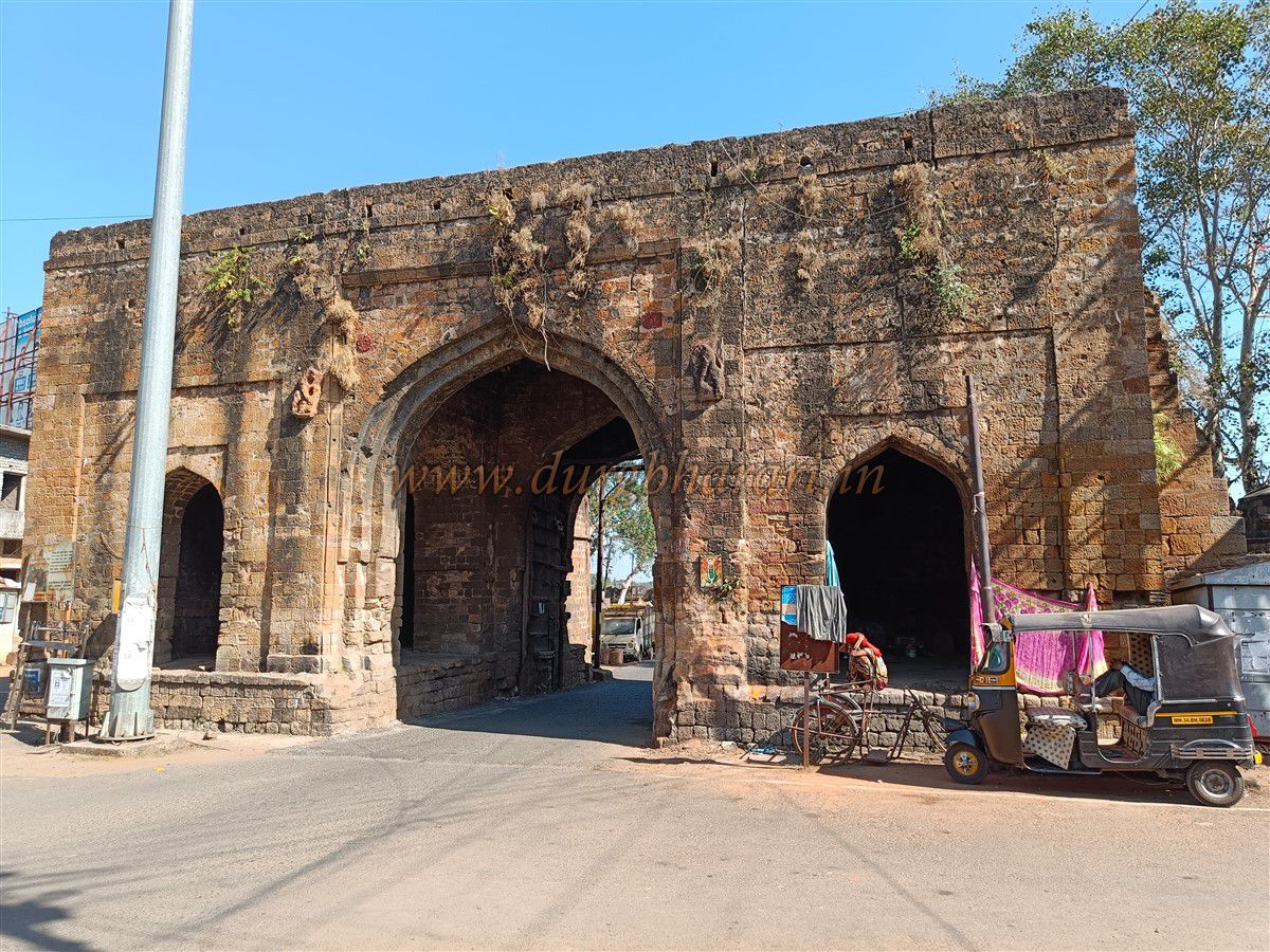
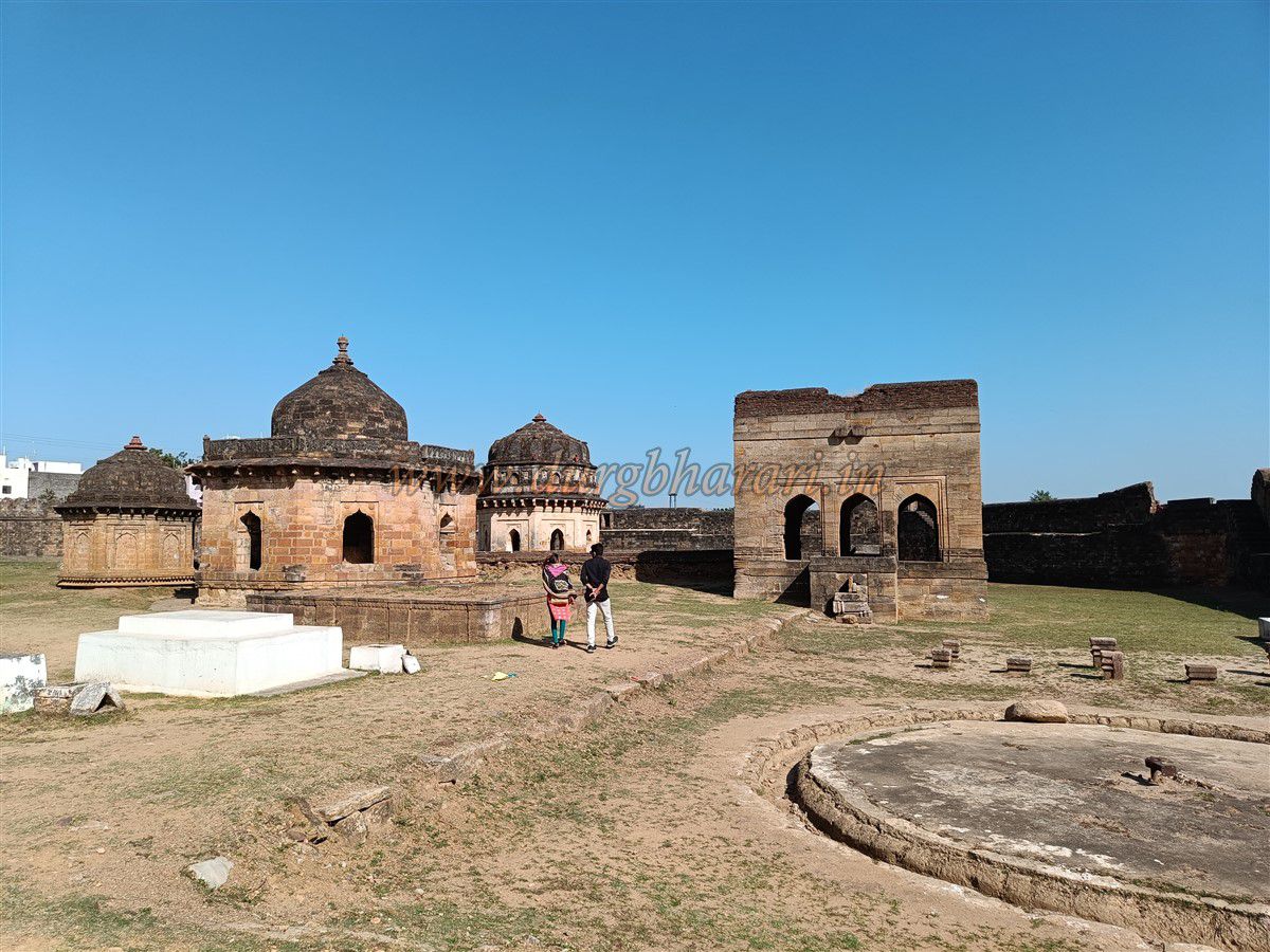
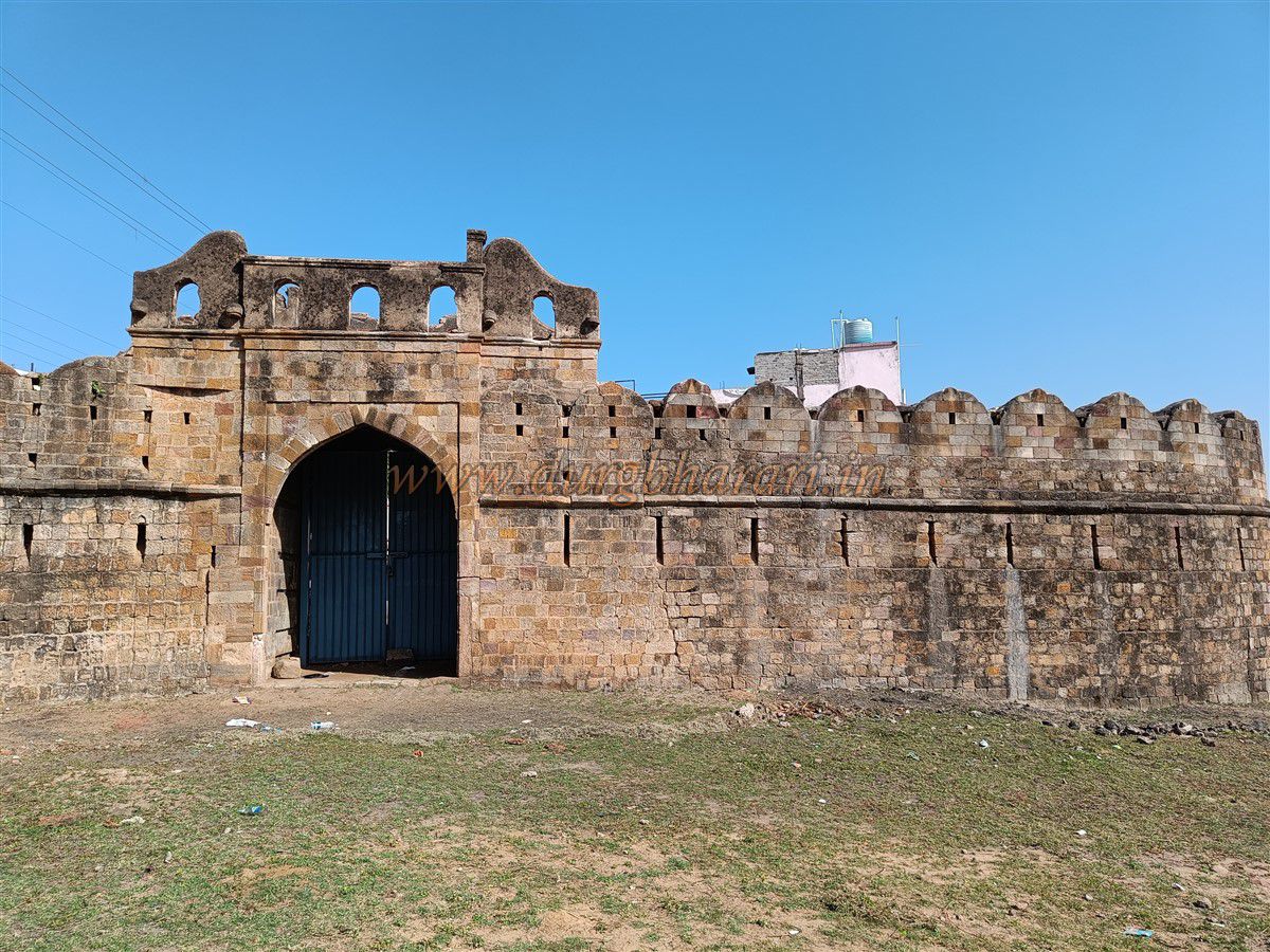
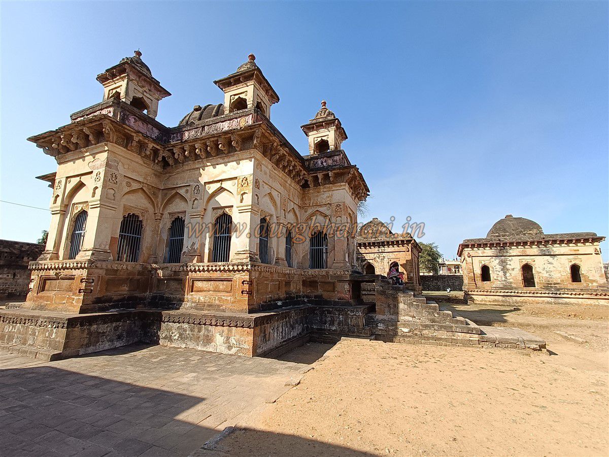
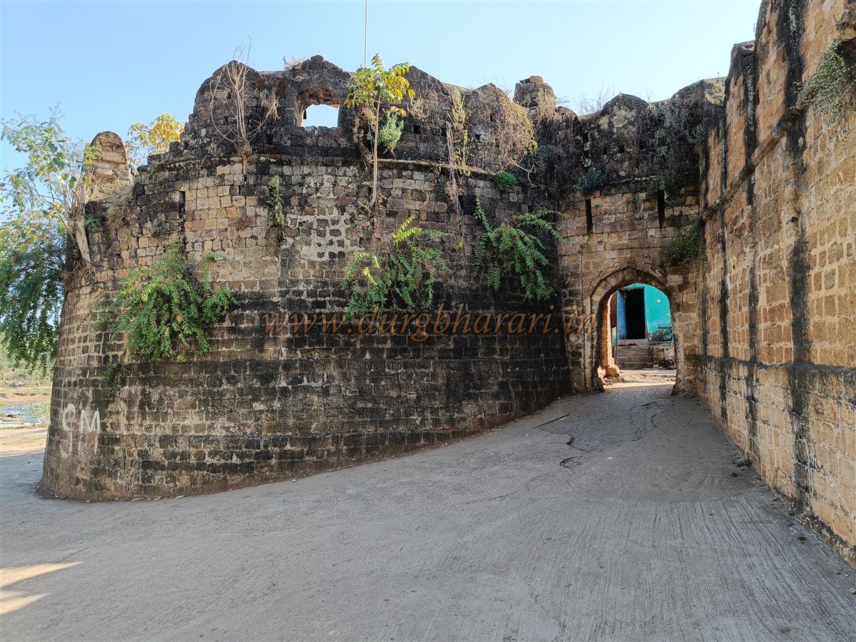
Anchaleshwar Gate, west-facing and built between two bastions, has guard chambers on both sides inside. Gond royal emblems are carved on both sides, with minarets built above. Loopholes and windows for defense are also found. Steps lead to the top of the wall and bastion. Below the steps, a room for soldiers is present. A cannon platform is built on the left bastion, with a granary below it, now filled with earth. The wooden door is still intact, with large iron spikes. Vehicles currently use this gate. A portion of the wall near the right bastion was broken to create a road for heavy vehicles. In front of the gate lies the Zarpat River. There once was a wooden bridge across the river, remnants of which are still visible. Now, a permanent concrete bridge has been constructed. The newly developed Chandrapur city lies across the river, and to visit the Mahakali temple, one must cross over. Two important structures near the Anchaleshwar Gate are the Anchaleshwar Temple and the Gond royal family’s tombs. Both structures were originally enclosed within separate fortifications, which were later connected to the main fort.
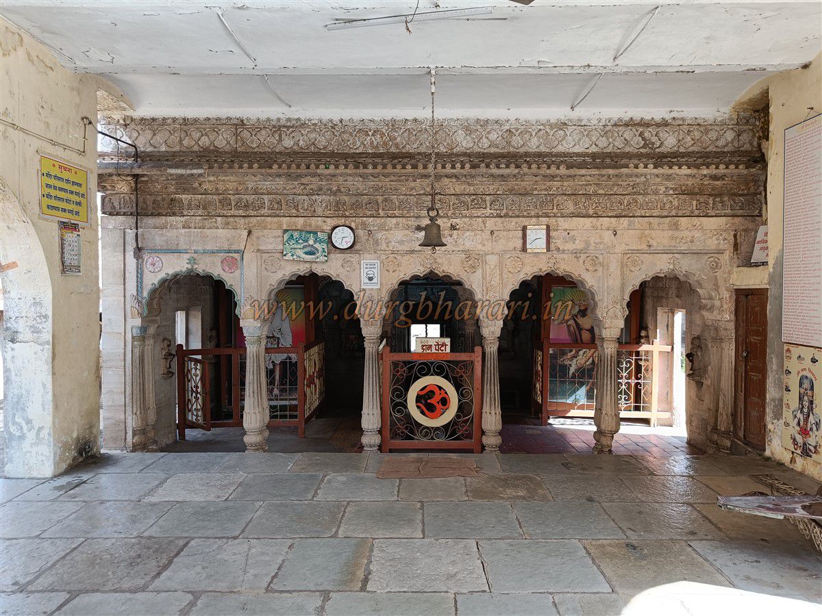
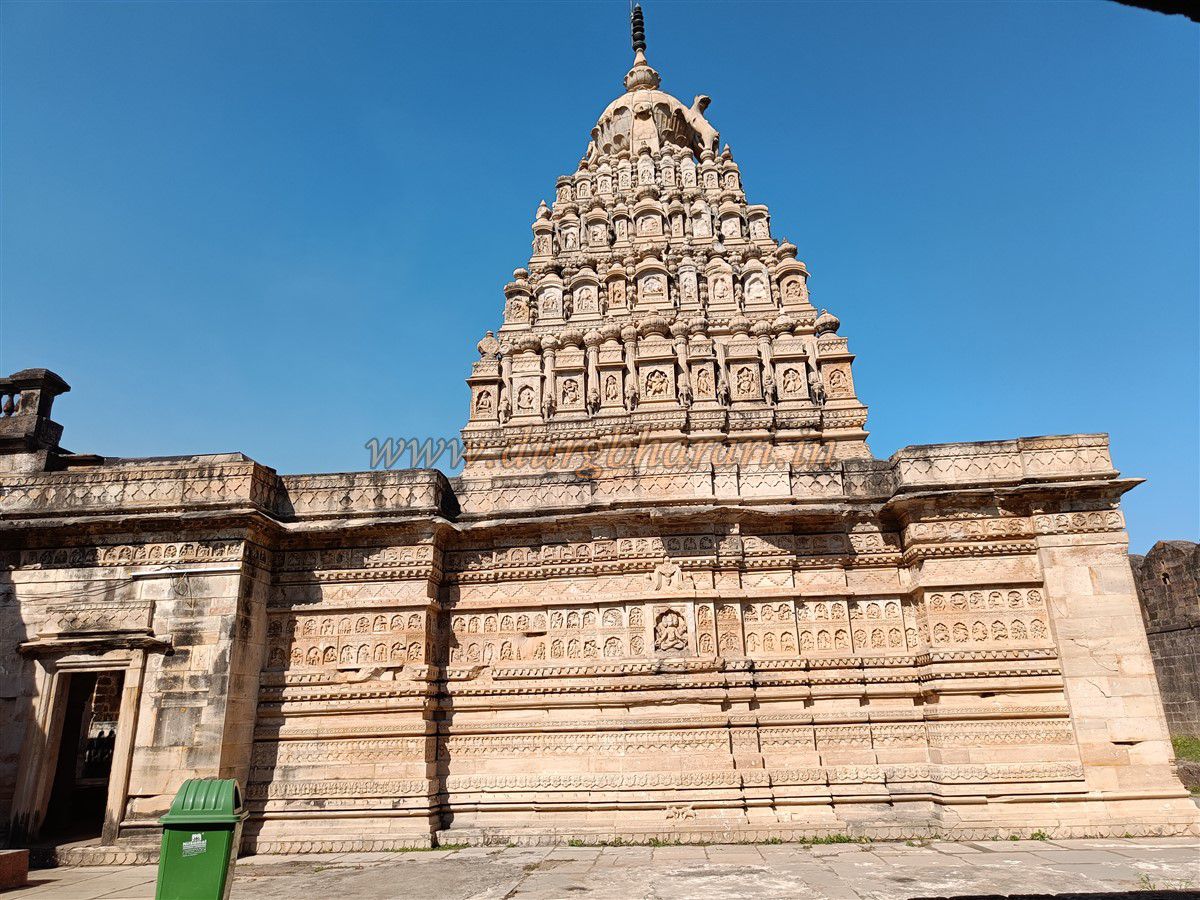
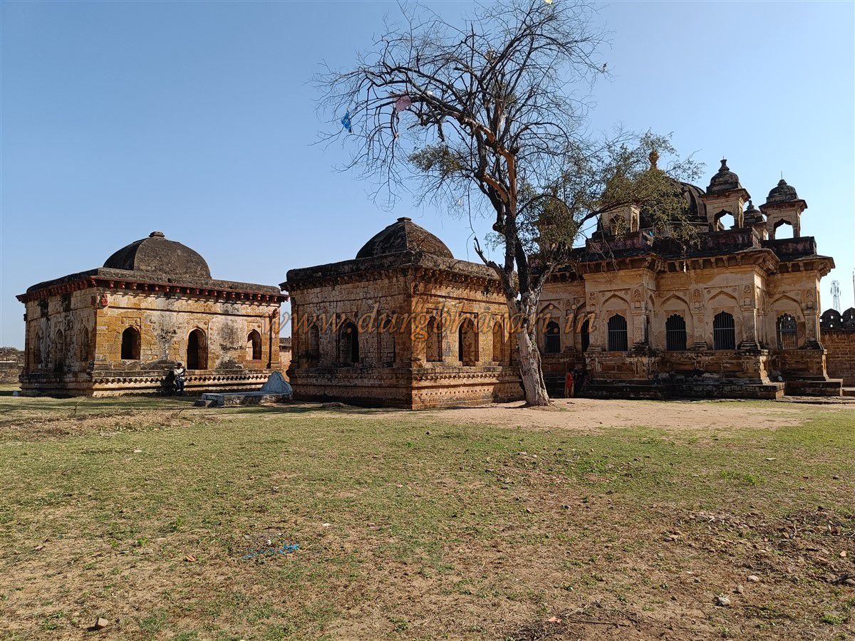
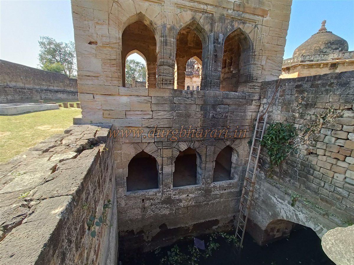
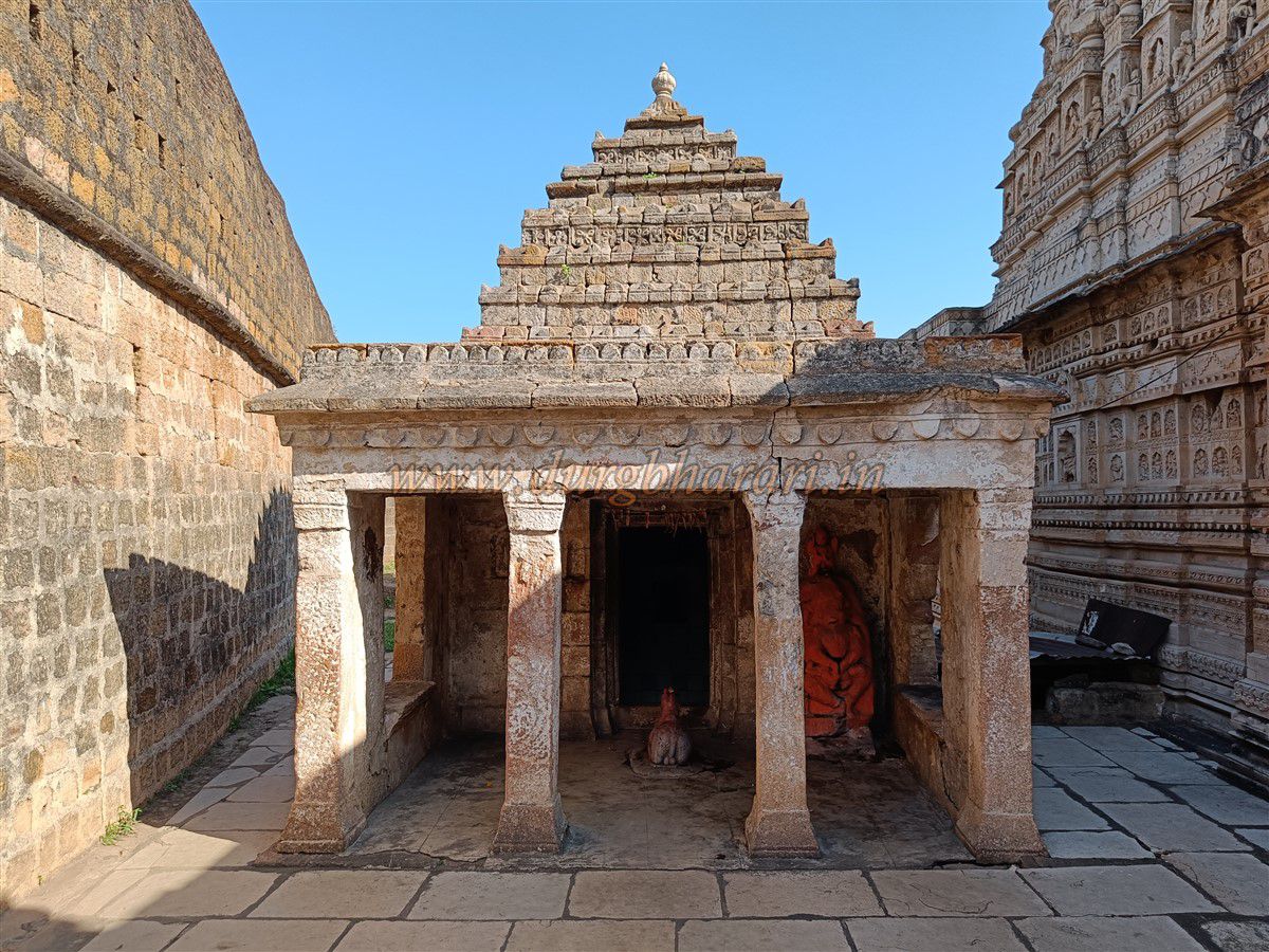
The Anchaleshwar Temple, dedicated to Shiva, stands near the riverbank. A small Ganesh temple and some carved sculptures are displayed nearby. Entering through the temple’s gateway, to the left lies the beautifully carved entrance to the royal tombs, featuring Ganesh and Gond emblems. One should first visit the Anchaleshwar Temple, which is richly adorned with carvings inside and out. Its spire is also sculpted. The premises contain two small yet exquisite Shiva temples, one with a grand and detailed idol of Narasimha. For devotees, there is a stepped well and several pavilions for shelter and water. Inside the sanctum, instead of a shalunka, there is a hole from which water continuously seeps. Stone lamps carved into the hands of wall sculptures are worth noticing. After the temple visit, one can enter the Gond royal tomb complex—a large enclosed courtyard, with the main fort wall on one side and three other fortified sides. The original door linking the fort to the tomb area is now closed. Inside are a lime mill and a beautiful three-storied stepped well with room’s underground, resembling a water palace. A pulley system on top was used to draw water, which was channelled throughout the complex. There are 18 beautifully constructed samadhi platforms, canopies, and small structures. The most remarkable among them is the tomb of Raja Birshah, in front of which stands an artistic fountain fed by terracotta pipes connected to the well.
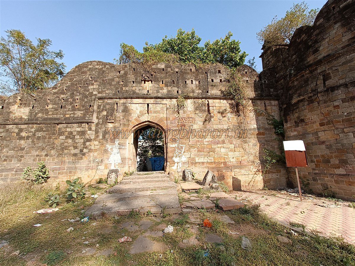
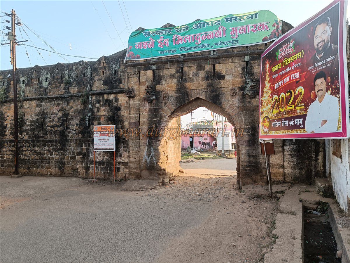
A visit to the Anchaleshwar Temple and the royal tombs takes around 45 minutes. The next destination is Masan Khidki, near Balaji Temple. This gate was not used for regular entry but led to the fort’s cremation ground. Located by the Zarpat River, the area is now overgrown with thorny bushes and debris. Direct access beyond this point is not possible due to the river. Masan Khidki, Bagad Khidki, and Teen Khidki lie between Anchaleshwar and Jatpura Gates. After seeing Masan Khidki, proceed to Bagad Khidki, the southernmost point of the fort, a narrow section flanked by two bastions, between which the gate is built. Inside, rooms for soldiers are provided. The façade displays Gond emblems, lotus motifs, and two other carvings. Steps lead to the upper part. The right bastion is circular, while the left resembles a lotus flower. The stretch of wall between Jatpura Gate and Bagad Khidki runs alongside the Ramala Lake, providing natural defense. Walking along the lake's edge toward Jatpura Gate, one sees three windows in the wall overlooking the lake—perhaps used for surveillance or boating. Within 10 minutes, one reaches back to Jatpura Gate, completing the fort tour.
In addition to this, there is a rectangular citadel (Balekilla) with its own wall in the center of Chandrapur. It has four round bastions and an east-facing gate on the west side. Since it is now used as a prison, entry is restricted. Near its eastern wall is the Someshwar Temple. In Chandrapur city, one can also visit the Mahakali Temple, the tomb of Gangasingh, Ramala Lake, Rambagh, and the memorial of Capt. Corham. The fort can be explored either on foot or by vehicle. A rickshaw tour of the entire fort and city takes about four hours, but walking requires a full day.
In ancient times, the Chandrapur region was known as Lokapura and later as Indrapura. In the 13th century, the Gond dynasty rose in Vidarbha and established their rule here, reigning for nearly 400 years. Their cultural imprint remains evident on the fort structures. Their royal emblem was a lion mounted on an elephant, symbolizing valour, often carved at the fort entrances. When Bheem Ballarsha moved the capital from Shirpur to Ballarsha, his successor Khadkya Ballalshah administered the Chandrapur region. Initially, Ballarsha was the capital (1437–62). Later, Khandkya Ballalshah decided to shift the capital to Chandrapur and planned a new fort on the banks of the Zarpat River. He appointed Tel Thakur, an architect, in 1472 to design the fort. After a survey, Thakur planned a perimeter of 7.5 miles and began construction. However, the fort wasn’t completed during Khandkya lifetime. His son Hirshah came to power and built the four main gates. The emblem of the lion atop the elephant symbolized valour and was adopted as the royal insignia, carved on all four gates—although the lion is shown twice the size of the elephant. During Hirshah’s time, while the fort was still under construction, the capital shifted from Ballarsha to Chandrapur. The citadel was completed during the reign of Dhundya Ramshah (1597–1622), who made large donations. Records state that the construction cost 1.25 crore rupees. The Gond capitals shifted from Ballarsha to Chandrapur and eventually to Nagpur.
After the early Gond period, the dynasty accepted vassalage under Muslim rulers, leading to fewer battles. However, Nagpur’s Bhonsles and the Nizam eyed Chandrapur rich fort and kingdom. In the early 18th century, internal conflict among Gond heirs led to Bhonsle dominance in Chandrapur. Nilkanthshah, the last Gond king, violated a treaty with the Bhonsles, prompting Raghuji Bhonsle to attack in 1750. Nilkanthshah was defeated and imprisoned in Ballarpur Fort, where he died in 1751—marking the end of the glorious Gond rule.
In 1816, the Bhonsles signed a treaty with the British for a stationed army. In January 1818, according to another treaty, Chandrapur Fort was to be handed to the British, but when it wasn't, the British forces besieged the fort on 9 May 1818. From 9 to 13 May, cannon fire was directed from Mana Hill outside Pathanpura. The Bhonsle forces retaliated. The battle raged for four days, but the fort's strength made conquest difficult. On 19 May, a breach was made, and on 20 May, troops entered the city. Gangasingh Jat, the fort commander, fought valiantly and was martyred. Ali Khan, a gunner, shot accurately and killed British officer Major Corham. Their tombs can still be seen in Chandrapur. Eventually, the Union Jack was hoisted on Pathanpura Gate, and the British took over. Captain Scott noted a loot worth ten lakh rupees. After the death of Raghuji Bhonsle of Nagpur, the British annexed his kingdom citing lack of heirs, integrating the region into the British Empire.
© Suresh Nimbalkar
GALLERY