CHAMBHARGAD
TYPE : HILL FORT
DISTRICT : RAIGAD
HEIGHT : 680 FEET
GRADE : MEDIUM
The city of Mahad has a glorious history dating back to the seventh century. There are 7th-century Gandharapale Buddhist caves along the Gandhari river in Mahad taluka on the banks of Savitri, Gandhari, and Kala rivers. The origin of the word “Mahad” comes from the Pali word Mahahat, meaning big market. Mahad was the largest market in the surrounding area. Large scale trade was carried on by boat from the Savitri river. As this route of the Savitri river is filled with silt, only remnants of Mahikavanti port and Dasgaon port remain. Chains of forts like Daulatgad, Songad, Mahendragad aka Chambhargad were constructed to protect this trade route from the port. As Raigad was chosen as the capital of the Swarajya, the sea forts under the influence of Raigad became more important in terms of protection of the capital
...
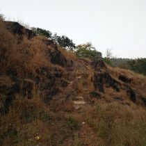
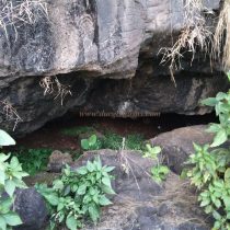
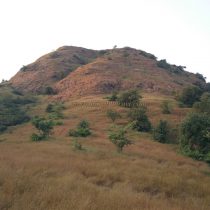
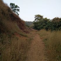
as the mountain range starting from Raigad in the north stops at the forts of Chambhargad and Songad. The chain of these forts made it difficult for the enemy to easily attack the capital. Although it is difficult to say exactly when Chambhargad fort was built, the fort must have existed before Shivaji Maharaj’s era. This fort which is a sub-fort of Raigad was an important watchtower on the creek. Remains of this fort can be seen on the hill at the back of Chambharkhind village, which is adjacent to the highway in Mahad city. The fort has a simple elliptical head and extends from south to north and is 550 feet above sea level. The path which takes you to the fort is in the village. A path from the school at the edge of the village leads to the mountains. 5 minutes further along this path, you will see a small dam. After climbing the hill on the left side of the dam, the path to the fort begins. As there was not much movement of people on the fort, the path was clean and clear, so we should climb in the direction of the gorge on the right side of the fort. After half an hour of climbing, we reach the gorge. When you come to the gorge, keeping the ridge to the left and go a little further. We reach the top of the fort by taking the broken path. In about 15 minutes we enter the fort. Upon entering the fort, 4-5 huge rocks are seen lying side by side. The head of the fort is a small plateau with a saffron flag fluttering over it. There are very few remnants of structures on the plateau and when you go straight north from the plateau, you can see 3 water cisterns at the bottom. A footpath descends into this water cistern next to a collapsed bastion. Near the cistern, some holes have been carved to erect pillars. When you go down, you can see another water cistern next to the previous one. Looking at this pillar carved in the rock, one can guess that the fort is ancient. Apart from this, on the east side of the fort and the west side, one can see two such cisterns each. On the plateau, you can see the quadrangle structure of a building towards the gorge. Daulatgad, Songad, Mangalgad, Raigad forts as well as Potla, Guhiri, and Kalkai hills are visible from the top of the fort. The entire Mahad city is visible from the top. It takes one hour to reach the fort from Chabharkhind village and half an hour to walk around the fort. There are not many records about Chambargad in history.
© Suresh Nimbalkar


