BHUDARGAD
TYPE : HILL FORT
DISTRICT : KOLHAPUR
HEIGHT : 3198 FEET
GRADE : EASY
Maharashtra, which is known as the land of forts, many talukas like Purandar, Devgad, Panhala are named after their forts. Bhudargad is one such taluka in Kolhapur district which is known after its fort. It must be the largest hill fort on the plateau after the Janjala fort of Aurangabad. The total area of this fort is 180 acres and the length of the ramparts should be about 5 km. Bhudargad fort is at a distance of 65 km from Kolhapur via Gargoti road whereas 12 km from the taluka of Gargoti. On the Gargoti-Ajra road, at a distance of 4 km from Gargoti, there is a fork to reach Peth Shivapur village situated at the foot of the fort. Peth Shivapur is the former market of the fort and a paved road has been constructed from the village to the Bhairavnath temple on the fort.
...
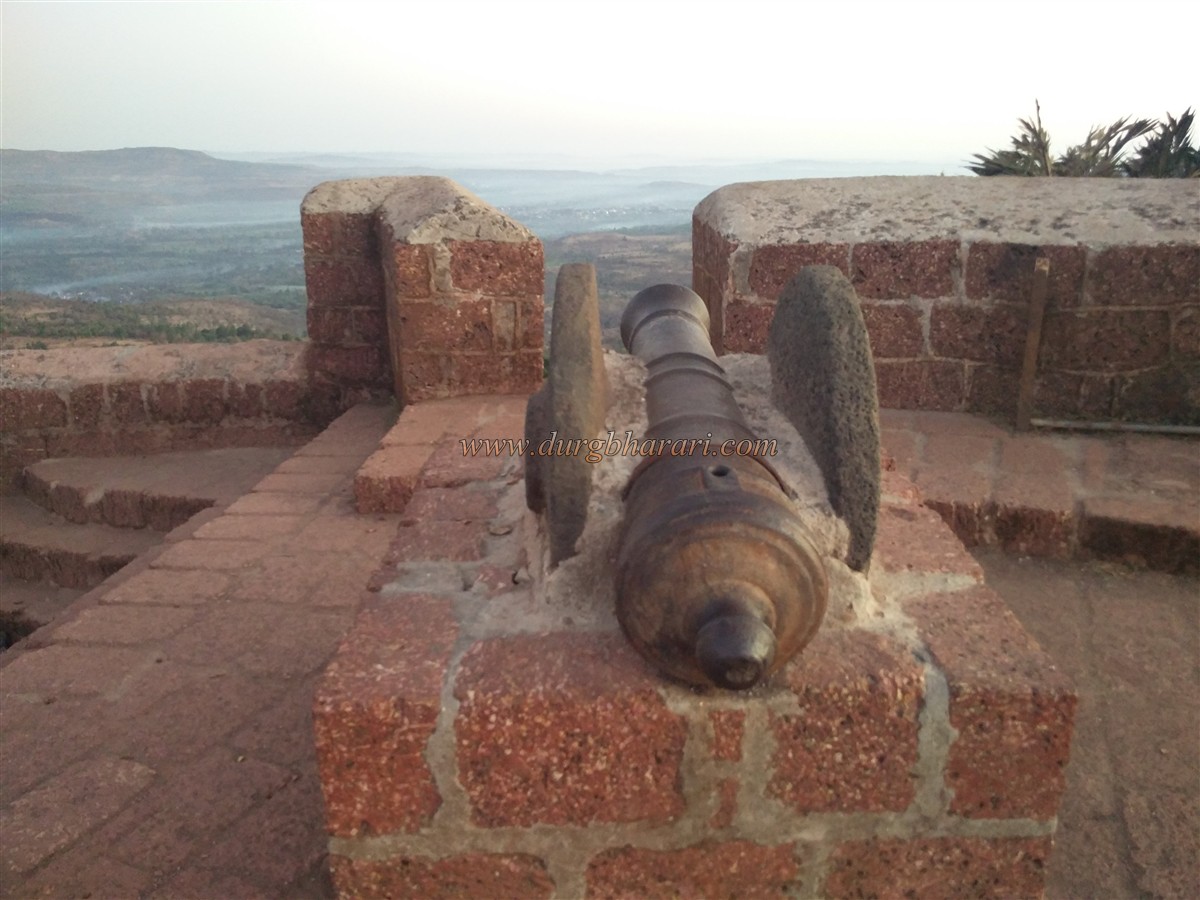
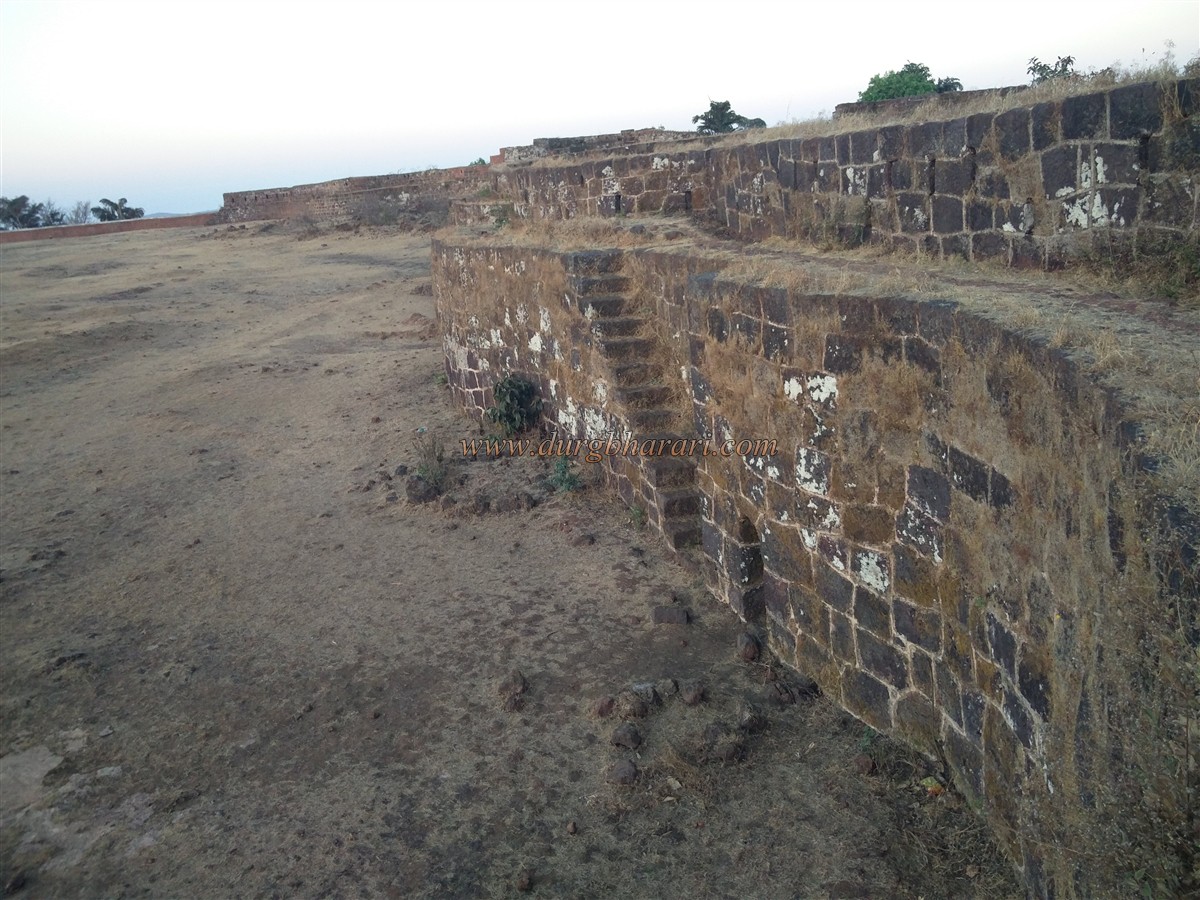
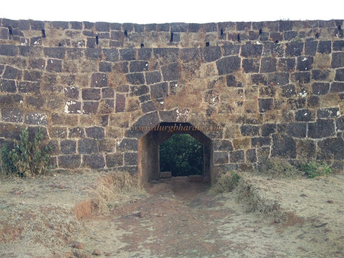
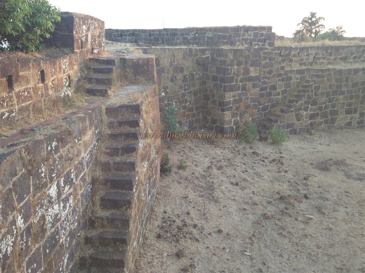
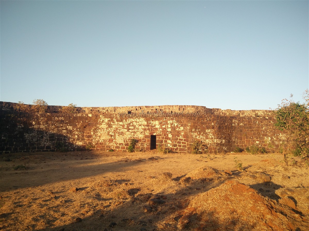
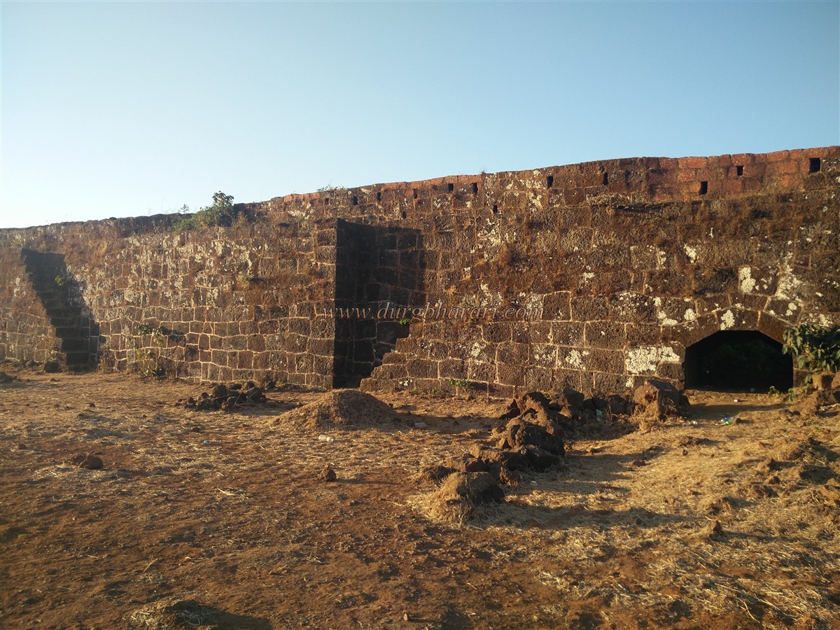
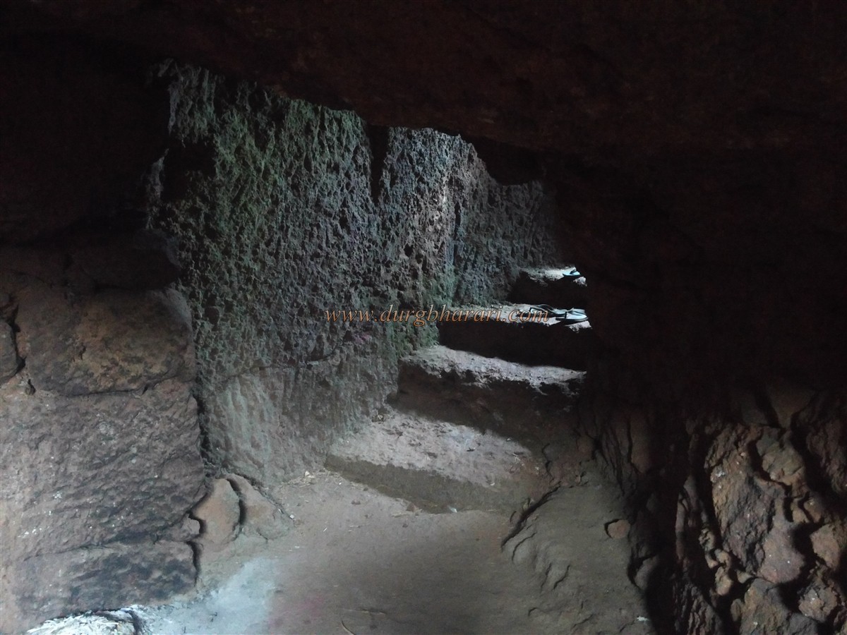
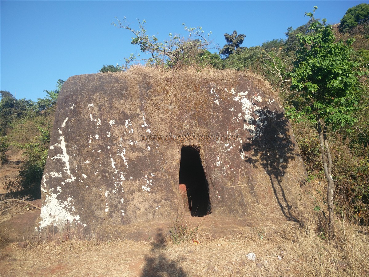
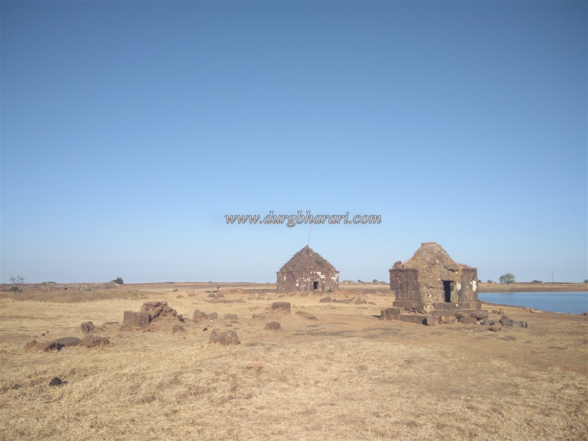
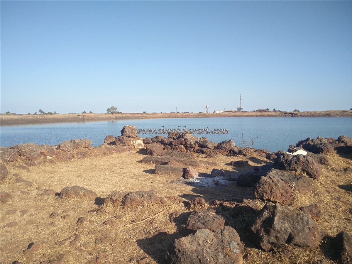
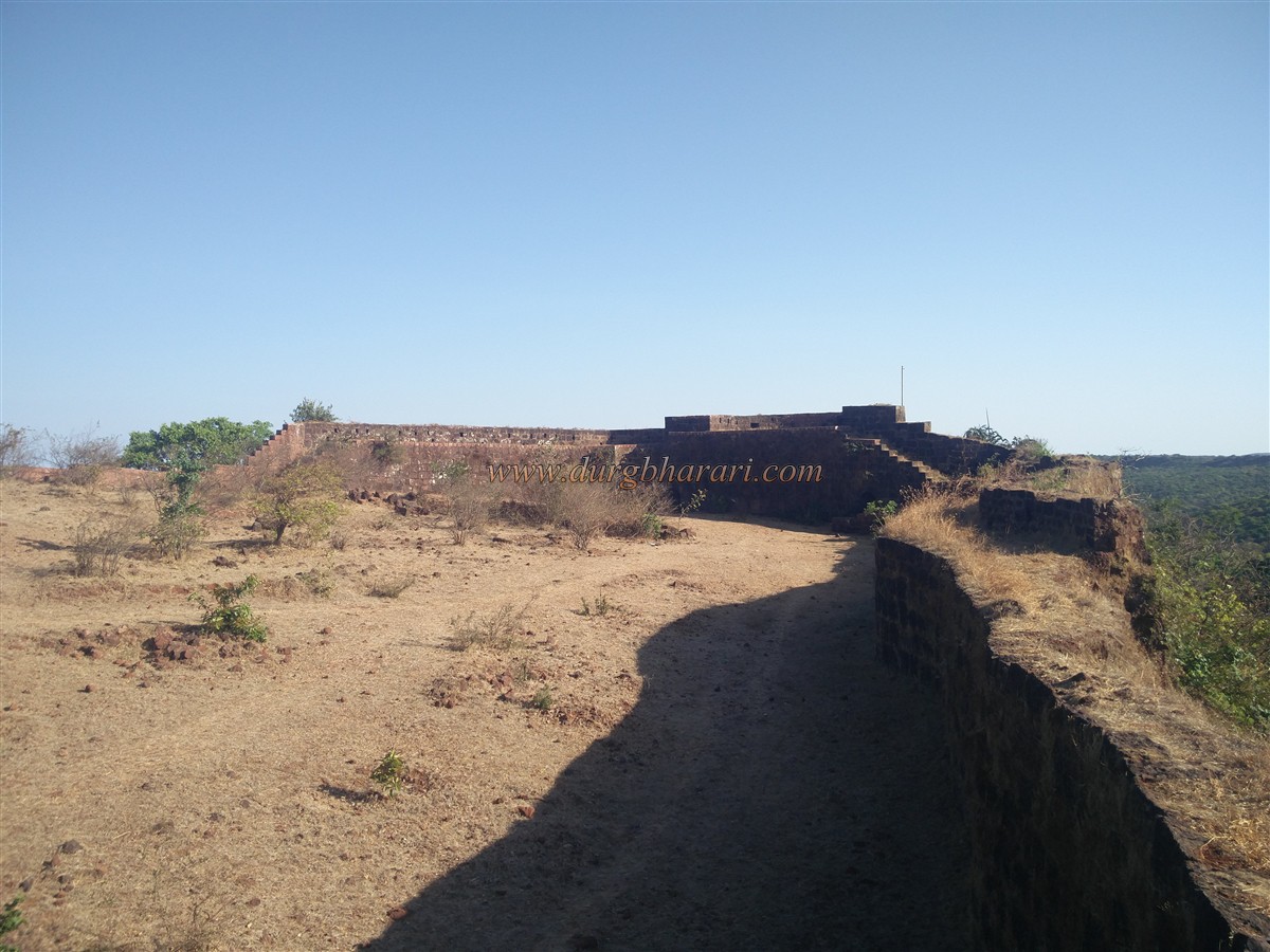
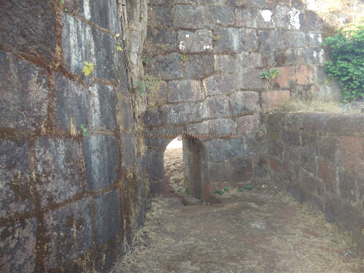
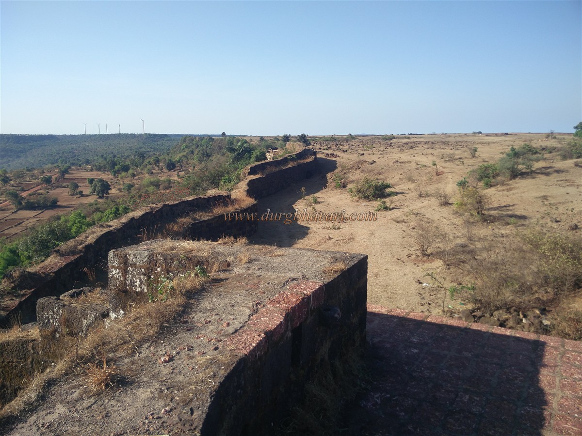
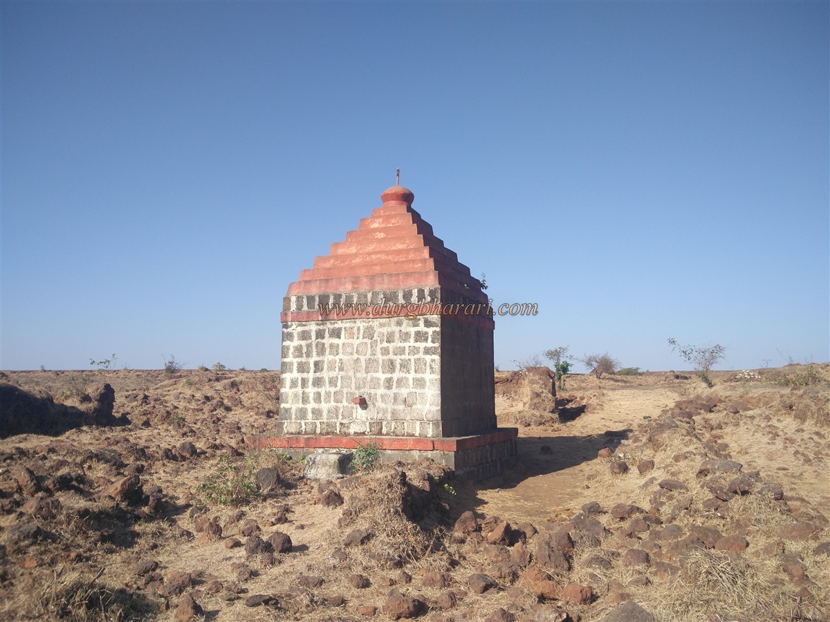
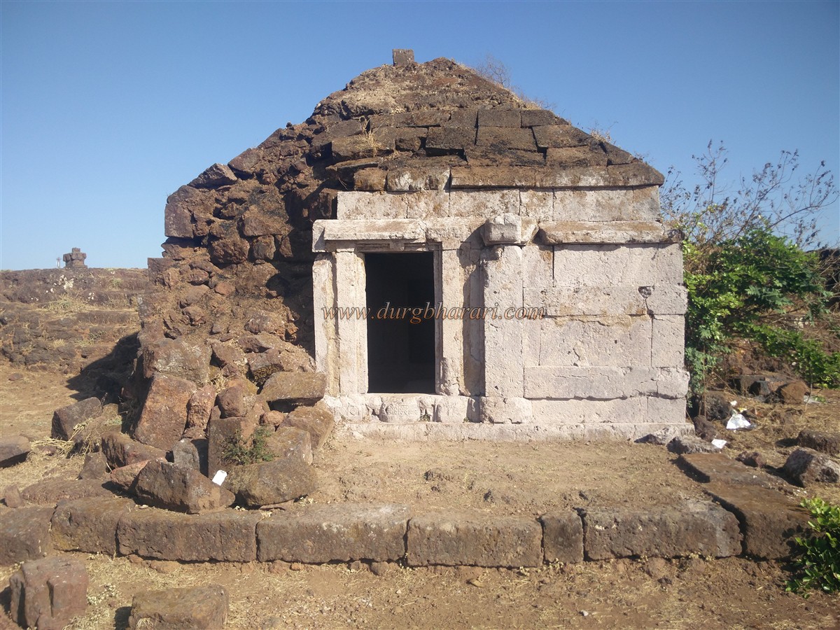
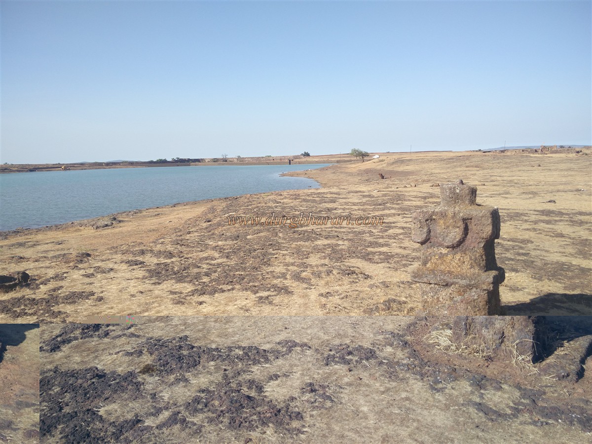
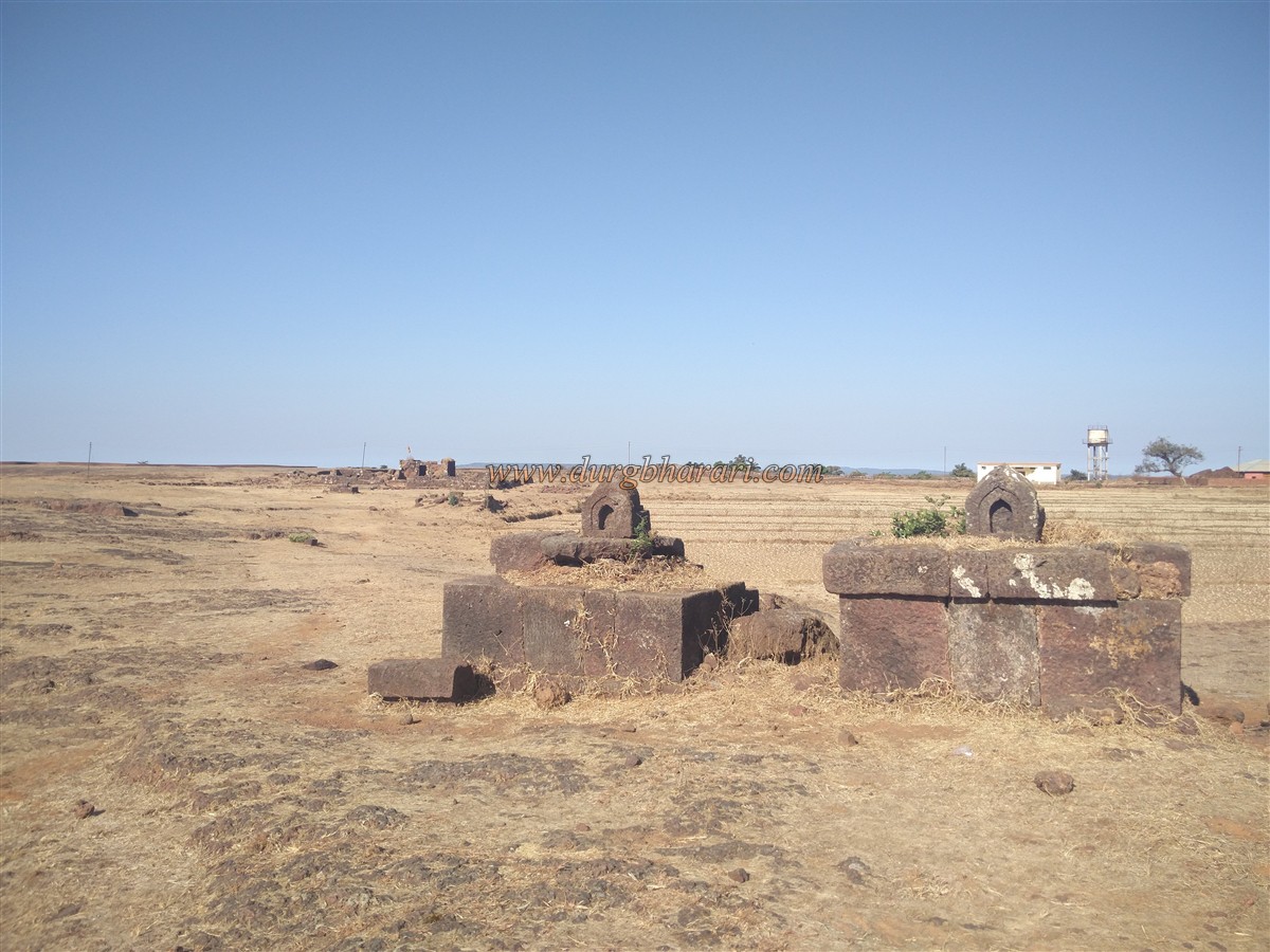
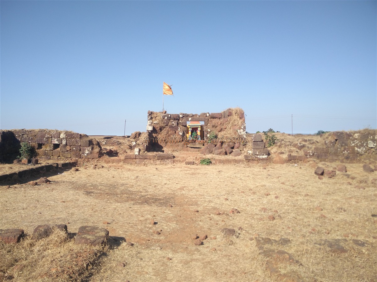
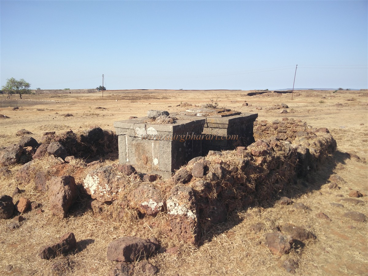
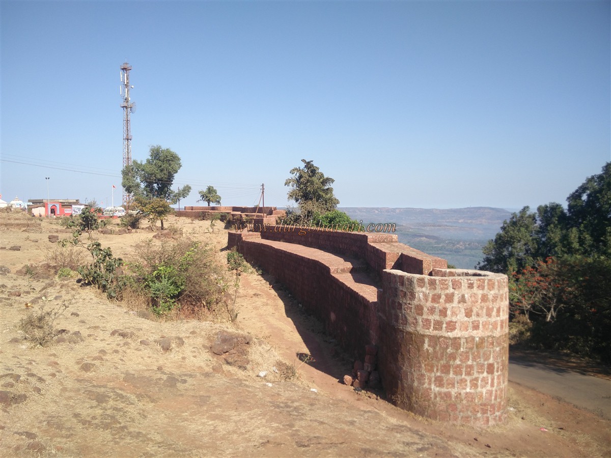
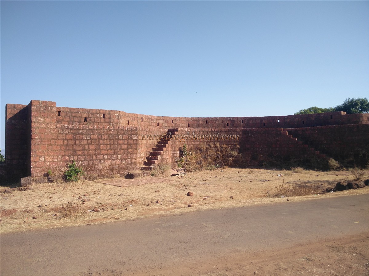
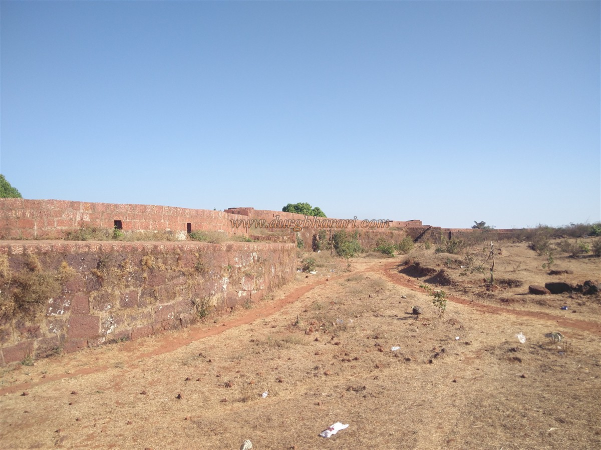
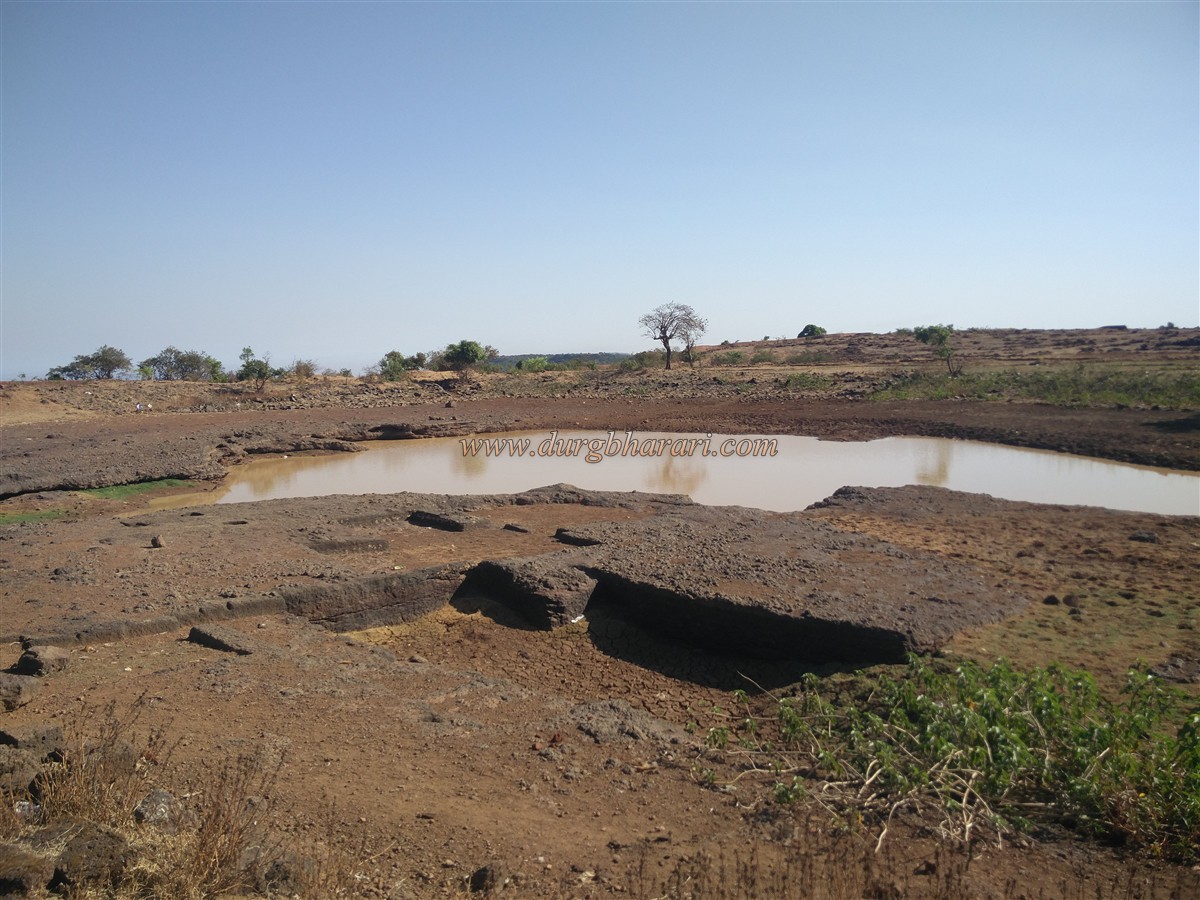
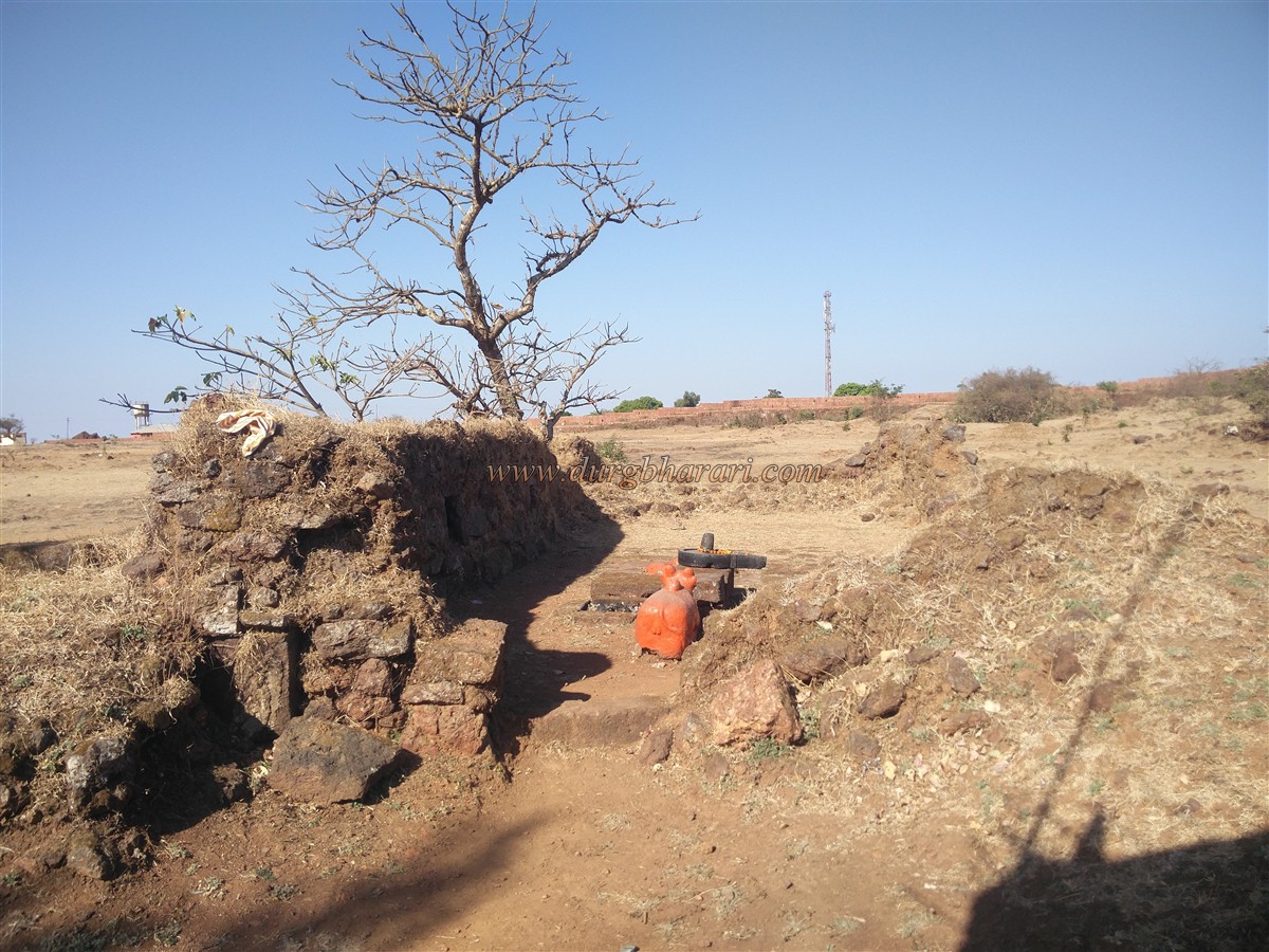
There is an old Shiva temple on the way. You can reach the fort directly by private vehicle, otherwise, you can reach Peth Shivapur by availing the S.T bus service and from there you will reach the fort in half an hour. Our journey starts by visiting the Bhairavnath temple. The building style of Bhairavnath temple is slightly different and is influenced by the architectural style of the temples in Goa. The temple is still in good condition and devotees from the area are constantly visiting this place. There is a wall around the temple and Ganesha sculpture is carved on the entrance of the wall. The temple is built of stone and its hall is weighed on five arches. There is an armed idol of Bhairavnath in the sanctum sanctorum of the temple. There are two lampposts one in the precincts and the other near the fortified bastion. The saffron flag is hoisted on this bastion and the only cannon on the fort which is 6 feet long is placed here. To the right of the temple is a Samadhi on a quadrangle structure and at some distance from this structure, there are small lampposts on two sides. Next to it is a ruined structure with just a wall remaining. After seeing these quadrangle structures, come back to the temple and start your fort round by climbing on the rampart next to the cannon. The height of the wall is about 10-12 feet and the curtain walls are 4-6 feet wide. The ramparts have recently been repaired and rebuilt on the site of the collapse. The entire fort has covered with trees and bushes due to afforestation on all sides of the fort. As the area of the fort is randomly spread, you have to walk from the curtain wall to see the structures and remain properly. See the remains and climb back to the top. This allows you to see the entire fort in 4-5 hours. There are more than 30 places with steps to climb on the rampart. The two protrusions of the fort face west. At the beginning of our fort round, we first come to the first western part of the fort. There is a strong bastion built on this trunk and a small arched door is built on the occasional exit from the fortified ramparts near this bastion. Currently, the door is closed with an iron gate. As you walk along the ramparts, except for the two main gates, you will see a total of seven gates through which the ramparts can be reached. On the way from the first bastion to the second bastion, you can see two restrooms in the ramparts. On the western side of the fort, two strong bastions are built side by side on this trunk. The lower part of the bastion has been given more protection by building a double rampart. The entrance to the fort from the east may have been closed at a later time. In front of these bastions are the remains of a large number of outposts. Another small hexagonal door can be seen in this rampart. Going further from the ramparts, on the left side, you can see the quadrangle structure of a big mansion. In the next part of the fort, agriculture is practiced on a large scale and also there are a lot of remains of houses here. A sculpture of an unknown deity has been erected on a quadrangle structure near the remains of the houses. Two barns and a restroom have been built in the fortifications here. Next, you see two mines dug to remove stones for construction of the fort. Going further from here, in some places, the structures appear to have turned into mounds of mud. Seeing all this, we come to the eastern part of the fort. There is a 10x10 feet cave carved under the ground over here. There is a worn-out Nandi outside the cave and after going down a few steps you can see 5-6 carved idols. One of these idols is worshiped by the villagers as Jakhmata. The east-facing gate and ramparts of this southeastern part of the fort have been destroyed today and only a quarter of the gate remains in the trees. From here a dirt road comes to the fort and a small part of the ramparts which were remaining has been broken down for the construction of this road. Going 60-70 feet down this dirt road, on the left side is a cave of size 10x10 feet carved in a large rock. The locals call this rock Pokhardhonda. Turn back from here and start your next fort round. There are some architectural remains built in a straight line and two stone temples can be seen near the lake in front. One of these temples has a Shivling and the other is empty. Adjacent to this temple, there are two more quadrangle structures. A long stone wall has been built on the bank of the lake to block the flow of water. The area of the lake is 25 acres and no other hill fort has such a big lake on it. This lake is known as Dudhi Lake as the water of this lake is milky in color but this milky water should only exist in the rainy season as the water was clear during our visit to the fort in March. After seeing the lake, come back to the shore and start your next fort round. There is a stone wall with steps 10 feet wide and 30-32 feet long near the ramparts. The exact purpose of this wall is not known but the entire fort area can be seen from this wall. Remains of a large number of houses can be seen in the next part of the wall. This place should be the main settlement of the fort. At this place, you can see the Shiva temple built on a tall quadrangle structure. Apart from this, there are water cisterns carved in the rock and there is a deep well of rectangular shape. After walking around the settlement and going in the direction of the ramparts, you can see a small, partially closed door in the ramparts. After seeing the door, we reach the armored bastion at the south end of the fort. There are two gates on either side to go to the ramparts outside this bastion. The bastion has a barrage for firing guns. The entire bastions are still in its original state. Remains of some outposts can be seen in front of the bastion. After walking for about 5 minutes from the bastion, you can see another small lake on the left. The area around the lake is heavily cultivated and there are four water cisterns carved in the rock on the banks of the lake. There are remnants of some houses near these cisterns and Shivling and Nandi are placed on the opening of one of these ruined structures. A new Samadhi has been erected here. Next, come back to the ramparts and move on. A beautiful view of Peth Shivapur village at the foot of the fort can be seen from here. The river plains of Dudhganga and Vedganga rivers are visible in the distance in the north. The fort is 3190 feet above sea level. Another small gate can be seen in the ramparts of this place. Coming straight from the ramparts, we reach the entrance by car. The gate of the fort at this place has been destroyed and there are no remains of it. On the way to Bhairavnath temple, on the right side, you can see the remains of a mansion. From here a dirt road leads to the lake on the left. At the beginning of this road, on the right-hand side, there are the remains of a large building. Adjacent to this is a Shiva temple and there are some relics in the temple premises. This temple has been renovated by Karveerkar Chhatrapati. This temple has a bust of Shivaji Maharaj established by Bhalji Pendharkar in 1945. After seeing the temple, we go straight to the road and reach the wall of the lake. Now turn left and take a walk on this side of the lake. At the beginning of the road, there are two samadhi’s built of stone in a ruined structure. From here we come to a ruined temple. There is an idol of Ambamata in the sanctum sanctorum of the temple and the remains of the temple prove how magnificent the former temple must be. There are some carved stones in front of the temple and at a distance, there is a broken Samadhi on a quadrangle structure. If you keep on proceeding on this route, you will find that there are many samadhi’s en route. Going further from here, one can see a temple on the bank of the lake. The sanctum sanctorum of this temple is carved in stone and the outer hall is built of wrought stone. The temple consists of some carved idols. Since there is a lake in front of the temple, water must accumulate here during the rainy season. Therefore, a stone lamp carved in the temple is placed on the hummock behind the temple. This is where your fort round ends. If you want to stay at the fort, you can do so at Bhairav Mandir or Shiva Mandir. Every year in the month of Magh, a big procession takes place on the fort from Krishna Pratipada to Dashmi. Avoid visiting the fort at this time as it is crowded when the procession takes place. In 1187, Vikramaditya Raja Bhoj (II) brought the capital of the Shilahar dynasty from Valva to Panhala. Bhudargad should be one of the forts built by Raja Bhoj in the South of Maharashtra. After the fall of Shilahar, King Singhan of the Yadav dynasty established his rule over Karveer province in 1209 AD. Firstly, the fort was under Devgiri rule, then it fell into the hands of Bahamani then Adilshahi took it over. The fort first came under Swarajya in 1667 but soon Adilshahi took it over. In 1672, Shivaji Maharaj recaptured the fort. At this time, Maharaj rebuilt the fort and made it a strong military outpost. Adilshahi Sardar was killed in the battle of capturing the fort and their flags fell into the hands of the Marathas. These flags were kept in the Bhairavnath temple and are said to be there even today. (I did not get to see those flags.) Chhatrapati Rajaram Maharaj on his way back from Jinji stayed at this fort. In the late eighteenth century, Parashurambhau Patwardhan conquered the fort by capturing the platoons on the fort. After 10 years, this fort was conquered by Karveerkar Chhatrapati. Parshurambhau Patwardhan and Ichalkaranjikar Gopalpant Apte could not capture the fort even after their tremendous efforts. Samangad and Bhudargad were the prominent forts during the revolt against the British in Kolhapur in 1844. At that time Babaji Ahirekar was the fort keeper and he was accompanied by Subhana Nikam along with 300 soldiers. To defeat them, General Dilamoti attacked the fort. The main gate of the fort and some parts of the ramparts were destroyed by the cannons fired by the British at this time. On 13th October 1844, the British army took complete control of Bhudargad. The fortifications of the fort were demolished by the British to prevent the revolt.
© Suresh Nimbalkar
GALLERY