BHORGIRI
TYPE : HILL FORT
DISTRICT : PUNE
HEIGHT : 2510 FEET
GRADE : EASY
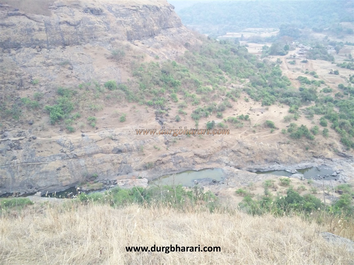
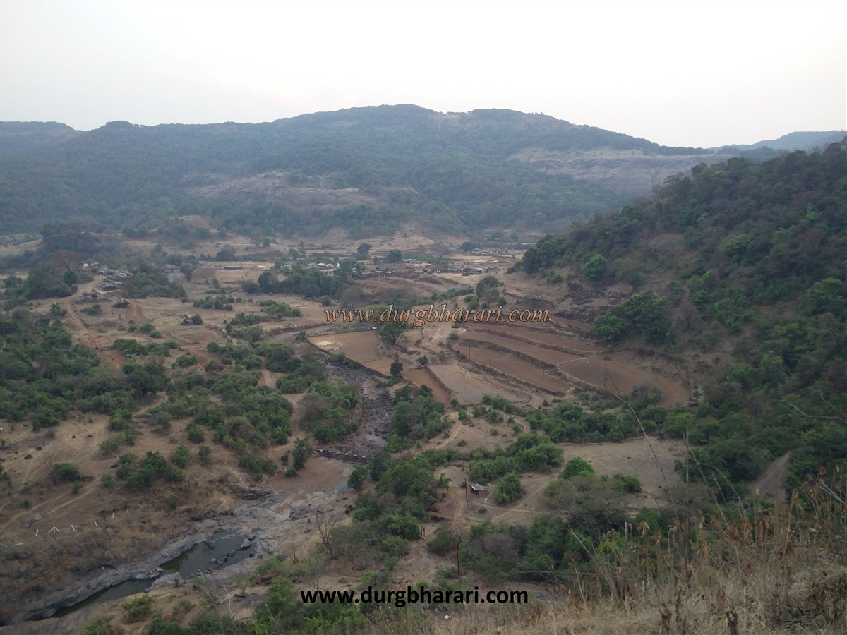
The river Bhima originates in the Bhimashankar range in the Sahyadri and flows to Rajgurunagar, fertilizing the land at the foot of the range. Bhanwargiri aka Bhorgiri is a small fort situated in this valley of the river Bhima. Bhorgiri - Bhimashankar - Khands was an ancient trade route. At that time some goods landing at Kalyan port used to reach Khed Rajgurunagar on this route. At the foothills of Bhimashankar, two ancient forts, Padargad on the Konkan side and Bhoragiri on the wharf side were built to protect the road. Bhorgiri village at the foot of the fort can be reached from Rajgurunagar taluka in Pune district. Rajgurunagar is 10 km from Chakan on Pune-Nashik road. The distance from Rajgurunagar to Bhorgiri is about 50 km. At Rajgurunagar turn left and the road from Chaskaman and Wada village leads to Bhorgiri village.
...
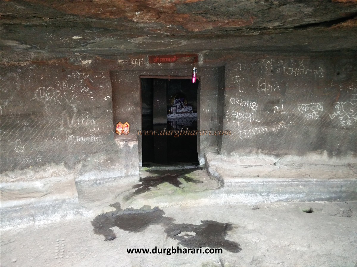
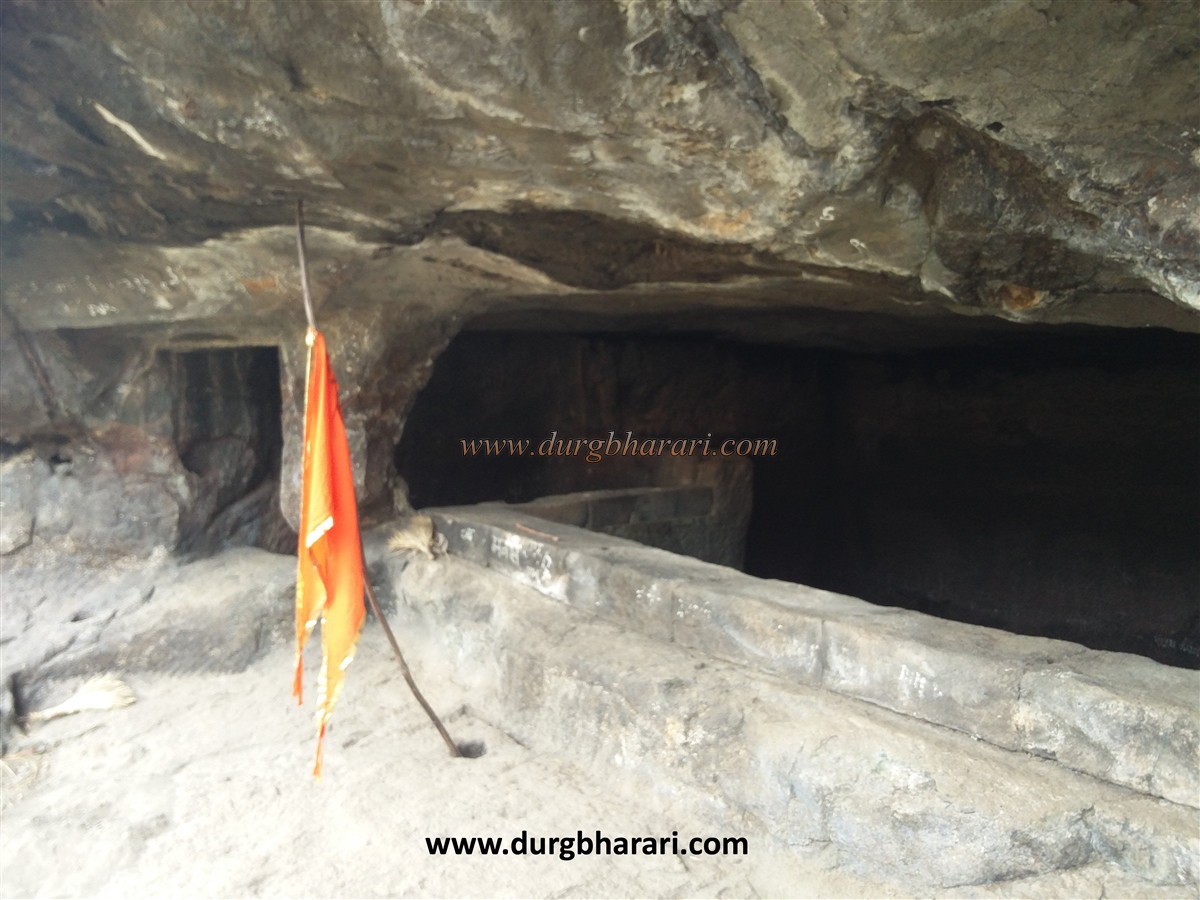
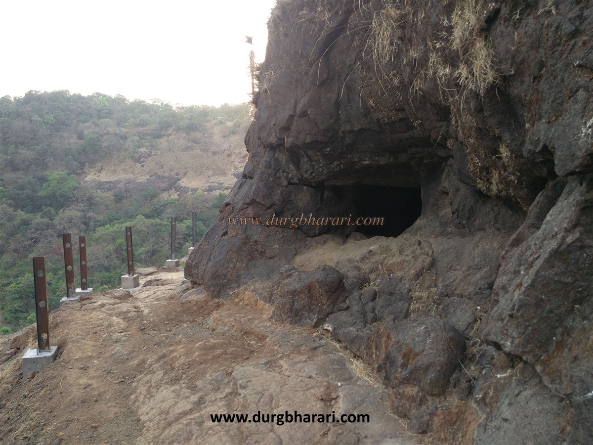
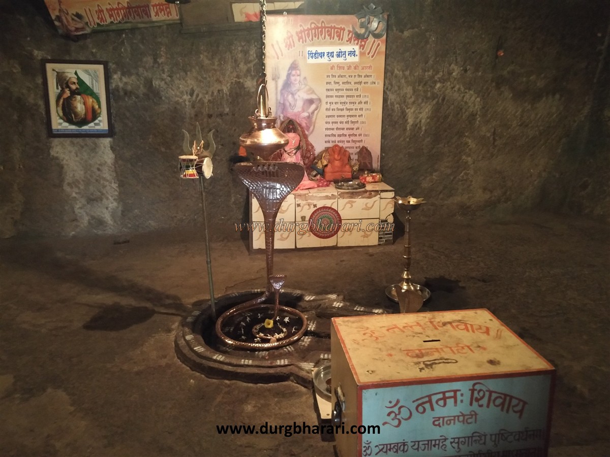
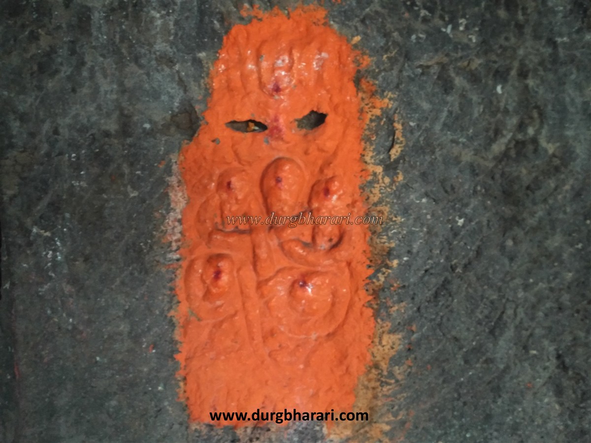
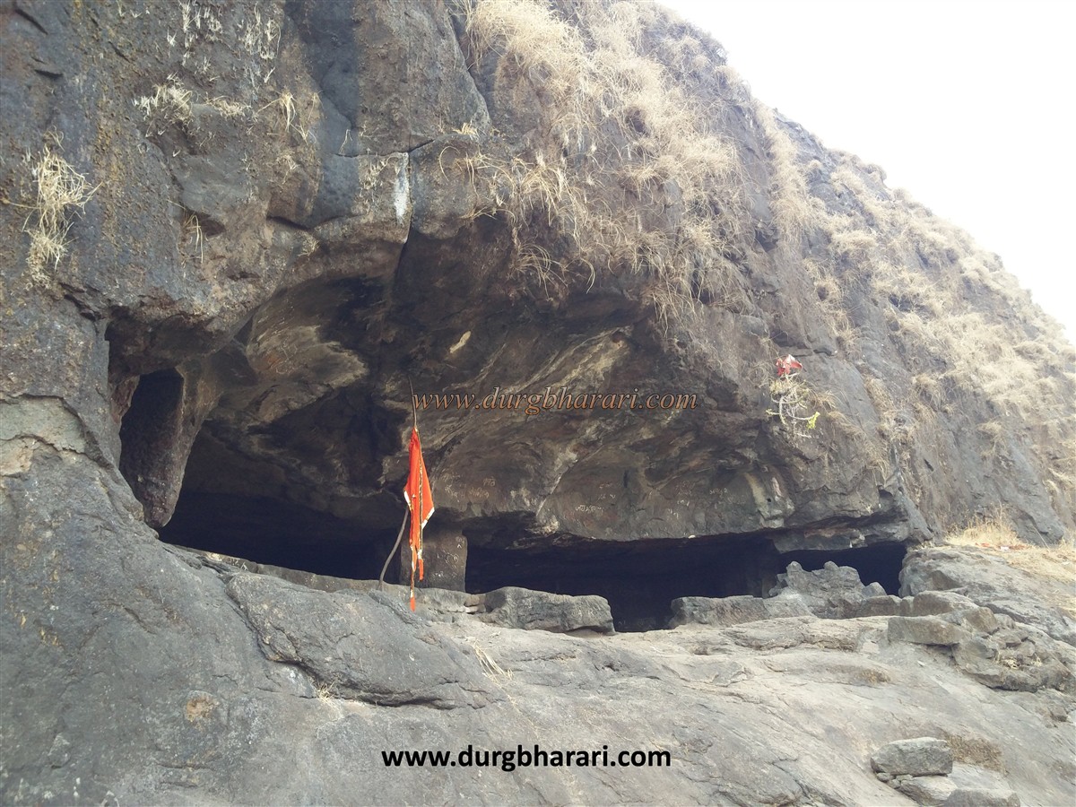
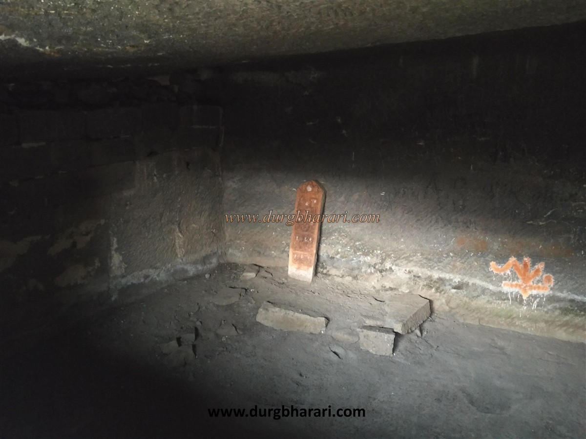
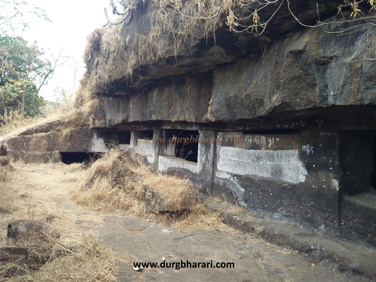
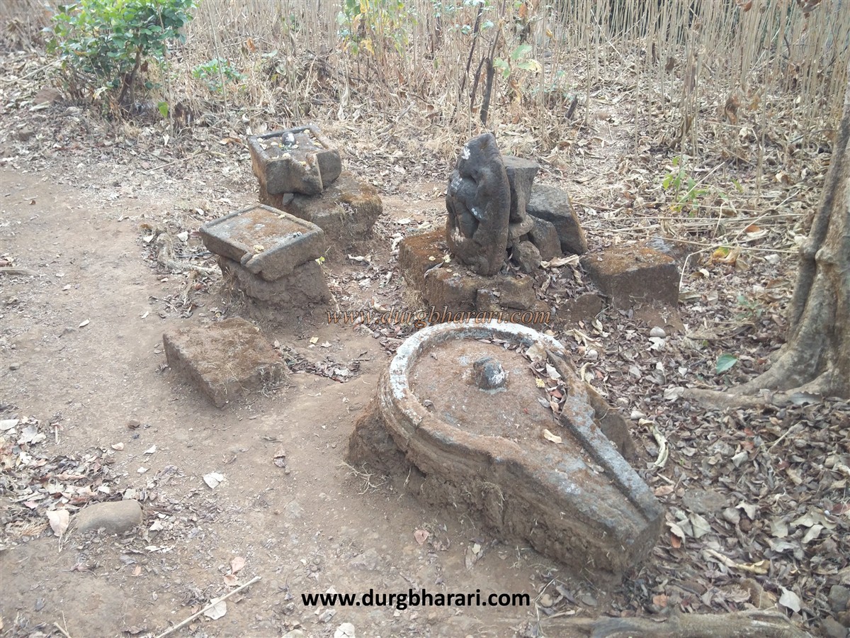
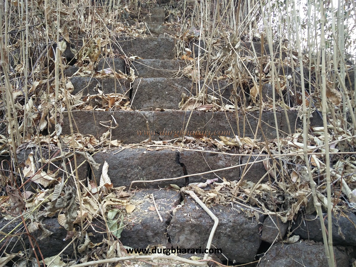
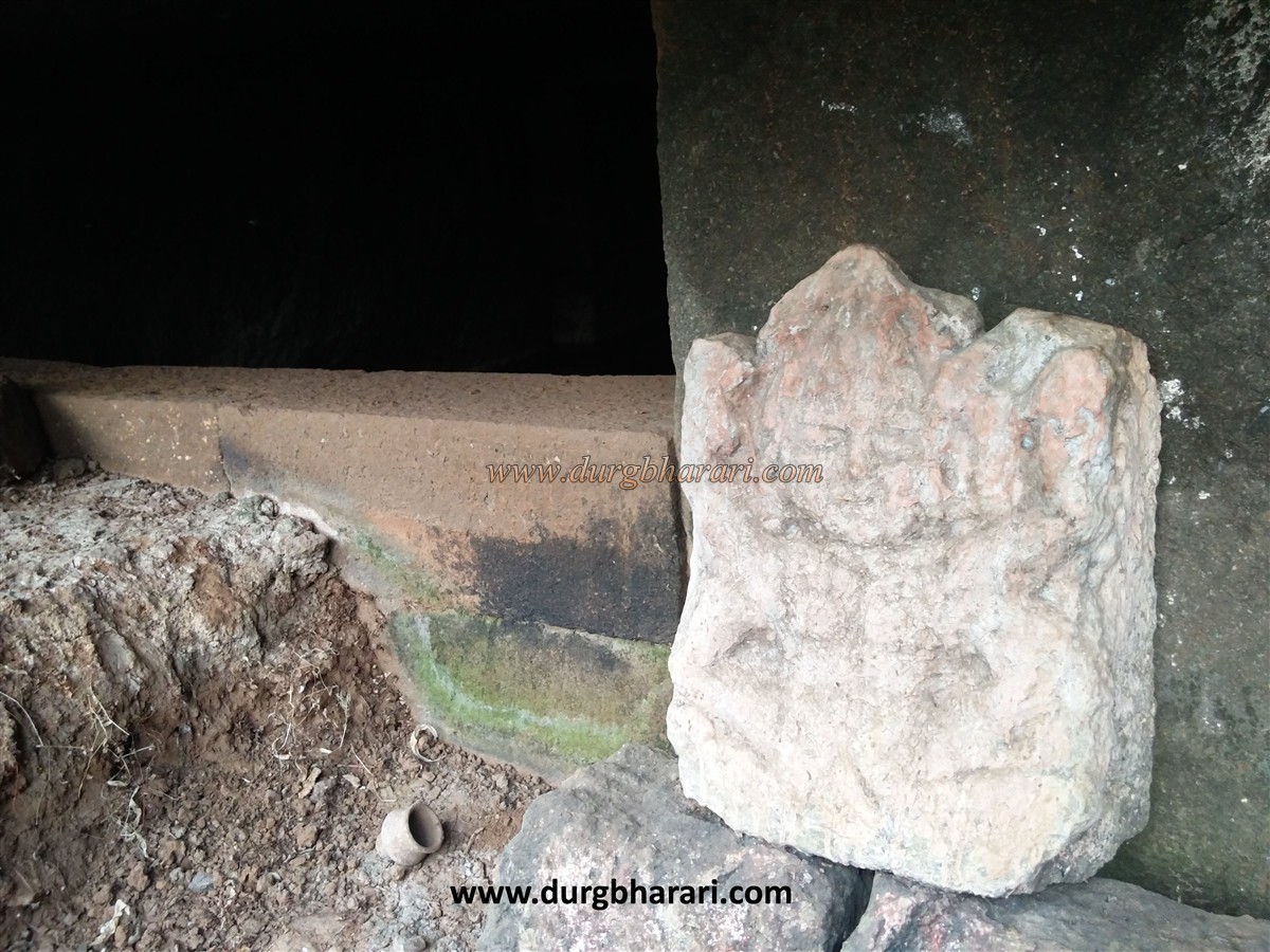
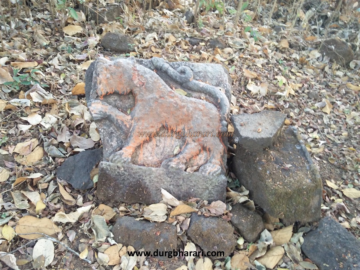
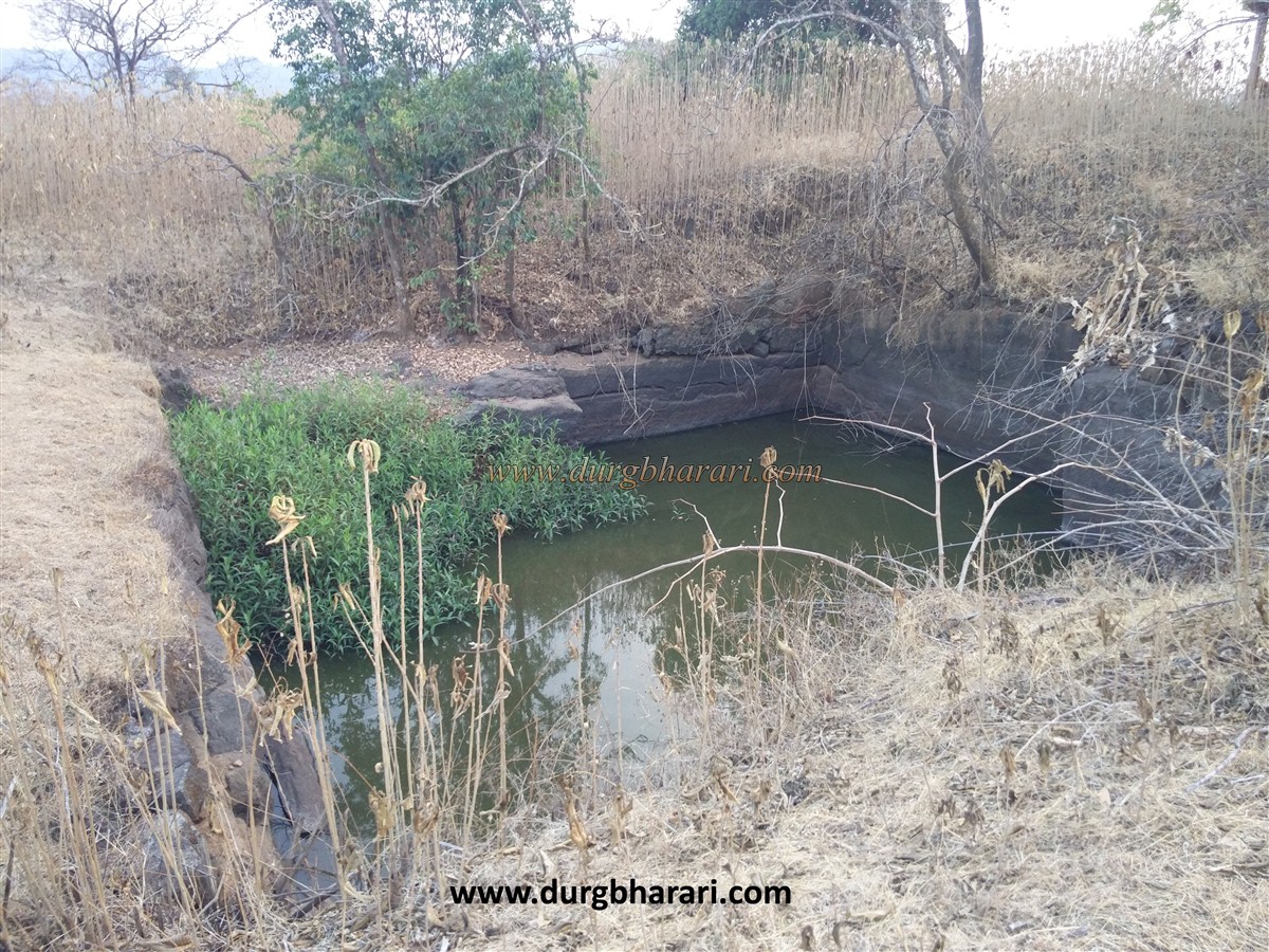
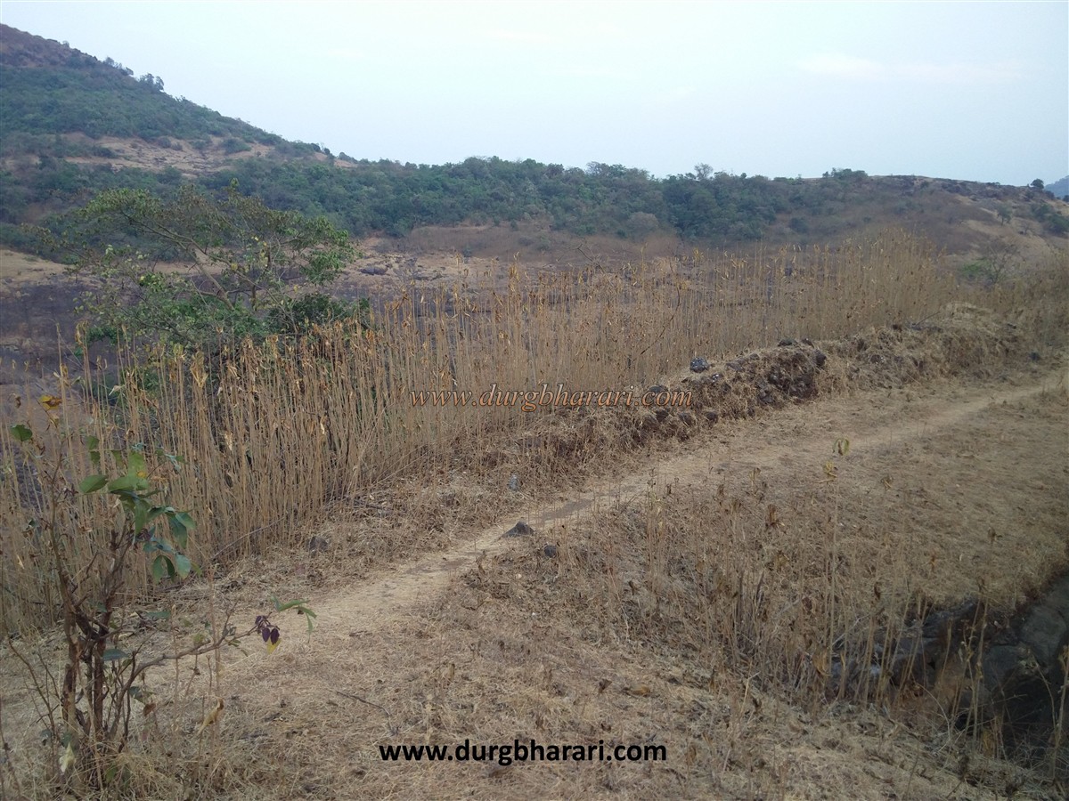
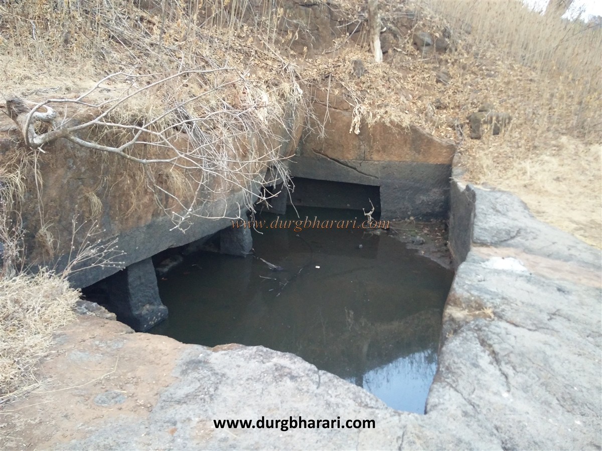
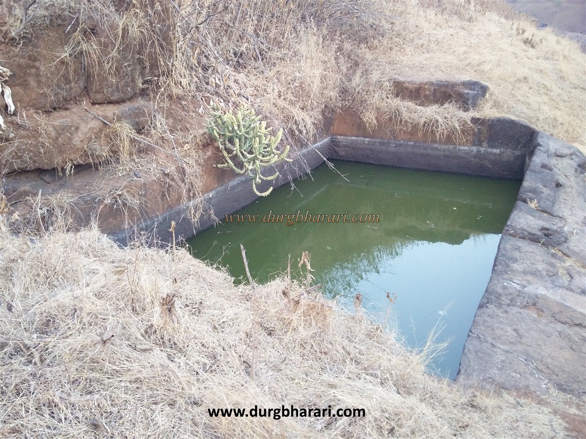
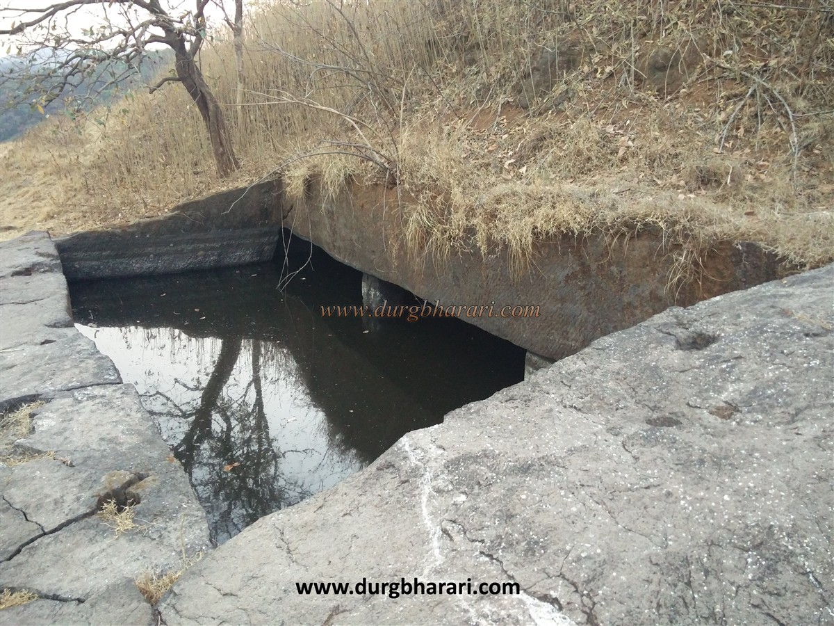
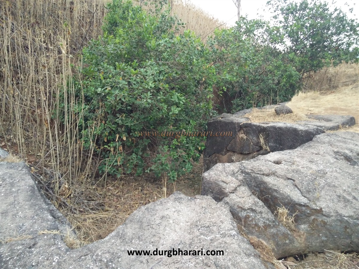
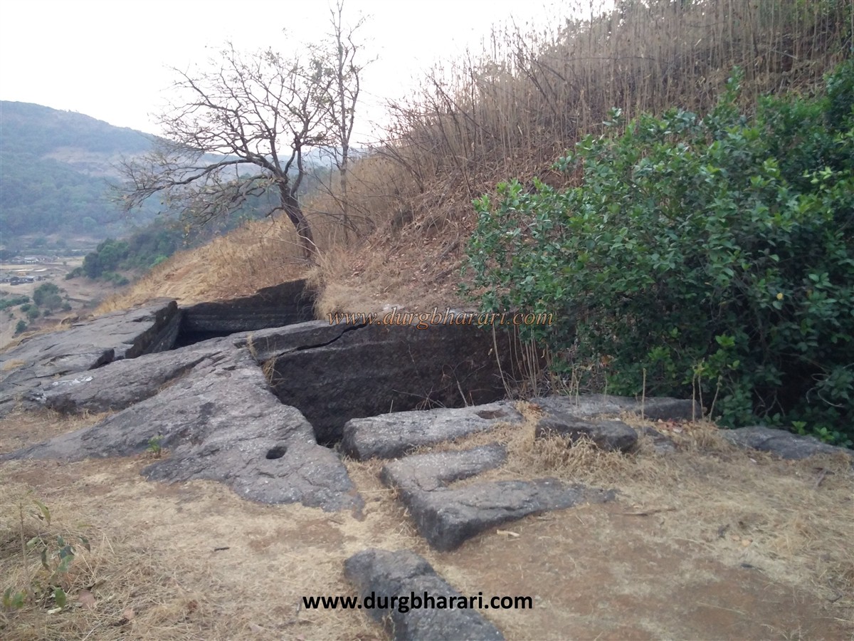
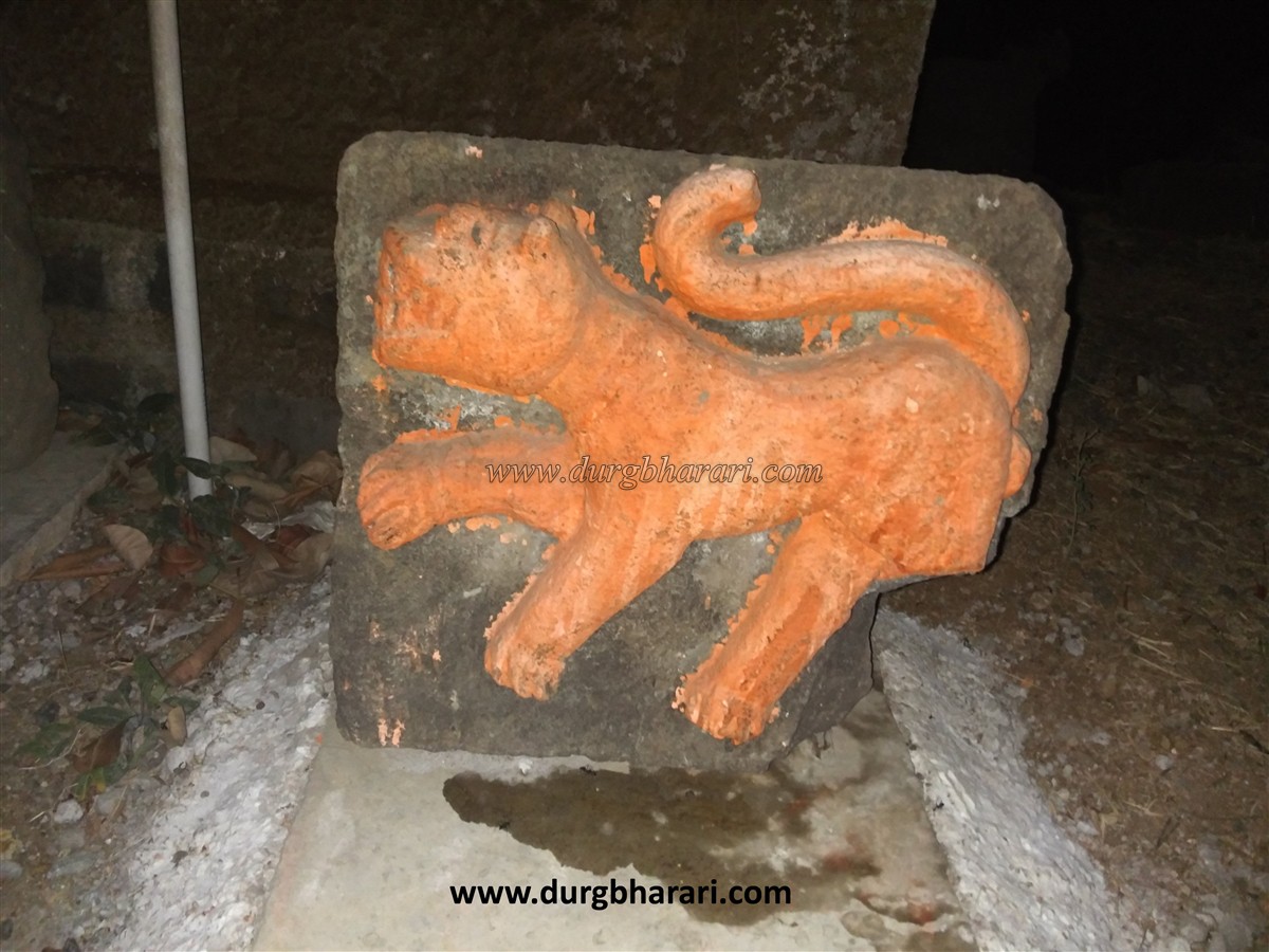
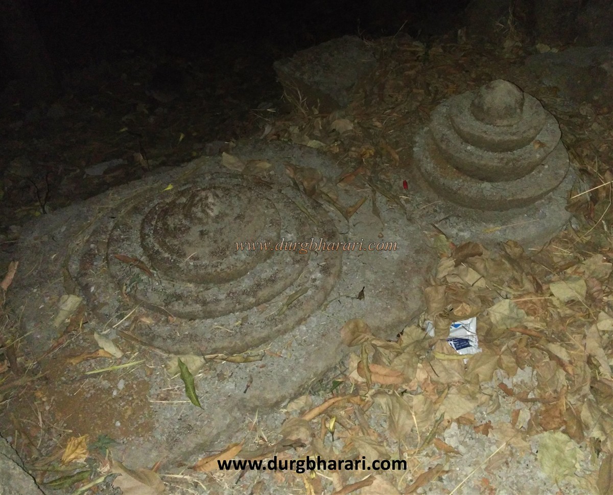
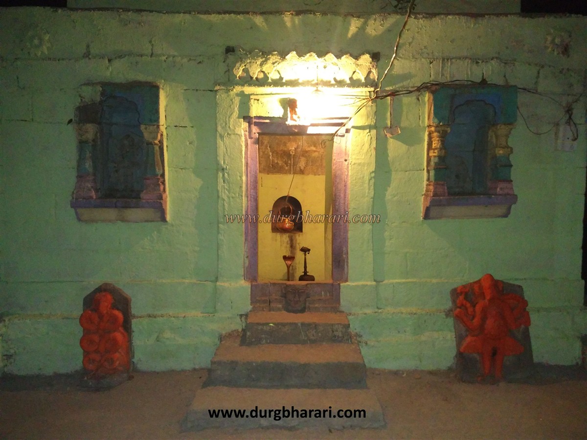
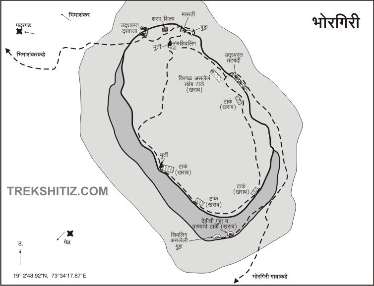
Bhimashankar is only six kilometers on foot from here. Bhorgiri is a small village at the foothills of two forts. The small Bhorgiri fort on the hill on the right side of the village is easily visible due to the cave carved in the rock on the fort and the saffron flag. As you enter the village, you can see the newly built Koteshwar temple on the banks of the river Bhima, maintaining the original sanctum sanctorum. There are many carved stones scattered in the temple premises. It shows the pillars of the temple, the Kirtimukh, the hero stones, the interior of the dome as well as the two sculptures. Nearby there is a carved sculpture of man and tiger fighting. The grandeur of the temple can be imagined from these scattered remains. One of the 12 Shiv temples built by the Shilahar dynasty Jhanjharaja in the 9th-10th century is the Kotishwar temple at Bhorgiri aka Bhavargiri village. There is a Shivling in the temple and outside the temple, there is a unique sculpture of Lord Ganesha. At the waist of this idol, which is about one and a half feet high, is carved like a girl's skirt. This idol of Ganesha has an ax in his right hand and the trunk of Ganesha is resting on fruit in his left hand. Since the electricity is taken from the village in the cave on the fort, the way to the fort is easily known based on this electricity pole. In half an hour from the village, we reach the base of the fort. The forest department has built a shelter at the base and the way to the fort has been dug and widened. Work is underway to build steps and iron bars on this road. The winding path leads to the fort and we reach the first stage of the two caves below the fort. The overall excavations and interior of the cave look like it was built for Buddhist monks, but in later times it has been converted into a temple. The first cave is divided into two parts, the mandap, and the sanctum sanctorum, with dry water cisterns on either side of the mandap. The inner cave is weighed on four pillars and in recent times an idol of the goddess has been installed inside. Due to a large amount of leakage of water in this cave, it has been accumulated till the knee length. Currently, the same water is used for drinking. On the outside of the cave is shivling and Nandi next to the dry cistern on the left. Next to this cave is a semi-excavated cave and next to it is another cave. The cave is spacious and is a good place to stay on the fort. There is a Shivling in the sanctum sanctorum and a serpent sculpture is carved on the outer wall. After seeing the cave, turn back and start climbing the hill on the way. At the last stage of the road, there are some steps carved in the rock and from here you enter the fort through the collapsed ramparts. Bhorgiri fort is 2058 feet above sea level and this rectangular fort is spread over an area of 4 acres from south to north. It should be about 450 feet high from the base. Upon entering the fort, a large barn can be seen in front. The barn is divided into three sections, the front side and two water cisterns carved into the cave on the right and left sides. The cistern on the left side is dry and the cistern on the right has potable water. You should see this barn and start walking around the fort on the right side. At the beginning of the road, there are two quadrangle structures and a Shivling idol placed under a tree. One of the steps leading to the front of the idol is seen descending the valley. On the way down, you can see steps and two caves carved in the rock on the right. In one of these caves, water is stored and a sculpture is placed outside the cave. The second cave, however, is filled with a large amount of soil. After seeing these caves and coming back to the upper path, you will see another path going down to the left side where you can see the ruins of the ramparts and the entrance. Here you can see the sharabh sculptures at the entrance lies in the trees. The path leading down from the fort through this gate leads to Bhimashankar via Nigdale. From here, the path takes a detour to the entire fort and ends at the barn where you started. On this path, you can see a total of eleven water cisterns carved in the rock. Some of them are twin cisterns, seven have water in them and four cisterns are dry. A small Shivling is carved on the last cistern. On this road, you can see the fort's remaining ramparts and two bastions. The feature of these bastions is that both these are square-shaped. On the hill in the middle of the fort, there is a huge excavated cistern. The forest department has also built a shelter here. The Bhimashankar Sanctuary and the flow of the river Bhima can be seen from the fort. Due to the rapid flow of water in the bhima river during the monsoons, huge potholes have formed in this river. Looking at the overall size of the fort, it looks like a watchtower. Due to the small size of the fort, one hour is enough for the fort round. The history of the fort is unknown as it is not mentioned anywhere in the historical documents.
© Suresh Nimbalkar
GALLERY