BHARATGAD
TYPE : COASTAL FORT
DISTRICT : SINDHUDURG
HEIGHT : 210 FEET
GRADE : EASY
The river Gad, which originates near Bhairavgad in the Sahyadri range, is the Kalaval creek which joins the Arabian sea. Many small forts are built on the bank of this river from its source to its confluence. Bhairavgad, Songad, and Ramgad are forts near the source of the river, then on both sides of the Kalaval creek on a small hill Bharatgad and Bhagwantgad fort’s pair and at the confluence of the river, fort Sarjekot is built. This area has benefited from the abundance of nature and this enchanting area is a must-visit for Konkan explorers!! If you have a private vehicle with you while traveling in Konkan and you start early in the morning, you can easily see the four forts of Sarjekot, Bharatgad, Bhagwantgad, Ramgad in one day.
...
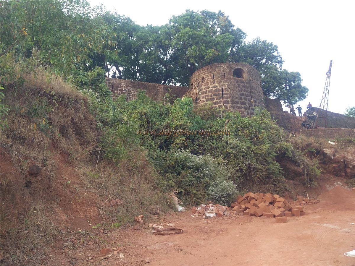
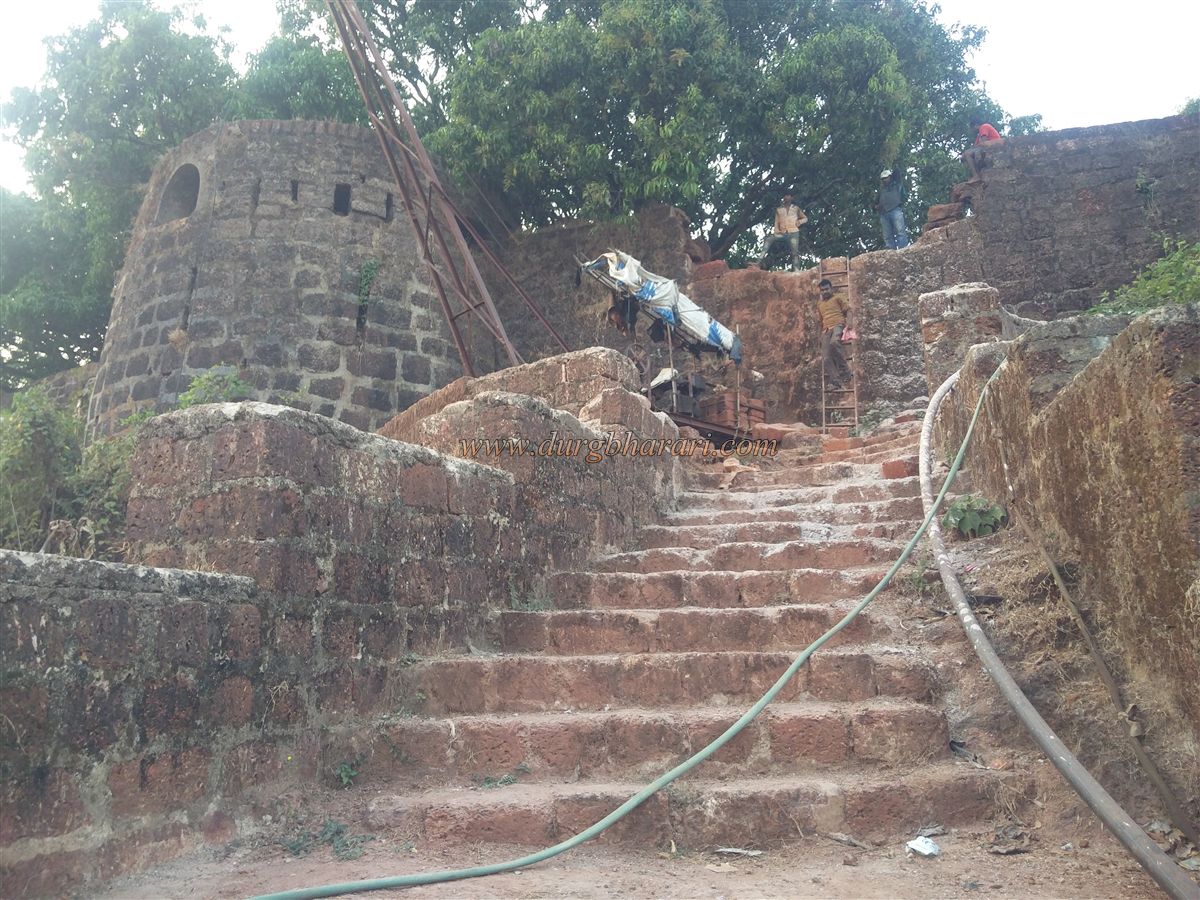
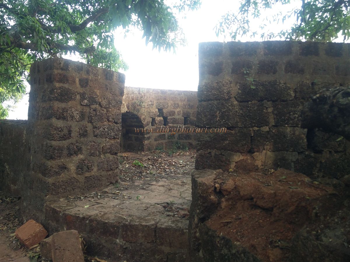
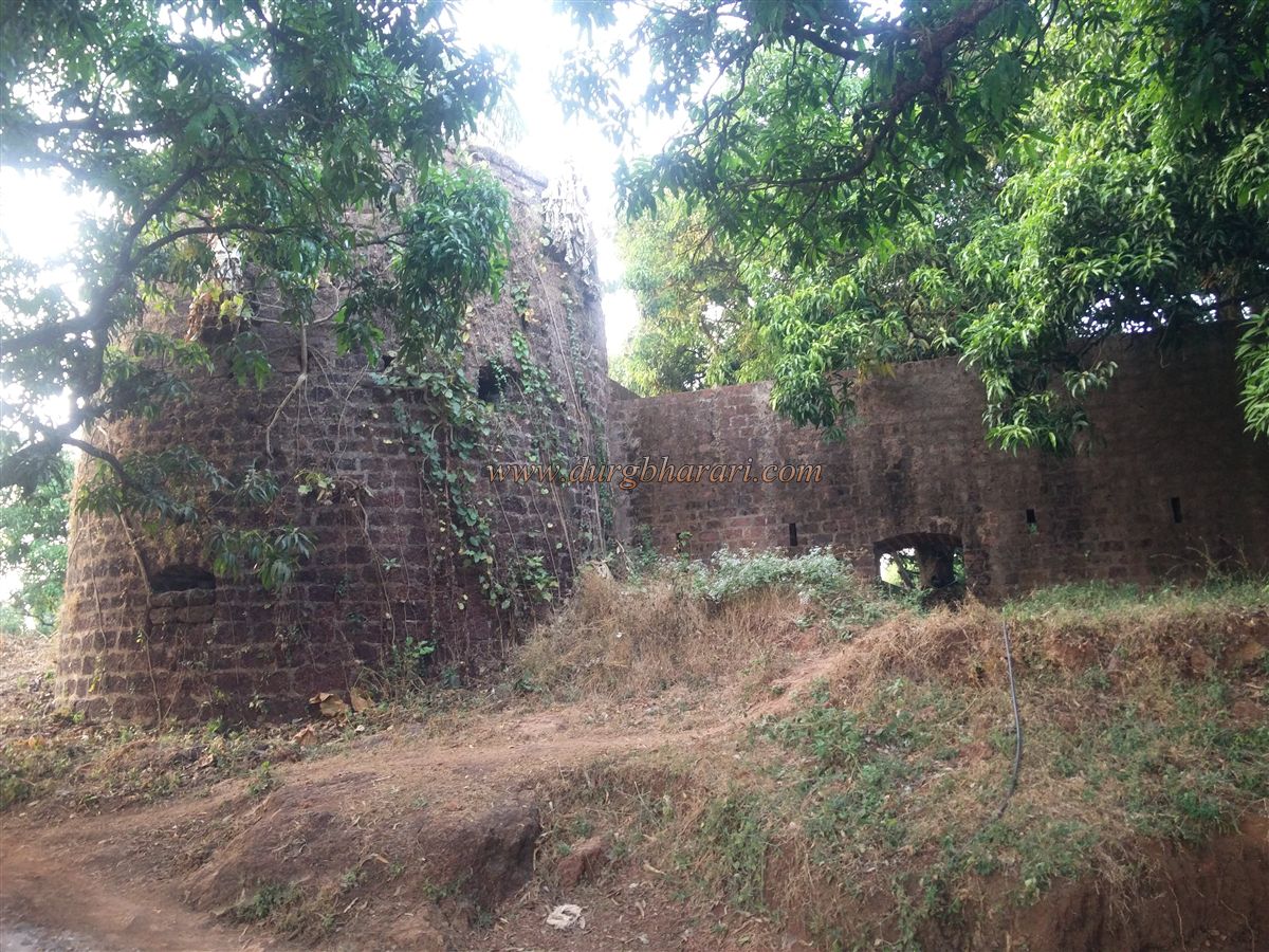
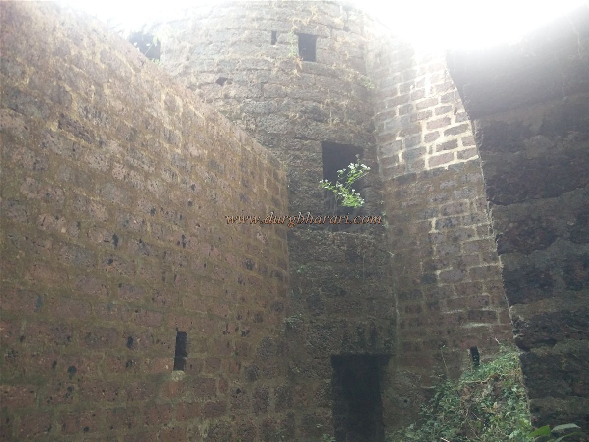
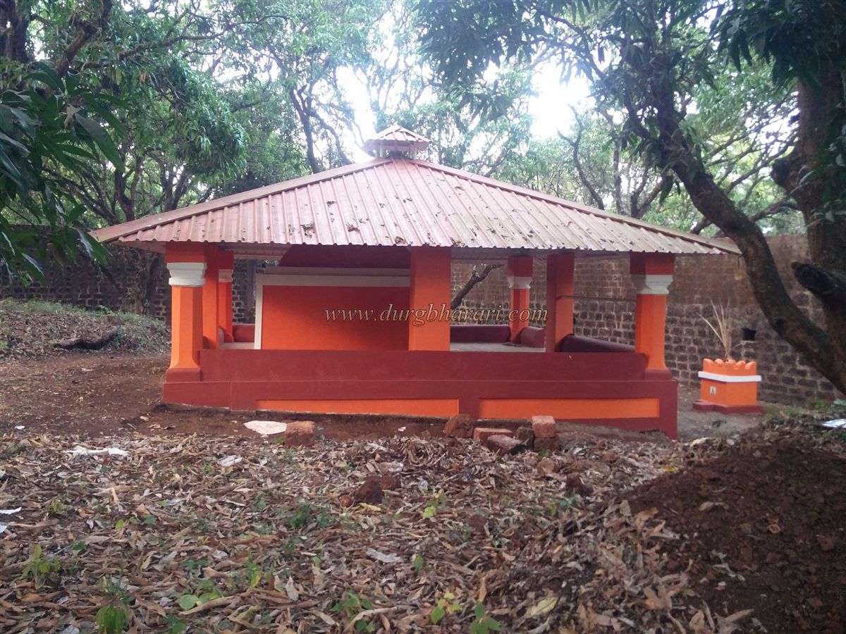
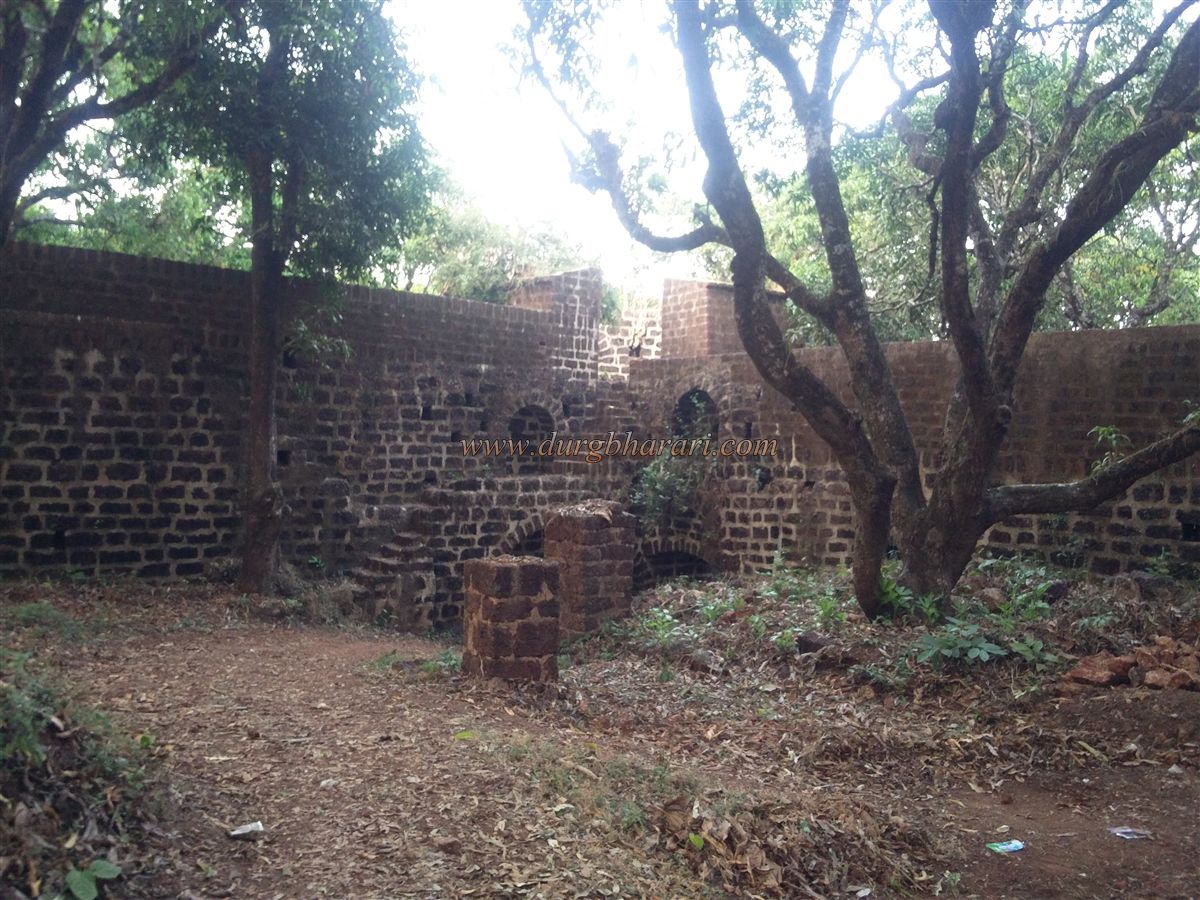
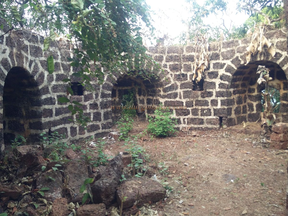
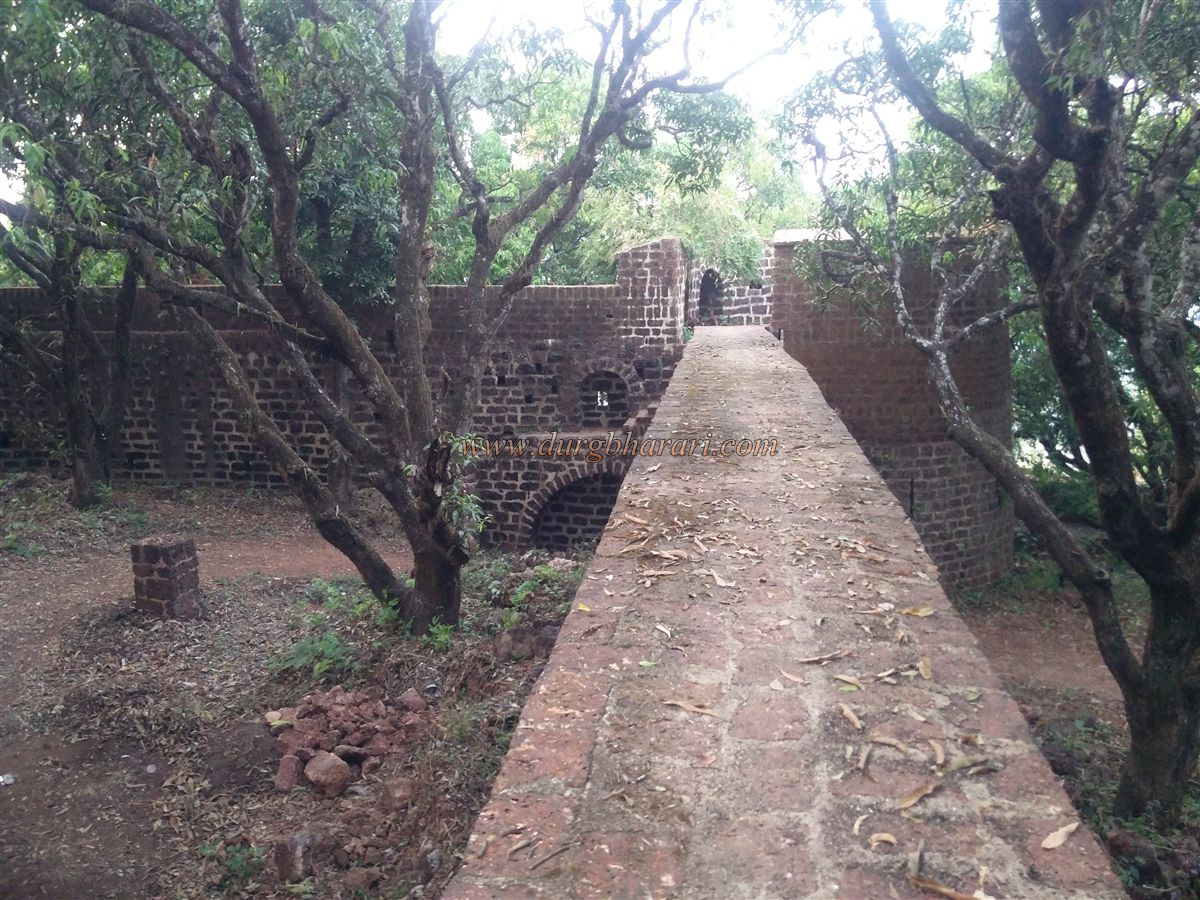
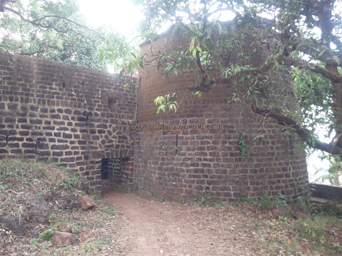
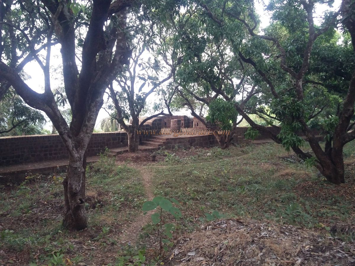
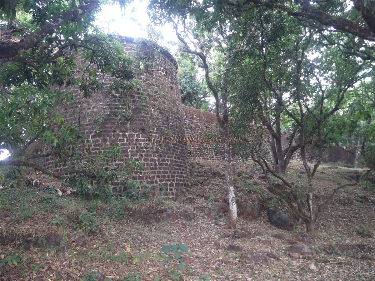
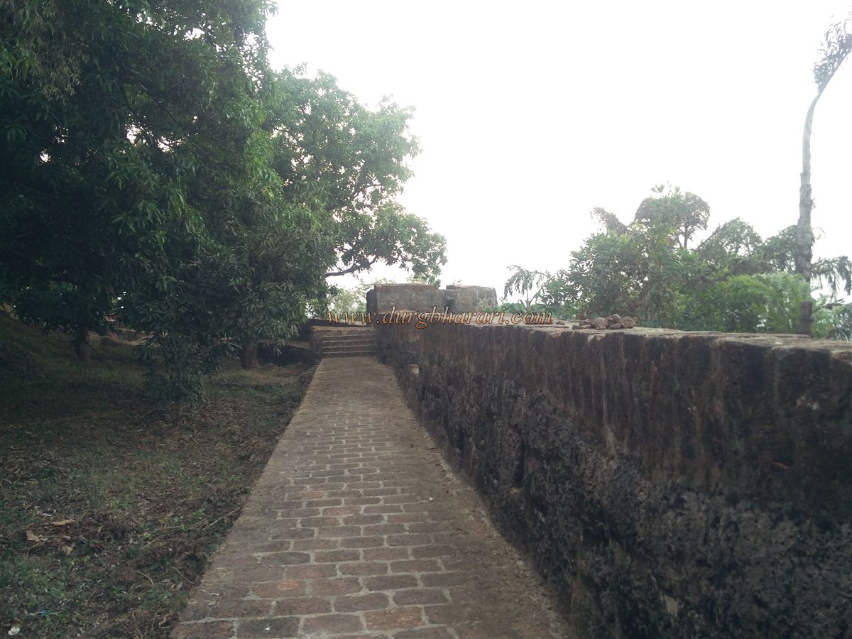
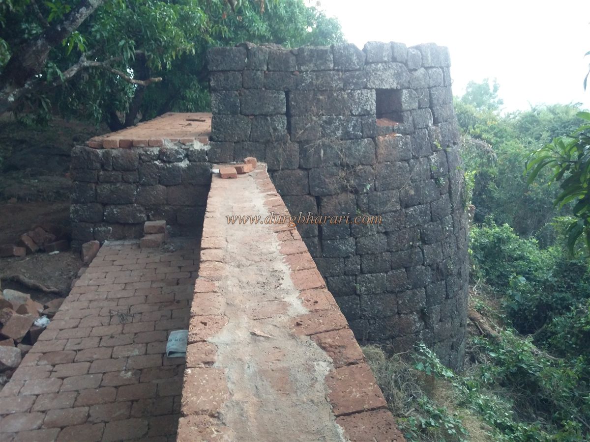
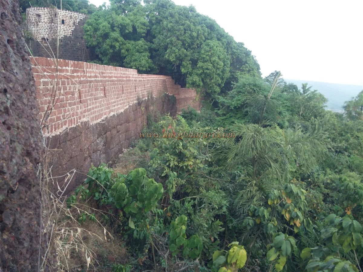
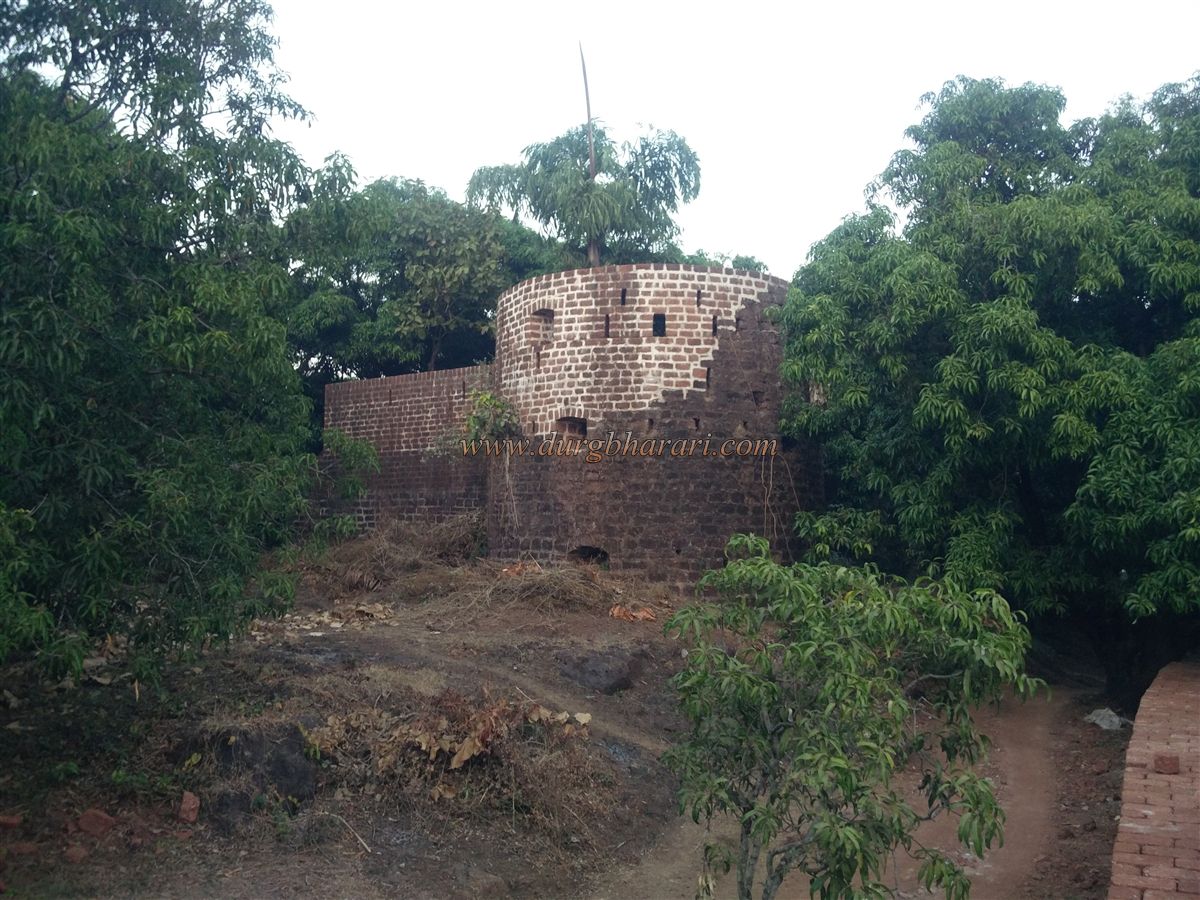
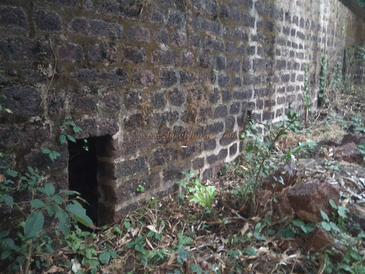
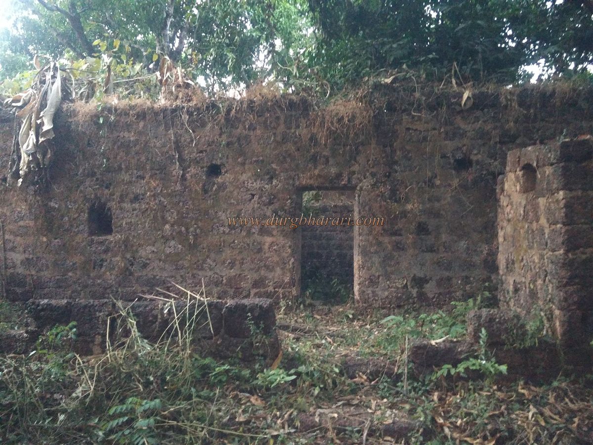
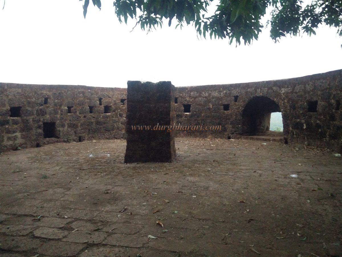
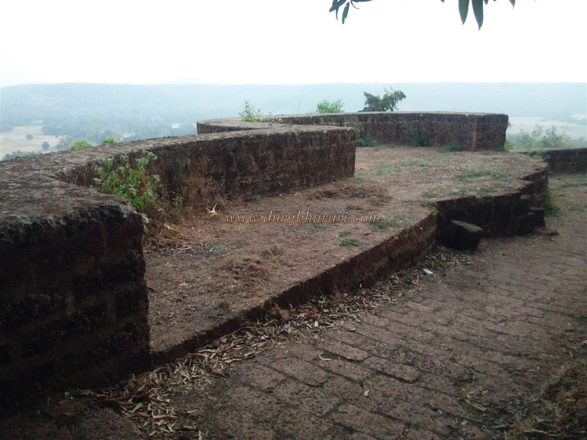
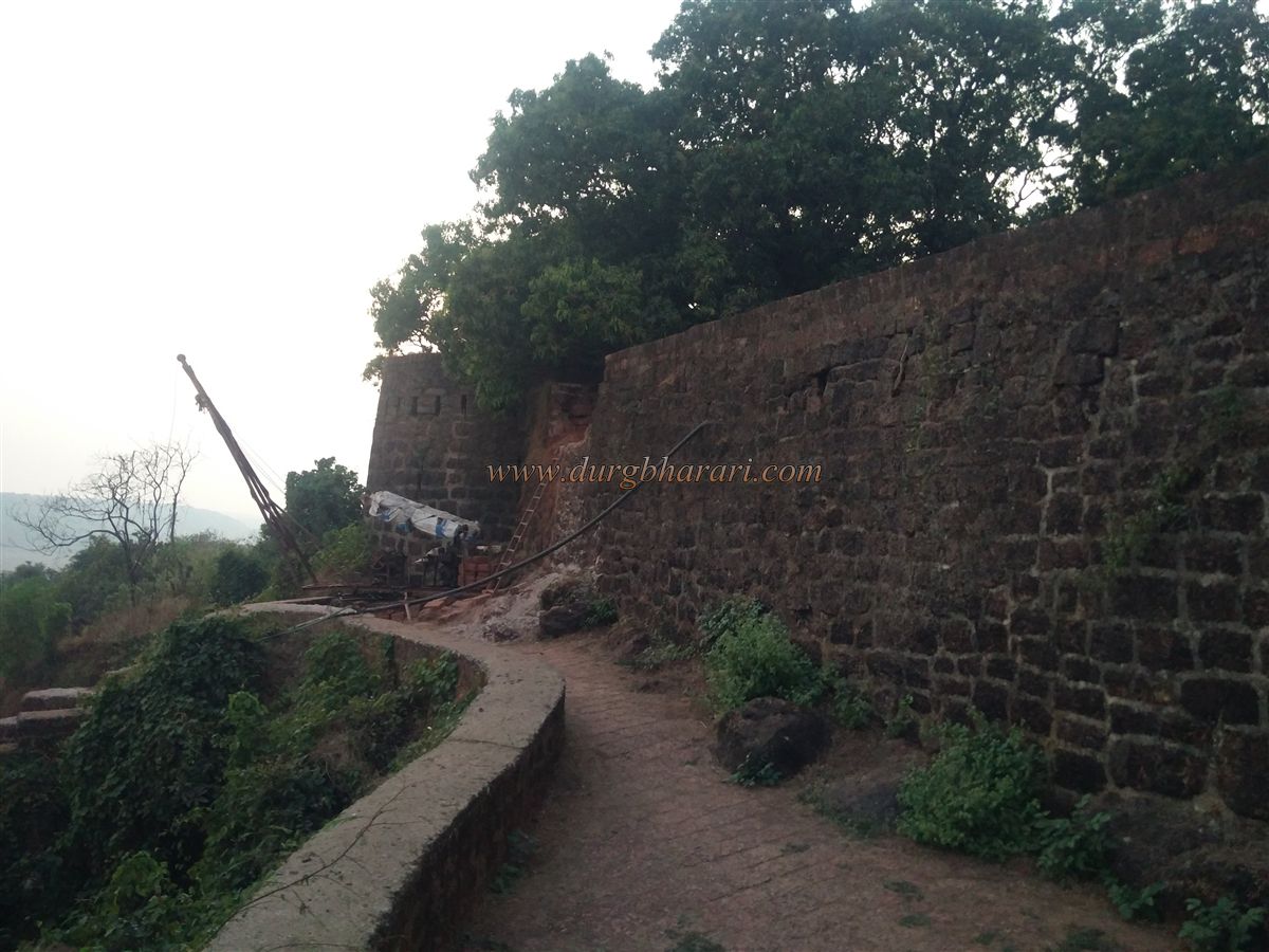
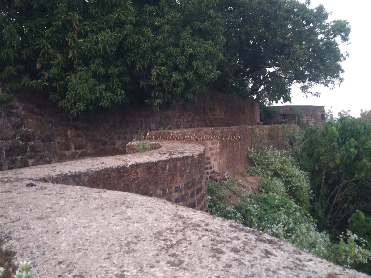
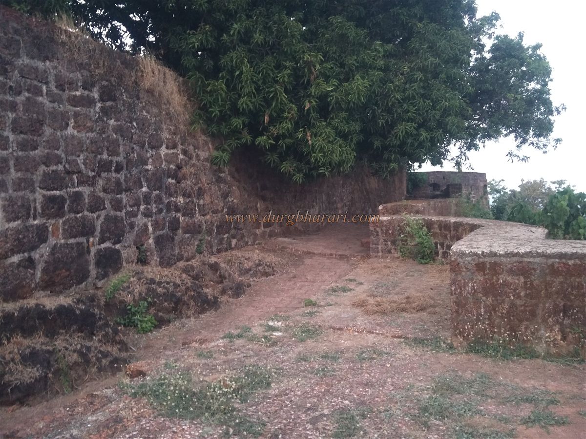
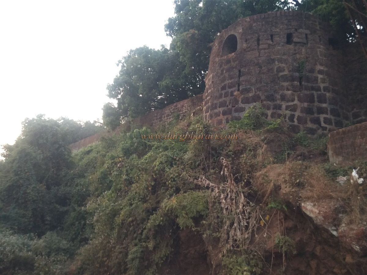
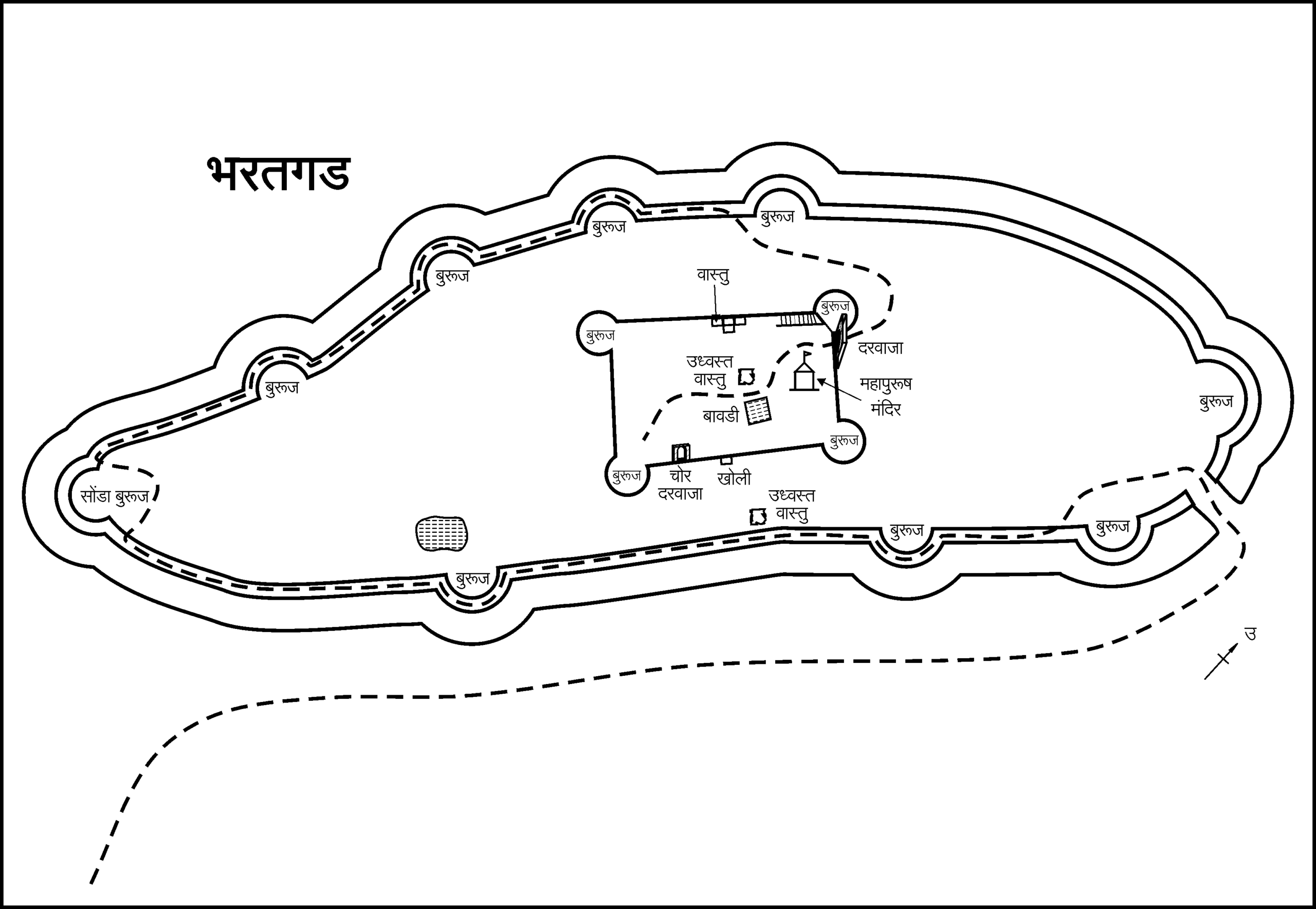
Masure is a foothill village to reach Bharatgad in Malvan taluka of Sindhudurg district and Malvan is the nearest town. The city of Malvan is 460 km from Mumbai. Masure village is at a distance of 20 km from Malvan. Masure village is at a distance of 35 km from Kankavali via Anganewadi. Bharatgad is situated on a small hill 215 feet high from east to west behind the village of Masure on the south bank of Kalaval Bay. On reaching the village, one can see the ramparts and bastions of Bharatgad on the hill behind the village. There is a path leading to the fort near the Pavanai temple in the village and steps are built in jambha stone on this path. In this way, we reach the destroyed east-facing gate of the fort in 10 minutes. If you have a vehicle with you, you can go directly to the door by vehicle. Although the gate of the fort has been destroyed, the adjoining bastions and ramparts remain. A 20 feet deep and 10 feet wide moat has been dug outside the ramparts of the fort and the stones from these moats have been used in the construction of the fort. Currently, the moat is overgrown with shrubs. After climbing a few steps through this door, the path turns right. There is a bastion built on the outer ramparts and a moat has been dug under it. There is a road leading to the north gate of the fort from the bank. This way we enter the fort near the large bastion at the north end through a north-facing the door. The fort, which is circular in the center, is tapering towards the north and south ends and the entire area of the fort is about 7 acres. Both ends of the fort are surrounded by large bastions. The fort is divided into two parts, Plateau and citadel. The citadel is with 3 bastions in the middle and Machi on the other side. The Archaeological Department has recently repaired the fort and is making a good effort to restore it to its original form. After entering the fort, first, climb the curtain wall on the left side and go around from the east side of the fort. Going south from the bank, one can see a quadrangle structure in the next part of the bastion. From here, on the right, you can see the ramparts of the fort, its small gate, and the adjoining bastion. Going further from here, you can see the dry rainwater harvesting lake carved in the rock near the third bastion. After crossing this bastion, we come to the bastion located on the trunk at the southern end of the fort. From here you can see Kalaval creek flowing in the distance and Bhangwatgad hidden in thick bushes beyond the creek. From here, 4 more bastions can be seen on the way to the north from the western ramparts of the fort. In this rampart, you can see a total of 9 bastions, both small and large, and round in shape. All of these bastions have cannon fences. Some of the bastions have stone pillars in the center and are designed to withhold the bastions in the rainy season. From the last bastion, you can see the ramparts of the fort, the main gate, and the adjoining bastion. The ramparts of the citadel are about 10-12 feet high and 350 x 180 feet long. The citadel is spread over 1.5 acres. Upon entering through the door, there is a guard porch on the right side and steps are leading to the adjacent bank as well as to the bastion. To the left of the door is the restored temple of Mahapurush on the quadrangle structure and there is Tulsi Vrindavan in the temple premises. In Konkan, Banyan is worshipped as a great man, but the Banyan tree is not seen here. Behind the temple, on the left side, there is a well with steps dug in the rock and some steps of this well have been destroyed with time. The well is said to be 200 feet deep. There is no bastion at the end of the fort near the well, but there is a closed structure like a barn. To the right of the well is a quadrangle structure of 5-6 feet height and this structure reminds us of the quadrangle structure of the temple at Bhagwantgad. To the right of this structure is a building adjacent to the wall, but the construction of this building seems to be very recent. After seeing this, go to the back of the citadel. The bastion on the right at the back of the citadel has been completely demolished, while the partially demolished bastion on the left has been rebuilt. This three-story bastion has accommodation. Adjacent to this bastion is a small entrance to the fort. Apart from this, two latrines can also be seen in the ramparts. After visiting the citadel and reaching the North bastion, your hour-long trek ends. In 1670, Shivaji Maharaj had inspected this hill for construction of the fort on the hill near Kalaval creek in Masure village. But because of the lack of water on the hill, he gave up the idea of building a fort here. While reading the history of Sawantwadikar Sawant and Kolhapurkar Chhatrapati, the constant quarrel between them comes to mind. In 1701, Sawant dug the first well to build a fort on a hill near the village of Masure and built Bharatgad when the well was built. After a rift between the Peshwa and Tulaji Angre, Sawantani sided with the Peshwa. In 1748, Tulaji Angre attacked Bharatgad and conquered it. But soon Sawant recaptured the fort. In the year 1787, Karveerkar conquered Bharatgad from Sawant but later handed over the control to Sawant. When the fort was conquered by the British under the leadership of Captain Hutchinson in 1818, the fort was facing water shortage due to the usage of artillery at the fort. Therefore, wooden drums were used to store water on the fort. An inspection conducted in 1818 records that there were eighteen cannons on the fort.Today not even a single cannon can be seen on fort.
© Suresh Nimbalkar
GALLERY