BHANDARGAD
TYPE : HILL FORT
DISTRICT : THANE
HEIGHT : 2680 FEET
GRADE : HARD
Mahuli Fort, located in Shahapur taluka close to Mumbai and Thane, is a popular destination for a one-day trek. Its popularity stems from the steady stream of amateur trekkers and tourists who flock here for recreation. Nestled in the Sahyadri mountain range, Mahuli is part of a fort-trio comprising Mahuli, Bhandargad, and Palasgad. These three forts, although originally connected, are now separated by natural passes—Mahuli in the centre, Palasgad to the north, and Bhandargad to the south. Each of these forts has its own gate and access route.
Among the three, Mahuli is the largest, and paths from it lead to both Palasgad and Bhandargad. With proper planning, one can stay overnight at the base and, with an early start, explore all three forts in a single day and return by evening. Since each fort is distinct, this description focuses solely on Bhandargad.
...
To visit Palasgad and Mahuli from Mumbai-Thane, one must reach Mahuli village via Asangaon on the Mumbai-Nashik highway. The distance is 77 km from Mumbai and 55 km from Thane. There is a tourist rest house for accommodation, and the village also offers lodging in temples dedicated to Ganapati and Shiva. At the base of the fort are three old temples—dedicated to Ganapati, Shiva, and the village deity. Scattered around these temples are some carved sculptures, and there is also a medieval-era tank in the village.
Standing facing the Shiva temple, a path goes behind it and to the right. A few minutes along this trail, you encounter a Ganesh temple with a hand pump in front that provides drinking water. Inside the temple premises are a stone dome and a broken virgal (hero stone). Proceeding from here, one passes under a newly constructed archway and enters a tourism centre established by the forest department. Entry to the fort requires a fee of ₹20 per person.
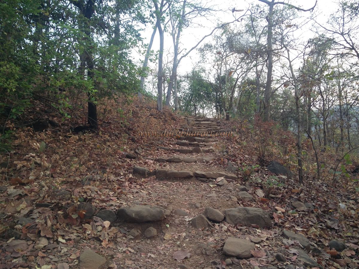
Though the trail to the fort is well-trodden due to the number of visitors, it involves a fair climb through sparse forest. After crossing a small hill and a stream near the tourism centre, one reaches a flat area with remnants of old structures—possibly from the Peshwa era, when officials and mansions were located at the base of the fort.
Further along the path and after some simple rock patches, it takes about two hours to reach the base of Mahuli cliff. A 15–20-foot-high iron ladder is installed to scale the cliff and the surviving fort wall. Climbing this, one enters Mahuli Fort.
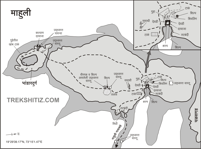
There are several access routes to the fort: the main gate (Mahadarwaja), Hanuman Gate, Kalyan Gate, Vandre Pass, and the passes between Mahuli and Palasgad. Although the ladder route from Mahuli village isn't the original path, it's now the easiest and most used.
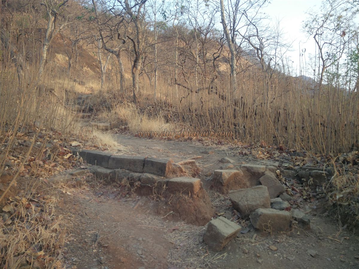
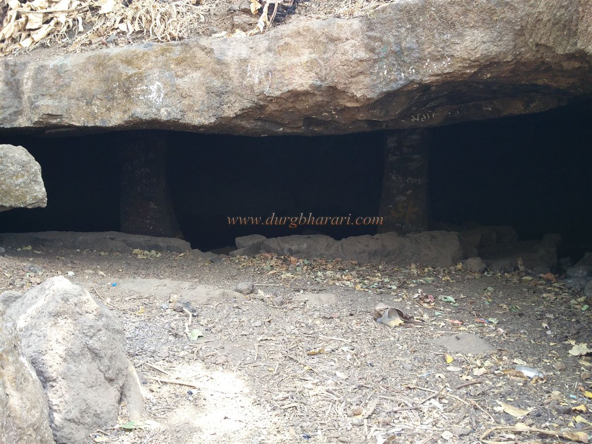
Since this trek aims specifically for Bhandargad, only brief mentions of Mahuli’s structures are made. After crossing the wall, the trail ahead leads toward Mahuli’s main gate, and along the way, a rock-cut water cistern can be seen—though its water is not potable. A few minutes ahead, a signboard on a tree points left toward Bhandargad.
Turning left, you pass three stones stacked from a ruined Samadhi. Farther along, hidden among karvi bushes, is a 6-foot-tall square platform made of cut stone—possibly the base of a once stone-walled wada. Numerous structural remnants lie hidden in the surrounding bushes. Further on is a carved rectangular memorial slab whose meaning is unclear.
Beyond this, one reaches a Shiva temple built on a plinth. Three walls with niches still stand, and within is a stone-carved shivling and a broken virgal. In front of the temple lies a large, now dry tank. Continuing on the trail, one passes another carved slab, likely once placed on a grave. A fork in the path leads left to Hanuman Gate of Mahuli, while the straight trail, through a jamun grove, leads to Bhandargad.
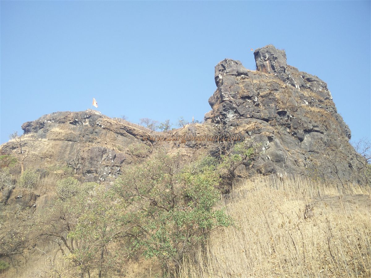
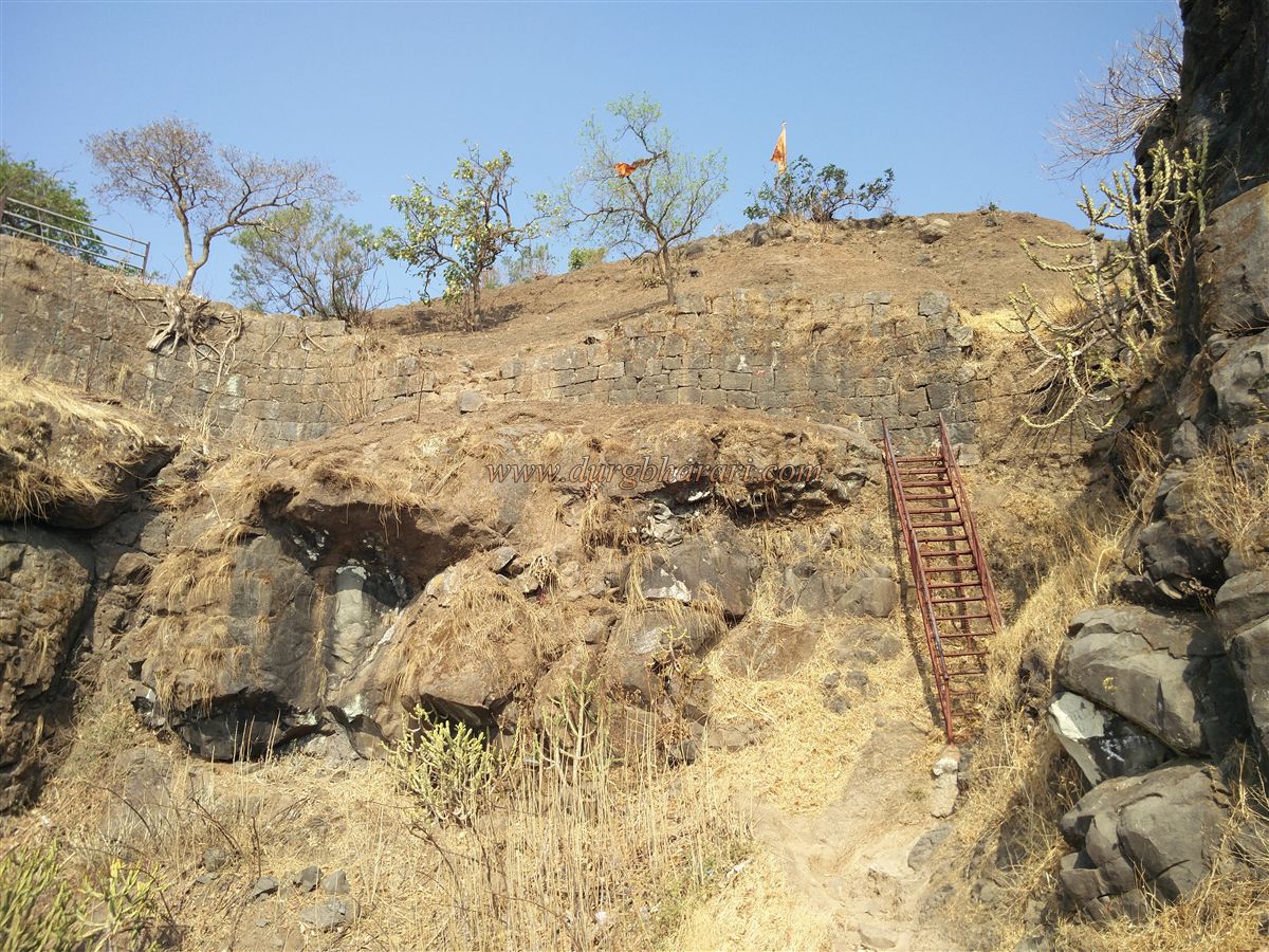
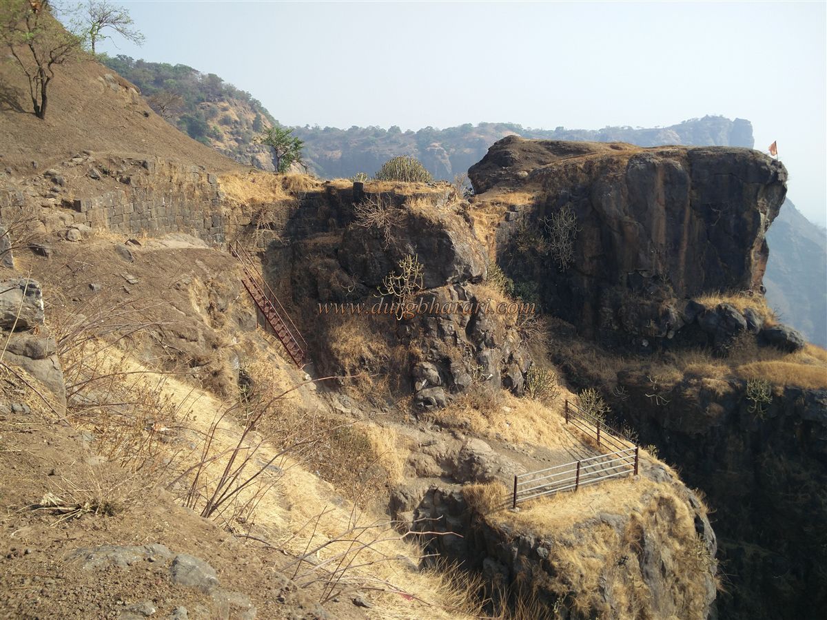
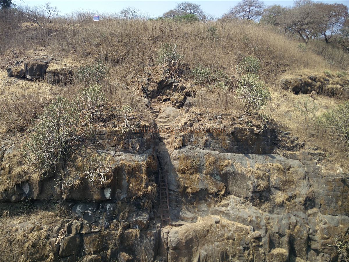
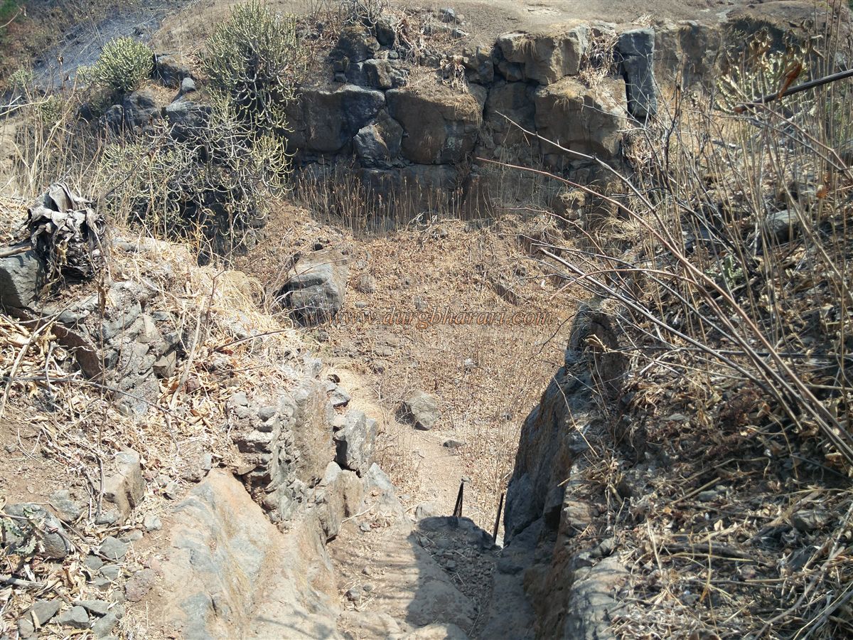
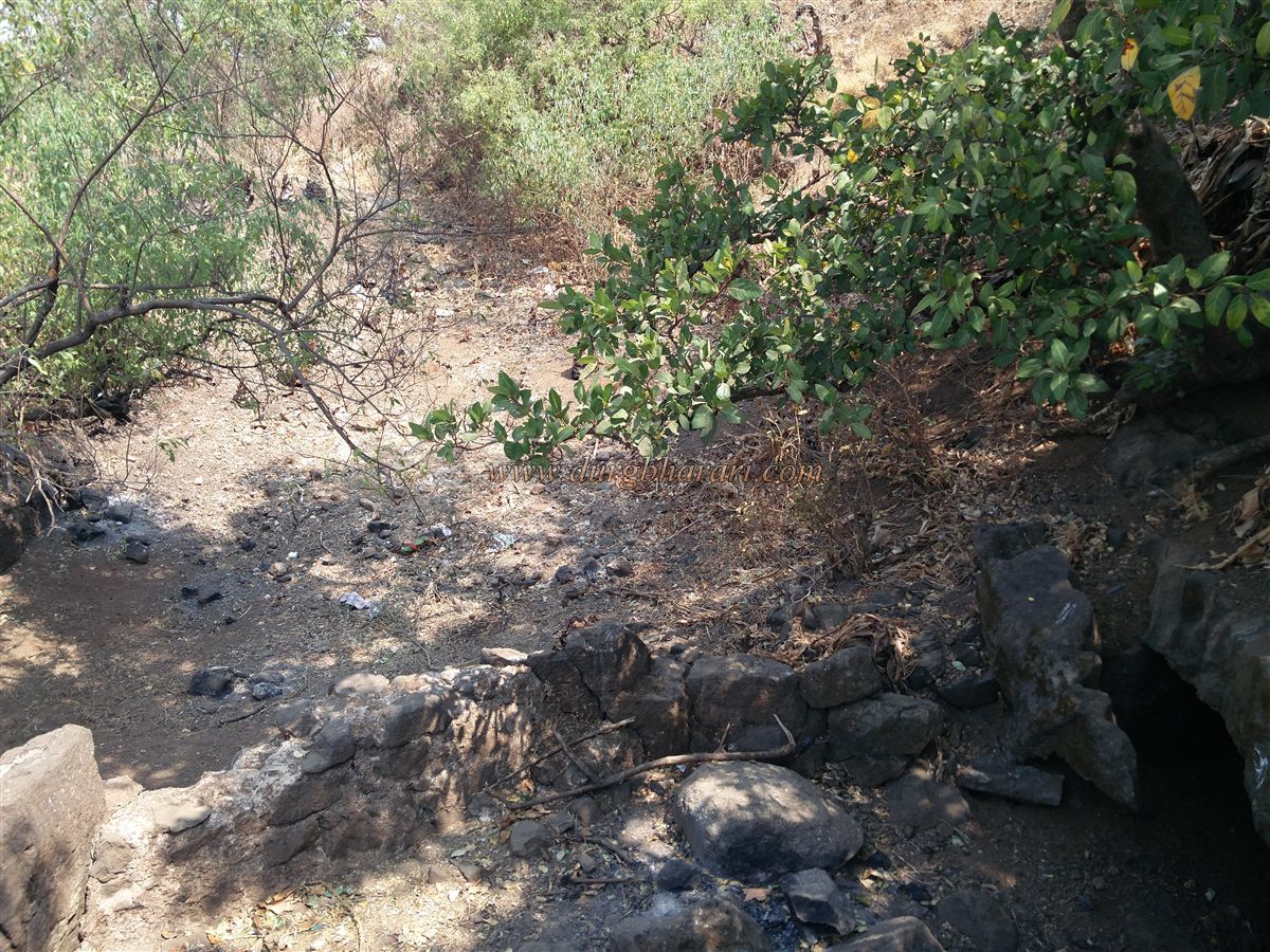
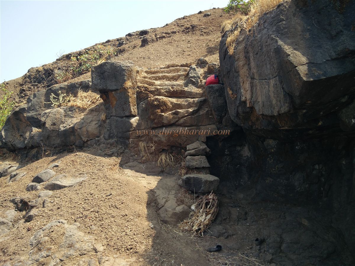
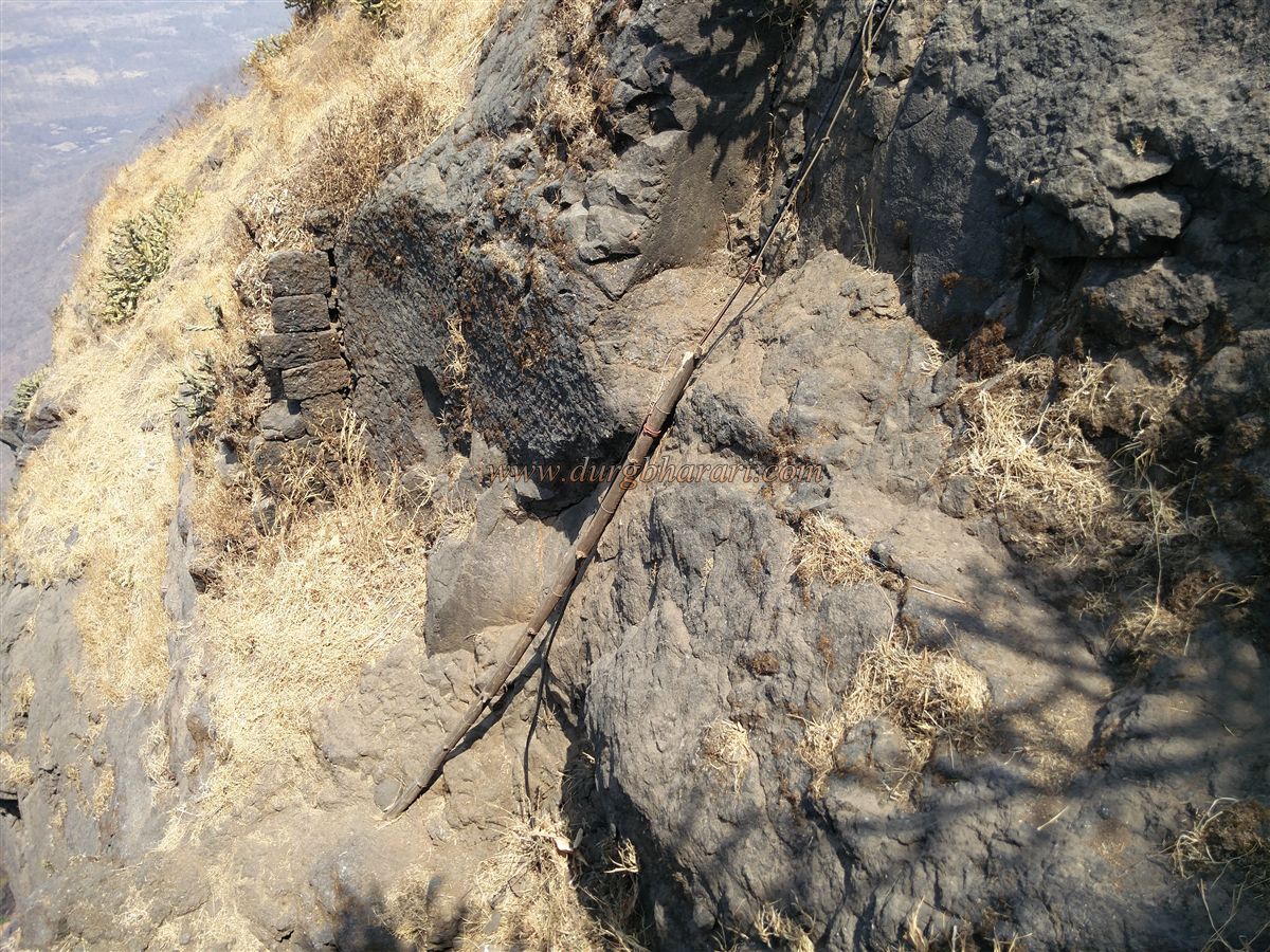
This path reaches the pass between Mahuli and Bhandargad. From this ridge, one gets a view of Bhandargad fort wall, stone-carved steps, and the pass between two cliffs. To reach Bhandargad, one must descend about 100 feet into the pass and then climb the adjoining hill. Two slightly unstable iron ladders assist in the climb, and above them are stone steps carved into the rock, indicating the likely location of a former small entrance.
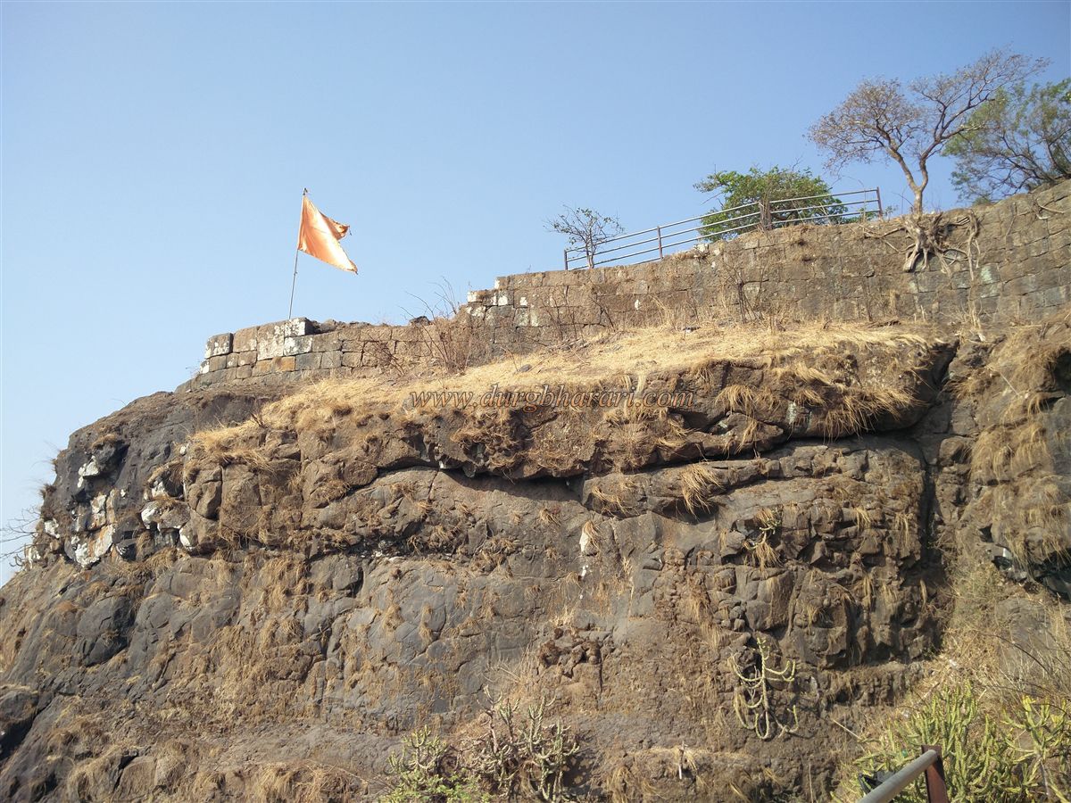
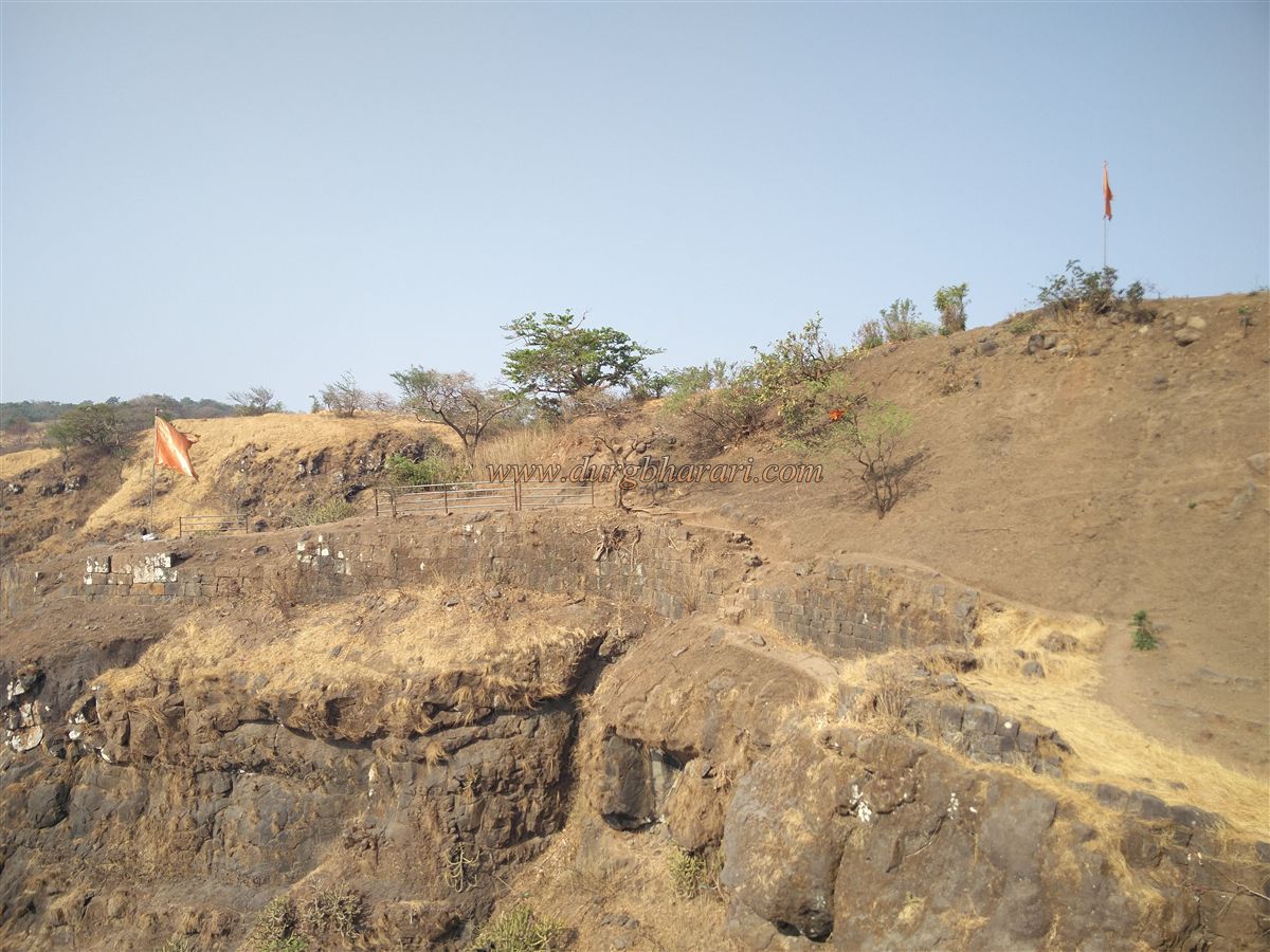
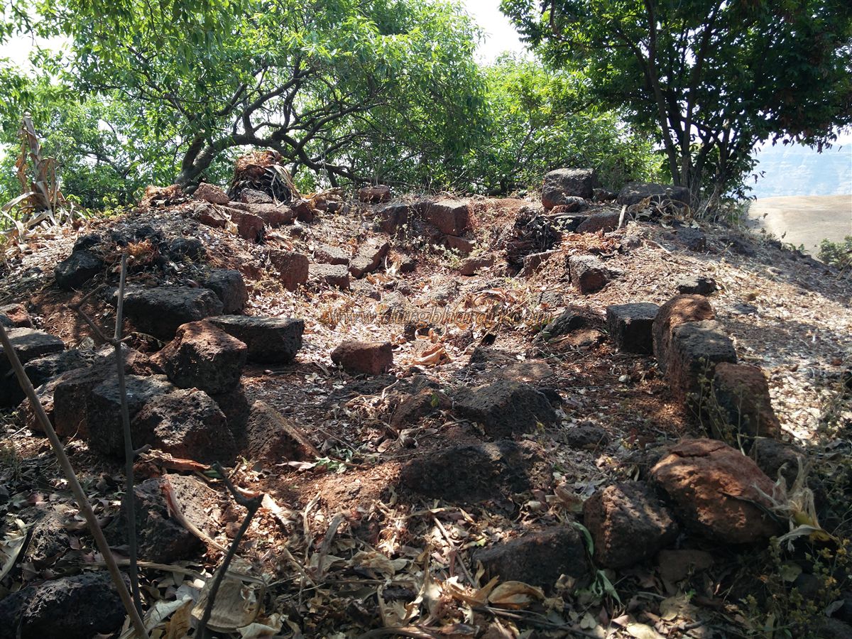
These steps lead to the top of Bhandargad, which stretches approximately 21 acres north to south and rises 2,640 feet above sea level. Due to minimal foot traffic, the area is heavily overgrown, with many remnants buried or obscured by vegetation.
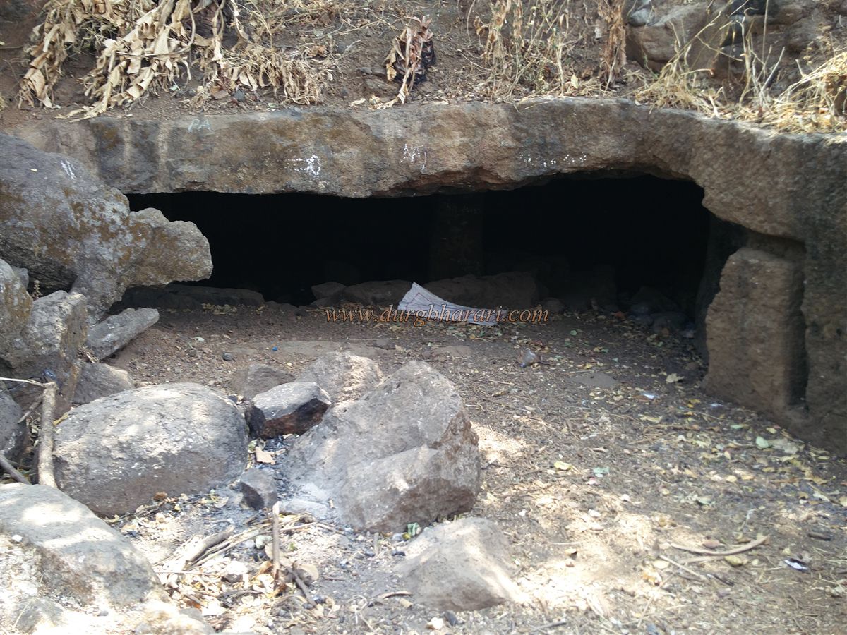
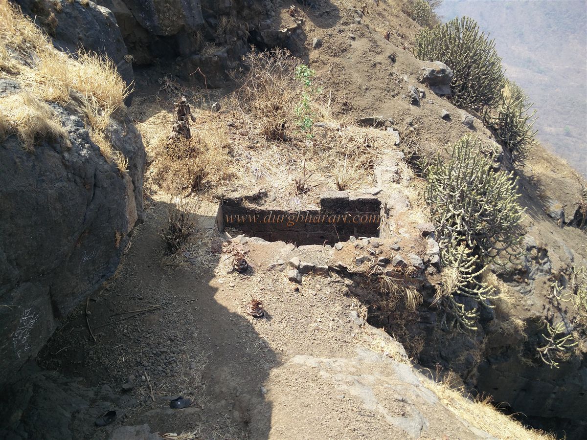
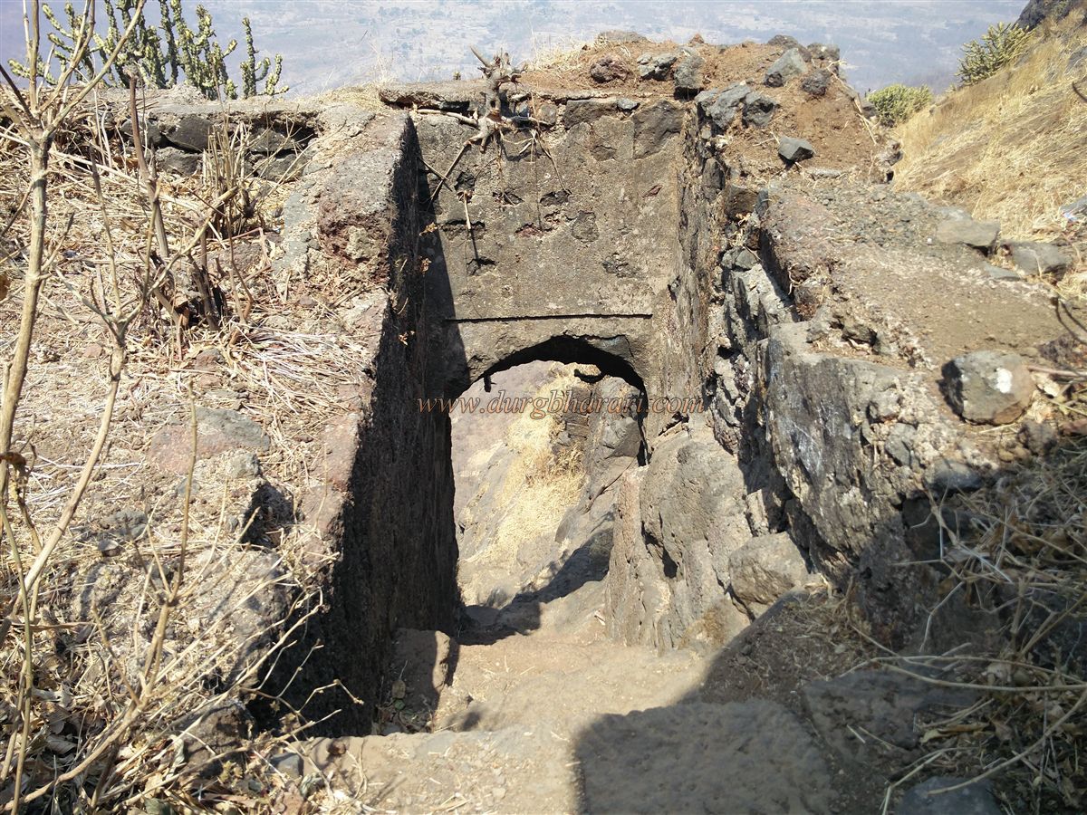
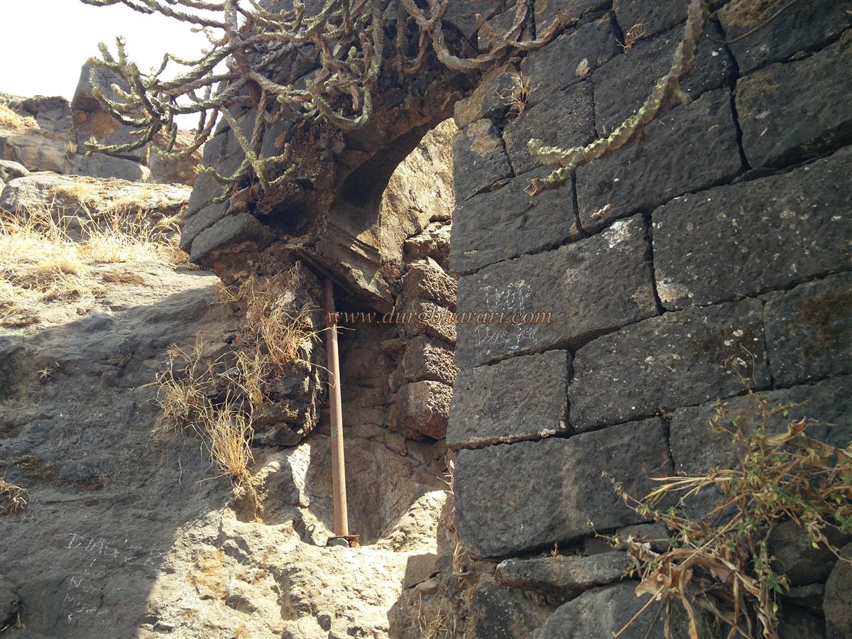
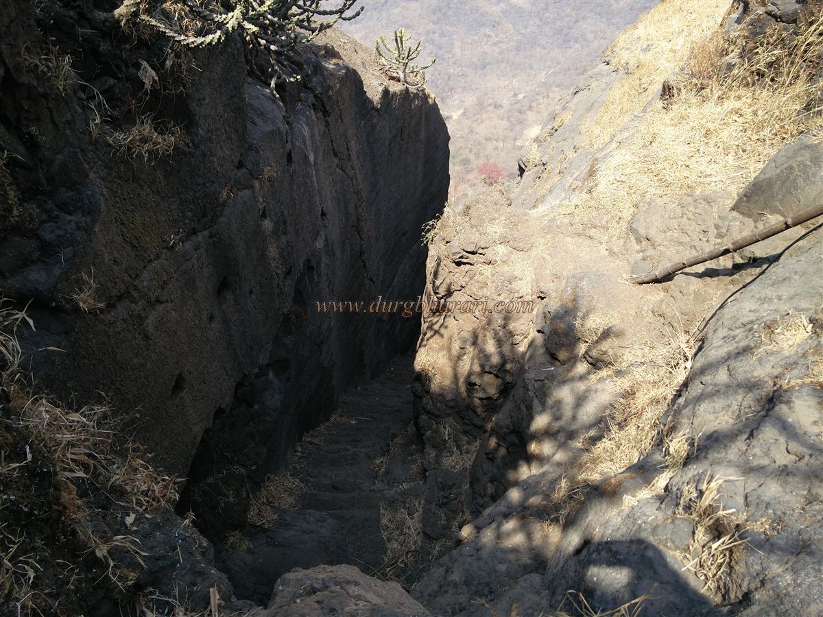
Heading south across the plateau, you find bases of structures buried in soil. At one spot, paduka (sacred footprints) are carved on a slab, alongside a buried tulsi Vrindavan. A faint path along the western edge leads downward toward Kalyan Gate, the main gate of Bhandargad. This gate is located at the mouth of a narrow gorge and is reached by descending 50–60 feet along a narrow rocky path. The gate’s interior features a worn inscription in Devanagari script. The gate is in poor condition, now supported by an iron post. The lower steps are broken, and a bamboo and a wire assist in descending. The path beyond is fully rock-cut. Along this descent is another heavily eroded inscription.
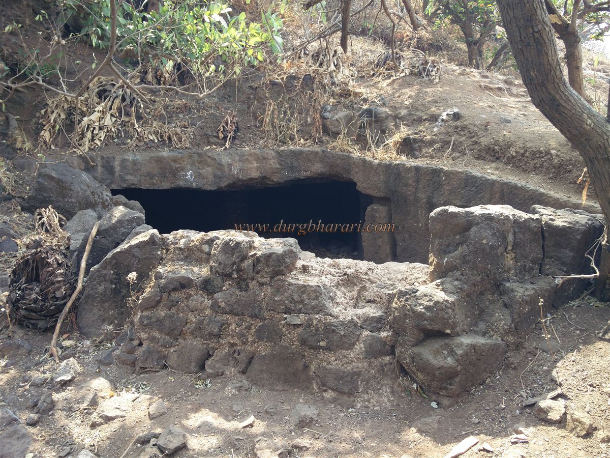
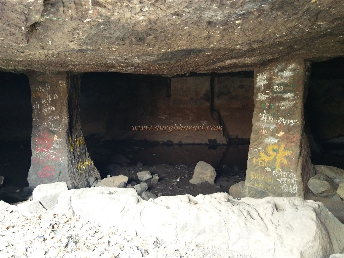
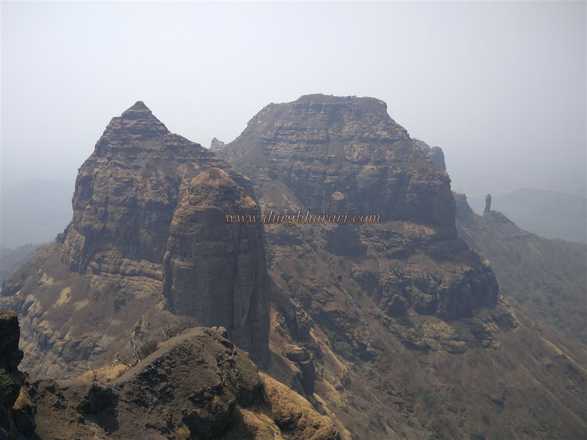
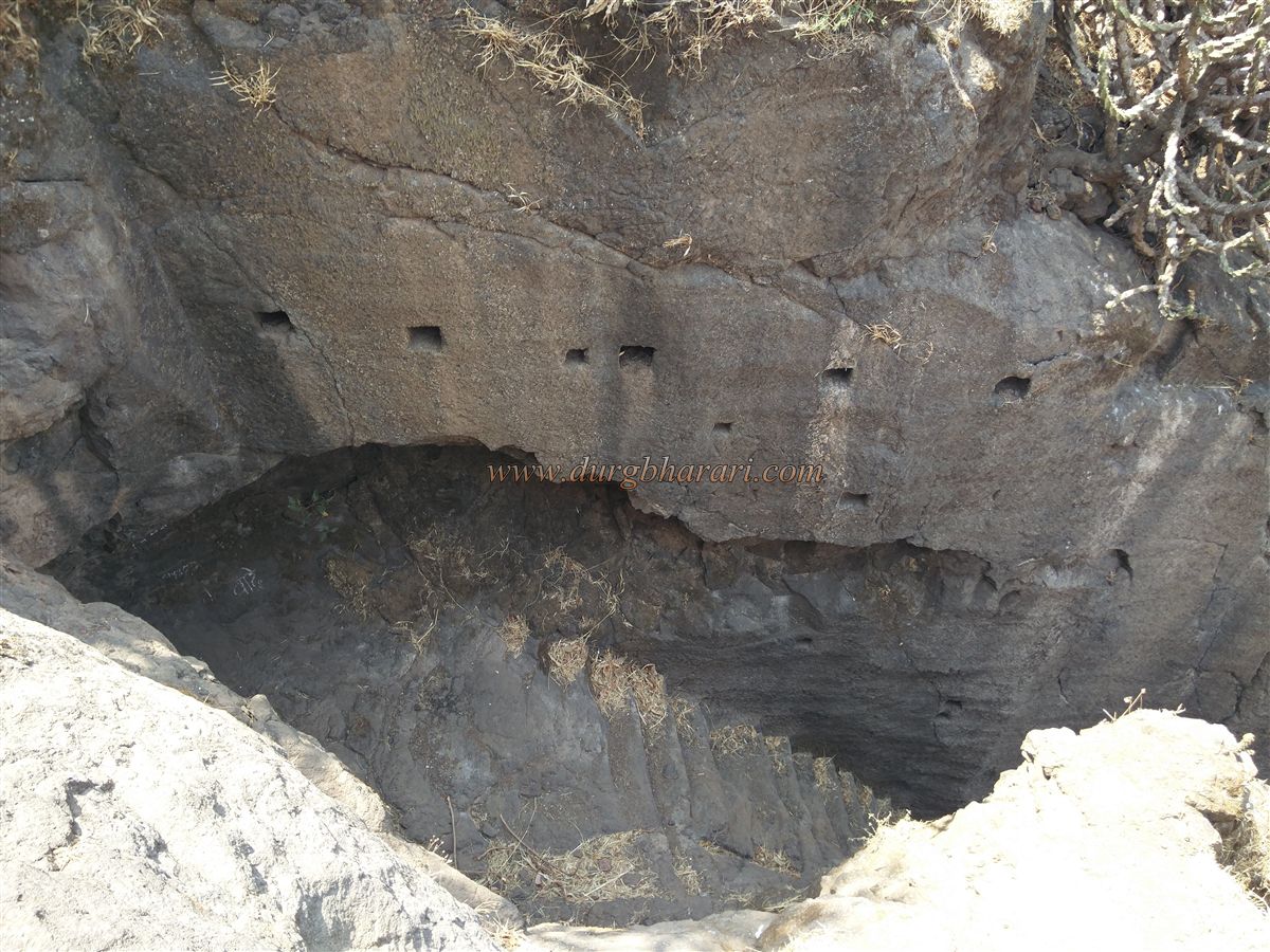
After viewing the gate, one returns to the main trail and ascends toward a buried tank with a rock-cut cistern at one corner, which contains potable water year-round. From here, ruins of a structure appear to the left, and the trail eventually leads to the southern tip of Bhandargad. From this vantage point, the spires of Bhatoba, Navra, and Navri are seen ahead, with Wazir Pinnacle to the right. To the north, one can see the Alang, Madan, Kulang ranges, Kalsubai, Tungareshwar, and Gumtara forts, while eastward lie Harishchandragad and Ajobagad, and to the south, the Matheran range and other areas are visible.
The climb from the base to Bhandargad takes about three hours, and another hour is sufficient to explore the fort. Given its layout, Bhandargad was likely used for surveillance and served as a guardian fort for Mahuli.
Though the builder is unknown, around 1485, after the decline of the Bahamani Sultanate, this area came under the control of Malik Ahmad, founder of the Nizamshahi dynasty. During the medieval period, its strategic location near Kalyan Subha made it a link between important cities like Nashik, Surat, Junnar, and Ahmednagar. Routes connected Mahuli via Javhar to Surat, and through Murbad and Naneghat to Junnar and Ahmednagar.
Palasgad history is closely tied to Mahuli. In 1635–36, when combined Mughal and Adilshahi forces came to overthrow the Nizamshahi, Shahaji Raje took shelter in the stronghold of Mahuli. Mughal commander Khan Jaman laid siege. Shahaji sought help from the Portuguese, but they refused, and he eventually surrendered. Later, on 8 January 1658, Shivaji Maharaj captured the fort from the Mughals.
In the 1665 Treaty of Purandar, Shivaji handed over 23 forts to the Mughals, cleverly listing Mahuli, Palasgad, and Bhandargad as three separate forts rather than a single cluster. Manohardas Gaud was appointed Mughal Killeder and carried out repairs on the fort.
In February 1670, Shivaji himself led an assault to reclaim the fort. Though Gaud defended it strongly—killing 1,000 of the 1,500 Maratha soldiers—he eventually abandoned the fort due to the threat from the Marathas. Allavardin Beg succeeded him as Killeder. On 16 June 1670, Moropant Pingle reclaimed Mahuli, Palasgad, and Bhandargad after a two-month siege.
After Sambhaji Maharaj’s death, Killeder Dwarakoji betrayed the Marathas and handed the fort to the Mughals. As direct assault was too difficult, the Marathas retook it through espionage in 1735. Later, under the second Bajirao, the fort was surrendered to the British through a treaty in June 1857.
© Suresh Nimbalkar
GALLERY