BHAMERGAD
TYPE : hill FORT
DISTRICT : DHULE
HEIGHT : 2280 FEET
GRADE : MEDIUM
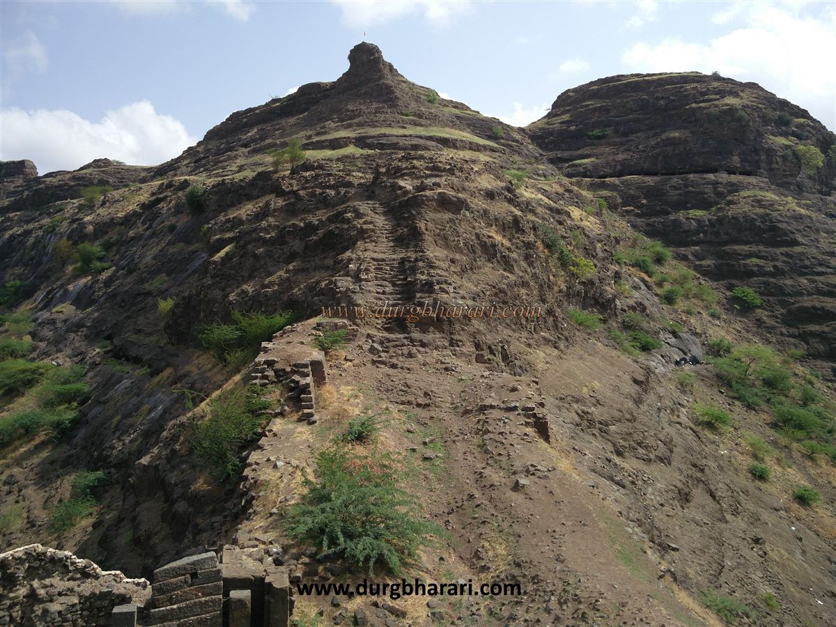
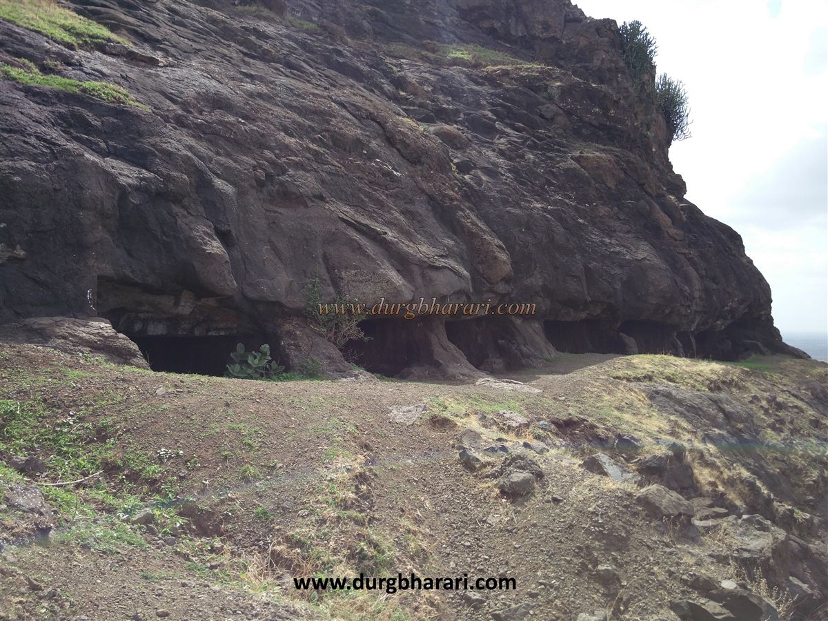
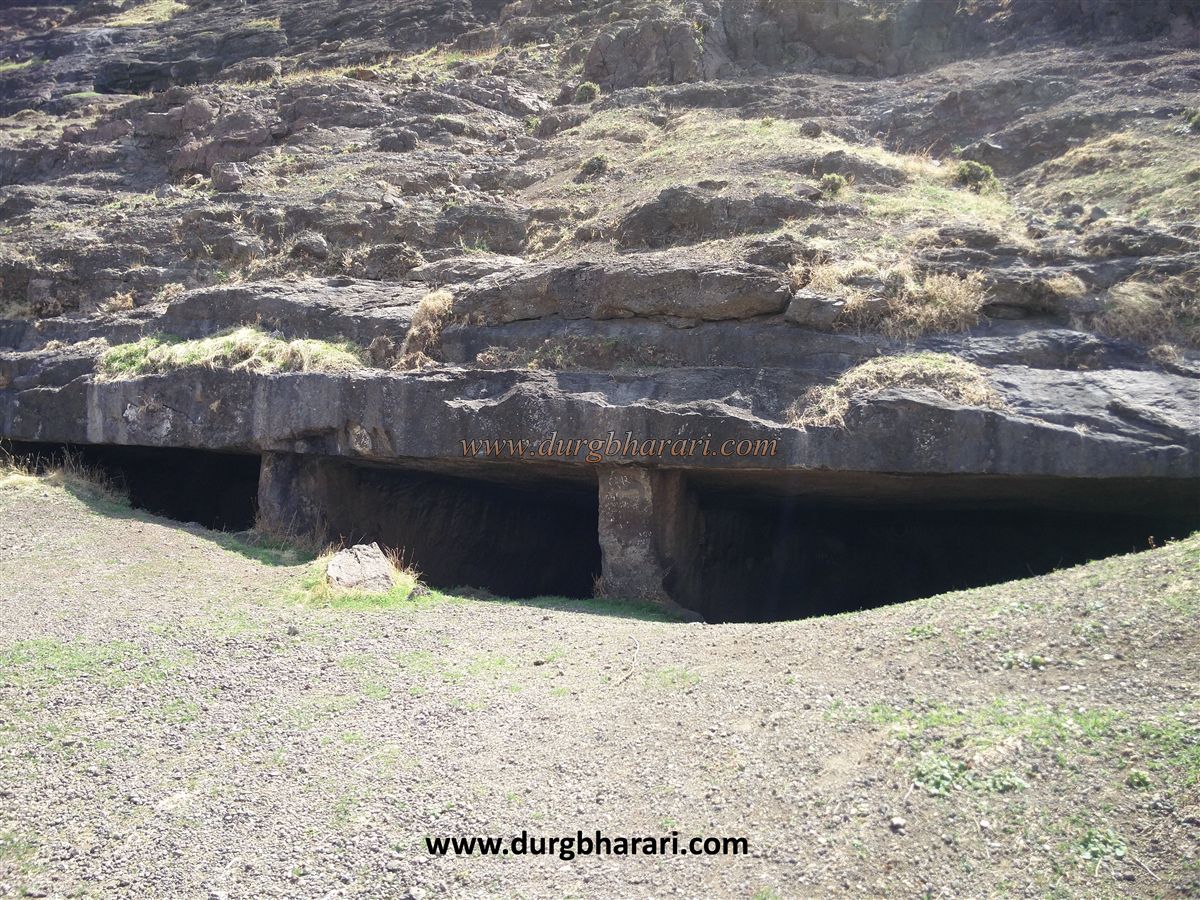
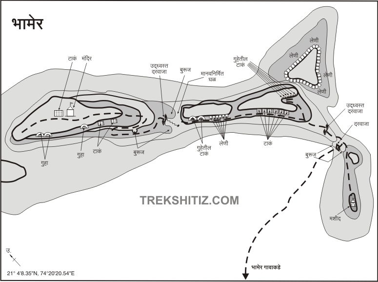
Bhamgiri or Bhamergad is the most beautiful hill fort among the five hill forts in Dhule district. This fort is located at a distance of 50 km from Dhule on the Dhule-Surat highway in Sakri taluka of Dhule district. This fort is 2500 feet above sea level. This fort was once the capital of the Ahir kings, this fort is spread across the village of Bhamer in U shape. The village and the fort were protected by the rulers of the time by building double ramparts. Such a beautiful fort and village must be visited by a fort lover at least once. In ancient times, Bhamer was known as a glorious and prosperous city on the Surat-Burhanpur highway. The trade route to Nashik also passed through this city. While the fort was in the possession of the Ahir family, more than fifty caves were excavated during this period.
...
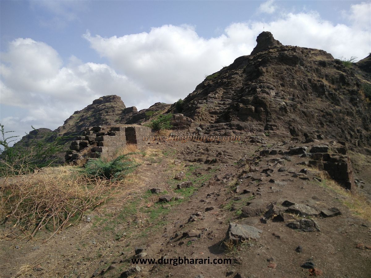
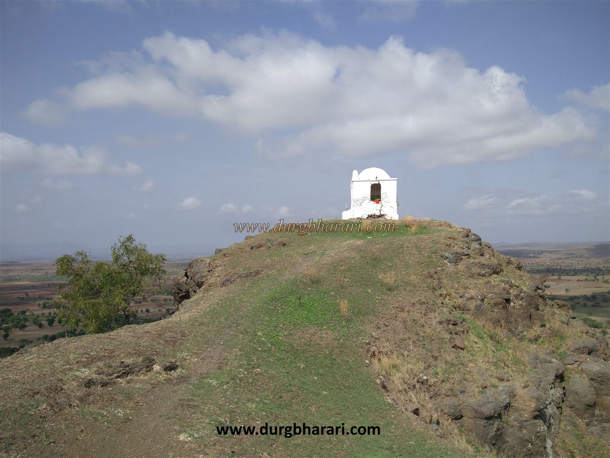
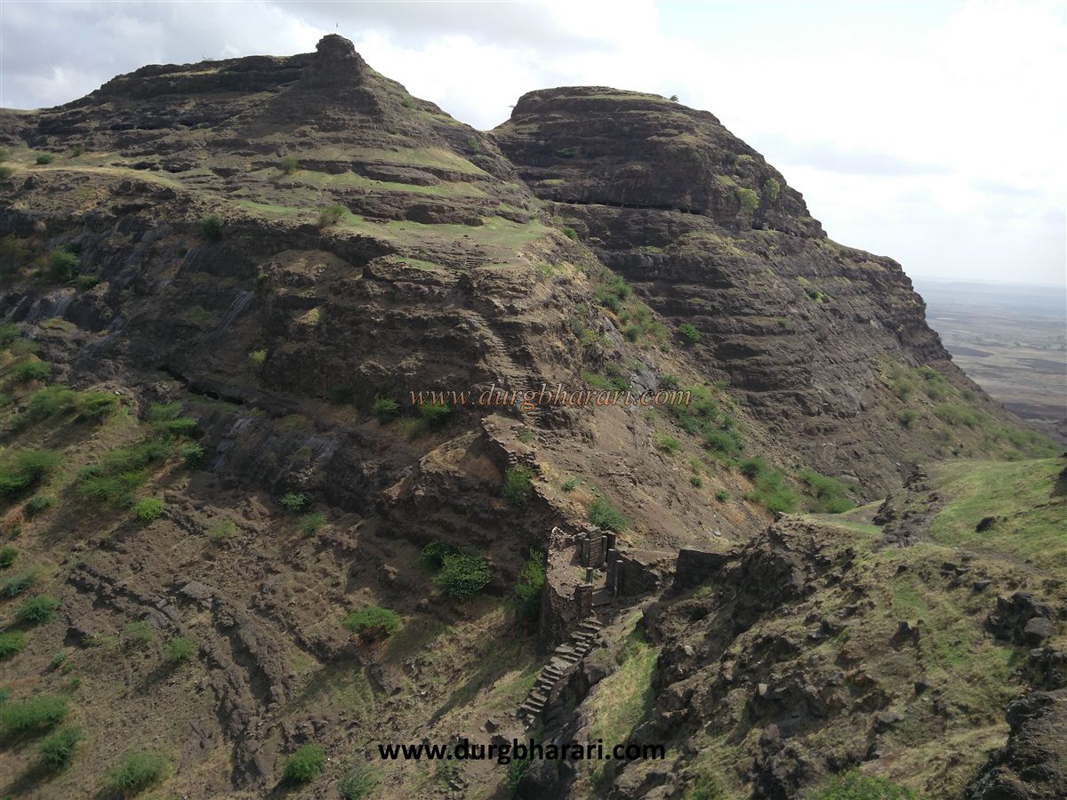
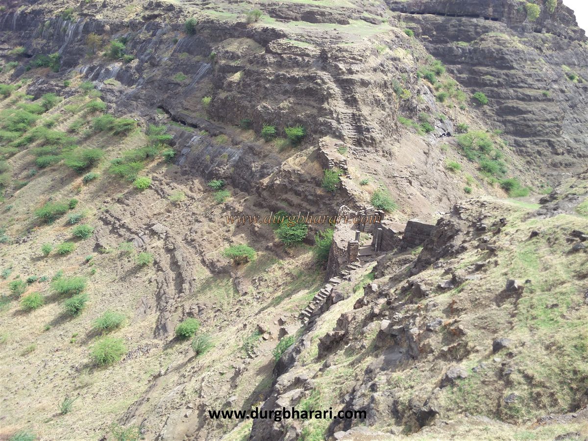
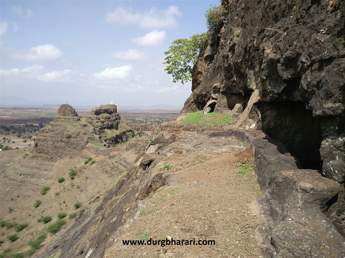
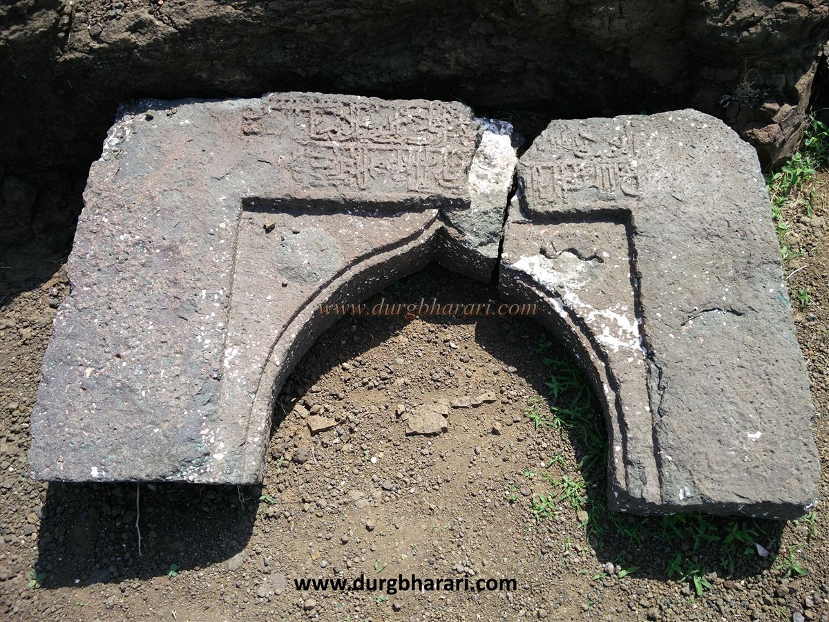
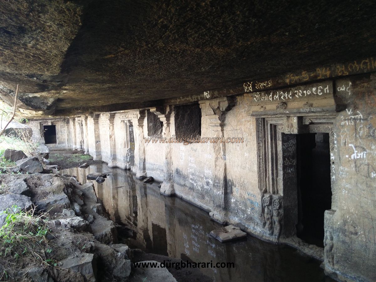
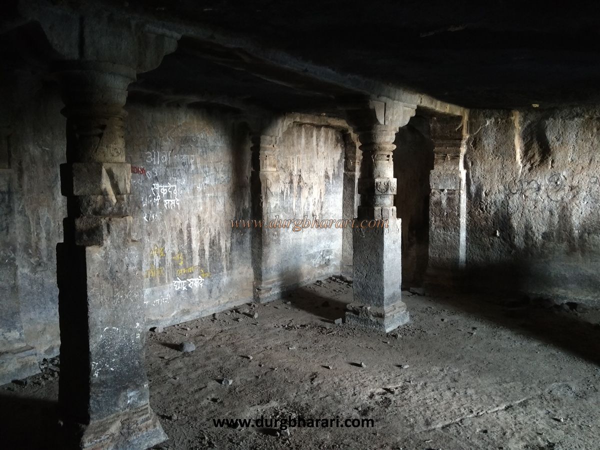
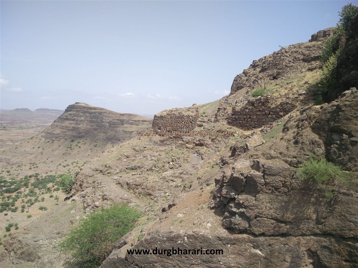
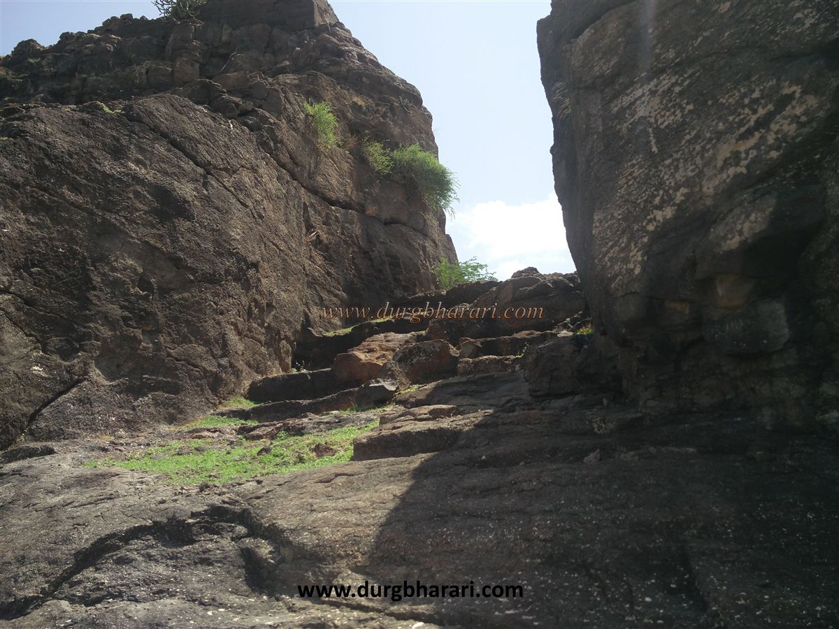
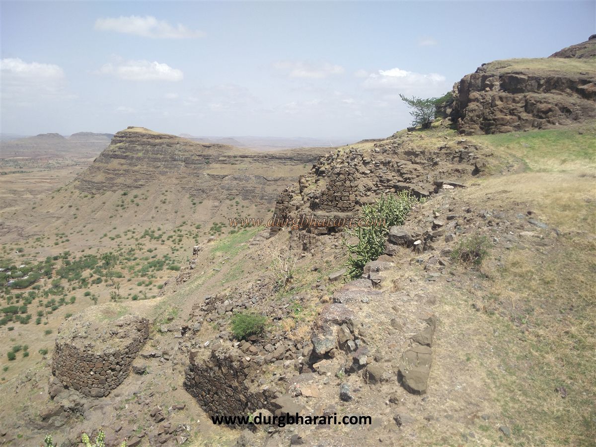
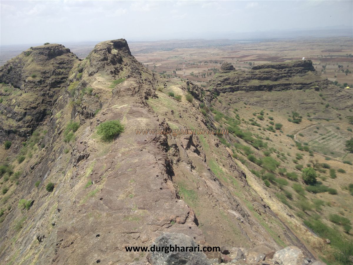
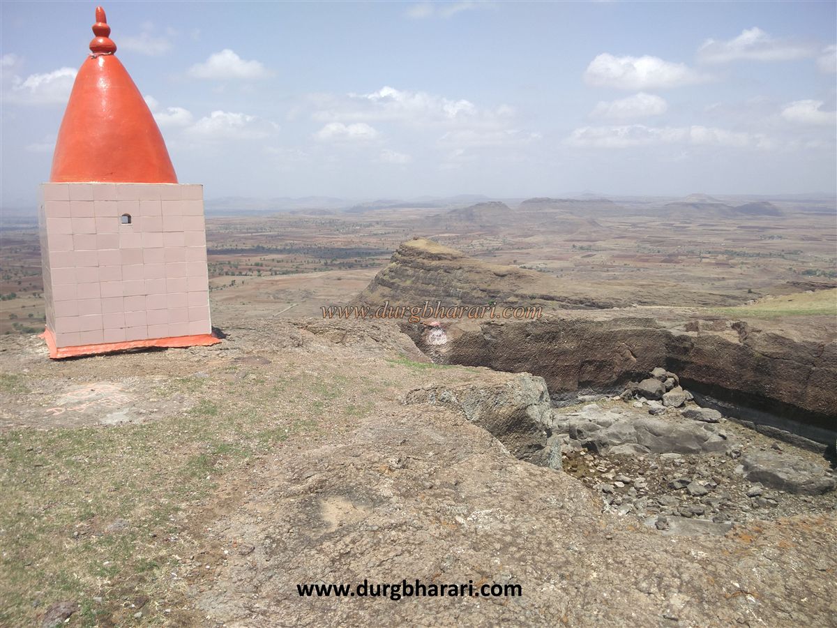
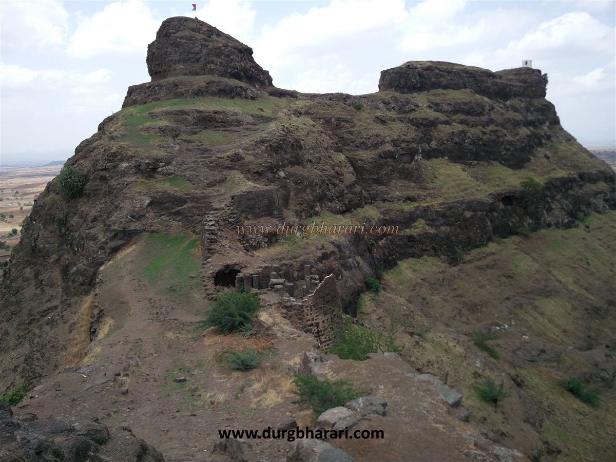
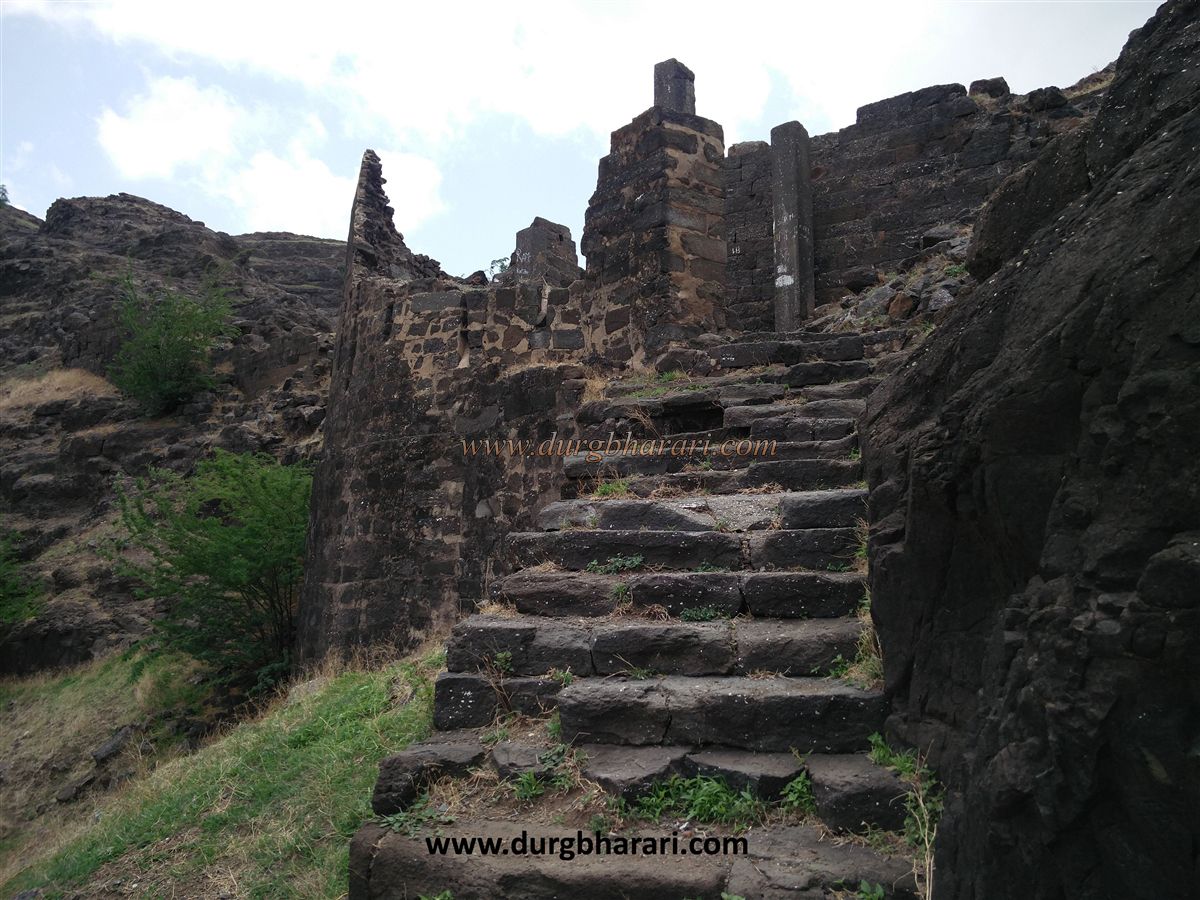
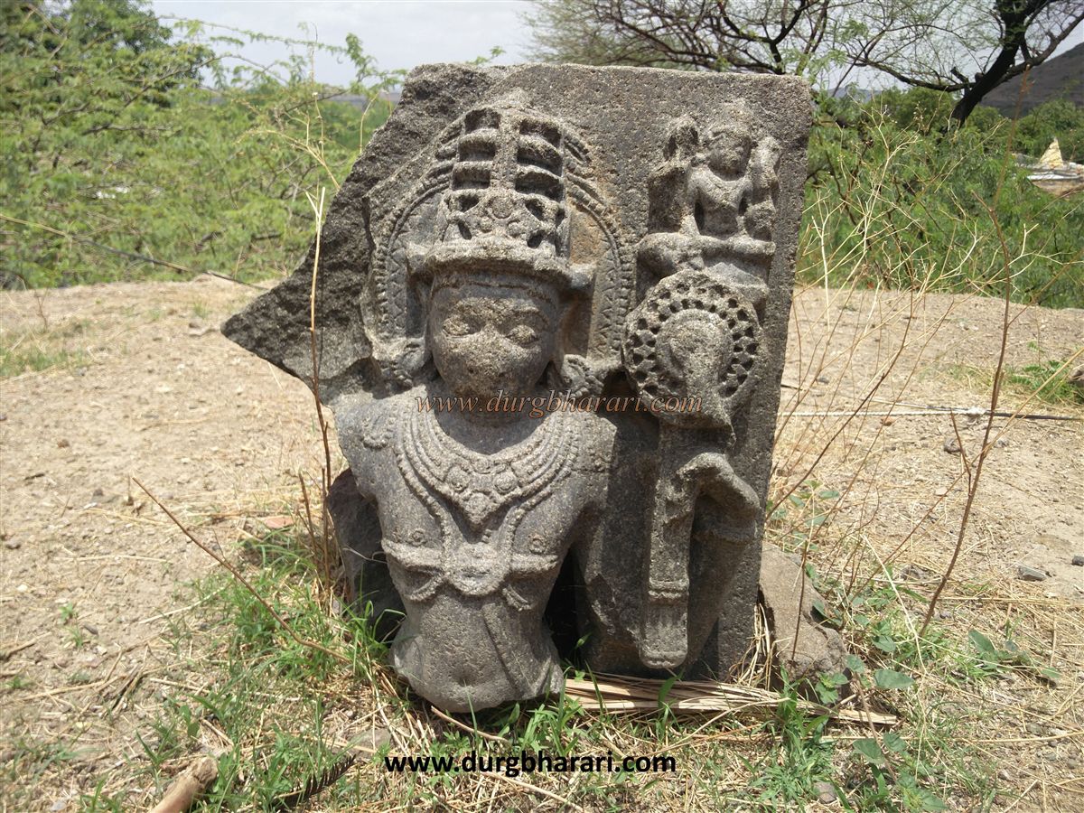
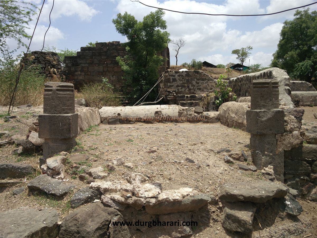
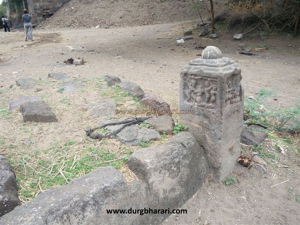
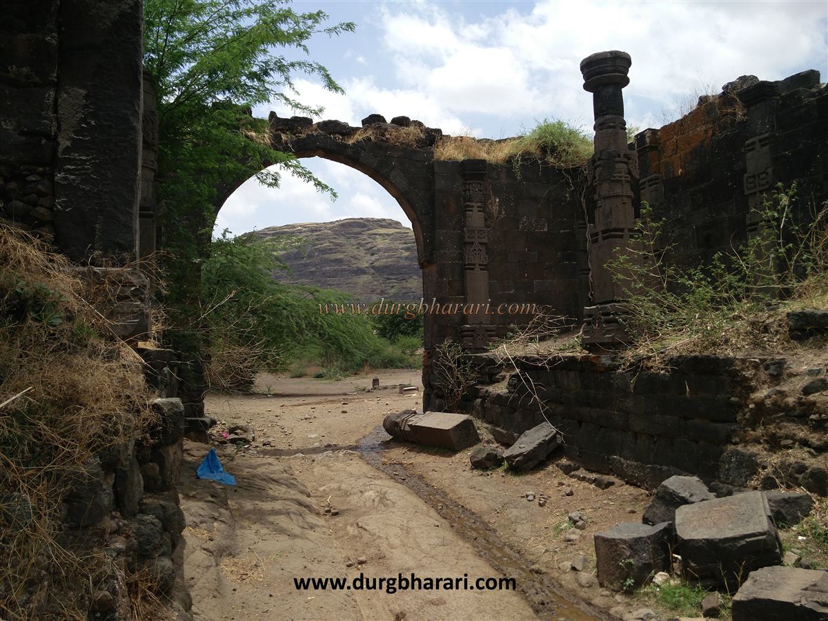
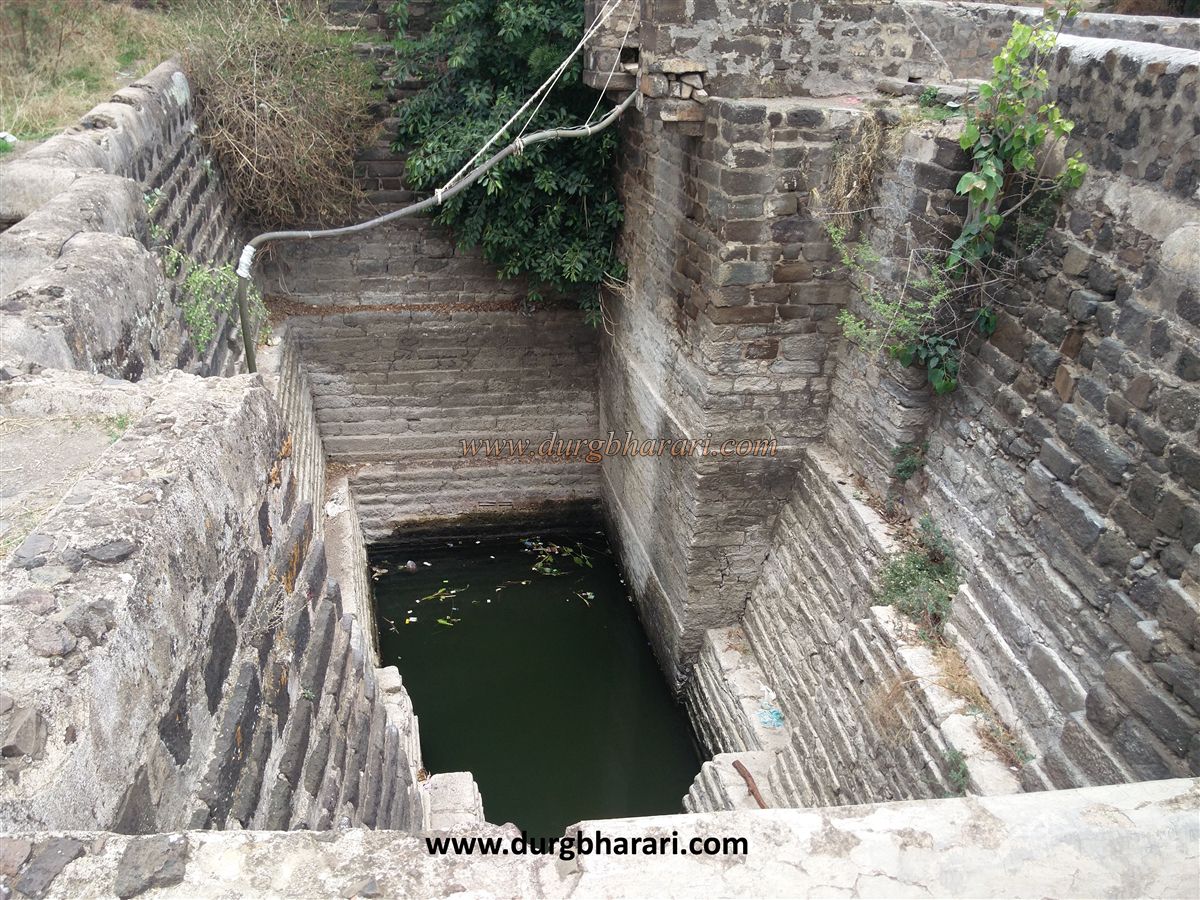
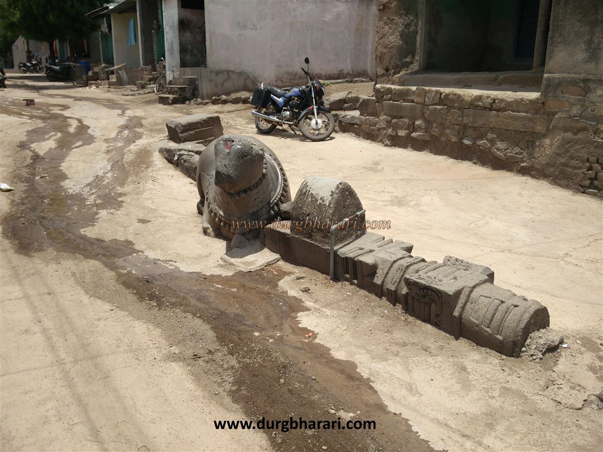
Even today the locals identify these caves as the houses of Ahir King. Coming to Bhamer from Dhule-Surat road, the caves carved on the hill in the belly of the fort are easily visible. The fort can be easily seen from a distance due to its steep slopes and semicircular ridges. Bhamer village once had a good fortification but nowadays the fortifications have completely collapsed. On entering the village of Bhamer, the arch of the gate and the carvings on it attract the attention of the people. On the side of this arch, there is an ancient well of square shape and next to it there are big stone drums. The water from this well is pumped out and is used for drinking by the cattle in the village. On the left, a large ancient well supplies water to the entire village. During the four or five months of summer, there is a water crisis in Bhamer village and only one well in the entire village consists of water. Upon entering through the door, on the left side, you can see 12 ornate round pillars of 8-9 feet height carved in stone. According to the villagers, justice was being done in this place during the Peshwa period. In front of the arch, there are two ruins on a quadrangle structure and the remains of an old mosque can be seen nearby. The houses in the village are of ancient style and at the base of these houses, stone pillars, yaksha, and Gandharva idol can be seen. On the way to the fort, a 2.5 feet high stone Nandi and two 6 feet carved pillars and some idols are lying partially buried in an alley. Looking at these remains, there should have been a temple here. After crossing the village, we come to the temple of Lord Shiva. From here, Bhamergad aka Bhamgiri fort is situated on a total of three hills. There is a small Dargah on the right side of the hill with caves carved on the opposite hill and the citadel of Bhamergad on the left side hill. The citadel and the middle hill are separate from each other. The ramparts are built parallel to the hill of the citadel. Outside one of these bastions, there is a large cistern and on one of the bastions, there is a broken idol of Lord Vishnu. Most of this wall is covered with trees, but as the bastions are huge, they can be seen from a long distance. The structure of this fort and bastion can be seen from the top of the fort. After 10 minutes, we reach the ruined door of the gorge by a muddy footpath on the right-hand side behind the village. Coming to this door, you can see the caves carved in the rock on the left side. In the gorge, there are two gates built at right angles at the base of the bastion. The stone pillars and bastions in the arch of the door testify its splendor. Upon entering through the entrance, you can see the hill of Dargah on the right-hand side, the hill of caves in front, and the hill of the citadel on the left-hand side. The entrance to the fort is built in such a way that the enemy approaching the entrance could easily be killed until they reach the middle hill and the hill on the right side. We reach the Dargah by climbing the steep hill on the right-hand side. After seeing this and coming back to the entrance, crossing a small hill, we come to the mountain of caves. There are about forty caves carved on each side of the hill, 24 caves of which you can see. These caves are 10 x 10 feet to 25 x 10 feet in length and width with tanks in it. Some tanks are dry and some are filled with clean water. Each tank is carved at the bottom of the first tank and the water from one tank to the other is facilitated through a hole in the bottom of the other tank. This water planning in this fort is worth studying. The road leading to the 24 caves is dangerous and the next caves cannot be seen without mountaineering equipment. After seeing the caves, we should come back and take the steps carved in the rock to the left-hand side of the fort. After climbing a total of 60 steps, the true size of the fort can be seen. On the way, there is a Persian inscription carved in a broken stone arch. At the end of the steps, there are the next six caves on the first stage. A little further up from there are 3 more caves. A small space is carved on the top of the door of these caves for keeping a small Ganesha’s idol. Idols of men and women and pairs of birds are carved next to it. Each cave is about 30 x 30 feet and its roof is weighed on twelve stone pillars. This cave has carved windows. Beyond this last cave is another cave of 20 x 20 feet and about 30 feet deep. Its mouth is at the top of the carved caves. Ascending from these caves, you can see the bastion in front and the fort behind it, while on the right-hand side you can see a notch dug in the rock. This notch separates the citadel and the adjoining hill from each other. There are bastions on both sides of the 15 feet × 30 feet notch, while there is a deep ravine at the front and the back. After a short climb through this moat, we reach the hill on the side of the moat, from where the entire Bhamer fort and the surrounding area can be seen. On the way down from the ditch to the citadel, after 10-12 steps, there is another ruined door. On this road, you can see a dry water cistern. To reach the top of the fort, one has to cross a rock patch again. The top of the fort is a plateau 30 feet wide and spread across a long distance. The villagers have recently built a small temple of Sati on this plateau. Adjacent to this temple is 20 feet water tanks and some other relics. Going a little further, you can see the second bastion of the citadel at the other end. Descending from here, you can see three water cisterns on the hillside and the Deur hill and the caves on it. Looking down at the village from here, the moat between the fort and the villages is visible. From here you have to climb the sloping bank and come back to the citadel. When you climb up here, you can see the entire fort. From Bhamer fort, Galna fort is seen on the south side and two pairs of peaks called Ravya-Java are seen on the east side. It takes one hour to climb the fort and three hours to walk around it. 1hour is enough to see the important places in the village. The history of Bhamer village is very ancient. Bhadravati Nagar was here in ancient times. King Yuvanashva was ruling here at that time. During the Mahabharat war, this king fought on the side of the Pandavas. His daughter Bhadravati's name was transformed into "Bhamer" over time. Yuvanashva, the Mahabharat king of Toranmal, was living at Bhamer in the rainy season. Bhamer (Bhambhagiri) has maintained its rich historical heritage from 1000 to 1500 years. The fort must have existed during the Satvahana period, this could be said by looking at the caves on the fort. In medieval times, the fort was a major center of trade. It was considered very important from the rulers of that time to have a strong fort like Bhamer to dominate the Khandesh-Barhanpur-Surat route. Roads leading to Nashik-Dhule-Surat pass-through this Bhamer area. In ancient times, caves were carved on this trade route. The Jain caves here still retain the heritage of ancient art. There is also an inscription here existing to date. Jaitugi's second Sindhan (1210-46) son of the Yadav clan of Devagiri came to the throne. It is recorded that he defeated Lakshmideva of Bhambhagiri (Bhamer) in Pimpalgaon taluka of Khandesh. In Khandesh, Yadav kings are also called Gawli kings. Bhamer was under Islamic rule from the time of Bahamani until the 18th century. At the beginning of the 18th century, the Bhamer region came under the control of the Dabhade dynasty, but Bhamer fort came under the control of the Marathas in 1752. After that, the province of Bhamer was given to the grandson of Vitthal Shivdev Vinchurkar. Even after the British captured all the forts in 1818, the straw chief Kalekhan revolted and captured Bhamer in 1820, but caption Briggs crushed the rebellion and destroyed the buildings and fortifications on the fort.
© Suresh Nimbalkar
GALLERY